EMERGENCY COMMUNICATIONS
Emergency Communications
By Rob Murray on SV AVANT
Cruisers spend big dollars on emergency communications, and in most cases never use them. What are some of the options, their pros and cons, and use cases aboard?
EPIRB
EPIRBs (Emergency Position Indicating Radio Beacon(s)) are the gold standard in reliability and durability. Designed by an international consortium of search and rescue agencies in the 1980s, these use the SARSAT (Search And Rescue Satellite Aided Tracking) system of satellites (a combination of government operated LEOSAR, GEOSAR, and MEOSAR satellites) combined with a network of 29 MCCs (Mission Control Centers) which communicate with national RCCs (Rescue Coordination Centers).
When you activate your EPIRB, a SARSAT satellite will pick up the signal within minutes and relay it to the MCC nearest the satellite via their Local User Terminal. The MCC will relay the transmission to the national authority’s RCC you have registered your EPIRB with (typically your flag country). Then ‘your’ RCC will relay the information to the RCC responsible for the area you are in and reach out to the emergency contacts registered with your beacon, and the RCC local to your location will begin a rescue operation. This is typically done in less than an hour.
COSPAS-SARSAT System Overview
The downside of EPIRBs is they are one-way communicators – they simply relay your call for help, and do not indicate if it’s a fire, sinking, or medical emergency.
Once purchased, EPIRBs are free to operate (no subscription fee), and the only ongoing cost is periodic replacement of the batteries (depends on unit specifications). Most units are water activated, so they should be stored where rain or spray won’t set them off inadvertently. They are specified to operate for a minimum of 48 hours, but typically will operate for much longer.
EPIRBs must have the battery replaced after use, they are good for a single activation per battery.
PLB
PLBs (Personal Locator Beacon(s)) are basically EPIRBs in short pants. Smaller and lighter than EPIRBs, they are typically less expensive as well. The broadcast at the same power as EPIRBs (5.0 watts) but have half the battery life (24 hours minimum vs 48 hours with an EPIRB). As with EPIRBs, they will typically operate much longer than the minimum specified.
Similar to EPIRBs, they must be registered with a national authority and have no operating cost beyond periodic battery replacement.
PLBs, like EPIRBs must have the battery replaced after use, they are good for a single activation per battery.
SEND
SENDs (Satellite Emergency Notification Device(s)) are devices like the InReach, InReach Mini, Garmin InReach Messenger, Zoleo, Spot, Spot X, Yellowbrick, ACR Bivy Stick, Motorola Defy Satellite Link and so on.
These use various commercial satellites or commercial satellite constellations and allow emergency ‘send help’ communications, typically with a dedicated SOS button. They also typically allow two-way communications, like a text or SMS on your phone (some allow this in a self-contained method, some require tethering with a smartphone or tablet). Most operate on the Iridium Satellite Network, which is generally considered to be of the highest quality and offers global coverage. Some use other networks like Globalstar, which does not offer global coverage. They typically operate at about 1.5 watts of transmit power.
Most use the IERCC (International Emergency Response Coordination Center) as their emergency response partner ( WWW.IERCC.COM ). Spot uses Overwatch Rescue ( WWW.OVERWATCHXRESCUE.COM ).
When you press ‘SOS’ on the device, it sends a message via the satellite or satellite constellation to the emergency response partner and they act in a way like the EPIRB response mechanism above, but they call/text you back (if your device allows) as well as calling your emergency contacts.
If the device allows you to send and receive messages you can also initiate a two-way conversation with a shoreside contact for a serious but not life-threatening situation, such as an engine or medical problem.
Most SENDs also support the sending of ‘breadcrumb’ trails while cruising. This is useful to allow shoreside contacts to follow you and leaves a record of your journey should you ‘go dark’ in an emergency that incapacitates you and your crew such that you are unable to activate any of your devices, giving search and rescue teams a starting place to look for you.
Each of these devices, being commercial, requires a subscription. Costs vary.
SENDs are rechargeable and can be used again and again. Battery life varies between units.
There is a good comparative review of many units at ( https://www.treelinereview.com/gearreviews/best-personal-locator-beacons )
DSC Distress Calls
Marine radios (VHF and MF/SSB) can send a DSC (Digital Selective Calling) alert, usually by pressing a red button on the radio. The button usually must be held down for more than 3 seconds to activate it (this to limit the chance of false alerts). This sends a GPS position if your radio contains or is connected to a GPS, plus your MMSI (Marine Mobile Service Identity).
VHF is monitored for these alerts worldwide (withing coverage limits), but coverage via MF/SSB is spotty. (There are propagation issues, and some rescue authorities no longer monitor the frequency. The USCG stopped monitoring the 2182Hz rescue frequency in 2013.)
VHF DSC alerts will be picked up by other vessels within radio range.
This is cost-free.
How do you contact Search and Rescue directly wherever you are?
Each country has SEARCH AND RESCUE NUMBERS. These can be found on the Ocean Posse website for each area we operate in:
https://oceanposse.com/aruba/#emergencies
https://oceanposse.com/azores/#emergencies
https://oceanposse.com/bahamas/#emergencies
etc
https://oceanposse.com/italy/#emergencies
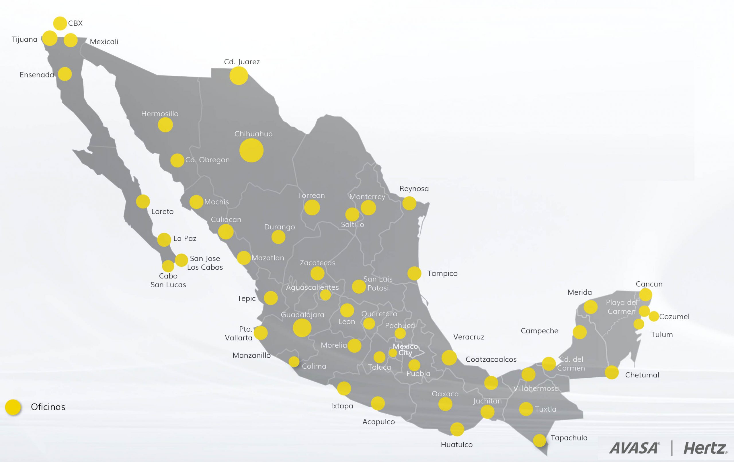
https://oceanposse.com/mexico/#emergencies
Ocean Posse members can substitute the country you are in to get to the right numbers
What about Cell Phone Satellite Communications?
Some newer cell phones from Apple or Google/Pixel have limited SOS satellite connectivity, and Samsung has announced forthcoming satellite capability. Somewhat klugey, they require manual alignment of the device and use the GlobalStar network. Not all devices have the feature, and some are limited by the carrier. The geographic coverage is quite limited. These should be considered back-ups until the technology becomes more mature.
What should you do to get ready for an emergency?
Select and install your chosen devices and set them up appropriately.
For EPIRBs and PLBs, that means registering them with the appropriate national authorities and mounting their storage brackets in suitable locations. Each device has a testing schedule and protocol, so add reminders to your calendar to ensure you keep up with the schedule.
For SEND devices, ensure you have the appropriate subscription in place and the emergency contacts are registered, and the appropriate contacts are in the device’s address book or contact list. If the device tethers with a smart phone or other device, ensure the appropriate software is installed and up to date, and the tethering connection(s) have been tested. Having the tethering connection enabled on multiple devices adds redundancy. Most send devices get firmware updates from the manufacturer, so find out how your device updates and schedule a check every 90 days or so to ensure you’re up to date. Ensure you have a charging/battery replacement protocol in place so that the device is always charged up or, if it has replaceable batteries, you have spares on hand.
For DSC Alerts, make sure your radio(s) have your MMSI programmed in and have access to a reliable GPS signal, and that the radio(s) have a first-class antenna connection (testing with an SWR meter is the best way to ensure this).
Once the hardware and software are established, train your crew in the use of these devices and make sure they know how and when to use them. Preparing a ‘Cheat Sheet’ of simple instructions that can be posted in a handy spot ensures they are not falling back on memory in an emergency.
You have an emergency, what should you do?
If you are faced with a life-threatening situation or there is an imminent threat of danger such as loss of life, potential loss of life, loss of the vessel, potential loss of the vessel, sinking, fire, loss of the rig, or other serious emergency you should activate all of your emergency communications all at once. If you have all three, use the EPIRB, SEND and DSC alert all at the same time.
- The EPIRB will get SAR resources mobilized rapidly on a nation-to-nation basis. It is hands down the most reliable distress signaling mechanism.
- The SEND will typically allow two-way communication on the nature of the emergency and what aid is required.
- The VHF DSC Alert will summon any nearby vessels to your aid.
If you are faced with a potential life-threatening situation or there is the potential for an imminent threat of danger to develop, you should initiate a two-way communication with a shoreside contact to seek advice and/or advise them of the situation (ideally with one of the emergency contacts for your EPIRB or SEND). This could be via any means available, Cell Phone, Starlink (email, teleconference, etc.), SEND, or whatever works. Nearby vessels should be alerted via a normal VHF radio call. This allows them to be aware of what’s going on and be ready to scale up response appropriately as the situation demands.
Posse Perk
Ocean Posse members have access to additional help from other Posse members who may be nearby and from Posse HQ. Members can send a message on the Posse line Ap to reach out for nearby vessels. The Posse Team has assisted in rescue coordination and has connections in many regions with search and rescue and other resources to assist if required. Contact Dietmar at dietmar@oceanposse.com or text him at ( +1 (702) 861-9823 ) to set the team in motion!
NAUTICAL MEASUREMENTS
NAUTICAL MEASUREMENTS:
ONE SHOT AT A TIME
By Mike Descheemaeker of SV WHIRLWIND
The nautical mile, not to be confused with the statute mile, is the basis for ocean navigation ... but why?
I thought it would be fun to explore the different nautical words and the variations of actual lengths and depths of different forms of sea people measurements. The 'knot', the 'fathom', the 'cable', the 'shot', the 'shackle' are all different ways to look at length, distance, and speed. In our modern way of navigating our vessels many of these expressions have really become archaic and less important to the modern navigator. Nonetheless, a general idea of there usages and their origins is quite interesting.
THE KNOT: UNRAVELLED
Obviously, we all are familiar with the knot as a measurement of speed. One nautical mile per hour is equivalent to one knot. The nautical mile deals directly with measuring a curved surface. From my trusty Celestial Navigation: A Step By Step Procedure For The Complete Idiot I will borrow this excellent description of measurement:
“We measure straight lines by inches, feet and statute miles. 12 inches equals one foot, 5,280 feet equals one statute mile. We measure angles and arcs by seconds, minutes and degrees, 60 seconds equals one minute, 60 minutes equals one degree and 360 degrees equals one complete circle.”
So because the earth is a big round sphere it is measured using minutes of arc. If we take the 360 degrees the sun appears to travel around the earth each day and divide by 24, the sun appears to travels 15 degree of arc every hour or 900 miles per hour. This rapid speed rotation of the earth makes the sun appear to move. 900 (miles/hour) times 24 (hours/day) is 21,600 miles/day...the entire circumference of the earth sees the sun each day. To check the numbers another way, one can multiply 360 degrees times 60 minutes of arc to get 21,600 minutes. One minute of arc is equivalent to one nautical mile based on the circumference of our planet.
The term knot to designate speed derived from the common log used on board sailing ships beginning in the 17th century. A spool of knotted line was lowered over the stern with a wooden triangle attached to the end upon release it was timed with an hour glass the number of knots that came out in the time on the glass was how many knots or nautical miles per hour the the ship was traveling thru the water.
THE FATHOM: UNVEILED
As mariners gathered information underway like their speed in combination with a dead reckoning and a noon site hopefully every day, the ancient mariner could keep a pretty good idea of their place on earth. Knowing one's location on the earth is of great importance and so is knowing how much water is under the keel. This notion of depth was traditionally expressed in fathoms. This word came from various ancient languages in what is now Europe and the Mediterranean. A fathom meant outstretched arms or about six feet. This measurement could vary from five to seven feet depending on nationality and merchant or naval service. The term deep six comes from burials at sea. Naval Service required that sailors be buried in waters over six fathoms. 'By the deep six' would signify almost seven fathoms. Eventually, the British formally declared a fathom as " a thousandth of a nautical mile". Back in the 17/1800's, when ships were made of wood and men were made of iron, finding the bottom involved having someone in 'the chains' which was a platform where the shrouds terminated at the hull. A person could stand on the platform and swing a lead line to find soundings. With a breast rope over his chest to hold him on board, he would swing and cast. This was exhausting and wet work. One had to swing, cast, and retrieve a heavy lead bell shaped 7-14lb weight repeatedly to continuously monitor the bottom. The weight would need to increase depending on depth and speed of the vessel. Fathoms were used to simplify the process of assessing depth. The leaded lines were as long as 20 fathoms marked at 2,3,5,7,10,15,20 fathoms. This development gave a quick and fairly accurate way to sound the bottom.
Taking the depth a step further mariners developed a way to asses the bottom composition as well. A shallow cup at the bottom of the lead could hold a scoop of tallow. This way when the lead hit the bottom the makeup of the bottom could be determined by looking at what stuck in the scoop upon retrieval. This information was was useful anchoring as well as determining location such as distance from shore or a river mouth. Sometimes multiple men would be swinging leads to keep up with boat speed. Remember, the British Navy didn’t take kindly to their Captains sticking ships on reefs. Losing a King's ship due to negligence was a sure way to find your way high and dry begging on the docks if you weren’t introduced to the hangmen’s noose first. While the use of a lead line to asses depth is an old technique made obsolete by modern depth sounders, we keep and use a lead line on SV WHIRLWIND to measure depth in anchorages that we recon in our dinghy.
THE CABLE, SHOT AND SHACKLE: UNHOOKED
Anchors in these days of old were attached to the ship with cables which were large hemp ropes laid up left handed with three right hand laid hemp ropes. A cable in England was 85-100 fathoms long, the length of the rope walk where the ropes were made being the determining factor. A cable length was 1/10 of a nautical mile and used to express measurements of distance under one mile. People may have said, "We are 2 cable lengths from the anchorage or the reef lays 3 cable lengths off the starboard beam."
As hemp gave way to chain to make up anchor cables the designation of shots and shackles came into use. A shot of chain was used by the US Navy as 15 fathoms or 90 feet and a shackle of chain was used in the British Navy was 12 fathoms. Shots or shackles were connected together to create chain cables of up to 100 fathoms or larger. Because of its weight, chain requires less scope than a rope rhode and certainly a lot less worry around sharp rocks and coral. As chain came into favor, however, Captains found it prudent to still carry hemp cables for certain circumstances like sending out a kedge anchor or taking anchorage near a drop off. Near a subsurface dropoff the possibility of the anchor sliding off the ledge before or during retrieval made bringing up the anchor much harder if it was all chain and hanging anchor so they may use hemp cable instead. In general. fighting ships could retrieve an anchor much faster with a hemp cable than chain because anchors were weighed by man power. Capstan hemp was much lighter therefore much faster.
While many of these terms and technologies have been left behind and traded for modern convenience and a rapid acquisition of data, it is still a thrill to remember the past mariners, their ways, and their speech that got us where we are today. As we take a glimpse into the past examining terms and technologies when speed was measured by knotted line and bottoms were found with tallowed lead may we hold fast like an anchor to the spirit of adventure and exploration.
ITCZ
Navigating the Intertropical Convergence Zone (ITCZ): A Captain’s Comprehensive Guide
Introduction
As captains, we often find ourselves navigating through some of the most challenging and unpredictable waters on Earth. Among these, the Intertropical Convergence Zone (ITCZ) stands out as one of the most formidable and intriguing. This vast and ever-changing band of weather, located near the equator, where the northeast and southeast trade winds converge, presents unique challenges that test even the most seasoned mariners.
In this guide, we will explore the ITCZ in depth, drawing on both scientific understanding and practical experience. We will delve into the meteorological forces at play, examine historical accounts, discuss modern navigation strategies, and provide detailed advice on how to safely and efficiently traverse this complex region. Whether you're planning a passage from the Americas to the South Pacific or navigating the Atlantic, understanding the ITCZ is essential for a successful voyage.
Understanding the ITCZ: The Meteorological Perspective
The ITCZ is a critical component of the global climate system, driven by the convergence of the trade winds from the northern and southern hemispheres. This convergence causes air to rise, leading to the formation of extensive cloud systems, thunderstorms, and, often, torrential rainfall. The ITCZ is not a single, stationary line but rather a dynamic and fluctuating zone that can vary in width from a few miles to several hundred miles, depending on the time of year and local conditions.
At its core, the ITCZ is the result of differential heating of the Earth's surface. The equatorial region receives more direct sunlight, causing the air to warm and rise. As this air ascends, it cools and condenses, forming clouds and precipitation. The rising air creates a low-pressure zone that draws in the surrounding trade winds, which, upon meeting, further fuel the upward motion of air and the development of weather systems.
One of the most challenging aspects of the ITCZ is its unpredictability. The zone's location shifts seasonally, following the sun as it moves between the Tropic of Cancer and the Tropic of Capricorn. This seasonal movement, combined with the influence of ocean currents, local weather patterns, and larger atmospheric phenomena such as the El Niño-Southern Oscillation (ENSO), makes the ITCZ a constantly moving target for navigators.
Historical Encounters with the ITCZ: Lessons from the Past
Throughout history, mariners have had to contend with the challenges posed by the ITCZ. From the early explorers who first ventured into these tropical waters to modern-day sailors crossing vast oceanic distances, the ITCZ has been a region of both opportunity and peril.
Consider the experiences of the Spanish and Portuguese navigators during the Age of Discovery. Their voyages into the uncharted waters of the Atlantic and Pacific brought them into direct contact with the ITCZ, often leading to weeks of being becalmed or struggling through violent squalls. These early sailors quickly learned to respect the ITCZ, recognizing its potential to halt their progress or, worse, threaten their lives.
More recently, accounts from solo sailors and participants in transoceanic yacht races have highlighted the challenges of the ITCZ. For instance, in the 1968 Golden Globe Race, competitors faced the daunting task of navigating through the ITCZ while conserving limited resources and maintaining their mental and physical well-being. The lessons learned from these and other encounters emphasize the importance of preparation, patience, and adaptability when facing the ITCZ.
The Science of the ITCZ: Deep Dive into Meteorological Dynamics
To fully appreciate the complexities of the ITCZ, it's essential to understand the underlying meteorological dynamics that drive its behavior. The ITCZ is closely linked to the Hadley Cell, one of the Earth's primary atmospheric circulation patterns. The Hadley Cell is characterized by rising air near the equator, which then moves poleward at high altitudes before descending in the subtropics and returning to the equator as the trade winds.
Within the ITCZ, the rising air undergoes significant cooling as it ascends, leading to the condensation of moisture and the formation of large cumulonimbus clouds. These clouds can reach altitudes of up to 60,000 feet, producing intense thunderstorms, heavy rainfall, and sometimes even tropical cyclones. The vertical motion of air within the ITCZ also leads to the development of a distinct weather pattern known as the "tropical trough," characterized by a belt of low pressure that can spawn squalls and other hazardous conditions.
One of the key challenges in navigating the ITCZ is the unpredictability of these weather patterns. The convergence of the trade winds can create areas of relative calm, known as the doldrums, where winds are light and variable. These doldrums can trap vessels for days or even weeks, making progress difficult and testing the patience and endurance of the crew.
In contrast, the ITCZ is also known for its sudden and violent squalls, which can bring winds of 30 knots or more, along with heavy rain and lightning. These squalls can develop rapidly, often with little warning, and can pose a significant threat to the safety of the vessel and crew. Understanding the signs of an approaching squall, such as the buildup of towering clouds and the sudden drop in pressure, is crucial for any captain navigating the ITCZ.
Modern Navigation Strategies: Leveraging Technology and Experience
In today's world, captains have access to a wealth of information and technology that can help them navigate the ITCZ more effectively. Satellite imagery, weather forecasts, and real-time data from weather buoys and ships allow for a more accurate assessment of current conditions and the likely behavior of the ITCZ in the coming days.
One of the most valuable tools for navigating the ITCZ is the use of satellite-based weather forecasting systems. These systems provide detailed information on the location and movement of the ITCZ, as well as the development of weather patterns within the zone. By analyzing this data, captains can make informed decisions about the best course to take, avoiding the most severe weather and minimizing the time spent in the ITCZ.
In addition to satellite data, captains can also benefit from the experience and knowledge of other mariners who have recently navigated the ITCZ. Reports from other vessels, shared through maritime communication networks or online forums, can provide valuable insights into current conditions and potential hazards.
Despite the advances in technology, navigating the ITCZ remains a challenge that requires skill, experience, and a deep understanding of the ocean and atmosphere. Captains must be prepared to adjust their plans as conditions change, using their judgment and intuition to make the best decisions for the safety and success of the voyage.
Practical Advice for Navigating the ITCZ
When planning a passage through the ITCZ, there are several key factors to consider. First and foremost, timing is crucial. The width and intensity of the ITCZ can vary significantly depending on the time of year and the specific location. Generally, the ITCZ is narrower and less active during the winter and early spring, making these the preferred times for crossing. However, local conditions and long-term weather patterns, such as El Niño or La Niña, can also influence the behavior of the ITCZ, so it's important to monitor the latest forecasts and adjust your plans accordingly.
Another important consideration is the choice of route. The ITCZ can be more active in certain regions, such as the Atlantic and eastern Pacific, while being less intense in others. For example, the ITCZ in the central Pacific tends to be narrower and more predictable, making it a popular choice for transoceanic passages. However, even within a specific region, the ITCZ can vary in intensity and location, so it's essential to gather as much information as possible before setting out.
One strategy for minimizing the time spent in the ITCZ is to stay north or south of the zone for as long as possible, taking advantage of the more stable trade winds before making the crossing. This approach can reduce the risk of encountering severe weather and increase the likelihood of a smoother passage. However, it's important to avoid getting too close to the equator, where the trade winds can weaken, and the doldrums can become more persistent.
When crossing the ITCZ, it's important to be prepared for a wide range of conditions. This means ensuring that your vessel is in top condition, with all systems and equipment fully operational. It's also essential to have a well-trained crew who are familiar with the challenges of navigating in tropical waters. In particular, be prepared for the possibility of squalls and thunderstorms, which can develop rapidly and with little warning. Having a plan in place for dealing with these situations, including reefing sails, securing loose gear, and maintaining a proper lookout, can make all the difference in ensuring a safe passage.
Finally, it's important to remain flexible and patient when navigating the ITCZ. The weather in this region can change rapidly, and it's not uncommon to experience periods of calm followed by intense storms. By staying alert and being ready to adjust your plans as conditions change, you can increase your chances of a successful crossing.
Case Studies: Navigating the ITCZ in the Pacific and Atlantic
To illustrate the challenges and strategies involved in navigating the ITCZ, let's examine two case studies: one in the Pacific and one in the Atlantic.
Case Study 1: Pacific Crossing from Mexico to the Marquesas
One of the most popular routes for long-distance cruisers is the passage from Mexico to the Marquesas Islands in French Polynesia. This route typically involves crossing the ITCZ somewhere between 05N and 10N, depending on the time of year and the specific conditions.
For many captains, the key to a successful Pacific crossing is careful planning and timing. Most cruisers aim to depart from Mexico in late March or early April when the ITCZ is typically narrower and less active. This timing allows them to take advantage of the strong northeast trade winds while minimizing the time spent in the ITCZ.
Once underway, many captains choose to stay north of the ITCZ for as long as possible, often following a course that takes them west to around 125W before heading south. This strategy allows them to avoid the most active part of the ITCZ, which tends to be located closer to the equator. However, once they reach around 132W, it's usually time to head south and make the crossing.
During the crossing, captains must be prepared for a wide range of conditions, from calm seas and light winds to squalls and thunderstorms. Keeping a close eye on the weather and being ready to adjust the sails and course as needed is essential for a safe and successful passage.
Case Study 2: Atlantic Crossing from Africa to the Caribbean
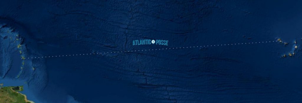
The Atlantic ITCZ, located between Africa and the Caribbean, is another region where careful planning and navigation are crucial. Many sailors crossing the Atlantic from the Canary Islands or Cape Verde to the Caribbean must contend with the ITCZ, particularly during the winter months when the zone is closer to the equator.
In this region, the ITCZ is often more active, with a higher likelihood of encountering squalls and thunderstorms. To minimize the time spent in the ITCZ, many captains choose to follow a more southerly route, staying below 10N for as long as possible before making the crossing. This approach allows them to take advantage of the stronger trade winds and avoid the most intense weather.
However, even with careful planning, the Atlantic ITCZ can be unpredictable, and captains must be prepared for a range of conditions. Regular communication with other vessels, monitoring of weather reports, and the use of satellite data can help in making informed decisions and ensuring a safe passage.
Dealing with Squalls and Thunderstorms: Best Practices
One of the most challenging aspects of navigating the ITCZ is dealing with squalls and thunderstorms. These intense and often short-lived weather events can pose a significant threat to the safety of the vessel and crew. Understanding how to recognize, prepare for, and respond to squalls is essential for any captain crossing the ITCZ.
Recognizing Squalls
Squalls are typically associated with the towering cumulonimbus clouds that form in the ITCZ. These clouds can be identified by their distinctive shape, with a flat base and a billowing top that often extends well into the upper atmosphere. As the squall approaches, you may notice a sudden drop in pressure, a darkening of the sky, and an increase in wind speed.
In some cases, squalls may be accompanied by thunder and lightning, which can add to the danger. It's important to keep a close eye on the sky and be alert for any signs of an approaching squall, particularly during the afternoon and evening when these events are most common.
Preparing for a Squall
When you identify an approaching squall, it's important to take immediate action to prepare the vessel and crew. This may include reducing sail, securing loose gear, and ensuring that all crew members are aware of the situation and ready to respond. Reefing the sails early is often the best course of action, as it allows you to maintain control of the vessel without being overpowered by the wind.
It's also important to secure any loose items on deck and below, as the sudden increase in wind and the rough seas that often accompany squalls can cause significant damage. Make sure that all hatches and ports are securely closed to prevent water from entering the vessel.
Navigating Through a Squall
As the squall hits, you'll need to maintain control of the vessel while minimizing the impact of the wind and waves. In many cases, the best approach is to head up into the wind, reducing your speed and allowing the squall to pass over you. This can help to minimize the strain on the sails and rigging and reduce the risk of damage.
If the squall is particularly intense, you may need to heave to, allowing the vessel to ride out the storm with minimal sail. This can be an effective way to maintain control and stability while waiting for the squall to pass.
Responding to Thunderstorms
Thunderstorms in the ITCZ can be particularly dangerous, as they are often accompanied by lightning, heavy rain, and strong winds. If you find yourself in the path of a thunderstorm, it's important to take immediate action to protect the vessel and crew.
First, reduce sail and secure the vessel as you would for a squall. Lightning poses a significant risk, particularly to vessels with tall masts, so it's important to minimize the risk of a direct strike. Ensure that all crew members are below deck, and avoid touching metal objects or electrical equipment.
If lightning strikes the vessel, it can cause significant damage to the electrical systems, so it's important to be prepared for the possibility of losing power or navigation equipment. Having a backup navigation plan, such as paper charts and a handheld GPS, can be invaluable in this situation.
The Psychological Impact of Navigating the ITCZ
Navigating the ITCZ can be a physically and mentally demanding experience for both the captain and crew. The uncertainty of the weather, the potential for long periods of calm, and the sudden onset of violent squalls can take a toll on morale and well-being.
As a captain, it's important to be aware of the psychological impact that the ITCZ can have on the crew and to take steps to maintain morale and mental health. This may include ensuring that the crew gets enough rest, providing regular updates on the weather and progress, and encouraging open communication.
It's also important to be patient and adaptable, recognizing that the ITCZ can be unpredictable and that plans may need to change as conditions evolve. By maintaining a positive and proactive attitude, you can help to keep the crew focused and motivated, even in the face of challenging conditions.
The Optimum Intermediate Waypoint
Obviously, based on the above illustrations, there is no precise optimum intermediate waypoint. All one can say is that at this time of year it is most likely to be somewhere between 03N and 07N at about 130W. Generally one needs to remain north of the ITCZ for as long as possible. This means one makes most of one’s westing in the northeast trades. Another reason to elect this strategy is that at this time of year the northeast trades tend to be stronger than the southeast
trades. A third reason is that one is more likely to find spaces between the convection cells the further one is to the west. However, it usually is not worth sailing further than about 132W before diving south; the extra distance isn’t worth it. There is a fourth reason that has to do with the doldrums. During the recommended season, there is a good probability that the further west one goes, the more likely one will find a sharp transition between the northeast and southeast trades. Cutting the corner before the recommended waypoint, i.e. diving south, increases the probability of encountering large areas of calm. If you leave late in the season, say in June, this becomes even more probable. The reason is that the low-pressure systems forming a few hundred miles off Southern Mexico during hurricane season have the effect of markedly reducing the strength of the winds in the far southeastern corner of the tradewind belt.
A fifth reason for making most of your westing in the northeast trades as well as not leaving it too late to depart, is that as hurricane season approaches, the southeast trades in the far Eastern Pacific steadily veer, becoming southwest winds. Not only would these winds be head winds, the severity of the ITCZ weather increases as the winds shift from a convergence situation to one of shear. On reaching the ITCZ most vessels power or motor sail due south so as to cut the ITCZ at right angles in order to transit in the shortest possible time. Once one is finally in steady southeast trades one sets course directly for the Marquesas. Sometimes the southeast trades are actually east winds.
Sailing this dogleg course is about 100 miles longer than the direct great circle or rhumb line route. That’s less than three percent more than the shortest route.
While this strategy minimizes the amount of time one may be exposed to the ITCZ, one should still expect squalls at any time along the route, especially after clearing the Revillagigedos Archipelago. After all, this entire 3000-mile passage is made in the tropics.
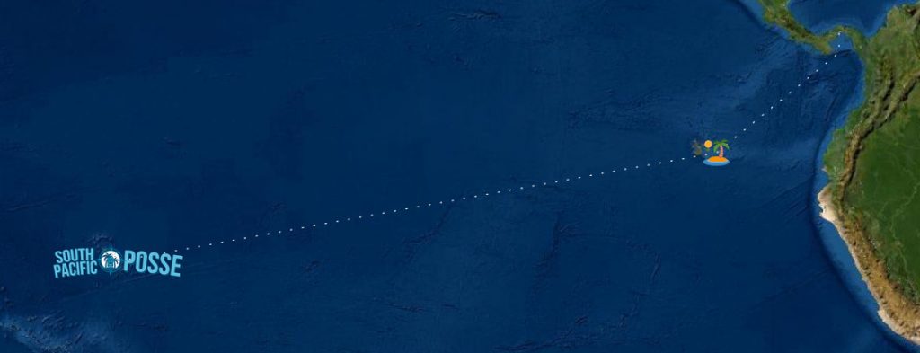
Navigating the ITCZ When Sailing from Panama to the Marquesas via the Galapagos
The journey from Panama to the Marquesas, with a stopover in the Galapagos Islands, is one of the most iconic passages for long-distance cruisers. This route takes you through some of the most challenging waters, where understanding the ITCZ and the broader meteorological patterns is essential for a successful and safe passage. The following considerations are crucial when planning and executing this voyage.
1. Timing the Departure from Panama
The timing of your departure from Panama is critical in determining how favorable the conditions will be as you approach and navigate through the ITCZ. Most captains aim to leave Panama between late February and early April, when the ITCZ is generally narrower and less active. This period also coincides with the transition from the dry season to the wet season in the eastern Pacific, which can help in avoiding the worst of the weather conditions.
Departing during this window also allows you to avoid the hurricane season in the eastern Pacific, which officially runs from May to November, with a peak in late August and September. By setting sail earlier in the year, you minimize the risk of encountering cyclonic activity, which can complicate the crossing of the ITCZ.
2. Navigating the Gulf of Panama
Before you even reach the ITCZ, you must contend with the conditions in the Gulf of Panama. This area is known for its variable winds, with the potential for both calm conditions and strong winds depending on the time of year and local weather patterns. The prevailing winds here are generally light and variable, especially during the dry season (December to April), but can pick up to 15-20 knots when influenced by the Papagayo winds from Central America.
The Gulf of Panama is also home to strong currents, particularly the Humboldt Current, which flows from south to north along the west coast of South America. Understanding these currents is essential for planning your route out of the gulf and towards the Galapagos Islands.
3. The Approach to the Galapagos Islands
Once you clear the Gulf of Panama, your next major milestone is the Galapagos Islands, located around 900 nautical miles to the southwest. The passage from Panama to the Galapagos typically involves crossing the equator and navigating through regions of light and variable winds, especially as you near the equator.
Look for elebated northerlies to blow you south West - they are strongest between Mid December - early April
The equatorial countercurrent, which flows eastward near the equator, can also impact your progress, requiring careful course adjustments. It's important to monitor the current patterns closely and adjust your route to take advantage of favorable currents while avoiding any areas of significant adverse flow.
The approach to the Galapagos can be complicated by the convergence of several currents, including the Humboldt Current, the South Equatorial Current, and the Cromwell Current (an upwelling current that brings cold, nutrient-rich water to the surface). These currents, combined with the frequent occurrence of light winds, can make for a slow and sometimes frustrating approach to the islands.
4. The Stopover in the Galapagos Islands
A stopover in the Galapagos is not only a unique opportunity to explore one of the most ecologically rich and biologically diverse regions in the world but also a chance to rest and prepare for the long passage ahead to the Marquesas. During your stay, it’s essential to check the latest weather updates and forecasts for the ITCZ, as its position and intensity can change during the time you are in the islands.
Ensure that your vessel is well-prepared for the next leg of the journey, including performing any necessary maintenance, provisioning for the long passage ahead, and ensuring that all navigation and communication systems are fully operational.
The Galapagos Islands also have strict regulations regarding biosecurity and the protection of the local environment, so it’s important to comply with all entry and exit requirements, including obtaining the necessary permits and following guidelines for waste disposal and anchoring.
5. Crossing the ITCZ from the Galapagos to the Marquesas
After departing from the Galapagos, the next significant challenge is crossing the ITCZ en route to the Marquesas. This leg of the journey covers approximately 3,000 nautical miles, and the ITCZ typically lies between 02°N and 07°N in this region, depending on the time of year.
Position and Width of the ITCZ:
- The position of the ITCZ in this area can vary significantly, sometimes shifting north or south depending on the broader atmospheric conditions, such as the El Niño-Southern Oscillation (ENSO). During an El Niño event, the ITCZ may shift further south, bringing wetter conditions to the region. Conversely, during La Niña, the ITCZ may shift north, which can lead to drier and more stable conditions in the equatorial Pacific.
Tactics for Minimizing Time in the ITCZ:
- To minimize your time in the ITCZ, it’s advisable to sail west as far as possible before turning south to cross the ITCZ. A common strategy is to stay near or slightly north of the equator, taking advantage of any favorable currents and winds, before making a southwesterly turn to cross the ITCZ at its narrowest point.
Navigating Squalls and Doldrums:
- The ITCZ is notorious for its unpredictable weather, including sudden squalls, heavy rains, and long periods of calm, known as the doldrums. When preparing to cross the ITCZ, it’s crucial to be ready for both extremes. Ensure that your crew is prepared for rapid changes in conditions, including reefing sails quickly during a squall and maintaining morale during extended periods of calm.
- Regularly monitoring the weather, using satellite imagery and onboard radar, can help in identifying areas of convective activity and planning your route to avoid the worst of the weather. Staying north of the ITCZ for as long as possible is often recommended, as this allows you to take advantage of the more consistent northeast trade winds before making the crossing.
Crossing Strategies:
- Once you decide to cross the ITCZ, maintaining a flexible approach is key. Be prepared to adjust your course to avoid the most active areas of convection, and consider motoring through periods of calm if you have sufficient fuel reserves. Many captains find that crossing at a slight angle to the ITCZ, rather than perpendicular to it, can help in reducing the time spent in the zone and avoiding the most intense weather.
6. Reaching the Marquesas
As you emerge from the ITCZ and enter the southern hemisphere, you’ll encounter the southeast trade winds, which will carry you toward the Marquesas. These winds are generally more stable and reliable than those in the northern hemisphere, making for a relatively straightforward passage to your destination.
The approach to the Marquesas is often a welcome relief after the challenges of the ITCZ. The islands themselves are a dramatic sight, with towering volcanic peaks rising out of the ocean, and they offer a safe and sheltered anchorage after your long passage.
Upon arrival, it’s important to remember that the Marquesas are part of French Polynesia, and you’ll need to comply with the local customs and immigration requirements. This may include obtaining a visa and completing entry formalities, so be sure to have all necessary documentation ready.
In addition to the formalities, take the time to enjoy the stunning natural beauty of the Marquesas, from the lush green valleys to the rich cultural heritage of the local communities. The islands are a true reward after the long and challenging passage from Panama, and they offer a chance to rest, resupply, and prepare for the next leg of your journey.
Conclusion: Navigating the ITCZ from Panama to the Marquesas via the Galapagos
The passage from Panama to the Marquesas, with a stopover in the Galapagos, is one of the most rewarding and challenging routes in long-distance sailing. By carefully planning your departure, understanding the unique challenges of each leg of the journey, and being prepared for the unpredictable nature of the ITCZ, you can navigate this iconic route with confidence.
As you sail through the ITCZ, remember that patience, preparation, and adaptability are your greatest allies. By staying informed, monitoring the weather closely, and being ready to adjust your plans as conditions change, you can ensure a safe and successful crossing, leading to the unforgettable experience of making landfall in the remote and beautiful Marquesas Islands.
Dr. Donald J. Anderson; Feb '07
The Intertropical Convergence Zone, usually referred to as the ITCZ, is a band of disturbed unsettled weather surrounding the earth a few degrees north of the equator where the northeast and southeast tradewinds converge and where the sea surface temperatures reach their maximum values. It is characterized by cells of moderate to strong convection interspersed with areas of flat calm (the doldrums). The convection cells appear as tall cumulonimbus clouds reaching heights well above 20,000 feet. At the surface beneath these cells there is frequent torrential rain with thunder and lightning.
Conditions are often squally with winds from any direction. The squalls rarely exceed 35 knots.
Unlike the bad weather associated with frontal systems at higher latitudes where they travel from west to east at about 20 knots or more, those in the ITCZ seem to form and dissipate in place, in other words they are stationary systems. Furthermore they can form and disappear over very short periods of time, sometimes less than 24 hours. Seas usually are moderate to small but confused since they can come from any direction or several directions at once. The ITCZ migrates north and south following the sun, lagging it by about two months. The north-south width of the disturbed area varies from none at all to as much as 300
miles wide. The north-south seasonal boundary migration is usually between about 01N and 14N with the northern extreme occurring during August and the southern extreme during February.
During the winter and spring months, when the ITCZ is closest to the equator, cyclonic storms can not form in the ITCZ because there is negligible coriolis force close to the equator. However, small area low level cyclonic circulations (LLCC’s) up to about 120 miles in diameter with winds to 35 knots do occasionally form with very heavy rain and of course confused seas. These have the characteristics of miniature tropical disturbances. They travel east to west at 10 to 20 knots embedded in the southern boundary of the northeast trades. The strongest winds will be found in their northwest quadrant where they enhance the trades.
During the late summer months, when the ITCZ is at its maximum north migration, it experiences a larger coriolis force (actually a conservation of momentum effect rather than a force). This physical situation is an essential component of cyclogenesis leading to tropical storms and hurricanes. It is the principal reason why the highest frequency and the greatest intensities for hurricanes occur during the months of August and September.
Another tropical weather phenomenon affecting conditions along the ITCZ is the tropical wave. This is a whole subject unto itself so suffice it to say here that if one is prudent and makes passage from Mexico to the Marquesas between mid-March through the end of April, one does not have to worry about them. However, later in the season they could really spoil you day.
Should you be unfortunate enough to be making this passage late in the season then here is the stuff to watch for. Each year on average, we experience about 60 tropical waves moving east to west. They begin their journey along the coast of West Africa and march west at 10 to 15 knots eventually dissipating near the date line. They are north-south troughs lying between about 05N and 18N, about 800 to 1200 miles long. Width is about 300 miles at the surface. They occur mid-May through the end of November so that means a wave passes about every three to four days. Most pass relatively unnoticed to the cruising sailor. Others cause a significant clockwise wind shift as they pass and some have torrential rain on the back side. A small number, about 16 in all, interact with disturbed areas in the ITCZ such that they become part of a significant tropical cyclone development, i.e. cyclogenesis.
In the Northeast Pacific, all tropical storms and hurricanes have at least one tropical wave as a component of their cyclogenesis. Only about half of the tropical cyclones on the Atlantic side have such a component, why I don’t know. Frequently in the transition zone between the stable northeast and southeast trades there is an area of southerly winds of 5 to 20 knots over a north-south distance of up to 100 miles. Northerly winds in the transition zone are very rare. Sometimes there is sufficient separation between the convection cells that one might find a smooth transition between the northeast and southeast trades with the winds never dropping below 15 knots. If one is fortunate enough to find this condition while transiting the ITCZ, it is more likely to be blind luck than astute strategic planning. The convection cells simply form, dissipate and reform in a seemingly random fashion over periods of less than 48 hours which is far too brief a period for a slow moving vessel to effectively steer a course that will assure her of a smooth transit of the ITCZ. The location of the actual convection is rarely right over the convergence zone. Strictly speaking, the convergence is a zone of wind convergence and the convection cells usually lie on the north side of the convergence zone with their southern boundaries close to the convergence line.
This annual migration is illustrated by the climates of those islands lying in the tropics versus those situated close to the equator. Isla del Cocos (5-30N 87-00W) and the Palmyra Atoll (5-55N 162-05W) are both situated at about 06ºN. Although they are 4500 miles apart, they both are within the ITCZ for most of the year which is the reason they have average annual rainfalls of about 280 and 180 inches a year respectively. This accounts for the large tropical rain forests on both islands. Isla del Cocos is the more humid of the two because it is situated in the far Eastern Pacific where winds are mostly light while the Palmyra Atoll is in the Central Pacific where the trade winds are well established and consistent. The Galapagos Archipelago (00-30N 90-40W) straddles the equator and Christmas Island (01-55N 157-25W) is only 115 miles north of the equator. Although they are 4000 miles apart, their annual rainfall is similar; about 20 and 35 inches respectively. Annual rainfall in the Galapagos is fairly consistent whereas on Christmas Island it goes through wide swings between moderate rainfall to periods of drought lasting 18 months or more. Part of the reason is the tendency of the ITCZ to thin out as it progresses west toward the Central Pacific. During a strong El Niño episode, when sea surface temperatures can be two to four degrees Celsius above normal, the trade winds are weaker and the annual rainfall in the Galapagos and Easter Island can exceed five times the average amount. As already mentioned, the recommended period for passages from Mexican ports to the Marquesas is about the middle of March through April. During this period, the ITCZ usually lies between about 03N and 07N.
The north-south width of the convection cells tends to decrease towards the west, especially west of about 125W. Figures 1 and 2 are color-coded infrared satellite images. Note the thinning out of the ITCZ as one moves west. Of even greater significance is the change in the ITCZ over a very short period of time. These images were taken only thirteen days apart. With that in mind, note the significant shift towards the south and the essential disappearance of any convection west of 130W on March 9. This does not mean the ITCZ is moving south in a predictable manner. It simply illustrates dramatically the large variations that can take place over very short periods of time. The distribution of convection could easily return to something like what existed thirteen days earlier. Such is the meandering variability of the convergence zone. The location of the ITCZ is given every six hours in the NWS High Seas Forecasts. The format is a sequence of lat/lon coordinates with comments on where along the ITCZ there is moderate or strong convection. This is useful information but one should not expect it to be current. The reason is that the convection cells can develop as strong thunderstorms and then be completely dissipated over a period of less than 24 hours. Unlike thunderstorms at higher latitudes, where they move from west to east at about 20 knots, those in the ITCZ tend to remain stationary. On the other hand, the latitude or line of the ITCZ, wiggles or meanders like the Gulf Stream. For a given longitude, the north-south position of the ITCZ can vary as much as 120 miles in a 24-hour period. What all this means is that by the time a vessel receives the ITCZ data, conditions have probably changed significantly. A slow moving vessel can not expect to find a hole in the convection chain based on information received via INMARSAT-C or USCG HF-voice weather forecasts. One might be able to improve one’s chances if one has the capability to receive (real time) the low altitude polar orbiting NOAA weather satellite infrared encoded images directly as they pass over one’s location. Aboard “SUMMER PASSAGE” we use the OCENS software and receiver. Forecasting the day-to-day meanderings of the ITCZ is for me at any rate impossible. It’s rather like trying to predict which way the rabbit is going to go when I chase him across the meadow. I know he probably will stay somewhere ahead of me, but when and where will he zig or zag? The only charts I’m aware of in the public domain that come reasonably close to forecasting the ITCZ are the streamline charts generated by the USN’s NOGAPS model. But even then, one has to weight or bias them each day based on QuikSCAT scatterometer surface wind data. Computed wind vectors from scatterometer measurements are remarkably accurate. However, one has to be careful not to put too much faith in the data on the edges of the swaths or in the vicinity of very heavy precipitation. So how does a slow moving vessel make something useful out of ITCZ data? Well, if one plots the coordinates every 24 hours, beginning several days in advance, and if one uses the same piece of paper or electronic chart, then one will have a band that shows the most probable width and location of the ITCZ. To illustrate this exercise I have plotted the daily coordinates given for the ITCZ over an eight-day period. Figure 3 shows these plots. Note the wider swings at the eastern end versus the smaller swings at the western end. Also note that during this brief period of time, the north-south swings range from about 175 to 475 miles. This illustrates my point that a slow-moving vessel can not expect to exploit the ITCZ to advantage. The rate of changes in the ITCZ far exceed the rate of progress of a slow-moving vessel. Obviously, based on the above illustrations, there is no precise optimum intermediate waypoint. All one can say is that at this time of year it is most likely to be somewhere between 03N and 07N at about 130W. Generally one needs to remain north of the ITCZ for as long as possible. This means one makes most of one’s westing in the northeast trades. Another reason to elect this strategy is that at this time of year the northeast trades tend to be stronger than the southeast trades. A third reason is that one is more likely to find spaces between the convection cells the further one is to the west. However, it usually is not worth sailing further than about 132W before diving south; the extra distance isn’t worth it. There is a fourth reason that has to do with the doldrums. During the recommended season, there is a good probability that the further west one goes, the more likely one will find a sharp transition between the northeast and southeast trades. Cutting the corner before the recommended waypoint, i.e. diving south, increases the probability of encountering large areas of calm. If you leave late in the season, say in June, this becomes even more probable. The reason is that the low-pressure systems forming a few hundred miles off Southern Mexico during hurricane season have the effect of markedly reducing the strength of the winds in the far southeastern corner of the tradewind belt. A fifth reason for making most of your westing in the northeast trades as well as not leaving it too late to depart, is that as hurricane season approaches, the southeast trades in the far Eastern Pacific steadily veer, becoming southwest winds. Not only would these winds be head winds, the severity of the ITCZ weather increases as the winds shift from a convergence situation to one of shear. On reaching the ITCZ most vessels power or motor sail due south so as to cut the ITCZ at right angles in order to transit in the shortest possible time. Once one is finally in steady southeast trades one sets course directly for the Marquesas. Sometimes the southeast trades are actually east winds. Sailing this dogleg course is about 100 miles longer than the direct great circle or rhumb line route. That’s less than three percent more than the shortest route. While this strategy minimizes the amount of time one may be exposed to the ITCZ, one should still expect squalls at any time along the route, especially after clearing the Revillagigedos Archipelago. After all, this entire 3000-mile passage is made in the tropics.
USA EAST COAST 🇺🇸 CRUISING THE EAST COAST WITH THE OCEAN POSSE
|
Sailing South from Maryland to Florida and Crossing Over to the BahamasIntroductionEmbarking on a sailing journey from Maryland to Florida and then crossing over to the Bahamas is an adventure that promises scenic beauty, diverse weather patterns, and a rich array of sailing experiences. This journey, often undertaken by cruisers and sailors, involves careful planning, strategic decision-making, and a good understanding of the various routes and challenges along the way. Route OverviewThe journey can be divided into several legs: the trip down the U.S. East Coast from Maryland to Florida, and the subsequent crossing of the Gulf Stream to reach the Bahamas. Each leg offers its own unique experiences and requires distinct preparations. Sailing from Maryland to FloridaThe Coastal Route (Outside)One of the primary decisions sailors must make is whether to sail offshore (the outside route) or to navigate the Intracoastal Waterway (ICW). The coastal route involves sailing in the open Atlantic Ocean, which can be faster but is dependent on favorable weather conditions. Advantages
Disadvantages
The Intracoastal Waterway (ICW)The ICW is a series of connected rivers, bays, and canals that provide a protected passage from Norfolk, Virginia, to Miami, Florida. Advantages
Disadvantages
Crossing the Gulf StreamThe Gulf Stream is a powerful, warm ocean current that flows northward along the eastern coast of the United States. Crossing this current is a critical part of the journey from Florida to the Bahamas. Timing the CrossingTiming is crucial when crossing the Gulf Stream. The best conditions for crossing occur when there is little to no wind from the north. North winds oppose the current, creating steep, choppy waves that can make the crossing dangerous.
Strategies for Utilizing the Gulf Stream
Reaching the BahamasEntry PointsThe most common entry points into the Bahamas from Florida are Bimini, West End, and the Abacos.
Navigating the Bahamian WatersThe waters in the Bahamas are shallow and filled with coral reefs. Accurate charts, local knowledge, and careful navigation are essential.
Preparation and ConsiderationsVessel ReadinessEnsure that your vessel is well-prepared for the journey. This includes:
SuppliesStock up on supplies, as some items can be expensive or hard to find in the Bahamas.
Legal and CustomsEnsure all paperwork is in order for clearing customs in the Bahamas.
|
EAST COAST MARINAS WHICH SPONSOR THE OCEAN POSSE
Marathon Marina – Florida, USA
Pier 66 Hotel & Marina – Ft. Lauderdale, Forida, USA
Titusville Marina – Florida, USA
IGY Marina at Ortega Landing – Jacksonville, Florida, USA
Morningstar Marinas Golden Isles St. Simons Isl. – Georgia, USA
Windmill Harbour Marina – Hilton Head South Carolina , USA
Coffee Bluff Marina – Savannah Georgia , USA
Hazzard Marine – Gerogetown, North Carolina , USA
Holden Beach – Town Dock, North Carolina , USA
Portside Marina – Morehead City, North Carolina USA
York River Yacht Haven – Virginia , USA
Yorktown Riverwalk Landing – Virginia USA
KEY WEST MARINAS
KEY LARGO MARINAS
Key Largo:
- Key Largo Harbor Marina
- Phone: +1 (305) 451-0045
- Website: Key Largo Harbor Marina
- Ocean Reef Club Marina (Private)
- Phone: +1 (305) 367-2611
- Website: Ocean Reef Club
- Marina Del Mar
- Phone: +1 (305) 451-4107
- Website: Marina Del Mar
- Gilbert’s Resort & Marina
- Phone: +1 (305) 451-1133
- Website: Gilbert’s Resort
- Anchorage Resort & Yacht Club
- Phone: +1 (305) 451-0500
- Website: Anchorage Resort
- Key Largo Fisheries Marina
- Phone: +1 (305) 451-3782
- Website: Key Largo Fisheries
- Pilot House Marina
- Phone: +1 (305) 451-3142
- Website: Pilot House
- Bayside Inn Key Largo Marina
- Phone: +1 (305) 451-4450
- Website: Bayside Inn Key Largo
- Mangrove Marina
- Phone: +1 (305) 852-8380
- Website: Mangrove Marina
- Sunset Cove Marina
- Phone: +1 (305) 451-0705
- Website: Sunset Cove
WEATHER
GULFSTREAM
TIDAL RANGE
Maximum Tidal range recorded has been 5.9 feet – check for local variations
FLORIDA PILOT CHARTS
EAST COAST Pilot Charts provide historic points and aggregated information of wind flows, air and ocean temperatures, wave heights, rain, barometric weight, and climate conditions at all seasons. This data was acquired from oceanographic and meteorologic perceptions over hundreds of years starting in the late eighteenth century. These diagrams are planned to help mariners choose routes with respect to the normal climate and sea conditions using prevailing seasonal wind information. For an explanation of historic East Coast Climatology and how to read Wind-Roses follow this link.
US FLORIDA HISTORIC HURRICANE TRACKS
PORTS OF ENTRY
Portsmouth, Virginia
36°50.4’N, 76°17.7’W
Located at the entrance to the Intracoastal Waterway (ICW), Portsmouth is a historic port city offering comprehensive services for sailors. The port is well-protected and has a bustling waterfront with marinas, shipyards, and nautical services. The Elizabeth River provides a scenic and navigable route into the harbor.
Charleston, South Carolina
32°46.6’N, 79°55.6’W
Charleston is a historic port city with a deep natural harbor that offers excellent facilities for sailors. The harbor is accessible via the Charleston Harbor Entrance Channel, and it provides easy access to the ICW. Charleston is known for its southern charm, historic architecture, and vibrant maritime culture.
Savannah, Georgia
32°05.6’N, 81°05.5’W
Savannah, located along the Savannah River, is a major port city with a rich history and well-developed maritime infrastructure. The port is accessible through a deep and well-marked channel, and it offers numerous marinas and boatyards. Savannah is renowned for its historic district and southern hospitality.
Fernandina Beach, Florida
30°40.2’N, 81°27.9’W
Situated on Amelia Island, Fernandina Beach is the northernmost port of entry in Florida. It provides a well-protected harbor with easy access to the Atlantic Ocean and the ICW. The port is known for its charming historic downtown, maritime services, and the annual Isle of Eight Flags Shrimp Festival.
Miami, Florida
25°46.4’N, 80°11.4’W
Miami is a major international port of entry with world-class facilities and services for sailors. The port is accessible via the Government Cut Channel, which is well-marked and deep. Miami offers a vibrant cultural scene, extensive maritime services, and is a popular departure point for the Bahamas and the Caribbean.
West Palm Beach, Florida
26°42.3’N, 80°02.8’W
West Palm Beach is a key port of entry on Florida’s Gold Coast, providing a protected harbor and easy access to the ICW and the Atlantic Ocean. The port features numerous marinas, repair facilities, and amenities for sailors. It is a gateway to the northern Bahamas and offers a bustling waterfront with shops, restaurants, and entertainment.
Jacksonville, Florida
30°23.5’N, 81°30.5’W
Jacksonville is located at the mouth of the St. Johns River, offering a large and well-protected harbor. The port is accessible via the deepwater channel of the St. Johns River Entrance. Jacksonville provides extensive maritime services, including marinas, shipyards, and chandlers, making it a convenient stop for sailors heading south or north along the coast.
Norfolk, Virginia
36°50.9’N, 76°17.7’W
Norfolk, located at the southern end of the Chesapeake Bay, is a major naval and commercial port. The port provides extensive facilities and services for sailors, including marinas, repair yards, and supply stores. Norfolk is a strategic starting point for entering the ICW and exploring the mid-Atlantic region.
Beaufort, North Carolina
34°43.2’N, 76°40.1’W
Beaufort is a historic port town located along the ICW and near the entrance to the Beaufort Inlet. The port offers a protected harbor with marinas and maritime services. Beaufort is known for its rich maritime history, scenic waterfront, and as a gateway to the Outer Banks and the Cape Lookout National Seashore.
Port Everglades, Florida
26°05.5’N, 80°06.7’W
Port Everglades, located in Fort Lauderdale, is one of the busiest cruise and cargo ports in the United States. The port offers a well-protected harbor with state-of-the-art facilities for sailors. It provides easy access to the ICW and the Atlantic Ocean, making it a strategic point for sailors heading to the Bahamas and beyond.
Port Canaveral, Florida
28°24.5’N, 80°36.3’W
Port Canaveral is a major port located on Florida’s Space Coast. The port offers a deep and protected harbor with extensive maritime services, including marinas and repair facilities. Port Canaveral is a convenient stop for sailors heading to the Bahamas and the Caribbean, and it is known for its proximity to the Kennedy Space Center.
Key West, Florida
24°33.5’N, 81°48.1’W
Key West is the southernmost port of entry in the continental United States, providing comprehensive customs and immigration services for arriving vessels. The harbor offers a well-protected anchorage, multiple marinas, and extensive maritime services. Key West is a vibrant destination known for its historic charm, cultural events, and lively waterfront.
Marathon, Florida
24°42.8’N, 81°05.9’W
Marathon, located in the middle of the Florida Keys, is a designated port of entry with customs and immigration facilities. The port is accessible via the Moser Channel and offers several marinas, boatyards, and marine services. Marathon is an important boating hub known for its convenient location, scenic beauty, and rich maritime culture.
Key Largo, Florida
25°05.4’N, 80°26.4’W
Key Largo is another port of entry in the Florida Keys, providing customs and immigration services for arriving vessels. The port is known for its proximity to the John Pennekamp Coral Reef State Park, making it a popular destination for divers and snorkelers. Key Largo offers multiple marinas and marine services, with easy access to both the Atlantic Ocean and Florida Bay.
Islamorada, Florida
24°55.0’N, 80°37.8’W
Islamorada serves as a port of entry in the Florida Keys, offering customs and immigration services. Known as the “Village of Islands,” Islamorada is a popular destination for sport fishing and water sports. The port provides several marinas and nautical services, catering to both recreational and commercial vessels.
Port Everglades, Florida
26°05.5’N, 80°06.7’W
While not technically part of the Florida Keys, Port Everglades in Fort Lauderdale is a major nearby port of entry for vessels heading to or from the Keys. The port offers comprehensive customs and immigration services and provides extensive facilities for sailors, including marinas, repair services, and supply stores. It is a strategic point for sailors heading to the Bahamas and beyond.
DOCUMENTS
CLEARING INTO THE US
- US CUSTOMS: US ROAM application was updated July 2022. A new feature assists with port check ins required by US Customs if the foreign vessel has the ROAM application. A vessel first checks in at arrival, and obtains a cruising permit. The vessel captain then enters in the Cruising Permit/ number to US ROAM application. After successful permit information is entered in ROAM, vessels can then use the application to do online check-in at their next port of entry/stops. If a cruising permit has not been entered into ROAM, a boat must physically check in at each stop made at US Ports. Basically a vessel either uses the ROAM app for online check in–or if ROAM is not available, they must check in physically at each port of entry, as has been done previously. There is no change in the need for foreign vessels to check in, just the way its possible.
US ROAM APP >>
1. Key West, Florida
24°33.58’N 81°47.80’W
Key West, Florida, is the southernmost point in the continental United States and a vibrant destination for sailors. Known for its historic charm, eclectic culture, and vibrant nightlife, Key West offers a unique blend of relaxation and adventure. Sailors can explore the turquoise waters of the Florida Keys, with ample opportunities for snorkeling, diving, and fishing. The island is home to several marinas, including the Key West Historic Seaport, providing top-notch facilities for visiting boats. On land, visitors can tour the Ernest Hemingway Home and Museum, stroll down Duval Street, and visit the Southernmost Point buoy. Key West is also famous for its sunsets, best viewed from Mallory Square, where nightly celebrations include street performers, food vendors, and live music. The combination of natural beauty, rich history, and lively atmosphere makes Key West a must-visit destination for sailors navigating the East Coast.
2. Miami, Florida
25°46.42’N 80°8.47’W
Miami, Florida, is a major hub for sailors, offering a mix of vibrant city life and beautiful waterways. Known for its iconic skyline, stunning beaches, and diverse culture, Miami is a key destination for those sailing along the East Coast. The city boasts several world-class marinas, including the Miami Beach Marina and the Miamarina at Bayside, providing excellent facilities for boats of all sizes. Sailors can explore Biscayne Bay, a popular spot for sailing and watersports, or head offshore to enjoy the Atlantic Ocean. Miami is also famous for its nightlife, with numerous bars, clubs, and restaurants offering a variety of entertainment options. Cultural attractions include the Art Deco Historic District in South Beach, the Vizcaya Museum and Gardens, and the vibrant neighborhoods of Little Havana and Wynwood. With its combination of natural beauty, modern amenities, and rich cultural offerings, Miami is a top destination for sailors.
3. Fort Lauderdale, Florida
26°7.70’N 80°6.58’W
Fort Lauderdale, Florida, known as the “Yachting Capital of the World,” is a premier destination for sailors. The city features an extensive network of canals and waterways, earning it the nickname “Venice of America.” Fort Lauderdale is home to several state-of-the-art marinas, such as the Bahia Mar Yachting Center and the Fort Lauderdale Marina, offering excellent services and amenities for visiting vessels. The city’s Intracoastal Waterway provides a scenic and sheltered route for navigating the coast. Sailors can enjoy the beautiful beaches, explore the historic Riverwalk, or visit the Bonnet House Museum and Gardens. Fort Lauderdale also hosts the annual Fort Lauderdale International Boat Show, one of the largest in the world, attracting boating enthusiasts from around the globe. The city’s vibrant dining and nightlife scene, combined with its natural beauty and excellent facilities, make Fort Lauderdale a must-visit for sailors on the East Coast.
4. West Palm Beach, Florida
26°42.79’N 80°2.99’W
West Palm Beach, Florida, is a vibrant coastal city known for its upscale atmosphere and beautiful waterfront. Located along the Intracoastal Waterway, West Palm Beach offers several marinas and docking facilities, including the Palm Harbor Marina and the Safe Harbor Rybovich, providing top-notch services for visiting sailors. The city’s scenic waterfront, Clematis Street, and CityPlace offer a variety of dining, shopping, and entertainment options. Sailors can explore the nearby Palm Beach, known for its luxury estates and pristine beaches, or visit cultural attractions such as the Norton Museum of Art and the Kravis Center for the Performing Arts. The waters around West Palm Beach are ideal for sailing, with plenty of opportunities for fishing, snorkeling, and diving. The combination of elegant surroundings, excellent facilities, and diverse activities make West Palm Beach a popular destination for sailors.
5. Jupiter, Florida
26°56.35’N 80°4.98’W
Jupiter, Florida, is a charming coastal town known for its picturesque waterways and relaxed atmosphere. Located along the Loxahatchee River and the Intracoastal Waterway, Jupiter offers several marinas and boatyards, including the Jupiter Yacht Club Marina and the Loggerhead Marina, providing excellent services for sailors. The Jupiter Inlet offers easy access to the Atlantic Ocean, making it a popular spot for offshore fishing and sailing. One of the town’s most iconic landmarks is the Jupiter Inlet Lighthouse, which offers panoramic views of the surrounding area. Sailors can explore the nearby beaches, such as Jupiter Beach and Juno Beach, known for their natural beauty and tranquil ambiance. The town also offers a variety of dining and entertainment options, with numerous waterfront restaurants and bars. The combination of scenic waterways, excellent facilities, and laid-back charm make Jupiter a must-visit destination for sailors navigating the East Coast.
6. Stuart, Florida
27°11.63’N 80°15.50’W
Stuart, Florida, known as the “Sailfish Capital of the World,” is a popular destination for sailors and fishing enthusiasts. Located on the St. Lucie River and the Intracoastal Waterway, Stuart offers several marinas and docking facilities, including the Sunset Bay Marina and the Sailfish Marina, providing top-notch services for visiting boats. The city’s location offers easy access to the Atlantic Ocean, making it an ideal spot for deep-sea fishing and sailing. Stuart’s historic downtown area features charming shops, restaurants, and galleries, offering a relaxed and friendly atmosphere. The nearby beaches, such as Bathtub Reef Beach, provide pristine spots for swimming and sunbathing. The St. Lucie Inlet Preserve State Park offers excellent opportunities for kayaking, hiking, and wildlife observation. The combination of excellent fishing, beautiful waterways, and a welcoming community make Stuart a favorite destination for sailors on the East Coast.
7. Fort Pierce, Florida
27°26.76’N 80°19.48’W
Fort Pierce, Florida, known as the “Sunrise City,” offers a blend of natural beauty, rich history, and vibrant culture, making it an attractive destination for sailors. Located along the Indian River Lagoon and the Intracoastal Waterway, Fort Pierce provides several marinas and docking facilities, including the Fort Pierce City Marina and the Harbortown Marina, offering excellent services for visiting vessels. The city’s historic downtown features a variety of shops, restaurants, and galleries, providing a welcoming and lively atmosphere. Sailors can explore the nearby beaches, such as Fort Pierce Inlet State Park, known for its pristine sands and excellent surfing conditions. The Indian River Lagoon offers abundant opportunities for fishing, kayaking, and wildlife observation. The combination of scenic waterways, excellent facilities, and diverse attractions make Fort Pierce a popular stop for sailors navigating the East Coast.
8. Vero Beach, Florida
27°39.58’N 80°22.60’W
Vero Beach, Florida, is a charming coastal city known for its pristine beaches, cultural attractions, and welcoming community. Located along the Indian River Lagoon and the Intracoastal Waterway, Vero Beach offers several marinas and docking facilities, including the Vero Beach City Marina and the Loggerhead Marina, providing excellent services for visiting sailors. The city’s beautiful beaches, such as South Beach and Jaycee Beach, offer perfect spots for swimming, sunbathing, and beachcombing. Vero Beach is also known for its cultural offerings, with attractions such as the Vero Beach Museum of Art and the Riverside Theatre providing enriching experiences. The nearby Indian River Lagoon offers abundant opportunities for fishing, kayaking, and wildlife observation. The combination of natural beauty, excellent facilities, and cultural attractions make Vero Beach a favorite destination for sailors on the East Coast.
9. Melbourne, Florida
28°5.66’N 80°36.59’W
Melbourne, Florida, located along the Space Coast, is a vibrant city known for its beautiful beaches, rich history, and technological innovation. Situated on the Indian River Lagoon and the Intracoastal Waterway, Melbourne offers several marinas and docking facilities, including the Melbourne Harbor Marina and the Telemar Bay Marina, providing excellent services for visiting sailors. The city’s historic downtown features a variety of shops, restaurants, and cultural attractions, offering a lively and welcoming atmosphere. Sailors can explore the nearby beaches, such as Melbourne Beach and Indialantic Beach, known for their pristine sands and excellent surfing conditions. The nearby Kennedy Space Center provides a fascinating glimpse into the history of space exploration. The combination of natural beauty, excellent facilities, and cultural and technological attractions make Melbourne a popular destination for sailors navigating the East Coast.
10. Cocoa Beach, Florida
28°22.77’N 80°36.39’W
Cocoa Beach, Florida, is a renowned destination known for its beautiful beaches, excellent surfing, and vibrant atmosphere. Located along the Space Coast, Cocoa Beach offers several marinas and docking facilities, including the Cocoa Village Marina and the Cape Marina, providing top-notch services for visiting sailors. The city’s famous beach is a hotspot for surfing, with the iconic Ron Jon Surf Shop offering equipment and lessons. Sailors can explore the nearby Banana River Lagoon, known for its rich biodiversity and excellent fishing opportunities. The city is also home to the Kennedy Space Center, where visitors can learn about the history of space exploration and witness rocket launches. The Cocoa Beach Pier offers dining, shopping, and entertainment options with stunning ocean views. The combination of natural beauty, excellent facilities, and diverse attractions make Cocoa Beach a must-visit destination for sailors on the East Coast.
11. Daytona Beach, Florida
29°13.66’N 81°0.50’W
Daytona Beach, Florida, is a lively coastal city known for its wide beaches, motorsports, and vibrant atmosphere. Located along the Atlantic Ocean and the Halifax River, Daytona Beach offers several marinas and docking facilities, including the Halifax Harbor Marina and the Daytona Marina, providing excellent services for visiting sailors. The city’s famous beach is known for its hard-packed sand, which allows for driving and various beach activities. Daytona Beach is also home to the Daytona International Speedway, hosting the annual Daytona 500 and other motorsport events. Sailors can explore the nearby Ponce de Leon Inlet, known for its historic lighthouse and excellent fishing opportunities. The city’s vibrant nightlife, with numerous bars, clubs, and restaurants, adds to its appeal. The combination of natural beauty, excellent facilities, and diverse attractions make Daytona Beach a popular destination for sailors navigating the East Coast.
12. St. Augustine, Florida
29°53.50’N 81°18.70’W
St. Augustine, Florida, known as the oldest city in the United States, is a historic and charming destination for sailors. Located along the Matanzas River and the Intracoastal Waterway, St. Augustine offers several marinas and docking facilities, including the St. Augustine Municipal Marina and the Camachee Cove Yacht Harbor, providing excellent services for visiting boats. The city’s historic district features cobblestone streets, colonial architecture, and landmarks such as the Castillo de San Marcos, a 17th-century Spanish fort. Sailors can explore the scenic waterways, visit the St. Augustine Lighthouse and Maritime Museum, or enjoy the beautiful beaches, such as St. Augustine Beach and Anastasia State Park. The combination of rich history, beautiful scenery, and excellent facilities makes St. Augustine a must-visit destination for sailors on the East Coast.
13. Jacksonville, Florida
30°19.47’N 81°39.19’W
Jacksonville, Florida, is a bustling city known for its expansive riverfront, vibrant culture, and diverse attractions. Located along the St. Johns River and the Intracoastal Waterway, Jacksonville offers several marinas and docking facilities, including the Metropolitan Park Marina and the Ortega River Marina, providing top-notch services for visiting sailors. The city’s riverfront area features numerous parks, restaurants, and cultural attractions, including the Jacksonville Landing and the Museum of Science and History. Sailors can explore the nearby beaches, such as Jacksonville Beach and Neptune Beach, known for their beautiful sands and excellent surfing conditions. The Timucuan Ecological and Historic Preserve offers opportunities for kayaking, hiking, and wildlife observation. The combination of urban amenities, natural beauty, and excellent facilities makes Jacksonville a popular destination for sailors navigating the East Coast.
14. Fernandina Beach, Florida
30°40.18’N 81°27.90’W
Fernandina Beach, located on Amelia Island in Florida, is a charming and historic town known for its Victorian architecture, pristine beaches, and rich maritime history. The town offers several marinas and docking facilities, including the Fernandina Harbor Marina and the Amelia Island Marina, providing excellent services for visiting sailors. The historic downtown area features quaint shops, restaurants, and museums, offering a welcoming and relaxed atmosphere. Sailors can explore the beautiful beaches, such as Main Beach and Peters Point Beach, known for their soft sands and clear waters. The nearby Fort Clinch State Park offers opportunities for hiking, biking, and exploring the well-preserved 19th-century fort. The combination of historical charm, natural beauty, and excellent facilities makes Fernandina Beach a favorite destination for sailors on the East Coast.
15. Brunswick, Georgia
31°8.19’N 81°29.51’W
Brunswick, Georgia, is a historic port city known for its beautiful waterfront, charming downtown, and rich maritime heritage. Located along the Turtle River and the Intracoastal Waterway, Brunswick offers several marinas and docking facilities, including the Brunswick Landing Marina and the Golden Isles Marina, providing excellent services for visiting sailors. The city’s historic district features beautiful Victorian-era buildings, quaint shops, and restaurants, offering a welcoming and relaxed atmosphere. Sailors can explore the nearby Golden Isles, including St. Simons Island and Jekyll Island, known for their beautiful beaches, golf courses, and historic sites. The surrounding waters offer excellent opportunities for fishing, boating, and wildlife observation. The combination of historic charm, natural beauty, and excellent facilities makes Brunswick a popular destination for sailors navigating the East Coast.
16. Savannah, Georgia
32°4.84’N 81°5.24’W
Savannah, Georgia, is a historic and picturesque city known for its charming squares, cobblestone streets, and Southern hospitality. Located along the Savannah River and near the Intracoastal Waterway, Savannah offers several marinas and docking facilities, including the Savannah Riverfront Marina and the Isle of Hope Marina, providing excellent services for visiting sailors. The city’s historic district features beautiful antebellum architecture, lush parks, and landmarks such as Forsyth Park and the Savannah Historic District. Sailors can explore the scenic waterways, visit the nearby Tybee Island with its beautiful beaches and historic lighthouse, or enjoy the vibrant dining and cultural scene. The combination of rich history, beautiful scenery, and excellent facilities makes Savannah a must-visit destination for sailors on the East Coast.
17. Hilton Head Island, South Carolina
32°10.52’N 80°45.74’W
Hilton Head Island, South Carolina, is a premier destination known for its beautiful beaches, world-class golf courses, and upscale amenities. Located along the Intracoastal Waterway, Hilton Head offers several marinas and docking facilities, including the Shelter Cove Marina and the Harbour Town Yacht Basin, providing top-notch services for visiting sailors. The island’s stunning beaches, such as Coligny Beach and Folly Field Beach, offer perfect spots for swimming, sunbathing, and beachcombing. Sailors can explore the scenic waterways, with opportunities for kayaking, fishing, and wildlife observation. The island is also home to several renowned golf courses, such as the Harbour Town Golf Links. The combination of natural beauty, excellent facilities, and upscale amenities makes Hilton Head Island a popular destination for sailors on the East Coast.
18. Beaufort, South Carolina
32°25.55’N 80°40.21’W
Beaufort, South Carolina, is a charming coastal town known for its historic charm, beautiful waterfront, and Southern hospitality. Located along the Beaufort River and the Intracoastal Waterway, Beaufort offers several marinas and docking facilities, including the Downtown Marina of Beaufort and the Lady’s Island Marina, providing excellent services for visiting sailors. The town’s historic district features beautiful antebellum homes, quaint shops, and restaurants, offering a welcoming and relaxed atmosphere. Sailors can explore the nearby islands, such as Hunting Island with its pristine beaches and historic lighthouse, or enjoy the scenic waterways with opportunities for fishing, kayaking, and wildlife observation. The combination of historical charm, natural beauty, and excellent facilities makes Beaufort a favorite destination for sailors navigating the East Coast.
19. Charleston, South Carolina
32°46.63’N 79°57.99’W
Charleston, South Carolina, is a historic and vibrant city known for its beautiful architecture, rich history, and Southern charm. Located along the Ashley River and the Cooper River, Charleston offers several marinas and docking facilities, including the Charleston City Marina and the Safe Harbor Charleston City, providing excellent services for visiting sailors. The city’s historic district features cobblestone streets, colorful antebellum houses, and landmarks such as the Battery and Rainbow Row. Sailors can explore the scenic waterways, visit the nearby beaches, such as Folly Beach and Isle of Palms, or enjoy the vibrant dining and cultural scene. Charleston is also home to several historic forts, including Fort Sumter, where the first shots of the Civil War were fired. The combination of rich history, beautiful scenery, and excellent facilities makes Charleston a must-visit destination for sailors on the East Coast.
20. Georgetown, South Carolina
33°22.06’N 79°17.67’W
Georgetown, South Carolina, is a historic port city known for its beautiful waterfront, charming downtown, and rich maritime heritage. Located along the Waccamaw River and the Intracoastal Waterway, Georgetown offers several marinas and docking facilities, including the Georgetown Landing Marina and the Harborwalk Marina, providing excellent services for visiting sailors. The city’s historic district features beautiful antebellum homes, quaint shops, and restaurants, offering a welcoming and relaxed atmosphere. Sailors can explore the scenic waterways, visit the nearby beaches, such as Pawleys Island and Litchfield Beach, or enjoy the vibrant dining and cultural scene. The surrounding waters offer excellent opportunities for fishing, boating, and wildlife observation. The combination of historic charm, natural beauty, and excellent facilities makes Georgetown a popular destination for sailors navigating the East Coast.
21. Myrtle Beach, South Carolina
33°41.91’N 78°52.87’W
Myrtle Beach, South Carolina, is a popular tourist destination known for its beautiful beaches, vibrant nightlife, and family-friendly attractions. Located along the Grand Strand, a 60-mile stretch of coastline, Myrtle Beach offers several marinas and docking facilities, including the Myrtle Beach Yacht Club and the Barefoot Marina, providing excellent services for visiting sailors. The city’s wide, sandy beaches are perfect for swimming, sunbathing, and beachcombing. Sailors can explore the nearby Intracoastal Waterway, known for its scenic beauty and excellent fishing opportunities. Myrtle Beach is also home to numerous entertainment options, including amusement parks, golf courses, and live shows. The combination of natural beauty, excellent facilities, and diverse attractions makes Myrtle Beach a must-visit destination for sailors on the East Coast.
22. Southport, North Carolina
33°55.56’N 78°1.17’W
Southport, North Carolina, is a charming coastal town known for its historic charm, beautiful waterfront, and relaxed atmosphere. Located along the Cape Fear River and the Intracoastal Waterway, Southport offers several marinas and docking facilities, including the Southport Marina and the Deep Point Marina, providing excellent services for visiting sailors. The town’s historic district features beautiful Victorian homes, quaint shops, and restaurants, offering a welcoming and relaxed atmosphere. Sailors can explore the scenic waterways, visit the nearby beaches, such as Oak Island and Bald Head Island, or enjoy the vibrant dining and cultural scene. The combination of historic charm, natural beauty, and excellent facilities makes Southport a favorite destination for sailors navigating the East Coast.
23. Wilmington, North Carolina
34°14.13’N 77°56.55’W
Wilmington, North Carolina, is a historic and vibrant city known for its beautiful riverfront, rich history, and Southern charm. Located along the Cape Fear River and near the Intracoastal Waterway, Wilmington offers several marinas and docking facilities, including the Port City Marina and the Wilmington Marine Center, providing excellent services for visiting sailors. The city’s historic district features cobblestone streets, beautiful antebellum homes, and landmarks such as the Bellamy Mansion and the USS North Carolina Battleship. Sailors can explore the scenic waterways, visit the nearby beaches, such as Wrightsville Beach and Carolina Beach, or enjoy the vibrant dining and cultural scene. The combination of rich history, beautiful scenery, and excellent facilities makes Wilmington a must-visit destination for sailors on the East Coast.
24. Morehead City, North Carolina
34°43.35’N 76°42.45’W
Morehead City, North Carolina, is a vibrant coastal town known for its beautiful waterfront, excellent fishing, and friendly community. Located along the Intracoastal Waterway and near the Atlantic Ocean, Morehead City offers several marinas and docking facilities, including the Morehead City Yacht Basin and the Portside Marina, providing top-notch services for visiting sailors. The town is famous for its annual Big Rock Blue Marlin Tournament, attracting fishing enthusiasts from around the world. Sailors can explore the nearby beaches, such as Atlantic Beach and Emerald Isle, known for their pristine sands and clear waters. The nearby Cape Lookout National Seashore offers opportunities for hiking, birdwatching, and exploring the historic Cape Lookout Lighthouse. The combination of excellent fishing, beautiful waterways, and friendly community makes Morehead City a favorite destination for sailors on the East Coast.
25. Beaufort, North Carolina
34°43.17’N 76°39.72’W
Beaufort, North Carolina, is a historic coastal town known for its charming waterfront, rich maritime history, and friendly community. Located along the Intracoastal Waterway and near the Atlantic Ocean, Beaufort offers several marinas and docking facilities, including the Beaufort Docks and Town Creek Marina, providing excellent services for visiting sailors. The town’s historic district features beautiful antebellum homes, quaint shops, and restaurants, offering a welcoming and relaxed atmosphere. Sailors can explore the scenic waterways, visit the North Carolina Maritime Museum, or take a ferry to the nearby Shackleford Banks, home to wild horses and pristine beaches. The nearby Rachel Carson Reserve offers opportunities for kayaking, birdwatching, and wildlife observation. The combination of historic charm, natural beauty, and excellent facilities makes Beaufort a must-visit destination for sailors navigating the East Coast.
26. Oriental, North Carolina
35°1.77’N 76°41.76’W
Oriental, North Carolina, is a small and picturesque town known as the “Sailing Capital of North Carolina.” Located along the Neuse River and the Intracoastal Waterway, Oriental offers several marinas and docking facilities, including the Oriental Marina & Inn and the Whittaker Pointe Marina, providing excellent services for visiting sailors. The town’s friendly and relaxed atmosphere is perfect for those looking to escape the hustle and bustle. Sailors can explore the scenic waterways, participate in local sailing events, or enjoy the town’s annual Oriental Boat Show. The nearby Pamlico Sound offers excellent opportunities for fishing, kayaking, and wildlife observation. The combination of a welcoming community, beautiful waterways, and excellent facilities makes Oriental a favorite destination for sailors on the East Coast.
27. New Bern, North Carolina
35°6.47’N 77°2.37’W
New Bern, North Carolina, is a historic and charming city known for its beautiful riverfront, rich history, and Southern hospitality. Located at the confluence of the Neuse and Trent Rivers, New Bern offers several marinas and docking facilities, including the New Bern Grand Marina and the BridgePointe Hotel and Marina, providing excellent services for visiting sailors. The city’s historic district features beautiful colonial architecture, quaint shops, and restaurants, offering a welcoming and relaxed atmosphere. Sailors can explore the scenic waterways, visit the Tryon Palace and Gardens, or enjoy the vibrant arts and cultural scene. The nearby Croatan National Forest offers opportunities for hiking, birdwatching, and wildlife observation. The combination of rich history, beautiful scenery, and excellent facilities makes New Bern a must-visit destination for sailors navigating the East Coast.
28. Ocracoke, North Carolina
35°6.75’N 75°59.22’W
Ocracoke, North Carolina, is a remote and charming island known for its pristine beaches, rich history, and relaxed atmosphere. Located on the Outer Banks and accessible only by boat or ferry, Ocracoke offers several marinas and docking facilities, including the Anchorage Inn and Marina and the National Park Service Docks, providing excellent services for visiting sailors. The island’s beautiful beaches, such as Ocracoke Beach, offer perfect spots for swimming, sunbathing, and beachcombing. Sailors can explore the scenic Silver Lake Harbor, visit the historic Ocracoke Lighthouse, or take a stroll through the quaint village. The nearby Cape Hatteras National Seashore offers opportunities for hiking, birdwatching, and wildlife observation. The combination of natural beauty, rich history, and relaxed atmosphere makes Ocracoke a favorite destination for sailors on the East Coast.
29. Cape Lookout, North Carolina
34°36.32’N 76°32.49’W
Cape Lookout, North Carolina, is a remote and scenic destination known for its pristine beaches, iconic lighthouse, and rich wildlife. Located on the southern tip of the Outer Banks, Cape Lookout offers several anchorage options for visiting sailors. The Cape Lookout National Seashore is a protected area that features beautiful barrier islands, sand dunes, and tidal marshes. Sailors can explore the scenic waterways, visit the historic Cape Lookout Lighthouse, or enjoy the unspoiled beaches, which are perfect for swimming, sunbathing, and beachcombing. The area is also known for its excellent fishing, kayaking, and birdwatching opportunities. The combination of natural beauty, rich wildlife, and remote location makes Cape Lookout a must-visit destination for sailors navigating the East Coast.
30. Wrightsville Beach, North Carolina
34°12.98’N 77°47.63’W
Wrightsville Beach, North Carolina, is a vibrant coastal town known for its beautiful beaches, excellent surfing, and laid-back atmosphere. Located near Wilmington and along the Intracoastal Waterway, Wrightsville Beach offers several marinas and docking facilities, including the Wrightsville Beach Marina and the Sea Path Yacht Club, providing top-notch services for visiting sailors. The town’s wide, sandy beaches are perfect for swimming, sunbathing, and beachcombing. Sailors can explore the nearby Masonboro Island, a pristine barrier island offering excellent opportunities for kayaking, fishing, and wildlife observation. The town also hosts several sailing and surfing events throughout the year, adding to its lively atmosphere. The combination of natural beauty, excellent facilities, and vibrant community makes Wrightsville Beach a popular destination for sailors on the East Coast.
31. Topsail Island, North Carolina
34°22.57’N 77°38.97’W
Topsail Island, North Carolina, is a beautiful barrier island known for its pristine beaches, relaxed atmosphere, and rich maritime history. Located along the Intracoastal Waterway, Topsail Island offers several marinas and docking facilities, including the Surf City Marina and the Harbour Village Marina, providing excellent services for visiting sailors. The island’s wide, sandy beaches are perfect for swimming, sunbathing, and beachcombing. Sailors can explore the scenic waterways, visit the Karen Beasley Sea Turtle Rescue and Rehabilitation Center, or enjoy the laid-back vibe of the island’s small towns. The nearby waters offer excellent opportunities for fishing, kayaking, and wildlife observation. The combination of natural beauty, relaxed atmosphere, and excellent facilities makes Topsail Island a favorite destination for sailors navigating the East Coast.
32. Swansboro, North Carolina
34°41.83’N 77°7.22’W
Swansboro, North Carolina, known as the “Friendly City by the Sea,” is a charming coastal town with a rich history and welcoming community. Located along the White Oak River and the Intracoastal Waterway, Swansboro offers several marinas and docking facilities, including the Swansboro Yacht Club and the Dudley’s Marina, providing excellent services for visiting sailors. The town’s historic district features quaint shops, restaurants, and historic buildings, offering a relaxed and friendly atmosphere. Sailors can explore the nearby Hammocks Beach State Park, known for its pristine beaches and excellent kayaking opportunities. The surrounding waters offer abundant opportunities for fishing, boating, and wildlife observation. The combination of historic charm, natural beauty, and excellent facilities makes Swansboro a popular destination for sailors on the East Coast.
33. Emerald Isle, North Carolina
34°40.57’N 77°0.81’W
Emerald Isle, North Carolina, is a beautiful coastal town known for its pristine beaches, clear waters, and family-friendly atmosphere. Located on Bogue Banks and along the Intracoastal Waterway, Emerald Isle offers several marinas and docking facilities, including the Emerald Isle Boating Access Area and the Island Harbor Marina, providing excellent services for visiting sailors. The town’s wide, sandy beaches are perfect for swimming, sunbathing, and beachcombing. Sailors can explore the scenic waterways, visit the nearby North Carolina Aquarium at Pine Knoll Shores, or enjoy the town’s laid-back vibe. The nearby waters offer excellent opportunities for fishing, kayaking, and wildlife observation. The combination of natural beauty, family-friendly atmosphere, and excellent facilities makes Emerald Isle a favorite destination for sailors navigating the East Coast.
34. Atlantic Beach, North Carolina
34°41.81’N 76°44.32’W
Atlantic Beach, North Carolina, is a vibrant coastal town known for its beautiful beaches, lively atmosphere, and excellent recreational opportunities. Located on Bogue Banks and along the Intracoastal Waterway, Atlantic Beach offers several marinas and docking facilities, including the Anchorage Marina and the Radio Island Marina, providing top-notch services for visiting sailors. The town’s wide, sandy beaches are perfect for swimming, sunbathing, and beachcombing. Sailors can explore the nearby Fort Macon State Park, known for its historic fort and scenic hiking trails. The nearby waters offer excellent opportunities for fishing, kayaking, and wildlife observation. The combination of natural beauty, excellent facilities, and vibrant community makes Atlantic Beach a popular destination for sailors on the East Coast.
35. New River, North Carolina
34°39.92’N 77°26.28’W
The New River, North Carolina, is a scenic and historic waterway known for its beautiful landscapes and excellent recreational opportunities. Located along the Intracoastal Waterway, the New River offers several marinas and docking facilities, including the New River Marina and the New River Yacht Club
REPAIRS AND SERVICE PROVIDERS
EMERGENCIES AND SAR INFO
JRCC Miami (7th District)
Type: JRCC, Country: United States, SRR: SRR Miami
Latitude, Longitude:
(25.83167076,-80.26999664)
Telephone:
1 305 415 6800
Email:
Fax:
1 305 415 6809
Website:
INMARSAT:
Telex:
+230 620 76733
Notes:
ANM 30/06 – – Email address updated January 4, 2011.
United States Coast Guard Operations Center – LANT
Type: MRCC, Country: United States, SRR: SRR Alameda | SRR Boston | SRR Cleveland | SRR Honolulu | SRR Juneau | SRR Miami | SRR New Orleans | SRR Norfolk | SRR Seattle | SRR UNITED STATES OF AMERICA
Latitude, Longitude:
(36.8363876,-76.2972183)
Telephone:
1 757-398-6700
Email:
Fax:
1-757-398-6775
US COAST GUARD web:
INMARSAT:
Telex:
Notes:
Coast Guard Command for Fleet, Rescue and Special Operations.
MRCC for SASS, Piracy, DSC, INMARSAT, EPIRB, AMVER, ELT and AIS notifications over all USA and territories SRRs. Atlantic Area Commander and Joint Task Forces.
CHARTS
- 4148 Havana to Tampa Bay
- 4149 Straits of Florida
- 11013 Straits of Florida and Approaches
- 11434 Florida Keys Sombrero Key to Dry Tortugas
- 11438 Dry Tortugas. Tortuga Harbor
- 11450 Fowey Rocks to American Shoal
- 11460 Cape Canaveral to Key West
- 11441 Key West Harbor and Approaches
- 11446 ICW Sugarloaf Key to Key West
- 11445 ICW Bahia Honda to Sugarloaf Key
- 11453 ICW Grassey Key to Bahia Honda
- 11449 ICW Matecumbe to Grassey Key
- 11464 ICW Blackwater Sound to Matecumbe
- 11463 ICW Sands Key to Blackwater Sound
- 11466 ICW Jupiter Inlet to Fowey Rocks
- 11474 ICW Bethel Shoal to Jupiter Inlet
- 11476 ICW Cape Canaveral to Bethel Shoal
- 11484 ICW Ponce de Leon Inlet to Cape Canaveral
- 11486 ICW St. Augustine Light to Ponce de Leon
- 11488 ICW Amelia Island to St. Augustine
AIDS TO NAVIGATION
COMMUNICATIONS
LAYING UP ON THE HARD
SY AVANT 🇨🇦 Rob & Debra – Beneteau 43.5′
We’ve had Avant offshore for a few years now and have developed a routine for
laying her up for the off season. It’s a fair amount of work, but pays
dividends in letting us come back to a vessel that’s not suffering from
mold or mildew, and hasn’t degraded (much) from the weather when we’re
away. We have set Avant up to wait for us on the hard and in the water,
and each has its unique requirements. Preparing the boat takes a
few days, but the effort pays dividends on our return.
MOLD
Mold is perhaps the most pernicious hazard for a laid up boat in the
tropics. If it gets a foothold, the warm, moist interior of the boat is
the perfect environment for it to grow, and it will grow everywhere, on
any surface. To forestall its growth, we clean the interior aggressively
and then spray all surfaces with a mixture of straight vinegar mixed
with a drop of dish soap per litre/quart (the dish soap is a surfactant
and stops the vinegar from beading), wipe them with a cloth wet with the
same mixture and allow the vinegar to dry in place. The ph value of
vinegar is antithetical to mold growth, and it simply won’t start where
there is vinegar on the surface. The smell is overwhelming on
application, but fades in an hour or so, and is undetectable on our
return. We also mist curtains and cushions with the same mixture, spray
liberally in the bilge, and leave a few bowls filled with just vinegar
(no soap) in various places around the boat to evaporate while we’re
away. We use at least a couple for gallons for this process.
View under the sun shade awning as we start to ‘gift wrap’ the rig with aluminum foil.
TARPS
Tarps are used for a couple of things: to keep sun off the decks and thus
control heat, and to keep the rain off portions of the deck. We use
them, but under the tarps we do get algae on deck.
BUGS
Of course, we live in fear of a bug infestation of some sort while away.
We buy cockroach bait (apparently the kind that comes in a tube like
toothpaste is best) and roach hotels and place them around the boat. We
use the whole tube, as this is not the place for half measures. We have
found two dead roaches and no live ones aboard on our return in the 14
years we’ve been laying up. We shudder to think how many we might have
found without the poison set out.
FOOD
The temperatures in the interior of the boat will be extreme: in the Sea of
Cortez, interior temperatures of 140°f/60°c are typically reached daily
for a boat on the hard for weeks at a time, and 120°f/49°c for a boat
in the water. We have had cans of food explode from the heat, and an
unopened bottle of ketchup left aboard cooked in the heat to turn the
rich dark brown colour of bbq sauce. For unopened food we want to try to
keep, we get small plastic bin liner bags and after emptying and dosing
the interior of the lockers with their vinegar wipe-down, we double bag
the food in small batches and stow back in the lockers. If a can
explodes it will do so inside the bag and the mess will be contained to
the ½ dozen or so items sharing the bag with it.
PLASTIC
Items made of plastic do not fare well. The heat and UV bake them. For items
below decks, we wet out a cloth with ArmorAll, Aerospace 303 or a
similar plastic treatment (easily found at auto stores) and wet wipe
them down. For items on deck that can’t be removed and brought below, we
treat them with protectant, wrap them in a layer of paper towel, wrap
aluminum foil over that (two layers of cheap tin foil seems to work
better than a single layer of thicker expensive stuff) and then secure
the tin foil with liberal amounts of duct tape (being very careful the
duct tape only adheres to the tin foil and not to anything under it). On
our return we find the duct tape has usually been reduced to a skeleton
of the reinforcement fabric and is easily removed.
We also wrap winches, blocks and all other deck hardware in a similar
fashion. UV will destroy the ball bearings in ball bearing blocks.
ZIPPERS AND SNAPS
Zippers and snaps like to corrode shut while the boat is laid up. We rub them
with cheap dollar store chapstick or lip balm (cheap lip balm is usually
a mix of waxes and petroleum oils like Vaseline) to increase the
chances they will work when we return.
ELASTIC
Elastic will no longer be after a season of baking in the heat. Shock cords
should not be used to secure anything as they will perish. Elastic in
clothing and swimming suits may not be elastic on your return.
LIGHTNING
Grounding. Most vessels are poorly grounded, and their grounding is ineffective
when hauled (yes, you can be struck by lightning when on the hard). You
can ground your boat quickly and simply with a set of jumper cables (or
add these to increase the grounding)
If in the water, we buy a set of cheap but fairly thick jumper cables.
Separate into two wires. Remove one clamp from each wire, strip back a
couple or six inches of insulation and ‘fray’ the end (or keep the clamp
and clamp it to a 1’x1’ metal plate) to make a better ground connection
with the water. We attach remaining clamp to a top shroud or other bit
of metal that connects to near the masthead and throw the frayed/plated
end in the water. One cable on the port side, one cable on the starboard
side.
If on the hard, separate cables and attach one to the top shrouds and Jack
stands on the port side, the other to the same points on starboard.
In either case, the cables will be trash at the end of the season, as they
are not designed for continuous outdoor use. Brushing clamps with wax,
Vaseline or any other topical protectant helps them rust less and look
better longer. Even if you *think* your boat might be/is well grounded,
these jumper cable tricks will ensure/increase the protection.
We gather up all portable and easily de-mounted electronics (hand held VHF
and GPS units, epirbs, led flashlights, portable radios, etc.) and wrap
them in paper towel, then in tin foil, then in plastic food wrap
(secured with masking tape), and then place them in the oven as a kind
of double faraday cage. We disconnect all antennas and easily unplugged
items like chartplotters, AIS, VHF, etc. and leave them disconnected and
just hanging to disrupt possible paths for lightning.
BATTERIES
Small batteries (AA, AAA, C, D, 9V, silver cells like A76, CR2025 and CR2032,
etc.) are removed from whatever they are powering, gathered,
inventoried and given away. They won’t be any good when we come back,
and we need to know how many and of what type we will need to bring when
we return.
The ships batteries (house and starting) we leave connected to our solar
array for charging while we’re away, to make sure power is available to
our bilge pumps. We disconnect (switch off at the panel) the shore side
charger as superfluous.
BILGE PUMPS
We inspect and test our bilge pumps. Avant will take on a bit of water
through the mast, and other leaks may appear over the season. We want a
bone-dry bilge to keep interior humidity down. We know of several
cruisers who have had a battery die due to bilge pump pumping, and
another couple who lost their boat to flooding while on the hard (their
cockpit drains blocked and water flooded in the companionway in a
tropical storm). If your boat has a garboard plug, you can leave it out
if you’re on the hard, and if it doesn’t and the concept works for your
hull form you can consider adding one.
THROUGH HULLS
We close all through hulls and tank vents and stuff stainless steel
scrubbies or rolled up green scrubbies in them if we’re on the hard. The
scrubbies prevent bugs from nesting in the holes. Some cruisers use
bromine tablets (for hot tubs) in their raw water strainers to
discourage growth there.
HEAD AND HOLDING TANK
We empty the holding tank and pump in 1 – 1½ gallons or so of vinegar and a
liberal amount of Pinõl or Lysol type cleanser. Better to have that
bake in the heat than what was in there before, and a completely dry
tank will form concrete-like deposits.
SAILS AND CANVAS
Sails and canvas are removed, inspected, repaired, cleaned, and neatly folded to be stowed below.
ENGINE
Our engine enjoys an oil change, fluid top up and wipe-down with an oily
rag before we go, and we leave the compartment door ajar so air can
circulate there too. Many cruisers do a freshwater flush of the
exhaust as well, but we don’t bother. Outboards are freshwater
flushed, given their annual service, and run dry of fuel before stowing below.
FUEL TANKS
Diesel tanks are filled to the top and treated with biocide (BioBore or
similar). Gas tanks are emptied, the gasoline given away, and the
plastic tanks are treated with ArmorAll or similar. We don’t bother
trying to ‘stabilize’ gasoline for storage, the quantity doesn’t justify
it. Jerry cans are emptied and treated with ArmorAll or similar. The
empty jerry cans and gas tanks are stored below.
PROPANE
We simply shut off the propane at the tanks.
WATER TANKS
Water tanks are emptied. When we return, we treat them as if contaminated as
recommended in this article. The water pump (and all other breakers save
the bilge pumps) is shut off.
MOORING LINES AND FENDERS
If we’re in the water, we double all mooring lines and add chafe guard (we
use fire hose) at all chafe points. We buy cheap children’s T-shirts
and slip them over our fenders as extra chafe guard/ UV protection,
securing them at the top end with small line or zip ties.
Even if you have a hired ‘boat watcher’ they’re unlikely to be 100%
available to come to your aid in a storm. They may be looking after
multiple boats, or the roof may be blowing off of their house (or their
mother’s house) in the same storm that threatens your boat. You need to
be secured for a storm.
Dinghy
We have a RIB inflatable dinghy, and some years we have been able to
secure covered storage for it at the marina or yard we’re at, which is
best. Other years we secured it to the deck upside down, inflated to
about ¾ normal pressure, spaced off the deck with dollar store pool
noodles and covered with a tarp. Protection from the sun while ensuring
its wrapping can’t hold water against the fabric are the keys to
success. If you can deflate yours and stow it below, that’s even better.
BOTTOM CLEANING
If you store in the water, you will need to arrange for regular bottom
cleaning. The interval will be determined by local conditions. Make sure
the cleaner is reliable, has references, and sends pictures or other
proof the job is being done: we know cruisers who found their cleaners
simply cashed the payments and didn’t do any cleaning until just before
their return.
CONTACT INFO
Post a card in the window with local contact information for your
boat-watcher (if you have one) and your contact info back home: name,
email, phone numbers.
When we return, we find Avant fresh and dirty, needing a good wash after we
enjoy a Christmas-like morning: like an unwrapping party of all her
tinfoiled appurtenances. After some reassembly, we’re ready to cruise
another season.
SY AVANT 🇨🇦 Rob & Debra – Beneteau 43.5′
GOOD NAUTICAL
AHOY !
... join the Ocean Posse to gain access to THIS AND OTHER information >>
JOIN THE OCEAN POSSE _FOR ACCESS TO THIS AND OTHER INFORMATION - SIGN UP HERE >>
ALREADY SIGNED UP ? FOLLOW THIS LINK TO LOGIN >>
The Ocean Posse offers many saving benefits in addition to validate information by fellow yacht owners >>
BENEFITS OF of joining the Ocean Posse
SAVE TIME - SAVE MONEY - and get the best and most up to date INFORMATION !
BENEFITS FOR YOU, YOUR YACHT & YOUR CREW |
|
|
PRE SEASON | IN SEASON | |
✔️ Up to date and verified information by fellow yachts | ✔️ | ✔️ |
📊 Communications focused on facts, not opinions or unsolicited advice | ✔️ | |
💰 Save real money at 70+ Marinas with discounts * | ✔️ ( June ) | ✔️ |
🛰️ Free vessel and fleet tracking courtesy of Predict Wind | ✔️ | |
🚩 Free Burgee | ✔️ | |
💰 Save with service providers and chandleries | ✔️ ( June ish ) | ✔️ |
🕵️ dedicated, experienced and discounted Canal and clearing in agents | ✔️ | ✔️ |
🗺️ Free aid to navigation 150 Gb OpenCPN satellite charts (mac/pc/android) | ✔️ immediately | ✔️ |
💰 Save Money on parts with a Westmarine Pro Discount | ✔️ | |
💰 Save Money with a Predict Wind Pro Discount | ✔️ | |
🗺️ Free Printable Reference Charts emergency backup to your electronics | ✔️ immediately | ✔️ |
📹 Free Video Seminars on destinations from those who are there | ✔️ immediately | ✔️ |
🌩️ Top weather routing avail by Marine Weather Center Chris Parker | ✔️ | |
⛵ Community of voyagers all are welcome, kids, single-handers, pets | ✔️ | ✔️ |
⚓ Peer support in emergencies with escalation procedures | ✔️ | |
🛈 Fleet Updates via email – free | ✔️ Prior Fleet immediately | ✔️ |
🏆 Fun Award Categories | ✔️ | |
📍 Free access to GOOD NAUTICAL Anchorage reports | ✔immediately | ✔️ |
☎️ Free Weekly live calls on Mondays via dedicated LINE.me group | ✔️ | |
💬 Free 24/7 LINE group channel | ✔️end of June | ✔️ |
🌊 Benefit from the latest information and prior experience participants | ✔️ | |
🔭 Be part of a fleet of sensor for those who come behind you or meet | ✔️ | |
🚷 Always priority traffic – for participants by participants | ✔️ |
- (* as long as you do not have prior contracts or reservations in place and of course subject to a marina’s availability the longer you stay the more discount the marina may give you )
If this is agreeable you can sign up now >>
Entering and Exiting Atolls in the South Pacific
1) enter during daylight hours
2) go in a slack tide or near slack tide – use interpolation to calculate slack tide – interploation and other tools are NOT perfect – be prepared to enter with ripples coming through
3) many times the atoll will still “empty out like a teacup” even though you are near slack tide as trade winds continuously fill the atoll due to elevated trade winds / big swell braking over the S / SE portion of the atolls
4) the most dangerous part are standing waves if you see those do NOT enter and wait
5) when entering with and out-flowing atoll your steering is enhanced as there is more water flowing over your rudders so in many case going in is easier than going out.
6) use satellite charts in addition to sonar charts to validate where shoaling and coral heads are as you enter the atoll.
7) if you can avoid entering during a squall, during low visibility and do no enter at night
8) The bigger the Atoll and the fewer the openings ( outflows ) the more ripping the current will be and the later the entry will be from slack tide
THE LONG OF IT
Where tide is of interest is around the atolls, explicitly when you are attempting to enter or leave one. Each pass is a flowing gateway. . The thing that matters is the passes here are undeniably more impacted by wind and wave impacts.
In the wake of visiting our third atoll and paying attention to the day to day dramatizations of others , we are examinging out when that subtle leeway will happen includes as much art as seamanship.
A few different rules for individual passes, again corresponding to a decent time from an essential port. Different tidal forecast distributions have a similar issue. They need to give you direction yet are restricted by the way that any direction they really do give is probably going to be erroneous.
There are not many essential ports here and the distance between where you are attempting to sort out your tides and where the essential is can rush to many miles. The two nearest to us Rangiroa (160miles away) and
Tahanea (around 100 miles), neither precisely close. Not an issue, I hear you say.
The enormous issue with the Tuamotos is that there are extra factors that can essentially modify the hour of slack water Despite the fact that tides are little, seldom north of one meter even at springs, the base outward momentum speed at passes in times of clear, actually weather conditions runs somewhere in the range of 4 and 6kts, subject to the atoll. With gigantic measures of water hustling all through the frequently restricted passes with reef tight either side, races, bubbles, standing waves and overfalls are normal external the brief time of slack, importance travel during slack remaining parts ideal. Nonetheless, the key proclamation that you should comprehend is that the active momentum speed is affected by climate and can, anytime of the tide, be essentially higher a speed than the approaching flowing stream.
Wind over tide is a significant thought In the Tuamotus, Atolls for the most part run SE to NW in locations. Most atolls are comprised of motus (the more modest islands making up the atoll’s edge) on the E side, where millennia of the ordinary trades have kept sand and ruin within the reef to shape them. The safeguarded W side is undeniably more infertile and most frequently comprises basically of reef with a couple of little segregated motus as it were. The S and N finishes of atolls will regularly have a motus because of the wave wash over impact of the ocean.
A few atolls (Makemo for example) have not many extremely lengthy motus on its E side which gives brilliant security to the tidal pond. Be that as it may, the more prominent the quantity of motus making up the E side of an atoll (Raroia has parts),
When the water is in the tidal pond, it necessities to get away and most atolls have yet a couple of fundamental passes where the water can escape from. Restricted measures of water will stream back out through the holes between the motus or back over the reef.
The course a pass faces is an element. One that faces E, into the Exchanges, will constantly have a breeze over tide impact during an active stream, keeping down and dialing the outward stream back
A decent wide, profound channel permits more water to drop of the tidal pond.
Also he size of the atoll thus the size of the catch region for water streaming in to the tidal pond. The most grounded of flowing races is at Hao, an exceptionally huge atoll. More than 30 miles in length it has a solitary pass confronting N. With such a lot of water coming into the tidal pond tossed over the reef, the race can work out positively past 10kts on an outward stream.
Thus, how much water in the tidal pond attempting to escape through the pass anytime of tide is the amount of what the weather conditions has unloaded across the reef and the typical tide. The more water there is in the tidal pond, the more prominent the momentum strength and speed of the active stream. This then, at that point, impacts a contrast among determined and genuine pants times. Furthermore, assuming that the tidal pond is exceptionally high after a time of terrible climate, you might find that the outward stream refutes the approaching tide, meaning no leeway period by any stretch of the imagination.
The Well known Guestimator gives the accompanying augmentations to current outward stream speeds:
1. Add 1 kt for each day the breeze has been blowing north of 20 kts from a S or W part
2. Add 0.5 kt for each day the breeze has been blowing more than 15 kts from a S or W part
3. Add 0.5 kt for each 1/2 meter augmentation of southerly swell over 1.5 meters (ie 3 meter grow = +1.5 kt)
4. Cap the Breeze Wave factor at 1.5 times the Typical Max Current
5. Take away 0.5 kt for wide/profound passes and for every additional pass that an atoll has
The Mona Passage
The Mona Passage | Canal de la Mona
Important Lights: Isla de Mona: Fl W
Canal de la Mona (Mona Passage), 61 miles wide between the west end of Puerto Rico and the east end of Hispaniola, is one of the principal entrances to the Caribbean Sea. Three small islands are located in the passage: Isla de Mona and Isla Monito about midway in the south part and Isla Desecheo about 12 miles west of the extremity of Puerto Rico in the north part. On the west side of Canal de la Mona, a bank extends from Cabo Engaño, the east extremity of Hispaniola, for 23 miles, with a least depth of 26 fathoms. Depths of 5 to 20 fathoms have been reported on the bank about 7 miles south-southeast of Cabo Engaño. Strong tide rips and heavy swells, caused by the meeting of contrary currents, are visible for many miles and mark the position of this bank. On the east side of the passage, an extensive bank makes off from the west coast of Puerto Rico extending p to 15 miles offshore. The west coast of Puerto Rico is described later in this chapter.
Currents Tidal currents set generally south and north through Canal de la Mona. Varying
AHOY !
... join the Ocean Posse to gain access to THIS AND OTHER information >>
JOIN THE OCEAN POSSE _FOR ACCESS TO THIS AND OTHER INFORMATION - SIGN UP HERE >>
ALREADY SIGNED UP ? FOLLOW THIS LINK TO LOGIN >>
The Ocean Posse offers many saving benefits in addition to validate information by fellow yacht owners >>
BENEFITS OF of joining the Ocean Posse
SAVE TIME - SAVE MONEY - and get the best and most up to date INFORMATION !
BENEFITS FOR YOU, YOUR YACHT & YOUR CREW |
|
|
PRE SEASON | IN SEASON | |
✔️ Up to date and verified information by fellow yachts | ✔️ | ✔️ |
📊 Communications focused on facts, not opinions or unsolicited advice | ✔️ | |
💰 Save real money at 70+ Marinas with discounts * | ✔️ ( June ) | ✔️ |
🛰️ Free vessel and fleet tracking courtesy of Predict Wind | ✔️ | |
🚩 Free Burgee | ✔️ | |
💰 Save with service providers and chandleries | ✔️ ( June ish ) | ✔️ |
🕵️ dedicated, experienced and discounted Canal and clearing in agents | ✔️ | ✔️ |
🗺️ Free aid to navigation 150 Gb OpenCPN satellite charts (mac/pc/android) | ✔️ immediately | ✔️ |
💰 Save Money on parts with a Westmarine Pro Discount | ✔️ | |
💰 Save Money with a Predict Wind Pro Discount | ✔️ | |
🗺️ Free Printable Reference Charts emergency backup to your electronics | ✔️ immediately | ✔️ |
📹 Free Video Seminars on destinations from those who are there | ✔️ immediately | ✔️ |
🌩️ Top weather routing avail by Marine Weather Center Chris Parker | ✔️ | |
⛵ Community of voyagers all are welcome, kids, single-handers, pets | ✔️ | ✔️ |
⚓ Peer support in emergencies with escalation procedures | ✔️ | |
🛈 Fleet Updates via email – free | ✔️ Prior Fleet immediately | ✔️ |
🏆 Fun Award Categories | ✔️ | |
📍 Free access to GOOD NAUTICAL Anchorage reports | ✔immediately | ✔️ |
☎️ Free Weekly live calls on Mondays via dedicated LINE.me group | ✔️ | |
💬 Free 24/7 LINE group channel | ✔️end of June | ✔️ |
🌊 Benefit from the latest information and prior experience participants | ✔️ | |
🔭 Be part of a fleet of sensor for those who come behind you or meet | ✔️ | |
🚷 Always priority traffic – for participants by participants | ✔️ |
- (* as long as you do not have prior contracts or reservations in place and of course subject to a marina’s availability the longer you stay the more discount the marina may give you )
If this is agreeable you can sign up now >>
TESTIMONIALS
John & Kristine
Tartan 42′“We’re humbled by the power of nature. The Posse gave us the confidence to embark on journeys we never thought possible. We started with a three-day passage and now, after an eight-day journey, we feel ready for more. We couldn’t have done it without the support and wisdom of the community.”
Laura & Scot
Beebe 50′“Our journey from the Pacific Northwest, through the Panama Canal, and down to Florida was filled with incredible moments, but the highlight was definitely going through the Panama Canal with the boat’s previous owners. The connection and camaraderie we felt with other Panama Posse members along the way made the adventure even more special.”
Rick & Maria
Beneteau ’37“Spending time in Banderas Bay reminded us of the wonderful Christmas and New Year we celebrated there with the Posse community. Meeting friends who have now made beautiful homes in the area was a highlight of our journey. We are now planning to bring our boat back to Hawaii, but the memories of this adventure will stay with us forever.”
With a 9.43 out of 10, the Ocean Posse ranks among the top-rated seafaring communities worldwide.
Our participants consistently recommend us to fellow adventurers.
This is testament to the exceptional experiences and camaraderie our participants are part of.
We are now in Costa Rica – we arrived yesterday – with a welcoming of a squall during our anchoring. We love the independence of sailing alone, but knowing that with just a few words, we can get all the assistance and knowledge we need from the Posse is incredibly reassuring. It’s the perfect balance of freedom and support. Of course we enlisted again for the next year – the money you pay you get back with the discounts – but I don’t care about that – it’s just a great idea and a great assembly – I love it !
Tomer & Limor
Tayana 48′
Kurtis
Bestway 50′I was class A plus O.C.D on the money wrapped tight SOB… as soon as I came across the border and saw the dolphins in front of the boat – clears his throat – a huge transformation – a lot came of my shoulder and I finally learned how to enjoy life like the dolphins – just have fun – occasional go over and have something to eat but then have some fun again. The posse is like I said before – the monetary is nothing – that was returned to me first time I bought something or the boat let alone all the other stuff and the discounts in marinas – the value is the people – it’s the camaraderie – every time you pull into a port you see that little burgee – hey I know you – and generally you do – it’s like you have family everywhere you go – and it’s just been awesome. The value is the people !
What you said way back in the beginning is true:so may things to see, and we go right by them. These amazing countries and places and cities and people usually have to get there. so our philosophy is we want to see as much as we can. We have no timeline so we have the luxury of doing this without a schedule. We had a great time with the rendezvous in Barra & we did some really nice l add on tours from Huatulco and Chiapas. We have been some really great amazing and beautiful places. Not to be obsequious, but I got to say this Posse organization has been so great. As an example – we cruising down the coast – and we get to marina Papagayo in Costa Rica – we have never been there and all the sudden we have 8 posse buddy boats that is 1000’s of miles away from where we started. It’s all thanks to the Ocean Posse – we really appreciate it – just loving it met so many great people and made so many good friends !
Jeff & Joy
DeFever 52′