
🇲🇽 MEXICO - PACIFIC

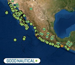
MARINAS MEXICO PACIFIC
- Marina Coral
- IGY Marina Cabo San Lucas
- Marina y Club de Yates Isla Cortés
- Marina de La Paz
- Marina El Cid Mazatlan
- Marina Vallarta
- Marina Puerto de la Navidad
- Marinas Ixtapa
- La Marina de Acapulco
- Vicente’s Moorings
- Marina Chahue
- Marina Chiapas
🇲🇽 MEXICO - CARIBBEAN
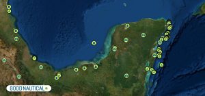
MARINAS MEXICO CARIBBEAN
| DOCUMENTATION | MEXICO |
| OPERATOR LICENSE | MEXICO |
| DOWNLOAD THE MEXICO BOATING GUIDE » |  |
| Passport | Valid for at least 6 months; requires one blank page |
| Boat Documentation | Coast Guard Doc (Original) |
| Proof of Insurance | Liability from a Mexican provider required |
| Crewlist | Required at checkin/out |
| Zarpe | Required at checkin/out |
| FISHING LICENSE | Required for each person BUY ONLINE @ sportfishingbcs.gob.mx |
| OFFICIAL PROCEDURES | |
| Official Country Visa | None if stay is less than 180 days $25 to replace if you loose the little card in your passport |
| Immigration Visa | Good for 180 days; must leave country to renew |
| Required Permits | TIP (Temporary Import Permit) – good for 10 years; fishing license required for each person aboard |
| Upon Arrival Visit: | Immigration; Customs; Port Authority |
| Upon Departure Visit: | Immigration; Customs; Port Captain |
| Entry & Exit Fees: | Free to $50 |
| Notes: | Expect to be boarded by Navy upon entering and/or leaving the country |
| OTHER | |
| Required Vaccinations | None |
| Pets | Vaccination Certificate |
| Currency: Peso |
 American Dollar to
  Mexican Peso
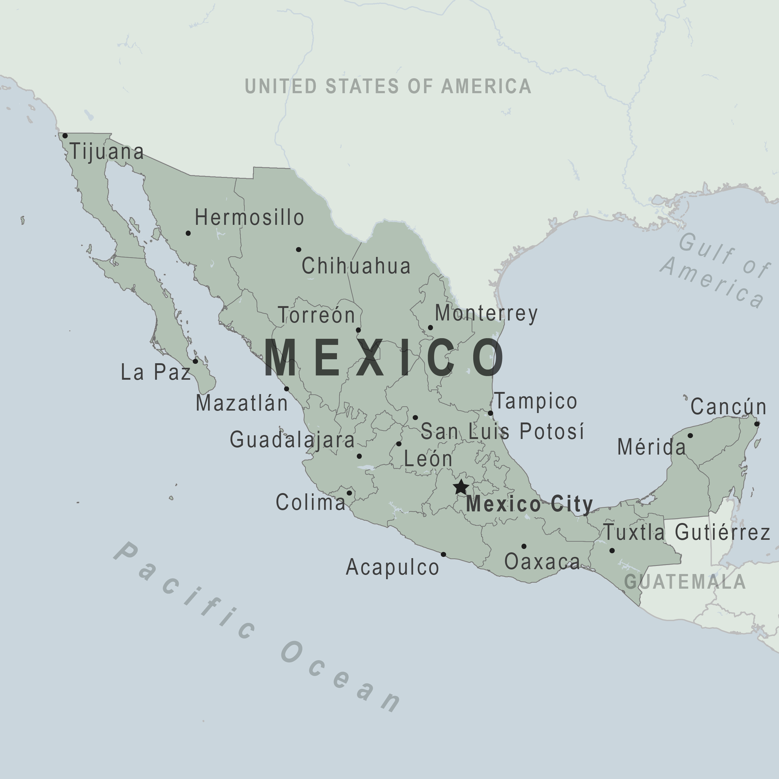
PORTS OF ENTRY
Caribbean
Cozumel, Isla Mujeres, Progreso, Puerto Aventuras, Puerto Juarez, Puerto Morelos
Pacific
Acapulco, Cabo San Lucas, Ensenada, Huatulco, La Paz, Mazatlan, Puerto Chiapas, Puerto Penasco , Puerto Vallarta, Salina Cruz, San Blas, Santa Rosalia, Zihuatenejo
| Crime Index | Safety Index | Corruption Index | Corruption Score | GDP | Pop (M) | Life Ex. | Cost of Living | Groc. | Rest. $ | Loc.Purch.P. |
| 50.32 | 49.68 | 123 | 30% | 8,699 | 124 | 76.7 | 29.39 | 28.88 | 26.78 | 50.43 |
US EMBASSY
TEL (01-55) 5080-2000
Paseo de la Reforma 305
Colonia Cuauhtenoc
06500 Mexico, DF
WEATHER PACIFIC & CARIBBEAN
TIDAL RANGE PACIFIC
North Ensenada 8.5 Feet North Inside the Sea of Cortez tidal range 21 feet Central Mexico Puerto Vallarta 6.1 feet Central Mexico Acapulco 4 feet South Mexico Chiapas 6 feet
TIDAL RANGE CARIBBEAN
Isla Mujeres Mexico 1.21ft. (0.37m) Cancun 0.8 feet Veracruz Mexico 3.18ft. (0.97m).
MEXICO PILOT CHARTS PACIFIC
The diagrams are planned to help the prudent mariner choose routes with respect to the normal climate and sea conditions. For an explanation of historic Mexican’s Climatology and how to read Wind-roses follow this link.
MEXICO PILOT CHARTS CARIBBEAN
MEXICO CARIBBEAN HISTORIC HURRICANE TRACKS
DOWNLOAD MEXICO PACIFIC PLANNING CHARTS
- 502 West Coast of North America / United States and Mexico
- 18000 Point Conception to Isla Cedros / California / Baja California / Mexico
- 21011 Punat Eugenia to Cabo San Lazaro / Baja California Sur / Mexico Mainland
- 21008 Golfo de California Northern Part / Mexico
- 21014 Cabo San Lazaro to Cabo San Lucas / Mexico
- 21017 Cabo San Lucas to Manzanillo
- 21020 Manzanillo to Acapulco / Mexico
- 21023 Acapulco to Puerto Madero / Mexico
MEXICO CHARTS CARIBBEAN
DOWNLOAD MEXICO CARIBBEAN PLANNING CHARTS
MEXICO SOUTH BOUND ROUTE SEGMENTS
SOUTH BOUND
🇺🇸 SAN DIEGO - ENSENADA 🇲🇽 65 nm
READ FULL DETAILS ON THE BAJA RUN HERE >>
🇲🇽 ENSENADA - TURTLE BAY 300 nm
READ FULL DETAILS ON THE BAJA RUN HERE >>
🇲🇽 TURTLE BAY - CABO SAN LUCAS 460 nm
READ FULL DETAILS ON THE BAJA RUN HERE >>
🇲🇽 CABO SAN LUCAS - Puerto Vallarta 370 nm
🇲🇽 PUERTO VALLARTA - BARRA DE NAVIDAD 160 nm
READ FULL DETAILS ON THE COSTALEGRE HERE >>
🇲🇽 BARRA DE NAVIDAD - ZIHUATANEJO 215 nm
READ FULL DETAILS ON THE COSTALEGRE HERE >>
🇲🇽 ZIHUATANEJO - ACAPULCO - HUATULCO 360 nm
🇲🇽 HUATULCO - CHIAPAS 253 nm
🇲🇽 CHIAPAS - PUERTO QUETZAL 🇬🇹 115 NM
ALERTS


KNOWN HIGH RISK AREAS
Do Not Travel To:
- Colima state due to crime.
- Guerrero state due to crime.
- Michoacán state due to crime.
- Sinaloa state due to crime.
- Tamaulipas state due to crime and kidnapping.
Reconsider Travel To:
- Chihuahua state due to crime.
- Coahuila state due to crime.
- Durango state due to crime.
- Jalisco state due to crime.
- Mexico state due to crime.
- Morelos state due to crime.
- Nayarit state due to crime.
- Nuevo Leon state due to crime.
- San Luis Potosi state due to crime.
- Sonora state due to crime.
- Zacatecas state due to crime.
For detailed information on all states in Mexico, please see below.
If you decide to travel to Mexico:
- Keep your traveling companions and family back home informed of your travel plans. If separating from your travel group, send a friend your GPS location. If taking a taxi alone, take a photo of the taxi number and/or license plate and text to a friend.
- Use toll roads when possible and avoid driving alone or at night. In many states, police presence and emergency services are extremely limited outside the state capital or major cities.
- Exercise increased caution when visiting local bars, nightclubs, and casinos.
- Do not display signs of wealth, such as wearing expensive watches or jewelry.
- Be extra vigilant when visiting banks or ATMs.
ENGLISH LANGUAGE LOCAL NEWSPAPERS AND NEWS SOURCES


Deko Marine & LOGISITCS
Carlos Castro
+1 619-571-0700
sales@dekomarine.com
2215 Paseo de las Americas,Suite 25