
🇭🇳 HONDURAS PACIFIC

🇭🇳 HONDURAS CARIBBEAN
| DOCUMENTATION |
HONDURAS 
TO MAKE THE ENTRY INTO HONDURAS FROM A SMALL YACHT OR SAILBOAT, FOLLOW THE FOLLOWING STEPS:
PRESENT A COPY OF EACH PASSPORT, BOAT NAVIGATION PERMIT, LAST PORT CLEARANCE.
TO REQUEST CLEARANCE TO EXIT HONDURAS ,
cp.roatan@marinamercante.gob.hn WAIT FOR THE SIGNED CLEARENCE PRESENT A COPY OF EACH PASSPORT, BOAT NAVIGATION PERMIT, PERMISSION RECEIVED FROM TIE PORT CAPTAIN UPON ARRIVAL
|
| Currency: Lempira |
 American Dollar to
  Honduran Lempira
PORTS OF ENTRY
Caribbean
Cayos Cochinos, La Ceiba, Puerto Castilla, Puerto Cortes, Puerto Lempira, Swan Islands
Pacific
San Lorenzo
| Crime Index | Safety Index | Corruption Index | Corruption Score | GDP | Pop (M) | Life Ex. | Cost of Living | Groc. | Rest. $ | Loc.Purch.P. |
| 78.34 | 21.66 | 123 | 30% | 2,551 | 8.8 | 74.6 | NA | NA | NA | NA |
US EMBASSY
TEL 504 2236 9320
+504 2238-5114; after hours emergency: same but dial Ext. 4100
Avenida La Paz
Tegucigalpa MDC
Honduras
https://hn.usembassy.gov/
WEATHER
PILOT CHARTS
Pilot Charts depict averages in prevailing winds and currents, air and sea temperatures, wave heights, ice limits, visibility, barometric pressure, and weather conditions at different times of the year. The information used to compile these averages was obtained from oceanographic and meteorologic observations over many decades during the late 18th and 19th centuries.
The charts are intended to aid the navigator in selecting the fastest and safest routes with regards to the expected weather and ocean conditions. The charts are not intended to be used for navigation.
🇭🇳 Honduras
CHARTS
DOWNLOAD REFERENCE CHARTS
PACIFIC
- Golfo de Fonseca – HONDURAS – EL SLAVADOR _ NICARAGUA 21521
-
Acajutla to Corinto – GUATEMALA – EL SALVADOR – HONDURAS 21520
CARIBBEAN
-
Northern Reaches to Cabo Gracias a Dios – (Caribbean Sea-Honduras) HONDURAS 28140
-
Cayos Vivorillo, Becerro and Caratasca (Caribbean Sea-Honduras) – HONDURAS 28103
-
Approaches to Puerto Castilla (Caribbean Sea-Honduras) – HONDURAS 28151
-
Approaches to La Ceiba (Caribbean Sea-Honduras) – HONDURAS 28154
-
Coxen Hole and French Harbor (Caribbean Sea-Honduras) – HONDURAS 28153
-
Isla de Guanaja (Caribbean Sea-Honduras) – HONDURAS 28152
-
Approaches to Puerto Cortes (Gulf of Honduras) – HONDURAS 28170
-
Approaches to Puerto de Tela (Gulf of Honduras) – HONDURAS 28171
-
Tela to Pelican Cays – HONDURAS – GUATEMALA – BELIZE – 28162
AIDS TO NAVIGATION
Please sign up with Good Nautical for Anchorages, Marinas, and Ports of Entry Information.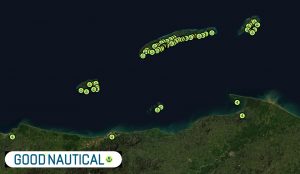
HONDURAS - GOLFO DE FONSECA - ROUTE SECTIONS
🇭🇳 GOLFO DE FONSECA - SAN LORENZO RIVER 🇭🇳
25 nm
🇸🇻 🇭🇳 GOLF DE FONSECA / ISLA EL TIGRE 🇭🇳
- MARINA PUESTA DEL SOL 🇳🇮
60nm
ALERTS


HONDURAS SEARCH AND RESCUE SAR
RCC Centro America &SPOC (COCESNA)
Type: MRCC, Country: Honduras, SRR: Honduras SRR | SRR HONDURAS
Latitude, Longitude:
(14.1000004,-87.0999985)
Telephone:
+504 22342507 alternative: +504 22331116
Email:
Fax:
504 234 2488 alternative email: coordinadorsar@ahac.gob.hn
Website:
INMARSAT:
Telex:
Notes:
Alternate E-mail; gustavogoemail@yahoo.com for RSC Honduras, rcc_sar@cocesna.org for RCC/SPOC of Central America.
In case of no response to the number 22331116, you can contact directly at cell number 99711321I
RCC Honduras
Type: ARCC, Country: Honduras, SRR: SRR HONDURAS
Latitude, Longitude:
(14.09832954,-87.20333099)
Telephone:
504 234 3360 ext 1310/1305
Email:
Fax:
504 234 2507 504 234 2488
Website:
INMARSAT:
Telex:
Notes:
FAX UPDATED BY RCC NORFOLK 12/24/2009