BOCAS DEL TORO ANCHORING ALERT

BOCAS DEL TORO ANCHORING ALERT

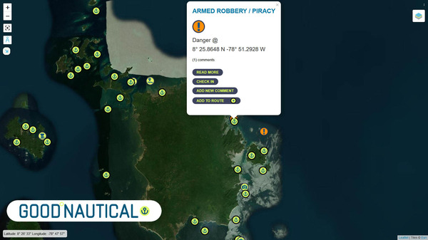
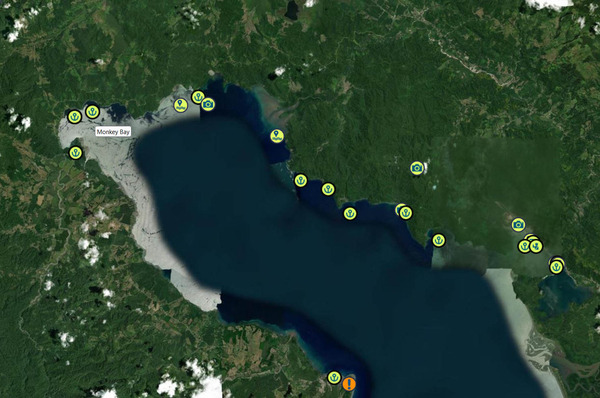
New Anchor restrictions in Bocas Del Toro just coming out. To avoid heavy fines check for up to date information to know where anchoring is allowed.

SV MAISON DE SANTE  spent hurricane season in Bocas Del Toro.  They have a finger on the pulse there and share new restrictions that affect the anchorage in Bocas del Toro outside Red Frog Marina.

ATTENTION: Starting December 6, 2024, boats are NO longer able to anchor outside Red Frog Marina in Bocas Del Toro, Panama or they may be subject to $250-$300 fine by the Armada. All boats who were in the anchorage were told to leave by the Armada yesterday. I confirmed this with both a boat who was in the anchorage as well as a marina resident. The exact circumstances that led to this decision are unknown at this time.

SY MAISON DE SANTÉ 🇺🇸 Nicole & Keenan -  Cal 46'


ADVENTURES IN PANAMA ABOUND PART 1

ADVENTURES IN PANAMA ABOUND

PART 1: ISLA TABOGA

Cruisers visiting Panama find adventures on land and out on the water.  Over the years Posse members have collectively seen so much of what the country has to offer.  There are so many great adventures to chose from.  A quick list includes: Isla Taboga, the mountain towns of Boquette and El Valle, the Canal Museum in Casco Viejo, the sloth sanctuary in the Gamboa Reserve, cruising the Coiba group, cruising the Perlas Islands, walking up Ancon hill overlooking Panama City, touring the Miraflores Lochs....and many many more.  Part 1 of ADVENTURES IN PANAMA ABOUND will explore the interesting history and adventure opportunities at Isla Taboga, Panama.

image
Town of Taboga as seen from the head of the Ferry Dock.

Rich in historical significance and boasting a relaxed getaway charm, Isla Taboga is an excellent place to visit near Panama City.  The island is so close to the city that there are multiple daily 30 minute ferries that bring people to and from the island for $17 round trip.  People visit to enjoy the beach, restaurants, hotels, multiple hiking trails, and the history.

Panama Posse parrtty HQ
Anchorage can be found on either side of Isla Morro.

Isla Taboga was discovered in 1513 by the Spanish explorer Vasco Nunez de Balboa.  Many subsequent explorers who crossed the Atlantic from Seville, Spain would disembark in what is now Portobello on the Caribbean coast of Panama, cross the isthmus of Panama on foot or by horseback until they reached Panama City.  They would then board canoes to the galleons anchored off Taboga.  Deep waters with good holding surround the island and made it an excellent place for large vessels to find safe harbor from which to explore and conquer new lands near and far.

This painting from 1850 shows Ships of old on Anchor in the deep waters off Taboga.

Like the ships of old the same anchorage is used today by modern transporters awaiting passage through the Panama Canal.

Going back 500 years again: By 1524 Father Hernando de Luque founded a church in the center of town and christened the town San Pedro.  The Church, while noted for being one of the oldest churches in the Western Hemisphere, is still standing and well cared for.

A view inside the church.
The Church faces a small square overlooking the harbor.

In the late 1500’s the island was renamed Taboga.  “Aboga” means “abundant fish” in the indigenous language of Taboga’s early inhabitants.  In the 1500’s many of Taboga’s inhabitants on record were slaves from Venezuela and Nicaragua.  The first Catholic saint of the Americas is said to have been born on the Island.  There is a cross in her honor on a hilltop with a beautiful view.  Today many people think of Taboga as the ”Island of Flowers” for all the flowers cascading over walls (from the most well maintained to the ancient, crumbling ones) and growing in the jungle.  The island is 12 square km; town itself, like many on the nearby islands, is quite densely packed and surrounded by wild jungle.

The island has a network of walking paths.

Today, one can travel along all the residential footpaths or in golf carts on the narrow streets in an afternoon and could spend days and days meandering through the jungle in search of treasure, wildlife, or relics of the past.

Treasure: Early prosperity turned Taboga into a target for piracy.  In the 1600’s pirates became a formidable force in the area and Taboga was no stranger to their presence and pillaging.  Infamous Pirate Henry Morgan among others is said to have sacked the island and used it as a base while attempting to sack Panama City and other nearby islands.  Legend has it that there are ashes of pirates inside the walls of the church and treasures buried on the island.  One can walk to a monument called Los Tres Cruzes to see the three graves of pirates that attempted to disturb the peace on Taboga.  They lost their lives in the fight and have remained as a symbol to all who visit.  Taboga is not to be sacked ever again.

Wildlife: Taboga is a volcanic Island that rises above the sea with a dense and healthy tropical forest.  While hiking through the forest we were treated to many (74) poison dart frog sightings, the smell of flowers, the sound of rain paddling the canopy overhead, the refreshing cool of mist hanging in the air slowly dripping down to the dark brown forest floor.  On the highest peak we enjoyed being at eye level with the largest and smallest of birds, from the black headed vultures to bright green teeny-tiny hummingbirds.

Relics of the past:  In the 1840’s the Pacific Mail and Steamship Company set up a shipping company on Taboga thinking they would move mail and produce throughout the region.  They ended up moving gold and gold diggers to and from California during the Gold Rush.  There are remnants of their shipyard operation on Isla Morro which is connected to Taboga by a sand spit.  In 1885 a medical center was built on the island while the French were making their attempt at the Panama Canal construction.  Many workers would take ill and go to Tabogo for care and quarantine.  While convalescing on Taboga, French painter Paul Gauguin, painted a scene of the bay that is appreciated to this day.  Additionally, the US military build a base on the island during WWII.  A bunker was built on the highest point with a 360 degree view that today offers a welcome breeze and incredible views of Taboga Bay, Panama City, the perlas Islands, and ships awaiting Canal transit.

An large, old anchor sits on Isla Morro with connecting sandspit and Isla Taboga in the background.
Poison Dart Frogs are everywhere in the jungle on Isla Taboga
Colorful mushrooms are also abundant on the forest floor.
So many ships on anchor between Isla Taboga and Panama City.

TO LEARN MORE ABOUT THE LEGENDS AND HISTORY OF TABOGA SEE THIS LINK: http://cerritotropicalpanama.com/pdf/1Piratetalesandtruths.pdf


MV TIDINGS OF JOY VISITS AN EMBERA VILLAGE

MV TIDINGS OF JOY VISITS AN EMBERA VILLAGE

Highlights visiting an Embera village in Panama; we were welcomed with music
The Embera traditionally cook over an open fire.  We enjoyed fresh caught fish and plaintains.
The Embera live in elevated thatch roofed huts

Tidings of Joy took a guided tour of the native village of the Embera tribe in Panama recently.  Here is their trip report:

Our wonderful guide Goran (+507 6314-0827) picked us up in front of Flamenco Marina and drove for a short, one hour drive outside the city to Chagres National Park. We watched the buildings, traffic and. noise melt into green lush trees, birds and silence. When we arrived at the parking lot, we were met by two native Embera men wearing traditional clothing. Our guide mentioned this isn’t their everyday wears but when there is a celebration, or they want to demonstrate their culture they will wear them. We walked down to a long, narrow wooden boat with single rows of seats that didn’t appear very sturdy at first glance. As we filed in one by one we were careful to walk in the middle to not tip the boat. One native man drove the outboard powered boat from the stern while the second man stood watch on the bow using a homemade wood pole as both a spear and a seat.

The bowman.
Jeff and Joy of MV Tidings of Joy sitting in a single wide vessel en route to the village
A waterfall in the lush jungle near the village

The river was long and somewhat shallow in spots and wrapped in green voluptuous trees. Birds flew overhead as we wound our way down the river. Our first stop was a forest where we walked on a muddy path over rocks and through streams to get to a gorgeous waterfall. Despite the water being a little chilly we all plunged in and swam to the waterfall. It felt freeing and safe and perfect. After we finished gallivanting in the water we made the trek back to our wood boat and carefully piled in. Our next stop was at the Embera village where women in traditional clothes greeted everyone individually shaking our hands and saying “welcome/bienvenido” as we walked up the slight incline towards the village. As we got closer four Embera men were standing in a line playing traditional music welcoming us. We were all seated in one of their two communal kitchens and observed two women frying up fish and plantains in a cauldron full of oil. While we waited for lunch to cook a different native woman stood in front of us and told us about their rich and vast history. We learned that the Embera tribe was not always from this area but used to reside down in the Darian region but because the boat ride full of fresh fruits to sell in the city took 7 days causing all of their food to spoil, they decided to move closer to the city. In this Embera village there are only 25 families. Each one lives in a homemade wooden house elevated 5-6 feet from the ground to prevent flooding and minimalize animal invasion. Children are taken by boat to school in a neighboring village where a teacher from the city teaches them Monday-Friday before returning to the city for the weekend. Presently, tourism is their main source of income. Each day men go out fishing and bring their catches back for the woman to prepare for the days meals. After our education about the Embera tribe we feasted on a lunch of fried fresh tilapia and fried plantains all served in a banana leaf wrapped in the shape of a bowl and a table full of fresh fruits the guides had provided. With full bellies and a lot to think about we were escorted into a large communal hut we were told was used for ceremonies and communal gathering. The locals had tables surrounding the perimeter filled with handmade crafts for sale. They wove baskets and plates and bowls along with jewelry and fabric they had created the designs for. Some of the men had wood carvings for sale of various animals and even wooden knives which Jeff decided he needed to have. After a brief lap around we all sat on wood benches and watched as the native woman performed traditional dances. Several men surrounded them playing instruments while they chanted and moved around. They even encouraged audience participation, and I sat watching as Jeff was escorted around in a circle hand and hand with a native woman teaching him their dance. All of the woman tourists were given homemade flower crowns to wear home. Embera felt like a peaceful eutopia and a wonderful pause from all of the commotion and chaos of everyday life. A tour we would highly recommend.
Women dancing in the communal hut.

THANK YOU FOR SHARING YOUR EXPERIENCE!

MY TIDINGS OF JOY 🇺🇸 Jeff & Joy - DeFever 52′


ANCHOR FEE SCAM ALERT

ANCHOR FEE SCAM ALERT

SV MAISON DE SANTE recently were approached to pay an anchor fee that was not valid.

SV MAISON DE SANTE reports:

Please learn from our mistake- For those going to Isla Escudo de Veraguas in the Bocas Del Toro region, Panama. Recently, we were approached by locals who insisted on payment of $15 for anchoring. They did not look official but had official looking receipts (like you would get in San Blas Islands). We never paid anything last year and paid this time thinking there might have been a change we were unaware of. Later (we) spoke to another local on the island who said, "do not pay her".   We never paid anything last year and in reaching out to the local Bocas Del Toro cruisers on WhatsApp, seems like this just started this year and some are falling for the trap.

My experience has been that most people in remote areas looking for a handout are happy with Colas and other basic supplies (school supplies, disposable batteries, some gas, or lures). We are happy to contribute but also it’s unfair to cruisers for people to falsely claim rules/regulations when they are not a governing authority.

I did get a receipt and have paid WAY more for a piece of paper! 😂


BUNDLED C'S POSSE PERK: COMMUNICATION, COMRADERIE, COMMUNITY

OCEAN POSSE PERK:

BUNDLED C'S

(COMMUNICATION, COMRADERY, COMMUNITY)

Some Ocean Posse Perks don't fit into one liners.  Some are the product of the fleet and the way the Posse is purposely set up.  Hence "The Bundled C's": this perk is really the result of the serendipitous, inner workings of many Posse Perks which include Communication, Comradery, and Community.

The Ocean Posse is a community of voyagers on their own schedules.  Each member participates in one or all of several format options for communication undeniably developing comradery over the course of their conversations, meet ups, shared anchorages, sunsets, and information exchanges.  This week was one of many examples between three vessels each in a different part of the ocean along their voyage connecting over where one might drop their hook after crossing into Panamanian Pacific waters from Costa Rican waters.

When a vessel checks out of Costa Rica in Golfito the authorities expect that, weather permitting, the vessel will then leave Costa Rican waters without stopping.  Leaving Golfito, Costa Rica for Panama vessels go south to round Punta Burica and east into Panamanian waters.  Punta Burica protects the waters and islands to the east from a lot of weather making for a pleasant cruise out of Costa Rica into Panama.  Many vessels will tuck into one of the small, less travelled, and spectacular islands of Western Panama en route east to Panama City.
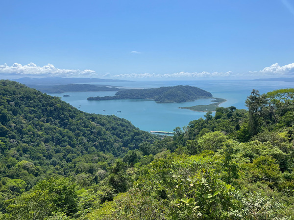
There are many small islands and island groups in western Panama that are beautiful to anchor in and explore. With so many places to anchor in pristine seclusion some Posse vessels have passed weeks to months cruising this small part of western Panama.

Today, there are a dizzying amount of chat groups out there for wherever you are..  The Ocean Posse uses the LineAp to have a focused, real time format for communicating among the fleet.  General communication is usually short lest people take their conversations directly to one another.  As rounding Punta Burica is a milestone along the Pacific Central American route, this week MV PAUSE reported :

Just rounding Punta Burica and are now in Panama from West Coast Cost Rica, headed to Isla Parida for the night. It has been pretty much non stop rain for 4 or 5 days now but fortunately no lightning.

This message came as an update on their progress.  Fellow fleet member SV RAAJA replied from further east:

I spent several days anchored off of Isla Gomez. It is a tiny uninhabited island with a beautiful beach. Highly recommended if you are headed for Parida!

Another vessel SV JUBEL who spent time cruising this area last season replied from the north side of Panama:

 Second this

MV PAUSE apparently swayed and please with the recommendations:

Just dropped the hook at Isla Gomez. Beautiful

MV PAUSE comfortably anchored off Isla Gomez, Panama after rounding Punta Burica.


THANKS FOR BUNDLING THE C'S TOGETHER & ENJOY THE ISLANDS!

MV PAUSE 🇺🇸 Beth & Larry - Nordhavn 55′, SV RAAJA 🇺🇸 Skip – J boat 46’, & SY JUBEL 🇨🇦 Leah & Kyle - Gulfstar 44'


Ready, Aye, Ready!

Ready, Aye, Ready!

“Ready Aye Ready” is the motto of the Canadian Navy. It implies that the Canadian Navy is always “ready”.

By Rob Murray on SV AVANT

A rolled bill stashed well inside a toilet paper roll holder.

We have been sailing Avant in Mexico and Central America for 11 years now, and one of the most common questions we get is “Do you feel safe?”

Yes, we do. We have not suffered a loss, seen a crime committed, or otherwise been bothered by crime. Ever. We do know of other cruisers that have suffered losses, though:
  • Dinghy theft. (Really, it’s outboard motor theft. By far the most common loss suffered by cruisers.)
  • Casual theft (thieves sneak aboard, usually when no one is aboard, and grab any valuables they can and dash off. Most common at a dock).
  • Pick pockets (in Guaymas, a cruiser had her wallet stolen from her purse in the grocery store – but that could have happened anywhere in the world).

Not to say it doesn’t happen, it does. But the violent crimes that make the news in Canada and the USA do not seem to happen on the coast or where the cruising community congregates. Most if not all of the murders are gang related, and mostly gang on gang events. We take normal 21st Century precautions; we don’t walk in strange neighborhoods at night, we don’t flash wads of cash, we don’t wear expensive jewelry or watches, etc. and we have not had a problem.

There are, however, security concerns and we have taken some simple steps to protect ourselves.

You don’t need to make it impossible to be a victim, you don’t need to make it impossible for someone to steal from you. You just need to make it harder. You just need to make your boat a less inviting target than the one next door. If you have locked your boat and hoisted your dinghy and outboard out of the water, cleared valuables from the cockpit, and a neighboring boat has all their hatches open and their dinghy floating beside their boat tied on with a rope painter, guess who is more likely to be a victim?  It’s like the old joke about bears, you don’t need to be able to outrun a bear, you just need to outrun the person you’re with.

The strategy we have employed for our personal security is pretty simple and pretty unobtrusive. It doesn’t impact our day to day lives by much, and we aren’t working hard to stay safe.

    1. Lock the boat, and tidy up. Simple. Free. Easy. When we’re away from the boat for a while, whether at the dock or at anchor, we lock the boat. Close and latch the hatches. Even if we haven’t seen another human being for days. We also have the means to lock ourselves in the boat, in the event we feel threatened and think that’s the safest option (boats with the hatches locked by padlocks may not have the means to do this, but it’s pretty easy to add an internal barrel bolt or similar lock). We changed out our lovely louvered wooden companionway boards for a simple sheet of plexiglass, far more resistant to being kicked in or carved open with a knife or chisel. We don’t stow anything within reach of the portlights we usually leave open. We stow winch handles and other deck gear below as appropriate when anchored or at the dock, and don’t leave things sitting around on deck or in the cockpit. We also lock the computer at the navigation station to the boat with a computer cable lock.
    2. Hide stuff. In the event someone does get aboard, we have some of our valuables and some spare cash hidden. We use a variety of means, including ‘diversion safes’ (food cans, boxes or jars, varnish or paint cans or bottles, hollowed out books, etc., that disguise a secret compartment to stash valuables in). These can be purchased or home made (paint the inside of an old mayonnaise jar white, and there you go!). More than one is a good idea, in various places around the boat. The downside is they can be taken as they are portable. Don’t use a WD-40 can as a diversion safe in your tool bag, as they may take the whole bag!
Is one of these novels a ‘book safe’?
  1. Secret compartments/ hidey-holes.  False drawer or locker bottoms, behind velcroed-on cabinet fronts or vinyl trim, envelopes taped behind or under drawers, the inside of the paper towel roller, shower curtain rod or toilet paper roller, false electric sockets, the inside of hollow closet rods, and other strategies can be employed.
Envelope taped under a drawer.
  1. Use decoys. We have a ‘muggers wallet’ prepared and left in plain sight on the navigation station, next to the companionway. A muggers wallet is a decoy wallet, an old, used one filled with expired credit cards and identification, receipts and small denomination bills of assorted currencies. The hope is a sneak thief will come aboard, see and seize the wallet and dash off, satisfied they have ‘scored’, while truly valuable goods remain unmolested.
A ‘muggers wallet’.
  1. Have backups. We have backup credit and ATM cards, connected to a separate bank account at a different bank from our primaries, safely stashed aboard. If our primary cards are lost, compromised or stolen, or if our primary bank has a bad hair day in the computer department, we can dig out the backups and be good to go until replacements can be sourced or the accounts reactivated.
  2. Know what’s there. We take pictures of our passports and the contents of our wallets and the interior of the boat and email them to ourselves so we have a record that we can access from any computer on the internet if they are lost.
  3. Be ready with active deterrents. In the extremely unlikely event we meet serious thieves intent on a face to face encounter and committing a violent crime against us, we are ready to meet the threat (at least with bravado). We have:
    • Heavy flashlights (3 cell D battery Maglites) mounted in clips next to the companionway and our berth. As well as being handy, blinding flashlights, these make great clubs.
A Maglite flashlight. Simply a heavy metal bodied flashlight, also useful as a club.
  • Fire extinguishers will discharge a large cloud of fine white dust that can disorient and confuse bad guys.
  • Machetes. We have a couple of machetes aboard, stored in a locker where they can be reached quickly and waved around to make a show of resistance. Easily seen from a distance, waving machetes is a distinctly unwelcoming gesture in every culture. Machetes are inexpensive and readily available in hardware stores. They can also be used to open coconuts.
A machete. When brandished or waved wildly, a cross cultural signal to ‘go away’.
    • Baseball bat. We also have a t-ball bat (mini baseball bat), which doubles as a fish bonker.
    • Flares. We have a white handheld flare mounted in clips in the companionway. In the event we are intercepted at sea or boarded at anchor, we can light it and toss it in an attacker’s boat. We don’t have a flare gun aboard, but one might be useful. Be aware that the flare shot from a flare gun will not light until the flare has burned for a while (they are designed to light in the air, not as they are discharged). They are not particularly powerful, and the flares with their propellant tend to bounce off what they hit. The muzzle energy of a 12g flare gun is less than that of a 22 caliber rifle and it is unlikely to penetrate just about anything due to its wide nosed projectile. Any damage it may cause will be due to the flare itself burning. Flare guns may also be illegal in certain jurisdictions (and if used in an offensive or defensive manner as a weapon, are considered weapons or firearms under the laws of many countries).
    • We have Bear Spray aboard, too (while wasp spray is often suggested as a deterrent, apparently it is largely ineffective).
    • (Note: In most countries south of the USA, Mace, Dog and Bear Sprays are illegal, but we’re living on the edge).
    • We keep our VHF on 24/7, and keep a handheld next to our berth, so we can raise an alarm with other cruisers (or heed their call) if we feel unsafe.

All of these strategies are designed around the idea that you don’t have to make it impossible to be attacked, you just have to make it unpleasant for would-be attackers, encouraging them to look elsewhere or take the rest of the day or night off.

Dinghy Outboard Theft

This is, by far, the most common loss suffered by cruisers. An outboard is a very valuable item in a fishing community, and all coastal villages are fishing communities. A simple 8-10 hp outboard can increase a fisherman’s ability to feed his family tenfold by allowing him to get further offshore when fishing. We always hip-hoist our dinghy at night, and do so with a wire cable harness with legs long enough to be far above reach, where they are attached to the halyard snap shackle, even when standing on deck (so a would-be thief can’t simply release the shackle and drop the dinghy). We lock the outboard to the dinghy’s transom with a heavy stainless lock, and use the same lock to lock the motor to the rail mount when it is stored aboard. We employ locals (usually children or the proprietors of beachfront restaurants) as watch keepers whenever possible when leaving the dinghy ashore, and use a long stainless cable to secure the dinghy ashore when it’s in an isolated or unsupervised location.

We don’t really notice that we’re doing these things on a day to day basis, they are just ‘habits or ‘housekeeping’. But we feel that these measures collectively decrease our chance of being victims (and losses if we are), as well as increase our ability to bounce back should we be targeted.

EDITORS NOTE:

Additionally, there is a huge resource in the Caribbean Safety and Security Net available for private cruising vessels.  Their website is extensive and their incident reports are kept up to date.  Their guidelines for precautions are applicable across all oceans.

https://safetyandsecuritynet.org/regional-piracy-infographics/

https://safetyandsecuritynet.org/piracy-passage-precautions-central-america/

STAY SAFE - STAY ALERT - HAVE FUN


PANAMA CANAL

Seven Wonders of the Modern World

The Panama Canal is designated as one of the “Seven Wonders of the Modern World and a Monument of the Millennium” by the American Society of Civil Engineers.
The earth and rubble removed between Colon and Balboa was enough to bury Manhattan to a depth of 12 feet. It connects the Pacific Ocean to the Atlantic Ocean across the Isthmus of Panama, via 6 locks facilitating international maritime trade.
 The maximum vessel dimensions are:
15.2 m  /49.8 ft draft
51.25 m / 168 ft width
366 m / 1201 ft length
57.91 m / 190 ft  height ( 205′ possible at MLW )

FEES

Transit Tolls.                        $1,935.00 up to 64.99ft (As of January 1st, 2024)     

                                              $2,130.00 up to 64.99ft (As of January 1st, 2025) 

Transit inspection                  $120.00

Transit Security fee               $165.00

Canal EDCS                           $75.00
Fenders & lines rental            $125.00
Bank charges                         $90.00 3% Visa/Mastercard
Agent service Fee                 $450.00 up to 65ft

$75.00 General Discount

STEPS

1) CONTACT AGENT TO GET ADDED TO THE SYSTEM AND SUBMIT VIRTUAL MEASUREMENTS  ( or do it your self with cash with the Panama Canal Authority )
2) PAY THE FEES TO AGENT
3) SUBMIT MEASUREMENT ( submit virtually  )
4) GET YOUR DATE
5) VOLUNTEER AS A LINE HANDLER ON ANOTHER YACHT
6) PLAN OUT YOUR TRANSIT NEEDS  4 LINE HANDLERS  / FENDERS AND LINES / FOOD / WATER ETC ( watch video )
7) ON THE DAY OF TRANSIT BE READY AND TAKE ON THE ADVISOR AT THE DESIGNATED LOCATION ( usually near a buoy )
8) TRANSIT
9) DROP OFF ADVISOR
10) DROP OF LINE HANDLERS
11) RETURN LINES AND FENDERS

PANAMA POSSE CANAL AGENTS

To arrange for transit with the Panama Canal Authority please contact our dedicated Panama Canal agents and sponsors of the Panama Posse and the Pacific Posse

CENTENARIO CONSULTING
Erick Gálvez
Erick Gálvez
info@centenarioconsulting.com
www.centenarioconsulting.com
Cellphone +507 6676-1376
WhatsApp +507 6676-1376


WAYPOINT YACHT SERVICES
www.waypointyacht.com

The Panama Canal—Atlantic Approach
|

The Atlantic Entrance to the Panama Canal leads from the Caribbean Sea, close N of the Cristobal breakwater entrance, passing through the length of Bahia Limon, which is protected by two breakwaters known as East Breakwater and West Breakwater, extending across its N end. This entrance has been recently (2016) widened to 520m and lies in the middle of the bay between the seaward ends of the breakwaters, marked by 6 buoys. Winds—Weather.—The climatological year in the canal area is customarily divided into a wet season (April through December) and a dry season (December through April). Average rainfall during the dry season is about 110mm, whereas that of the wet season is about 1,690mm, with the maximum precipitation occurring during daylight hours in both seasons. Uniformly high temperature and humidity make the climate oppressive. Regulations.—An IMO-approved TSS has been established in the approaches to Puerto Cristobal. The TSS, best seen on the chart in the outer approaches to Puerto Cristobal, is composed of the traffic separation scheme, several inshore traffic zones, and a precautionary area.

Puerto Cristobal 09° 21’N 079° 55’W Tides—Currents.—The greatest variation in range is 0.6m. The range is frequently more affected by the direction of the wind than by any other factor. Fresh NW winds may cause some current setting SE in Bahia Limon. An E set across the channel outside the entrance is normally encountered. Shallow water effect frequently causes vessels to respond adversely

Depths—Limitations

From the 20m curve N of the breakwater entrance, the depths gradually decrease to about 16m between the breakwaters, 16.5m in the charted channel, and 16.2m between a 40m standoff from the W breakwater coastline and a standoff distance from the E breakwater coastline, and to a least depth in the dredged entrance channel of 13m. The S part of Bahia Limon is shallow; this area is also used as a spoil area. A shoal area here uncovers. Several wrecks lie in this part of the bay. The harbor has depths of 7.9 to 11.3m.

Pilotage

Pilotage is compulsory for the Panama Canal, including Puerto Cristobal. Pilots board either on arriving inside the breakwaters or at the anchorage. Pilots leave outbound vessels after passing the lighted beacon W of Muelle Cristobal and when the vessel is steadied on its course; however, pilots will accompany vessels to a position just inside the breakwater entrance if desired. An ETA is required to be sent at least 96 hours in advance. Vessels approaching the canal from the Atlantic must report 12 hours before arrival at Puerto Cristobal any change of 1 hour or more in their ETA on VHF channel 12. Pilots do not operate outside the breakwater. For Panama Canal Pilot Contact Information, see table titled Panama Canal Pilots—Contact Information, in paragraph Regulations.—All vessels must hoist their designator signals during daylight when approaching and entering Bahia Limon. Vessels must call the signal station on VHF channel 12. Vessels shall, until a pilot boards, maintain a continuous watch on VHF channels 12 and 16. Vessels approaching the Panama Canal shall communicate by radio with the Navigation Division not less than 48 hours in advance of arrival. No vessel may approach within 1 mile of the breakwater entrance until it has identified itself. Anchorage.— At all times large deep-draft vessels and/or any vessel so directed may anchor outside the breakwater in the approved area. Vessels will be given a definite time to enter the breakwater, where the vessel will be met by transit pilots and boarding officials. Anchorage Area F at Puerto Cristobal has been resurveyed. Depths are approximately 1.3m less than charted. Anchorage is prohibited in or near the axis of the dredged channel.
Caution.—A submarine telephone cable, which may best be seen on the chart, lies W of the approved anchorage areas. Mariners anchoring W of the approved anchorages should keep clear of this cable. Battery Pratt is no longer available and Cristobal Signal Station VHF channel 12 provides no additional information. Vessels required to remain underway outside Bahia Limon are cautioned to keep N of the breakwaters until it is clear to enter before departing the lower chamber. Pilots board in position 9°24.5’N, 79°53.8’W. Regulations.—The Panama Canal Vessel Traffic Management System (VTMS) covers the approaches to Colon and its terminals.

Contact Information
National Port Authority
Telephone +507-510-5106 +507-510-5227
E-mail dpuertos@amp.gob.pa
Web site http://www.amp.gob.pa
Port Authority Telephone +507-430-9500

The Panama Canal

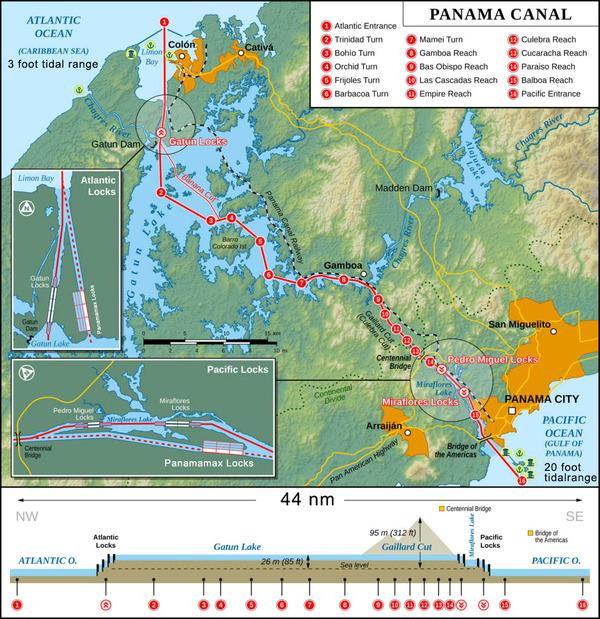
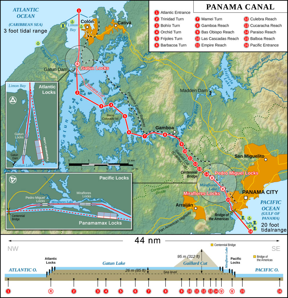
The Panama Canal, a lock-type canal traversing the Isthmus of Panama in a SSE direction for approximately 43 miles, connects Bahia Limon on the Atlantic side with Panama Bay on the Pacific side. The ports of entry for the canal are Cristobal, on the Atlantic side, and Balboa, on the Pacific side. All ships should be familiar with the Panama Canal Authority home page, especially the Maritime Services tab where there are Maritime Regulations. These regulations can be accessed from the Panama Canal Authority (ACP) home page provided below. Vessels should also be familiar with the Notices to Shipping section from the Panama Canal Authority (ACP) home page, most notably the Panama Canal Harbor Operations Requirements and the Panama Canal Vessel Requirements. Vessels should consult these regulations prior to transiting. A brief discussion of some of these regulations and requirements are provided for reference in this paragraph. These regulations apply to all navigable waters in the Atlantic entrance and the Atlantic anchorage areas, the port of Cristobal, and through the canal itself. The Panama Canal is largely made possible by the Gatun Lake watershed, which has a maximum operating level of 27.1m above sea level, and can vary according to the season of the year, or due to prolonged periods of no rainfall, and the Rio Chagres, which lies about in the middle of the Isthmus of Panama. Gatun Lake is reached through three sets of locks, which are arranged in duplicate on either side of the most elevated part of the canal, or through the new Atlantic and Pacific side expansion locks. The canal has recently completed (2016) a multi-year extensive expansion project to accommodate vessels that exceed the old Panamax dimensions. The expansion project has included the following improvements: 1. Widening and deepening of the Gatun Lake navigational channel, 2. Construction of a third set of locks on the Pacific (Cocoli Locks) and Atlantic (Agua Clara Locks) sides. 3. Raising the maximum operational level of Gatun Lake. 4. Widening of channel reaches and the turns in Gatun Lake. 5. Construction of a new Pacific Access channel that will bypass Miraflores Lake and the Miraflores Locks, connecting the new Pacific locks with the Culebra Cut. 6. Deepening of the Culebra Cut. The original Canal lock gates and valves are electrically operated from a central control station. The entire operation is directed by a lock master on the center wall. All of the canal lock chambers are similar in dimensions and method of operation. In transiting the canal, a vessel is raised in three steps, or lockages; first to the level of Gatun Lake through the Gatun Locks, then is subsequently lowered in three steps to sea level on the other side of the isthmus. The flights of locks are in duplicate, enabling vessels to pass in opposite directions simultaneously. Although two-way transit is possible, traffic typically transits the canal in shifts of northbound traffic or southbound traffic, running both channels in the same direction simultaneously. The average canal transit time is 12 hours. Fo Small vessel it may take up to 2 days The Panama Canal Expansion project has added two new sets of locks; one on the Atlantic Ocean side (Agua Clara Locks) and one on the Pacific Ocean side (Cocoli Locks). The new Atlantic side lock complex is situated E of the existing Gatun Locks and the new Pacific side lock complex is located SW of the existing Miraflores Locks.

The actual transit time is advised over VHF channel 12.
All vessels underway in the canal will maintain a continuous watch on VHF channel 13.
Bridge to bridge communications between vessels in the canal will be carried out on VHF channel 13 as well.
During the time when the Canal pilot is on board, VHF channel 13 may only be used by the pilot or at his direction, solely for navigational communications.
All communications between the Signal Station and vessels should be in English.
If any of the following events occur during canal transit, a report must be made to the Marine Traffic Control Unit:
1. Any accident or other incident which may cause delay or require assistance.
2. Discovery of any defect that may interfere with safe navigation.
3. Anchoring or mooring when visibility falls below 305m including during heavy squalls

PANAMA CANAL OVERVIEW
Panama Canala Layout updated


DETAILS


FEES ↴


FEES :
( Budget ~$  3000 for yachts under 65 feet )

+ Transit tolls
+ Transit inspection
+ Transit Security fee
+ Canal EDCS
+ Fenders & lines rental
+ Bank charges
+ Agent service Fee
+ Line handlers
– Panama Posse members discount

For an itemized quote please email Erick info@centenarioconsulting.com


REQUIRED INFO ↴

Have you transit before and Sin number:

> Name of Yacht:

> ITC Length:

> ITC Beam:

> Draft:

> Gross Tonnage:

> Nett Tonnage:

> VHF Call sign/letters:

> Registration number/Country/expiration date:

> Speed:

> Hull Color:

> Type of sailing boat:

> Hull material:

> Email:

> Last ten ports (10) with estimate departure date:

> next port after Panama:

> Boat builder Name / Country / Year:

> How many engines / Brand / Horse Power:

> Serial number of each:

> Hull number:

> Type of hull:

> Number of propellers:

> Type of propeller rotation:

> Owners address and telephone:

> Captain: name: date of birth: nationality: passport no.

> Crew on board date of birth nationality passport no:


WARNING !!!

09° 21 33.56' N 079° 56.1133' W

Two boats have reported running aground in the area near Shelter Bay Marina, despite charted depths over 4m

(reported depths under 2m). In each case their advisor directed them over the shallows. Caution advised!


PANAMA CANAL CHARTS

THREE SHEETS TO THE WIND >>


PANAMA DIGITAL CHARTS

PANAMA DIGITAL CHARTS IN MBTILES FORMAT

THE ABOVE FILES ARE FOR LOGGED IN USERS ONLY


VESSELS ARE GETTING A JUMPSTART ON CRUISING SEASON ON THE PACIFIC COAST

VESSELS ARE GETTING A JUMPSTART

ON CRUISING SEASON IN MEXICO, COSTA RICA, & PANAMA


The crew of SV PERCEPTION is happy to be on the move again. Sunset at anchor off Tamarindo Costa Rica.

SY PERCEPTION 🇺🇸 Jim & Melinda & Grace - Lagoon 42'


Let the Adventure begin! SV ZORBA is leaving Bocas del Torro for the San Blass Islands of Panama

SV ZORBA 🇲🇭 Tomer & Limor – Tayana 48’


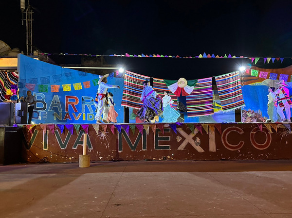
It’s go time for SV OKISOLLO! Ready to be heading south again! Adios Puerto Penasco.  See you soon in Barra de Navidad!


FAIR WINDS


CENTRAL AMERICA CELEBRATES INDEPENDENCE FROM SPANISH RULE

MEXICO, GUATEMALA, NICARAGUA, HONDURAS, EL SALVADOR, AND COSTA RICA CELEBRATE INDEPENDENCE FROM SPANISH RULE

SEPTEMBER 15TH, 1821

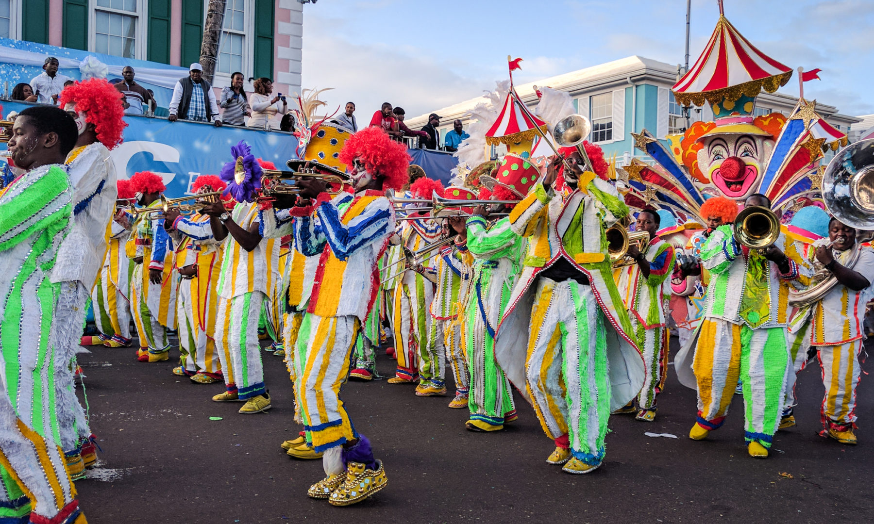
Mexico celebrates their independence from Spain with parades, flags, fireworks, music, and dancing.

September 15, 1821 honors Mexican Independence and the signing of the Act of Independence of Central America, also known as the Act of Independence of Guatemala in which all these nations declared their independence from the Spanish Empire.  (Panama gained their independence separately later in 1821.)  This landmark day is celebrated as Independence Day in all of these countries today.  Festivities Include flags flying, parades, fireworks, and traditional food, music, and dancing.

Parade in Nicaragua celebrating Independence Day
Here, Costa Rica announces their annual Independence celebration.  Even though the exact date was not shared by each Central American country, the timeframe was similar and the effort was generally collective.  Today, they each celebrates their independence from Spanish rule on September 15, 1821

Hernan Cortez, arguably had the most dramatic impact of all the Spanish explorers especially in Mexico and Central America.  Born to an impoverished noble family, he sought a life of adventure and riches in the New World.  He trained as a notary before sailing to Hispaniola (modern day Haiti and Dominican Republic) as a colonist in 1504.  After becoming the colony’s notary, he played a key role in the conquest of Cuba in 1511.  In 1518 he was elected captain of the third expedition to what is now Mexico.  He had some bad relations with the governor of Cuba who upon Cortes' departure attempted to recall the expedition.  Cortes ignored this and embarked on the voyage with 500 men, weapons, and horses to conquer Mexico.  Upon arrival, he befriended some natives, made enemy's of others, and sired his first born with a native woman named Dona Maria who also served him as an interpreter.

The Spanish Galleons made landfall at Tabasco in March 1519.
Spaniard Hernando Cortes (1485-1547) led the Spanish Empire ashore in Mexico

And so it was that in 1519, Spanish conquistador and expedition leader, Hernan Cortés, made landfall with men and horses on the shores of what is now Tabasco, Mexico.  He and his forces saw to the demise of the Aztec Empire, made their way inland to Mexico City, and seized power.  While the indigenous people resisted mightily, the Spanish were relentless.  The diseases and weaponry they brought overtook indigenous populations from Mexico south.  Cortés thereby brought a large portion of what is now Mexico, and soon the rest of what is now Central America, under the rule of King Castile.  Thus began the first phase of Spanish colonization of the Americas.  Cortes' second in command, Pedro de Alvarado was commissioned to settle lands further to the south.  One by one, Alvarado colonized the areas that are now known as Guatemala (in 1523), Nicaragua & Costa Rica (in 1524), El Salvador (in 1528), and Honduras (in 1528).  These countries, including what is now the state of Chiapas (in 1609) became known as the Captaincy General of Guatemala for which Spain's King Philip III held dominion.

Spanish and Portuguese Empires 1581-1640: The Spanish and Portuguese went out to the New World to expand their empire, trade, acquire riches, spread Catholicism and bring back wealth.  This worked for them for over 300 years.


After just over 300 years of Spanish rule, in the early 19th century global changes began to unsettle Spanish power making way for leaders in what is now Central America to declare their independence from Spain.  In Europe, Spain was engaged in the Napoleanic wars with took their attention away from their colonies across the Atlantic.  Further, with inspiration from Enlightenment thinkers, Mexico's fight for independence from Spain, and the American colonies' independence from England, and the French Revolution, José Cecilio del Valle, a Honduran lawyer, wrote The Act of Independence document bringing together a delegation of leaders from what is now  Guatemala, Nicaragua, Costa Rica, El Salvador, and Honduras.  They gathered in Guatemala city to create and sign the Act of Independence of Guatemala and to achieve sovereignty from Spain.

Soon after this declaration of independence these countries were briefly annexed by the newly independent Mexico.  In 1823 delegates gathered again to form a federal republic- the United Provinces of Central America.  The delegates drew up a constitution that provided leadership and regional autonomy.  Overtime, conflicts arose between the separate nations; the United Provinces of Central America eventually fell apart and the leaders of each distinct nation once more declared their independence.

National celebrations today have grown and can begin before September 15th and go through the month celebrating national pride, independence, culture and heritage.

In Guatemala, in addition to parades, people may carry torches from village to village.
Independence day celebration at a primary school in El Salvador
Honduras celebrates their independence: "Honduras, My Land Live Your Independence"

To read more on this subject this article covers quite a lot: https://shunoutdoor.com/article/why-does-central-america-celebrate-independence-day

This article is for the visual learners among us: https://studylib.net/doc/10144677/independence-movement-latin-america