

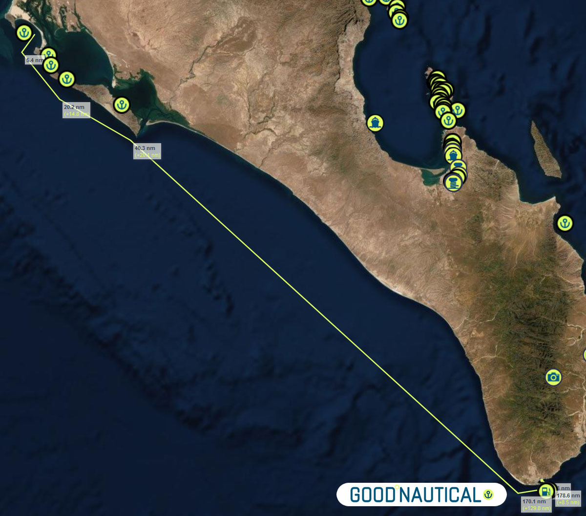
GOOD NAUTICAL ON THE WEST COAST OF THE BAJA: BAHIA SAN QUINTIN
GOOD NAUTICAL ON THE WEST COAST OF THE BAJA:
BAHIA SAN QUINTIN, MEXICO 
30° 23.7384′ N, 115° 55.5760′ W
Posse members on the West Coast are beginning to set their sights on the southbound journey. Consider a stopover in Bahia San Quintin on the west cost of the Baja Peninsula. Whale watching, sport fishing and fantastic seafood bring tourists to San Quintin. Oysters, mussels and abalones are harvested from the crystal clear waters of the bay so please avoid dumping waste of any kind overboard. The lagoon provides great opportunities for dinghy exploration and the remains of an abandoned British colony lie in the shore of the inner bay.

Anchorage
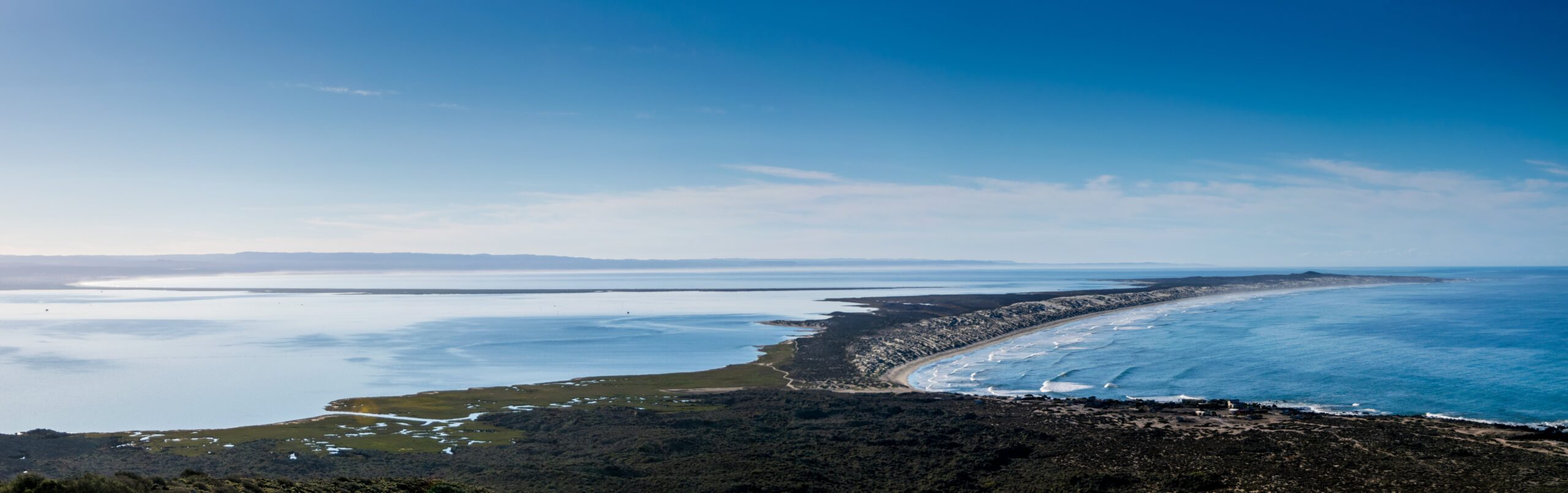
The anchorage on the east side of the bay is open to the SW and feels quite exposed with surf breaking even a mile offshore. Anchor on a sandy bottom in 5-10m just outside the shoal line which is marked by small breakers.
https://goodnautical.com/mexico-pacific/anchorage/bahia-san-quintin
Bahia San Quintin
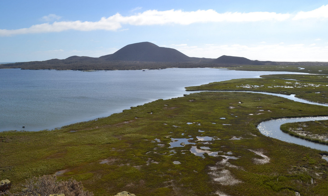
Bahía San Quintín, located on the Pacific coast of Baja California, Mexico, is a hidden gem for sailors seeking an authentic and tranquil maritime adventure. This natural harbor, about 190 nautical miles south of San Diego, offers a unique blend of pristine beauty, rich marine life, and a glimpse into the unspoiled wilderness of Baja California.
Geography and Navigation
Bahía San Quintín is a broad, sheltered bay framed by volcanic hills and sandy beaches, providing excellent protection from the Pacific’s swells. The bay is about 6 miles wide and 11 miles long, offering ample anchorage space with good holding ground in sand and mud. The entrance to the bay can be tricky, especially for first-time visitors, due to shifting sandbars and shallow areas. It is advisable to enter during daylight with good visibility and to use updated nautical charts. Depth sounders and GPS are essential tools for navigating safely into the bay.
Weather and Climate
The climate in Bahía San Quintín is typically mild and dry, with average temperatures ranging from the mid-50s to the mid-70s Fahrenheit. The area enjoys a Mediterranean climate, with dry summers and mild, wet winters. Fog can be a common occurrence, especially in the mornings, so sailors should be prepared for reduced visibility at times. Winds are predominantly from the northwest, providing favorable sailing conditions for those heading south.
Flora and Fauna
Bahía San Quintín is a haven for nature lovers. The bay and its surrounding areas are home to a diverse array of wildlife. Birdwatchers will be delighted by the presence of numerous bird species, including the endangered black brant, as well as various shorebirds and waterfowl. The bay’s waters teem with marine life, making it a popular spot for fishing and snorkeling. Anglers can expect to catch species such as halibut, sea bass, and yellowtail.
Activities and Attractions
For sailors looking to stretch their legs, the area offers plenty of onshore activities. The surrounding landscape is perfect for hiking, with trails leading through volcanic rock formations and coastal dunes. The nearby fishing village of San Quintín provides a glimpse into the local culture and an opportunity to sample fresh seafood, particularly the region’s renowned oysters and clams. Visiting the local oyster farms can be a fascinating experience, offering insights into the aquaculture practices that sustain the local economy.
Services and Facilities
While Bahía San Quintín is relatively undeveloped compared to more popular tourist destinations, it offers essential services for visiting sailors. There are a few basic facilities, including fuel, provisions, and some repair services available in the village of San Quintín. It is advisable to stock up on necessary supplies before arriving, as options may be limited. For those needing more extensive services, the port of Ensenada, located about 130 nautical miles to the north, provides a wider range of amenities, including marinas, chandleries, and professional repair services.
Conservation and Sustainability
Bahía San Quintín is part of a protected natural area, and visitors are encouraged to respect the environment and practice sustainable boating. Efforts to preserve the bay’s natural beauty and biodiversity are ongoing, and sailors can contribute by following Leave No Trace principles, minimizing waste, and avoiding damage to sensitive habitats such as seagrass beds and bird nesting areas.
Conclusion
Bahía San Quintín offers a serene and rewarding destination for sailors looking to explore the less-traveled waters of Baja California. Its natural beauty, abundant wildlife, and tranquil atmosphere make it an ideal spot for those seeking to experience the unspoiled charm of Mexico’s Pacific coast. Whether anchoring in its calm waters, exploring its diverse ecosystems, or engaging with the local community, sailors will find Bahía San Quintín to be a memorable and enriching part of their maritime journey.
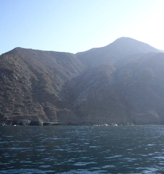
Landing on the Beach in High Surf
Landing on the beach in high surf at Bahía San Quintín can be challenging and requires careful planning and execution. The key to a successful landing is timing and understanding the wave patterns. It is essential to observe the surf for a period to identify any lulls between sets of larger waves. When ready, approach the beach at a 90-degree angle, maintaining enough speed to stay ahead of the breaking waves. As you near the shore, reduce speed and be prepared to jump out and pull the dinghy up the beach swiftly to avoid it being swamped by incoming waves. Ensure all equipment and passengers are secure, and wear appropriate safety gear such as life jackets. Landing in high surf can be risky, so if conditions seem too dangerous, it might be best to wait for calmer seas or find a more sheltered landing spot within the bay.
Bahia San Quintin
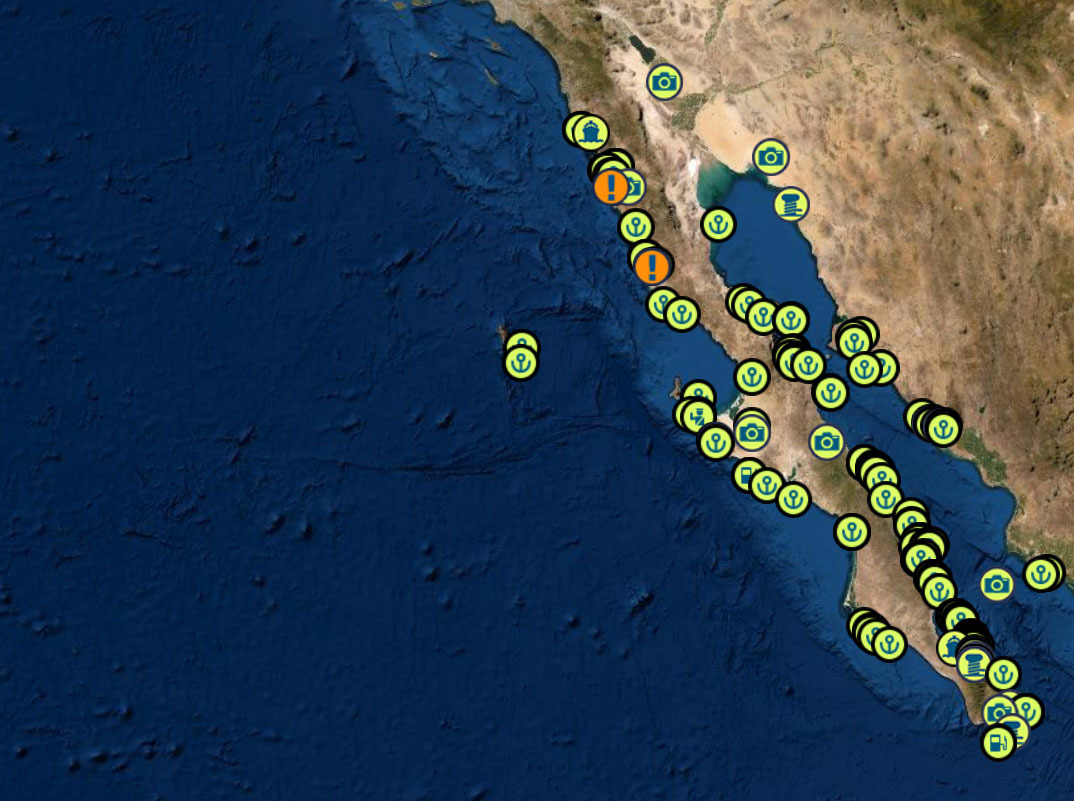
THE BAJA RUN - THE BAJA BASH
THE BAJA PENINSULA 750 NM WITH PLENTY OF ANCHORAGES AND ONE OVERNIGHT SAIL
DANGERS
FOG – KELP – REEFS – SMALL PANGAS – EXPENSIVE FUEL IN TURTLE BAY – WHALES – STRONG NW WINDS
BAJA RUN: 4 SEGMENTS TO THE SOUTH BOUND RUN
1) Leaving San Diego and Checking in into Mexico in Ensenada BC MX
2) Ensenada To Turtle Bay and anchorages in between
3) Turtle Bay to Mag Bay ( Bahia Magdalena BCS )
4) The overnight run from Mag Bay to Cabo and timing your sail around Cabo Falso into Cabo San Lucas
BAJA BASH: 7 SEGMENTS TO THE NORTH BOUND BASH
1) Fueling up and waiting for a weather window in Cabo San Lucas / San jose de Cabo
2) The overnight run around Cabo Falso to Mag Bay to Bahia Magdalena BCS
3) Beating from Mag Bay to Turtle Bay
4) Nudging up to the NE tip of iIla Cedros and sailing across a high wind zone to Fondadero San Carlos
5) San Carlos to San Quentin
6) San Quentin to Ensenada
7) Checking out of Ensenada and heading to San Diego
BAJA RUN SOUTH BOUND
|
|
|
① Start at Cruiseport Village Marina Ensenada and do your Mexico check ins 31° 51.2766′ N 116° 37.2433′ W |
|
|
|
|
Once you have made it out of Ensenada without dropping to much cash at Hussong’s Cantina |
|
|
|
|
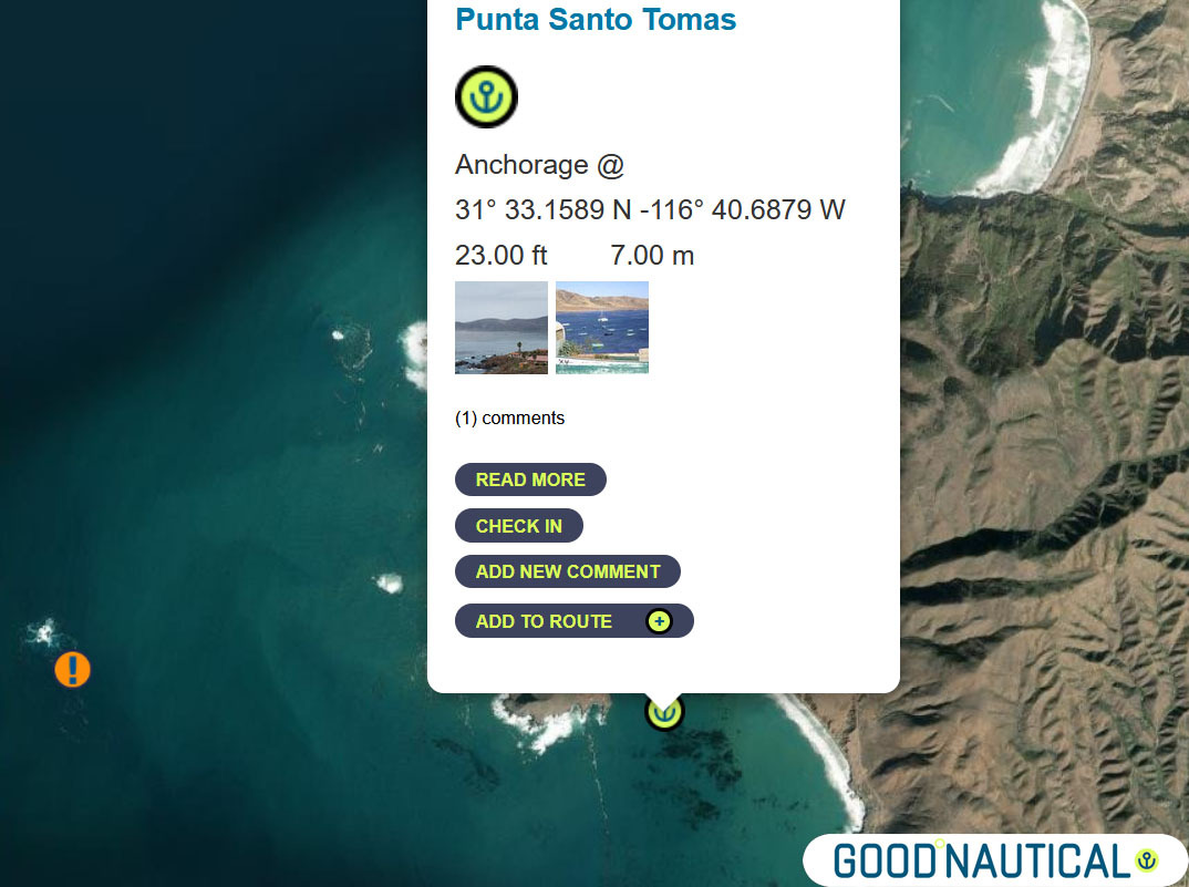
② head for Punta Santo Tomas at 31° 33.1589 N |
|
|
|
|
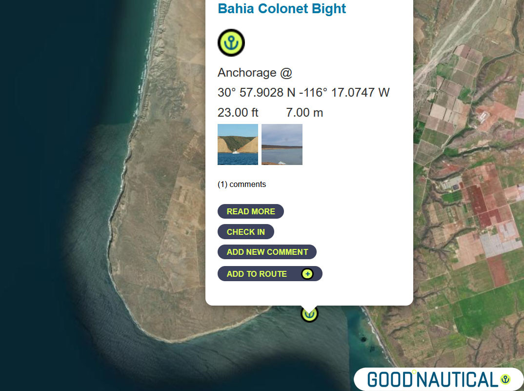
③ The next jump is either 40 nm to Bahia Colonet Bight 30° 57.9028 N 116° 17.0747 W – details at https://goodnautical.com/mexico-pacific/anchorage/bahia-colonet-bight |
|
|
|
|
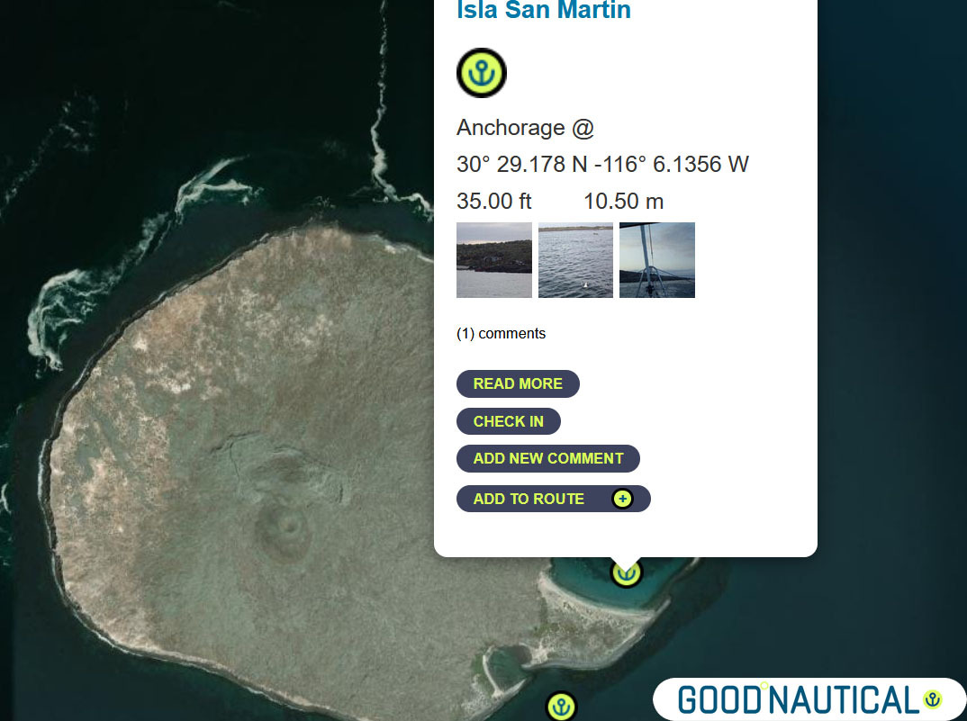
④ Or an extra 30nm Isla San Martin North bay 30° 29.178 N -116° 6.1356 W or South Anchorage depending on swell https://goodnautical.com/mexico-pacific/anchorage/isla-san-martin |
|
|
|
|
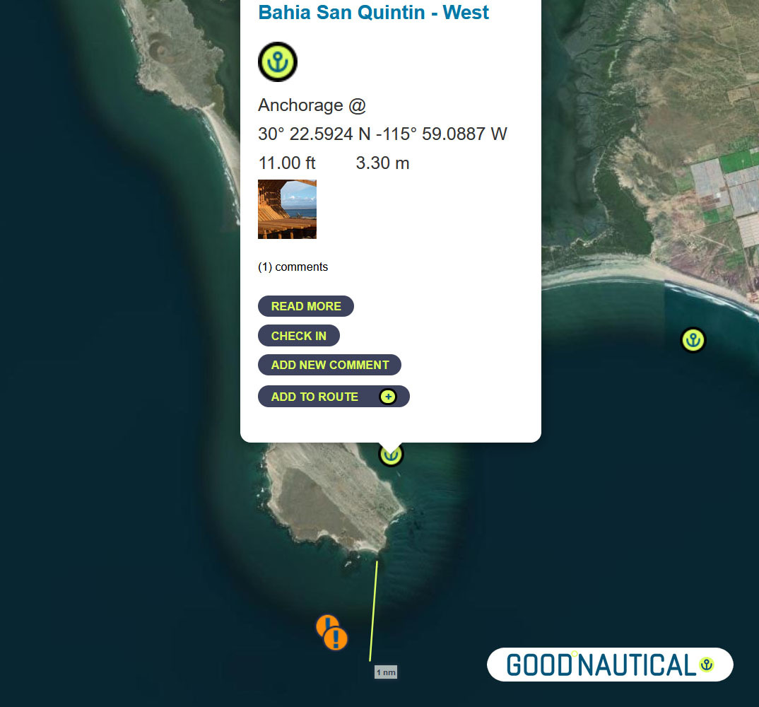
⑤For a more protective bay especially for those who wish to bash back up here is Bahia San Quintin https://goodnautical.com/mexico-pacific/anchorage/bahia-san-quintin-w and https://goodnautical.com/mexico-pacific/anchorage/bahia-san-quintin |
|
|
|
|
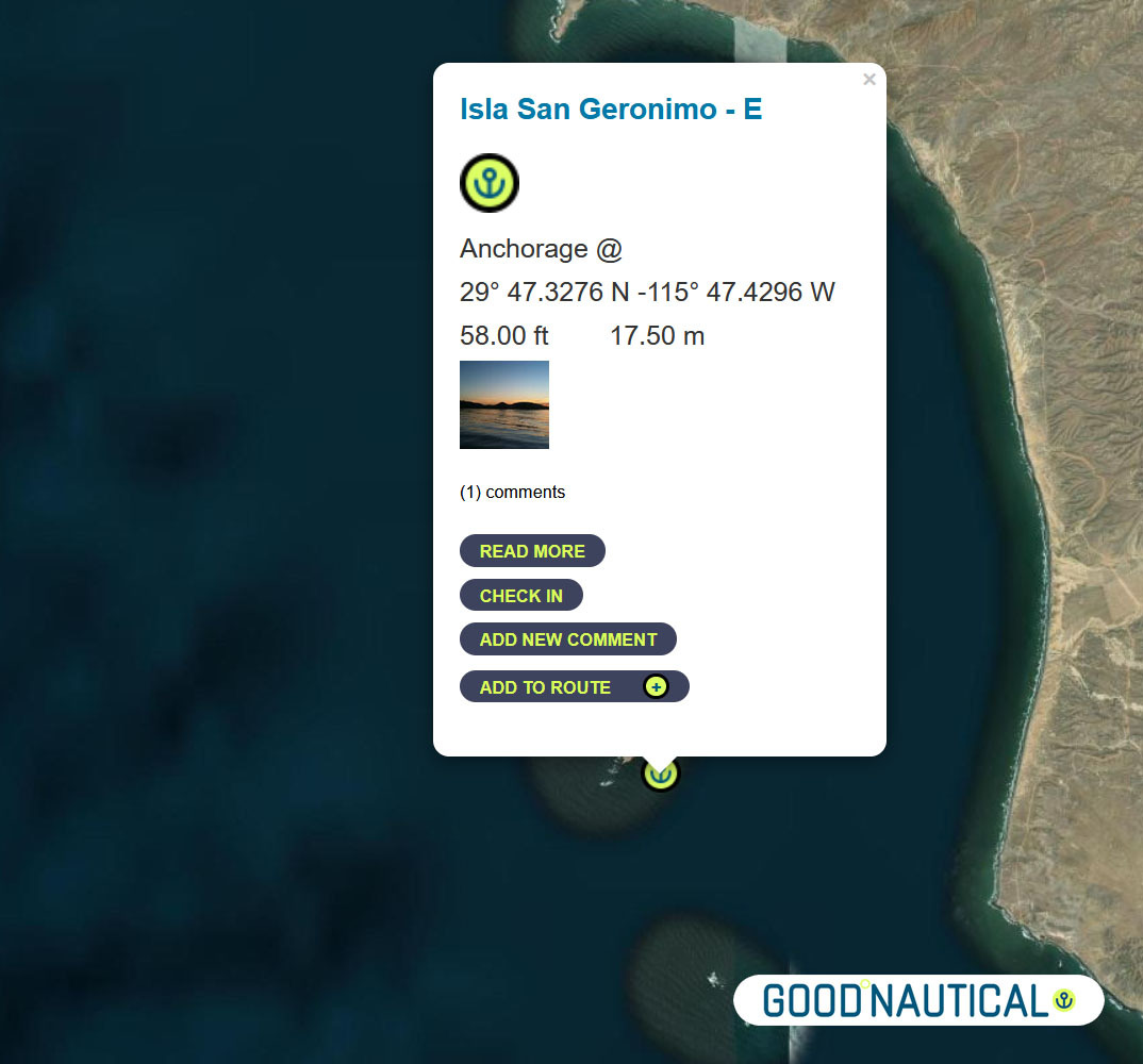
The ⑥ South of this – about 39 nm is a fair weather anchorage at 29° 47.3276 N 115° 47.4296 W behind ISLA SAN GERNOMIO – watch for 2 rocks south of it @ 29° 44.2191′ N 115° 46.2265′ W https://goodnautical.com/mexico-pacific/anchorage/isla-san-geronimo-e |
|
|
|
|
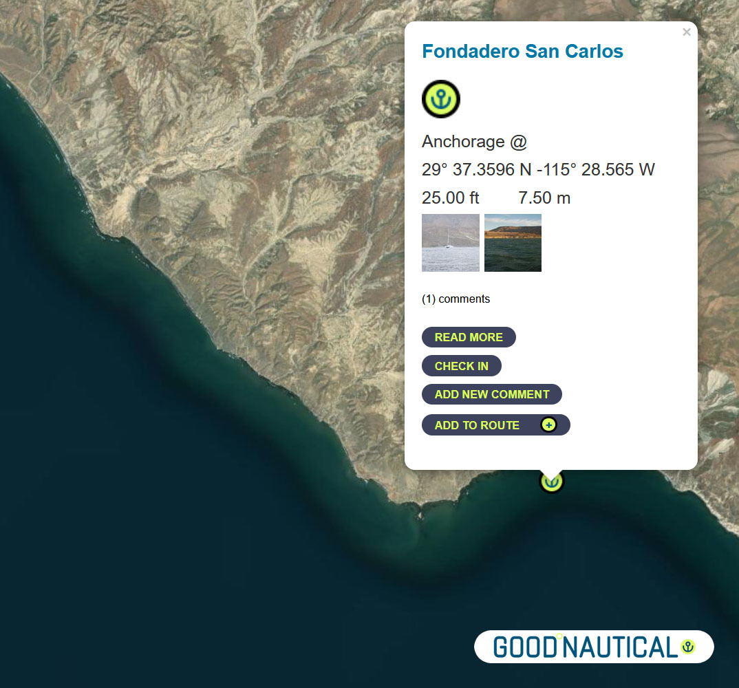
⑦ The next anchorage is a staple along the route FONDADERO SAN CARLOS Especially for those on a northbound track @ 29° 37.3596 N 115° 28.565 W This anchorage is 68 nm South of Sna Quintin – expect some kelp patches and shoaling on the northern bight https://goodnautical.com/mexico-pacific/anchorage/fondadero-san-carlos |
|
|
|
|
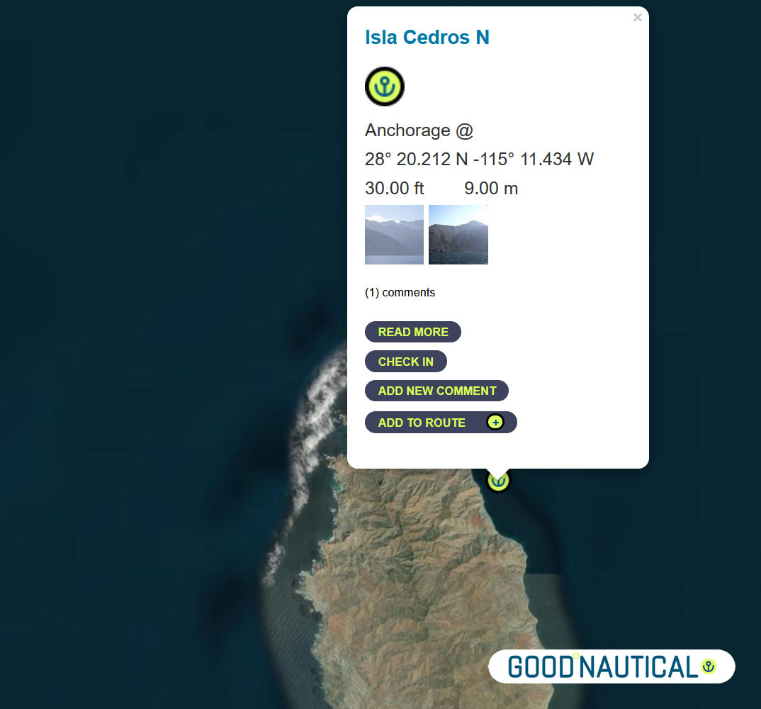
⑧ South ~ 80 nm across the bay of Sebastian Vizcaino is Isla Cedros N – aka the Cedros Island Yacht club anchorage at 28° 20.212 N -115° 11.434 W https://goodnautical.com/mexico-pacific/anchorage/isla-cedros-n Expect |
|
|
|
|
The east coast of Isla Cedros has several anchorages; the northern |
|
|
|
|
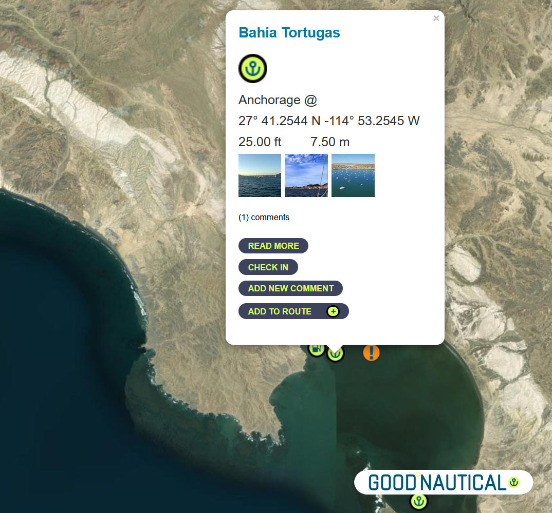
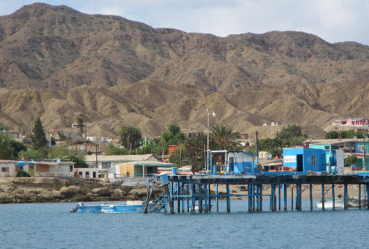
Bypassing a few anchorages on the East and South of Isla Cedros ~ ⑨50 nm south is Turtle Bay / Bahia Tortugas |
|
|
|
|
The locals will try to sell you fuel from pangas or via the fuel dock – |
|
|
|
|
⑩ The next jump is about 50 nm to Bahia Asuncion 27° 08.1355 N 114° 17.4206 W https://goodnautical.com/mexico-pacific/anchorage/bahia-asuncion |
|
|
The |
|
|
|
|
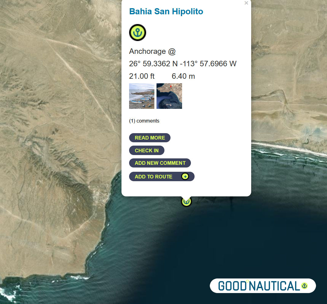
⑪Or push it another 24 nm to Bahia San Hipolito This
|
|
|
|
|
⑫A far more protected anchorage is 50 nm south of Bahia Asuncion or 105 nm south of Turtle bay is Bahia Ballenas @ 26° 46.0426 N -113° 30.0266 W https://goodnautical.com/mexico-pacific/anchorage/bahia-ballenas |
|
|
|
|
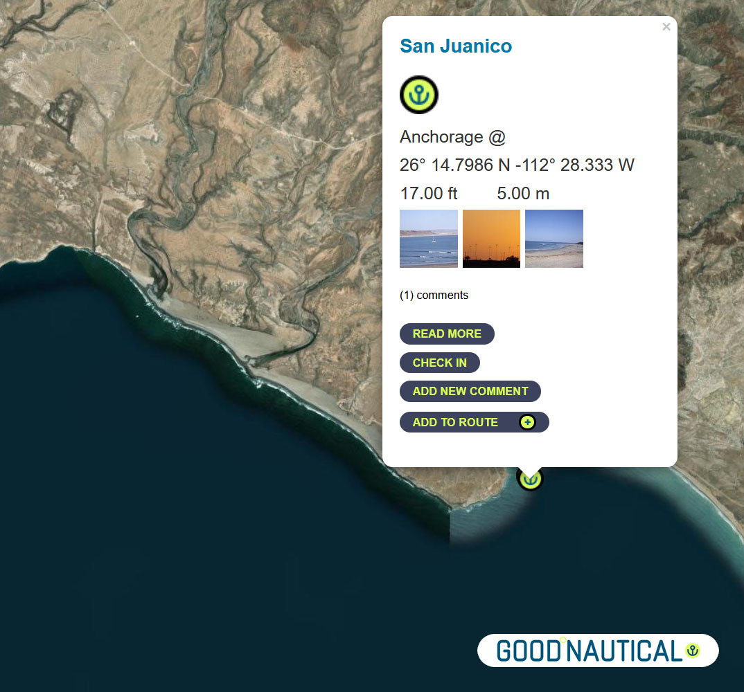
⑬ A prime spot along this coast is San Juanico / Scorpion Bay @ 26° 14.7986 N 112° 28.333 W about nm SE from Bahia Ballenas – with friendly locals and expats In |
|
|
|
|
|
|
⑭Another 85 nm to Bahia Santa Maria |
|
|
|
|
Bahia Santa Maria |
|
|
|
|
There is no permanent settlement in Bahia Santa Maria but a dinghy ride up
into river channels at the north end of the bay reveals a cluster of fishing shacks with brightly colored pangas tied up along the bank. From November to May itinerant fishermen stay in the bay to fish for tuna, jacks and dorado. |
|
|
|
|
⑮The final jump an overnight sail to Cabo San Lucas ( WEEKEND MORNINGS ARE TOUGH IN CABO MANY FISHING VESSELS LEAVE A T THAT TIME SO TRY TO ARRIVE AFTER 9 AM ) ~ 185 nm with no real stops along the way – as soon as you round the |
|
|
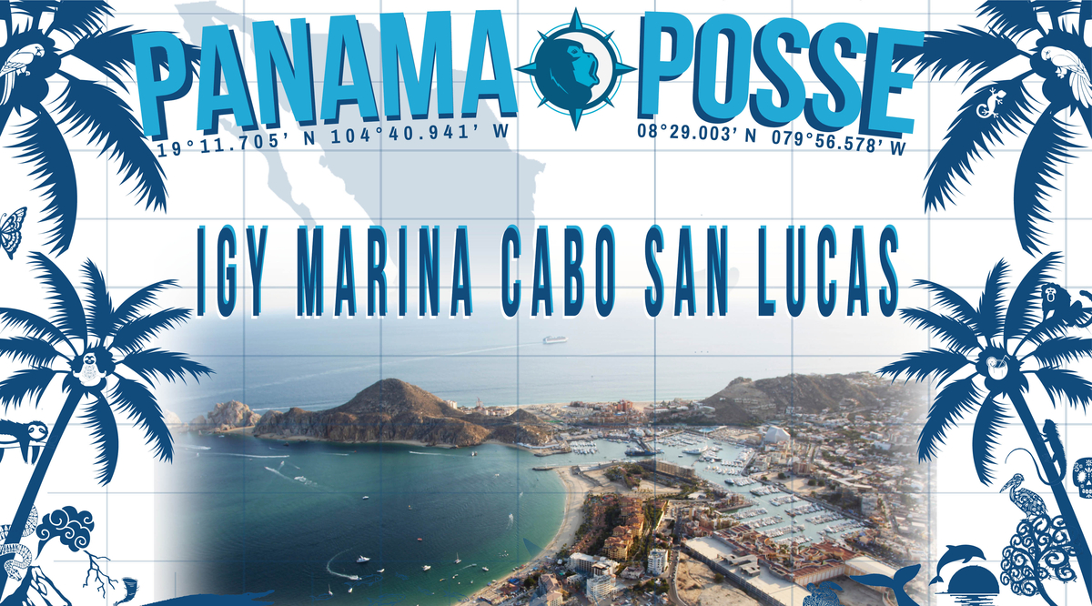
Make a reservation at our sponsorshop Marina IGY Cabo San Lucas – with Jesus A. Esquitel VHF 16 & 88A Tel +52 (624) 173-9140 CSL@IGYMarinas.com www.igy-cabosanlucas.com |
|
|
|

BAJA BASH NORTH BOUND
 |
⑮Leave from Cabo San Lucas ( WEEKEND MORNINGS ARE TOUGH IN CABO MANY FISHING VESSELS LEAVE A T THAT TIME SO TRY TO ARRIVE AFTER 9 AM )
~ 185 nm with no real stops along the way – as soon as you round the
cabe the warmer tropical air will welcomr you to Cabo San Lucas – best
not to arrive Weekends between 6 and 9 AM as scores of fishing vessels
are leaving Cabo and will produce eneourous wakes and traffic. Anchor at
22° 53.304 N 109° 53.844 W https://goodnautical.com/mexico-pacific/anchorage/cabo-san-lucas-se-coast
Make a reservation at our sponsorshop Marina IGY Cabo San Lucas – with Jesus A. Esquitel VHF 16 & 88A
Tel +52 (624) 173-9140
CSL@IGYMarinas.com
www.igy-cabosanlucas.com
CABO FALSO – get around it on a windless morning to make your way up ! It’s an overnight for most – look for winds with a more northern angle to run with less windwaves
A day c an make the total difference in weather-weather windows do come ..
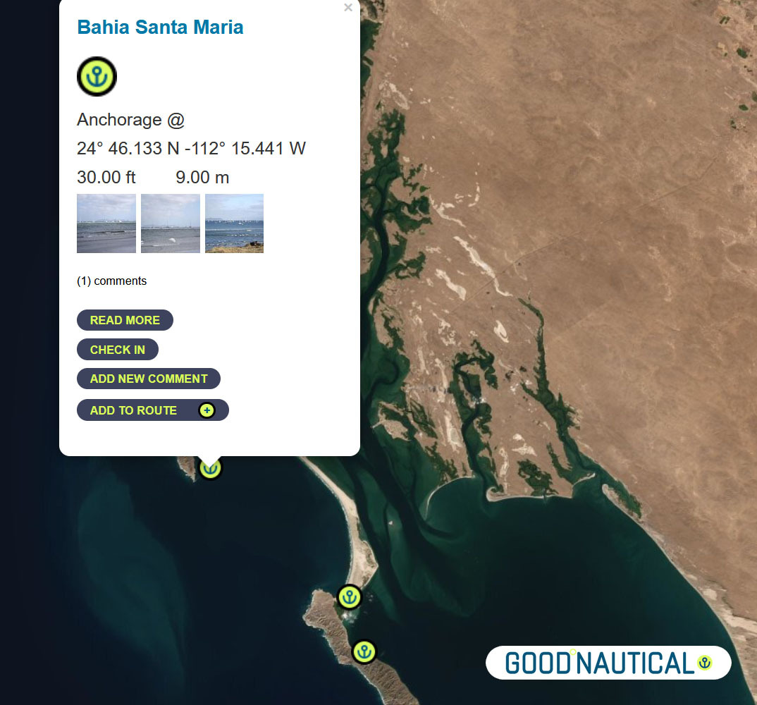
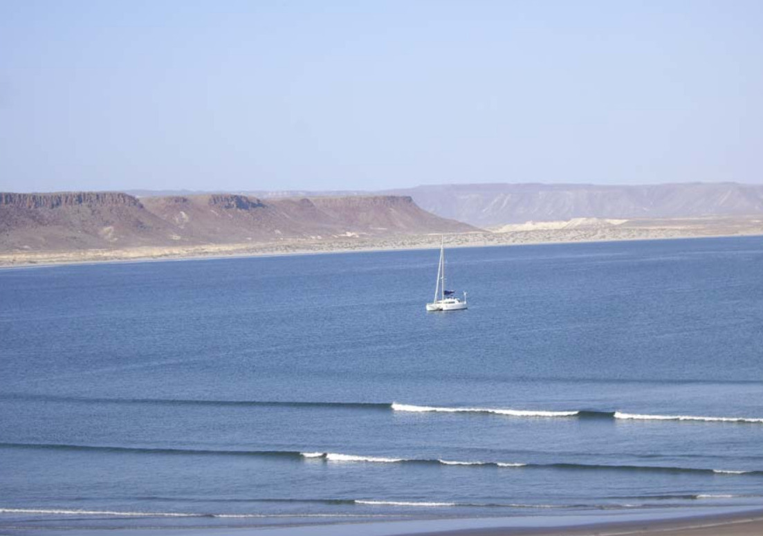
Bahia Santa Maria
is a large crescent shaped bay which lies just south of Cabo San
Lazaro. It is defined to the north and south by rocky islands and
bounded to the east by a narrow strip of sand ridges which separates it
from the huge lagoon of Bahia Magdalena behind.
into river channels at the north end of the bay reveals a cluster of
fishing shacks with brightly colored pangas tied up along the bank. From
November to May itinerant fishermen stay in the bay to fish for tuna,
jacks and dorado.
a major stop and wide bay with fisheries and cell signal 24°
46.133 N 112° 15.441 W
https://goodnautical.com/mexico-pacific/anchorage/bahia-santa-maria
⑭FROM Bahia Santa Maria 85 nm to
⑬ A prime spot along this coast is San Juanico / Scorpion Bay @ 26° 14.7986 N 112° 28.333 W about nm SE from Bahia Ballenas – with friendly locals and expats In
the mid-seventies surfers noticed the amazing waves peeling off Punta
Pequeña as the swell wraps around into Bahia San JuanicoI. The village
is host to a couple of abarrotes and restaurants and beach palapas.
SAN JUANICO SCORPION BAY
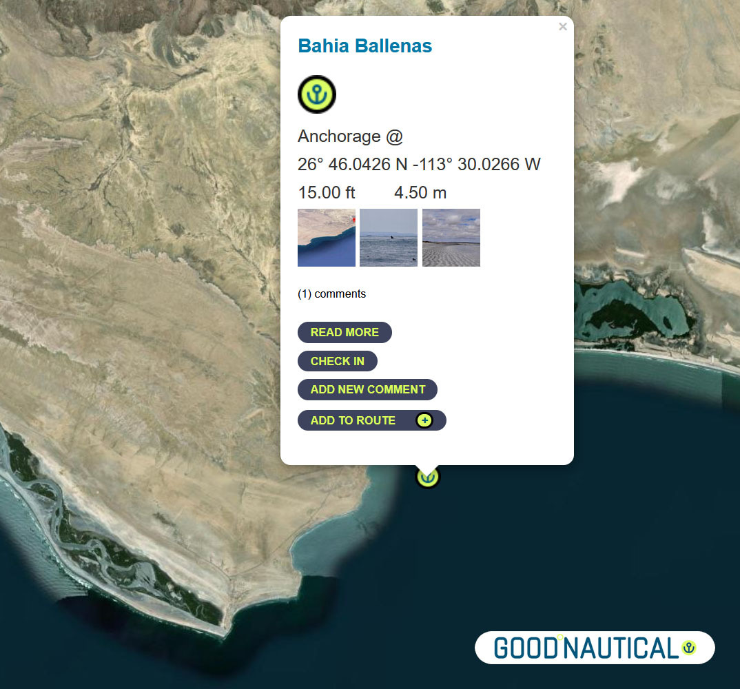
⑫A far more protected anchorage is 50 nm south of Bahia Asuncion or 105 nm south of Turtle bay is Bahia Ballenas @ 26° 46.0426 N -113° 30.0266 W https://goodnautical.com/mexico-pacific/anchorage/bahia-ballenas
Or push it another 24 nm to Bahia San Hipolito This
is a marginal anchorage exposed to wind and swell from north and south.
Anchor close to the beach in 6.4m on sand. @ 26° 59.3362 N -113°
57.6966 W https://goodnautical.com/mexico-pacific/anchorage/bahia-san-hipolito
NEXT UP THE COAST
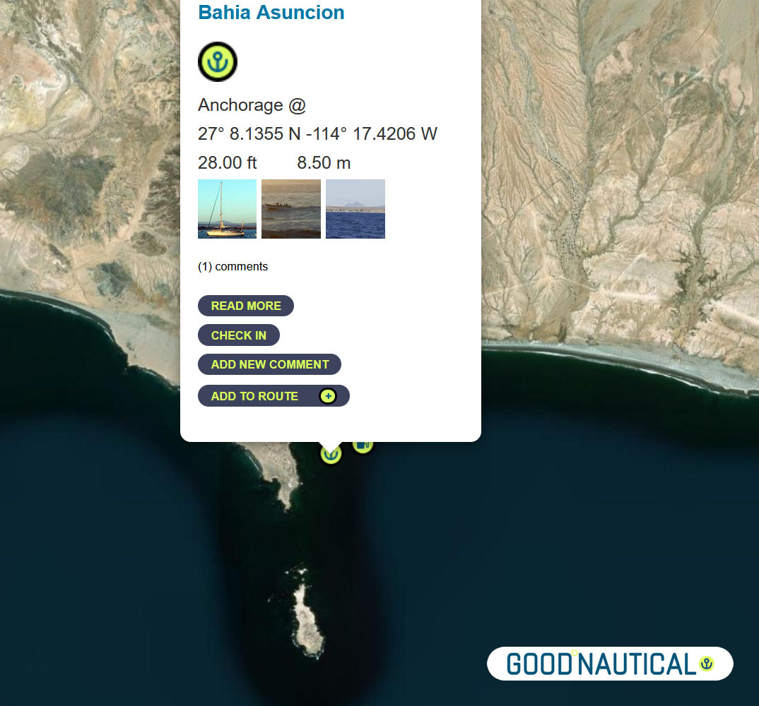
The
bay at Asuncion is home to the local fishing fleet and harvesting
shellfish is one of the main sources of income for the community. The
water is incredibly clear and no discharge is allowed to be dumped into
bay in order to preserve the high quality of the abalone.
⑩ The next jump is about 50 nm to Bahia Asuncion 27° 08.1355 N 114° 17.4206 W
https://goodnautical.com/mexico-pacific/anchorage/bahia-asuncion
ANCHORAGE LIST
| ID | Location | Latitiude | Longitude | NM | |
| ⓪ | San Diego Police Dock | 32° 42.537′ N | 117° 14.10543′ W | – | ⛽💧 |
| ① | Ensenada Cruiseport Village Marina | 31° 51.2766′ N | 116° 37.2433′ W | 60.04 | ⛽💧 |
| ② | Punta Santo Tomas | 31° 33.1589 N | 116° 40.6879 W | 18.37 | |
| ③ | Bahia Colonet Bight | 30° 57.9028 N | 116° 17.0747 W | 40.65 | |
| ④ | Isla San Martin North Bay | 30° 29.178 N | 116° 6.1356 W | 30.24 | |
| ⑤ | Bahia San Quintin | 30° 22.5924′ N | 115° 59.0887′ W | 8.97 | |
| ⑥ | Isla San Gernomio | 29° 47.3276′ N | 115° 47.4296′ W | 36.71 | |
| ⑦ | Fondadero San Carlos | 29° 37.3596′ N | 115° 28.565′ W | 19.19 | |
| ⑧ | Isla Cedros N | 28° 20.212′ N | 115° 11.434′ W | 78.62 | |
| ⑨ | Turtle Bay / Bahia Tortugas | 27° 41.2544′ N | 114° 53.2545′ W | 42.16 | ⛽💧 |
| ⑩ | Bahia Asuncion | 27° 08.1355′ N | 114° 17.4206′ W | 45.95 | ⛽ 💧 |
| ⑪ | Bahia San Hipolito | 26° 59.3362′ N | 113° 57.6966′ W | 19.66 | |
| ⑫ | Bahia Ballenas | 26° 46.0426′ N | 113° 30.0266′ W | 28.05 | |
| ⑬ | San Juanico / Scorpion Bay | 26° 14.7986′ N | 112° 28.333′ W | 63.50 | |
| ⑭ | Bahia Santa Maria | 24° 46.133′ N | 112° 15.441′ W | 89.47 | |
| ⑮ | Cabo San Lucas East | 22° 53.304′ N | 109° 53.844′ W | 171.87 | ⛽💧 |
| ⑯ | Los Frailes | 23° 22.836′ N | 109° 25.297” W | 39.54 | |
| ⑰ | Isla de Pajaros | 23° 15.2645′ N | 106° 28.3305” W | 162.80 | |
| ⑱ | Isla Isabella Anchorage South | 21° 50.5266′ N | 105° 52.907” W | 90.87 | |
| ⑲ | San Blas Outer Anchorage | 21° 31.043′ N | 105° 14.566′ W | 40.64 | ⛽💧 |
| ⑳ | Punta de Mita | 20° 45.764′ N | 105° 31.15′ W | 47.88 | |
| ㉑ | Punta Ipala | 20° 14.2306′ N | 105° 34.4255′ W | 31.71 | |
| ㉒ | Chamela – N | 19° 35.0404′ N | 105° 7.8663′ W | 46.50 | |
| ㉓ | Isla Paraiso – E | 19° 28.6194′ N | 105° 3.7637′ W | 7.50 | |
| ㉔ | Tenacatita – Inner Bay | 19° 17.9207′ N | 104° 50.1528′ W | 16.72 | |
| ㉕ | Marina Puerto Navidad | 19° 11.7294′ N | 104° 40.8748′ W | 10.73 | ⛽💧 |
WINDS
CURRENTS
SWELL AND WAVES