

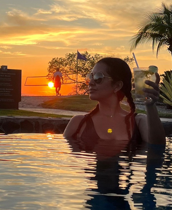
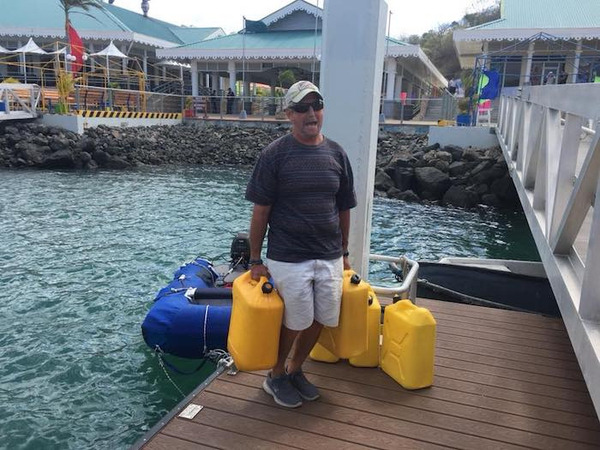
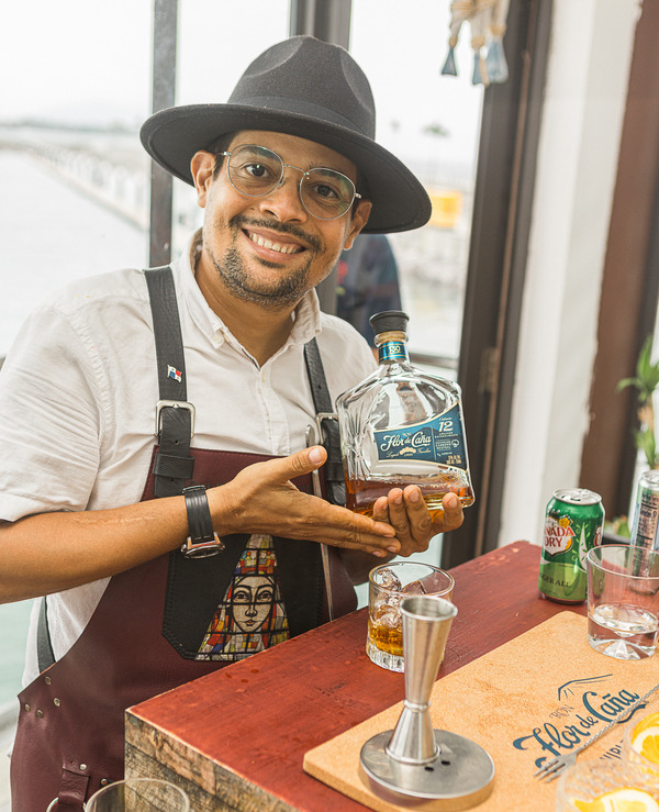
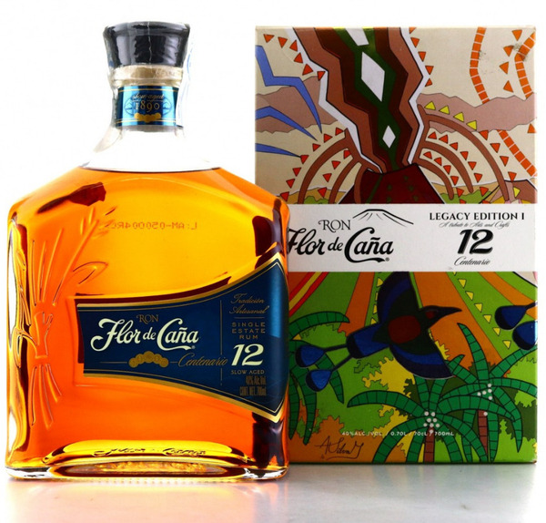
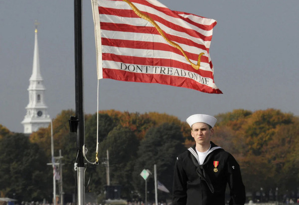
SEASON 8 AWARD ENTRIES: BIGGEST FISH CAUGHT
SEASON 8 AWARD ENTRIES: BIGGEST FISH CAUGHT

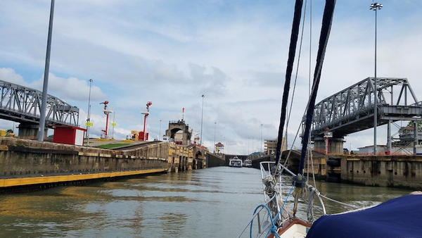
It was a blast. Tuna steaks forever. Vacuum packed and in the freezer. We weighed it with a luggage scale.

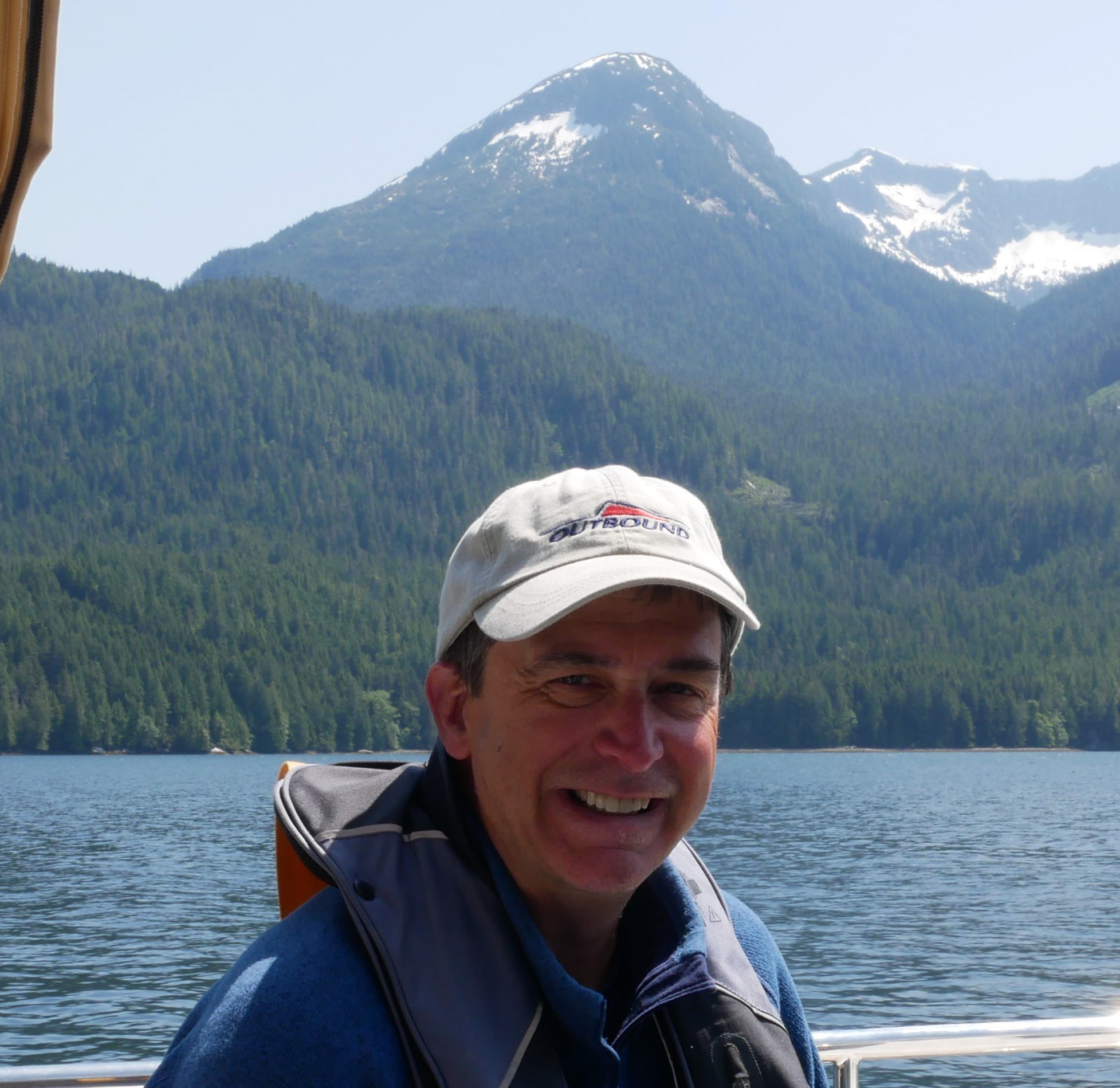
SV MALAIKA 🇺🇸 Robert & BettiAnn – Outbound 46′

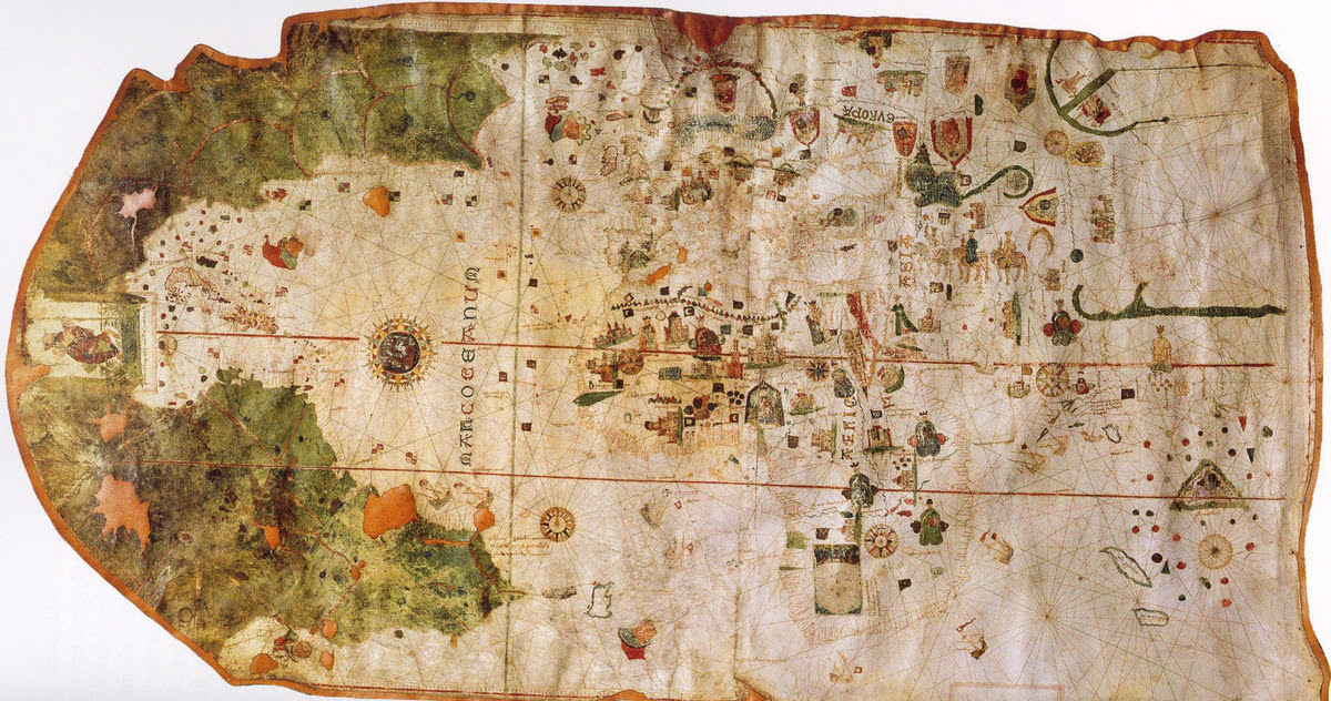
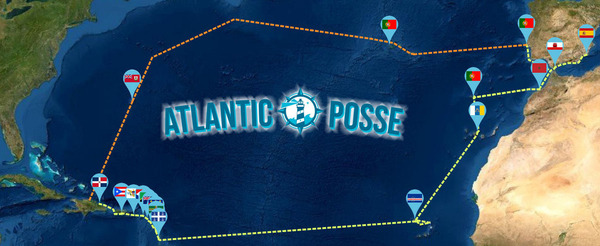
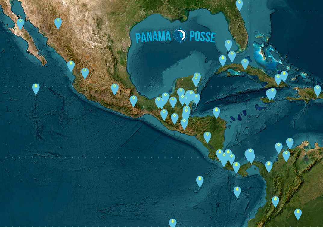
People'ing in the Americas
THE DISCOVERY OF THE LANDMASS OF THE MODERN AMERICAS did not begin with Christopher Columbus. The most long-standing and widely held theory has been that people entered the Americas in the north at the tail end of the last ice age some 10-15,000 years ago and began to settle across the land. This long standing theory holds that homo sapiens came across the Bering Straight on a now extinct land bridge from Asia. However, recent finding across the Americas are questioning this theory and proposing other theories. Interestingly, the study of Home Sapien migration through science, archeology, geneology and more continues to uncover more and more clues that cloud the picture of how and when homo sapiens populated the Americas more than they are shedding light on the mystery. Basically, people came overland by foot or people came by water from the east or the west. Experts have and continue to piece together the past with new findings and new ideas, yet sometimes the mystery just gets bigger. Regarding the 'by water theory from the west' according to Megan Gannon from Sapiens.org,
"According to this coastal migration theory, some 16,000 years ago the ice had retreated from the coastlines of the Pacific Northwest, such that seafaring people could take advantage of coastal resources like kelp forests to navigate all the way down the shores of California, eventually reaching sites like Monte Verde in Chile.
Proving the coastal theory is tricky. No wooden boats from that era have been found along the shore. The earliest campsites along the ancient Pacific coastline may be lost for good due to erosion and sea level rise. Yet scholars have some clues that people were living along the Pacific coast, including the footprints at Calvert Island.
Evidence of human habitation from at least 13,000 years ago on the Channel Islands in California suggests that people had the skills to build boats and reach these land masses, which were islands even then. In the last 15 years, archaeologists at Cedros Island off the coast of Baja California in Mexico have found traces of a nearly 13,000-year-old settlement. Some archaeologists, such as Loren Davis of Oregon State University, are turning to methods such as coring—removing of a long column of soil—to search for hints of now-underwater prehistoric sites along the Pacific continental shelf."
*NOTE: Cedros Island is on the southbounders route down the Pacific side of the Baja Peninsula. Multiple anchorages can be found. The fall is often a good time to use the southern Anchorage: https://goodnautical.com/mexico-pacific/anchorage/isla-cedros-s

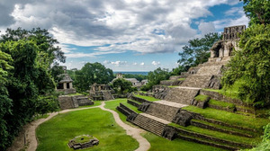
Nonetheless, while their daily life was not recorded or documented as ours it today, humans were in the Americas for likely over 10,000 years before the first life-changing contact with Europeans occurred in the end of the 15th century. A that time the Americas were the home to more than 50 million, perhaps as many as 75 million highly evolved communities of people. These ancient civilizations had experienced many changes and many catastrophes during their long history in the Americas, yet it seems certain that none of these experiences was as tragically transforming as the arrival of Europeans. In the long term, European settlers came to dominate most areas of the Americas. But even in the short term—in the first violent years of Spanish and Portuguese exploration and conquest—the impact of the new arrivals was profound. Battles between Natives and Europeans in the Americas continued but there were also many other interactions through which these very different civilizations shaped one another, learned from one another, and changed each other permanently and profoundly.

Europeans were almost entirely unaware of the existence of the Americas before the fifteenth century. A few early wanderers like Leif Eriksson, an eleventh-century Norse seaman, and perhaps others—had glimpsed parts of the New World and had demonstrated that Europeans were capable of crossing the ocean to reach it. But even if their discoveries had become common knowledge (and they had not), there would have been little incentive for others to follow. Europe in the middle ages (roughly 500– 1500 A.D.) was not an adventurous civilization. Europe was divided into innumerable small duchies and kingdoms, its outlook was overwhelmingly provincial. Subsistence agriculture predominated, and commerce was limited; few merchants looked beyond the boundaries of their own regions. The Roman Catholic Church exercised a measure of spiritual authority over most of the continent, and the Holy Roman Empire provided at least a nominal political center. Even so, real power was for the most part widely dispersed; only rarely could a single leader launch a great venture. Gradually, however, conditions in Europe changed so that by the late fifteenth century, interest in overseas exploration had grown.
15th Century: WHY EUROPEANS LOOKED WESTWARD
Two important and related changes provided the first incentive for Europeans to look toward new lands. One was a result of the significant population growth in fifteenth-century Europe following the Black Death. The Black death was a catastrophic epidemic of the bubonic plague that began in Constantinople in 1347, which had decimated Europe, killing (according to some estimates) more than a third of the people of the continent and debilitating its already limited economy. By the early 1500's the population had rebounded. With that growth came a rise in land values, a re-awakening of commerce, and a general increase in prosperity. Affluent landlords became eager to purchase goods from distant regions, and a new merchant class emerged to meet their demand. As trade increased, and as advances in navigation and shipbuilding made long-distance sea travel more feasible, interest in developing new markets, finding new products, and opening new trade routes rapidly increased. Paralleling this rise of commerce in Europe, and in part responsible for it, was the rise of new governments that were more united and powerful than the feeble political entities of the feudal past. In the western areas of Europe, the authority of the distant pope and the even more distant Holy Roman Emperor was necessarily weak. As a result, strong new monarchs emerged there and created centralized nation-states, with national courts, national armies, and—perhaps most important—national tax systems. As these ambitious kings and queens consolidated their power and increased their wealth, they became eager to enhance the commercial growth of their nations. Ever since the early fourteenth century, when Marco Polo and other adventurers had returned from Asia bearingexotic goods (spices, fabrics, dyes) and even more exotic tales, Europeans who hoped for commercial glory had dreamed, above all, of trade with the East. For two centuries, that trade had been limited by the difficulties of the long, arduous overland journey to the Asian courts. But in the fourteenth century, as the maritime capabilities of several western European societies increased and as Muslim societies seized control of the eastern routes to Asia, there began to be serious talk of finding a faster, safer sea route to Asia. Such dreams gradually found a receptive audience in the courts of the new monarchs. By the late fifteenth century, some of them were ready to finance daring voyages of exploration. The first to do so were the Portuguese. They were the preeminent maritime power in the fifteenth century, in large part because of the work of one man, Prince Henry the Navigator. Henry’s own principal interest was not in finding a sea route to Asia, but in exploring the western coast of Africa. He dreamed of establishing a Christian empire there to aid in his country’s wars against the Moors of northern Africa; and he hoped to find new stores of gold.


The explorations Prince Henry began did not fulfill his own hopes and yet, they ultimately led farther than he had dreamed. Some of Henry’s mariners went as far south as Cape Verde, on Africa’s west coast. In 1486 (six years after Henry’s death), Bartholomeu Dias rounded the southern tip of Africa (the Cape of Good Hope); and in 1497–1498 Vasco da Gama of Portugal proceeded all the way around the cape to India. In 1500, the next fleet bound for India, under the command of Pedro Cabral, was blown westward off its southerly course and happened upon the coast of Brazil.
But by then another man, in the service of another country, who had already encountered the New World. Christopher Columbus, who was born and reared in Genoa, Italy, obtained most of his early seafaring experience in the service of the Portuguese. As a young man, he became intrigued with the possibility, already under discussion in many seafaring circles, of reaching Asia by going not east but west. Columbus’s hopes rested on several basic misconceptions. He believed that the world was far smaller than it actually is. He also believed that the Asian continent extended farther eastward than it actually does. He assumed, therefore, that the Atlantic was narrow enough to be crossed on a relatively brief voyage. It did not occur to him that anything lay to the west between Europe and Asia. Columbus failed to win support for his plan in Portugal, so he turned to Spain. The Spaniards were not yet as advanced a maritime people as the Portuguese, but they were at least as energetic and ambitious. In the fifteenth century, the marriage of Spain’s two most powerful regional rulers, Ferdinand of Aragon and Isabella of Castile, had produced the strongest monarchy in Europe. Like other young monarchies, it soon grew eager to demonstrate its strength by sponsoring new commercial ventures. Columbus appealed to Queen Isabella for support for his proposed westward voyage. In 1492, having consolidated the monarchy’s position within Spain itself, Isabella agreed to Columbus’s request. Commanding ninety men and three ships—the Niña, the Pinta, and the Santa María — Columbus left Spain in August 1492 and sailed west into the Atlantic on what he thought was a straight course for Japan. Ten weeks later, he sighted land and assumed he had reached his target. In fact, he had landed on an island in the Bahamas. When he pushed on and encountered Cuba, he assumed he had reached China. He returned to Spain in triumph, bringing with him several captured natives as evidence of his achievement.

(He called the people he found in what was to him The New World' "Indians" because he believed they were from the East Indies in the Pacific.) But Columbus had not, of course, encountered the court of the great khan in China or the fabled wealth of the Indies. A year later, therefore, he tried again, this time with a much larger expedition. As before, he headed into the Caribbean, discovering several other islands and leaving a small and short-lived colony on Hispaniola. On a third voyage, in 1498, he finally reached the mainland and cruised along the northern coast of South America. When he passed the mouth of the Orinoco River (in present-day Venezuela), he concluded for the first time that what he had discovered was not in fact an island off the coast of China, as he had assumed, but a separate continent; such a large freshwater stream, he realized, could emerge only from a large body of land. Still, he remained convinced that Asia was only a short distance away. And although he failed in his efforts to sail around the northeastern coast of South America to the Indies (he was blocked by the Isthmus of Panama), he returned to Spain believing that he had explored at least the fringes of the Far East. He continued to believe that until he died. Columbus’s celebrated accomplishments made him a popular hero for a time, but he ended his life in obscurity. When Europeans at last gave a name to the New World, they ignored him. The distinction went instead to a Florentine merchant, Amerigo Vespucci, a member of a later Portuguese expedition to the New World who wrote a series of vivid descriptions of the lands he visited and who recognized the Americas as new continents. Columbus has been celebrated for centuries as the “Admiral of the Ocean Sea” (a title he struggled to have officially bestowed on him during his lifetime) and as a representative of the new, secular, scientific impulses of Renaissance Europe. Columbus was also a deeply religious man, even something of a mystic His voyages were inspired as much by his conviction that he was fulfilling a divine mission as by his interest in geography and trade. A strong believer in biblical prophecies, he came to see himself as a man destined to advance the coming of the millennium. “God made me the messenger of the new heaven and the new earth,” he wrote near the end of his life, “and he showed me the spot where to find it.”

A similar combination of worldly and religious passions lay behind many subsequent efforts at exploration and settlement of the New World. Partly as a result of Columbus’s initiative, Spain began to devote greater resources and energy to maritime exploration and gradually replaced Portugal as the leading seafaring nation. The Spaniard Vasco de Balboa fought his way across the Isthmus of Panama in 1513 and became the first known European to gaze westward upon the great ocean that separated America from China and the Indies. Seeking access to that ocean, Ferdinand Magellan, a Portuguese in the employ of the Spanish, found the strait that now bears his name at the southern end of South America, struggled through the stormy narrows and into the ocean (so calm by contrast that he christened it the “Pacific”), then proceeded to the Philippines. There Magellan died in a conflict with the natives, but his expedition went on to complete the first known circumnavigation of the globe (1519–1522). By 1550, Spaniards had explored the coasts of North America as far north as Oregon in the west and Labrador in the east, as well as some of the interior regions of the continent.
While Humans as a species have been in the Americas for well over ten thousand years, the effect of European explorers upon their arrival in the late 1400's to the mid 1500's was staggering and swift. While Christopher Columbus was not the first person to come to the Americas, he and his compatriots put a proverbial stake in the ground and claimed their discovery for their crown, their nation and the world. Prior to this, the world outside of people's immediate environment had previously been so obscure. European explorers came from their distant land, charting the ocean along the way, and encountered both lands and people they did not know existed and yet as a species humans, homo sapiens had existed on this round planet for hundreds of thousands of years. How had they spread out so far and wide? How had they become so isolated from one another? How had their stories been shared and lost?
Piecing together the past through the lens of today, available historic records, and scientific findings is no easy task. In fact, it leads one to the Paradox of Knowledge that Albert Einsein described with “The more I learn, the more I realize how much I don’t know.”

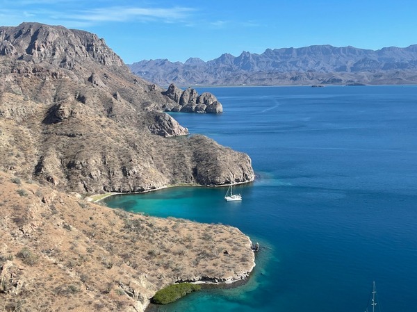
GOOD NAUTICAL ON THE WEST COAST OF THE BAJA: BAHIA SAN QUINTIN
GOOD NAUTICAL ON THE WEST COAST OF THE BAJA:
BAHIA SAN QUINTIN, MEXICO 
30° 23.7384′ N, 115° 55.5760′ W
Posse members on the West Coast are beginning to set their sights on the southbound journey. Consider a stopover in Bahia San Quintin on the west cost of the Baja Peninsula. Whale watching, sport fishing and fantastic seafood bring tourists to San Quintin. Oysters, mussels and abalones are harvested from the crystal clear waters of the bay so please avoid dumping waste of any kind overboard. The lagoon provides great opportunities for dinghy exploration and the remains of an abandoned British colony lie in the shore of the inner bay.

Anchorage
The anchorage on the east side of the bay is open to the SW and feels quite exposed with surf breaking even a mile offshore. Anchor on a sandy bottom in 5-10m just outside the shoal line which is marked by small breakers.
https://goodnautical.com/mexico-pacific/anchorage/bahia-san-quintin
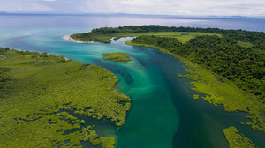
Bahia San Quintin
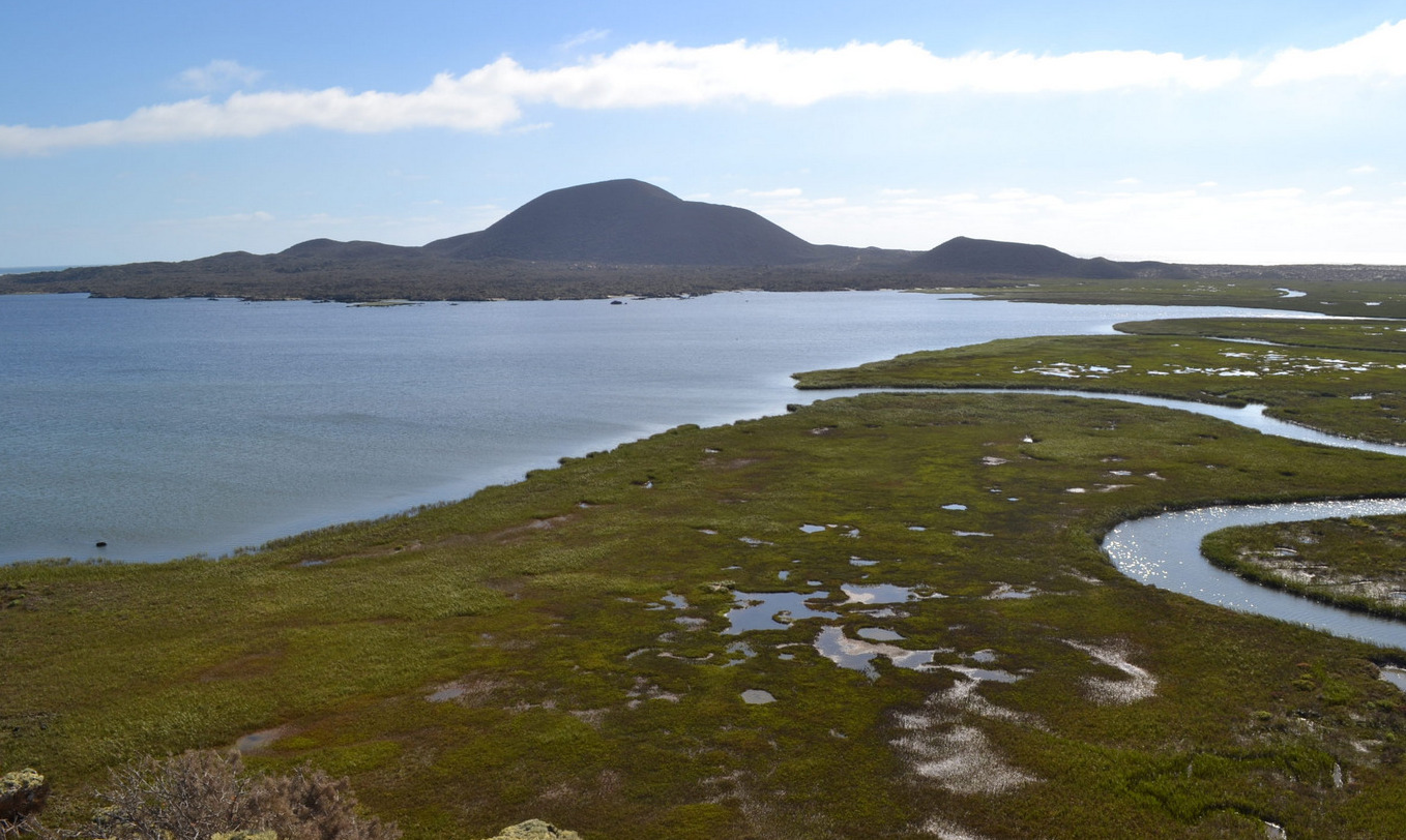
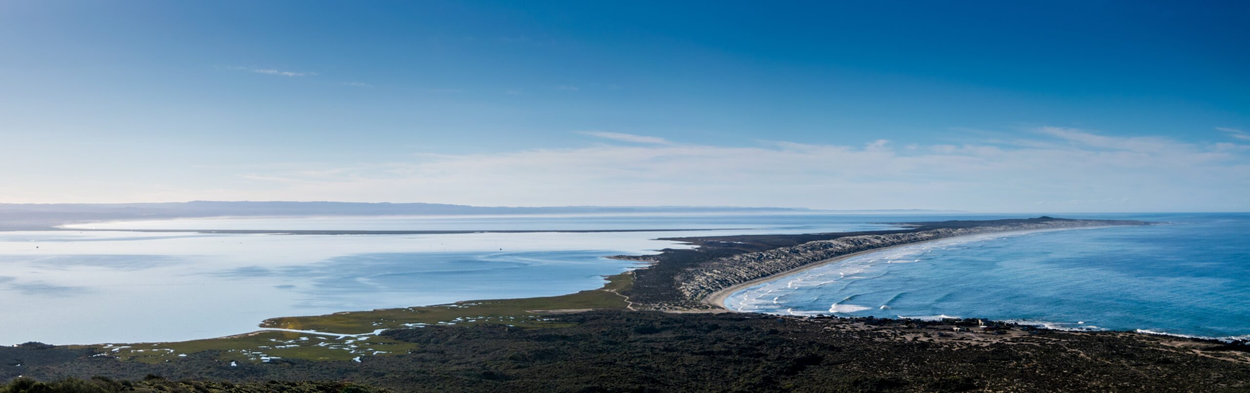
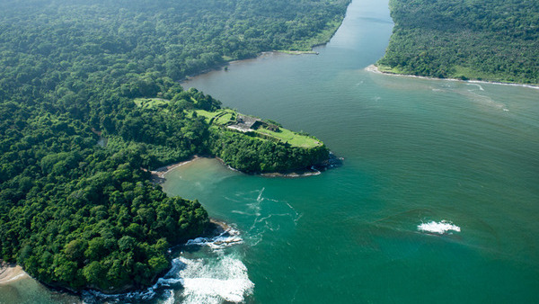
Bahía San Quintín, located on the Pacific coast of Baja California, Mexico, is a hidden gem for sailors seeking an authentic and tranquil maritime adventure. This natural harbor, about 190 nautical miles south of San Diego, offers a unique blend of pristine beauty, rich marine life, and a glimpse into the unspoiled wilderness of Baja California.
Geography and Navigation
Bahía San Quintín is a broad, sheltered bay framed by volcanic hills and sandy beaches, providing excellent protection from the Pacific’s swells. The bay is about 6 miles wide and 11 miles long, offering ample anchorage space with good holding ground in sand and mud. The entrance to the bay can be tricky, especially for first-time visitors, due to shifting sandbars and shallow areas. It is advisable to enter during daylight with good visibility and to use updated nautical charts. Depth sounders and GPS are essential tools for navigating safely into the bay.
Weather and Climate
The climate in Bahía San Quintín is typically mild and dry, with average temperatures ranging from the mid-50s to the mid-70s Fahrenheit. The area enjoys a Mediterranean climate, with dry summers and mild, wet winters. Fog can be a common occurrence, especially in the mornings, so sailors should be prepared for reduced visibility at times. Winds are predominantly from the northwest, providing favorable sailing conditions for those heading south.
Flora and Fauna
Bahía San Quintín is a haven for nature lovers. The bay and its surrounding areas are home to a diverse array of wildlife. Birdwatchers will be delighted by the presence of numerous bird species, including the endangered black brant, as well as various shorebirds and waterfowl. The bay’s waters teem with marine life, making it a popular spot for fishing and snorkeling. Anglers can expect to catch species such as halibut, sea bass, and yellowtail.
Activities and Attractions
For sailors looking to stretch their legs, the area offers plenty of onshore activities. The surrounding landscape is perfect for hiking, with trails leading through volcanic rock formations and coastal dunes. The nearby fishing village of San Quintín provides a glimpse into the local culture and an opportunity to sample fresh seafood, particularly the region’s renowned oysters and clams. Visiting the local oyster farms can be a fascinating experience, offering insights into the aquaculture practices that sustain the local economy.
Services and Facilities
While Bahía San Quintín is relatively undeveloped compared to more popular tourist destinations, it offers essential services for visiting sailors. There are a few basic facilities, including fuel, provisions, and some repair services available in the village of San Quintín. It is advisable to stock up on necessary supplies before arriving, as options may be limited. For those needing more extensive services, the port of Ensenada, located about 130 nautical miles to the north, provides a wider range of amenities, including marinas, chandleries, and professional repair services.
Conservation and Sustainability
Bahía San Quintín is part of a protected natural area, and visitors are encouraged to respect the environment and practice sustainable boating. Efforts to preserve the bay’s natural beauty and biodiversity are ongoing, and sailors can contribute by following Leave No Trace principles, minimizing waste, and avoiding damage to sensitive habitats such as seagrass beds and bird nesting areas.
Conclusion
Bahía San Quintín offers a serene and rewarding destination for sailors looking to explore the less-traveled waters of Baja California. Its natural beauty, abundant wildlife, and tranquil atmosphere make it an ideal spot for those seeking to experience the unspoiled charm of Mexico’s Pacific coast. Whether anchoring in its calm waters, exploring its diverse ecosystems, or engaging with the local community, sailors will find Bahía San Quintín to be a memorable and enriching part of their maritime journey.
Landing on the Beach in High Surf
Landing on the beach in high surf at Bahía San Quintín can be challenging and requires careful planning and execution. The key to a successful landing is timing and understanding the wave patterns. It is essential to observe the surf for a period to identify any lulls between sets of larger waves. When ready, approach the beach at a 90-degree angle, maintaining enough speed to stay ahead of the breaking waves. As you near the shore, reduce speed and be prepared to jump out and pull the dinghy up the beach swiftly to avoid it being swamped by incoming waves. Ensure all equipment and passengers are secure, and wear appropriate safety gear such as life jackets. Landing in high surf can be risky, so if conditions seem too dangerous, it might be best to wait for calmer seas or find a more sheltered landing spot within the bay.
Bahia San Quintin

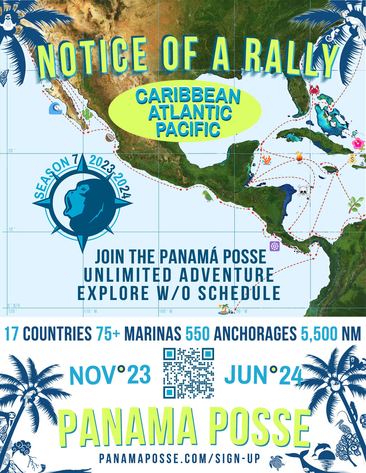
THE BAJA RUN - THE BAJA BASH
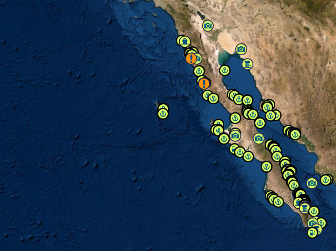
THE BAJA PENINSULA 750 NM WITH PLENTY OF ANCHORAGES AND ONE OVERNIGHT SAIL
DANGERS
FOG – KELP – REEFS – SMALL PANGAS – EXPENSIVE FUEL IN TURTLE BAY – WHALES – STRONG NW WINDS
BAJA RUN: 4 SEGMENTS TO THE SOUTH BOUND RUN
1) Leaving San Diego and Checking in into Mexico in Ensenada BC MX
2) Ensenada To Turtle Bay and anchorages in between
3) Turtle Bay to Mag Bay ( Bahia Magdalena BCS )
4) The overnight run from Mag Bay to Cabo and timing your sail around Cabo Falso into Cabo San Lucas
BAJA BASH: 7 SEGMENTS TO THE NORTH BOUND BASH
1) Fueling up and waiting for a weather window in Cabo San Lucas / San jose de Cabo
2) The overnight run around Cabo Falso to Mag Bay to Bahia Magdalena BCS
3) Beating from Mag Bay to Turtle Bay
4) Nudging up to the NE tip of iIla Cedros and sailing across a high wind zone to Fondadero San Carlos
5) San Carlos to San Quentin
6) San Quentin to Ensenada
7) Checking out of Ensenada and heading to San Diego
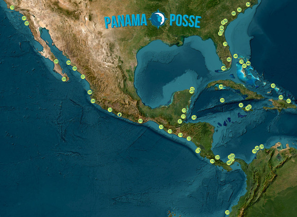
BAJA RUN SOUTH BOUND
|
|
|
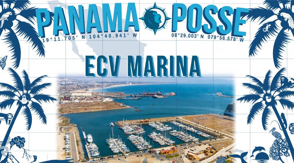
① Start at Cruiseport Village Marina Ensenada and do your Mexico check ins 31° 51.2766′ N 116° 37.2433′ W |
|
|
|
|
Once you have made it out of Ensenada without dropping to much cash at Hussong’s Cantina |
|
|
|
|
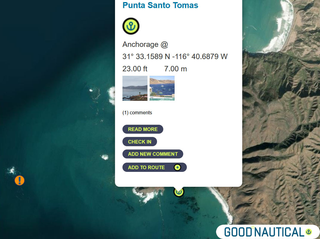
② head for Punta Santo Tomas at 31° 33.1589 N |
|
|
|
|
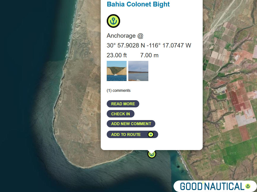
③ The next jump is either 40 nm to Bahia Colonet Bight 30° 57.9028 N 116° 17.0747 W – details at https://goodnautical.com/mexico-pacific/anchorage/bahia-colonet-bight |
|
|
|
|
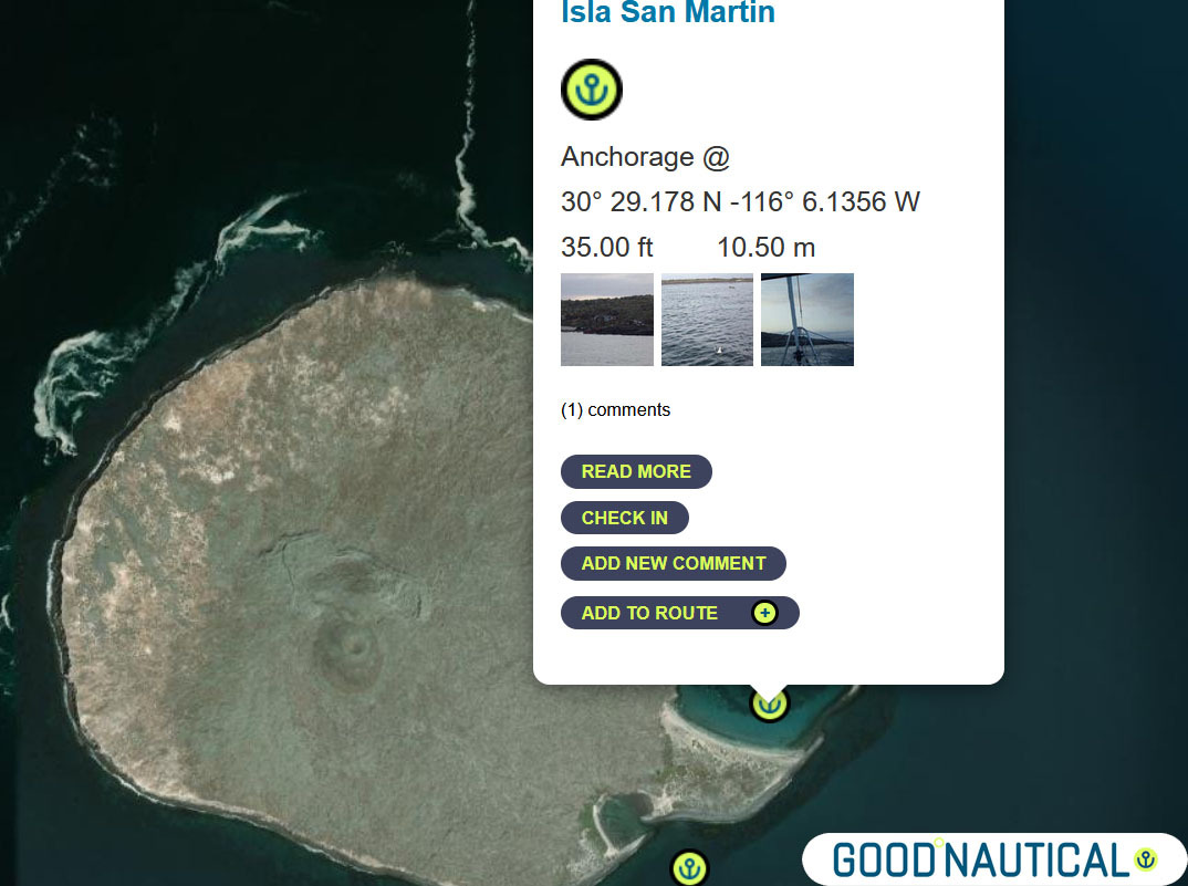
④ Or an extra 30nm Isla San Martin North bay 30° 29.178 N -116° 6.1356 W or South Anchorage depending on swell https://goodnautical.com/mexico-pacific/anchorage/isla-san-martin |
|
|
|
|
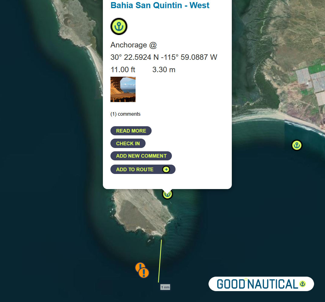
⑤For a more protective bay especially for those who wish to bash back up here is Bahia San Quintin https://goodnautical.com/mexico-pacific/anchorage/bahia-san-quintin-w and https://goodnautical.com/mexico-pacific/anchorage/bahia-san-quintin |
|
|
|
|
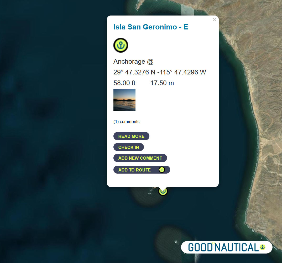
The ⑥ South of this – about 39 nm is a fair weather anchorage at 29° 47.3276 N 115° 47.4296 W behind ISLA SAN GERNOMIO – watch for 2 rocks south of it @ 29° 44.2191′ N 115° 46.2265′ W https://goodnautical.com/mexico-pacific/anchorage/isla-san-geronimo-e |
|
|
|
|
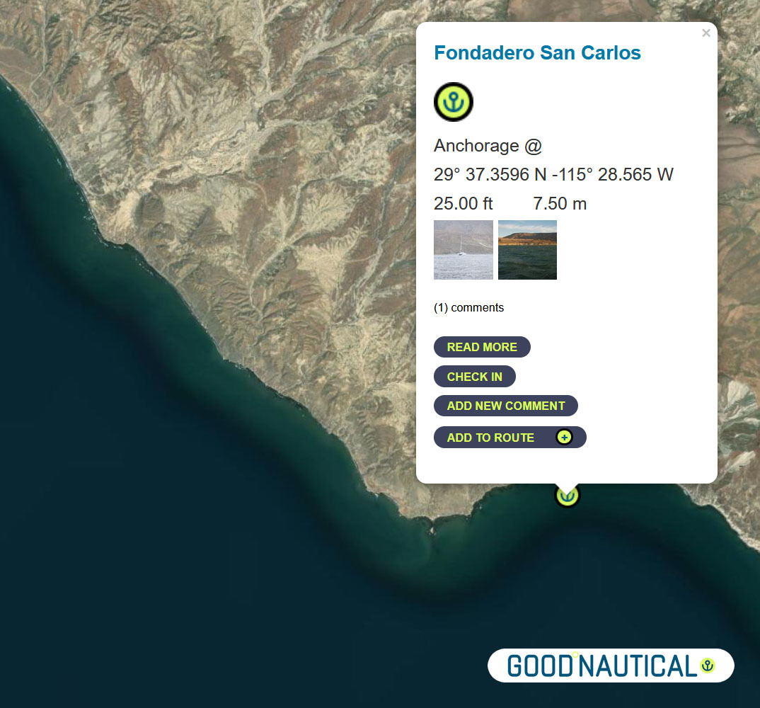
⑦ The next anchorage is a staple along the route FONDADERO SAN CARLOS Especially for those on a northbound track @ 29° 37.3596 N 115° 28.565 W This anchorage is 68 nm South of Sna Quintin – expect some kelp patches and shoaling on the northern bight https://goodnautical.com/mexico-pacific/anchorage/fondadero-san-carlos |
|
|
|
|
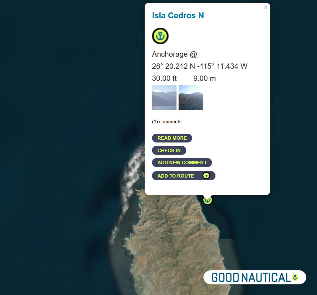
⑧ South ~ 80 nm across the bay of Sebastian Vizcaino is Isla Cedros N – aka the Cedros Island Yacht club anchorage at 28° 20.212 N -115° 11.434 W https://goodnautical.com/mexico-pacific/anchorage/isla-cedros-n Expect |
|
|
|
|
The east coast of Isla Cedros has several anchorages; the northern |
|
|
|
|
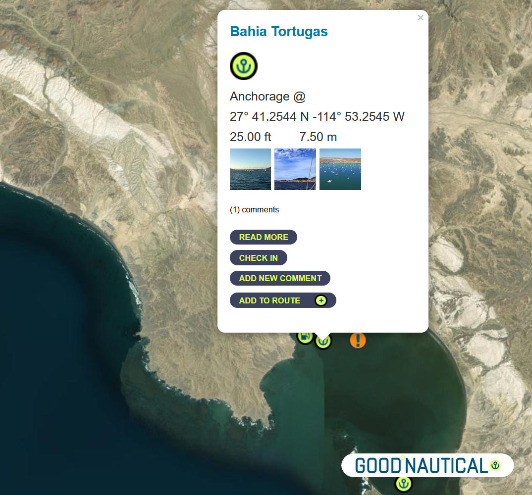
Bypassing a few anchorages on the East and South of Isla Cedros ~ ⑨50 nm south is Turtle Bay / Bahia Tortugas |
|
|
|
|
The locals will try to sell you fuel from pangas or via the fuel dock – |
|
|
|
|
⑩ The next jump is about 50 nm to Bahia Asuncion 27° 08.1355 N 114° 17.4206 W https://goodnautical.com/mexico-pacific/anchorage/bahia-asuncion |
|
|
The |
|
|
|
|
⑪Or push it another 24 nm to Bahia San Hipolito This
|
|
|
|
|
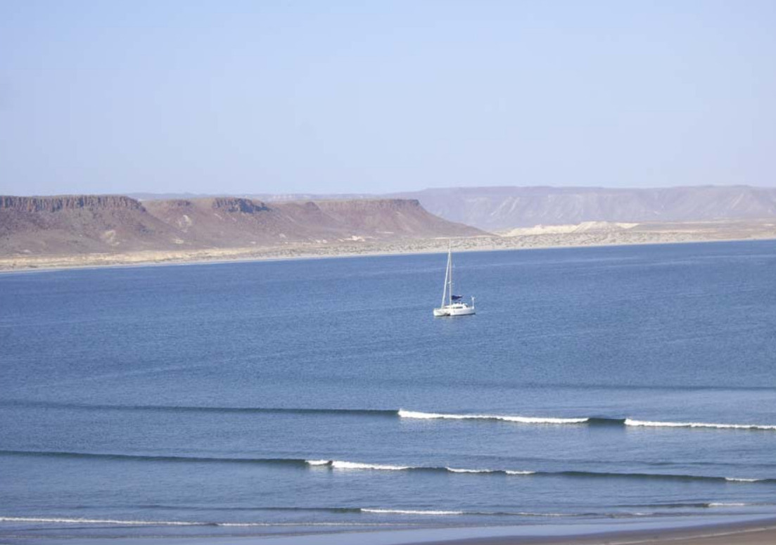
⑫A far more protected anchorage is 50 nm south of Bahia Asuncion or 105 nm south of Turtle bay is Bahia Ballenas @ 26° 46.0426 N -113° 30.0266 W https://goodnautical.com/mexico-pacific/anchorage/bahia-ballenas |
|
|
|
|
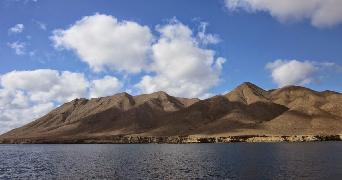
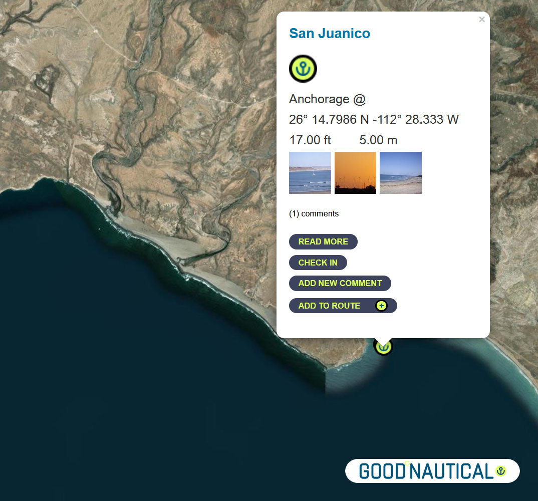
⑬ A prime spot along this coast is San Juanico / Scorpion Bay @ 26° 14.7986 N 112° 28.333 W about nm SE from Bahia Ballenas – with friendly locals and expats In |
|
|
|
|
|
|
⑭Another 85 nm to Bahia Santa Maria |
|
|
|
|
Bahia Santa Maria |
|
|
|
|
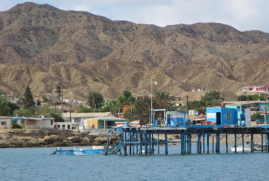
There is no permanent settlement in Bahia Santa Maria but a dinghy ride up
into river channels at the north end of the bay reveals a cluster of fishing shacks with brightly colored pangas tied up along the bank. From November to May itinerant fishermen stay in the bay to fish for tuna, jacks and dorado. |
|
|
|
|
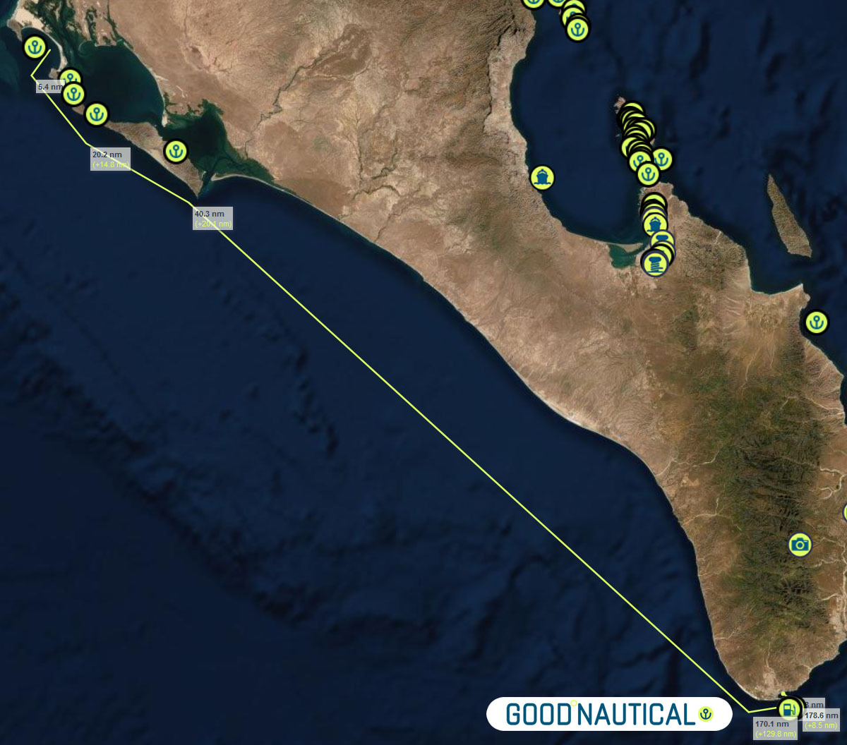
⑮The final jump an overnight sail to Cabo San Lucas ( WEEKEND MORNINGS ARE TOUGH IN CABO MANY FISHING VESSELS LEAVE A T THAT TIME SO TRY TO ARRIVE AFTER 9 AM ) ~ 185 nm with no real stops along the way – as soon as you round the |
|
|
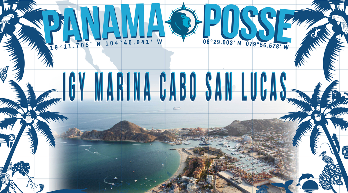
Make a reservation at our sponsorshop Marina IGY Cabo San Lucas – with Jesus A. Esquitel VHF 16 & 88A Tel +52 (624) 173-9140 CSL@IGYMarinas.com www.igy-cabosanlucas.com |
|
|
|
BAJA BASH NORTH BOUND
 |
⑮Leave from Cabo San Lucas ( WEEKEND MORNINGS ARE TOUGH IN CABO MANY FISHING VESSELS LEAVE A T THAT TIME SO TRY TO ARRIVE AFTER 9 AM )
~ 185 nm with no real stops along the way – as soon as you round the
cabe the warmer tropical air will welcomr you to Cabo San Lucas – best
not to arrive Weekends between 6 and 9 AM as scores of fishing vessels
are leaving Cabo and will produce eneourous wakes and traffic. Anchor at
22° 53.304 N 109° 53.844 W https://goodnautical.com/mexico-pacific/anchorage/cabo-san-lucas-se-coast
Make a reservation at our sponsorshop Marina IGY Cabo San Lucas – with Jesus A. Esquitel VHF 16 & 88A
Tel +52 (624) 173-9140
CSL@IGYMarinas.com
www.igy-cabosanlucas.com
CABO FALSO – get around it on a windless morning to make your way up ! It’s an overnight for most – look for winds with a more northern angle to run with less windwaves
A day c an make the total difference in weather-weather windows do come ..
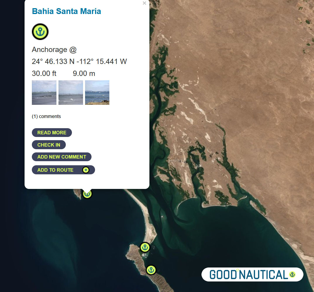
Bahia Santa Maria
is a large crescent shaped bay which lies just south of Cabo San
Lazaro. It is defined to the north and south by rocky islands and
bounded to the east by a narrow strip of sand ridges which separates it
from the huge lagoon of Bahia Magdalena behind.
into river channels at the north end of the bay reveals a cluster of
fishing shacks with brightly colored pangas tied up along the bank. From
November to May itinerant fishermen stay in the bay to fish for tuna,
jacks and dorado.
a major stop and wide bay with fisheries and cell signal 24°
46.133 N 112° 15.441 W
https://goodnautical.com/mexico-pacific/anchorage/bahia-santa-maria
⑭FROM Bahia Santa Maria 85 nm to
⑬ A prime spot along this coast is San Juanico / Scorpion Bay @ 26° 14.7986 N 112° 28.333 W about nm SE from Bahia Ballenas – with friendly locals and expats In
the mid-seventies surfers noticed the amazing waves peeling off Punta
Pequeña as the swell wraps around into Bahia San JuanicoI. The village
is host to a couple of abarrotes and restaurants and beach palapas.
SAN JUANICO SCORPION BAY
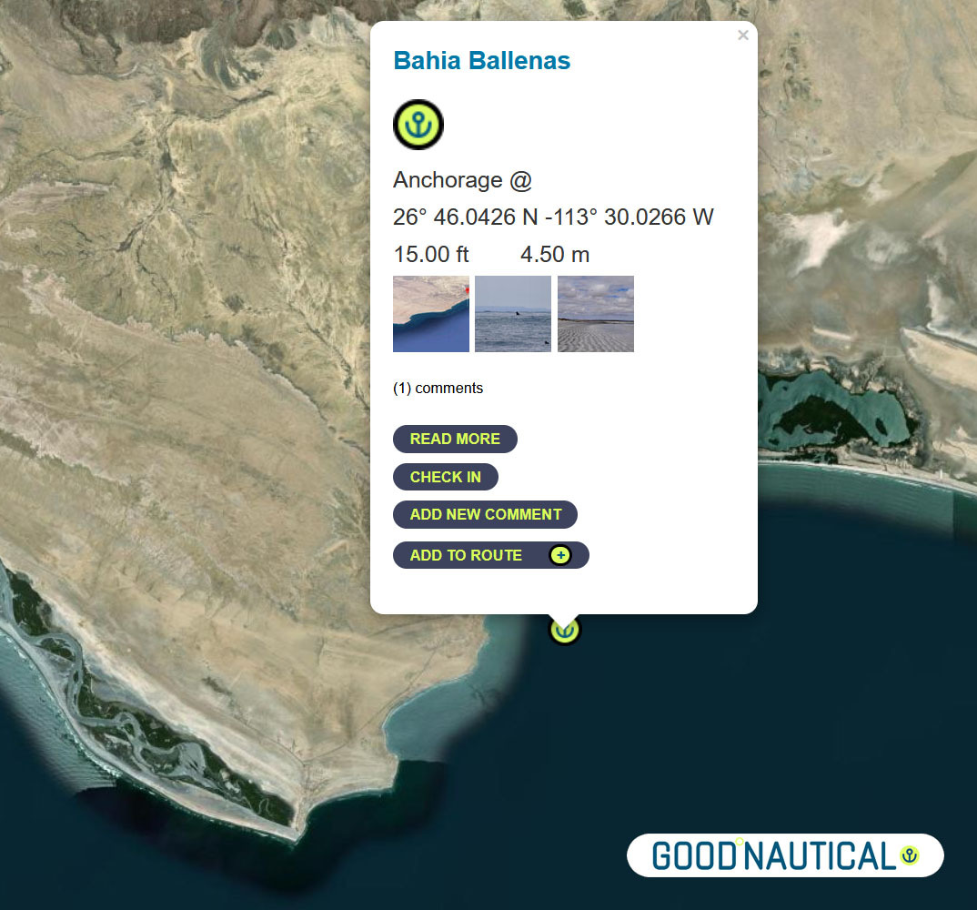
⑫A far more protected anchorage is 50 nm south of Bahia Asuncion or 105 nm south of Turtle bay is Bahia Ballenas @ 26° 46.0426 N -113° 30.0266 W https://goodnautical.com/mexico-pacific/anchorage/bahia-ballenas
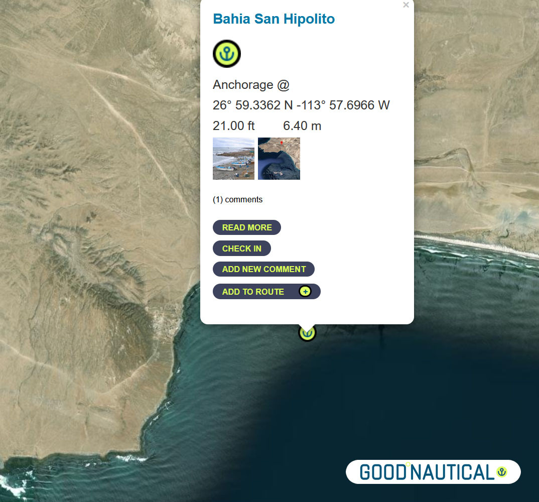
Or push it another 24 nm to Bahia San Hipolito This
is a marginal anchorage exposed to wind and swell from north and south.
Anchor close to the beach in 6.4m on sand. @ 26° 59.3362 N -113°
57.6966 W https://goodnautical.com/mexico-pacific/anchorage/bahia-san-hipolito
NEXT UP THE COAST
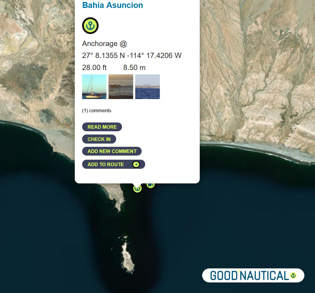
The
bay at Asuncion is home to the local fishing fleet and harvesting
shellfish is one of the main sources of income for the community. The
water is incredibly clear and no discharge is allowed to be dumped into
bay in order to preserve the high quality of the abalone.
⑩ The next jump is about 50 nm to Bahia Asuncion 27° 08.1355 N 114° 17.4206 W
https://goodnautical.com/mexico-pacific/anchorage/bahia-asuncion
ANCHORAGE LIST
| ID | Location | Latitiude | Longitude | NM | |
| ⓪ | San Diego Police Dock | 32° 42.537′ N | 117° 14.10543′ W | – | ⛽💧 |
| ① | Ensenada Cruiseport Village Marina | 31° 51.2766′ N | 116° 37.2433′ W | 60.04 | ⛽💧 |
| ② | Punta Santo Tomas | 31° 33.1589 N | 116° 40.6879 W | 18.37 | |
| ③ | Bahia Colonet Bight | 30° 57.9028 N | 116° 17.0747 W | 40.65 | |
| ④ | Isla San Martin North Bay | 30° 29.178 N | 116° 6.1356 W | 30.24 | |
| ⑤ | Bahia San Quintin | 30° 22.5924′ N | 115° 59.0887′ W | 8.97 | |
| ⑥ | Isla San Gernomio | 29° 47.3276′ N | 115° 47.4296′ W | 36.71 | |
| ⑦ | Fondadero San Carlos | 29° 37.3596′ N | 115° 28.565′ W | 19.19 | |
| ⑧ | Isla Cedros N | 28° 20.212′ N | 115° 11.434′ W | 78.62 | |
| ⑨ | Turtle Bay / Bahia Tortugas | 27° 41.2544′ N | 114° 53.2545′ W | 42.16 | ⛽💧 |
| ⑩ | Bahia Asuncion | 27° 08.1355′ N | 114° 17.4206′ W | 45.95 | ⛽ 💧 |
| ⑪ | Bahia San Hipolito | 26° 59.3362′ N | 113° 57.6966′ W | 19.66 | |
| ⑫ | Bahia Ballenas | 26° 46.0426′ N | 113° 30.0266′ W | 28.05 | |
| ⑬ | San Juanico / Scorpion Bay | 26° 14.7986′ N | 112° 28.333′ W | 63.50 | |
| ⑭ | Bahia Santa Maria | 24° 46.133′ N | 112° 15.441′ W | 89.47 | |
| ⑮ | Cabo San Lucas East | 22° 53.304′ N | 109° 53.844′ W | 171.87 | ⛽💧 |
| ⑯ | Los Frailes | 23° 22.836′ N | 109° 25.297” W | 39.54 | |
| ⑰ | Isla de Pajaros | 23° 15.2645′ N | 106° 28.3305” W | 162.80 | |
| ⑱ | Isla Isabella Anchorage South | 21° 50.5266′ N | 105° 52.907” W | 90.87 | |
| ⑲ | San Blas Outer Anchorage | 21° 31.043′ N | 105° 14.566′ W | 40.64 | ⛽💧 |
| ⑳ | Punta de Mita | 20° 45.764′ N | 105° 31.15′ W | 47.88 | |
| ㉑ | Punta Ipala | 20° 14.2306′ N | 105° 34.4255′ W | 31.71 | |
| ㉒ | Chamela – N | 19° 35.0404′ N | 105° 7.8663′ W | 46.50 | |
| ㉓ | Isla Paraiso – E | 19° 28.6194′ N | 105° 3.7637′ W | 7.50 | |
| ㉔ | Tenacatita – Inner Bay | 19° 17.9207′ N | 104° 50.1528′ W | 16.72 | |
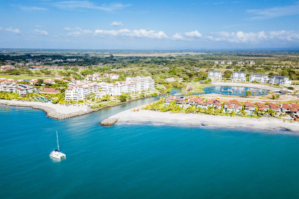
| ㉕ | Marina Puerto Navidad | 19° 11.7294′ N | 104° 40.8748′ W | 10.73 | ⛽💧 |
WINDS
CURRENTS
SWELL AND WAVES
FLEET UPDATE 2023-07-04
|


|
|
|

|
|


|