ROUTES
OCEAN POSSE ROUTES
There are many key routes along the Ocean Posse - we are collecting reports and are compiling a comprehensive list of how to get from A to B in favorable conditions.
-
Maritime Routes: These are established paths or corridors on the sea used by vessels for regular voyages between cruising ports, often based on historic patterns, ocean currents, and safety considerations. They are like highways of the ocean, used for seasonal sailings, staging for ocean crossings, and enjoyable cruising. Choose from the ROUTES menu above.
-
Maritime Approaches and GPX Tracks: These refer to the navigable waters leading into anchorages, marinas, to moorings, into small harbors, into atolls, though reefs or coastal areas. They are recorded for safe entry and exit from a known points of interest and involve a series of, way-points, and controlled access points. Approaches require careful navigation, GPS accuracy due to factors like shoals, reefs, rocks, obstructions, tides, yacht and small vessel traffic and potential hazard. GPX tracks are kept within GOODNAUTICAL.com for Ocean Posse participants and are organized by global maritime areas (GMA's)
-
Access know routes or challenging passages from the ROUTE sub menus above


ABC'S to COLOMBIA
ABC’S to COLOMBIA
this is a downwind run – fast and furious
Route Overview
Distance: Approximately 350 nautical miles
Estimated Duration: 2–4 days, depending on weather, vessel speed, and stopovers
Route Highlights:
- Aruba’s protected leeward coast
- The open Caribbean Sea crossing
- Venezuelan Waters – don’t get too close
- Santa Marta’s dramatic Sierra Nevada backdrop
Weather Considerations
- Trade Winds:
The prevailing northeast trade winds (15–25 knots) will likely be on the beam or quarter. Expect steady winds but prepare for gusts.
They can pipe up to 35 knots – accidental gibes and risk of rig breaks due to heavy sea state and winds. - Seas:
The waters ill be choppy, with swells ranging from 4–8 feet. It can become rough near the Guajira Peninsula due to accelerated winds.
You can expect up to 12 – 15 foot seas and massive following seas
- Season:
- Best time: November to May
- Caution: June–October is hurricane season. Though storms skew north of thi route
rare in this region, the sea can be unpredictable with squalls and lightning
Route Planning
- Departure from Aruba:
- Depart from Oranjestad or Barcadera during daylight.
- Clear customs and immigration before leaving.
- Open Crossing:
- Stay south to avoid the rougher central Caribbean.
- Monitor weather updates for squalls.
- Guajira Peninsula:
- The region can have strong katabatic winds and high seas.
- Approach with caution; night passages are not recommended.
- Arrival in Santa Marta:
- Santa Marta Marina provides excellent facilities and a secure anchorage.
- Clear customs and immigration upon arrival.
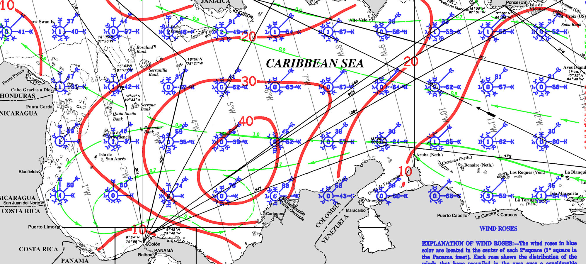
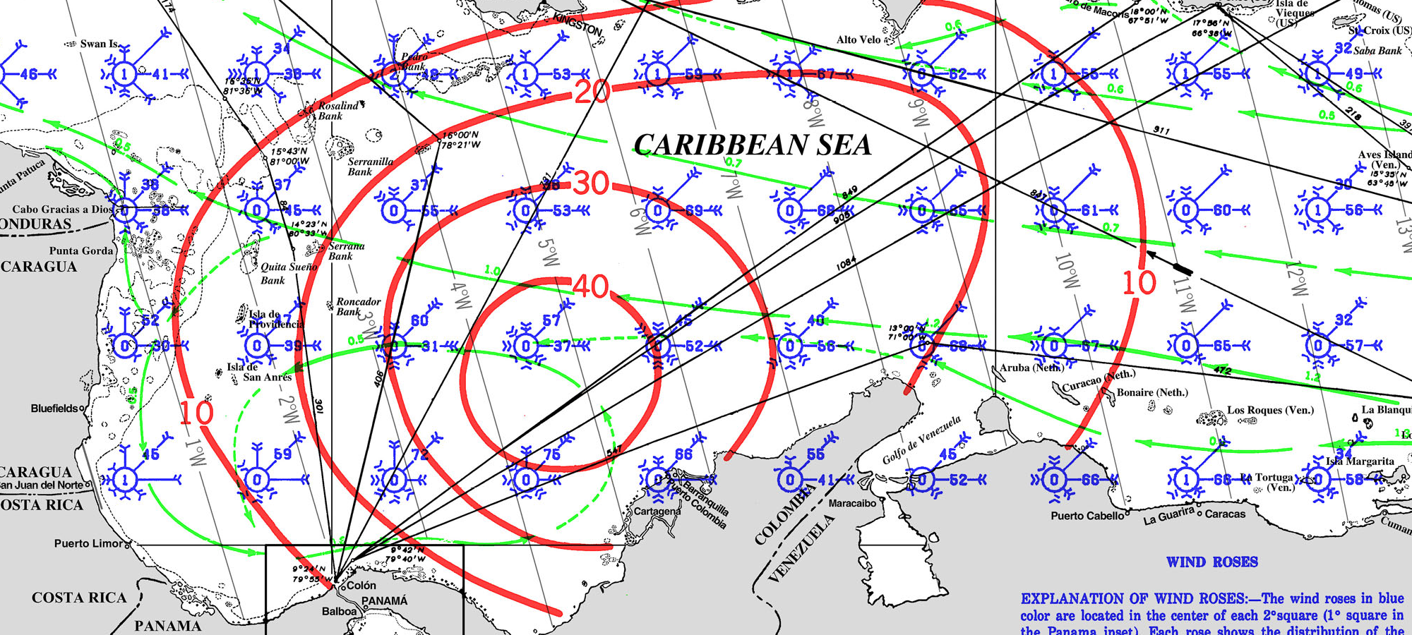
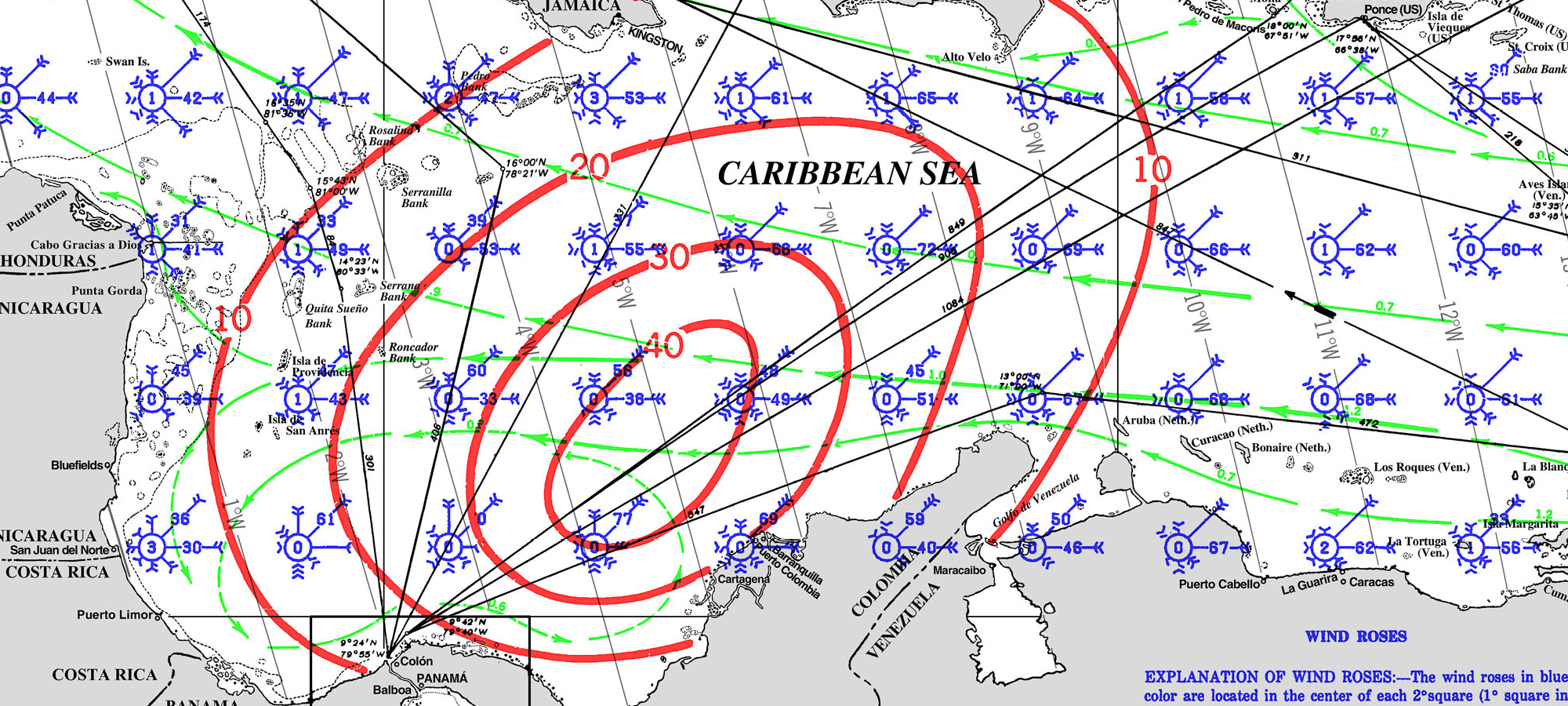
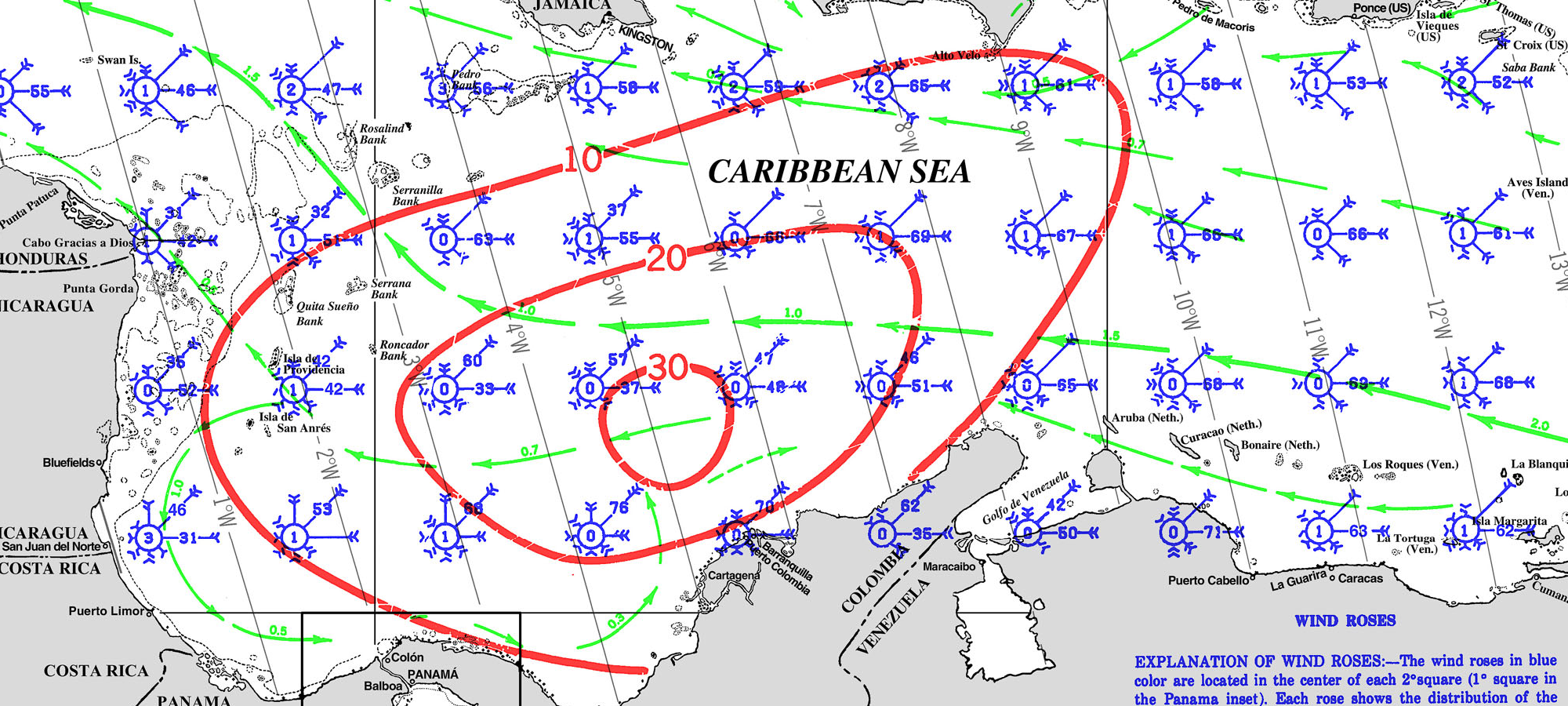
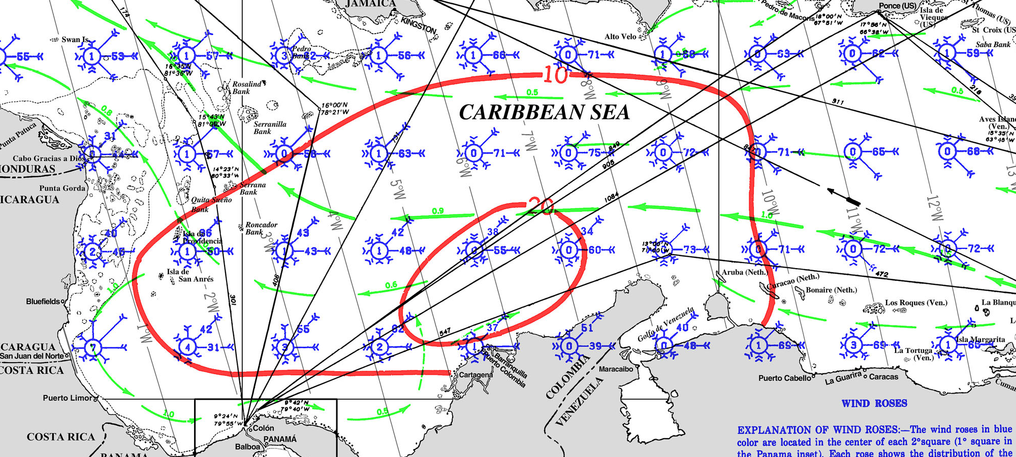
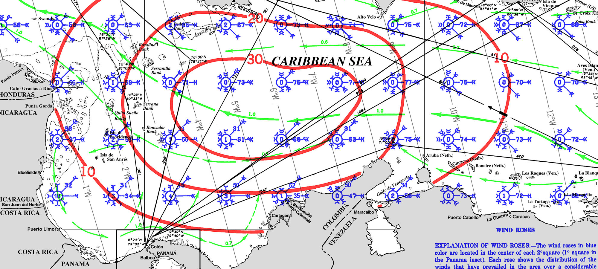
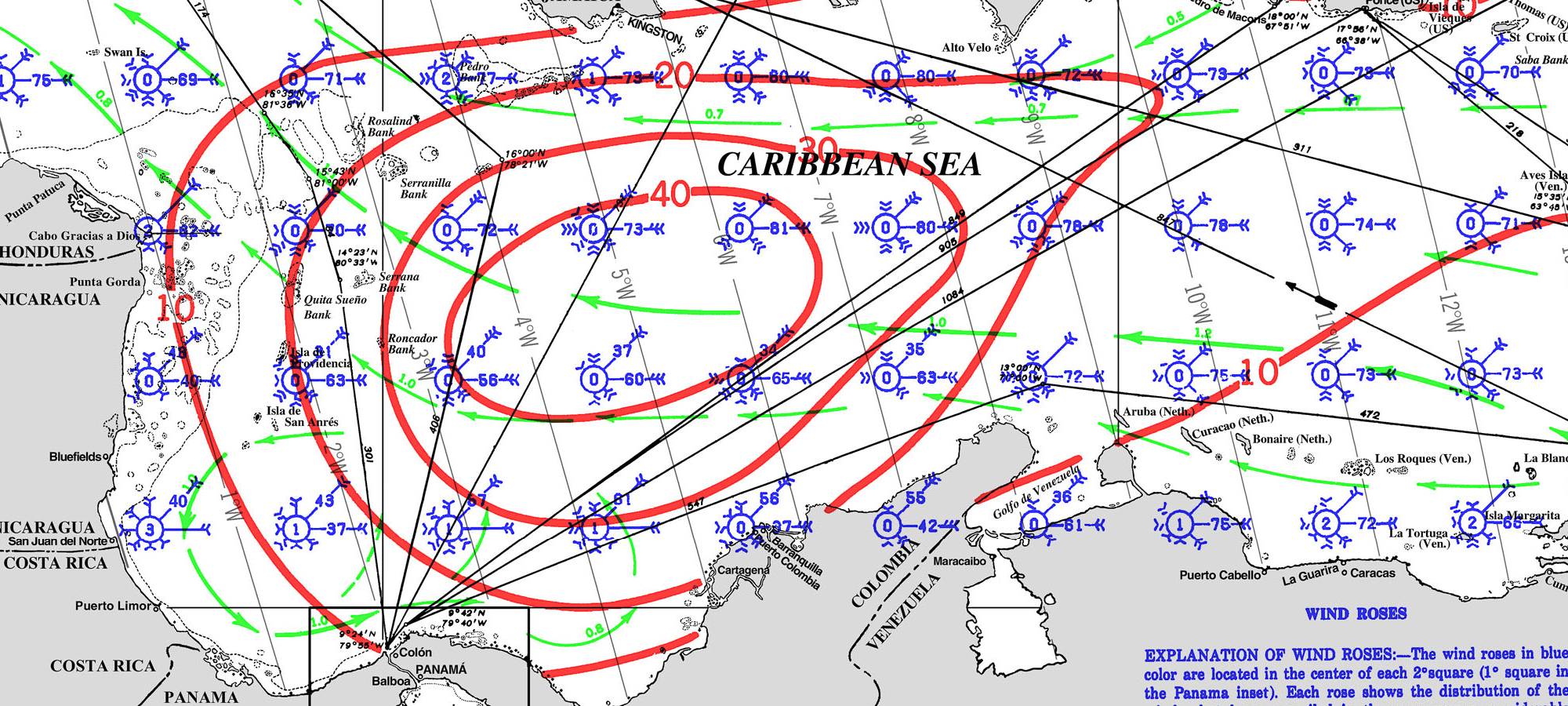
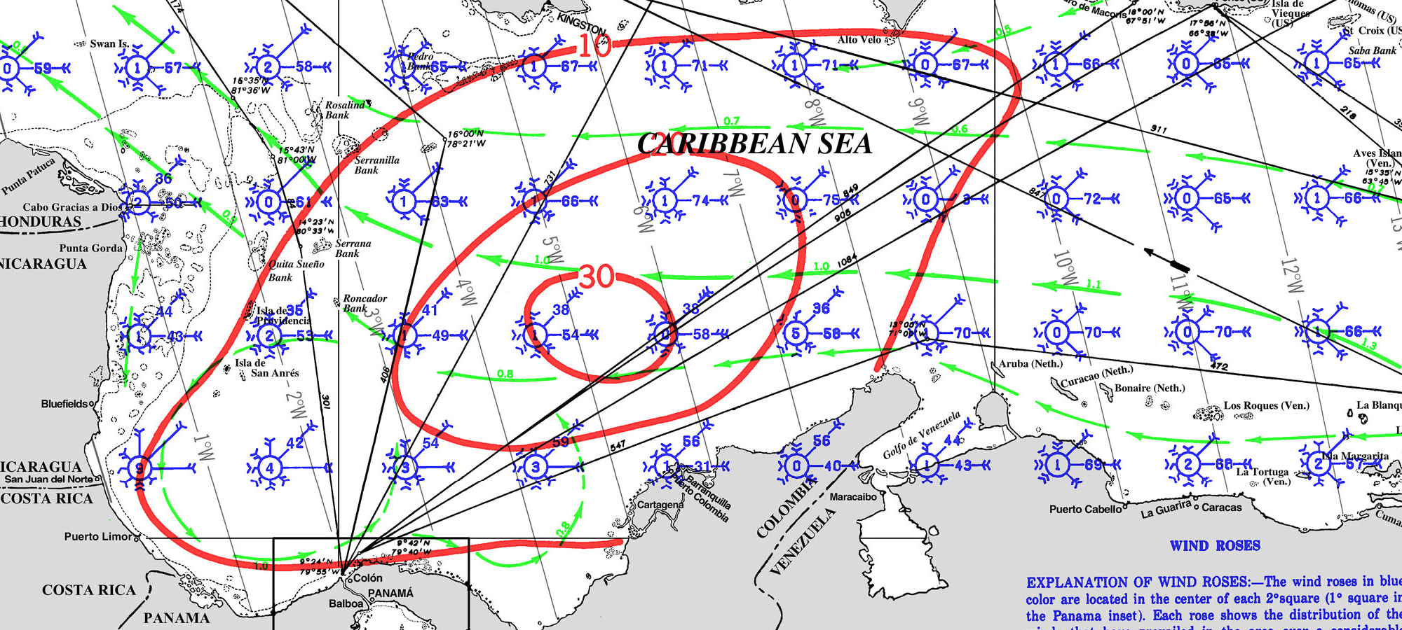
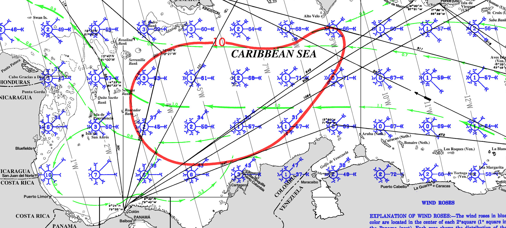
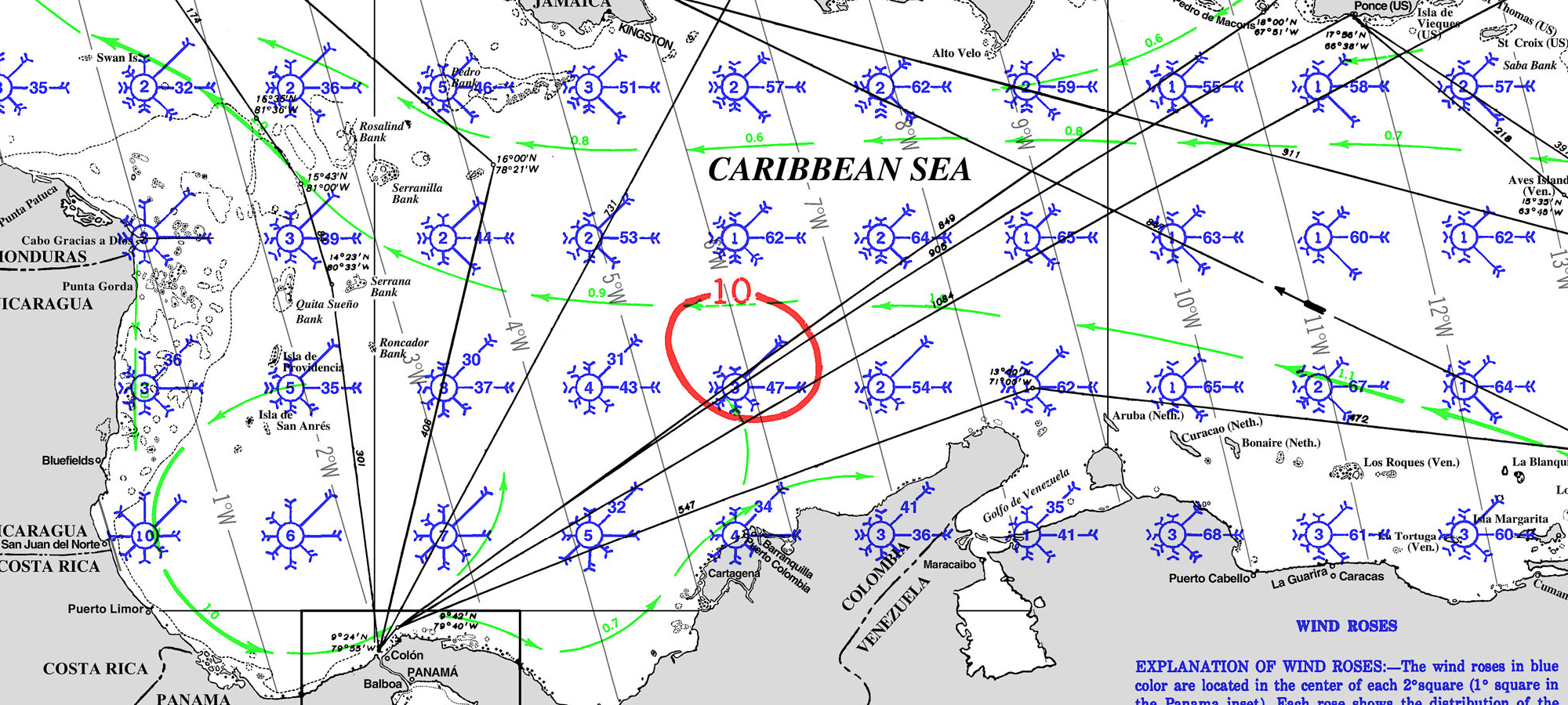
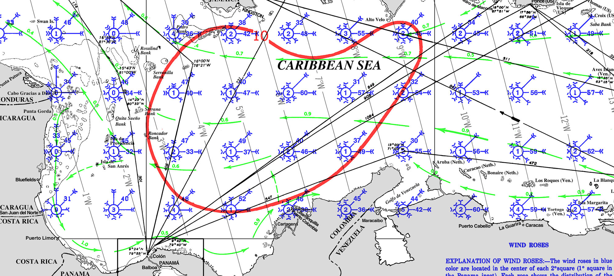
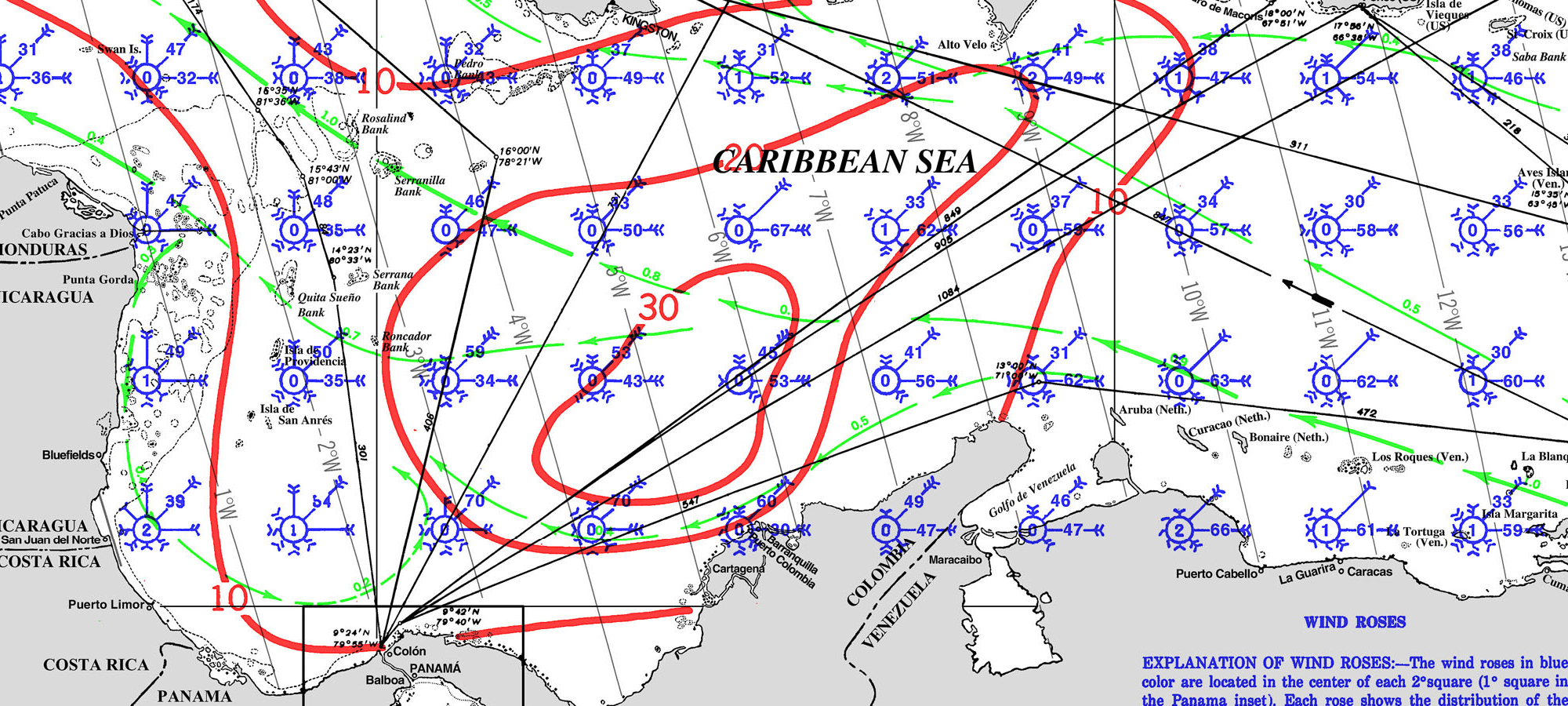
PILOT CHARTS FOR THIS ROUTE