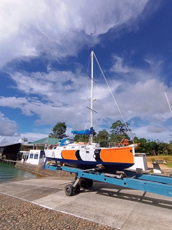
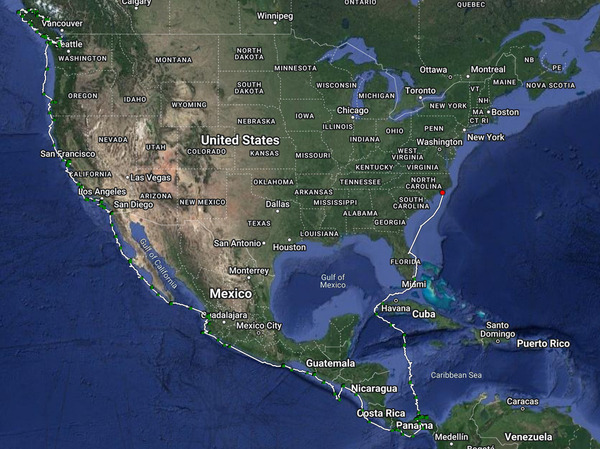
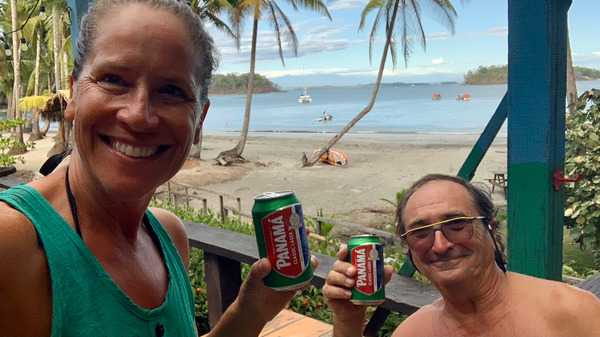
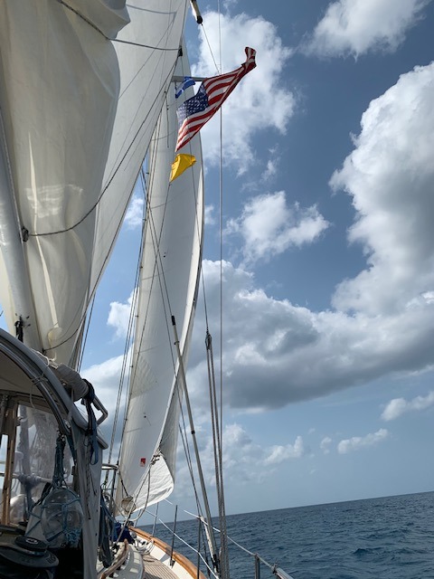
SY PATHFINDER 🇺🇸 Jean-Philippe & Nicole – Lagoon 39′
GOOD SAMARITAN OF THE YEAR AWARD
For
altering course responding to Carinthia's Pan Pan / subsequent
assistance in providing emergency bildge pumps and subsequent monitoring
of Carinthia on a 50 nm track to the boatyard.
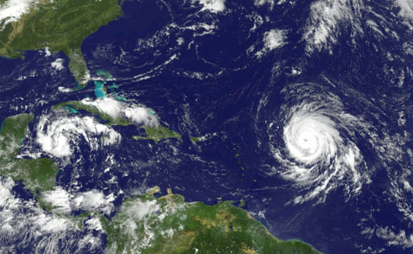
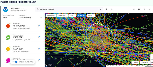
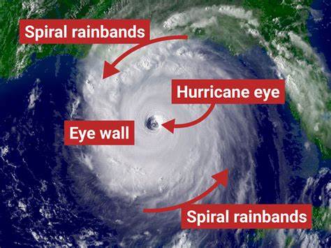
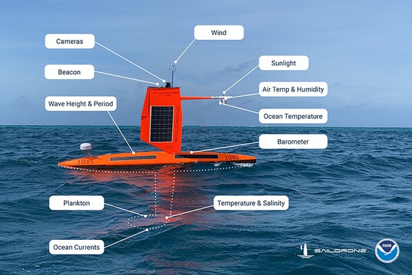
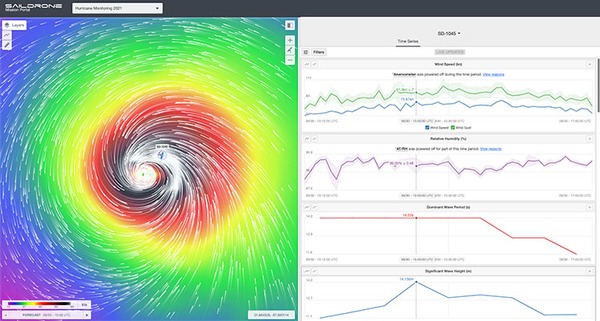
Saildrones equipped with a range of sensors to collect a broad scope of data
Hurricane season in the Atlantic is near and Saildrones are preparing for another season of observations.
Saildrones
have been helping scientists map superstorms at sea and collect data to
better understand rapid-intensification of superstorms for only a few
years. The Saildrone is a 23-foot craft that has been designed, built
and engineered to point into the absolute worst weather conditions a
hurricane can offer. The vessel is adorned with a host of
meteorological and oceanographic instruments powered by wind, water and
sun to collect and send data on land. The goal is to collect air,
surface, and subsea data in real time. The data is meant to help
scientists develop a more sophisticated understanding of why such
storms’ intensity has spiked over the last half-century. Storms
are going through rapid-intensification, lasting longer, tracking
further inland and farther north than they have historically threatening
millions of coastal residents in the United States from Texas to Maine.
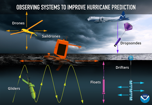
The Saildrone is one of many tools in service collecting data
A
handful of these bright orange, unmanned , remotely piloted vessels
have been built and launched in the Atlantic ocean patrolling the
Carribean for storms. In 2021, one in particular, called Saildrone
Explorer SD 1045, with it’s a 15’ rigid carbon-fiber sail and a deep
keel managed to truly weather and help map a storm, Hurricane Sam.
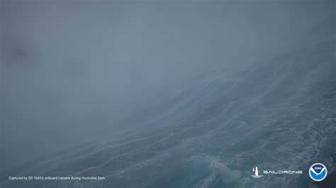
Steering on the edge of the eye wall of Hurricane Sam, this
Saildrone 1045 found 143 mph gusts, measured 89-foot waves, recorded
multiple knockdowns, 360-degree capsizes and a 30-mph surf down the back
of a giant wave.
Saildrone captures images of frothy intensity near the eye of Hurricane Same
Scientists
the world over are investigating, comparing and hypothesizing about
climate changes in the past, present, and future. Scientists seek
answers that will help predict and avoid environmental and human
disasters.
More and more storms are doing what is called rapid intensification. Scientists have not known why. Of
particular interest to the scientists monitoring Saildrone 1045 in 2021
was data that indicated that as Hurricane Sam went through rapid
intensification the sea temperature was warming not cooling and the
salinity was lower. This information was so ‘off’ from what was
expected that the data put the Saildrone’s instruments in question.
However, comparing Saildrone data to nearby buoy ad satellite data
confirmed that the instruments were in fact in good working order.
Now it was not the instruments in question but rather a discovery
that led to more questions. Scientists concluded that there was a pool
of fresh water floating on the ocean surface under the eye. This
pool was obstructing ocean upwelling and evaporation beneath the
hurricane from cooling the ocean water and thereby tempering the storm. But Why? …and How did this pool form? Where did the freshwater come from?
This
image provided by the NOAA showing Transmit data from a saildrone in
(what was) real-time to operational weather prediction centers to
improve atmosphere-ocean initial conditions in forecast models.
Scientist are looking near and far for the answers to these questions.
We
live on but one planet and scientists often illuminate interconnections
on our planet that were once thought to be distant and disconnected.
Catherine McKenzie wrote in her book, Fractured,
“They
say that if a butterfly flaps its wings in the Amazonian rain forest,
it can change the weather half a world away. Chaos theory. What it means
is that everything that happens in this moment is an accumulation of
everything that’s come before it. Every breath. Every thought. There is
no innocent action. Some actions end up having the force of a tempest.
Their impact cannot be missed. Others are the blink of an eye. Passing
by unnoticed. Perhaps only God knows which is which.
All
I know today is that you can think that what you’ve done is only the
flap of a butterfly wing, when it’s really a thunderclap. And both can
result in a hurricane”
Balance
A
precious balance of forces exist in our world inspiring scientists to
question cause and effect, to look deeply at humans place in this
balance.
Many
believe humans indeed tip the scales somewhere, somehow, or in some way
and spend their life's work seeking this understanding.
The
conclusion about the freshwater pool has inspired new research around
salinity levels in the ocean, how they are changing and the causes for,
in this case, a pool of intense dilution. Rising sea
temperatures? Melting iceburgs? Increased rainfall?
Deforestation?
All
of this data and these questions are relevant in all the world’s
Oceans, not just the Atlantic. Superstorms may be billed under
different names in different oceans, IE typhoons in the Northwest
Pacific, Cyclones in the South Pacific and Hurricanes in the Atlantic,
but their trend and impacts are the same. The world over
Superstorms are growing stronger as the ocean warms beneath them and
wreaking havoc on human life and structures.
“About
a third of the world’s population has no access to
extreme-weather-early-warning systems- including a stunning 60 percent
of people in Africa.” The disproportionate impact of storms in
communities without forecasting systems let alone electricity is
staggering. “Oceanographers often point out that appropriations
for NASA’s deep-space exploration outpaces ocean exploration by more
than 150 to 1- to the point that scientists know more about the surface
of Mars than they do about our own seas, which play an outsize role in
the climate crisis and are far more important to the survival of our
species.” Some scientists refer to this as a black hole of data.
As
people that live on and spend a lot of time on the Ocean we are
intimately connected to the salty sea and the weather. It is worth
reading about this exciting and relevant research:
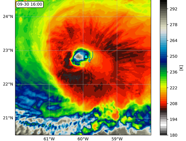
Saildrone
1045 location (triangle) overlaid on an infrared image from NOAA
geostationary satellite (colors) at 16:00 UTC September 30, 2021. The
saildrone track (light blue line) starts at 04:00 UTC on the same day.
Courtesy of Edorado Mazza, University of Washington.
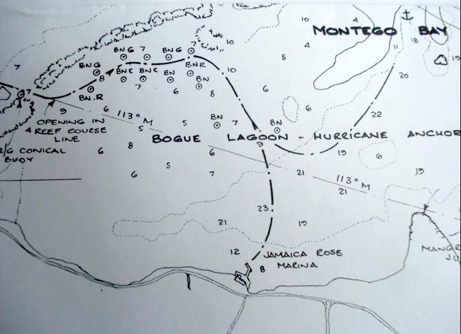
Excellent for protection- a bonafide HURRICANE HOLE
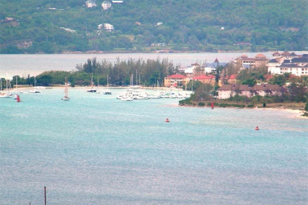
View
from the Richmond Hill Inn (500’ above the bay) includes the Montego
Bay Yacht Club and anchorage area. The area directly behind the club is
Bogue Lagoon.
BOGUE LAGOON ANCHORAGE SKETCH-
from the FREE CRUISING GUIDE TO JAMAICA by Frank Virgintino
archived in https://panamamposse.com/books
"Once past the buoy there is a series of markers -- rusted and old, but
serviceable -- to lead you in. Do not shortcut any of them. Their colors are
faded, so you need to stay alert. Do not even think about entering at night.
This anchorage should be used in heavy “northers” or even hurricanes. It is
well protected with good holding. There is a Houseboat restaurant in the
lagoon; you can anchor close by and dinghy over to enjoy a really nice meal.
The entrance channel carries 7’ of water. If you need more, wait for a high
tide which will give you another foot. Once inside, the depth in the
anchorage area is between 15’ and 20’.
Unless you like this type of anchorage, there is nothing to recommend here
other than avoiding heavy weather. This is mangrove country so when the
wind is down, mosquitoes can be merciless. Check your mosquito screens."
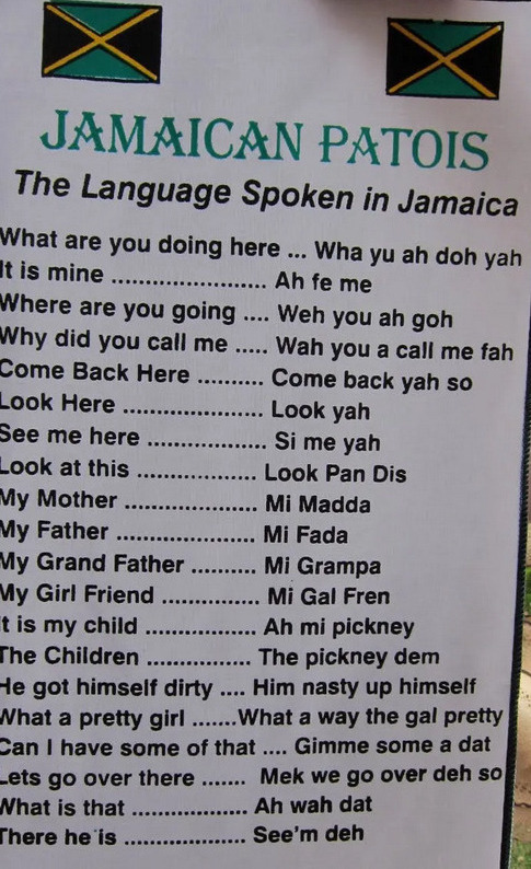
Patois
is a fascinating linguistic and cultural phenomenon, reflecting the
history, resilience, and creativity of the Jamaican people. It's an
integral part of the local culture, contributing to the vibrant and
diverse tapestry of Jamaica's heritage.
The
vocabulary draws from a range of sources, including English, African
languages, Spanish, and Indigenous Taino words. Many words and phrases
have specific cultural or local meanings that may not be immediately
apparent to non-native speakers. Jamaican Patois also includes unique
idiomatic expressions and proverbs that reflect the island's history,
traditions, and way of life.
Reggae
music evolved from earlier Jamaican musical genres such as ska and
rocksteady, but it also drew inspiration from African rhythms and
religious practices. The lyrics of reggae songs often address social and
political issues, promoting messages of liberation, unity, and
resistance against oppression. Many reggae songs express themes of
empowerment, equality, and the celebration of Jamaican identity and
culture.
The
connection between the slave uprisings and reggae music is evident in
the lyrics of influential reggae artists such as Bob Marley, Peter Tosh,
and Burning Spear, among others. Their songs often speak to the history
of slavery, the struggles faced by the African diaspora, and the quest
for justice and equality. Through their music, they helped raise
awareness of Jamaica's history and cultural heritage on a global scale.
Furthermore,
the rhythmic elements of reggae, with its distinctive bass lines,
offbeat guitar strumming, and syncopated drumming, can be traced back to
African musical traditions brought to Jamaica during the era of
slavery. This rhythmic foundation, combined with the socio-political
messages of the lyrics, contributed to reggae's unique and influential
sound.
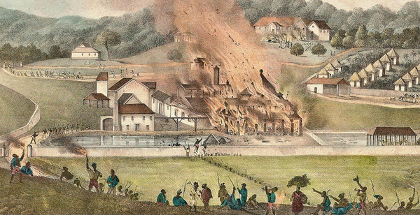
Painting
by Adolphe Duperly depicting the Roehampton Estate in St. James,
Jamaica, being destroyed by fire during the uprising.
The
legacy of the slave uprisings, along with the experiences of slavery
and oppression, deeply influenced Jamaican culture, providing a
foundation for the emergence of various cultural expressions, including
music. Reggae, which gained international recognition and became a
symbol of Jamaican culture, has roots deeply connected to the historical
struggles for freedom and social justice.
Chronology of Resistance in the West Indies - JAMAICA
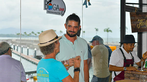
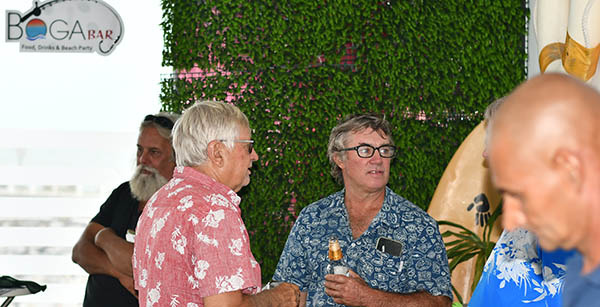
10) PLEASE SHARE YOUR END OF SEASON STORIES AND HIGHLIGHTS
Among
the Panama Posse are great adventurers and often in
landscapes are breathtakingly beautiful, poignant, or fascinating
in some way. Please share you photos either on the Line App
for the group to enjoy or feel free to send pictures with captions or
short accompanying stories to me at editor@panamaposse.com.
Every week I assemble the newsletter with information from the
fleet and for the fleet. If you think it is newsworthy, send it to
me and I will do my best to include it.
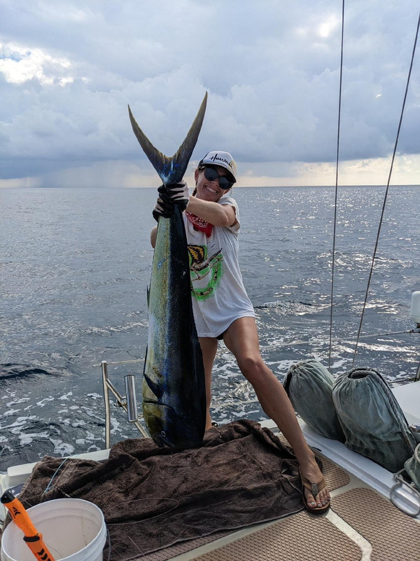
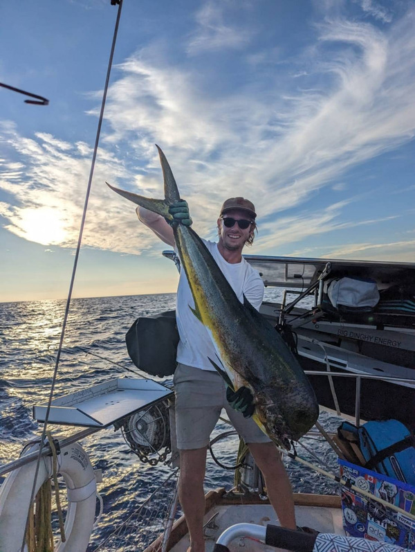
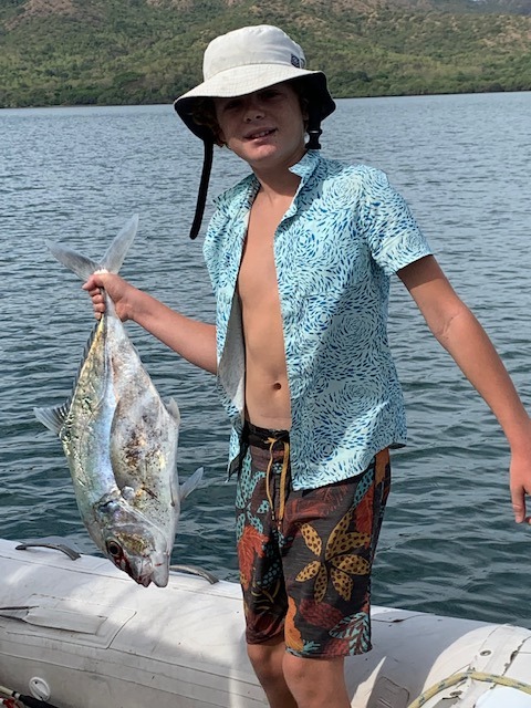
Budding Sailor and Fisherman extraordinaire, Russell, catches an African Pompano
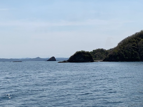
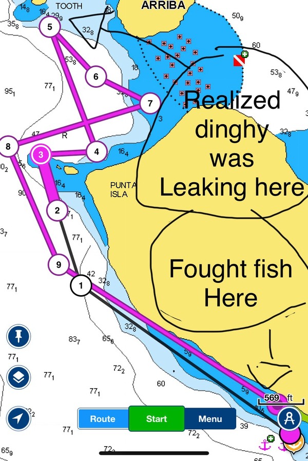
Bahia Santa Elena, Guanacaste, 🇨🇷 Costa Rica
"I woke up at 5:30 in the morning. The sun was up and it was hot
all ready. I asked my dad if he wanted to go fishing and began
preparing our 11’ inflatable dingy while he drank his morning cup of
coffee. We went out of the small cove where we were anchored and
to the first large rock at the entrance to the Bay.
We
fished at the entrance rock for awhile and all we caught was a small
starry grouper. Then we went out to the small island in the mouth
of the bay where we jigged for a bit. After jigging for about five
minutes we noticed that the dingy was taking on water. So, we
started to troll back. Along the way we got 3 bites but no fish.
We were almost back to our mothership, Whirlwind, and wondering,
"Maybe it is the lure? Maybe the lure doesn't work?".
No
sooner had we finished asking these questions when we got a big bite!
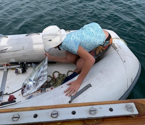
Immediately, the rod started screamin'. After a bit of a
fight, I pulled in a big pompano. We went to the beach and started
fileting it. While we were fileting it we saw a monster roster
fish. My dad tried to catch it but know luck. We are
cooking up the Pompano up know and after that I intend to catch that
rooster...if I can."
Thanks for sharing Russell! This African Pompano met it's match.
Hurricane!
The word is both feared and respected by knowledgeable mariners and old
timers along the U.S. Coastal areas of the Gulf of Mexico and the
Atlantic Ocean. Residents of Southeast Florida are constantly alert to
the news of tropical storms developing in or headed for the Atlantic
Ocean or Caribbean Sea, or Gulf of Mexico. This interest is at its
highest during the official hurricane season from June 1st to November
30.
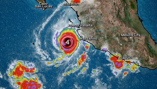
A
hurricane is a violent tropical cyclone, with winds of 74 or more miles
per hour, which spiral counterclockwise around a relatively calm center
known as the "eye” of the storm. At full strength hurricane winds can
gust to more than 200 miles per hour as far out as 20 to 30 miles from
the eye. Winds of 39 mph and greater can extend 200 miles or more in
advance of the hurricane and trail hundreds of miles behind. The
greatest threat from hurricane wind is flying debris. Winds may also
disrupt electrical power, telephone service, gas, fresh water supplies,
and transportation. Tornados are also possible as a spinoff of the
hurricane’s winds.
The
greatest danger of the hurricane, however, is from the storm surge. As
the storm approaches and moves across a coastline, storm surge may rise
10 feet or more above normal high tide and usually is accompanied by
battering waves which will overcome coastal lowlands. In addition,
extensive rainfall associated with the storm, may cause widespread
flooding further inland. More than 23 inches of rainfall in 24 hours
have been recorded in association with a hurricane.
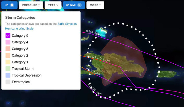
Hurricanes are classified by wind strength known as the Saffir/Simpson Scale:
Category : Wind
I : 74-95 mph
II : 96-110 mph
III: 111-130 mph
IV: 131-155 mph
V : 156 + mph
Tropical Depression - A circulation at the surface of the water with a sustained wind speed of 38 mph.
Tropical Storm - Distinct circulation with sustained wind speeds of 39 to 73 mph.
Hurricane - A tropical cyclone that rotates counterclockwise with sustained winds of 74 mph or greater.
Tropical Storm Watch - The alert given when a tropical storm poses a threat to a certain coastal area within 36 hours.
Tropical Storm Warning - A tropical storm is expected to strike within 24 hrs. with sustained winds of 39 to 73 mph.
Hurricane Watch - The alert given when a hurricane poses a threat to a certain coastal area within 36 hrs.
Hurricane Warning -
A hurricane is expected to strike within 24 hours with sustained winds
of 74 mph or more accompanied by heavy rain and high waves.
Storm Surge -
A rise in tide caused by a hurricane as it moves over or near the
coastline. It can be much higher than the normal tidal rise, with
breaking waves on top.
Beyond the definitions the manual has information on
General Precautions for Boat Owners
General Precautions for Boat Owners
Specific Precautions for Boat Owners
What do do Before and After a Hurricane
General Procedures to Process Vessel Claims
Boat Owner’s Preparation Worksheet
A Template to fill in with important numbers that one would need in case of a hurricane emergency
Important Points
• Develop your hurricane plan early. Only you can be responsible for your plan.
• Make all arrangements for moving and securing your vessel prior to
hurricane season.
• There are insufficient safe havens for all vessels in the county. Those who
act early will fare the best.
• Do not stay on your vessel, or attempt to move or secure your vessel after
small craft warnings have been posted.
• Do not be fooled by the lull or calm as the eye passes. The second half of
the storm will soon strike with full intensity.
• Marine agencies will pull their vessels from the water when wind and seas
warrant. They will not risk their lives to rescue careless boaters.
• Stay tuned to all broadcasts and official bulletins until the storm has fully abated.
• Do not return to your vessel until the hurricane has cleared your area and you are told its OK to return.
• Your life is more valuable than your property. Do not allow yourself to become a hurricane statistic!
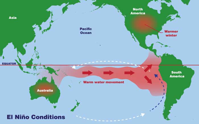
Many
fish that live in the normally cooler waters off the coast of South
America move away or die. Fishermen first called this condition of warm
coastal water and poor fishing "El Niño." El Niño means "the Christ
Child." They call it that because it typically occurs at
Christmastime.
This
information about sea surface temperature can allow scientists to more
accurately detect conditions such as El Niño while they are forming.
There
is a 60% chance for a transition from ENSO-neutral to El Niño during
May-July 2023, and this will increase to about 70% in June-August and
80% between July and September, according to the Update, which is based
on input from WMO Global Producing Centres of Long-Range Forecasts and
expert assessment
During
El Niño years, the Atlantic Ocean tends to be cooler than normal, which
can create a more stable atmosphere and increase wind shear, making it
more difficult for hurricanes to form and intensify. Therefore, El Niño
years tend to have fewer and weaker hurricanes in the Atlantic basin.
During
an El Niño year, the sea surface temperatures in the eastern Pacific
tend to be warmer than normal, which creates a more unstable atmosphere
and decrease wind shear, making it easier for hurricanes to form and
intensify.
As a result, El Niño years tend to have more and stronger hurricanes in the eastern Pacific basin.
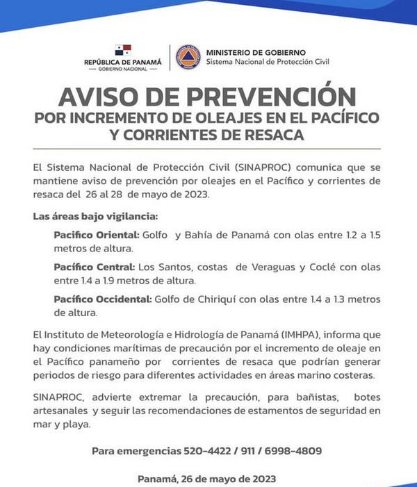
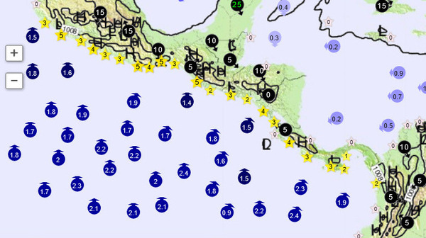
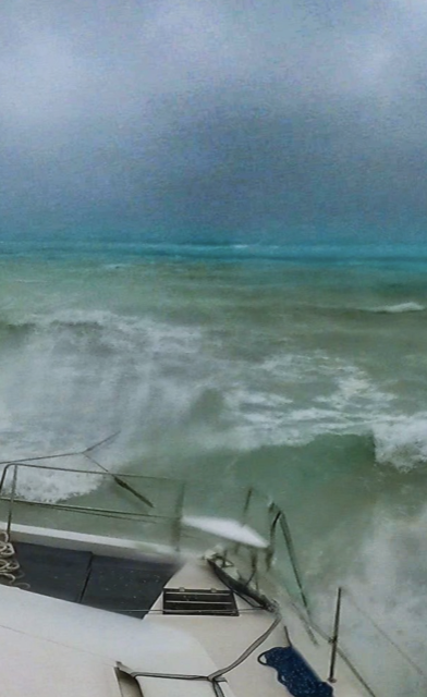
HIGH WAVE ALERT PANAMA
HIGH WAVE ALERT
13) MUST SEE:
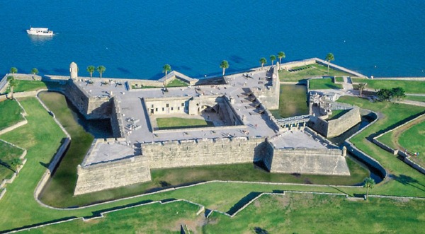
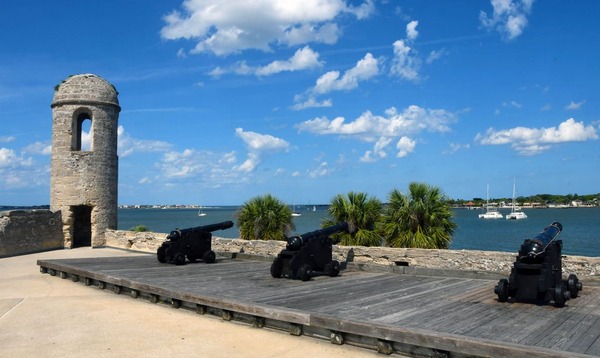
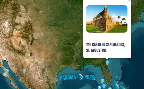
CASTILLO SAN MARCOS 🇺🇸 ST AUGUSTINE FLORIDA
The
Castillo de San Marcos is the oldest masonry fort in the continental
United Statesand is located on the western shore of Matanzas Bay in the
city of St. Augustine, Florida. The Castillo was designed by the Spanish
engineer Ignacio Daza and construction begn in 1672, 107 years after
the city’s founding by Spanish Admiral and conquistador Pedro Menéndez
de Avilés, when Florida was part of the Spanish Empire.
Distinct shape of Castillo San Marcos from above.
Castillo
de San Marcos was for many years the northernmost outpost of Spain’s
vast New World empire. It is the oldest masonry fort and the
best-preserved ex-ample of a Spanish colonial fortification in the
continental United States. This Fort anchored East Florida’s defenses,
which extended northward to the St. Mary's River, westward to the St.
Johns, and southward to Fort Matanzas. It protected St. Augustine from
pirate raids and from Spain’s major rival, Great Britain, during a time
when the Florida-Georgia-Carolina coastline was an explosive
international battleground.
The
roots of the Castillo’s history reach back to the years just after
Christopher Columbus’s final transatlantic voyage, when conquistadors
carved out a vast and wealthy overseas empire for Spain, first in the
Caribbean and then on the mainland of Mexico, Central America, Colombia,
Venezuela, and Peru. Products of these tropical and mountainous
territories brought high prices on the Continent, and Spanish galleons
sailed home laden with exotic dyes, sugar, tobacco, chocolate, pearls,
hardwoods, and silver and gold. These so-called “treasure fleets” made
Spain the most powerful and envied nation in Renaissance Europe.
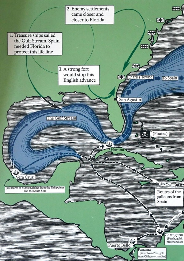
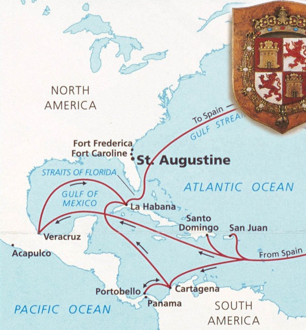
Thanks
to the travels of Ponce de Leon in 1513, Spanish navigators knew that
the best return route from Spain’s rich Caribbean possessions was along
the Gulf Stream, through the Bahama Channel, and past the shores of
Florida. The Spanish knew they must defend this peninsula to prevent
enemies from using its harbors as havens from which to raid the passing
treasure fleets.
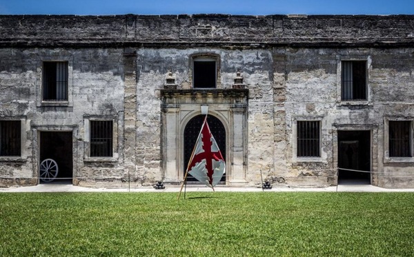
The
Castillo’s baptism of fire came in 1702 during the War of the Spanish
Succession, when the English occupied St. Augustine and unsuccessfully
besieged the fort for 50 days. The English burned the town before they
left, but the Castillo emerged unscathed, thereby making it a symbolic
link between the old St. Augustine of 1565 and the new city that rose
from the ashes.
CASTILLO SAN MARCOS TIMELINE
1513 Sailing from Puerto Rico, Spanish claim Florida.
1565 Spanish found St. Augustine and destroy French at Fort Caroline and Matanzas Inlet.
1672 Ground is broken on October 2 for Castillo de San Marcos.
1695 Castillo de San Marcos (curtain walls, bastions, living quarters, moat, ravelin, and sea-wall) is finished in August.
1702
War of the Spanish Succession pits Spain and France against Austria,
Great Britain, and others. Coastal Georgia missions are
destroyed by Carolinians en route to St. Augustine. Carolinians
occupy and burn St. Augustine but the Castillo successfully resists
their siege.
1738
Spanish governor at St. Augustine grants freedom to runaway British
slaves. Black families settle at new town called Fort Mose.
1740
St. Augustine successfully endures siege by British, Georgian, and
South Carolinian forces. Spanish attack and de-feat British Highland
troops camped at Fort Mose.
1740-42 Fort Matanzas is built to block southern approach to St. Augustine.
1756-62 Fort Mose re-built in masonry. Earth-works at Mose extended to complete northern-most defense.
1763 Peace of Paris gives Florida to Great Britain in exchange for La Habana. Castillo becomes known as Fort St. Mark.
1783 Peace of Paris recognizes independence of the United States and returns Florida to Spain.
1821 Spain cedes Florida to the United States.
1825 Castillo de San Marcos renamed Fort Marion.
1924 Fort Marion and Fort Matanzas are proclaimed national monuments
1933 Transferred to the National Parks Service
1942 Original name Castillo San Marcos is restored
🇹🇨 South Bank Marina & Boatyard – Turks and Caicos
🇧🇸 Romora Bay Resort and Marina – Bahamas
🇧🇸 Elizabeth on the Bay Marina – Bahamas
🇧🇸 Great Harbour Cay Marina – Bahamas
🇧🇸 Blue Marlin Cove Resort & Marina – Bahamas
🇩🇴 Ocean World Marina – Dominican Republic
🇩🇴 Marina Puerto Bahia – Dominican Republic
🇺🇸 Marathon Marina – Marathon Keys
🇺🇸 Pier 66 Hotel & Marina – Ft. Lauderdale, USA
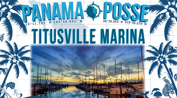
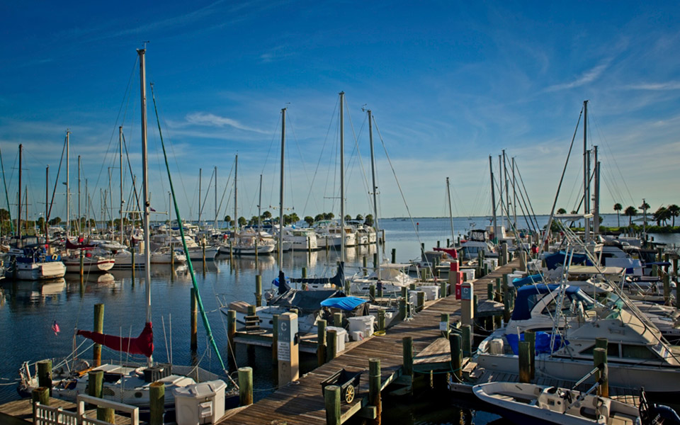
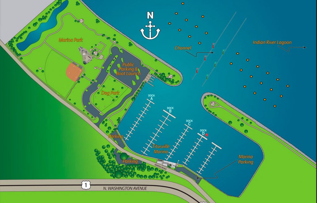
🇺🇸 Titusville Marina - Florida, USA
🇺🇸 IGY Marina at Ortega Landing – Jacksonville, FL , USA
🇺🇸 Oasis Marinas at Fernandina Harbor Marina – FL , USA
🇺🇸 Morningstar Marinas Golden Isles St. Simons Isl. – Georgia, USA
🇺🇸 Windmill Harbour Marina – Hilton Head South Carolina , USA
🇺🇸 Coffee Bluff Marina – Savannah Georgia , USA
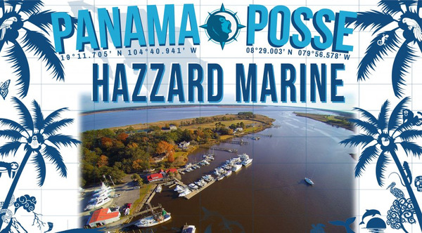
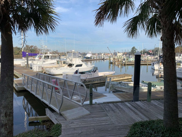
🇺🇸 Hazzard Marine – Gerogetown, North Carolina , USA
🇺🇸 Holden Beach – Town Dock, North Carolina , USA
🇺🇸 Portside Marina – Morehead City, North Carolina USA
🇺🇸 Tideawater Yacht Marina – Portsmouth, USA
🇺🇸 Ocean Yacht Marina, Portsmouth, USA
🇺🇸 Yorktown Riverwalk Landing – Virginia USA
🇺🇸 Regatta Point Marina – Deltaville, Virginia USA
🇺🇸 Regent Point Marina – Topping, Virginia USA
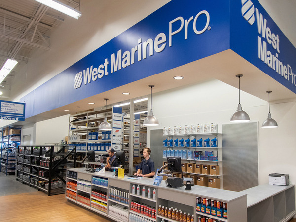
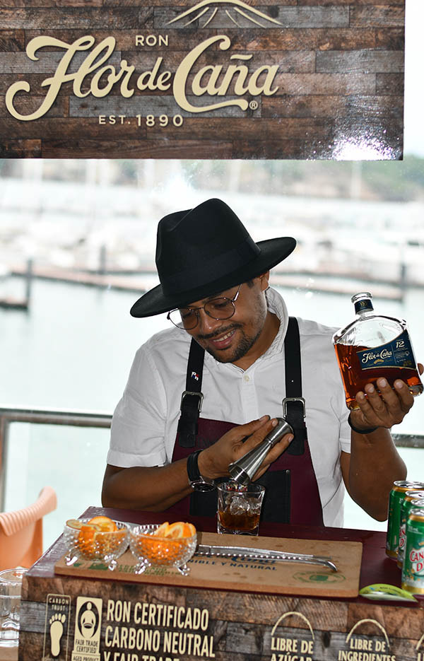
15) PANAMA POSSE SPONSORS
PREDICT WIND
SEVENSTAR YACHT TRANSPORT
HOME DEPOT PRO MEXICO
HERTZ RENTAL CARS MEXICO
YACHT AGENTS GALAPAGOS
FLOR DE CAÑA
SAFE HARBOR SOUTH BAY MARINA EVENT CENTER
WESTMARINE PRO
SAILMAIL
CHRIS PARKER - MARINE WEATHER CENTER
SAN DIEGO MARINE EXCHANGE
DOWNWIND MARINE
BELIZE TOURISM
PANAMA YACHT BROKER
LATITUDES AND ATTITUDES
DELTA MIKE MARINE SUPPLY PANAMA
SHELTER ISLAND INFLATABLES
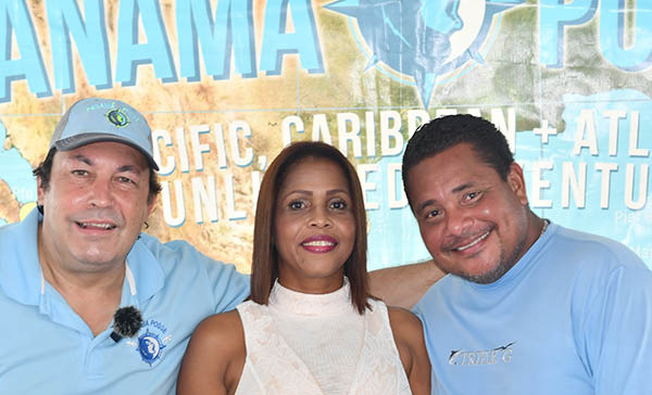
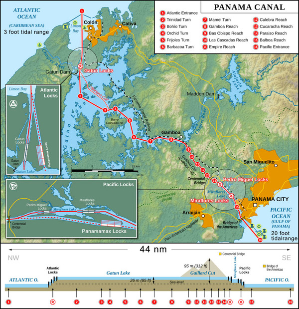
16) PANAMA CANAL AGENT CENTENARIO CONSULTING ERICK GALVEZ
To
arrange for transit with the Panama Canal Authority please contact Eric
Galvez our dedicated Panama Canal agent and sponsor of the Panama Posse
and the Pacific Posse
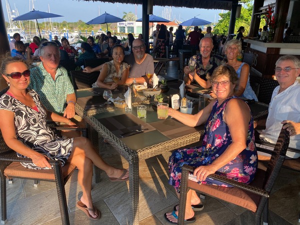
Panama Posse Mothers Day dinner at Restaurante Baos, 🇲🇽 Marina Chiapas.
Present were Glenn and Ashley SV C-Ya, Crystal and Kurt SV “Crystal Seas” Robin and Tad SV Bisou, and Dave and Mary SV “Yo-D-Yo”.
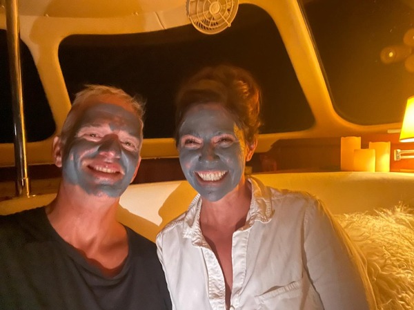
Mothers Day calls for vessel spa treatment
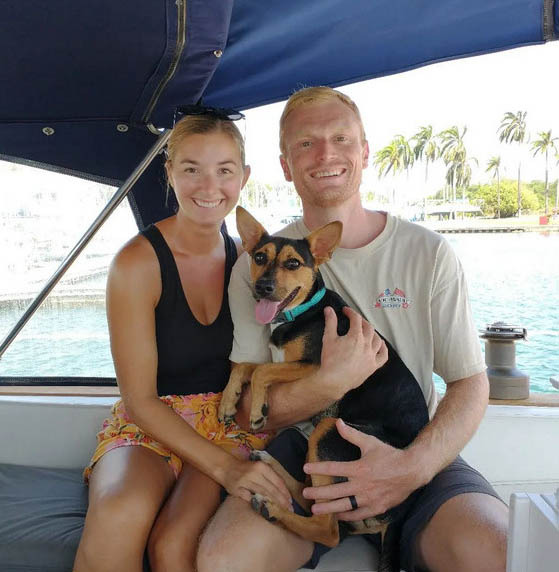
SY SERENITY 🇺🇸 Mark & Kathryn – Antares 44′
4) AWARD ENTRIES
GALLEY GODDESS NOMINEE
We on Oceananigans would love to submit our Galley Goddess nominee, Malana!
As many know, we are a full time cruising boat of 9, consisting of 5 ravenous children and two over-eating males. Rain, Shine, Calm or Rough Passages, Stocked or Bare Pantry, the galley always produces amazing meals. We on Oceananigans appreciate our Galley Goddess very much and are excited to nominate her (in secret).
SY OCEANANIGANS 🇺🇸 Ryan & Karis - Lagoon 56'
UNINVITED (JUNGLE) GUEST NOMINEE
SY JUNGLE 🇺🇸 Jim & Deb - Sea Horse Mandarian 52′
COURAGE AWARD NOMINEE
Foolish us thinking the crossing to French Polynesia was the part to be worried about. Since arriving we've been hit by an indirect lightning strike that fried all of our electronics, and then hit by a random un-forecasted storm that pounded us (onto shore) for 4 hours with sustained winds in the high 60s-70s.
We'll take the crossing any day - its French Polynesia that's scary!! ;)
But its also amazingly beautiful!!
SY KARMA 🇺🇸 Jennifer & Bryan - Catana Bali 39′
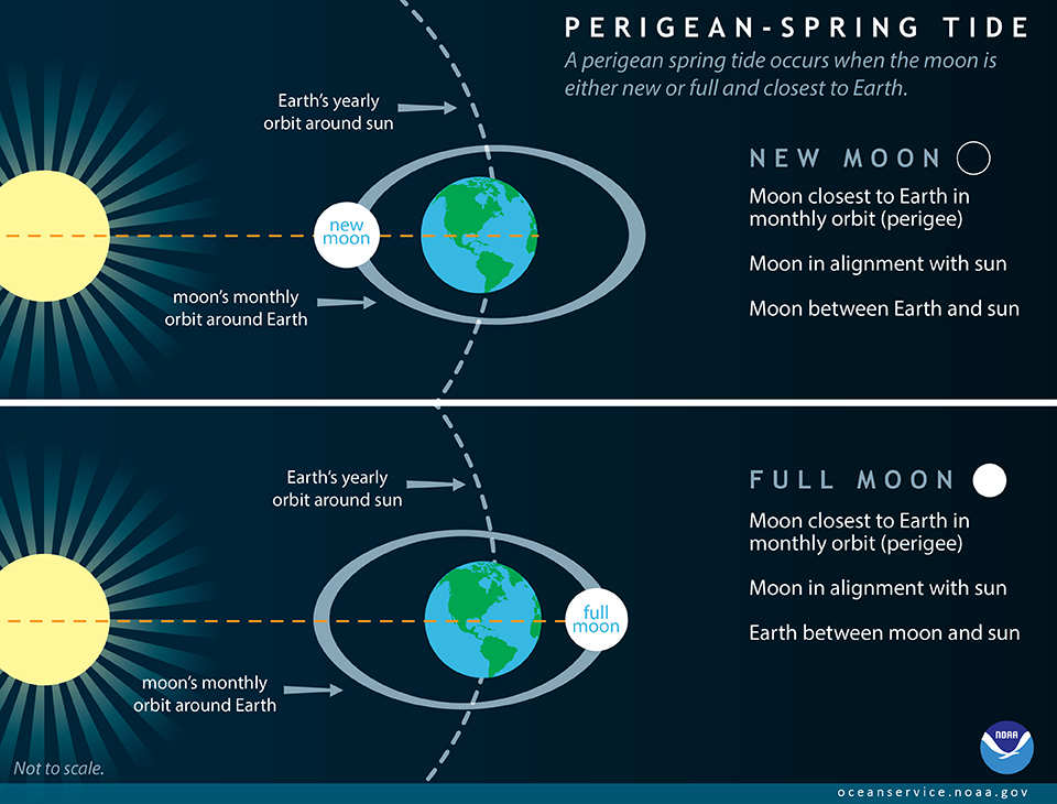
5) KING TIDES explainin'
According to NOAA: "Tides are long-period waves that roll around the planet as the ocean is "pulled" back and forth by the gravitational pull of the moon and the sun as these bodies interact with the Earth in their monthly and yearly orbits."
The new moon was on May 19th 2023. The gravitational pull of the moon on the water at this time is its greatest of the month and tides are more extreme.
This coupled with the big swell in the Eastern Pacific occurring will make for a King Tide. A King Tide is a non-scientific term used to describe exceptionally high tides that occur during a new or full moon. The Perigean Spring Tide occurs when the moon closest to the earth and either in it's new or full phase. These tides also make for notable tidal swings to be very mindful of.
Along the Pacific coast of the Panama Posse route big swells are coming in to beaches and bays with Southern exposure. Swell will also wrap around points and affect other areas. The bar entrance to Bahia del Sol in El Salvador has been intermittently open and closed due to this high swell and secondary swell event in the eastern Pacific.
We pay close attention to anchoring depths in big swell events because waves can break in areas that are atypical.
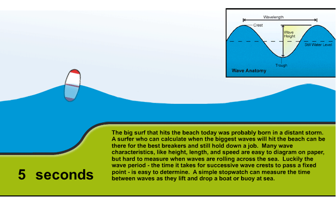
Ocean Explorer an education branch of NOAA explains what happens to a wave when it moves into shallower water and interacts with the seafloor as follows:
When the water depth decreases to one half of a wave’s wavelength, the wave starts to “feel the bottom”. That means that the deepest water molecules set into circular motion by the wave’s energy run into the seafloor. This forces the wave to grow upwards, so wave height increases. The base of the wave is slowed down by friction against the sea bottom, while the top of the wave rushes ahead, so the wave crest begins to lean more and more forward until it topples over, and breaks on the shore.
Waves in the lonely stretches of the open sea are little noticed by anyone but the occasional sailor. But once they reach shore, they become much more interesting. When waves break, or become unstable and topple forward, they thrill beachgoers and dramatically reshape the coastline.
Measuring a Wave
The approximate speed of a wave train can be calculated from the average period of the waves in the train, using a simple formula: speed (in knots, which are nautical miles per hour) = 1.5 x period (in seconds). If NOAA reports that a gale 400 nautical miles offshore has kicked up high waves with a period of 12 seconds, when should you go to the beach?
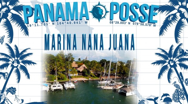
Río Dulce is a great hurricane haven! Welcome Multihulls and Monohulls ⛵, feel free to ask about our Drydock services to repair and maintaint your boat! We have a huge work area and an awesome team! Our Dockmaster speaks perfect English, spanish and French.
We look forward to meeting all the participants of the Panama Posse.
CONTACT
ADDRESS : Km. 274 Carretera a Petén, Río Dulce
EMAIL: reservas@nanajuanariodulce.com
TEL: +502 7790 7676
WEB: nanajuanariodulce.com
RATES
BERTHING RATES (x foot x month)
MONOHULLS 40+: 49.38Q=6.41USD
CATAMARAN 40+: 65.18Q=8.47USD
CATAMARAN 45+: 75.05Q = 9.75 USD
6 months or more paying in advance: 5 % discount.
KWH consumption 3.56Q=0.46usd
(1 Q = 0,13 usd)
STORAGE RATES (x foot x month)
MONOHULLS 40+: 45.43Q=5.90USD
CATAMARAN 40+: 61.23Q=7.95USD
CATAMARAN 45+: 71.10Q = 9.24 USD
HAUL OUT RATES:
MONOHULLS: 71.10Q per ft=9.24USD
CATAMARAN 40+: 71.10Q per ft=9.24USD
CATAMARAN 45+: 86.90 per ft=11.29 USD
Pressure wash 474Q=61.57usd
As a special we will reward the Panama Posse participants with
10 % discount over Marina, Haul Out and Storage Fees (excl. Electricity)
15 % discount at the Nanajuana Hotel (subject to availability)
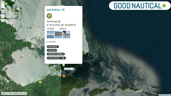
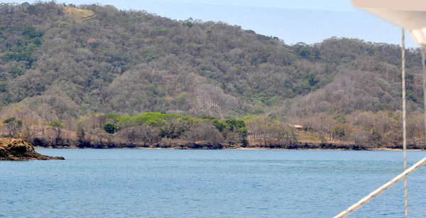
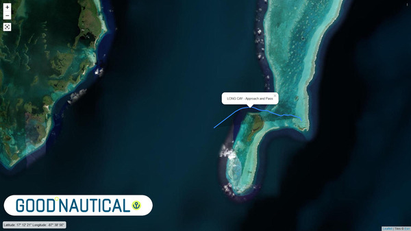
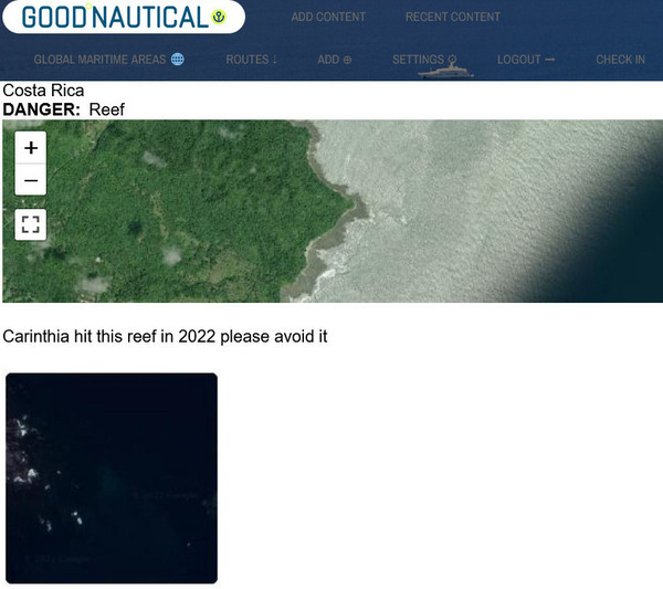
7) GOOD ANCHORAGE GOOD NAUTICAL ISLA CEDROS, 🇨🇷 COSTA RICA
Isla Cedros is a very beautiful island in Gulfo de Nicoya in Costa Rica. With multiple different anchorages all around the island one can easlily spend weeks gunkholing here. The western anchorages are well out of the swell and exceptionally calm.
Isla Cedros is a great spot to base out of for many many reasons.
One can land a dingy near the ferry terminal and buy supplies in the nearby town.
There are taxis there as well for trips further afield.
Additionally, one can take the ferry to Punarenas for onward travel to the capitol of San Jose.
There is a nice bar on the island
APPROACH A power line between the mainland and the SW tip of Isla Cedros hangs at approximately 44’at MHW. A second power lines runs between Isla Cedros and Isla Jesusita at a height of approximately 80’ near the shore of Jesusita. Use extreme caution passing under it, staying close to the shoreline of Isla Jesusita in depths of 4-5m.
This mangrove lined channel between Isla Cedros and Isla Jesusita is well protected from the southerly swell but can be exposed to weather from the north. The tranquility of the bay may occasionally be disturbed by the caretakers generator or a troop of howler monkeys in the trees.
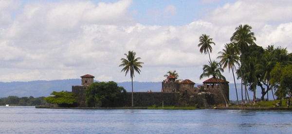
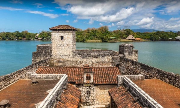
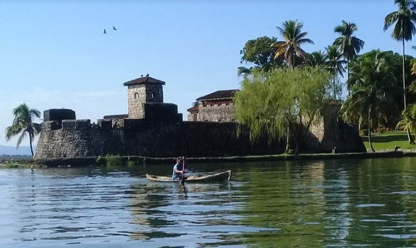
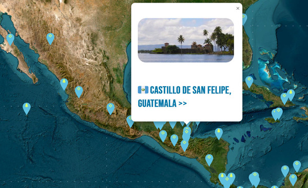
8) 🇬🇹 THE CASTLE OF SAN FELIPE DE LARA
(CASTILLO DE SAN FELIPE DE LARA)
CASTILLO DE SAN FELIPE DE LARA is a Spanish colonial fort at the entrance to Lake Izabal in eastern Guatemala.
Lake Izabal is connected with the Caribbean Sea via the Dulce River and El Golfete lake. The fort was strategically situated at the narrowest point on the river. The Castillo de San Felipe was used by the Spanish for several centuries, during which time it was destroyed and looted several times by pirates
The fort is listed on the UNESCO World Heritage Tentative List and is a popular regional tourist destination.
The Castillo de San Felipe was built to protect the port of San Antonio de las Bodegas on the south shore of Lake Izabal from frequent pirate attacks, mostly by English pirates.
After nightfall, passage along the river into the lake was blocked by a large chain that crossed from the fort to the far bank. San Antonio was the main port for receiving Spanish shipping carrying goods for the Captaincy General of Guatemala and was responsible for supplying and garrisoning the fort. Guatemalan records contain details of captains being appointed to the fort well into the 18th century.
The position was a joint post, also including the position of mayor of San Pedro de Amatique and San Antonio de las Bodegas. The latter post was in name only, since the towns were soon abandoned due to constant slave raids by the Mosquito Zambo that left the Motagua delta and shores of Lake Izabal largely deserted, with those inhabitants that did not flee being sold into slavery in the British colony of Jamaica.
Sign up by July 4th so you receive the greatest discounted to the Posse for the season. The current Season, Season 6 officially closes on July 4th and Season 7 eases in on June 5th.
When you re-sign up everything starts fresh and you keep all your perks. You can renew between now or whenever you choose but all benefits including discounts and access to information ends July 4th so that the new Panama Posse can form and focus on building, on-boarding and improving the next season and welcoming the next season's participants. This is how the Posse stays relevant, fresh and continues to update and capture new information.
Stay connected, stay informed, save money & stay with the Panama Posse.
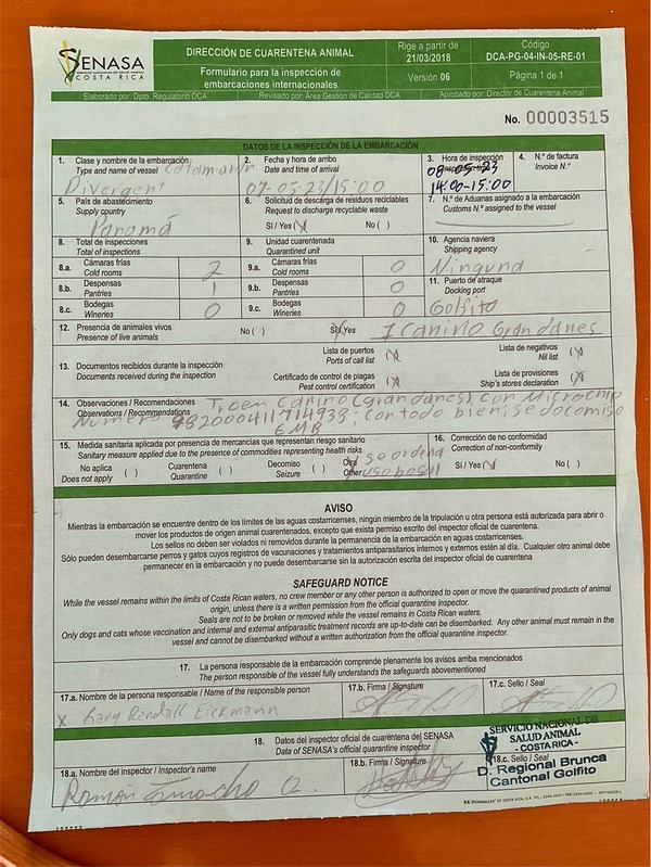
There are different requirements entering different countries and different ports along the route. It is important to know what you need and be prepared. Often being over prepared is better than being under prepared. Recently checking into Golfito SY Divergent reports needing a health certificate for their dog upon entry after leaving Panama. Thankfully, Divergent was prepared and has shared their experience:
Even Boat dogs need Clearance Clarence.
The first thing we did was to secure an animal health certificate before leaving Panama. This officially gave us 10 days to get checked into Costa Rica.
We obtained the certificate from a veterinarian that was a 25-minute rental car ride southeast of Buenaventura marina. It would be a much shorter drive from Vista Mar Marina. The clinic was Mia Vet Clinic in Gorgona beach plaza, Nuevo Georgona, Panama. The phone / WhatsApp number is+507 6608 7214. This number is for Linda, and she speaks fluent English.
Once we arrived in Golfito, we obtained a form from the agent at Fishhook Marina, Bruce Blevins, to fill out before contacting the SENASA office (servicio national de Salud animal). When we went to immigration, I explained we had a pet onboard. The customs officer phoned the SENASA office and arranged for the inspector to visit our boat. The inspector's name was Ramon Camacho. His number is +506 8820 5021. When he arrived at the boat, he reviewed our health certificates from entry and exit of Panama, asked a few questions, filled out more documents, and told us we had to make a bank deposit of 56,518 Colons ($105.15 USD) and deliver deposit receipt to his office the following day. Then things took another turn. He wanted to check all refrigerators and freezers for contraband animal products. Well, come to find out, you can not have any pork of any kind brought into Costa Rica. He confiscated all our bacon and bratwurst. It was not difficult, just one more step. I hope some of you will find this information helpful.
All of this is totally do'able and best to be on top of. Some ports will ask and some ports will not. Check in on the Line Ap to access reports on port specific entry experiences to stay up to date.
For details on how to enter each country with your pet please visit
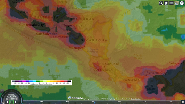
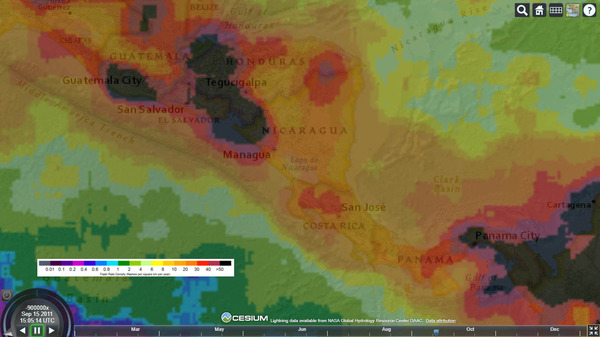
The data represents 16 years of satellite derived lightning observations from the Lightning Imaging Sensor (LIS) on the Tropical Rainfall Measuring Mission (TRMM) satellite.
Lightning Density in June
Lightning Density in September
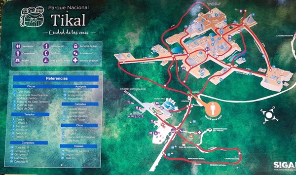
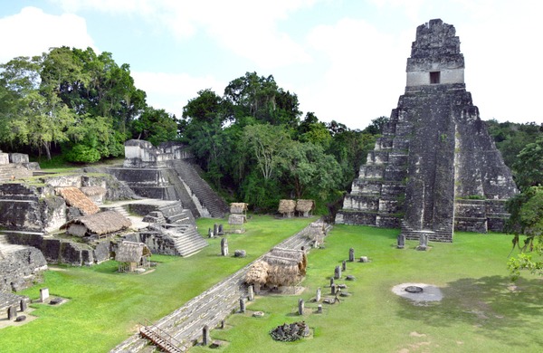
15) TIKAL NATIONAL PARK 🇬🇹 GUATEMALA
UNESCO WORLD HERITAGE CENTER
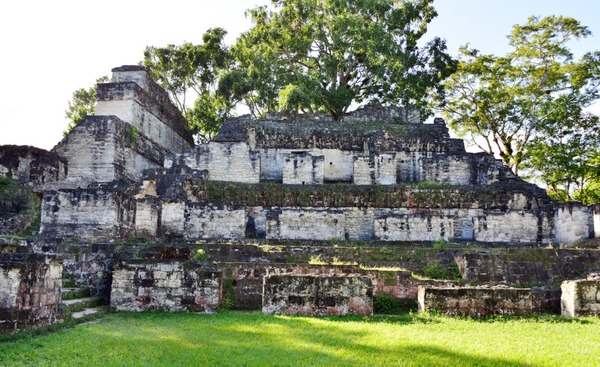
Located northwest of Rio Dulce, Guatemala, Tikal is the ruin of an ancient city. Tikal is located submerged in the northern rainforests in the Petén Basin in Guatemala. It is one of the largest archeological sites and urban centers of the pre-Columbian Maya civilization. It was declared a UNESCO World Heritage Site.
Tikal, an ancient city.
Tikal was the capital of a conquest state that became one of the most powerful kingdoms of the ancient Maya. Tikal showcases monumental architecture. The site dates back as far as the 400 BC. Between 00 to 900 the city dominated much of the Maya region politically, economically, and militarilly. From Tikal people traded throughout Mesoamerica as far north as Teotihuacan in current day Mexico.
6.2 sq mi of this city, Tikal, has been mapped.
The city itself was located among abundant fertile upland soils, and may have dominated a natural east–west trade route across the Yucatan Peninsula. Conspicuous trees at the Tikal park include gigantic kapok the sacred tree of the Maya; tropical cedar , and Honduras mahogany.
Tikal was abandoned by the 10th century.
Much of the history here is being discovered, preserved, and made accessible.
We welcome the Panama Posse with a 15 % discount on slip rates !
17) PANAMA POSSE SPONSORS
PREDICT WIND
SEVENSTAR YACHT TRANSPORT
HOME DEPOT PRO MEXICO
HERTZ RENTAL CARS MEXICO
YACHT AGENTS GALAPAGOS
FLOR DE CAÑA
SAFE HARBOR SOUTH BAY MARINA EVENT CENTER
WESTMARINE PRO
SAILMAIL
CHRIS PARKER - MARINE WEATHER CENTER
SAN DIEGO MARINE EXCHANGE
DOWNWIND MARINE
BELIZE TOURISM
PANAMA YACHT BROKER
LATITUDES AND ATTITUDES
DELTA MIKE MARINE SUPPLY PANAMA
SHELTER ISLAND INFLATABLES
18) PANAMA CANAL AGENT CENTENARIO CONSULTING ERICK GALVEZ
To arrange for transit with the Panama Canal Authority please contact Eric Galvez our dedicated Panama Canal agent and sponsor of the Panama Posse and the Pacific Posse
This website uses cookies to ensure that we can provide you with information you seek.
To continue to use this site you need to agree to accept these cookies.


![Catch a Wave What happens to a wave as it moves into shallow water? [Check Answer] Describe how the slope of the seafloor controls the way a wave breaks. [Check Answer] Which type of breaker - spilling, plunging, or surging – will cause the most coastal erosion? Explain. [Check Answer] Which type of breaker - spilling, plunging, or surging – will deposit sand onshore and expand beaches? Explain. [Check Answer]](https://oceanexplorer.noaa.gov/edu/learning/9_ocean_waves/activities/media/breaking_waves.gif)