Sun Feb 09 2025 13:17:00 UTC-5 Motored out of the anchorage, put all three sails up, motor is off. Doi g 6.5 knots on a broad reach
And we're off!
08° 49.5366' S 140°14.8833' W ⚓Ha'ahopu Bay FP all to our selves
After over a month sea we made it to French Polynesia, hearts full, and sails at rest (for a few days). Every mile was worth it in moments like this.
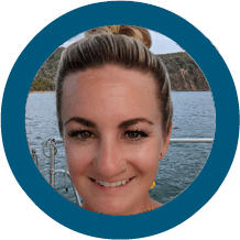
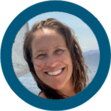
SY JUBEL 🇨🇦 Kyle & Leah - Gulfstar 44'
2) PICTURES OF THE WEEK
Beautiful Santa Marta Colombia!
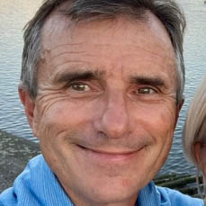
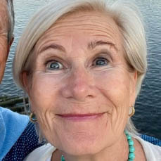
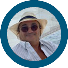
MY MARTINI 🇺🇸 Bryan and Mary - Nordhavn 63'
SY Paikea just crossed the equator and got a visit from Neptune
0° 00.030' S 86° 00.677' W
SY PAIKEA 🇩🇪 Thomas & Barbara - Bavaria 37'
Blue marlin caught on our way to Hiva Oa - 7ft 3inch long
SY ATARAXIA 🇳🇱 Ludwig & ETAP YACHTING 46'
The moon setting as we were lifting anchor this morning at 6:15. The Norther winds that were blowing subsided. So, we headed North to Agua Verde. We will sit out another Norther that is predicted to blow this week before we head further North to Loreto.
On our way here today, we spotted Orcas for the first time. They were too far out to get a good picture. Plus, they didn’t come very far out of the water when surfacing. You could see their spouts. At first we thought they were dolphins. But, their taller fins gave us the clue. I did catch one leaping out of the water with my binoculars! Fantastic
Puerto Agua Verde BCS 🇲🇽 MEXICO
MV DELTA SWIZZLER 🇺🇸 Mark & Cindy - Vantare 58'
Sunset @ Santa Marta 🇺🇸 COLOMBIA
SY MAISON DE SANTE Keenan & Nicole - Cal 46'
Sundowners on the beach at the beautiful Hirafa anchorage on Fakarava with Zephyr, Downshifting, Gerty and Jabulo.
MY DOWNSHIFTING 🇺🇸 Carine - Nordhavn 47'
Moonrise Laguna Porras, Bocas del Toro PANAMA
SY PATHFINDER 🇺🇸 JP & Nicole - Lagoon 39'
Good one tonight at Big Bight Bocas del Toro PANAMA
.. found the worst bathroom in Panama.
MY TIDINGS OF JOY 🇺🇸 Jeff & Joy - DeFever 52'
MY Serenity, SY Serenity, MY Crackerjack & MY Pause get together at SBM before heading different directions
Jungle staring back at you @ Golfo Dulce 🇨🇷 COSTA RICA share your secret anchorages
4) OCEAN POSSE PICTURE OF THE YEAR AWARD ENTRIES
Galatea at Buporgana SY GALATEA 🇺🇸 Sarah & Mark - Morgan 46'
Platina II - Michelle & Marty have departed Panama City. Enroute to Las Perlas islands and Galapagos. Looking forward to the first leg of our passage to FP and seeing May of you in the Marquesas Platina II enjoying a nice sail to Galapagos finally. Day 1 saw Parasailor conditions. Shot by buddies in Marelief
SY PLATINA II 🇨🇦 Michelle & Martin - Saturn 48'
Entering Rio Dulce 🇬🇹 Guatemala
SY RAMBLE ON ROSE 🇺🇸 Don & Roz - Caliber 40'
5) UNEXPECTED NAVAL ENCOUNTERS
FYI, big fishing fleet between 2 and 3 degrees south, 95 to 98 west. I wasn't expecting this much company out here... THE CHINESE FISHING FLEET
SY EVENSTAR 🇺🇸George & Giselle - Lagoon 42'
6) GOING🌴TROPPO ?
When you’ve spent so much time in the tropics and time feels optional, and you start to believe that talking to geckos and birds is a valid form of social interaction. 🦎🍹😎
TAKE THE OCEAN POSSE TROPPO TEST
1) 🐬 Do you believe that dolphins you meet are trying to communicate (secret) messages to you?
Bonus points if you’ve attempted to “talk back” or wave with clicks and whistles. 😂🌊
2) 👞 Have you forgotten what putting on shoes feel like?
Bonus points if flip-flops are your "business casual" attire
3) 🌅 Are your sunset expectations have become a bit unrealistic, with ratings like “lingering Green Flash” or "Spinner dolphin double axel ripple" sunset ?
Do you find yourself waiting for a whale’s tale to touch the horizon exactly when the sun dips?
4) 🌊 Do you consider weather or tide apps unnecessary because you can “feel it in your knees”?
5) 🍹 Is your cocktail garnish now just whatever random organic item you find on deck?
6) 👋 Do you have to remind yourself of basic social etiquette when talking with “land people”?
Bonus troppo points if you accidentally say “aye, roger or copy that ” instead of “yes.”
7) 🦞 Have you started giving names and personalities to nearby, lobster, fish, birds or crabs?
“That’s Larry. He’s a bit of a jerk, always scuttling sideways.”
8) 🧭 Do you instinctively use nautical terms on land?
“Let’s haul out for lunch” or “I’ll meet you on the starboard side of the coffee shop.”
9) 📅 Do you occasionally loose track of what day of the week it is?
Bonus troppo points if you’re unsure of the month year or even decade.
10) 🩳 Do you continue wearing shorts long after they’ve developed multiple holes and stains are now part of the pattern ?
Bonus points if you claim they’re now “custom ventilation.”
so sorry Rick - we couldn't help ourselves
✅ Score yourself:
0-3 Landlubber – You’re still pretty grounded.
4-6 Moderately Troppo – You’re losing touch but still know what pants are.
7-10 Full Troppo 🌴– You’ve transcended land-based reality. Welcome to the club.
Built in 1631 by the Dutch, this fort offers incredible views of Great Bay and Philipsburg. It played a key role in the colonial battles between the Dutch, Spanish, and British. You can still see some old cannons and ruins.
SAILING AND CRUISING IN SINT MAARTEN 🇸🇽 JUST GOT A LOT EASIER & AFFORDABLE
10) HISTORIC DEPICTION 📜 HERNÁN CORTÉS
"Hernán" (2019-) is a historical drama series that dramatizes the conquest of Mexico by Spanish conquistador Hernán Cortés, focusing on the clash of cultures and perspectives from both the Spanish and native peoples. Available on AMAZON PRIME
The series follows Hernán Cortés's arrival in what is now Mexico and his subsequent conquest of the Aztec Empire, highlighting the complexities of the encounter between the Spanish and the indigenous populations.
The series explores the human side of Cortés, examining his motivations, relationships, and the impact of his actions on both the Spanish and the indigenous populations.
Map of Tenochtitlan and the Gulf of Mexico, from Praeclara Ferdinadi Cortesii de Nova maris Oceani Hyspania Narratio by Hernando Cortes (1485-1547) 1524
Isla Contadora, Las Perlas Pacific Panama ⚓️N08 37.453 W070 01.841 Low Tide 4.2 meter
One of our favorite places to snorkel, right off the boat and around the back, east side of the Sueca’s beach. Decent provisions, especially after the supply ship arrives on Wednesday
Walking around the island or rent a golf cart next door to the hotel Mar y Oro.
Walkable from Hotel Mar y Oro on Playa Cacique. We left dinghy on beach without issues. Had beers on the beach at hotel beach bar with Dutch neighbor boat.
Our Dutch crew, Lisa and Bart, were in good company 🇳🇱 Contadora has a wild history and you can see
Great Italian dinner only restaurant at the chef’s unique house, Casa Tortuga Thursday-Sunday. Highly recommend the pizza! Must reserve by WhatsApp before. +507 6715-2223 Google for location.
NOTE: there are a few anchorages which had incidents of piracy in the past
State-owned oil company Petroecuador declared a state of emergency in the Trans-Ecuadorian Pipeline System (SOTE) on Tuesday and halted crude oil exports following the spill in the northwestern province of Esmeraldas, which affected 500,000 people, according to authorities.
The "emergency declaration will not last longer than 60 days and aims to (...) allocate all necessary resources to minimize the impact of the force majeure event on hydrocarbon exploration, exploitation, transportation, and marketing operations," Petroecuador said in a statement.
On Thursday, an oil pipeline ruptured due to a collapse, leaking tens of thousands of barrels of crude oil, contaminating at least five rivers, including the Esmeraldas, which flows into the Pacific.
As a result of the spill, "we're talking about 500,000 people (affected) because we have a water community" that brings together several towns that share the supply from the same water treatment plant, Vicko Villacís, mayor of the city of Esmeraldas
The government has already declared an environmental emergency in the province, which is home to a wildlife refuge.
The state-owned Petroecuador company, which operates the pipeline, is using tanker trucks to recover the spilled crude oil in the El Vergel area of the town of Quinindé, where Mayor Ronald Moreno reported that some 4,500 families (around 15,000 people) are affected.
Agence France-Presse (AFP)
Could 200,000 barrels of oil get to the Galapagos via ocean currents ?
Stash an old 4g cellphone into a secret hiding spot - unplug the battery Yes, you can call 911 without a carrier plan or even a SIM card, although you'll still need to be within range of cellphone towers
17) INTRODUCING A NEW PARTNERSHIP MARINA
MARINA DI TEULADA 🇮🇹 SARDINIA ITALY SPONSORS THE OCEAN POSSE
38° 55.6433′ N 008° 43.1933′ E
We are pleased to support the Ocean Posse participants with a 10 % discount at our marina.
This navigation technique comes from the knowledge passed down through generations of Polynesians, who were among the world’s greatest navigators and explorers.
The origins of Polynesian way finding can be traced back to the seafaring cultures of the Pacific Islands, including the regions of Micronesia, Melanesia, and Polynesia. These navigators used a deep understanding of stars, wind patterns, cloud formations, ocean currents, the flight patterns of birds, and other signs of nature for long-distance voyaging.
Polynesian way finding is closely associated with the renaissance of traditional voyaging that began in the 70s with the construction and voyage of the Hōkūleʻa, a traditional double-hulled voyaging canoe. The Hōkūleʻa and its voyages played a pivotal role in reviving and preserving Polynesian navigation techniques. Mau Piailug, a master navigator from Micronesia, was instrumental in this revival, sharing his knowledge with Hawaiians and other Polynesians, thereby bridging the gap between ancient and modern Polynesian cultures.
Practical application on board your vessel measuring time
20) GOOD NAUTICAL ⚓
Sawa-I-Lau ⚓ Yasawa Islands 🇫🇯 FIJI
The ancient limestone formations, carved by constant wave action are hidden within an attractive little island. According to legend, a young chief once hid with his betrothed in the cave after her family threatened to marry her off to a rival chief.
Sawa-i-Lau anchorage, in the Yasawa Islands of Fiji, is a stunning and well-known stop for sailors cruising the region. Here’s what you should know:
Location: Near the famous Sawa-i-Lau limestone caves, in the northern Yasawa Islands.
The seabed is mostly sand with some patches of coral, so good holding can be found. Depth 5-10 meters, but some areas have shallower spots with coral heads to watch out for. Protection: Offers decent shelter from all but strong westerlies Access the lime stone caves from this anchorage
⚓ 16° 50.8951' S 177° 27.9740' E
21) SAN DIEGO MARINE EXCHANGE 🔱 SPONSORS THE OCEAN POSSE
The San Diego Marine Exchange (SDMX) is a vital hub for mariners, providing marine supplies, equipment, and expert services to commercial and recreational boaters. Established in 1950, SDMX serves the thriving maritime community of San Diego, offering everything from navigation tools and safety gear to maintenance essentials. As a trusted resource, it supports the Navy, fishing fleets, yacht owners, and shipyards, ensuring vessels are well-equipped for safe and efficient operations. With knowledgeable staff and a commitment to customer service, SDMX plays a crucial role in keeping the local maritime industry running smoothly, making it an indispensable asset for mariners.
22) OCEAN POSSE HAUL OUT FACILITIES
Follow this link for an ever increasing list of haul out facilities
Off the Pacific coast of Costa Rica, particularly in areas like the Nicoya Peninsula, the Gulf of Papagayo, and the Osa Peninsula, a spectacular marine show often unfolds—mobula rays leaping high above the ocean’s surface. These agile rays, sometimes called "flying rays", are famous for their incredible jumps, often launching several feet into the air before belly-flopping back into the sea.
Mobula rays belong to the same family as manta rays but are smaller, with wing-like pectoral fins that allow them to glide through the water gracefully. Their leaping behavior remains somewhat of a mystery, though researchers believe it could be linked to mating displays, predator evasion, or parasite removal. Some have even suggested that the loud splash they create upon re-entry may serve as a form of communication within their schools.
These mesmerizing creatures are most commonly seen at dawn and dusk, when they gather in large numbers near the surface. Lucky boaters, surfers, and divers may witness dozens of rays breaching in rapid succession, creating a breathtaking natural spectacle. Certain times of the year, particularly during seasonal plankton blooms, bring even larger congregations, as mobula rays follow food sources along the coast.
For those exploring Costa Rica’s Pacific waters, spotting a mobula ray in flight is a reminder of the ocean’s wild beauty—an awe-inspiring moment that blends mystery, elegance, and raw energy. Whether seen from a boat or while snorkeling in the clear blue shallows, these leaping rays add to the magic of Costa Rica’s vibrant marine ecosystem.
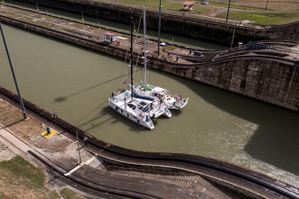
23) THE ALEXANDER LA VALLEY
When the Panama canal officially opened on August 15, 1914, the first ship to officially pass through was the SS Ancon. However, the honor of being the first vessel to ever cross the canal actually goes to a small, rather unimpressive dredging boat called the Alexander La Valley, which completed the journey in January 1914, months before the grand opening.
So, while the Ancon got all the fame and fanfare, the humble Alexander La Valley quietly made history first! 🚢😎
Erick Gálvez
OCEAN POSSE CANAL AGENTS
To arrange for transit with the Panama Canal Authority please contact our dedicated Panama Canal agents and sponsors of the Panama Posse and the Pacific Posse
Please be on the lookout for John Jones, single handing on Quiet, a Tayana 37, lost his mast about January 27 after departing El Salvador. He has fashioned a jury rig and is making for Nuku Hiva, FP. His AIS is non functional, but his tracking link works at: https://forecast.predictwind.com/tracking/display/Quiet/ To conserve power he does not run his tracker 24/7.
Underway making way for over 60 days now - His Last known position as of Last Update 2025 MAR 22 @ 19:08
OP 2025-01-26 Gatherings, Seminars - the Coast Guard is out here
“Black met black on the distant horizon, the stars alone distinguishing sky from lake. On the sand below, Silver Beach glittered at the water's edge while on the north side of the river the lighthouse's beacon signaled safe harbor.”
Guna Yala canoes in the San Blas, also known as ulus, are made from mahogany, bamboo, poles, fronds, and molas. Mahogany is a hardwood that's considered the best for the rainforest
Ulus are a lifeline for the Guna people and a common sight for cruisers in these stunning islands. You’ll often see villagers paddling their ulus out to anchored yachts, trading lobsters, crabs, and other fresh catches—or their famous molas, vibrant appliquéd cloth designs—for a cold drink, a hammer, or even a quick phone charge.
Ulus are built tough and simple. Their sprit sail rigs are no-frills—just a rough-hewn spar to hold up the peak and a sail made of whatever’s handy: old bedsheets, tarps, patched-up scraps. The sheet runs through a hole in the sternpost and gets tied off with a quick knot when the course is steady. There’s even a little flying jib strung up to the masthead. And somehow, with just a carved skeg for a keel, these things sail to weather like champs. They’re not just boats—they’re proof of what you can do with skill, ingenuity, and a whole lot of grit.
Ulus under under Sail by SY Footloose
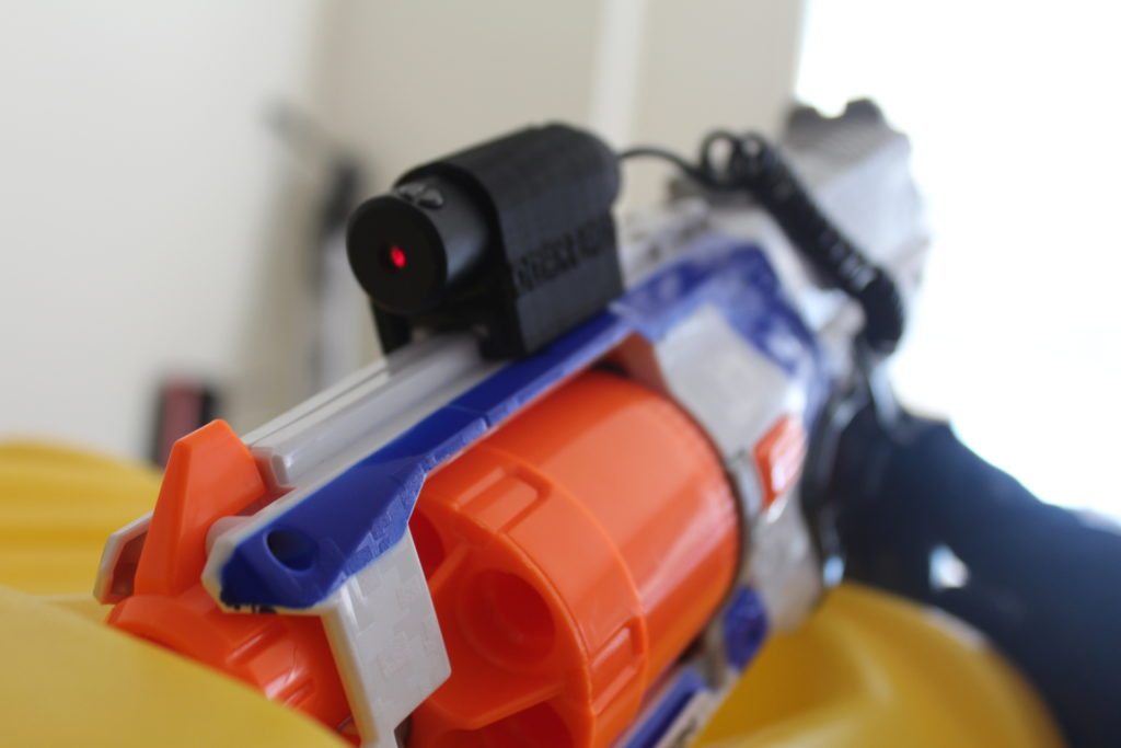
3) BOAT YOGA POSE ENTRY AWARD ENTRY
BOAT YOGA expertly executed by Brandt onboard SY PRIYA 🇺🇸 Ericson 38'
Meeting adventurers, sailors, and explorers is a great way to learn, share knowledge, and build lasting connections while embracing the spirit of exploration.
Ocean Posse gathering watching the Ohio State beating Notre Dame at he cruisers lounge @ Shelter Bay Marina
6) OCEAN POSSE CARIBBEAN PARTY
SHELTER BAY MARINA 🇵🇦 PANAMA
MEET THE FLEET EVENT OPEN TO ALL
09:00 – 12:00 Swap Meet @ Gazebo $1 Donation 12:00 - 21:00 Exhibits and Yacht Showings 14:00 LIFE RAFT INFLATION DEMO / Pool 14:30 Panama Canal Best Practices 15:00 Going Back To Cali Or Sea Of Cortez 15:30 Opencpn Sat Charts / Installation Usage 16:00 International Yacht Brokerage 16:30 South Pacific Posse Beyond Bora Bora 17:00 Safety And Security 17:30 Predict Wind 17:15 Open Bar By Flor De Caña 17:45 Sunset & Local Folkloric Dance 18:00 Pig Roast / Pot Luck +the Posse Feast 19:00 Dance / Mexican Train / Texas Hold'em
🇲🇽 Caleta Playa Paradiso 19° 28.3394' N 105° 3.6214' W
Approaches
Uncharted reefs and rocks make the northern entrance hazardous and it is recommended to approach this bay from the west, taking great care passing between the islands and the peninsula between the northern and southern coves.
Anchorage
The cove shoals rapidly and the bottom is rocky. Find a sandy patch close to the mouth of the inlet in 3-4m. Dinghy ashore to any of the small beaches in the bay except the beach in the southern cove which is claimed to be owned by the hotel.
This anchorage is located in the northern bay of Caleta Paraiso. It is a tiny cove with swinging room for just one boat and might be tight fit for larger vessels larger than 55’. The bay is well protected from the south and east and has moderate shelter from northerlies but swell from NW-N wraps around the headland.
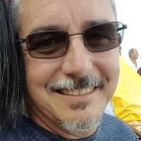
SY PRIYA 🇺🇸 Brandt - Ericson Yachts 38'
12) RECENT HISTORY OF INCREASING PANAMA CANAL 💵 FEES
Since 2001 the fees have been filling up
2001-2002: Tolls for small vessels were based on the Panama Canal Universal Measurement System (PC/UMS). Specific rates for vessels under 65 feet during this period are not detailed in the available sources.
2007: The ACP restructured its pricing to better align with the value provided to different market segments. This restructuring aimed to reflect the "true value" of the Canal's services to its customers.
Autoridad del Canal de Panamá
2016: A more complex toll system was introduced on April 1, 2016. For small vessels up to 125 feet, tolls were assessed based on length overall (LOA). The rates were:
Up to 50 feet: $800
50.01 to 80 feet: $1,300
80.01 to 100 feet: $2,000
100.01 feet and above: $3,200
2023: As of January 1, 2023, the transit cost for yachts less than 65 feet was $1,760. Additional fees included a $75 Transit Vessel Inspection (TVI) charge and a $165 security charge. A buffer deposit of $1,060 was also required if no agent was used, refundable upon successful transit without incident.
PANAMA CANAL RATE INCREASE IN 24 YEARS FOR SMALL VESSELS
Watch this Dugong + Turtle and a Manta Shrimp: Filmed by Kurt Roll in Lamen Bay on the island of Epi in Vanuatu 🇻🇺 Dugongs are endangered like the Manatee and both at sea grass.
14) GOOD NAUTICAL
ISLA CAVADA 🇵🇦 ISLAS SECAS PANAMA
Approach
⚓ 07° 59.6160' N 082° 1.9220' W
SV Remedy, SV Sancerre, SV Triaena plus a few other sailors in the anchorage of Isla Cavada 🇵🇦 PANAMA
15) BENEFITS OF JOINING THE OCEAN POSSE
✔️ Up to date and verified information by fellow yachts ✔️
📊 Communications focused on facts, not opinions or unsolicited advice ✔️
💰 Save real money at 70+ Marinas with discounts * ✔️
🛰️ Free vessel and fleet tracking courtesy of Predict Wind ✔
🚩 Free Burgee ✔️
💰 Save with service providers and chandleries ✔️
🕵️ dedicated, experienced and discounted Canal and clearing in agents ✔️
🗺️ Free aid to navigation 150 Gb OpenCPN satellite charts (mac/pc/android) ✔️
💰 Save Money on parts with a Westmarine Pro Discount ✔️
💰 Save Money with a Predict Wind Pro Discount ✔️
🗺️ Free Printable Reference Charts emergency backup to your electronics ✔️
📹 Free Video Seminars on destinations from those who are there ✔️
🌩️ Top weather routing avail by Marine Weather Center Chris Parker ✔️
⛵ Community of voyagers all are welcome, kids, single-handers, pets ✔️
⚓ Peer support in emergencies with escalation procedures ✔️
🛈 Fleet Updates via email – free ✔️
🏆 Fun Award Categories ✔️
📍 Free access to GOOD NAUTICAL Anchorage reports ✔️
☎️ Free Weekly live calls on Mondays via dedicated LINE.me group ✔️
💬 Free 24/7 LINE group channel ✔️
🌊 Benefit from the latest information and prior experience participants ✔️
🔭 Be part of a fleet of sensor for those who come behind you or meet ✔️
🚷 Always priority traffic – for participants by participants ✔️
(* as long as you do not have prior contracts or reservations in place and subject to a marina’s availability )
BULA BULA – WE WELCOME THE SOUTH PACIFIC POSSE TO FIJI
JUST FOR VISITING US FOR THE FIRST TIME YOU RECEIVE 2 FREE WELCOME DRINKS PER SOUTH PACIFIC POSSE YACHT
17) MARINA PAPAGAYO 🇨🇷 COSTA RICA SPONSORS THE OCEAN POSSE
10° 38.3783′ N 085°39.225′ W
GATEWAY TO THE EASTERN TROPICAL PACIFIC
Situated below the hurricane line and sheltered from the northern Papagayo winds, Marina Papagayo’s naturally protected harbor offers a year-round safe haven in a yachting paradise, just 30 minutes from an international airport. An idyllic stop-off point and staging area for epic diving and underwater adventures in the Eastern Tropical Pacific Seascape. Malpelo Island, Isla del Coco, Coiba and the Galápagos are all close by.
A Full Service Deep Sea Port
Marina Papagayo offers 180 fully serviced berths for yachts up to 250 feet LOA, with both single & 3-phase electrical service, grey & black water disposal and wireless broadband. All complimented by a wide range of services and amenities, including mooring assistance, 24/7 monitoring, yacht assist, on-site provisioning, fuel bunkering and dockside concierge service. From airport transfer, shuttle service, car rentals, dining reservations and activities for captains and crew members, the marina concierge team is at your service.
Where Captain is King
While staying at Marina Papagayo, captains and crew enjoy access to select facilities and amenities on Peninsula Papagayo. Including seven spectacular beaches, the Arnold Palmer Signature golf course, Andaz Costa Rica Resort Beach House and miles of hiking and biking trails. For insider access to nature unleashed, check out Papagayo Explorers Club. Their expert guides, naturalists and translators are available for crew expeditions off the beaten path.
Vessels of all shapes and sizes
Among its ultra-wide, custom-designed floating dock system, 180 owner and guest slips can accommodate a wide variety of watercraft. From superyachts and luxury cruisers to schooners and sportfishing vessels. Ultimately, 350 slips will fill the marina, making it the largest and most advanced in Costa Rica.
MARINA SUITES
The village at Marina Papagayo is undergoing a metamorphosis, offering new and enhanced amenities for owners and guests. A refreshed seaside apartment hotel offers studio, 1- and 2-bedroom suites with daily housekeeping, pool, gym, lounge and meeting rooms.
The Papagayo Peninsula, located in the northwest region of Costa Rica within the province of Guanacaste, is a stunning expanse of tropical paradise. Renowned for its luxurious resorts, pristine beaches, and biodiversity, the peninsula is a haven for travelers seeking adventure, relaxation, and a taste of the Pura Vida lifestyle. Stretching into the Pacific Ocean, this unique geographic feature boasts an array of natural and cultural wonders that make it a must-visit destination.
Geography and Nature
The Papagayo Peninsula spans over 1,400 acres of lush tropical landscapes. It is surrounded by the warm, crystal-clear waters of the Pacific Ocean, with numerous coves and beaches dotting its coastline. The region’s dramatic cliffs, rolling hills, and verdant forests are a testament to the rich volcanic origins of Costa Rica, offering breathtaking vistas at every turn.
The area is part of the Guanacaste Conservation Area, a UNESCO World Heritage Site, which highlights its ecological importance. Visitors can explore diverse ecosystems, from dry tropical forests teeming with wildlife to vibrant coral reefs offshore. The surrounding waters are ideal for snorkeling and diving, offering a glimpse of marine life like sea turtles, manta rays, and colorful fish.
Beaches and bays in the Papagayo Peninsula
The Papagayo Peninsula is home to some of the most beautiful beaches in Costa Rica, each with its unique charm:
Playa Nacascolo: A secluded and serene beach, Playa Nacascolo is a favorite for those seeking a quiet escape. Its calm waters are ideal for swimming and paddleboarding.
Playa Blanca: Known for its powdery white sand and turquoise waters, Playa Blanca offers excellent snorkeling opportunities.
Playa Panama: This beach is perfect for families, with gentle waves and plenty of shade. It’s also a great spot for kayaking and fishing.
Playa Hermosa: Located near the peninsula, this expansive beach is popular for its laid-back vibe and stunning sunsets.
Playa del Coco: A vibrant beach town near the peninsula, Playa del Coco is a hub for nightlife, dining, and shopping.
Luxury and Resorts
The Papagayo Peninsula is synonymous with luxury. The development of high-end resorts and residences has transformed the area into a premier destination for affluent travelers. Notable resorts like the Four Seasons Resort Costa Rica, Ritz-Carlton Reserve at Peninsula Papagayo and the Andaz Costa Rica Resort at Peninsula Papagayo provide world-class amenities, from spa treatments to gourmet dining and private beach access.
Wildlife and Ecotourism
Costa Rica is renowned for its commitment to conservation, and the Papagayo Peninsula is no exception. The region is a haven for wildlife, with numerous opportunities for eco-tourism:
Birdwatching: The peninsula is home to an array of bird species, including toucans, parakeets, and hummingbirds. Guided tours are available for avid birdwatchers.
Wildlife Spotting: Monkeys, iguanas, and coatis are commonly seen in the area, while sea turtles nest on nearby beaches during certain times of the year.
Sustainability Initiatives: Many resorts and tour operators in the Papagayo Peninsula prioritize sustainable practices, such as using renewable energy, supporting local communities, and protecting native habitats.
Climate
The Papagayo Peninsula enjoys a tropical climate with two distinct seasons:
Dry Season (December to April): This is the most popular time to visit, with sunny skies and little rain. It’s perfect for beach activities and outdoor adventures.
Green Season (May to November): While this period sees more rain, it’s also when the landscapes are at their most lush. Afternoon showers are common, but mornings are often sunny.
The Sensar Marine Bilge Sentry provides an exact measurement of the water in your bilge. In addition, it measures the temperature in the bilge so that you can ensure that your boat is not exposed to harmful frost and icing.
Battery Bank Monitoring
Sensar Marine monitors two battery banks and alerts you when charge is diminishing. The device will monitor 12, 24 & 48 volt banks and recognizes Lithium batteries. You will always know that your boat is ready to go.
Long Life Internal Battery
Sensar Marine has an internal battery that will operate for 40+ days without taking a charge from your boat’s battery. It will only charge when your boat is running, connected to shore power or solar charging. The internal battery will continue operating in temperatures from -40f to 185f. The device will always operate when on a mooring for an extended period.
Easy Installation
Sensar Marine is simple to install and easy to operate. The Sensar Marine app will let you know that your boat is OK, even when you are away.
Contact Information:
Paul Garland Email – paul.garland@sensarmarine.com
20) THE BATTLE OF THE FLOWERS BATALLA DE FLORES @ CARNIVAL BARRANQUILLA Sat, Mar 1, 2025 – Tue, Mar 4, 2025
A Celebration of Chaos and Color
The Barranquilla Carnival kicks off four days before Ash Wednesday, exploding into life with a riot of color, music, and unrestrained revelry. The crescendo arrives Saturday with the legendary Batalla de las Flores—a dazzling clash of Colombian joy, where the streets become battlegrounds of flowers, costumes, and unyielding celebration.
Tatiana, la reina del Carnaval 2025
Prelude to Madness: Pre-Carnival Frenzy
Though the carnival officially starts with the Lectura del Bando—a proclamation demanding uninhibited dancing and wild abandon—Barranquilla starts to buzz weeks ahead. Pre-Carnival events are electric with anticipation. From the Toma de la Ciudad (Taking the City) to the crowning of the Carnival King and Queen, the city pulses with life. But the highlight of this buildup is La Guacherna, a Friday night parade where cumbias, masquerades, and infectious rhythms light up the streets like a thunderstorm of joy.
Saturday: The Battle of the Flowers
Saturday delivers the Batalla de las Flores, a spectacle etched into history since 1903. For six vibrant hours, colossal floats roll down the avenues, each a masterpiece of artistry and exuberance. Iconic carnival characters like Rey Momo, María Moñitas, and the mischievous Hombre Caimán come to life, delighting the crowds. The queen of the carnival leads the charge, throwing flowers and dancing with her court, while marimondas—figures with long noses and vibrant costumes—march alongside gigantonas, dwarfs with oversized heads. It’s a symphony of chaos and jubilation.
Sunday: The Grand Parade
Sunday sheds the floats but not the fervor. It’s a day for masks, disguises, and fierce competition as dance groups battle for the honor of performing in next year’s Batalla de las Flores. Folk traditions like the Torito dance, the mesmerizing moves of the Garabato, and the elegant Hilanderas (Spinners) take center stage during the Gran Parada. The energy is raw, the stakes are high, and the streets pulse with life.
Monday: The Sound of Carnival
Monday cranks the volume up with the Festival de Orquestas. Caribbean and Latin bands ignite the city, vying for the coveted Golden Congo award. Amid the music, the Fantasy Parade adds a kaleidoscope of costumes and creativity, pushing the limits of imagination.
Tuesday: The Farewell of Joselito
Carnival ends with bittersweet revelry on Calle 84. Here, the queen of the carnival, dressed in mourning black, grieves the symbolic death of Joselito Carnaval, the soul of the party. Her theatrical fainting marks the passing of the festivities, but not before the streets explode once more with music, cumbia dancers, and costumed revelers, ensuring the carnival ends in unforgettable style.
The Barranquilla Carnival isn’t just a festival—it’s a full-throttle celebration of life, history, and the unbreakable spirit of Colombia. Each dance, costume, and note of music is a testament to the grit, joy, and passion that define this legendary event.
Stay at Marina Puerto Velero on your yacht to enjoy the nearby carnival
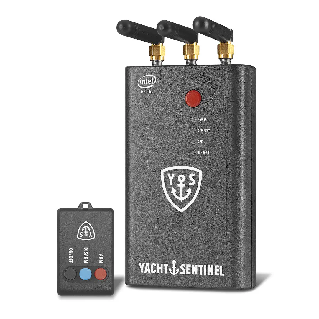
We regret to inform you that a sailboat anchored in La Paz Bay was recently broken into and stripped of valuables. This serves as an unfortunate reminder to remain vigilant and take extra precautions to secure your boats and belongings.
⚠️ What You Can Do:
✅Ensure hatches, doors, and lockers are securely locked when leaving your boat.
✅Avoid leaving high-value items visible or easily accessible.
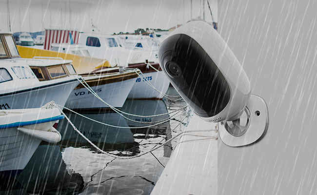
Install motion lights, alarms, or cameras if possible.
✅Don’t leave your boat unattended; if you must, inform your neighbors so they can keep an eye out.
✅Report any suspicious activity to the local cruiser network or authorities immediately.
📢 If You Notice Anything:
Please share any information about suspicious activity or sightings with the local boating community or your marina office to help keep everyone safe.
Let's work together to protect our vibrant community and each other. Stay safe, everyone!
The House on the Hill on the Panama Canal, often referred to in historical accounts, served as the residence of the chief engineer or project manager during the construction of the canal. It stands as a symbol of the monumental effort and leadership required to oversee one of the most ambitious engineering feats in history.
Key Facts about the House on the Hill and Its Role:
1. The Historical Context
The house was built during the early 20th century, during the American-led construction of the Panama Canal (1904–1914) by lead engineer John Frank Stevens.
It provided a commanding view of the canal's construction areas, symbolizing authority and oversight.
2. The Role of the Chief Engineer
The chief engineer was the lead figure in managing the canal's construction, with responsibilities ranging from technical problem-solving to labor management.
Notable chief engineers include:
John Frank Stevens: Credited with reorganizing the project and prioritizing worker health and safety.
George Washington Goethals: Known as the "Man Who Finished the Canal," he oversaw its completion and managed the transition to operations.
3. Strategic Location
Situated to provide a panoramic view of the canal's progress, the house symbolized the leadership's ability to "oversee" every aspect of the project.
Its location reinforced the project manager's central role in coordinating the vast workforce, machinery, and resources.
4. Living Conditions
The house offered better living conditions compared to the workers' accommodations, emphasizing the hierarchy within the project.
It was equipped with amenities that allowed the chief engineer to work and host meetings effectively.
This website uses cookies to ensure that we can provide you with information you seek.
To continue to use this site you need to agree to accept these cookies.