CHESAPEAKE TO THE U.S. VIRGIN ISLANDS
CHESAPEAKE TO THE U.S. VIRGIN ISLANDS – 3 CLASSIC JUMP-OFF POINTS
The run south from the Chesapeake to the Virgin Islands is a 1,300–1,600 nautical mile ocean passage that blends Gulf Stream strategy, mid-Atlantic weather systems, and tradewind navigation. Choosing the right jump-off point affects how you exit the coast, cross the Stream, and settle into your offshore rhythm.Below are three proven departure strategies based on 20 years of yacht passages.
1. HAMPTON / NORFOLK, VIRGINIA – THE TRADITIONAL ROUTE
Why Choose It:
The most common jump-off point for cruisers heading south. Easy provisioning, major yacht services, and plenty of fellow southbound boats make this the “migration highway.”
Distance: ~1,450 nm (via I-65 approach)
Key Waypoints:
1 Chesapeake Bay Exit – 36°58′ N, 76°18′ W (just outside Thimble Shoals Channel)
2 Gulf Stream Crossing – ~36°00′ N, 74°30′ W
3 I-65 Turnpoint – 25°00′ N, 65°00′ W (start running with the trades)
4 Virgin Islands Landfall – 18°20′ N, 64°50′ W
Strategy:
• Weather Window: Leave 24–36 hours after a cold front passes, riding the northwest-north winds offshore.
• Gulf Stream: Cross early in settled weather; avoid strong north winds over the Stream.
• I-65 Approach: Hold southeast until ~65° W before turning south to avoid punching directly into the trades.
Arrival Options: St. Thomas (Charlotte Amalie or Red Hook), St. John (Cruz Bay), or St. Croix (Christiansted).
Pros: Well-supported, good services pre-departure, easy for first-timers.
Cons: Heavy traffic lanes for first 300 nm; crowded during peak November window.
2. CAPE LOOKOUT / BEAUFORT, NORTH CAROLINA – THE GULF STREAM SLINGSHOT
Why Choose It:
Starting farther south shortens the Gulf Stream crossing and often gets you into offshore trades faster. Popular with experienced sailors looking for a quicker jump offshore.
Distance: ~1,350 nm (direct I-65 route)
Key Waypoints:
1 Cape Lookout Sea Buoy – 34°37′ N, 76°32′ W
2 Gulf Stream Entry Point – ~33°30′ N, 74°00′ W (short crossing angle)
3 I-65 Turnpoint – 24°30′ N, 65°30′ W
4 Virgin Islands Landfall – 18°20′ N, 64°50′ W
Strategy:
• Weather Window: Same as from Virginia—leave after a front. This starting point often gives you a cleaner offshore angle immediately.
• Gulf Stream: A more perpendicular crossing than from Hampton, less distance against the current.
• Trades: Expect to reach the NE trades about a day sooner than Virginia departures.
Arrival Options: Same as Hampton route.
Pros: Faster jump offshore, less time in coastal shipping lanes.
Cons: Fewer full-service yards; provisioning not as robust as Hampton.
3. BERMUDA STOPOVER – THE TWO-LEG PASSAGE
Why Choose It:
Ideal for yachts wanting a mid-passage rest, a weather reset, or crew change. Adds mileage but breaks the passage into two manageable ocean legs.
Total Distance: ~1,550–1,600 nm (two legs)
Leg 1: Chesapeake to Bermuda (~650–700 nm)
• Jump-Off Points: Hampton, VA or Beaufort, NC work equally well.
• Arrival: St. George’s Harbour, Bermuda – excellent yacht facilities.
• Weather Tip: Expect north-northeast winds after leaving; watch for Bermuda High positioning before committing to the final approach.
Leg 2: Bermuda to USVI (~850–900 nm)
• Waypoints:
1 Depart Bermuda ~32°22′ N, 64°40′ W
2 I-65 Area – ~23°30′ N, 65°00′ W
3 Landfall – ~18°20′ N, 64°50′ W
• Sailing: Typically a broad reach to beam reach with strengthening trades as you close the islands.
Pros: Safety and rest stop, chance to repair gear, enjoy Bermuda.
Cons: Weather delays common; adds 2–5 days overall depending on waiting periods.
| Jump-Off | Best For | Distance | Average Days | Advantages | Drawbacks |
|---|---|---|---|---|---|
| Hampton / Norfolk, VA | First-time offshore cruisers | 1,450 nm | 10–14 | Full services, easy provisioning, popular rally departures | Longer Gulf Stream crossing, heavy traffic lanes first 300 nm |
| Cape Lookout / Beaufort, NC | Experienced sailors seeking quicker trades | 1,350 nm | 9–12 | Faster Gulf Stream crossing, quicker jump offshore | Limited yacht services and provisioning |
| Bermuda Stopover | Crew changes, safer two-leg passage | 1,550–1,600 nm | 12–18 | Rest, reprovision, repair stop, safer legs | Weather delays common, adds extra miles and days |
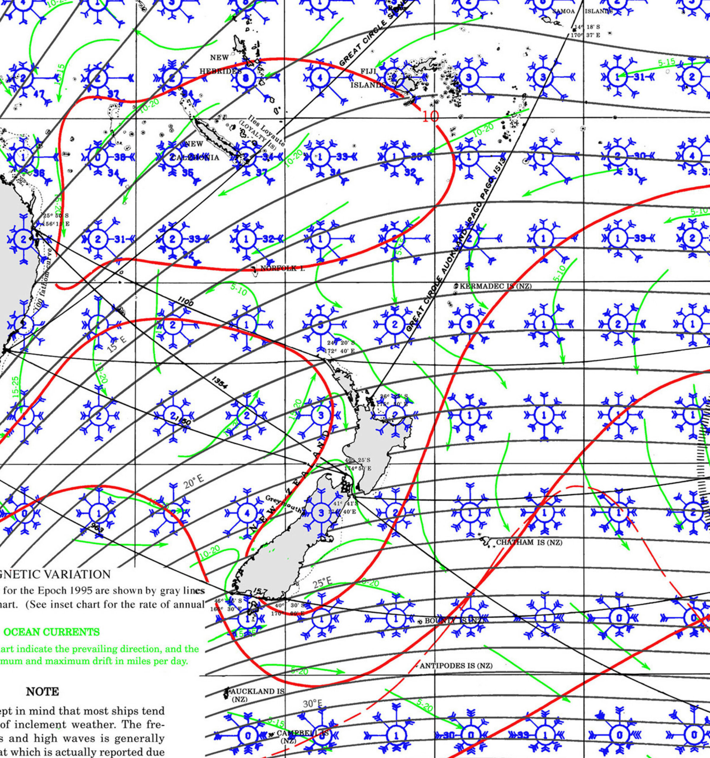
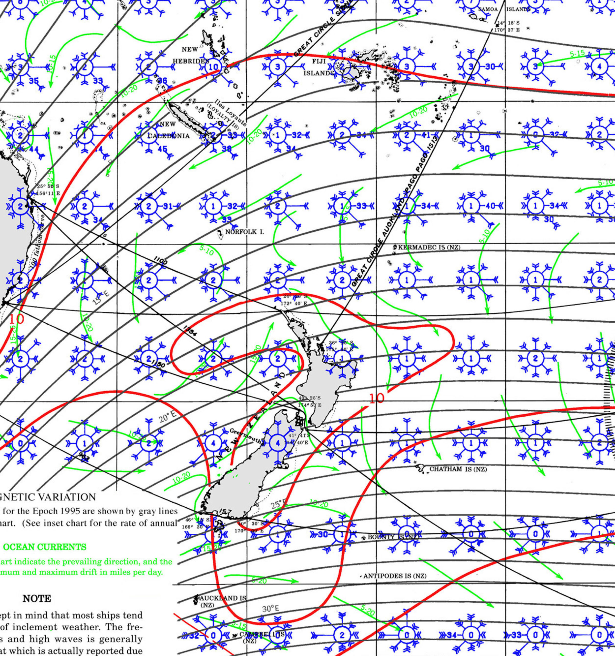
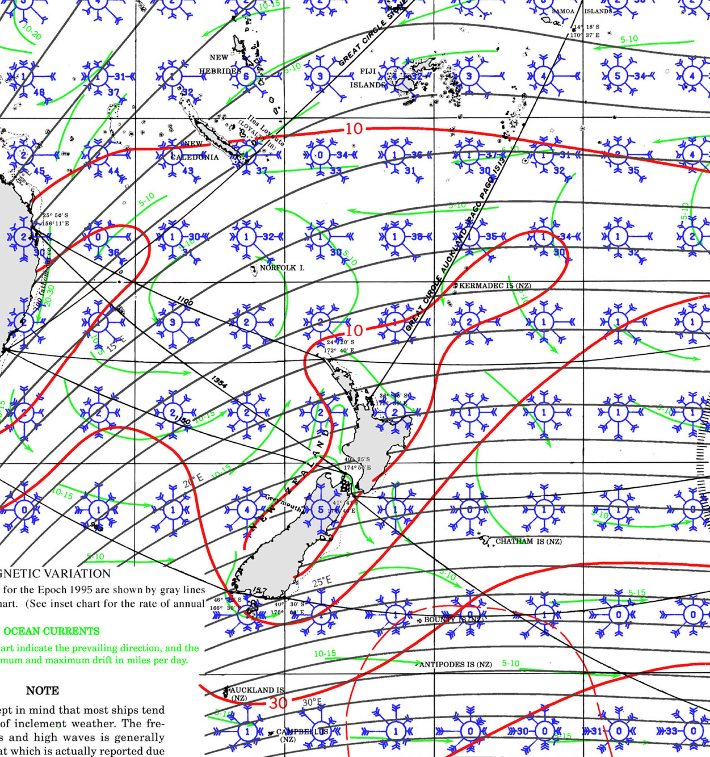
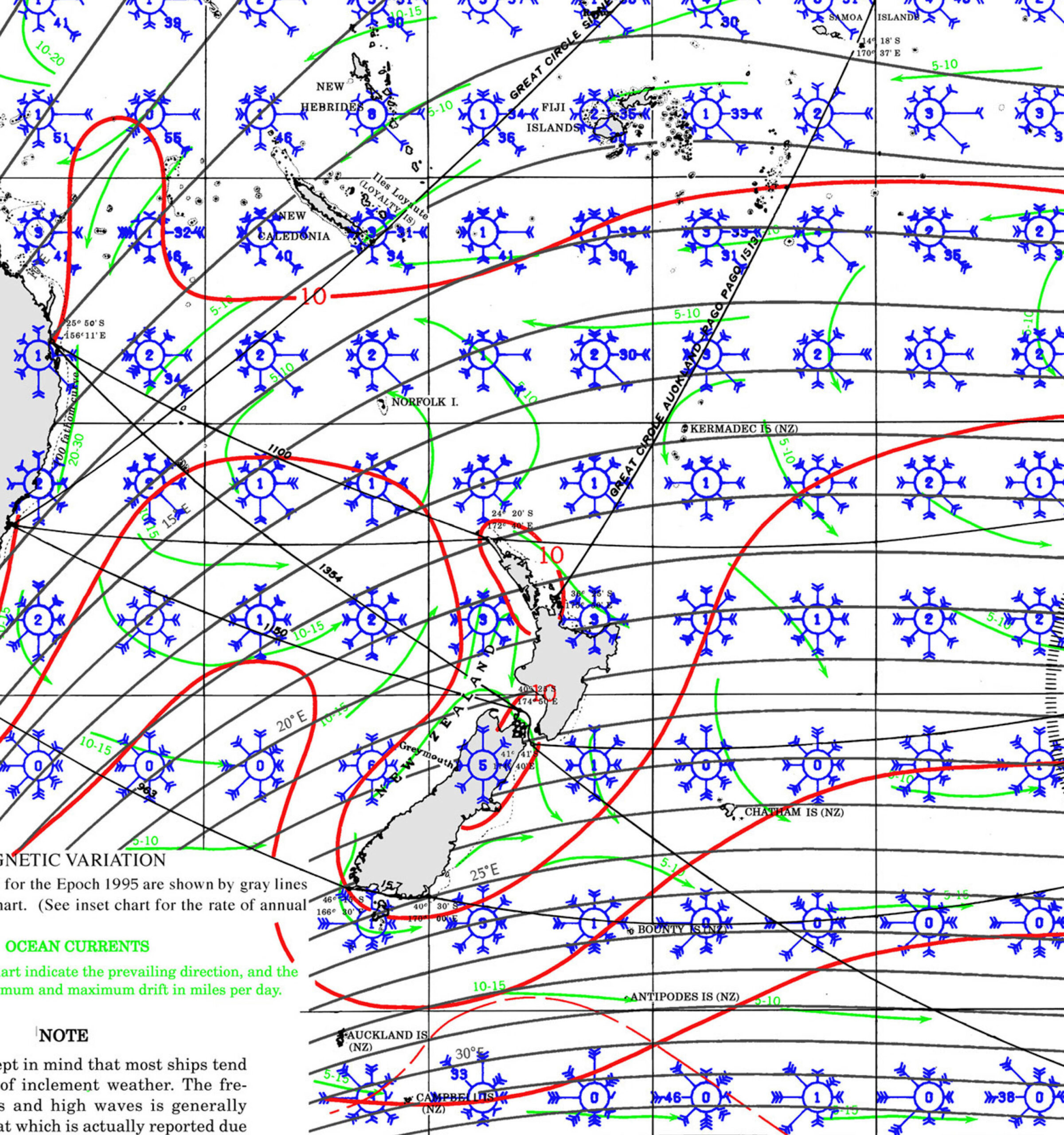
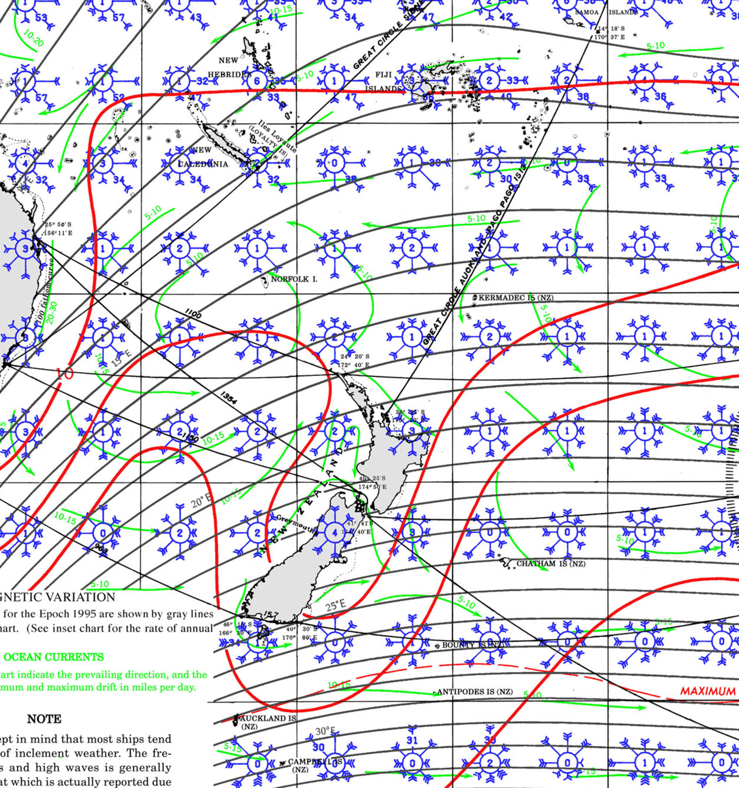
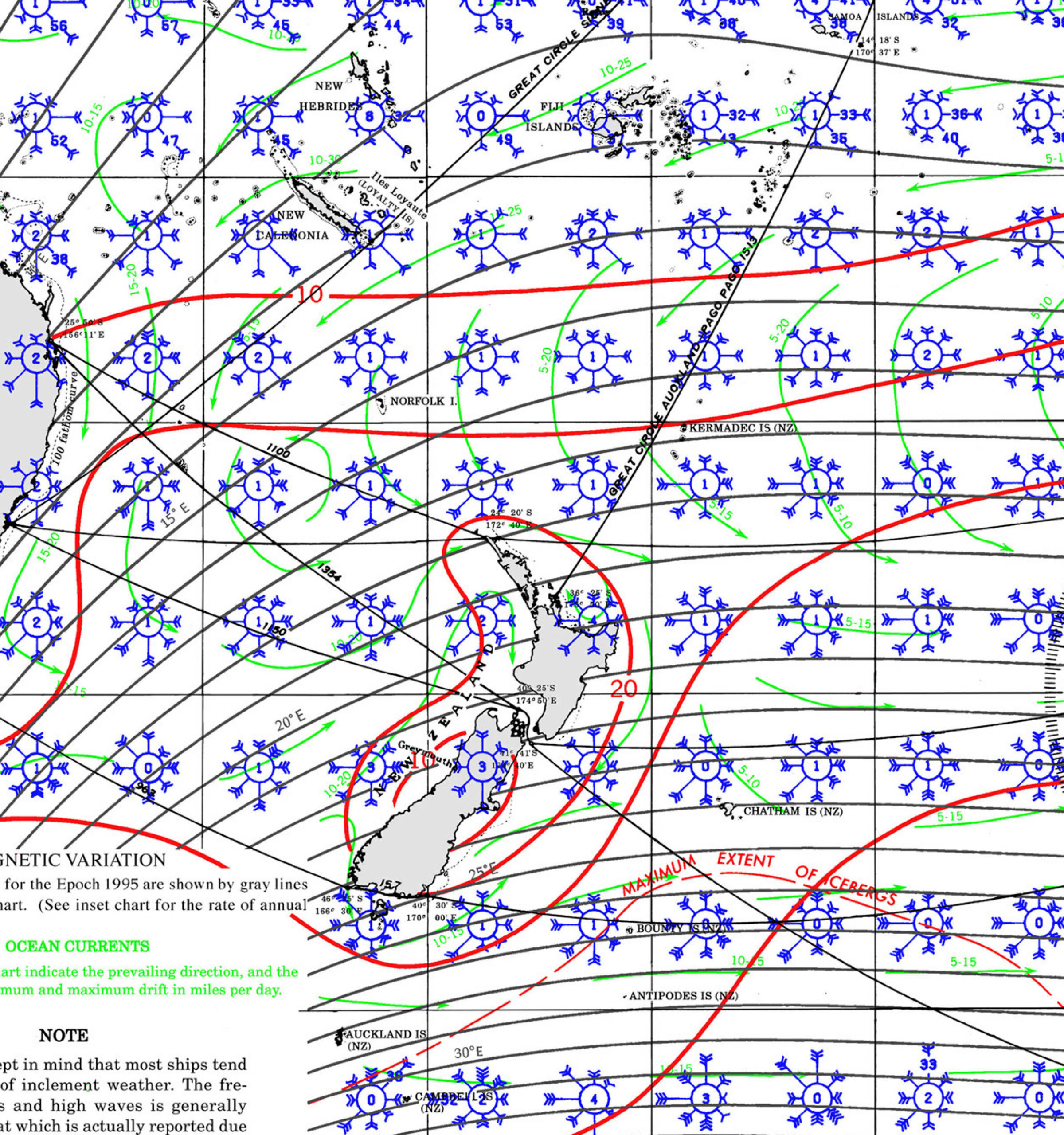
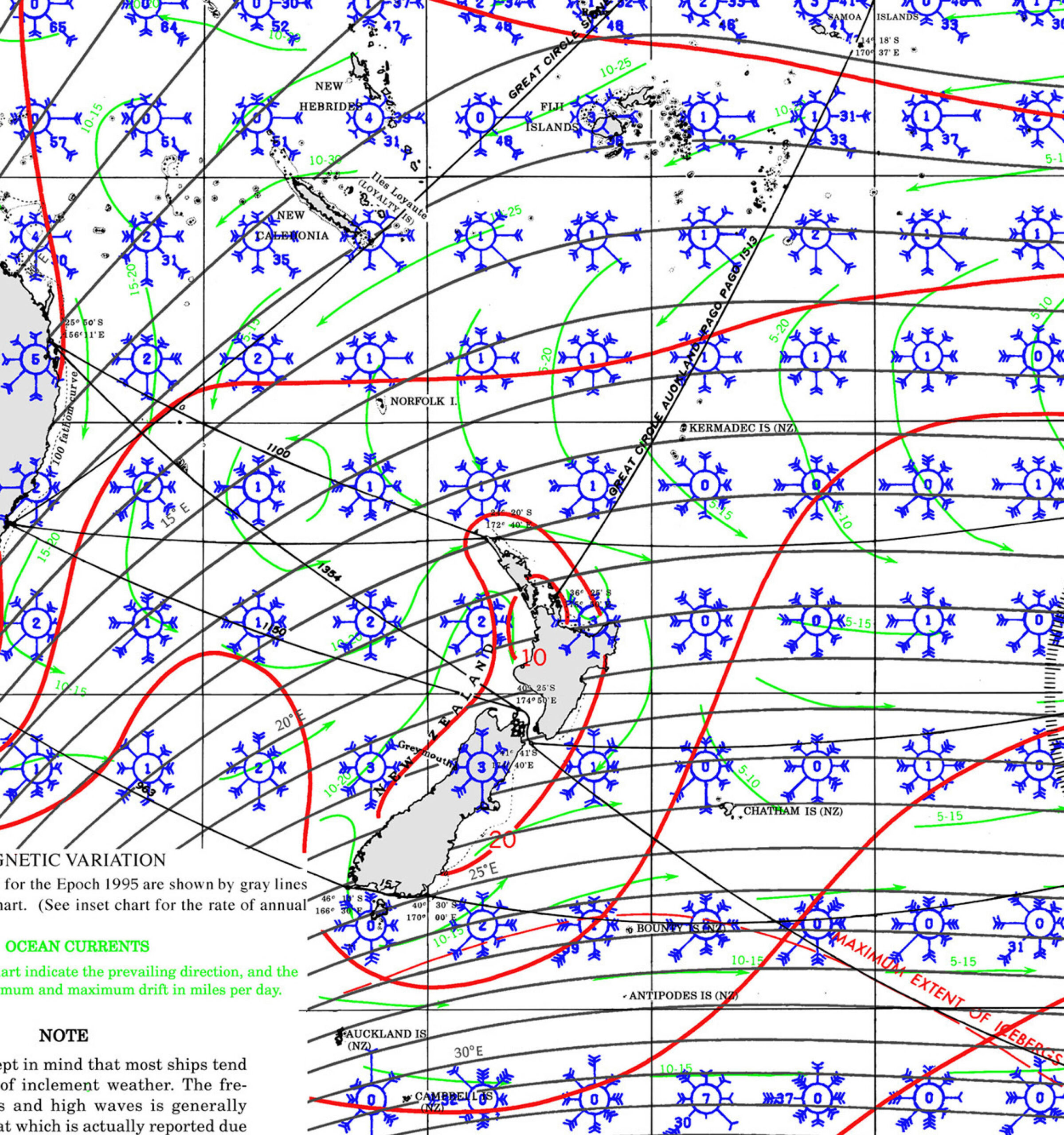
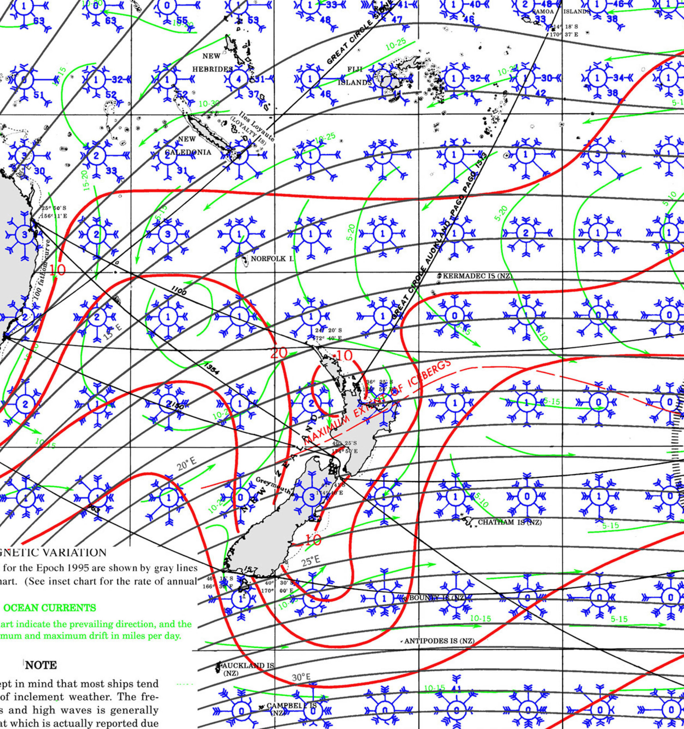
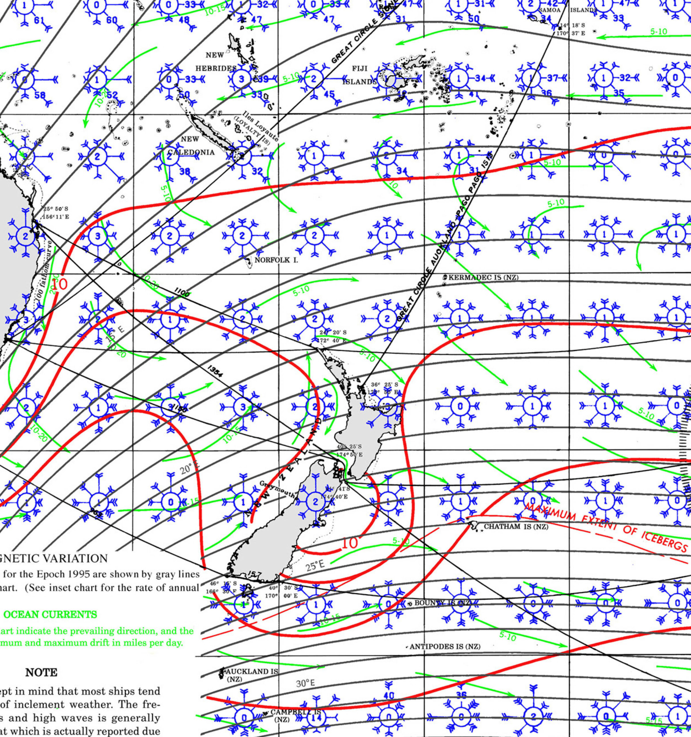
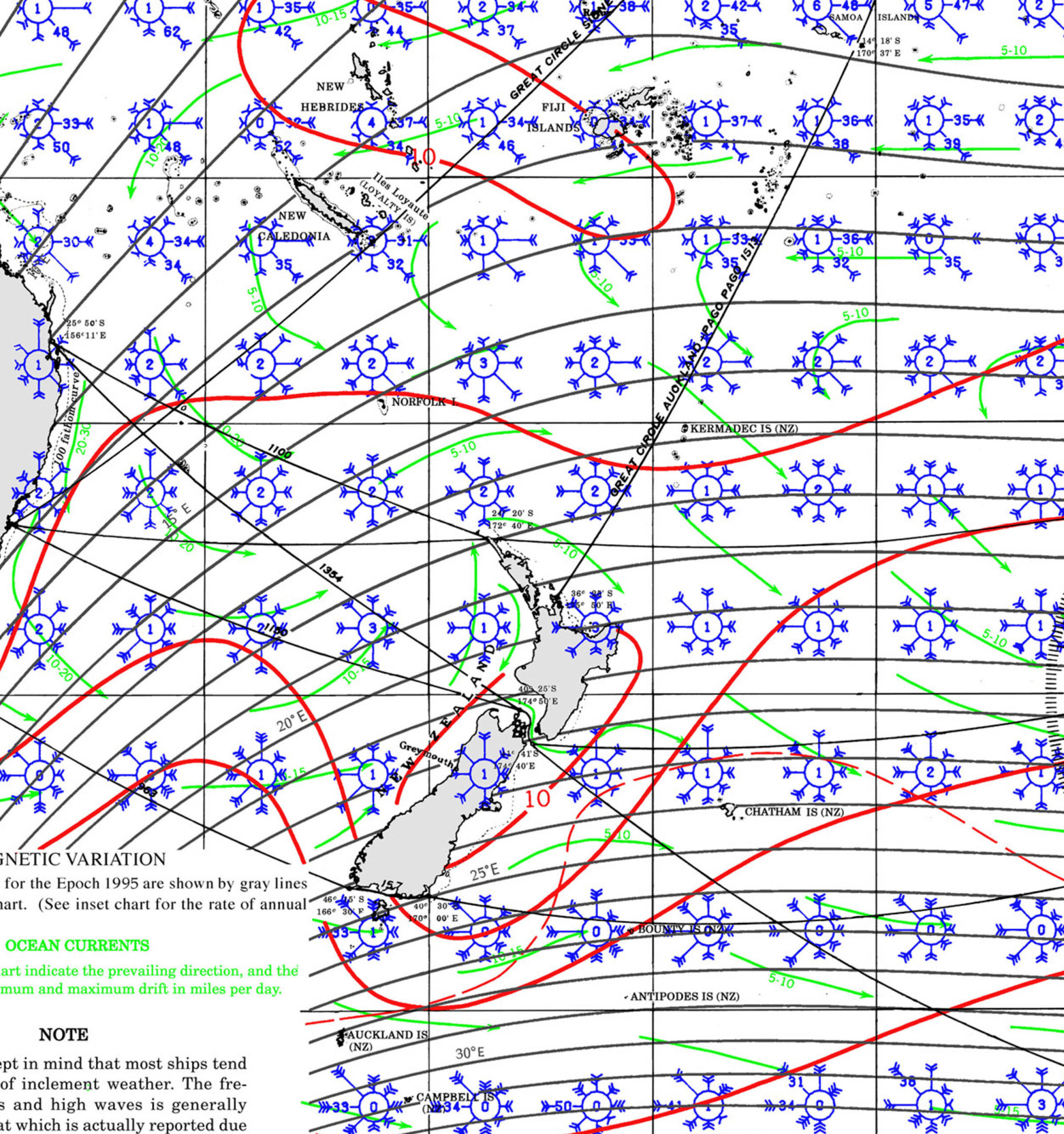
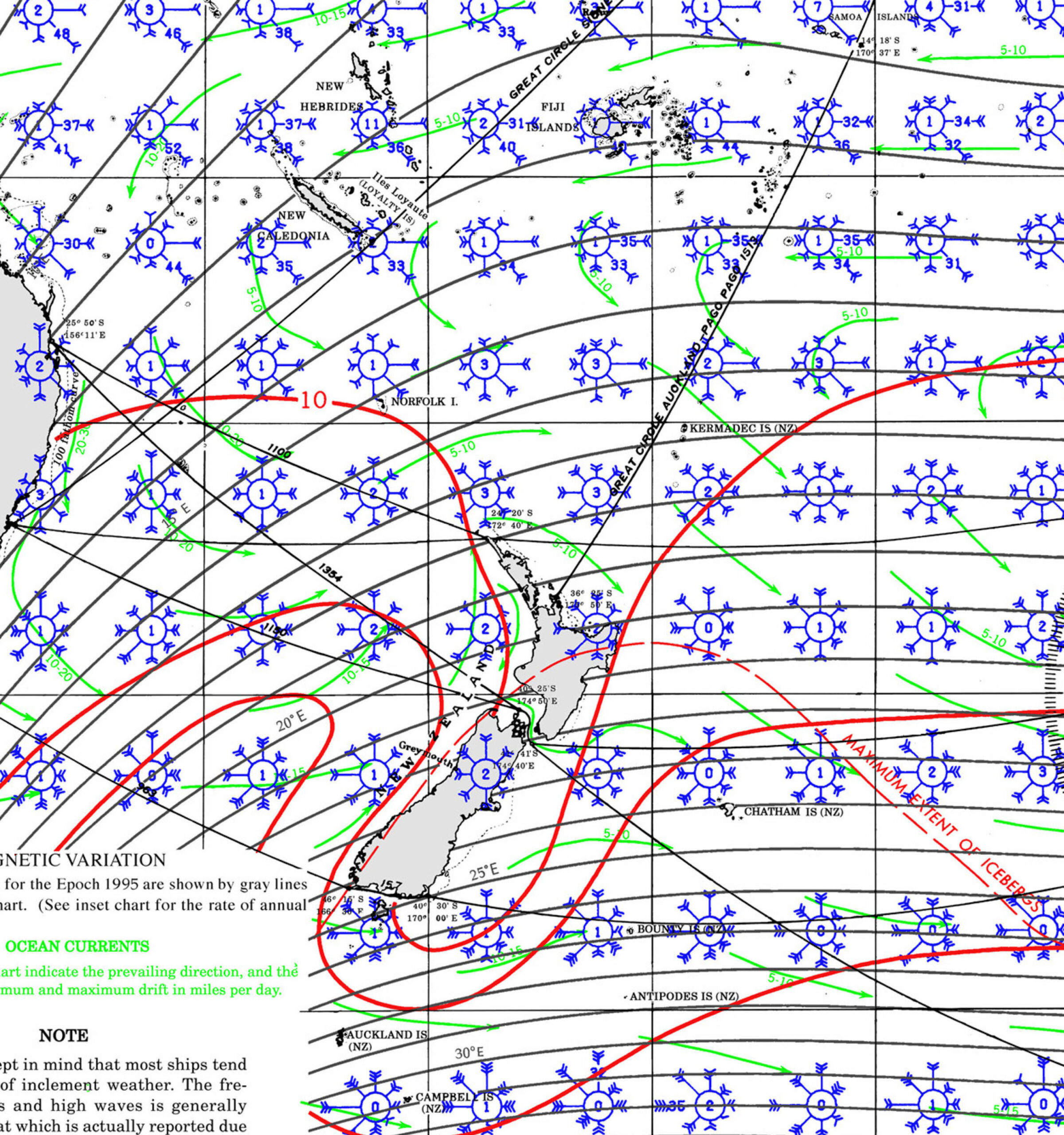
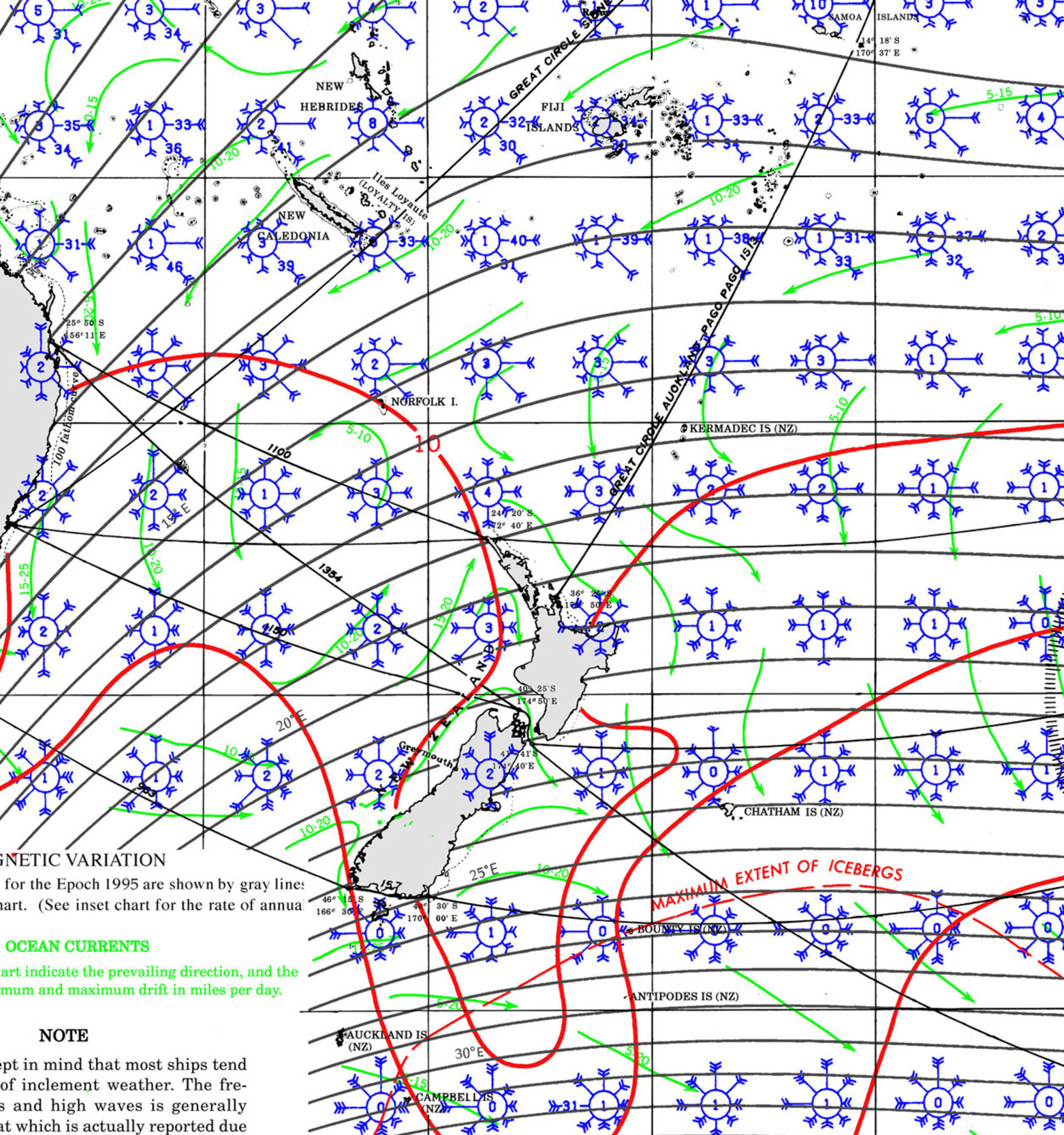
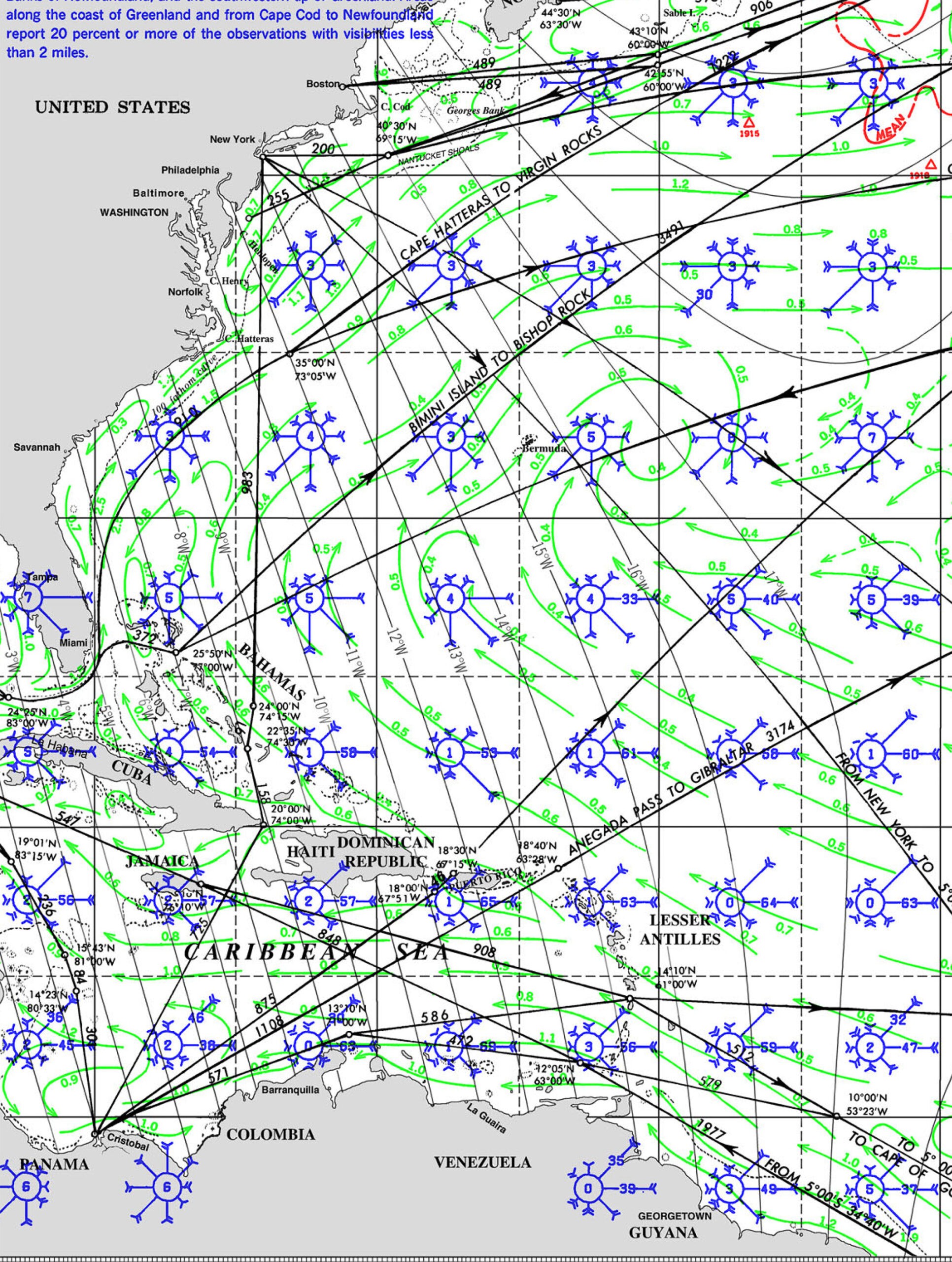
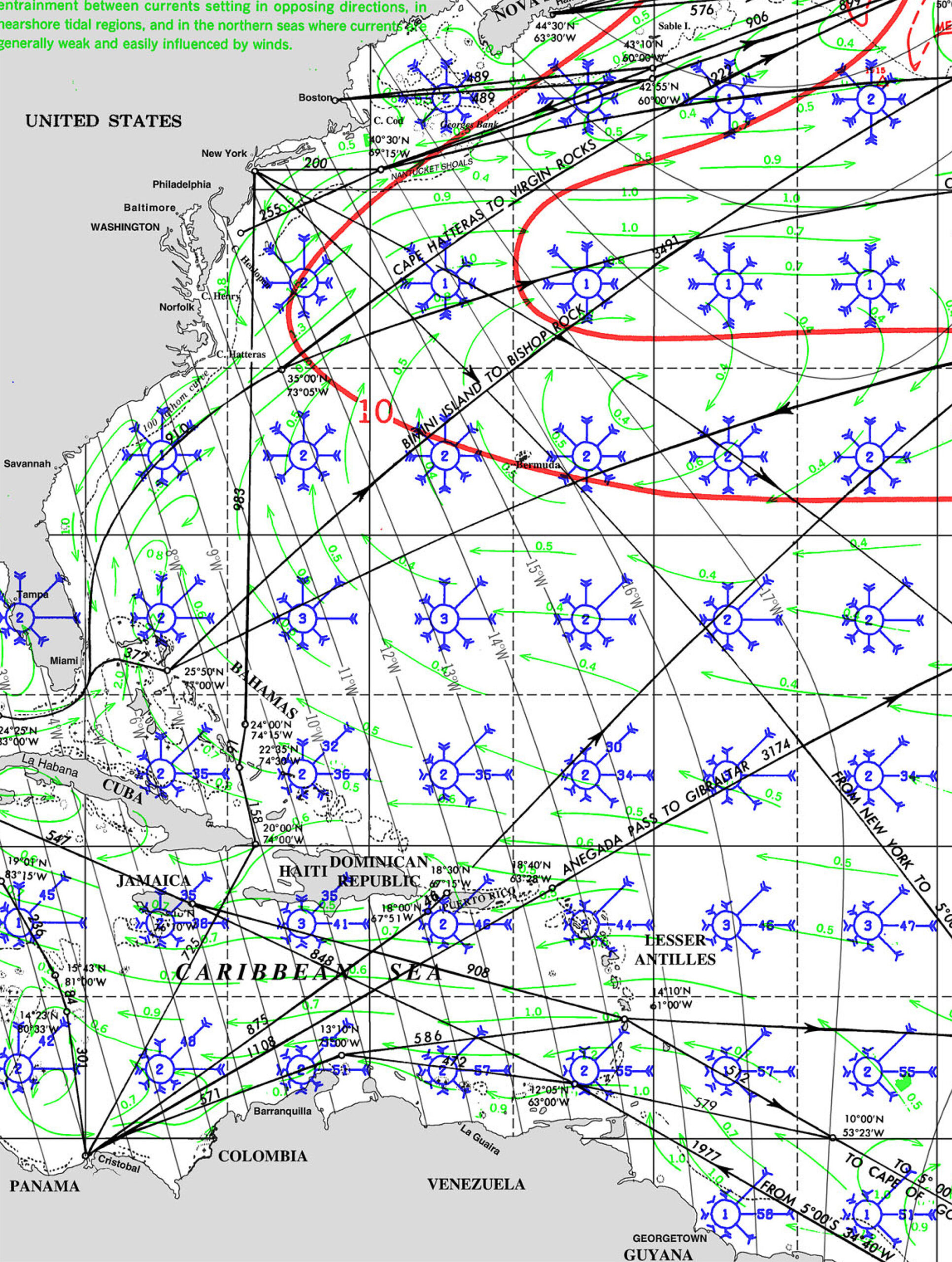
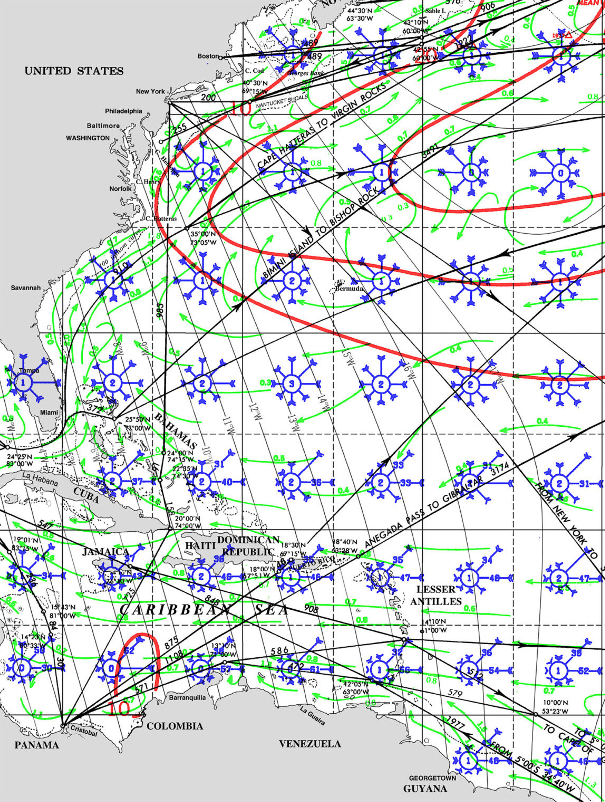
WIND
CURRENTS
SWELL AND WAVES
ROUTE PILOT CHARTS


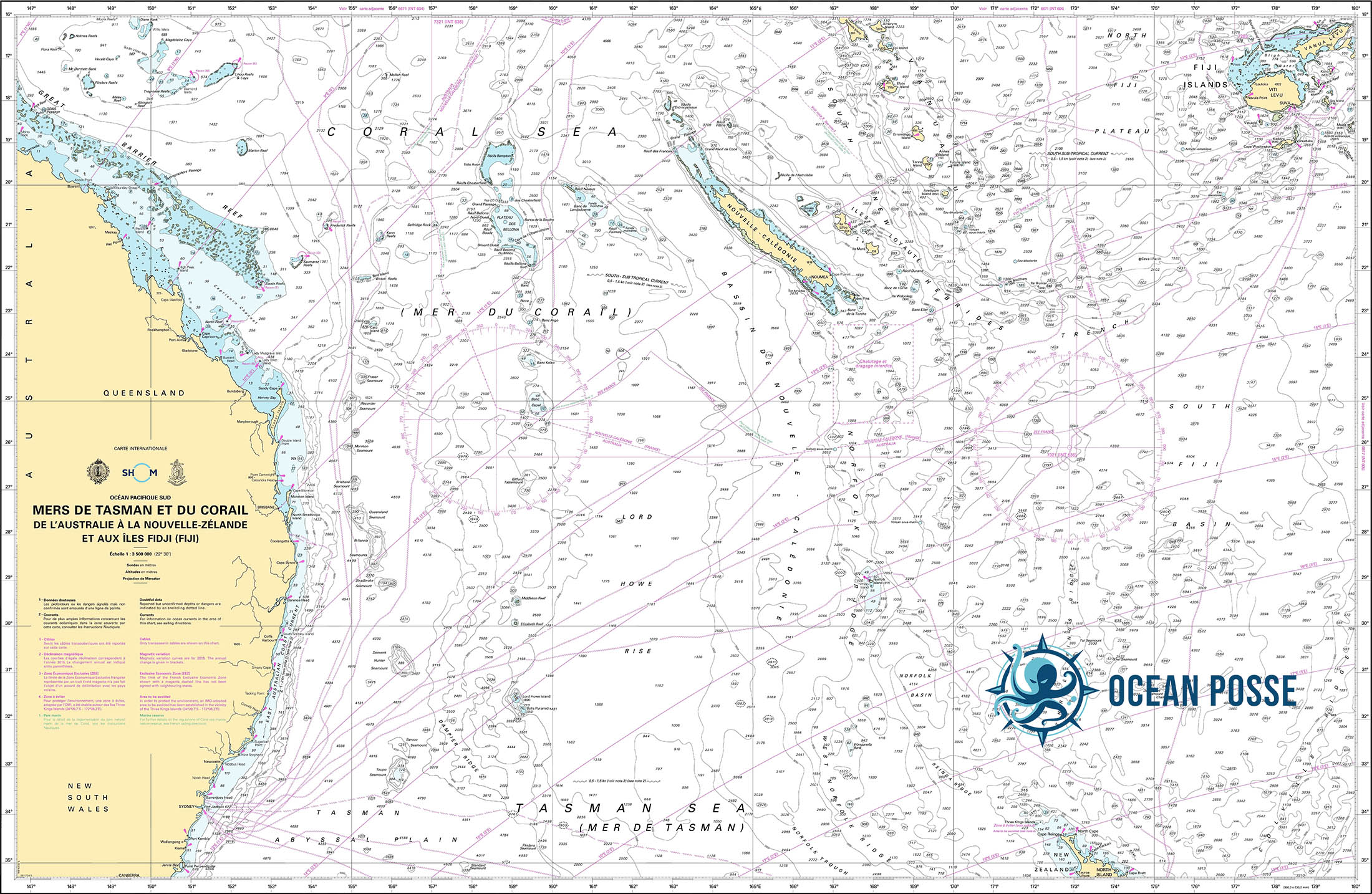
New Caledonia to Australia
The passage from New Caledonia to QLD, Australia is a common route for westbound cruisers completing a South Pacific season and heading to Australia for cyclone season. Below is an overview covering route options, timing, weather patterns, entry procedures, and navigational notes.
🧭 General Passage Overview
• Route: Nouméa (New Caledonia) to Bundaberg (Queensland, Australia)
• Distance: ~820 to 900 nautical miles depending on departure and arrival points
• Direction: West-southwest
• Time at sea: 5 to 7 days for most cruising yachts (avg. speed 5-7 knots)
• Destination port of entry: Bundaberg Port Marina (Port of Bundaberg – Biosecurity and Customs clearance available)
⛵ Recommended Timing
• Best Season: Late October to mid-November
• Why: This window is after the South Pacific cruising season and before cyclone risk increases. Weather is more stable and frontal systems in the Coral Sea are less frequent.
• Avoid: December onward due to increasing cyclone activity; also avoid departing during strong SE tradewinds or when a Tasman low is active.
🌦 Weather & Routing Considerations
• Prevailing winds: SE tradewinds (10-25 knots)
• Typical pattern: Start with E-SE winds, often light near New Caledonia and building mid-passage; expect more variable winds approaching the Queensland coast.
• Troughs & Fronts: Watch for cold fronts sweeping up from the Tasman Sea. These can bring strong SW to NW winds and squalls.
• Recommended Routing Tool: Use Weather Routing plugin in OpenCPN or services like PredictWind or FastSeas. GRIB files essential.
🗺 Navigational Notes
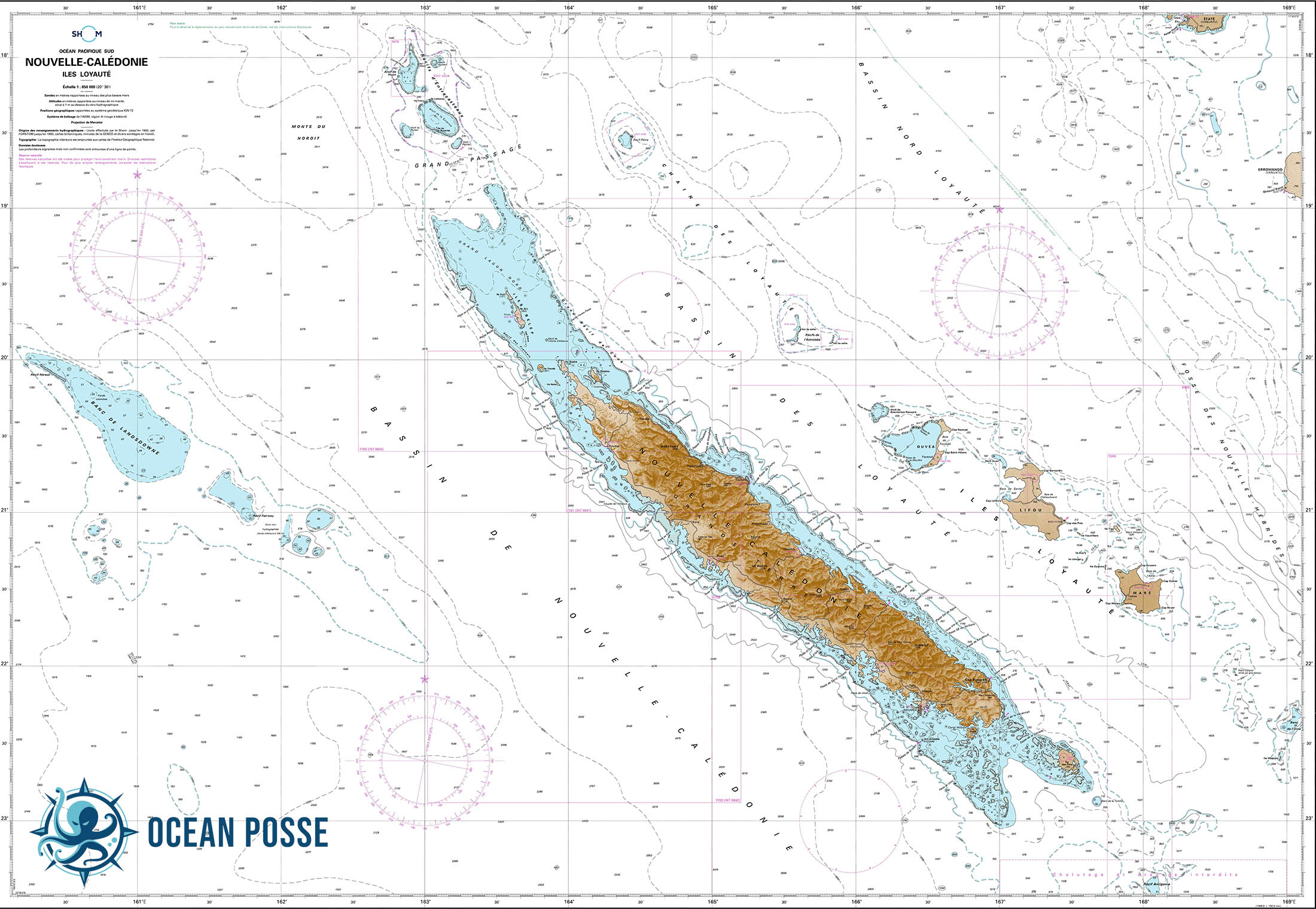
• Departure Point: Nouméa (Port Moselle Marina) or Baie de Prony for a better jump-off
• Arrival Waypoint: Bundaberg Fairway Buoy (then follow river channel to marina)
• Hazards:
◦ Coral Sea can become rough with wind-over-current conditions.
◦ Avoid lingering in the Capricorn Channel in a strong southerly.
◦ Stay alert for commercial shipping lanes and fishing buoys closer to Australia.
🇦🇺 Arrival in Australia – Border Procedures
• Biosecurity: Australian Border Force and Biosecurity (DAFF) require advance notification.
• Notice of Arrival: Must be submitted 96 hours before ETA (Australian Border Force Yacht Arrival Info)
• Prohibited Items: Fresh produce, untreated wood, animal products, seeds, etc.
• First Port of Entry: You must check in at an official port — Bundaberg is one of the most cruiser-friendly with a smooth process and marina support.
⚓ Bundaberg Port
• Coordinates: 24°45.802′ S 152°23.426′ E
• Services:
◦ Biosecurity & customs clearance on-site
◦ Friendly staff accustomed to international arrivals
◦ Fuel, haul-out, chandlery, provisioning
• Nearby town: Bundaberg (short taxi ride) for groceries, banks, travel services
WEATHER FORECAST
Swell