

CANAL CROSSING NOTES
CANAL CROSSING NOTES
Many Ocean Posse members cross the Panama Canal at some point on their journey. When this time comes people often wonder about the actual logistics of the transit, what food and beverages make for an easy day and happy line handlers, etc...
SV BRIGADOON III recently crossed the Panama Canal and is sharing the notes they shared of their experience to "give some friends a feel for what to expect and see it from my perspective".


The night before the transit, the four line-handlers arrived with the fenders and lines. One of the line-handlers was (Posse Sponsor and Canal Agent) Erick (Galvarez)’s son, Juan and another was Juan’s uncle “Junior”. Junior seemed to be the head line handler and gave the others direction. They slept one on each salon sofa, one in the aft quarter berth and Junior slept in the cockpit because, as he said, he snores.
The line-handlers arrived on time, as planned, at 6:30 pm and we had dinner ready for them -Spanish style meatballs in a roasted pepper sauce on Orzo, bean-corn salad and grapes for dessert. They devoured everything and all wanted to know what orzo was. They also drank water and Coke. I had read that they like Coke; regular not diet.
We had dinner before they arrived to simplify things. After dinner, they took off and Junior stayed and went to bed. Doug and I also went to bed and didn’t hear a peep from anyone.
We got up at 2:30 am and left the marina at 3:15 am to travel to a point between markers 2 and 4 to pick up our advisor. This area is just outside of Playita Marina. It took a while for Carlos, our advisor, to show up in the big pilot boat but eventually did and readied himself in the rocky seas for a very heroic leap to our boat. Once the advisor was aboard, all the line-handlers, except uncle Junior, went back to bed and we travelled in the dark under the Bridge of the Americas to the first lock which is about 7.5 miles from where we had picked up Carlos at about 4:15 am.
It was just getting light when we entered the first lock. The advisor gave us instructions and explanations for everything we needed to know as we went along, such as what to expect in the lock and that it takes 8 minutes for the water to fill the lock. He also explained how and when we would raft up to the other sailboat we were travelling with.
Because we were up-locking, we would travel behind the commercial ship. At the other end we would be down-locking and would be in front of the commercial ship.
We cleared the third lock at about 8 am so I got the coffee on and had oranges and muffins for everyone to tide them over while I made breakfast - rice and beans, eggs, avocado and salsa plus orange juice and more oranges. They love rice and beans.
As expected, the three younger line handlers went below to bed or rest and we carried on through Gatun Lake passing huge freighters going the opposite way.
At 12 noon and before we got to the Gatun locks, I made lunch - Chicken Chorizo Paella, grapes and watermelon. They also had water, coke and orange juice. Again, they gobbled it all up and helped with the dishes. Phew, no more dinners. We continued through the Gatun locks and about 20 minutes later the pilot boat showed up for Carlos the advisor. The three line-handlers continued on with us to Shelter Bay and Erick was waiting for them to transport them back home.
I want to add a comment on the line-handlers. Generally, when they are not needed, they are happy to hang out inside the boat. They were professional, tidy and kept their bags away and out of sight. They seemed to have a sixth sense of when they were needed as they would appear topsides, ready to work, out of nowhere. I suspect Erick has coached them because they were quiet, pleasant and thanked me for every meal. As for food, they liked the rice dishes and fruit. They had seconds of these dishes and they can pack away the food. They were not too interested in sweets such as muffins but did eat a bit of the chocolate that I had. According to Erick, they also like pasta. Remember, lunch is their main meal of the day. They appreciate water and Coke and enjoyed the orange juice I had.

SV SUMMERBREEZE followed in the wake of SV BRIGADOON III and found the notes super helpful.
SY BRIGADOON III Doug & Patty – Saga 43’ & MV SUMMERBREEZE 🇺🇸 Sam & Kurtis - Bestway 46'


 THANK YOU FOR SHARING YOUR NOTES AND YOUR COMMUNITY SPIRIT WITH ONE ANOTHER!

ADVENTURES IN PANAMA ABOUND PART 1
ADVENTURES IN PANAMA ABOUND
PART 1: ISLA TABOGA
Cruisers visiting Panama find adventures on land and out on the water. Over the years Posse members have collectively seen so much of what the country has to offer. There are so many great adventures to chose from. A quick list includes: Isla Taboga, the mountain towns of Boquette and El Valle, the Canal Museum in Casco Viejo, the sloth sanctuary in the Gamboa Reserve, cruising the Coiba group, cruising the Perlas Islands, walking up Ancon hill overlooking Panama City, touring the Miraflores Lochs....and many many more. Part 1 of ADVENTURES IN PANAMA ABOUND will explore the interesting history and adventure opportunities at Isla Taboga, Panama.
Rich in historical significance and boasting a relaxed getaway charm, Isla Taboga is an excellent place to visit near Panama City. The island is so close to the city that there are multiple daily 30 minute ferries that bring people to and from the island for $17 round trip. People visit to enjoy the beach, restaurants, hotels, multiple hiking trails, and the history.
Isla Taboga was discovered in 1513 by the Spanish explorer Vasco Nunez de Balboa. Many subsequent explorers who crossed the Atlantic from Seville, Spain would disembark in what is now Portobello on the Caribbean coast of Panama, cross the isthmus of Panama on foot or by horseback until they reached Panama City. They would then board canoes to the galleons anchored off Taboga. Deep waters with good holding surround the island and made it an excellent place for large vessels to find safe harbor from which to explore and conquer new lands near and far.
Like the ships of old the same anchorage is used today by modern transporters awaiting passage through the Panama Canal.
Going back 500 years again: By 1524 Father Hernando de Luque founded a church in the center of town and christened the town San Pedro. The Church, while noted for being one of the oldest churches in the Western Hemisphere, is still standing and well cared for.
|
|
In the late 1500’s the island was renamed Taboga. “Aboga” means “abundant fish” in the indigenous language of Taboga’s early inhabitants. In the 1500’s many of Taboga’s inhabitants on record were slaves from Venezuela and Nicaragua. The first Catholic saint of the Americas is said to have been born on the Island. There is a cross in her honor on a hilltop with a beautiful view. Today many people think of Taboga as the ”Island of Flowers” for all the flowers cascading over walls (from the most well maintained to the ancient, crumbling ones) and growing in the jungle. The island is 12 square km; town itself, like many on the nearby islands, is quite densely packed and surrounded by wild jungle.
|
Today, one can travel along all the residential footpaths or in golf carts on the narrow streets in an afternoon and could spend days and days meandering through the jungle in search of treasure, wildlife, or relics of the past. |
|
Treasure: Early prosperity turned Taboga into a target for piracy. In the 1600’s pirates became a formidable force in the area and Taboga was no stranger to their presence and pillaging. Infamous Pirate Henry Morgan among others is said to have sacked the island and used it as a base while attempting to sack Panama City and other nearby islands. Legend has it that there are ashes of pirates inside the walls of the church and treasures buried on the island. One can walk to a monument called Los Tres Cruzes to see the three graves of pirates that attempted to disturb the peace on Taboga. They lost their lives in the fight and have remained as a symbol to all who visit. Taboga is not to be sacked ever again. Wildlife: Taboga is a volcanic Island that rises above the sea with a dense and healthy tropical forest. While hiking through the forest we were treated to many (74) poison dart frog sightings, the smell of flowers, the sound of rain paddling the canopy overhead, the refreshing cool of mist hanging in the air slowly dripping down to the dark brown forest floor. On the highest peak we enjoyed being at eye level with the largest and smallest of birds, from the black headed vultures to bright green teeny-tiny hummingbirds. Relics of the past: In the 1840’s the Pacific Mail and Steamship Company set up a shipping company on Taboga thinking they would move mail and produce throughout the region. They ended up moving gold and gold diggers to and from California during the Gold Rush. There are remnants of their shipyard operation on Isla Morro which is connected to Taboga by a sand spit. In 1885 a medical center was built on the island while the French were making their attempt at the Panama Canal construction. Many workers would take ill and go to Tabogo for care and quarantine. While convalescing on Taboga, French painter Paul Gauguin, painted a scene of the bay that is appreciated to this day. Additionally, the US military build a base on the island during WWII. A bunker was built on the highest point with a 360 degree view that today offers a welcome breeze and incredible views of Taboga Bay, Panama City, the perlas Islands, and ships awaiting Canal transit. |


LA PAZ, MEXICO RESOURCE GUIDE
LA PAZ, MEXICO RESOURCE GUIDE
FROM THE CRUISERS HUB AT CLUB CRUCEROS

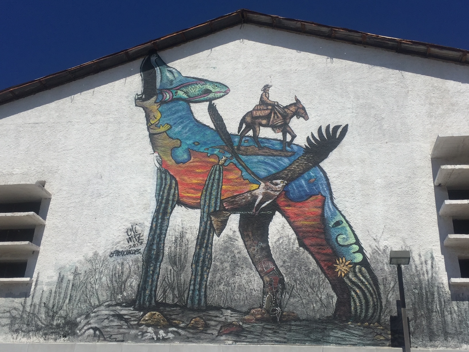
La Paz, the capital of Baja California Sur, is a major stop for cruisers and a gateway to the Sea of Cortez. About 50 nautical miles from Bahía de Los Muertos, La Paz offers several marinas, boatyards, and provisioning options. The city is known for its vibrant culture, murals big and small, great restaurants, and long Malecon (waterfront promenade). There are numerous anchorages around La Paz, such as Bahía Falsa and El Mogote, but the currents can be tricky, so mariners need to be careful. The anchorage in La Paz proper is noted by many to have what people call, "the La Paz Waltz" because the boats seem to dance around their anchor and one another throughout the day.
Ashore, cruisers find a welcome dinghy dock and cruisers hub at Marina La Paz. The cruisers hub is called Club Cruceros. The club hosts morning coffee, tends a 'give and take' library, and most notably, maintains a La Paz Cruisers Guide. This guide is kept up to date by resident long time cruisers. For all mariners planning a stop in La Paz, this resource is free and available in pdf form here: https://www.clubcruceros.net/Cruiser_Guide.pdf?

Using this guide, the city is made very accessible.
The art and murals throughout the city add to the beauty and whimsy of the visit.


MUST SEE ISLA ISABEL NATIONAL PARK MEXICO
MUST SEE: ISLA ISABEL NATIONAL PARK, MEXICO 🇲🇽

Isla Isabel National Park is a Mexican national park and protected area located off the coast of Nayarit southwest of Mazatlan. This isolated island was one Jacques Cousteau’s favorite places and Cousteau himself made the recommendation to the Mexican government to designate this island as a National Park. He spent a great deal of time here and has aired many specials on this fabulous gem. The Undersea World of Jacques Cousteau aired in 1975.
Isla Isabel is one of the main nesting islands for seabirds in the Pacific, including large colonies of Magnificent Frigate birds over 11,000 Fregata magnificens , Blue-footed Boobies Sula nebouxii, Brown Boobies Sula leucogaster and Sooty Terns Sterna fuscata. Marine life is rich, with over 24 shark and ray species, three species of sea turtles, the California Sea Lion Zalophus californianus, Humpback Whale Megaptera novaeangliae and Killer Whale Orcinus orca.
The island is uninhabited by humans, though there is a seabird reproductive research program run by UNAM and tourists visit to camp, fish and bird watch. After having depleted a huge colony of Sooty Terns, which in 1978 had over 150,000 pairs, cats were finally eradicated from the island in 1995 and the Terns are slowly recovering. The biodiversity and migratory populations of animals that live and return here year after year is a stunning MUST SEE.


POSSE TO POSSE PROP ANTIFOULING TEST
POSSE TO POSSE
PROP ANTIFOULING TEST
Many Posse members off the coast of the Americas are preparing to splash and cruise for the season. SV CARINTHIA has been on the hard in Shelter Bay Marina on the north side of the Panama Canal for hurricane season. The final touches are happening below the waterline with great anticipation.

Captain Dietmar of SV CARINTHIA shares a Posse to Posse Prop tip he is trying out this season:
testing a new prop and saildrive antifouling
we are applying baby diaper rash cream with zinc to new saildrives and props ... added economical benefit you can reapply under water 1 tube does both drives
Rob Murray of SV AVANT shares:
I have used that. It does work, but has poor durability. The creams have different levels of zinc oxide (20-40%], but I’ve never seen that make a difference.
Best let the saildrives and props be the judge. Please report back and let us know how the new antifouling works.

SEASON 8 AWARD ENTRIES: BIGGEST FISH CAUGHT
SEASON 8 AWARD ENTRIES: BIGGEST FISH CAUGHT

It was a blast. Tuna steaks forever. Vacuum packed and in the freezer. We weighed it with a luggage scale.

SV MALAIKA 🇺🇸 Robert & BettiAnn – Outbound 46′

LAYERS OF LIFE IN THE OCEAN
LAYERS OF LIFE IN THE DEEP SEA

From the Mediterranean to the Caribbean to the Galapagos to the Sea of Cortez to the expansive South Pacific Ocean Posse members have the opportunity to see, and in some cases, swim with a wide range of marine animals. Most marine life is seen at or near the surface in the upper reaches of what is termed the Sunlights Zone or the Epipelagic Zone. Interestingly, though what we see is in the merely upper reaches of the ocean's truly astounding depth. The ocean is unfathomably deep. The ocean is divided into various depth zones, each with its own unique environment, ecosystem, and community of creatures.
For those of us that want to enjoy some rather Zen armchair deep diving check out this video to see just how deep various creatures live and travel.


MV TIDINGS OF JOY VISITS AN EMBERA VILLAGE
MV TIDINGS OF JOY VISITS AN EMBERA VILLAGE


Tidings of Joy took a guided tour of the native village of the Embera tribe in Panama recently. Here is their trip report:
Our wonderful guide Goran (+507 6314-0827) picked us up in front of Flamenco Marina and drove for a short, one hour drive outside the city to Chagres National Park. We watched the buildings, traffic and. noise melt into green lush trees, birds and silence. When we arrived at the parking lot, we were met by two native Embera men wearing traditional clothing. Our guide mentioned this isn’t their everyday wears but when there is a celebration, or they want to demonstrate their culture they will wear them. We walked down to a long, narrow wooden boat with single rows of seats that didn’t appear very sturdy at first glance. As we filed in one by one we were careful to walk in the middle to not tip the boat. One native man drove the outboard powered boat from the stern while the second man stood watch on the bow using a homemade wood pole as both a spear and a seat.


The river was long and somewhat shallow in spots and wrapped in green voluptuous trees. Birds flew overhead as we wound our way down the river. Our first stop was a forest where we walked on a muddy path over rocks and through streams to get to a gorgeous waterfall. Despite the water being a little chilly we all plunged in and swam to the waterfall. It felt freeing and safe and perfect. After we finished gallivanting in the water we made the trek back to our wood boat and carefully piled in. Our next stop was at the Embera village where women in traditional clothes greeted everyone individually shaking our hands and saying “welcome/bienvenido” as we walked up the slight incline towards the village. As we got closer four Embera men were standing in a line playing traditional music welcoming us. We were all seated in one of their two communal kitchens and observed two women frying up fish and plantains in a cauldron full of oil. While we waited for lunch to cook a different native woman stood in front of us and told us about their rich and vast history. We learned that the Embera tribe was not always from this area but used to reside down in the Darian region but because the boat ride full of fresh fruits to sell in the city took 7 days causing all of their food to spoil, they decided to move closer to the city. In this Embera village there are only 25 families. Each one lives in a homemade wooden house elevated 5-6 feet from the ground to prevent flooding and minimalize animal invasion. Children are taken by boat to school in a neighboring village where a teacher from the city teaches them Monday-Friday before returning to the city for the weekend. Presently, tourism is their main source of income. Each day men go out fishing and bring their catches back for the woman to prepare for the days meals. After our education about the Embera tribe we feasted on a lunch of fried fresh tilapia and fried plantains all served in a banana leaf wrapped in the shape of a bowl and a table full of fresh fruits the guides had provided. With full bellies and a lot to think about we were escorted into a large communal hut we were told was used for ceremonies and communal gathering. The locals had tables surrounding the perimeter filled with handmade crafts for sale. They wove baskets and plates and bowls along with jewelry and fabric they had created the designs for. Some of the men had wood carvings for sale of various animals and even wooden knives which Jeff decided he needed to have. After a brief lap around we all sat on wood benches and watched as the native woman performed traditional dances. Several men surrounded them playing instruments while they chanted and moved around. They even encouraged audience participation, and I sat watching as Jeff was escorted around in a circle hand and hand with a native woman teaching him their dance. All of the woman tourists were given homemade flower crowns to wear home. Embera felt like a peaceful eutopia and a wonderful pause from all of the commotion and chaos of everyday life. A tour we would highly recommend.

THANK YOU FOR SHARING YOUR EXPERIENCE!
MY TIDINGS OF JOY 🇺🇸 Jeff & Joy - DeFever 52′
![]()
![]()

MARINA PAPAGAYO 🇨🇷 SPONSORS THE OCEAN POSSE
MARINA PAPAGAYO 🇨🇷 SPONSORS THE OCEAN POSSE
Marina Papagayo is proud to continue our sponsorship of the Ocean Posse fleet for the 2024/25 season. Our dockage discount for Posse members is:
Stay three nights pay for two
Stay for a week and pay for five days
Stay for a month and pay the annual monthly rate
Complimentary drink coupons for the Dive bar on arrival
We look forward to welcoming you to Marina Papagayo.
Best Regards,
Dan

https://oceanposse.com/marina-papagayo
Costa Rica is a very beautiful country to visit by boat all times of the year. Their biodiversity is protected and is a highlight from the coast to the mountaintops. Costa Rica is also out of the hurricane zone. Just lightning and thunder. A few Panama Posse vessels summered at Marina Papagayo and report that it gets way less rain and lightning/thunder compared to south CR like Golfito.
SV MAISON DE SANTE spent a hurricane season at Marina Papagayo:
A special shout out to Marina Papagayo and manager Dan for being a Panama Posse sponsor! Such a beautiful eco-conscious marina with everything you could ask for: potable water, complimentary pump out services, laundry, gym, pool, game room, hot showers with good water pressure, 24 hour security, recycling, mini market, marine store, and concierge services. There’s a nice walking trail to beautiful beaches and restaurants where you are likely to encounter all kinds of wildlife like deer, iguanas, and monkeys. The marina is so clean, you don’t have to think twice about cleaning the bottom of your boat (or running the water maker). A pet friendly marina with wonderful staff! I would highly recommend this marina to anyone visiting Costa Rica!


Season 8 Burgees are going UP
SEASON 8 BURGEES ARE GOING UP


