
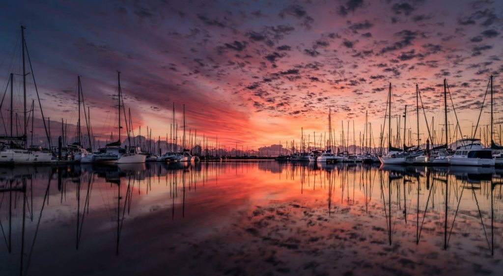
SAN FRANCISCO TO SAN DIEGO 550 NM MILES OF DOWNWIND BLISS
🧭 NORTH TO SOUTH: SAN FRANCISCO TO SAN DIEGO MAIN ANCHORAGES 550 nm
Sailing south from San Francisco to San Diego in August and September offers a generally begning blend of Pacific weather systems. August often starts with persistent coastal fog—especially north of Point Conception—where cold water and inland heat create dense marine layers that can reduce visibility to near zero. Radar and AIS and listening for northbound ships become essential tools during these stretches.
Rain is rare this time of year, but drizzle from fog can soak sails and decks. As you move further south, the fog generally thins, giving way to sunny skies and warmer air, particularly past Point Conception. That point itself marks a climatic boundary north of it, the California Current drives cool, moist air; south of it, conditions trend warmer, drier, and more stable.
Wind is typically out of the northwest, 10 to 25 knots, building in the afternoons. Mornings can be calm, and sailing is often best timed to take advantage of the early light air or ride the afternoon push. Swells also come predominantly from the northwest, ranging from gentle rollers to short-period chop, especially near points and capes.
Santa Ana winds do not develop till later those are hot, dry offshore blasts, can make rare early appearances in late September. If they arrive, expect dramatic shifts in wind direction and velocity, especially near Southern California’s coastal valleys. These winds can turn calm anchorages into lee shores and should be watched closely especially vessels anchoring in the Channel Islands or on moorings off Catalina Islands.
Whales, particularly humpbacks and blue whales, are often spotted during this run. Summer and early fall bring krill and baitfish to the surface, and large cetaceans follow. Keep a keen lookout, collisions are rare but possible.
Overall, this stretch of coast offers a steady downwind ride, moderated by marine layers and punctuated with wildlife. It’s a great time to sail south, just keep one hand on the helm and one eye on the barometer.
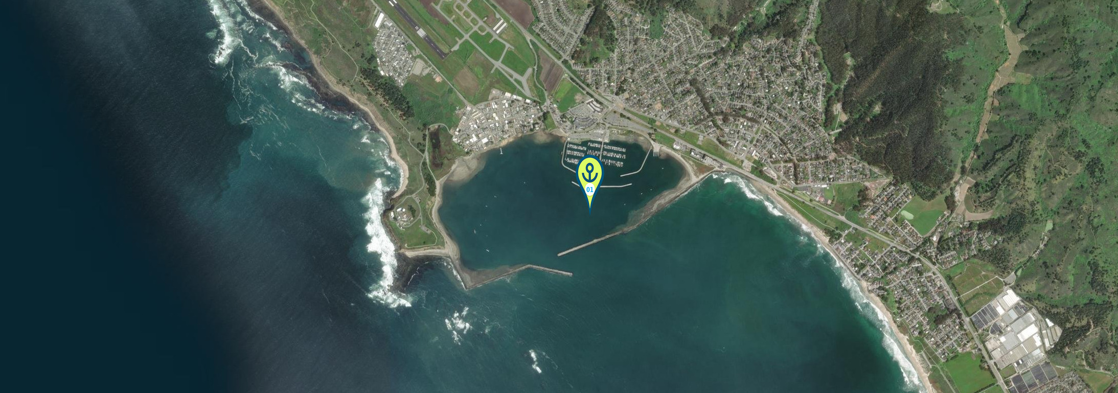
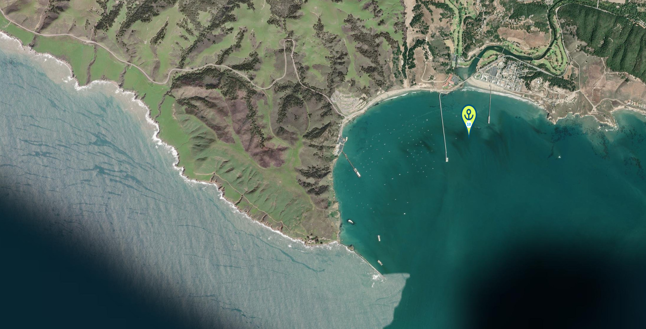
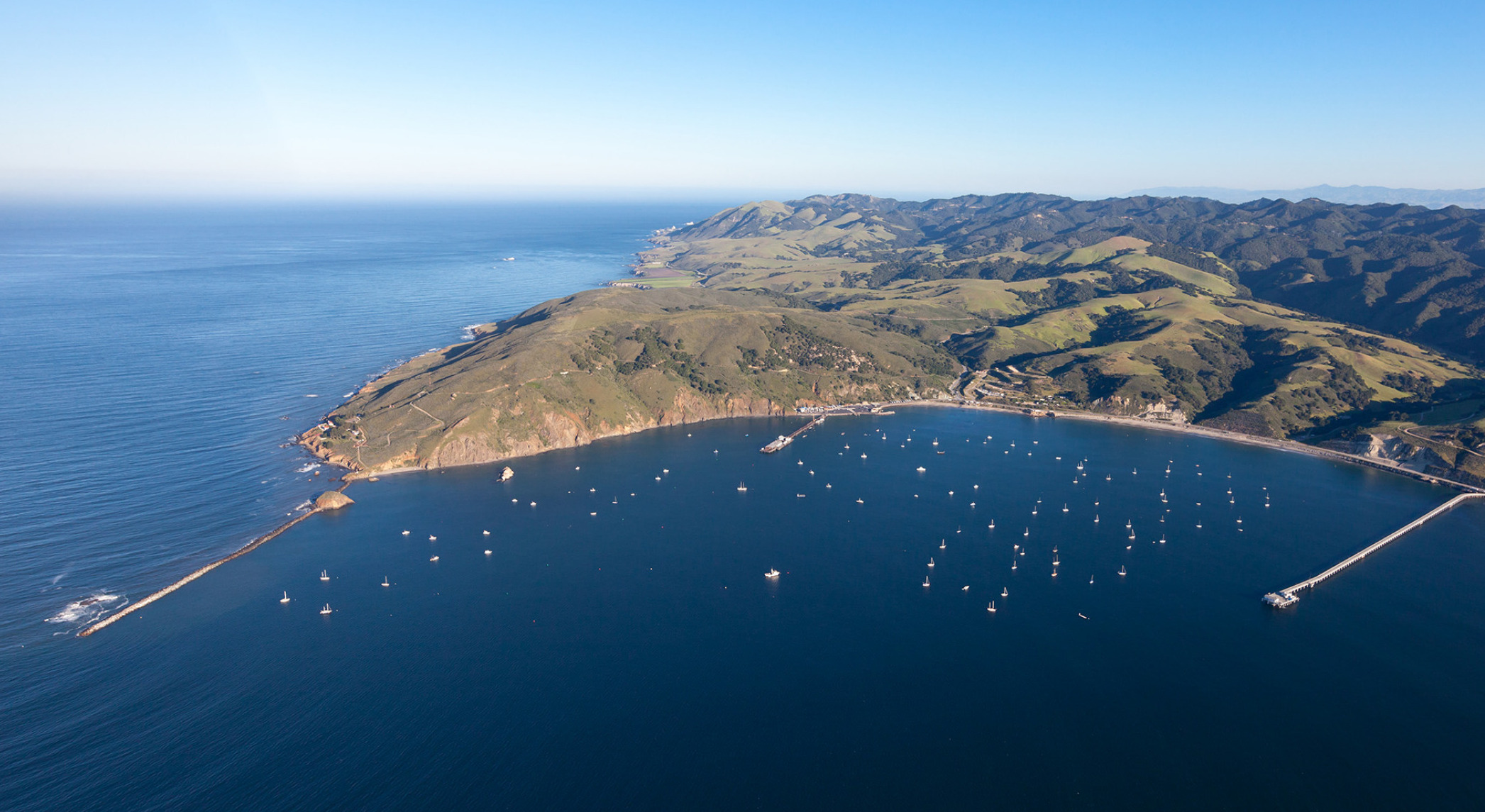
Leaving at the wrong time from Morro Bay during an August or September southbound passage can have serious consequences, especially when it comes to swell. The entrance to Morro Bay is narrow, shifting, and fully exposed to swell. It was build by the Army core of Engineers. While conditions inside the harbor are mostly calm, the bar at the entrance can turn treacherous quickly, especially after mid-morning when wind-driven swell builds.
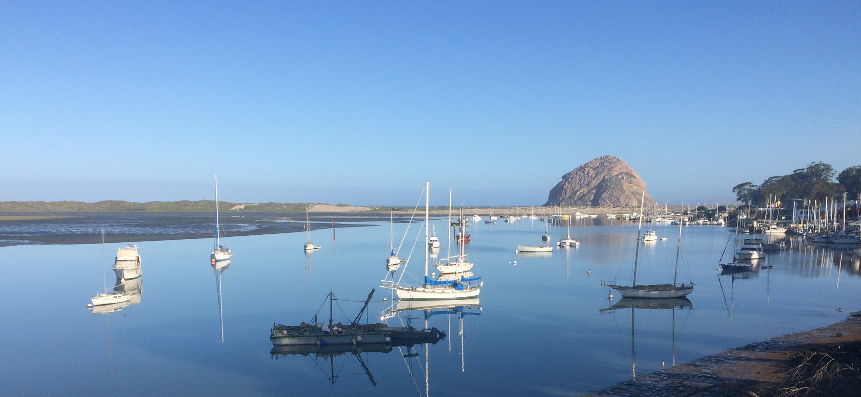
Look for the little otters in the bay.
If you miss the early departure window, the combination of rising tide and onshore breeze can stack swell right on the entrance, creating a breaking bar. Even modest swell, 4 to 6 feet at 10 seconds, can make it feel like you’re surfing through a washing machine. Larger swells or long-period waves can close out the entrance entirely, effectively locking boats inside for hours or even days.
Local warnings are often issued when the bar is breaking, and the Coast Guard may restrict departures. Timing is everything. Ideally, depart just after first light on a falling tide with minimal swell, before the wind picks up. Swell direction is key—anything west or northwest funnels directly in. Southern swell is less of a threat but still needs watching.
If you’re stuck inside, be patient. Use the downtime to top off fuel, re provision, or take on water. But resist the temptation to “punch through” a questionable entrance—many a skipper has regretted that decision.
Planning around swell windows is essential all along the California coast, but Morro Bay is one of the spots where getting it wrong can cost you more than just time

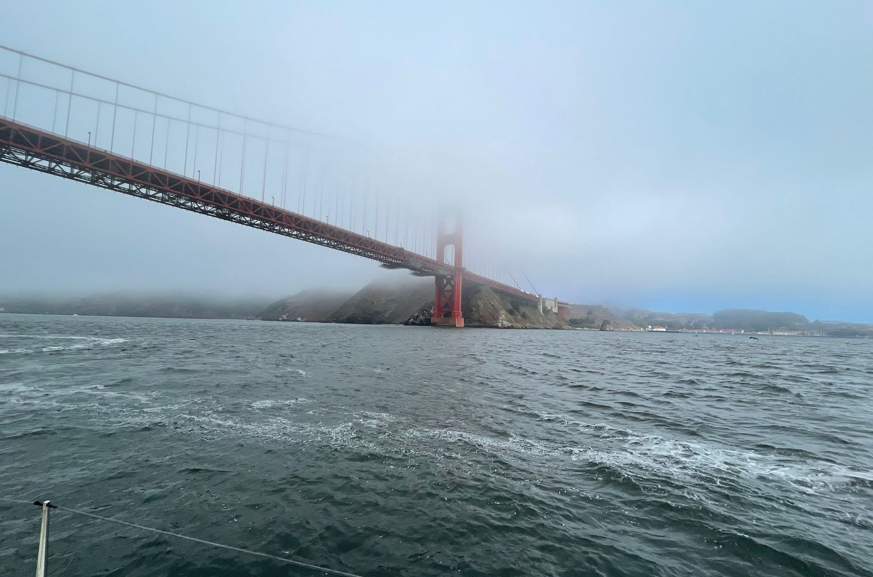
Sailing Out of San Francisco Bay
The Golden Gate is a narrow and dynamic gateway to the Pacific, funneled by tides, fog, and swell. Outbound passages are often against strong ebb currents that can exceed 4 knots, especially during spring tides. Combine this with a Pacific westerly swell and an incoming breeze, and the result is a sharp, confused sea known locally as “potato patch” conditions.
Fog and Visibility:
Fog is frequent from late spring through early fall, often hugging the coast and rolling in thick during the afternoon. Visibility can drop to near zero beyond Mile Rock or Point Bonita. Radar, AIS, and a sharp lookout are essential.
Wind:
The famous “Slot Effect” produces strong west-northwest winds that funnel through the Gate. Afternoon winds in summer typically build to 20-30 knots with gusts higher, especially off Angel Island and around Alcatraz.
Timing Your Exit:
The best time to sail out is during slack tide or the beginning of a flood to avoid standing waves and turbulence. Early morning departures offer lighter winds and reduced fog in some seasons.
Sea Life and Traffic:
Expect to encounter humpback whales, harbor porpoises, and large container ships. Stay outside the Traffic Separation Scheme lanes when possible and monitor VHF 13 and 14 for commercial traffic near the Gate.
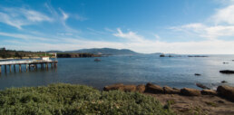
1. Half Moon Bay – Pillar Point Harbor ( 24 nm Golden Gate Bridge – Half Moon Bay )
• Location: 037° 29.8401′ N 122° 29.2901′ W
• Notes: Good first stop outside the Golden Gate. Anchoring near the outer harbor is common, though swell can wrap around. Pillar Point Harbor has guest docks and fuel dock if needed.

2. Ano Nuevo Bay – ( 32 nm Half Moon Bay – Ano Nuevo Bay )
Location : 37° 06.4809′ N 122° 18.9732′ W
Can be very rolly – anchor in Settled Conditions 22 feet
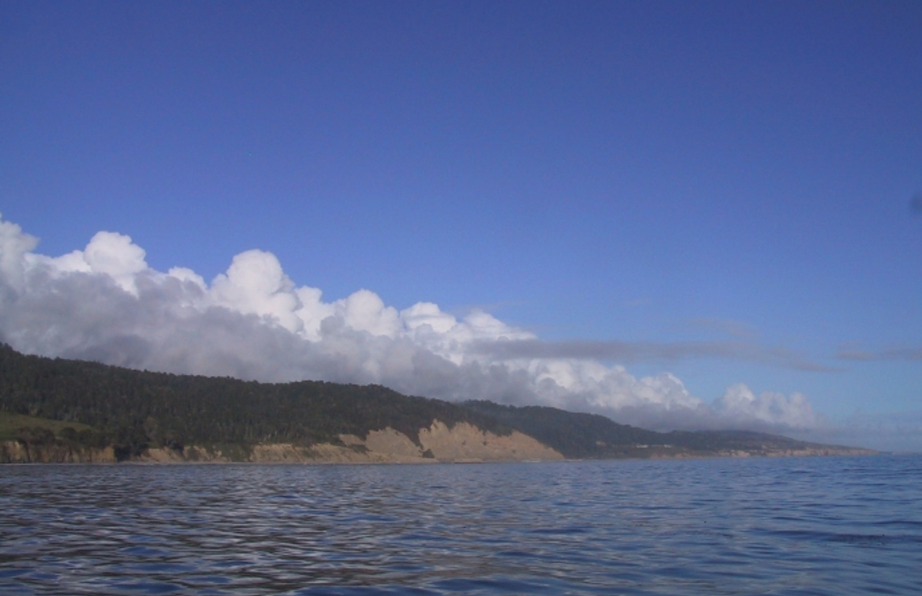
5. Santa Cruz
• Location: 36°57.050’N 122°00.910’W
• Notes: Open roadstead with decent holding, often rolly unless the swell is down. Good for a brief overnight in settled weather.
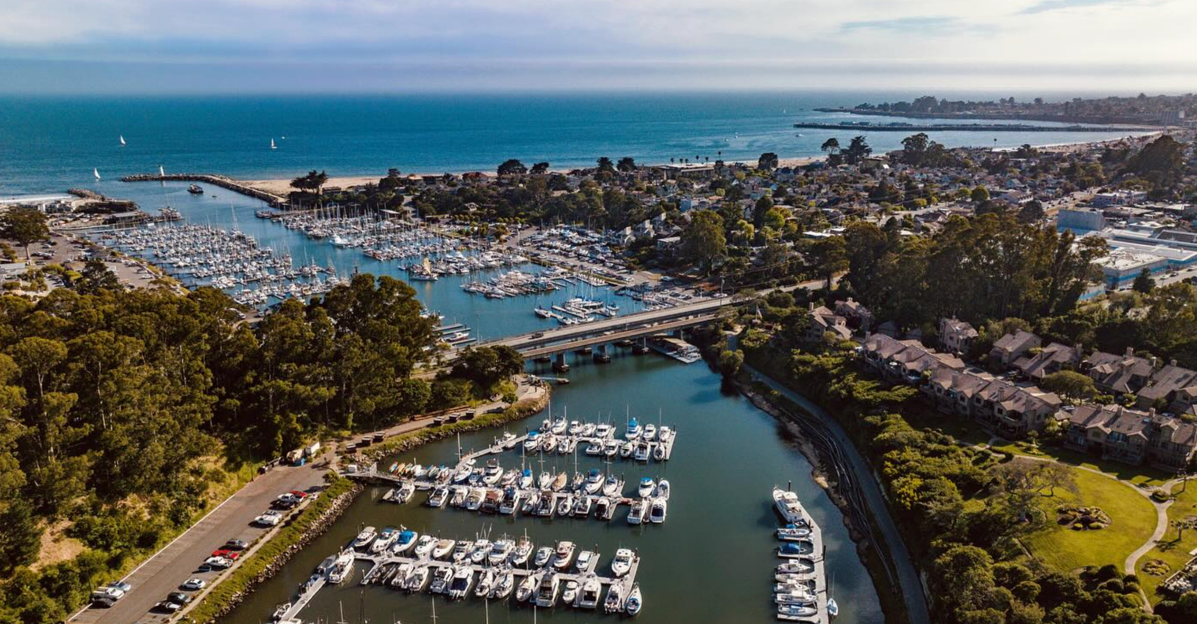
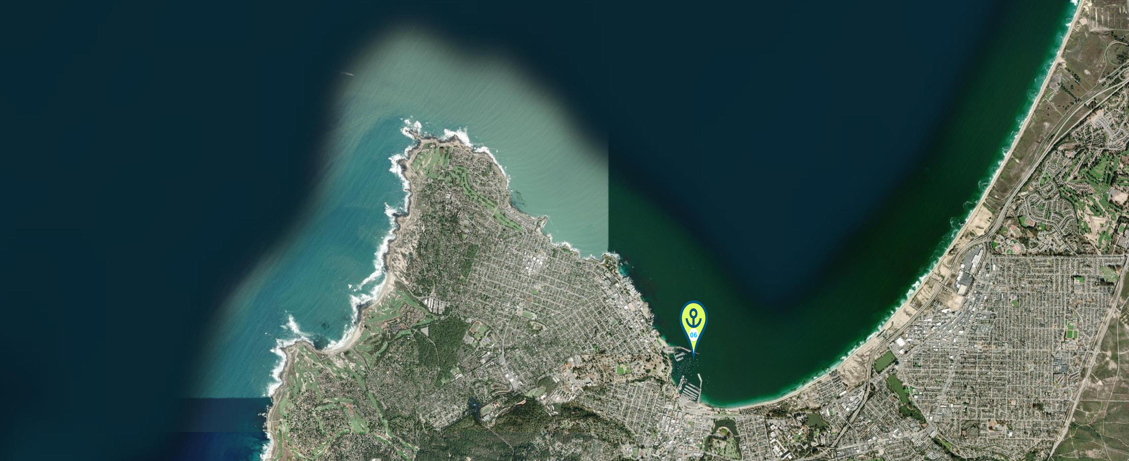
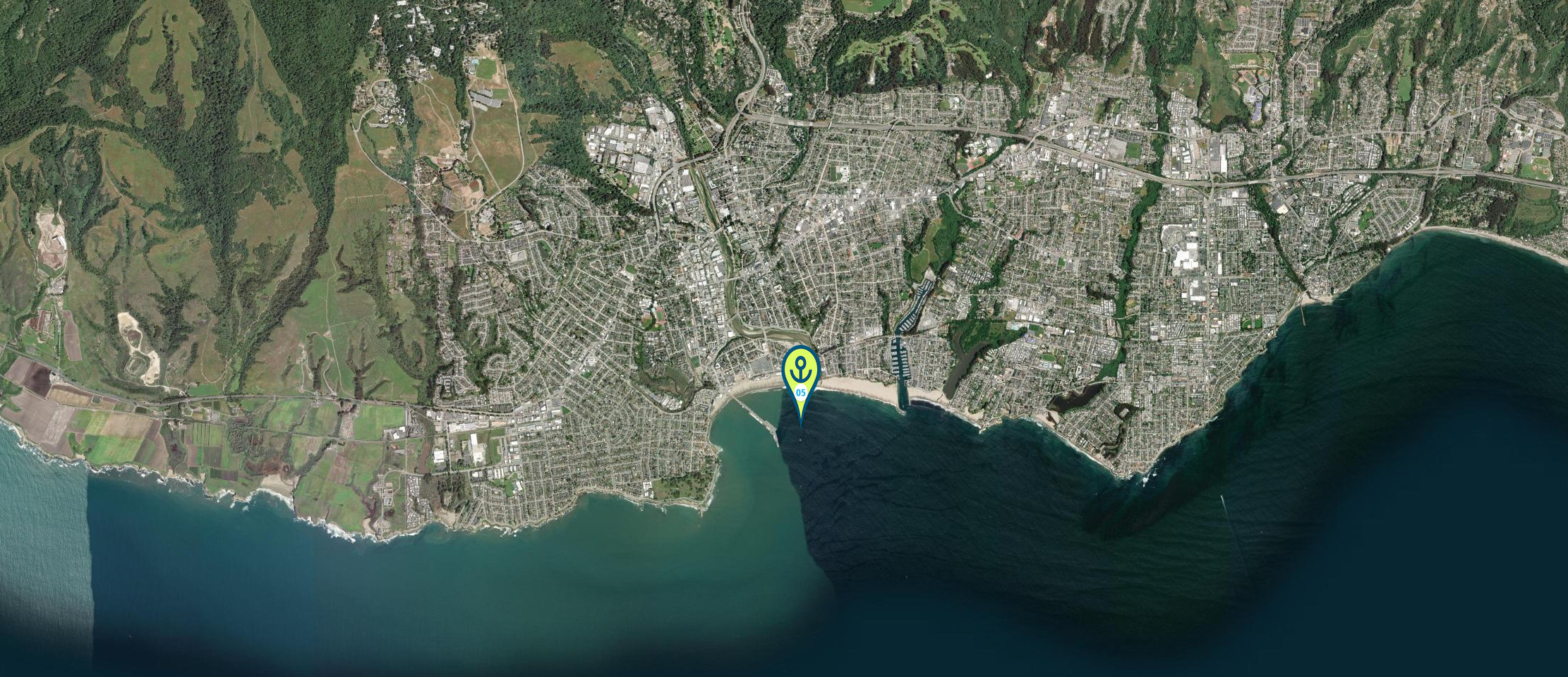
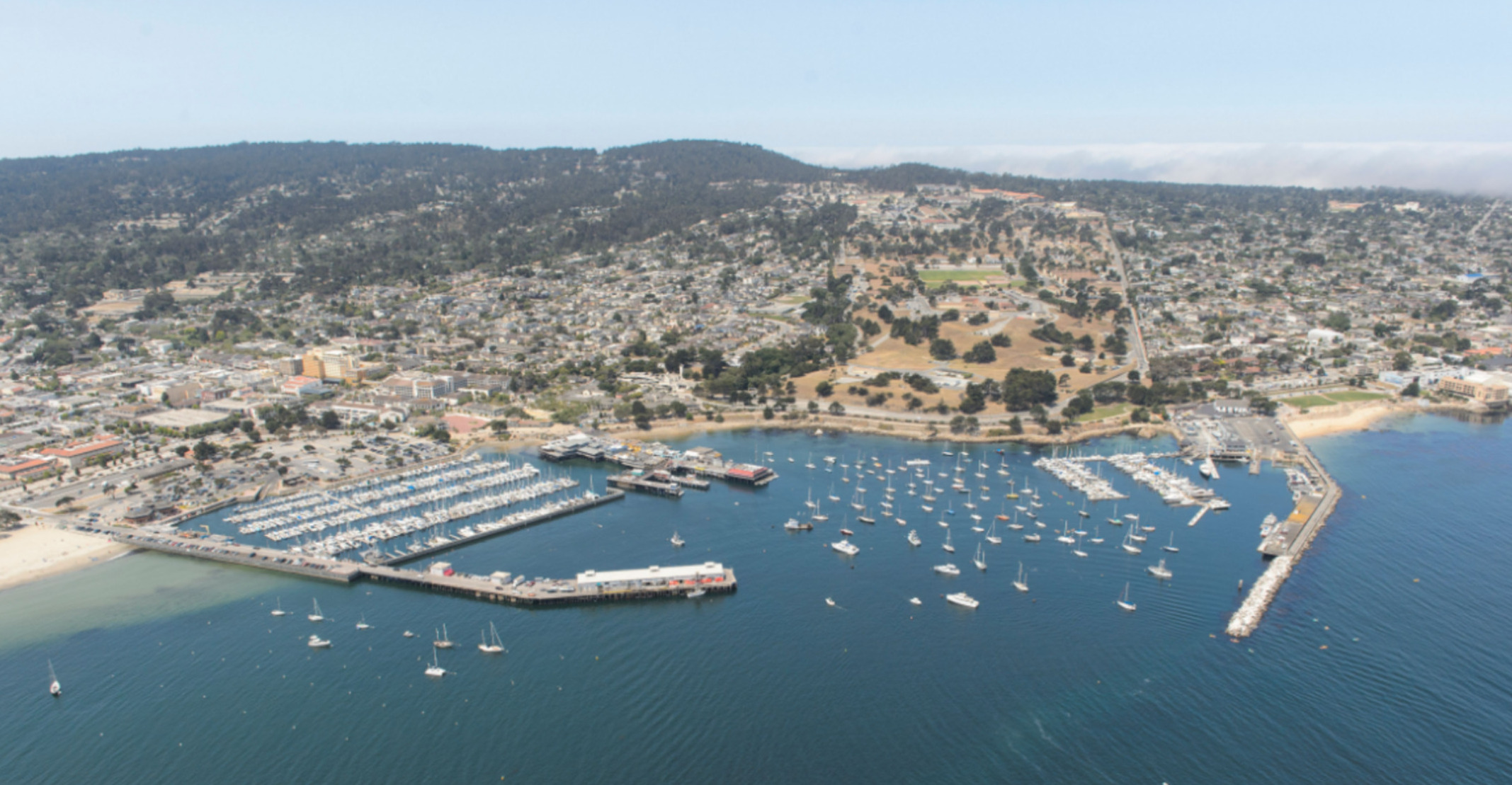
6. Monterey Bay (Monterey Harbor)
• Location: 36° 36.2509′ N 121° 53.1927′ W
• Notes: Well-protected marina with some space to anchor outside. Popular with cruisers. Watch for kelp beds. decent beach landing and marina access by dinghy.
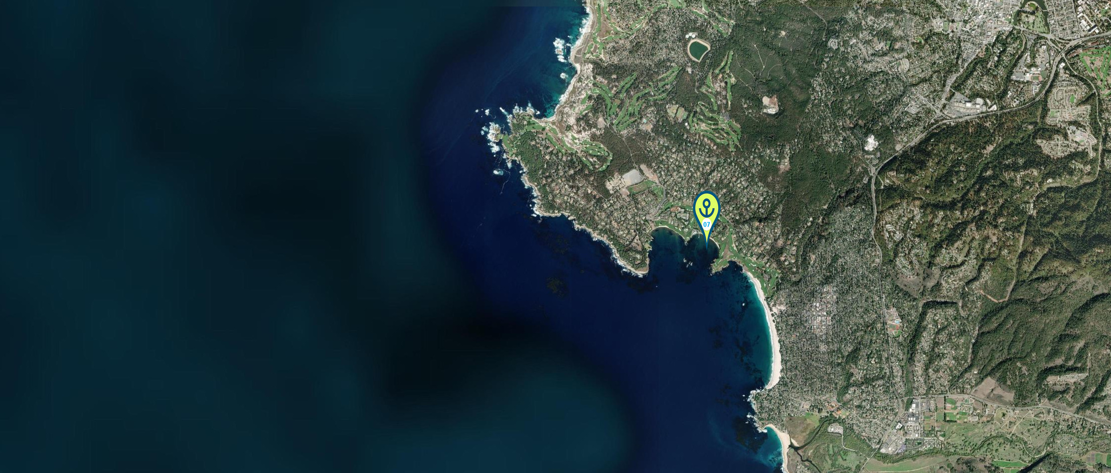
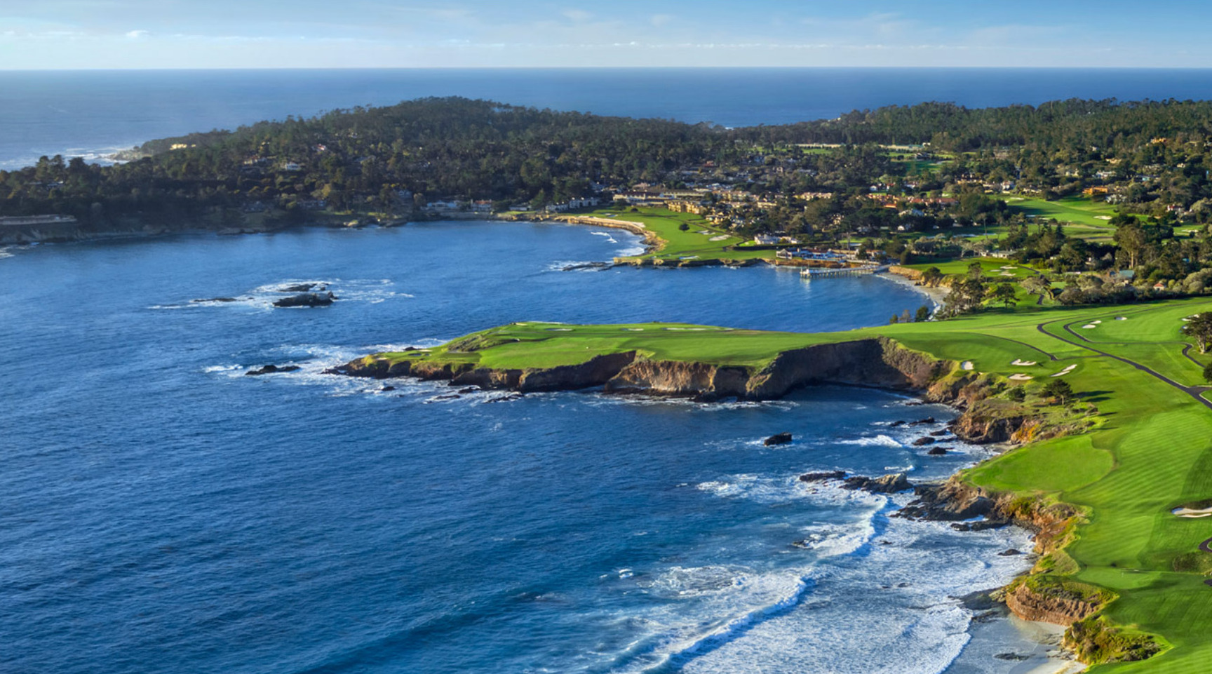
7. Stillwater Cove @ Pebble Beach
• Location: 36° 33.8651′ N 121° 56.4919′ W
• Notes: Beautiful but exposed anchorage. Only suitable in very calm weather. Kelp can make anchoring tricky. Surrounded by Pebble Beach golf course to the east and north, Anchoring allowed to the east of the mooring balls. When the harbor “closes” after Labor Day Weekend, anchoring within the mooring ball field is allowed. 10’-12’ at low tide. Can dinghy to the beach.
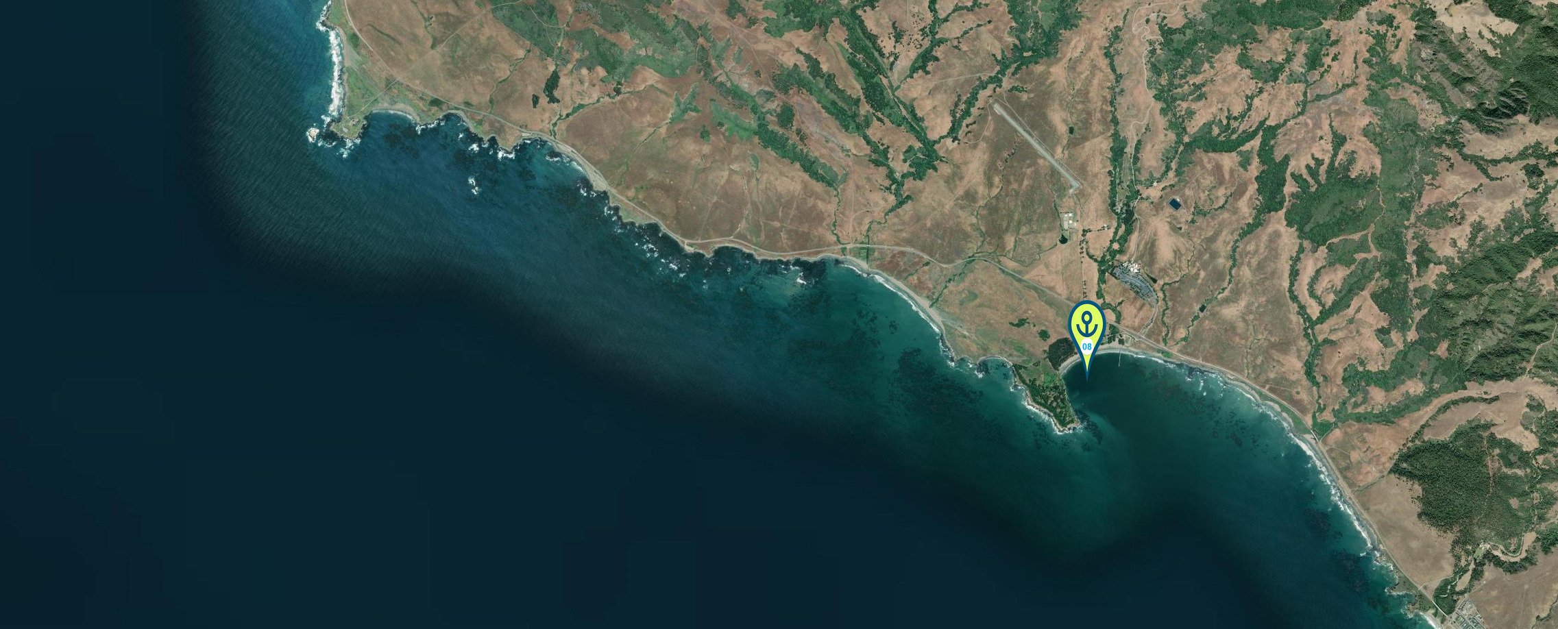
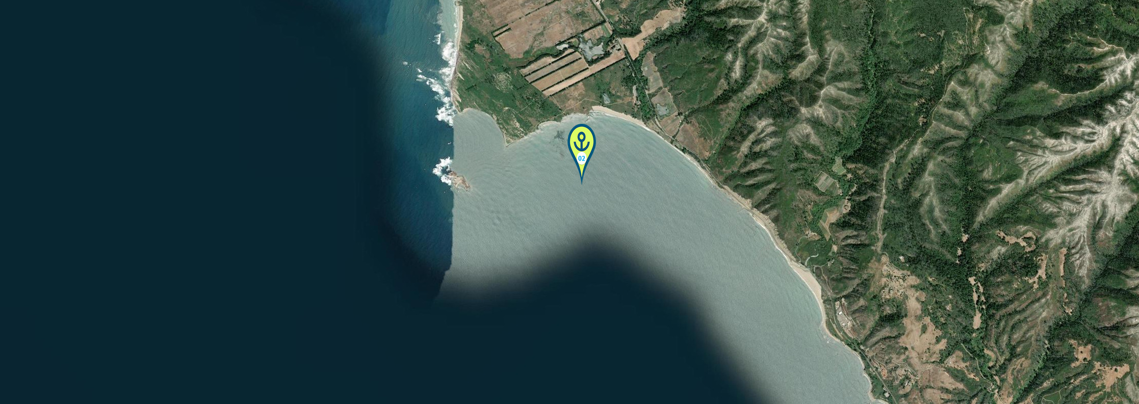
8. San Simeon Bay
• Location: 35° 38.3781’N 121° 11.5271′ W ~ 25′
• Notes: A fair-weather anchorage with some protection from NW swell. Good rest point between Monterey and Morro Bay.Stay 1/2 nm off San Simeon Point when entering as there is a kelp bed
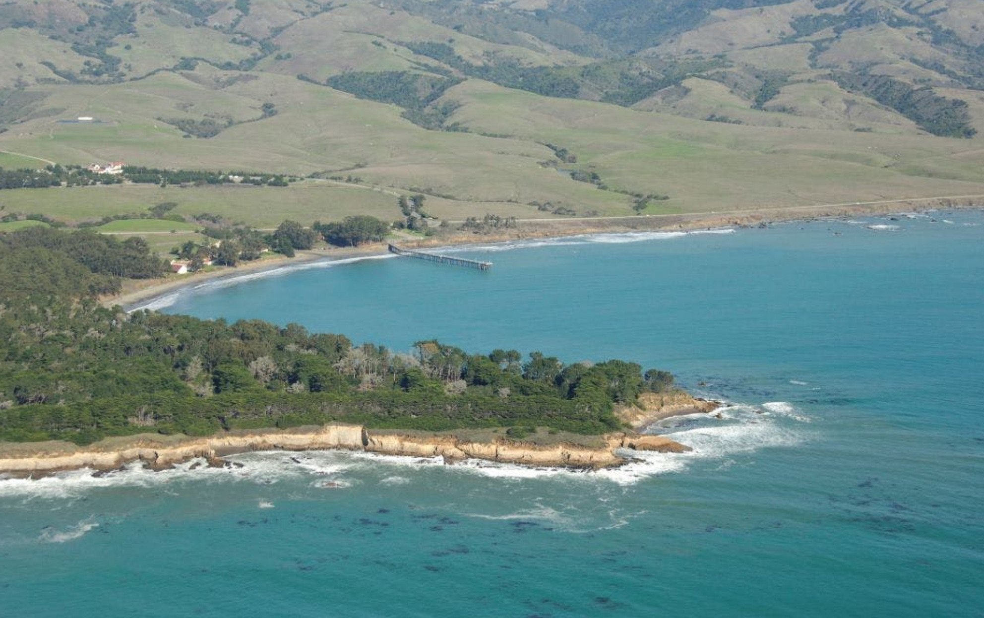

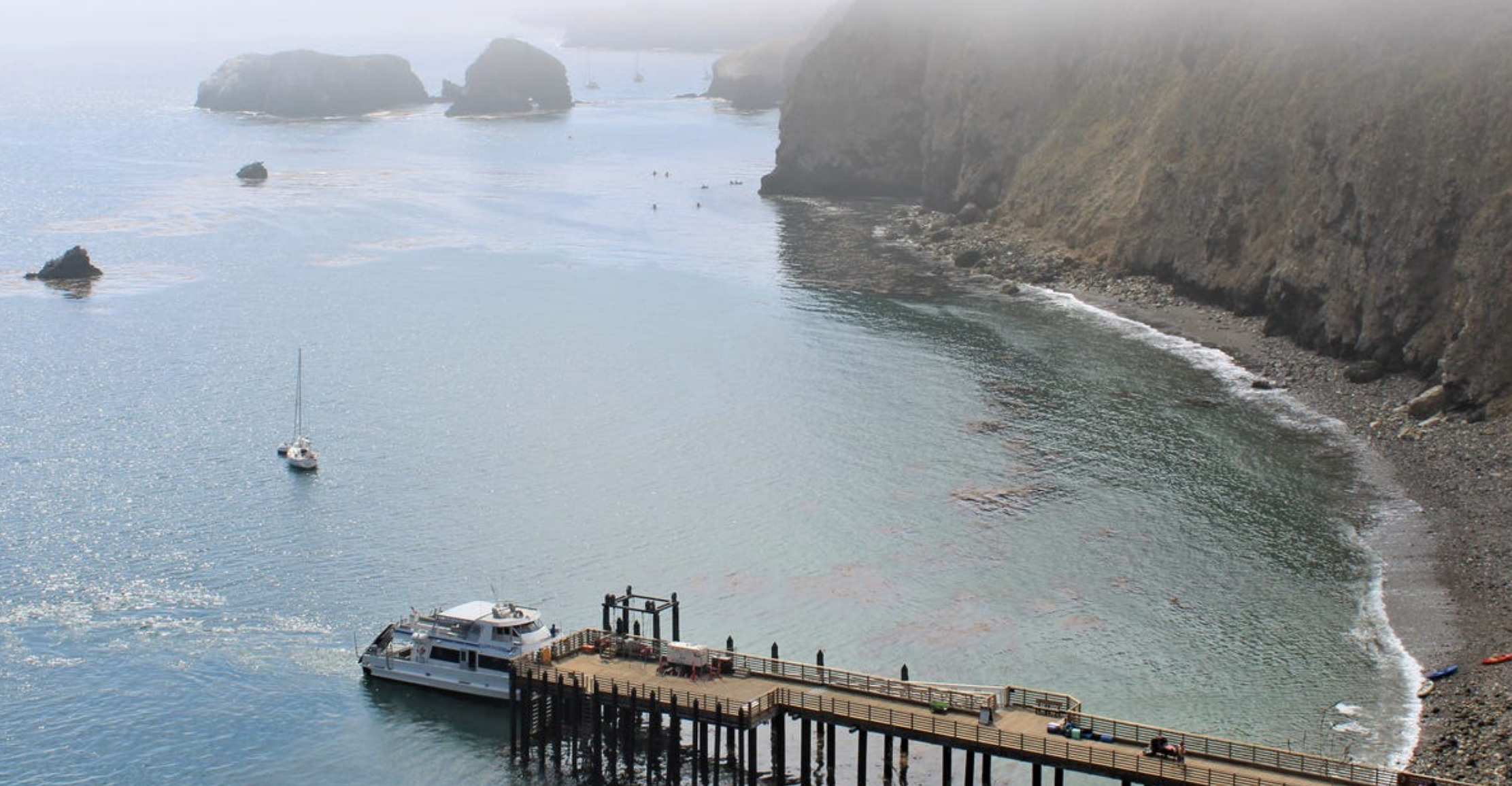
9. Morro Bay – wait for weather window to get around point Conception
• Location: 35°22.0625’N 120° 51.3813′ W
• Notes: Protected and popular stop. Narrow entrance channel with breaking waves in swell—check bar conditions. Good anchoring in the estuary. Wait for Weather window
10 Port San Luis (Avila Beach)
• Location: 35° 10.3471 ‘N 120° 44.2539’ W
• Notes: Wide open bay with many moorings between the westerly and the middle pier. and good anchorage in settled weather. Swell can make it uncomfortable.Protected anchorage Another spot to wait for weather windows around Point Conception.

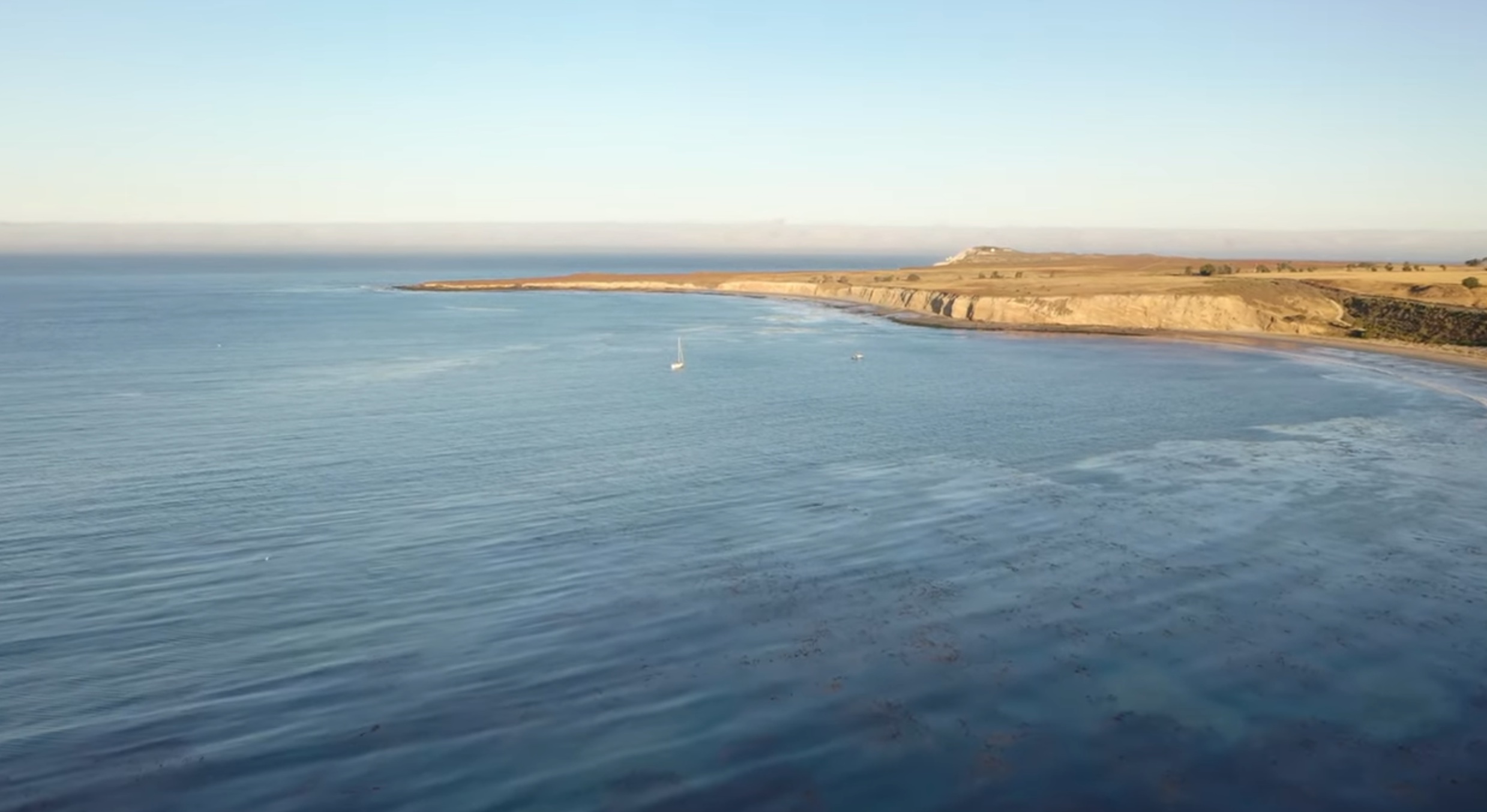
11. Cojo Anchorage (Point Conception)
• Location: 34°27.300’N 120°27.600’W
• Notes: Crucial staging anchorage for rounding Point Conception. Sheltered in NW winds but exposed to south. Anchor behind the point in sandy bottom.
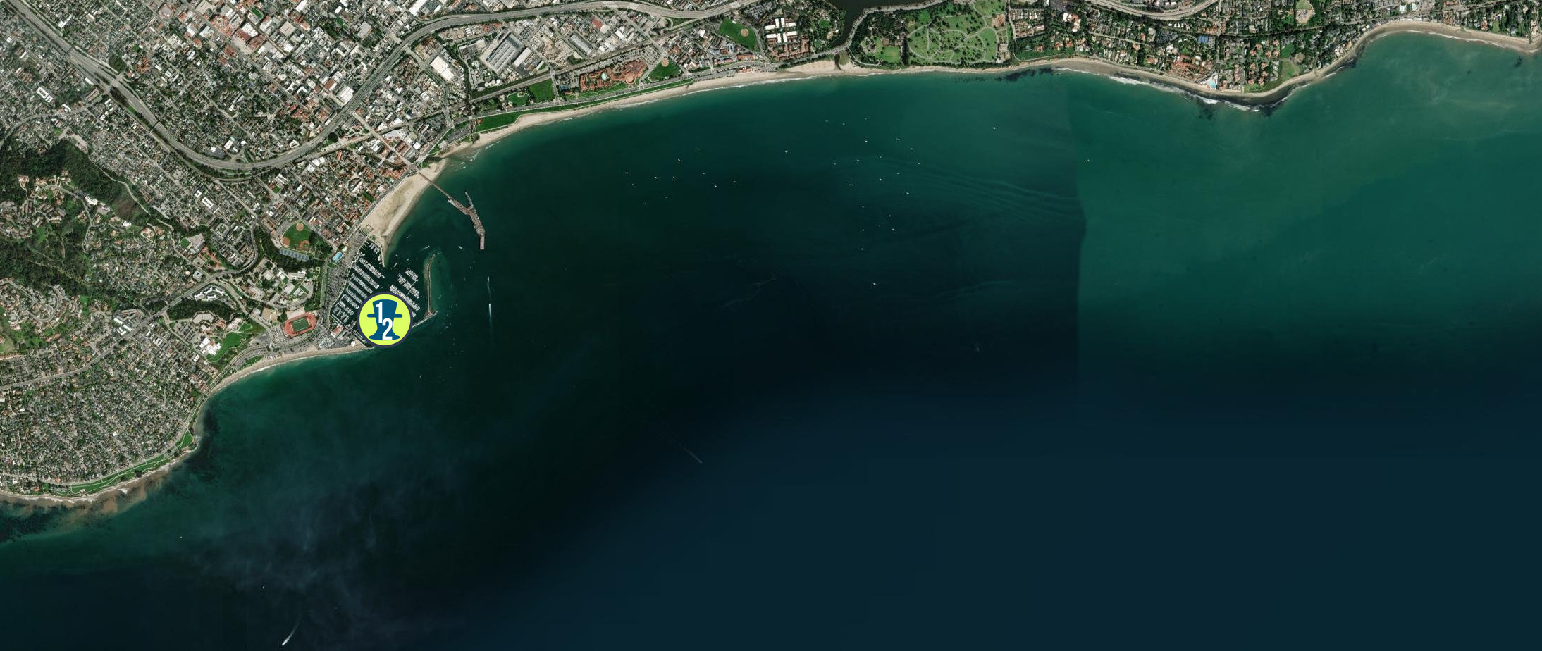
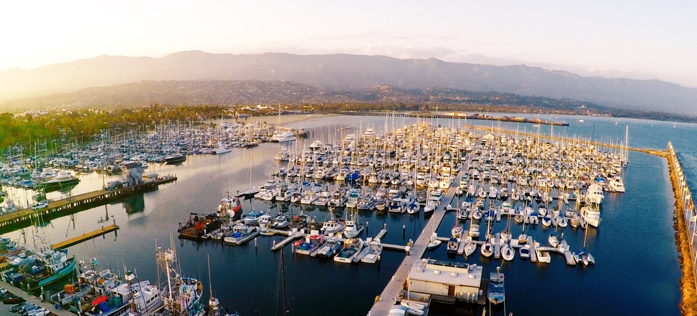
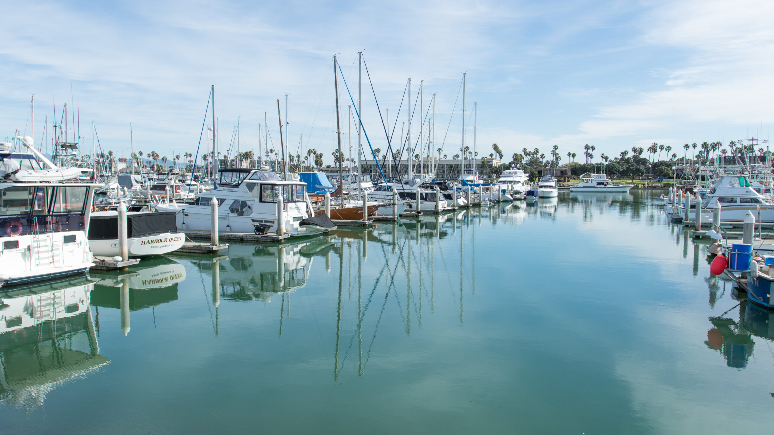
12. Santa Barbara marina has transient slips up to 2 weeks
• Location: 34°24.550’N 119°41.900’W
• Notes: You can anchor outside the breakwater or go into the marina. Good protection and amenities.
Channel Islands
• Key Spots:
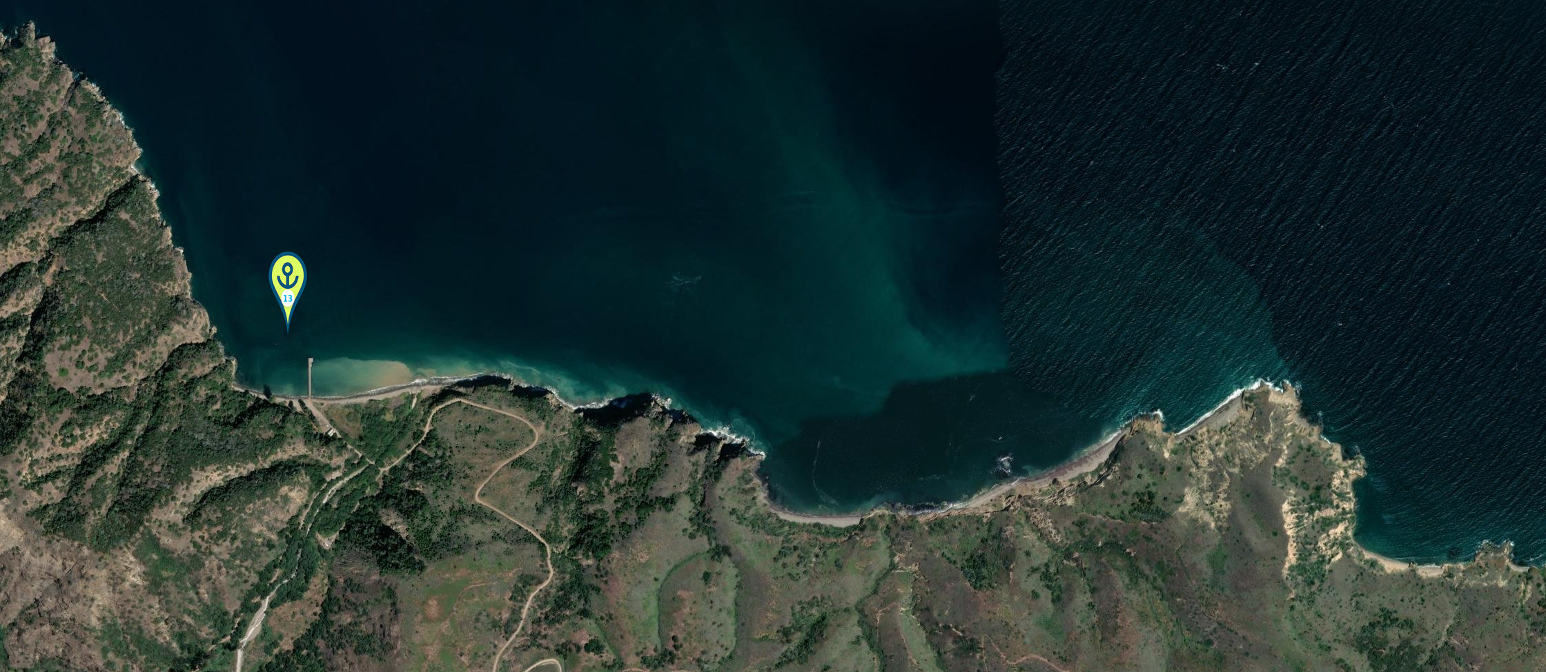
13. Prisoners Harbor (Santa Cruz Island) – 34°01.230’N 119°41.770’W
14. Smugglers Cove (Santa Cruz Island) – 33°59.700’N 119°29.800’W
15. Scorpion Anchorage – exposed but beautiful
• Notes: National Park territory with rugged anchorages. Worth detouring for if weather permits.
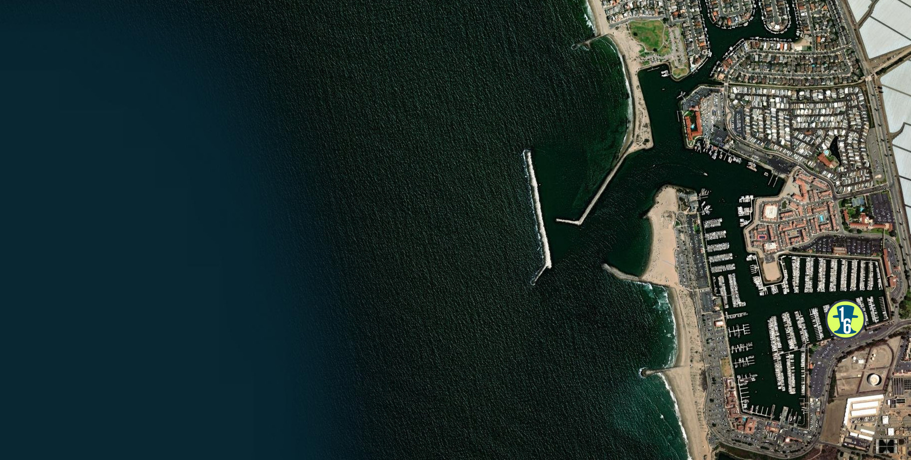
16. Safe Harbor Ventura Isle
• Location: 34° 14.7′ N 119° 15.595′ W
• Notes: Full-service marinas with limited anchoring. Protected
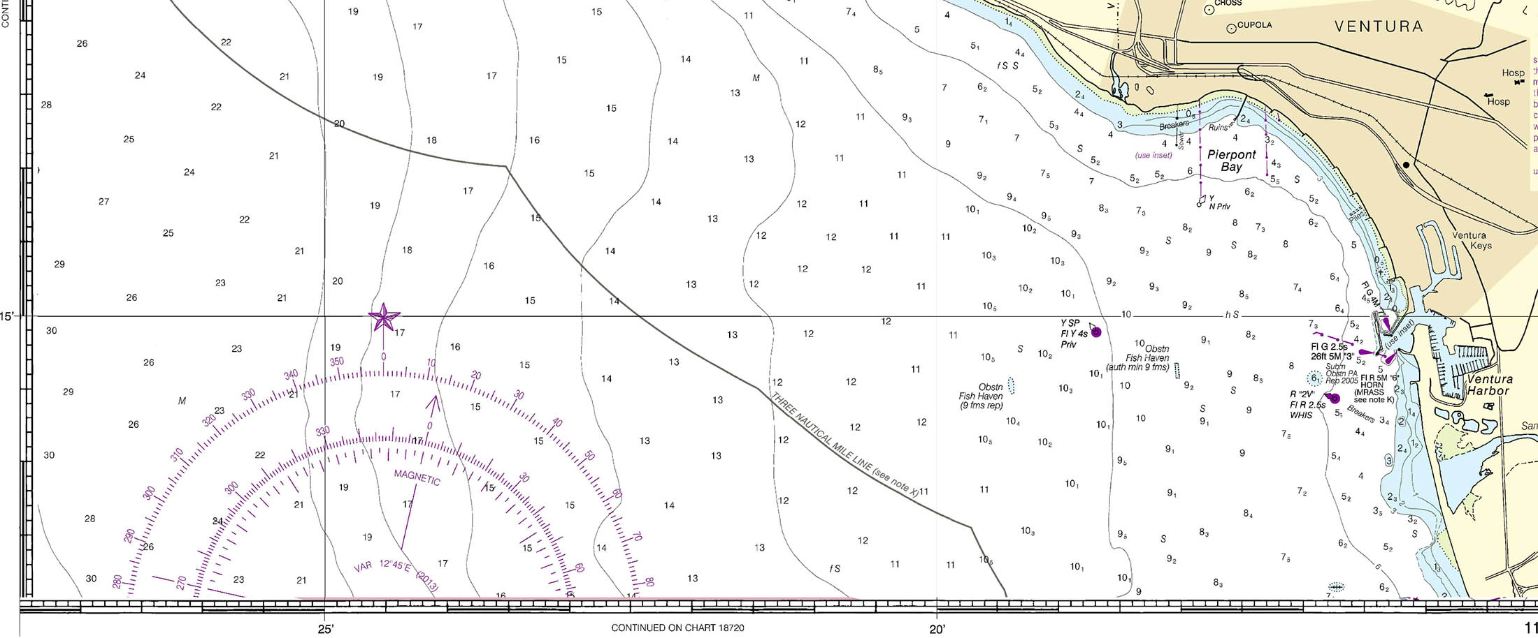
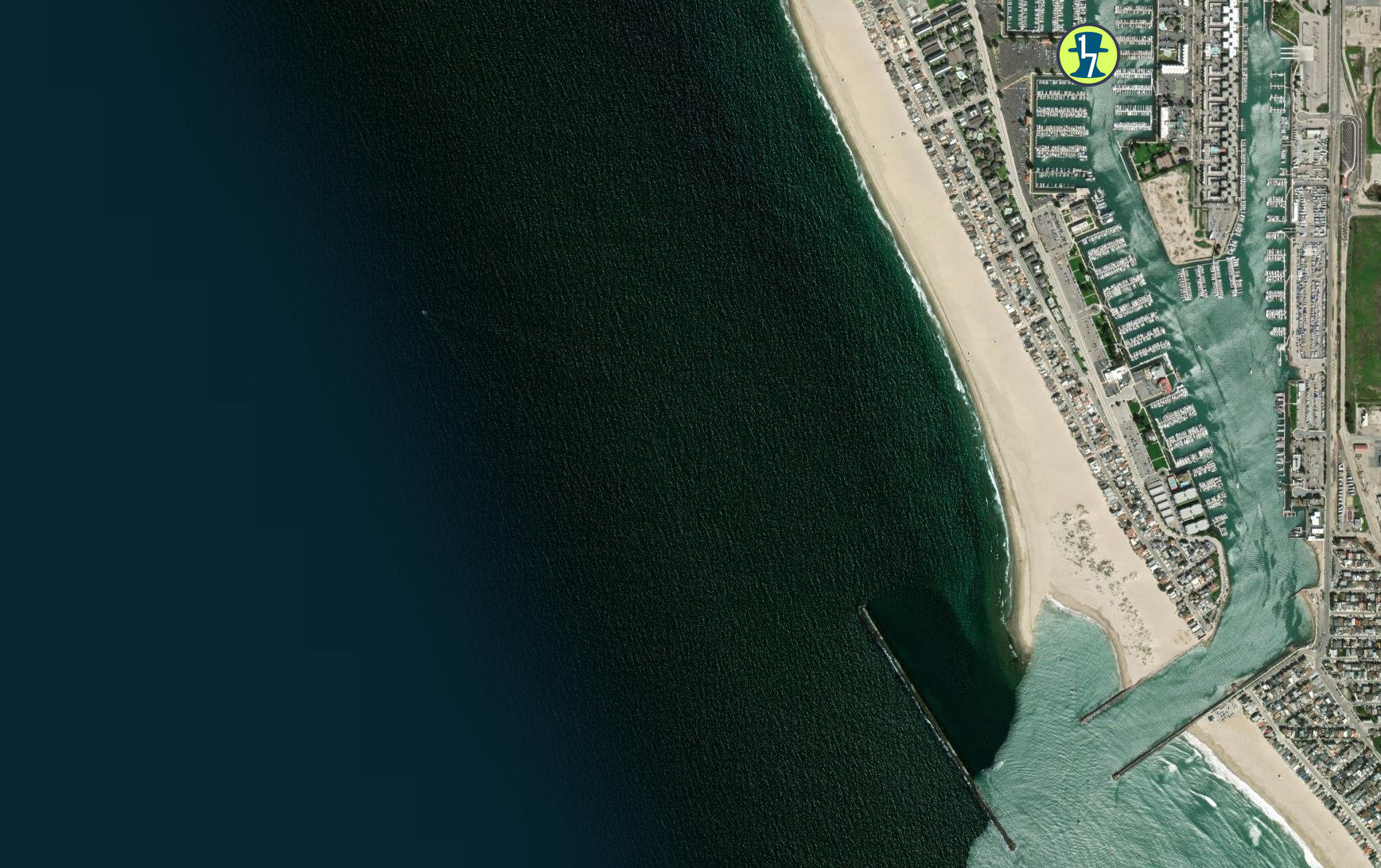
17) VINATGE MARINA
• Location:34° 10.2466′ N 119° 13.6883′ W
• Notes: Full-service marinas with limited anchoring. Protected

18. Marina del Rey – easy dock access to Trader Joe’s
• Location: 33°58.700’N 118°27.400’W
• Notes: Mostly marina slips, but limited anchoring space in the basin. Good provisioning stop.

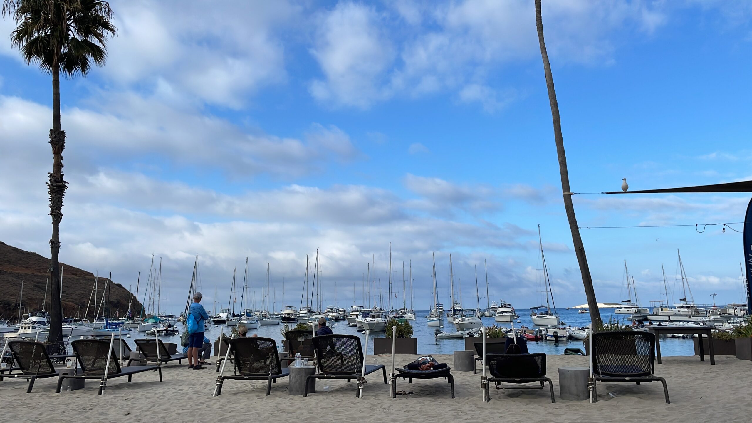
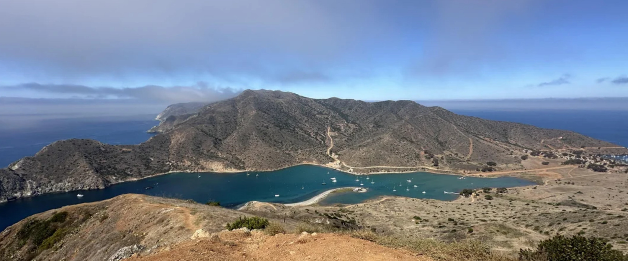
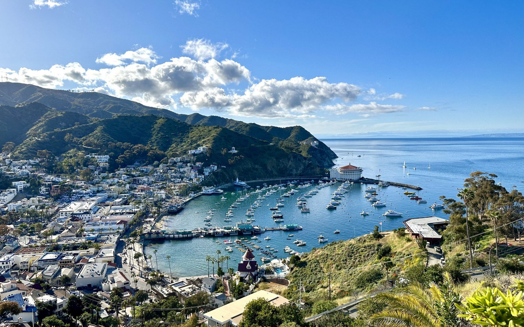
Catalina Island (Highly Recommended)
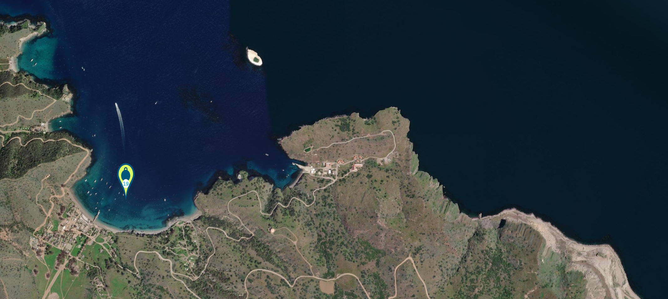
19. Two Harbors (Isthmus Cove) –33°26’34.9″N 118°29’45.4″W : Mooring balls only or anchor in nearby coves ( up to 70′ deep )

Catalina Island
20. Cat Harbor back side of Catalina Island in case of a Santa Ana wind 33°25’56.9″N 118°30’17.1″W
Catalina Island
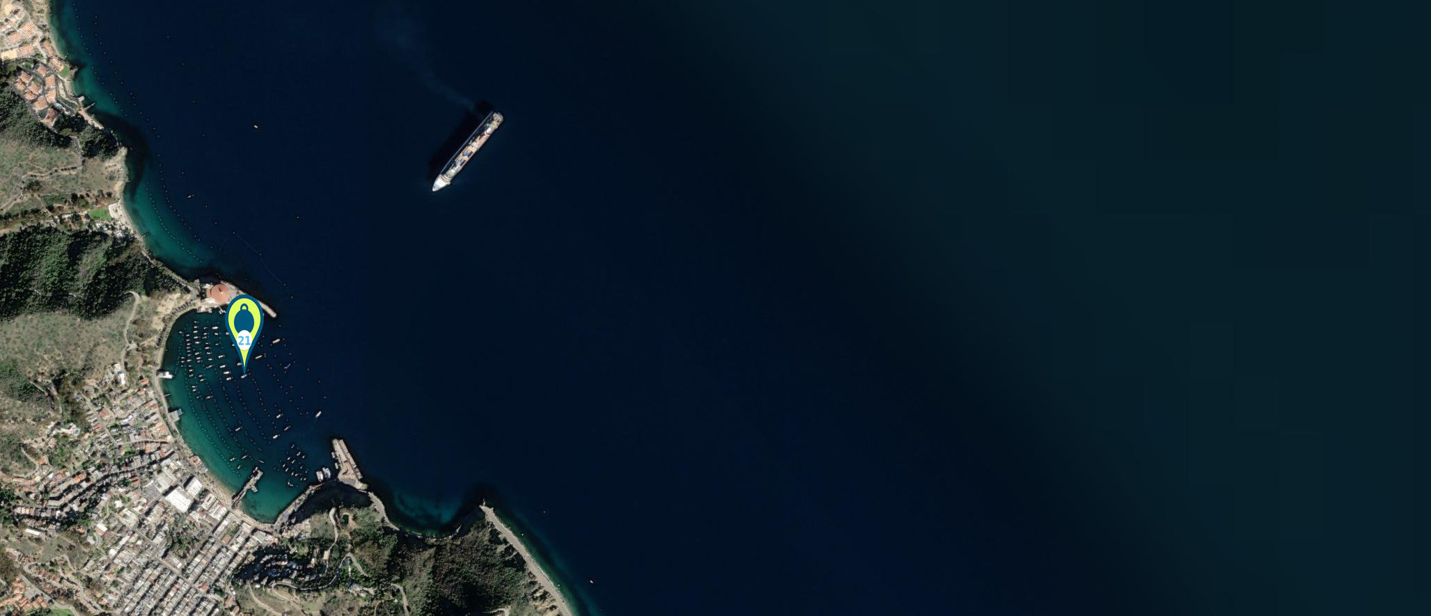
21. Avalon Harbor – 33°20’48.5″N 118°19’29.3″W : Mooring balls BUSY PORT TOURIST PORT
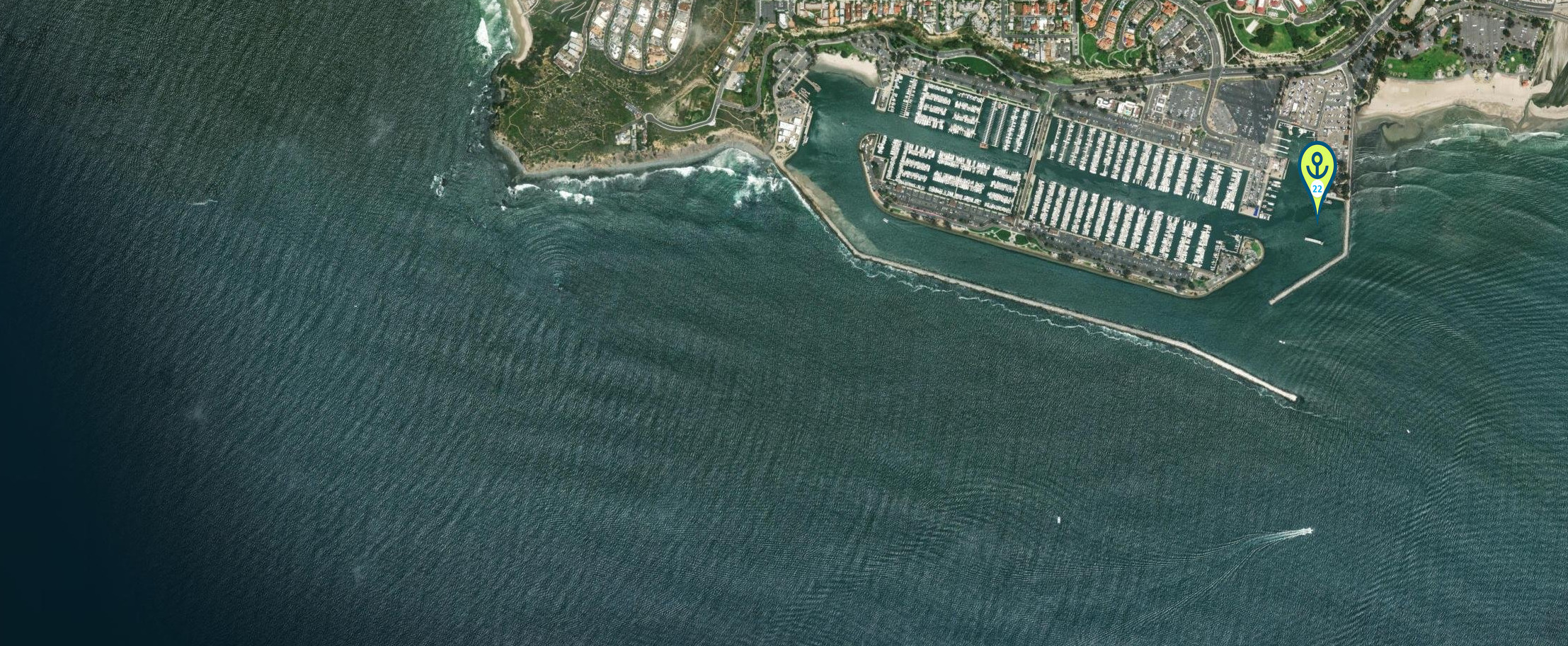
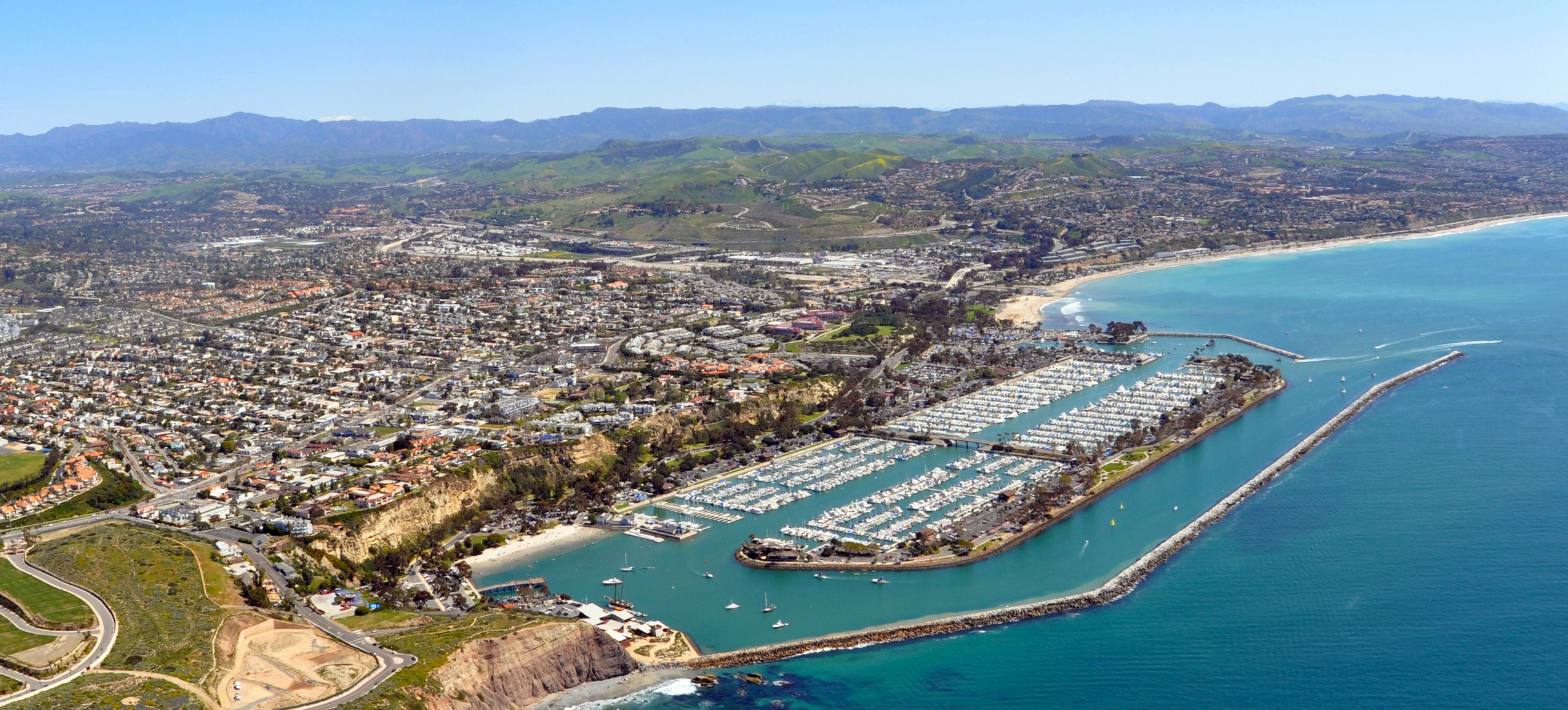
22. Dana Point Harbor
Location 33°27’31.5″N 117°41’26.6″W
Several Marinas and a breakwater

23. Oceanside Harbor
• Location: 33°12’29.9″N 117°23’48.4″W
• Notes: Limited guest space and anchoring. Good weather stop if space allows.


24. Mariners Basin – Mission Bay – San Diego North
Location 32°45.81′ N 117°14.865′ W
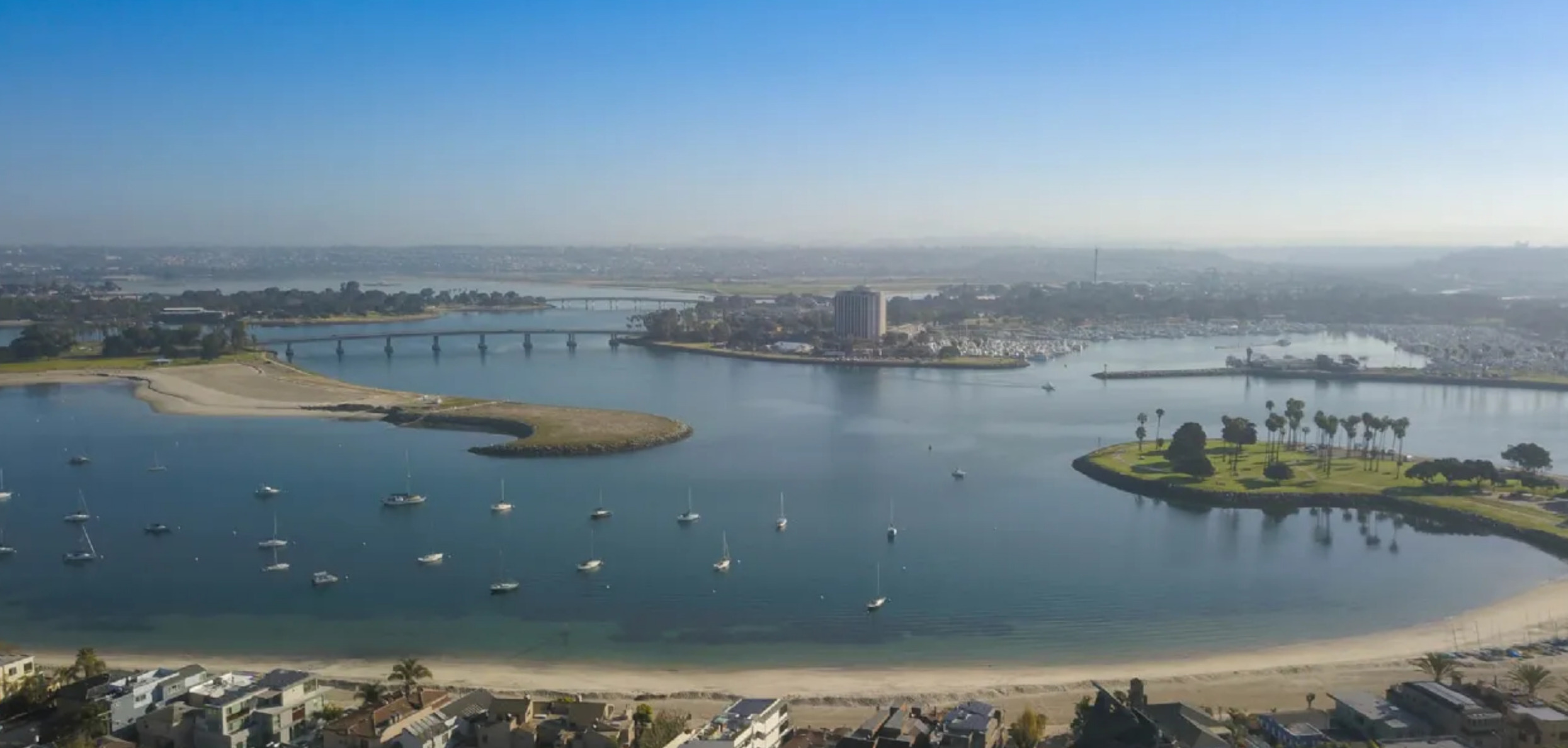
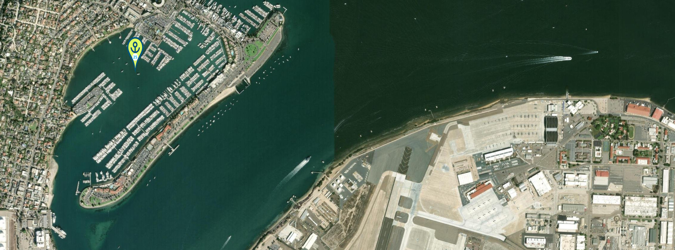
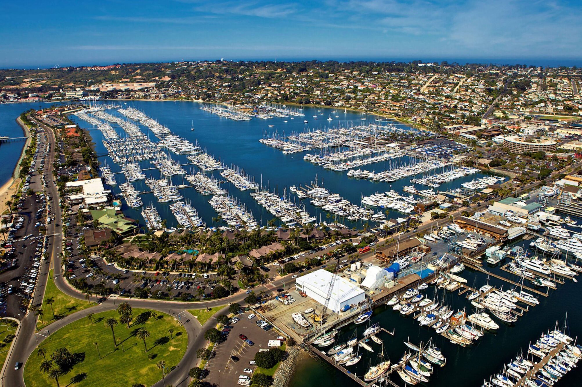
25. San Diego Bay Shelter Island
• Location: 32.716231, -117.230849
• Notes: Limited anchorage in Shelter bay 10 day limit
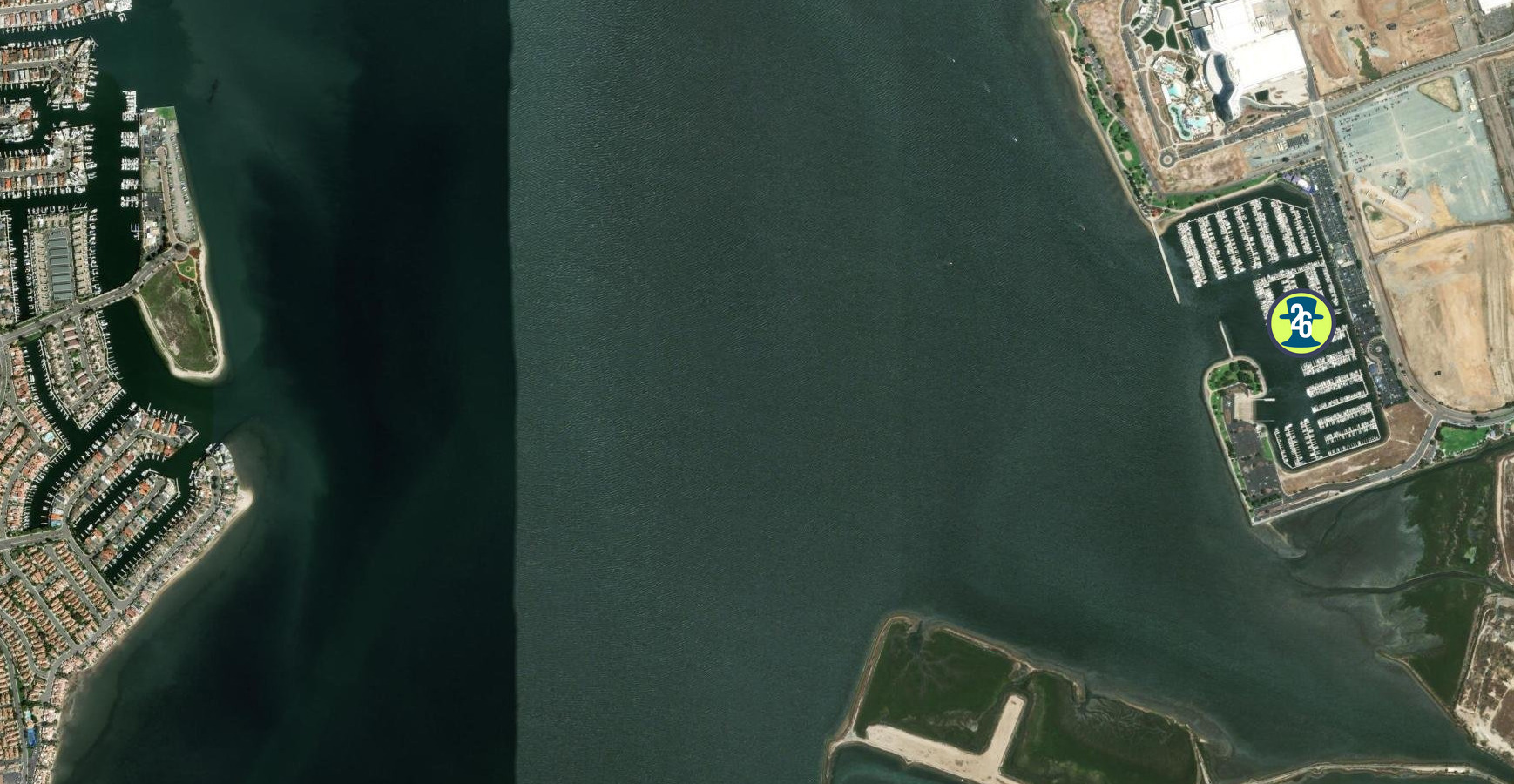
26. Safe Harbor South Bay
• Location: 32°37’17.9″N 117°06’07.6″W
• Every October we have the Cruising Seminars here in October
https://oceanposse.com/events/san-diego-seminar-series/


People'ing in the Americas
THE DISCOVERY OF THE LANDMASS OF THE MODERN AMERICAS did not begin with Christopher Columbus. The most long-standing and widely held theory has been that people entered the Americas in the north at the tail end of the last ice age some 10-15,000 years ago and began to settle across the land. This long standing theory holds that homo sapiens came across the Bering Straight on a now extinct land bridge from Asia. However, recent finding across the Americas are questioning this theory and proposing other theories. Interestingly, the study of Home Sapien migration through science, archeology, geneology and more continues to uncover more and more clues that cloud the picture of how and when homo sapiens populated the Americas more than they are shedding light on the mystery. Basically, people came overland by foot or people came by water from the east or the west. Experts have and continue to piece together the past with new findings and new ideas, yet sometimes the mystery just gets bigger. Regarding the 'by water theory from the west' according to Megan Gannon from Sapiens.org,
"According to this coastal migration theory, some 16,000 years ago the ice had retreated from the coastlines of the Pacific Northwest, such that seafaring people could take advantage of coastal resources like kelp forests to navigate all the way down the shores of California, eventually reaching sites like Monte Verde in Chile.
Proving the coastal theory is tricky. No wooden boats from that era have been found along the shore. The earliest campsites along the ancient Pacific coastline may be lost for good due to erosion and sea level rise. Yet scholars have some clues that people were living along the Pacific coast, including the footprints at Calvert Island.
Evidence of human habitation from at least 13,000 years ago on the Channel Islands in California suggests that people had the skills to build boats and reach these land masses, which were islands even then. In the last 15 years, archaeologists at Cedros Island off the coast of Baja California in Mexico have found traces of a nearly 13,000-year-old settlement. Some archaeologists, such as Loren Davis of Oregon State University, are turning to methods such as coring—removing of a long column of soil—to search for hints of now-underwater prehistoric sites along the Pacific continental shelf."
*NOTE: Cedros Island is on the southbounders route down the Pacific side of the Baja Peninsula. Multiple anchorages can be found. The fall is often a good time to use the southern Anchorage: https://goodnautical.com/mexico-pacific/anchorage/isla-cedros-s

Nonetheless, while their daily life was not recorded or documented as ours it today, humans were in the Americas for likely over 10,000 years before the first life-changing contact with Europeans occurred in the end of the 15th century. A that time the Americas were the home to more than 50 million, perhaps as many as 75 million highly evolved communities of people. These ancient civilizations had experienced many changes and many catastrophes during their long history in the Americas, yet it seems certain that none of these experiences was as tragically transforming as the arrival of Europeans. In the long term, European settlers came to dominate most areas of the Americas. But even in the short term—in the first violent years of Spanish and Portuguese exploration and conquest—the impact of the new arrivals was profound. Battles between Natives and Europeans in the Americas continued but there were also many other interactions through which these very different civilizations shaped one another, learned from one another, and changed each other permanently and profoundly.

Europeans were almost entirely unaware of the existence of the Americas before the fifteenth century. A few early wanderers like Leif Eriksson, an eleventh-century Norse seaman, and perhaps others—had glimpsed parts of the New World and had demonstrated that Europeans were capable of crossing the ocean to reach it. But even if their discoveries had become common knowledge (and they had not), there would have been little incentive for others to follow. Europe in the middle ages (roughly 500– 1500 A.D.) was not an adventurous civilization. Europe was divided into innumerable small duchies and kingdoms, its outlook was overwhelmingly provincial. Subsistence agriculture predominated, and commerce was limited; few merchants looked beyond the boundaries of their own regions. The Roman Catholic Church exercised a measure of spiritual authority over most of the continent, and the Holy Roman Empire provided at least a nominal political center. Even so, real power was for the most part widely dispersed; only rarely could a single leader launch a great venture. Gradually, however, conditions in Europe changed so that by the late fifteenth century, interest in overseas exploration had grown.
15th Century: WHY EUROPEANS LOOKED WESTWARD
Two important and related changes provided the first incentive for Europeans to look toward new lands. One was a result of the significant population growth in fifteenth-century Europe following the Black Death. The Black death was a catastrophic epidemic of the bubonic plague that began in Constantinople in 1347, which had decimated Europe, killing (according to some estimates) more than a third of the people of the continent and debilitating its already limited economy. By the early 1500's the population had rebounded. With that growth came a rise in land values, a re-awakening of commerce, and a general increase in prosperity. Affluent landlords became eager to purchase goods from distant regions, and a new merchant class emerged to meet their demand. As trade increased, and as advances in navigation and shipbuilding made long-distance sea travel more feasible, interest in developing new markets, finding new products, and opening new trade routes rapidly increased. Paralleling this rise of commerce in Europe, and in part responsible for it, was the rise of new governments that were more united and powerful than the feeble political entities of the feudal past. In the western areas of Europe, the authority of the distant pope and the even more distant Holy Roman Emperor was necessarily weak. As a result, strong new monarchs emerged there and created centralized nation-states, with national courts, national armies, and—perhaps most important—national tax systems. As these ambitious kings and queens consolidated their power and increased their wealth, they became eager to enhance the commercial growth of their nations. Ever since the early fourteenth century, when Marco Polo and other adventurers had returned from Asia bearingexotic goods (spices, fabrics, dyes) and even more exotic tales, Europeans who hoped for commercial glory had dreamed, above all, of trade with the East. For two centuries, that trade had been limited by the difficulties of the long, arduous overland journey to the Asian courts. But in the fourteenth century, as the maritime capabilities of several western European societies increased and as Muslim societies seized control of the eastern routes to Asia, there began to be serious talk of finding a faster, safer sea route to Asia. Such dreams gradually found a receptive audience in the courts of the new monarchs. By the late fifteenth century, some of them were ready to finance daring voyages of exploration. The first to do so were the Portuguese. They were the preeminent maritime power in the fifteenth century, in large part because of the work of one man, Prince Henry the Navigator. Henry’s own principal interest was not in finding a sea route to Asia, but in exploring the western coast of Africa. He dreamed of establishing a Christian empire there to aid in his country’s wars against the Moors of northern Africa; and he hoped to find new stores of gold.


The explorations Prince Henry began did not fulfill his own hopes and yet, they ultimately led farther than he had dreamed. Some of Henry’s mariners went as far south as Cape Verde, on Africa’s west coast. In 1486 (six years after Henry’s death), Bartholomeu Dias rounded the southern tip of Africa (the Cape of Good Hope); and in 1497–1498 Vasco da Gama of Portugal proceeded all the way around the cape to India. In 1500, the next fleet bound for India, under the command of Pedro Cabral, was blown westward off its southerly course and happened upon the coast of Brazil.
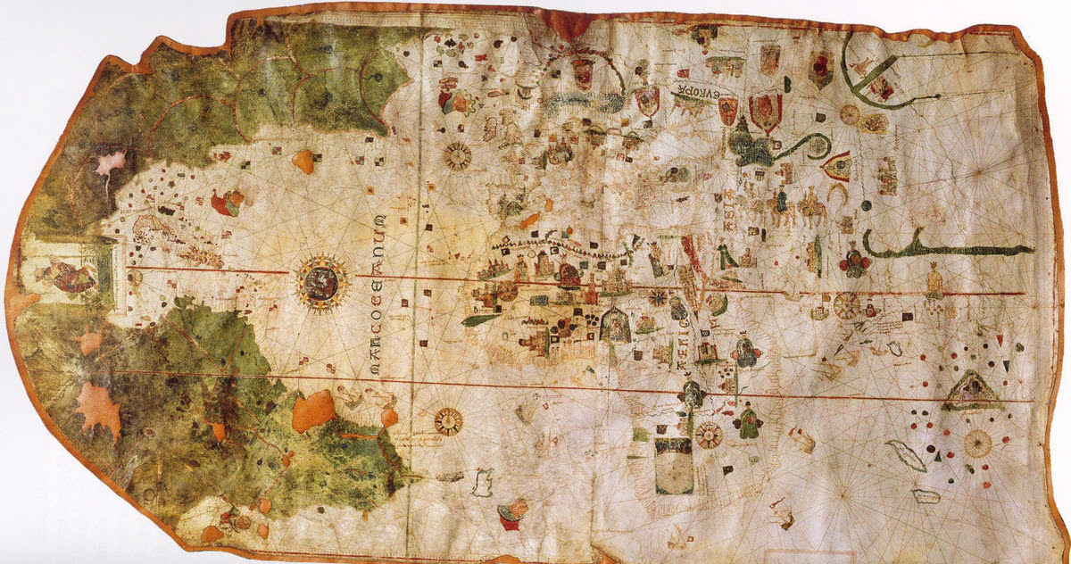
But by then another man, in the service of another country, who had already encountered the New World. Christopher Columbus, who was born and reared in Genoa, Italy, obtained most of his early seafaring experience in the service of the Portuguese. As a young man, he became intrigued with the possibility, already under discussion in many seafaring circles, of reaching Asia by going not east but west. Columbus’s hopes rested on several basic misconceptions. He believed that the world was far smaller than it actually is. He also believed that the Asian continent extended farther eastward than it actually does. He assumed, therefore, that the Atlantic was narrow enough to be crossed on a relatively brief voyage. It did not occur to him that anything lay to the west between Europe and Asia. Columbus failed to win support for his plan in Portugal, so he turned to Spain. The Spaniards were not yet as advanced a maritime people as the Portuguese, but they were at least as energetic and ambitious. In the fifteenth century, the marriage of Spain’s two most powerful regional rulers, Ferdinand of Aragon and Isabella of Castile, had produced the strongest monarchy in Europe. Like other young monarchies, it soon grew eager to demonstrate its strength by sponsoring new commercial ventures. Columbus appealed to Queen Isabella for support for his proposed westward voyage. In 1492, having consolidated the monarchy’s position within Spain itself, Isabella agreed to Columbus’s request. Commanding ninety men and three ships—the Niña, the Pinta, and the Santa María — Columbus left Spain in August 1492 and sailed west into the Atlantic on what he thought was a straight course for Japan. Ten weeks later, he sighted land and assumed he had reached his target. In fact, he had landed on an island in the Bahamas. When he pushed on and encountered Cuba, he assumed he had reached China. He returned to Spain in triumph, bringing with him several captured natives as evidence of his achievement.

(He called the people he found in what was to him The New World' "Indians" because he believed they were from the East Indies in the Pacific.) But Columbus had not, of course, encountered the court of the great khan in China or the fabled wealth of the Indies. A year later, therefore, he tried again, this time with a much larger expedition. As before, he headed into the Caribbean, discovering several other islands and leaving a small and short-lived colony on Hispaniola. On a third voyage, in 1498, he finally reached the mainland and cruised along the northern coast of South America. When he passed the mouth of the Orinoco River (in present-day Venezuela), he concluded for the first time that what he had discovered was not in fact an island off the coast of China, as he had assumed, but a separate continent; such a large freshwater stream, he realized, could emerge only from a large body of land. Still, he remained convinced that Asia was only a short distance away. And although he failed in his efforts to sail around the northeastern coast of South America to the Indies (he was blocked by the Isthmus of Panama), he returned to Spain believing that he had explored at least the fringes of the Far East. He continued to believe that until he died. Columbus’s celebrated accomplishments made him a popular hero for a time, but he ended his life in obscurity. When Europeans at last gave a name to the New World, they ignored him. The distinction went instead to a Florentine merchant, Amerigo Vespucci, a member of a later Portuguese expedition to the New World who wrote a series of vivid descriptions of the lands he visited and who recognized the Americas as new continents. Columbus has been celebrated for centuries as the “Admiral of the Ocean Sea” (a title he struggled to have officially bestowed on him during his lifetime) and as a representative of the new, secular, scientific impulses of Renaissance Europe. Columbus was also a deeply religious man, even something of a mystic His voyages were inspired as much by his conviction that he was fulfilling a divine mission as by his interest in geography and trade. A strong believer in biblical prophecies, he came to see himself as a man destined to advance the coming of the millennium. “God made me the messenger of the new heaven and the new earth,” he wrote near the end of his life, “and he showed me the spot where to find it.”

A similar combination of worldly and religious passions lay behind many subsequent efforts at exploration and settlement of the New World. Partly as a result of Columbus’s initiative, Spain began to devote greater resources and energy to maritime exploration and gradually replaced Portugal as the leading seafaring nation. The Spaniard Vasco de Balboa fought his way across the Isthmus of Panama in 1513 and became the first known European to gaze westward upon the great ocean that separated America from China and the Indies. Seeking access to that ocean, Ferdinand Magellan, a Portuguese in the employ of the Spanish, found the strait that now bears his name at the southern end of South America, struggled through the stormy narrows and into the ocean (so calm by contrast that he christened it the “Pacific”), then proceeded to the Philippines. There Magellan died in a conflict with the natives, but his expedition went on to complete the first known circumnavigation of the globe (1519–1522). By 1550, Spaniards had explored the coasts of North America as far north as Oregon in the west and Labrador in the east, as well as some of the interior regions of the continent.
While Humans as a species have been in the Americas for well over ten thousand years, the effect of European explorers upon their arrival in the late 1400's to the mid 1500's was staggering and swift. While Christopher Columbus was not the first person to come to the Americas, he and his compatriots put a proverbial stake in the ground and claimed their discovery for their crown, their nation and the world. Prior to this, the world outside of people's immediate environment had previously been so obscure. European explorers came from their distant land, charting the ocean along the way, and encountered both lands and people they did not know existed and yet as a species humans, homo sapiens had existed on this round planet for hundreds of thousands of years. How had they spread out so far and wide? How had they become so isolated from one another? How had their stories been shared and lost?
Piecing together the past through the lens of today, available historic records, and scientific findings is no easy task. In fact, it leads one to the Paradox of Knowledge that Albert Einsein described with “The more I learn, the more I realize how much I don’t know.”