🌪️ Cyclone Holes in the South Pacific
Initial List – Version 1..0.1 (expanded over time)
NOTE: Cyclone holes are never guaranteed safe — captains must always monitor weather systems and use discretion. and stay onboard
-
-
🇫🇯 Fiji
-
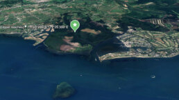
Mangrove Creek, Vuda Lagoon
📍 17°40.305′ S 177°23.690′ E
Sheltered mangrove-lined creek near Vuda Marina.
Excellent holding in mud, surrounded by trees, minimal fetch.
Marina access nearby; heavily used by locals during storms.
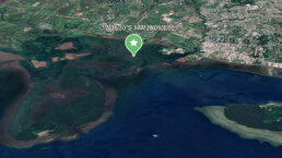
Nadi River (Upper reaches)
📍 17°45.200′ S 177°25.300′ E
Deep upriver option past the Nadi town bridge.
Mud bottom, mangrove protection, avoid during heavy rain due to runoff and debris.
Tight anchoring space, but used by locals during past systems with up to 29 yachts.
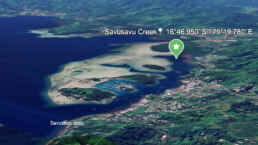
Savusavu Creek
📍 16°46.950′ S 179°19.780′ E
Behind Cousteau Resort and Waitui Marina.
Sheltered from most directions, silt/mud bottom.
Easy access to town, but prone to river flooding if cyclone is rain-heavy.
-
-
🇹🇴 Tonga
-
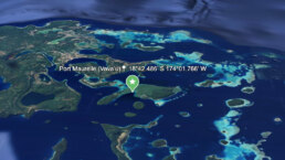
Port Maurelle (Vavaʻu)
📍 18°42.486′ S 174°01.766′ W
Good cyclone hole for smaller systems.
Surrounded by high hills, decent holding.
Limited space; better suited for early arrivals or smaller yachts.
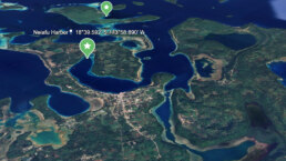
Neiafu Harbor
📍 18°39.592′ S 173°58.890′ W
Deep protected bay with marina moorings and anchorage.
Cyclone-rated moorings available.
Inland geography helps break wind, but overcrowding can be an issue.
-
-
🇻🇺 Vanuatu
-
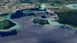
Port Vila (Paray Bay / Malapoa)
📍 17°44.930′ S 168°18.700′ E
Cyclone-rated moorings by Yachting World.
Well-protected from swell, though exposure to strong gusts possible.
Popular with cruisers seeking shelter from early cyclones.
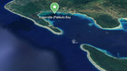
Luganville (Palikulo Bay)
📍 15°29.760′ S 167°11.700′ E
Well-protected east-facing bay, good holding, used during past cyclones.
Limited facilities, but remote and quiet.
Silt/mud bottom with mangrove perimeter.
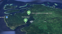
Port Sandwich 📍( Malekula ) 16°28.1783′ S 167°46.7966′ E
very deep bay ( 5 nm ) with lots of mangroves
muddy sandy bottom use mud flap dual anchor
sharks – do not swim a lot
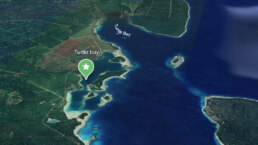
Turtle Bay 📍 ( Espiritu Santo East Coast ) 15°22’22.9″S 167°11’23.9″E
medium sandy bay inside double outer reef – good protection with some fetch
-
-
🇳🇨 New Caledonia
-
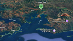
Baie de Prony (Bay of Prony)
22°21.400′ S 166°51.100′ E
Deep inlet with multiple coves and mangrove arms.
Excellent shelter options in Prony’s various branches (e.g. Baie du Carénage).
Prone to silting during prolonged rainfall.
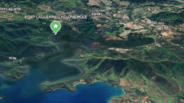
Port Bay Laguerre 📍 22° 08.5983′ S 166°19.9816′ “E
Mangrove lined river and small island basins
-
-
🇫🇷 French Polynesia
-
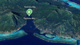
Baie d’Opunohu (Moʻorea)
📍 17°29.429′ S 149°51.994′ W
Deep and steep, but very protected.
Surrounded by lush ridgelines.
Holding can be variable; limited swing room.
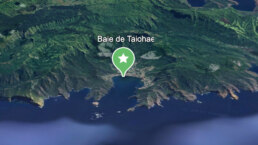
Baie de Taiohae (Nuku Hiva)
📍 8°54.812′ S 140°05.855′ W
Marquesas are out of traditional cyclone zone, but occasionally impacted.
Taiohae is a massive caldera, great shelter.
Surge can enter the bay, but wind protection is solid.
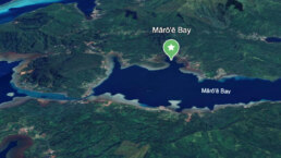
Mārō’ē Bay (Huahine
📍 16°44’57.9″S 151°00’11.8″W
Society Islands tucked in way up
-
🇦🇸 AMERICAN SAMOA
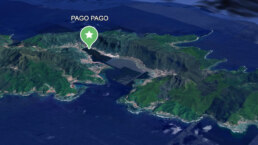
- Pago Pago Harbor 📍 14°16’25.3″S 170°41’14.1″W
-
🇳🇿 NEW ZEALAND
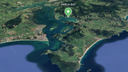
- Parua Bay 📍 1 35°46’35.0″S 174°27’23.3″E
When preparing to ride out a South Pacific cyclone, choosing the right bay or anchorage is critical. Cyclones rotate clockwise in the southern hemisphere, and the quadrant you’re in relative to the storm center dramatically impacts wind direction, wave setup, and surge. Here’s how to decide which sides to avoid and why:
❌ Bays to Avoid
1. Northern Quadrant (Especially Northeast)
• Why: This is the dangerous semicircle in a clockwise-rotating cyclone.
• Winds are strongest and combine with the cyclone’s forward movement.
• You’ll likely experience onshore winds, extreme wave setup, and high storm surge.
• Example: If a cyclone is approaching from the north or northwest, avoid north-facing bays.
2. East-Facing Bays
• In the southern hemisphere, the eastern side of the cyclone (NE and SE) often sees increasing pressure gradients and large, confused seas.
• These bays may offer poor protection from swell or surge, even if the winds are briefly offshore.
🌪️ HURRICANE & CYCLONE SEASON PREPARATION FOR YACHTS
A Mariner’s Guide to Riding Out the Storm or Clearing Its Path
When sailing vessels venture into hurricane latitudes, the season of tempests demands forethought, seamanship, and swift decision-making. Whether you’re moored in a hurricane-rated marina, nestled in a cyclone hole, or riding to anchor, preparation makes all the difference between survival and salvage.
⚓️ 1. MAKE FOR SAFE HAVEN EARLY
The greatest variable in any storm prep is your location. There is no substitute for securing your vessel well in advance. When tropical disturbances brew, time becomes tide.
Ideal Options:
• Haul Out: A hurricane cradle on land with proper tie-downs is safest. Seek yards with proven storm protocols.
• Mangrove Cyclone Hole: Natural protection from surge and wind, best when used with multiple anchor rodes spidered in all directions. – with a Mosquito mitigation plan.
• Hurricane-Rated Marina: Reinforced docks, floating pontoons, and staff who understand storm protocol.
Avoid:
• Open anchorages, exposed moorings, or poorly maintained slips.
• Relying solely on mooring balls of unknown quality.
⚠️ The time to relocate is days before the system turns deadly – not hours.
🪢 2. DOUBLE DOWN ON SECURING YOUR VESSEL
Once you’ve chosen your haven, the vessel must be made as storm-ready as possible. This is not the time for half-measures. Strip her down, double her lines, and prepare for 360° wrath.
Standing Orders:
• Strip topsides: Remove sails (main, headsail, stack packs), dodgers, biminis, solar panels (if possible), BBQs, jerry cans, paddleboards, and all loose deck gear.
• Secure below: Latch every cabinet, seal lockers, and remove perishables.
• Chafe protection: Apply to every critical line – think firehose sleeves, leather wraps, or sacrificial lines.
• Rig lines in opposing directions: Reduce the strain on any one cleat or bollard.
• Fenders: Deploy every one you own and source more if possible. Fender boards are invaluable when against pilings.
🧭 A good prep job makes the difference between a refit and a rum toast.
⚡️ 3. PROTECT SYSTEMS & POWER
Modern yachts are dependent on batteries, pumps, and electronics. Keep your electrical and bilge systems storm-hardened.
Power Prep:
• Fully charge batteries. If evacuating, disconnect and isolate bank terminals.
• Bilge pumps: Test auto and manual modes. Ensure backup pumps are operational.
• Secure fuel and water tanks: Full tanks reduce movement and condensation.
• Shut down non-essential circuits, seal panel with plastic wrap if leaving unattended.
🌧️ 4. SEAL THE HULL – INSIDE & OUT
Keep water where it belongs. Close all through-hulls not essential for bilge drainage.
• Tape hatches, vents, and companionways with waterproof tape or shrink wrap.
• Plug exhaust ports and intakes if engine is not in use.
• Inspect and reinforce portlights, skylights, and sliding hatches.
📜 5. INVENTORY & DOCUMENTATION
Prepare as if she’ll be inspected by insurance adjusters and salvors alike.
• Take photos of everything: standing rigging, electronics, interior, bilges.
• Store copies of insurance, registration, inventory lists, and maintenance records.
• Send cloud backups to shore-based contacts.
• Notify marina, neighbors, and your rally group of your prep and location.
🎒 6. PREPARE FOR ABANDON SHIP OR EVACUATION
Every captain must know when to stay and when to go. Once winds exceed 50 knots, you should be off the dock and ashore in shelter if your location allows.
Have Ready:
• Go-bag: Passport, cash, ID, medications, hard drive, emergency contacts.
• Dry bags for phones, backups, and radios.
• Evac plan: Know your route, shelters, and timing.
• Weather feeds: Follow multiple sources—NOAA, JTWC, Windy, and local VHF.
⚓️ When the barometer drops, don’t wait for permission – move.
✅ 7. HURRICANE PREP TIMELINE
Suggested Action Plan as Storms Approach
Time Before Landfall
Action
5 Days Out
Confirm safe haven; haul out if possible. Review insurance and secure plans.
4 Days Out
Strip canvas, remove or secure topside gear. Top off fuel, water, and battery banks.
3 Days Out
Begin final tie-downs, double lines, deploy chafe gear. Haul out or enter storm slip.
2 Days Out
Seal hatches, disconnect non-essentials, backup docs. Finalize evacuation plan.
1 Day Out
Abandon vessel if required. Shelter ashore with your go-bag. Monitor storm on handheld devices.

