
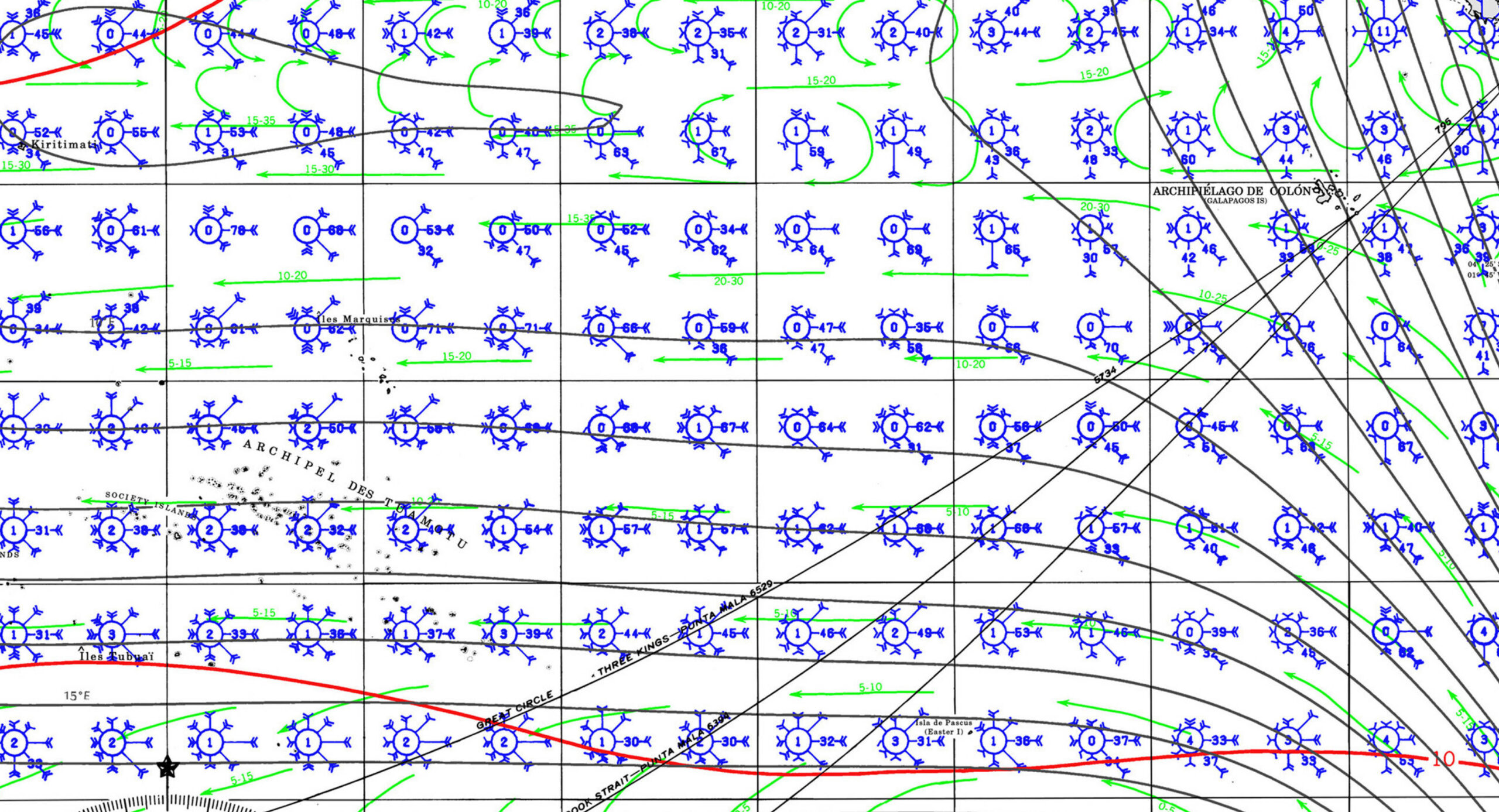
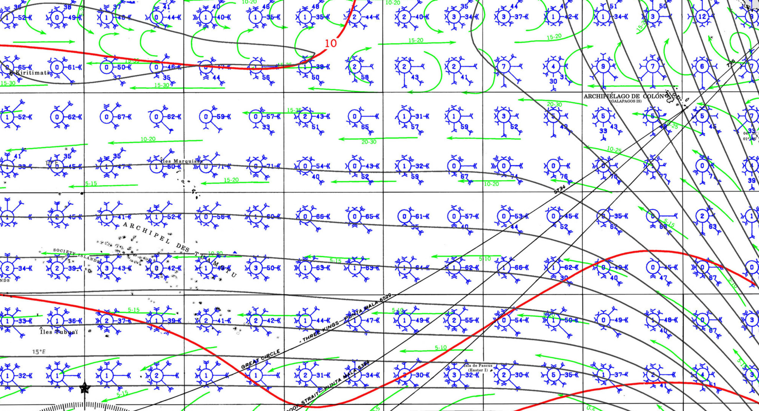
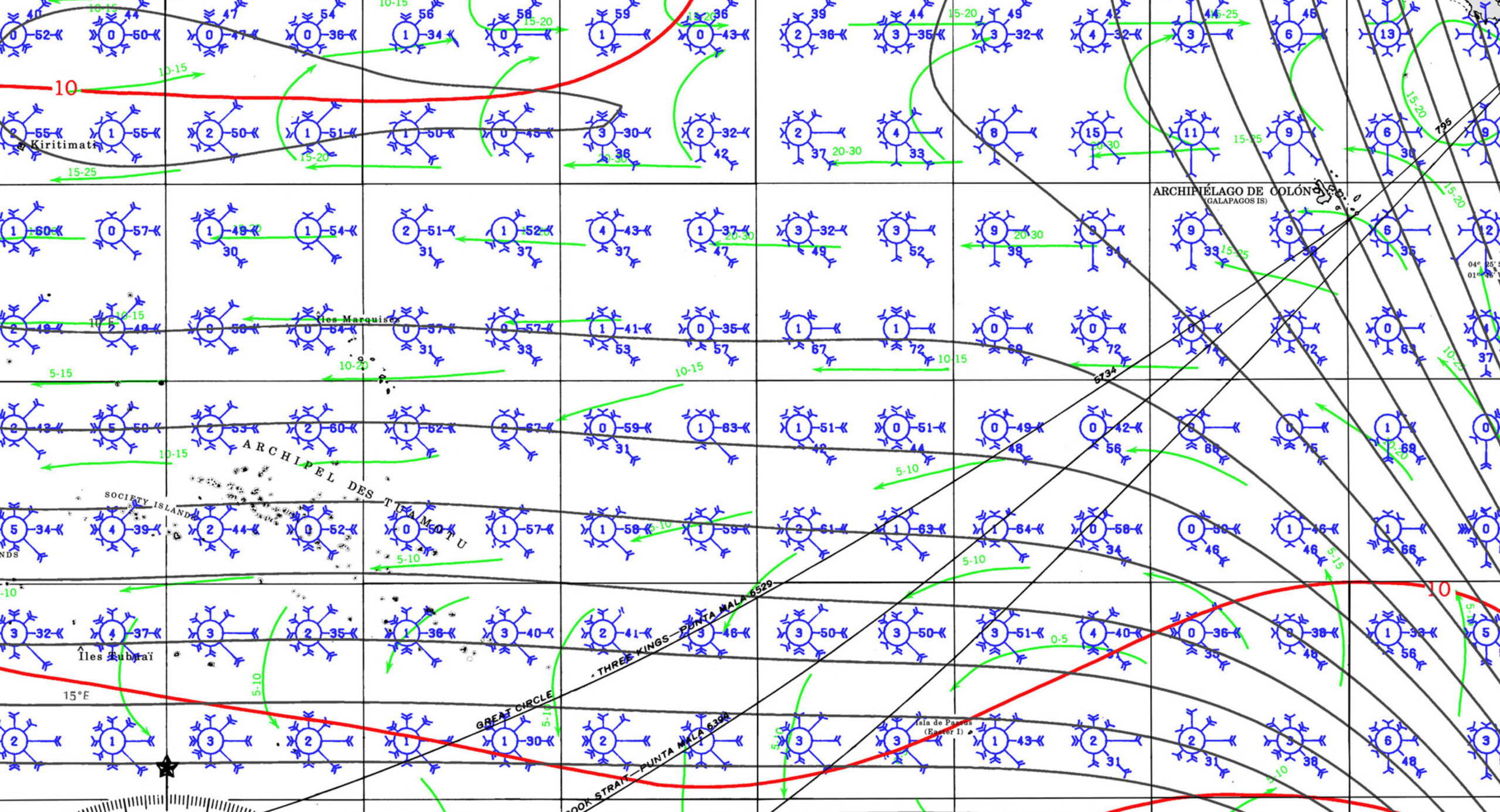
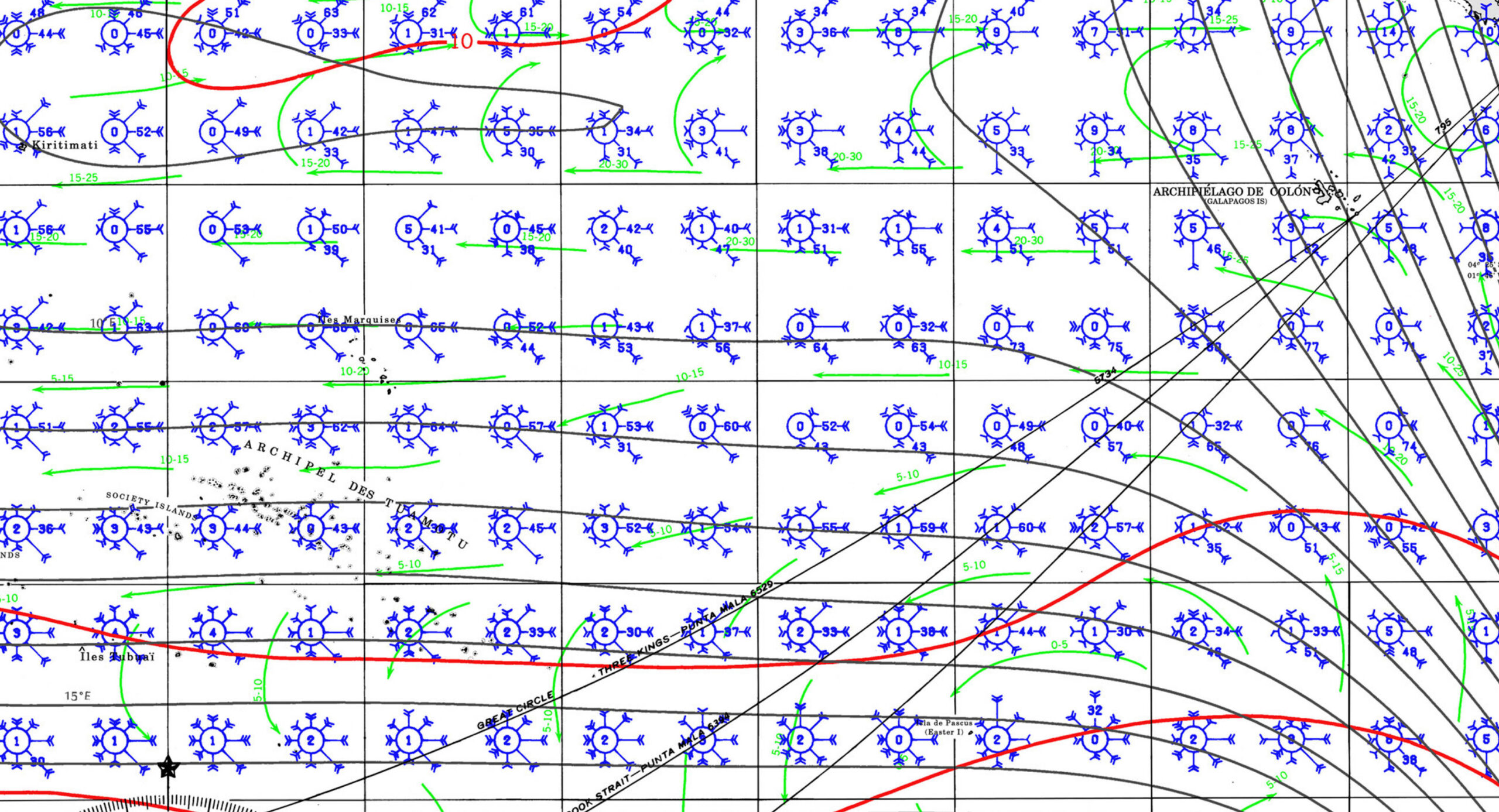
TRAVERSING FRENCH POLYNESIA WITHOUT A LONG STAY VISA
MARQUESAS – TUAMOTUS – SOCIETY ISLANDS
AHOY !
... join the Ocean Posse to gain access to THIS AND OTHER information >>
JOIN THE OCEAN POSSE _FOR ACCESS TO THIS AND OTHER INFORMATION - SIGN UP HERE >>
ALREADY SIGNED UP ? FOLLOW THIS LINK TO LOGIN >>
The Ocean Posse offers many saving benefits in addition to validate information by fellow yacht owners >>
BENEFITS OF of joining the Ocean Posse
SAVE TIME - SAVE MONEY - and get the best and most up to date INFORMATION !
| BENEFITS FOR YOU, YOUR YACHT & YOUR CREW |
|
|
| PRE SEASON | IN SEASON | |
| ✔️ Up to date and verified information by fellow yachts | ✔️ | ✔️ |
| 📊 Communications focused on facts, not opinions or unsolicited advice | ✔️ | |
| 💰 Save real money at 70+ Marinas with discounts * | ✔️ ( June ) | ✔️ |
| 🛰️ Free vessel and fleet tracking courtesy of Predict Wind | ✔️ | |
| 🚩 Free Burgee | ✔️ | |
| 💰 Save with service providers and chandleries | ✔️ ( June ish ) | ✔️ |
| 🕵️ dedicated, experienced and discounted Canal and clearing in agents | ✔️ | ✔️ |
| 🗺️ Free aid to navigation 150 Gb OpenCPN satellite charts (mac/pc/android) | ✔️ immediately | ✔️ |
| 💰 Save Money on parts with a Westmarine Pro Discount | ✔️ | |
| 💰 Save Money with a Predict Wind Pro Discount | ✔️ | |
| 🗺️ Free Printable Reference Charts emergency backup to your electronics | ✔️ immediately | ✔️ |
| 📹 Free Video Seminars on destinations from those who are there | ✔️ immediately | ✔️ |
| 🌩️ Top weather routing avail by Marine Weather Center Chris Parker | ✔️ | |
| ⛵ Community of voyagers all are welcome, kids, single-handers, pets | ✔️ | ✔️ |
| ⚓ Peer support in emergencies with escalation procedures | ✔️ | |
| 🛈 Fleet Updates via email – free | ✔️ Prior Fleet immediately | ✔️ |
| 🏆 Fun Award Categories | ✔️ | |
| 📍 Free access to GOOD NAUTICAL Anchorage reports | ✔immediately | ✔️ |
| ☎️ Free Weekly live calls on Mondays via dedicated LINE.me group | ✔️ | |
| 💬 Free 24/7 LINE group channel | ✔️end of June | ✔️ |
| 🌊 Benefit from the latest information and prior experience participants | ✔️ | |
| 🔭 Be part of a fleet of sensor for those who come behind you or meet | ✔️ | |
| 🚷 Always priority traffic – for participants by participants | ✔️ |
- (* as long as you do not have prior contracts or reservations in place and of course subject to a marina’s availability the longer you stay the more discount the marina may give you )
If this is agreeable you can sign up now >>
LOGIN:
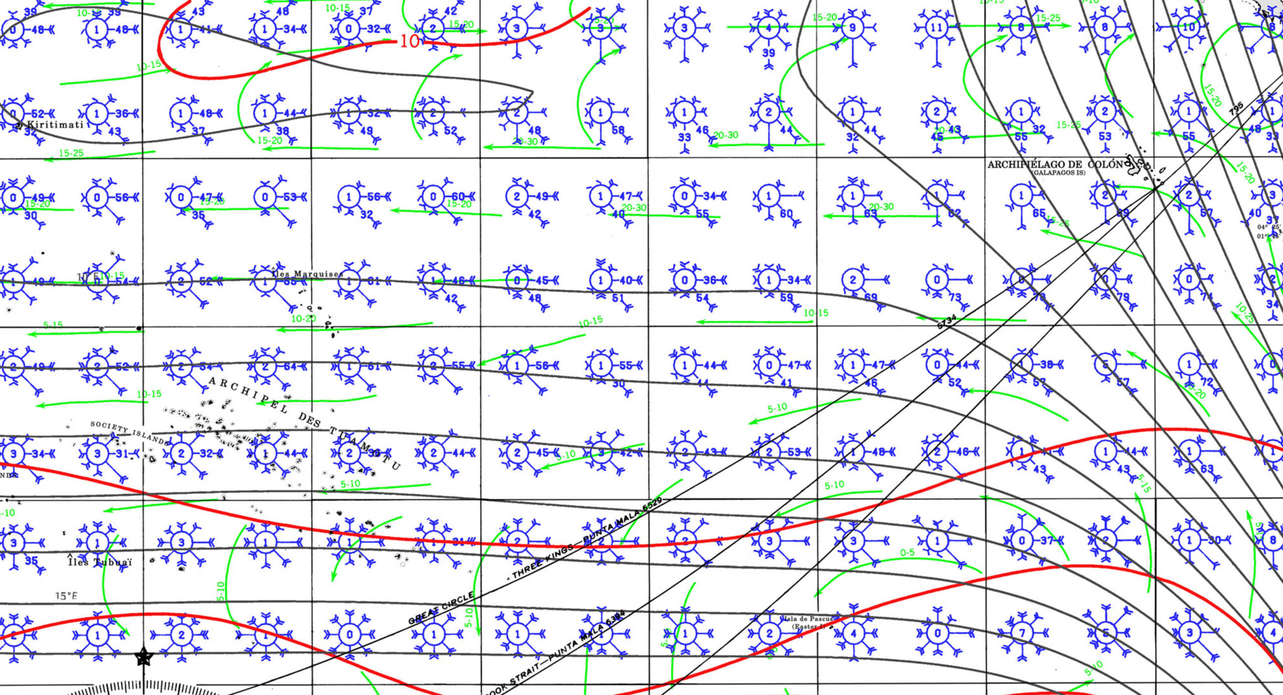
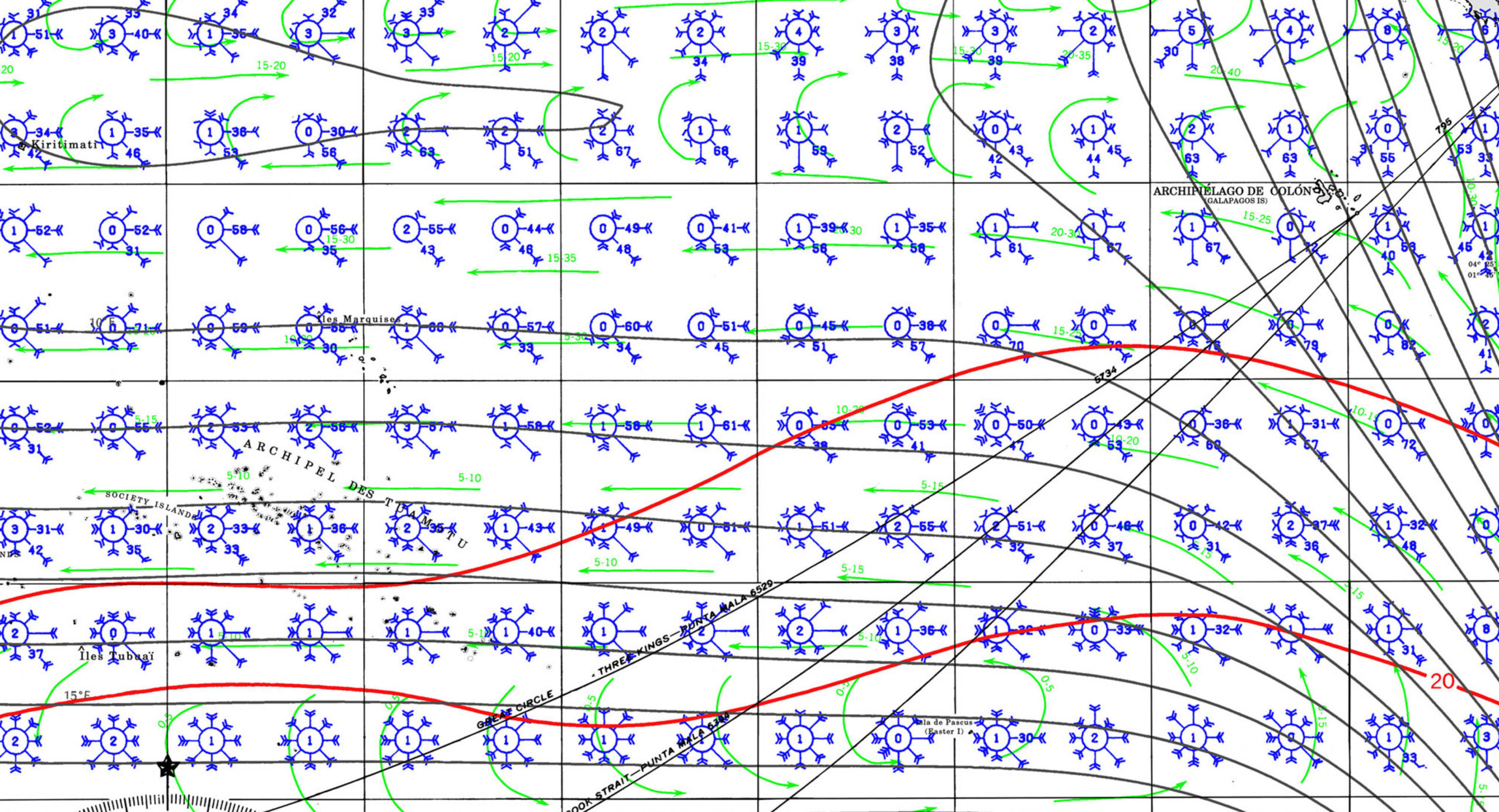
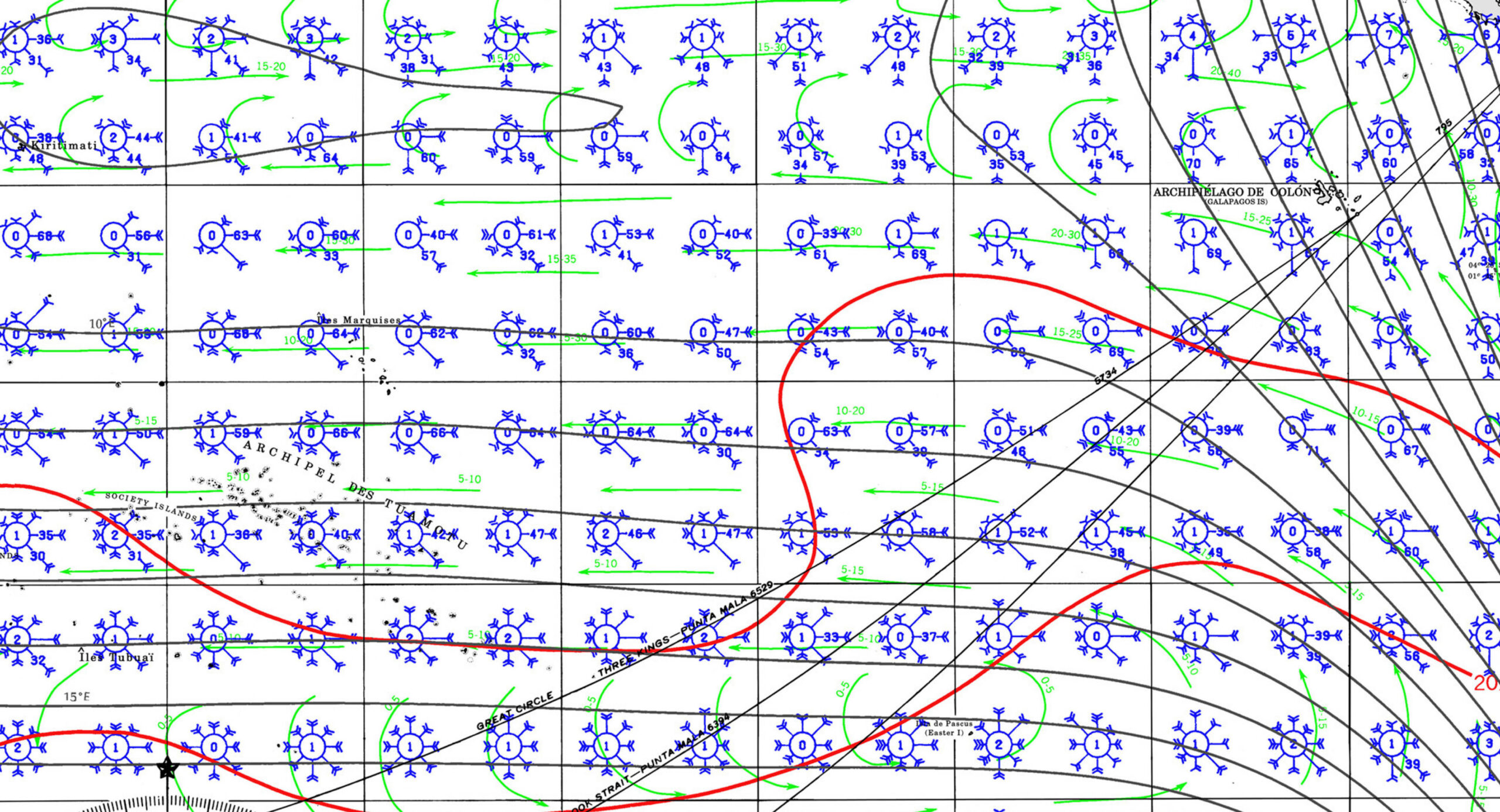
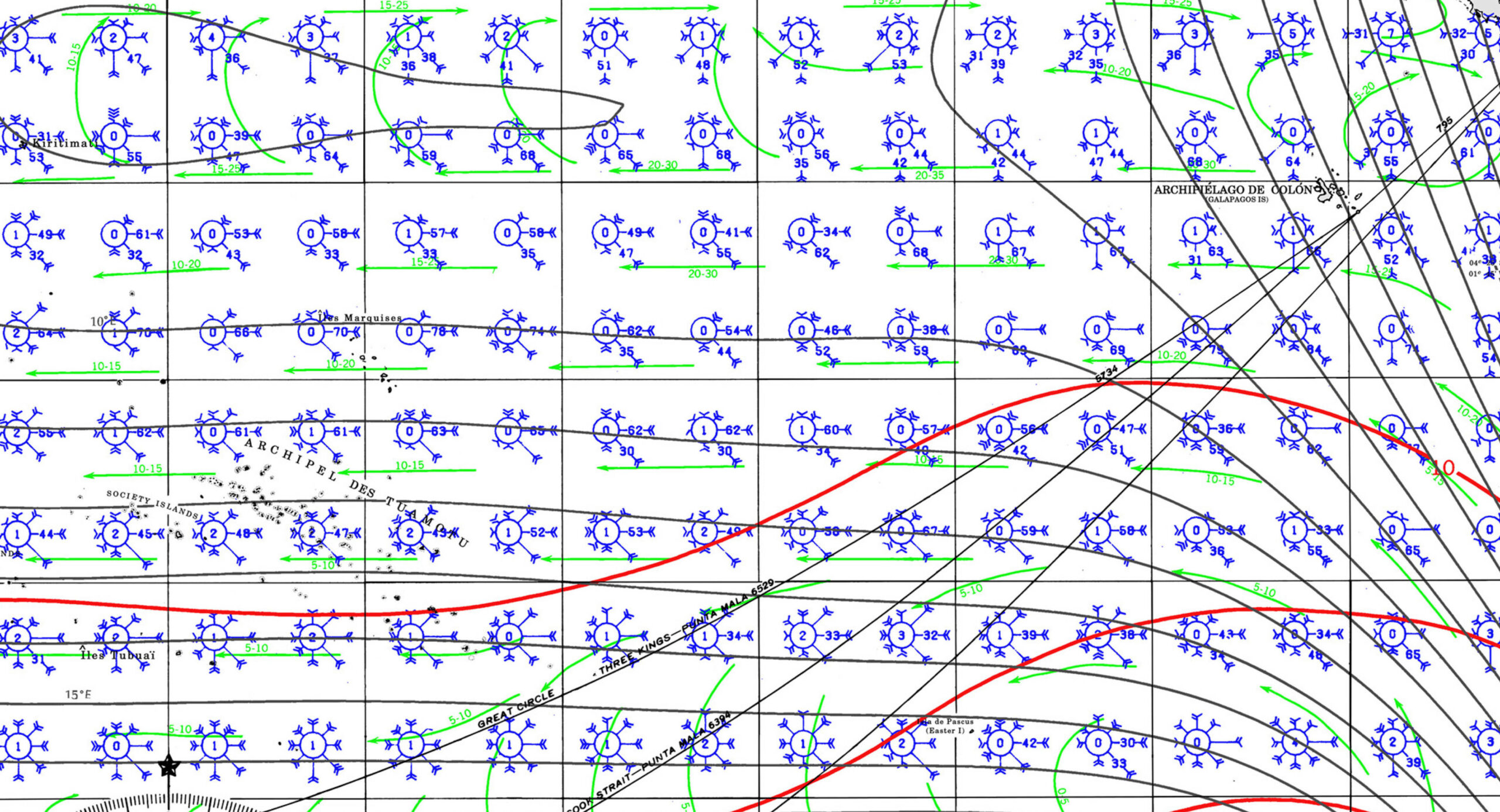
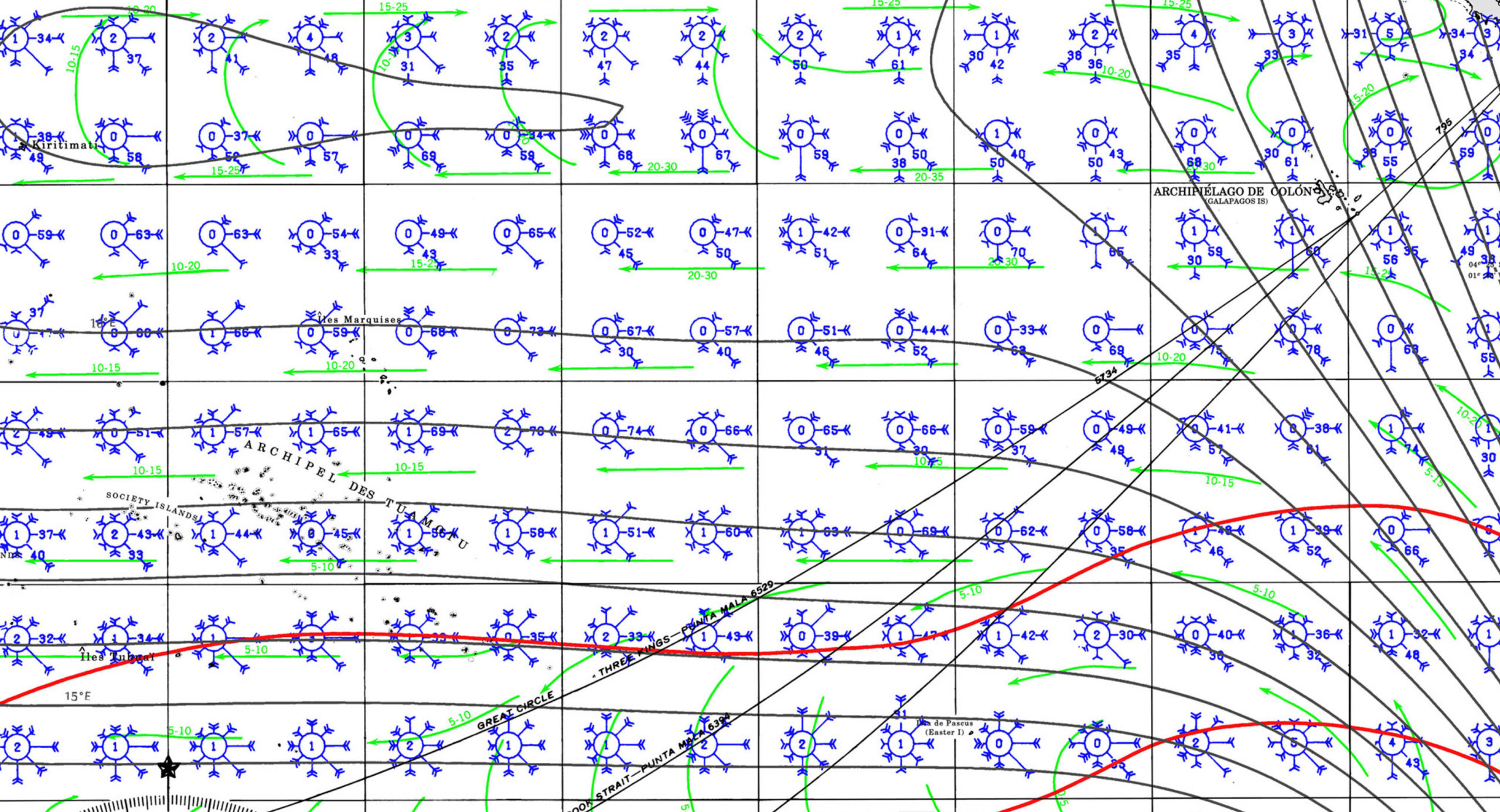
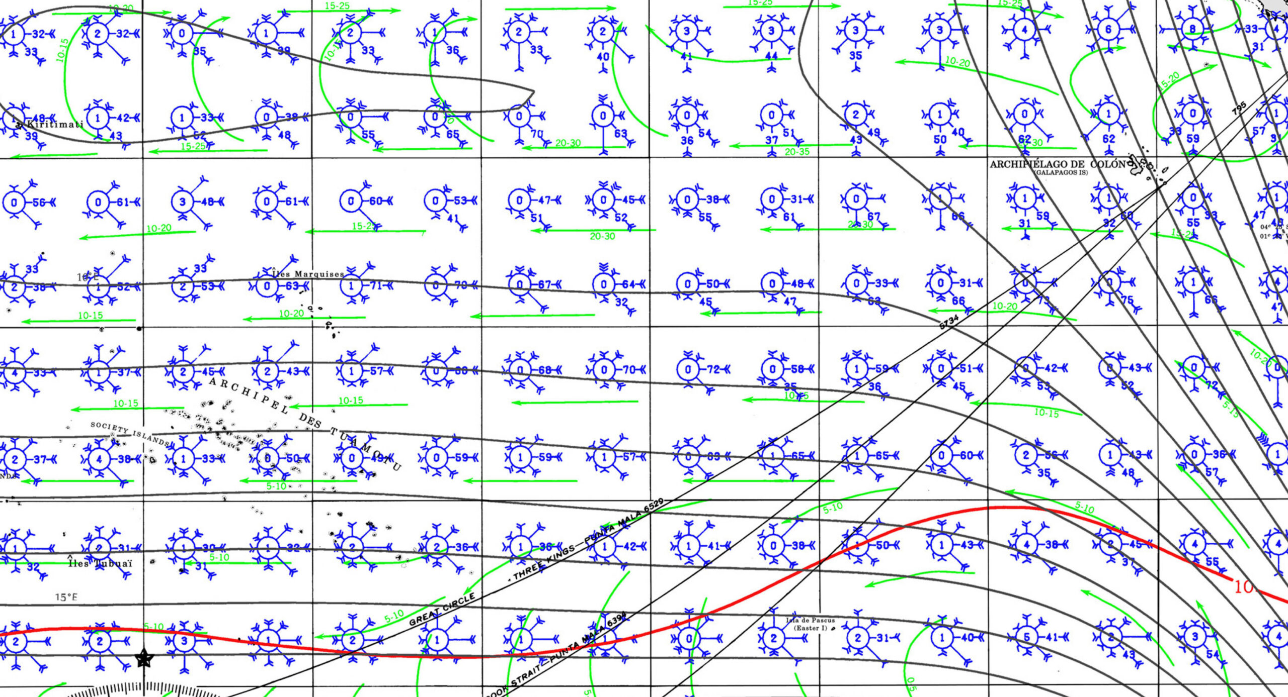
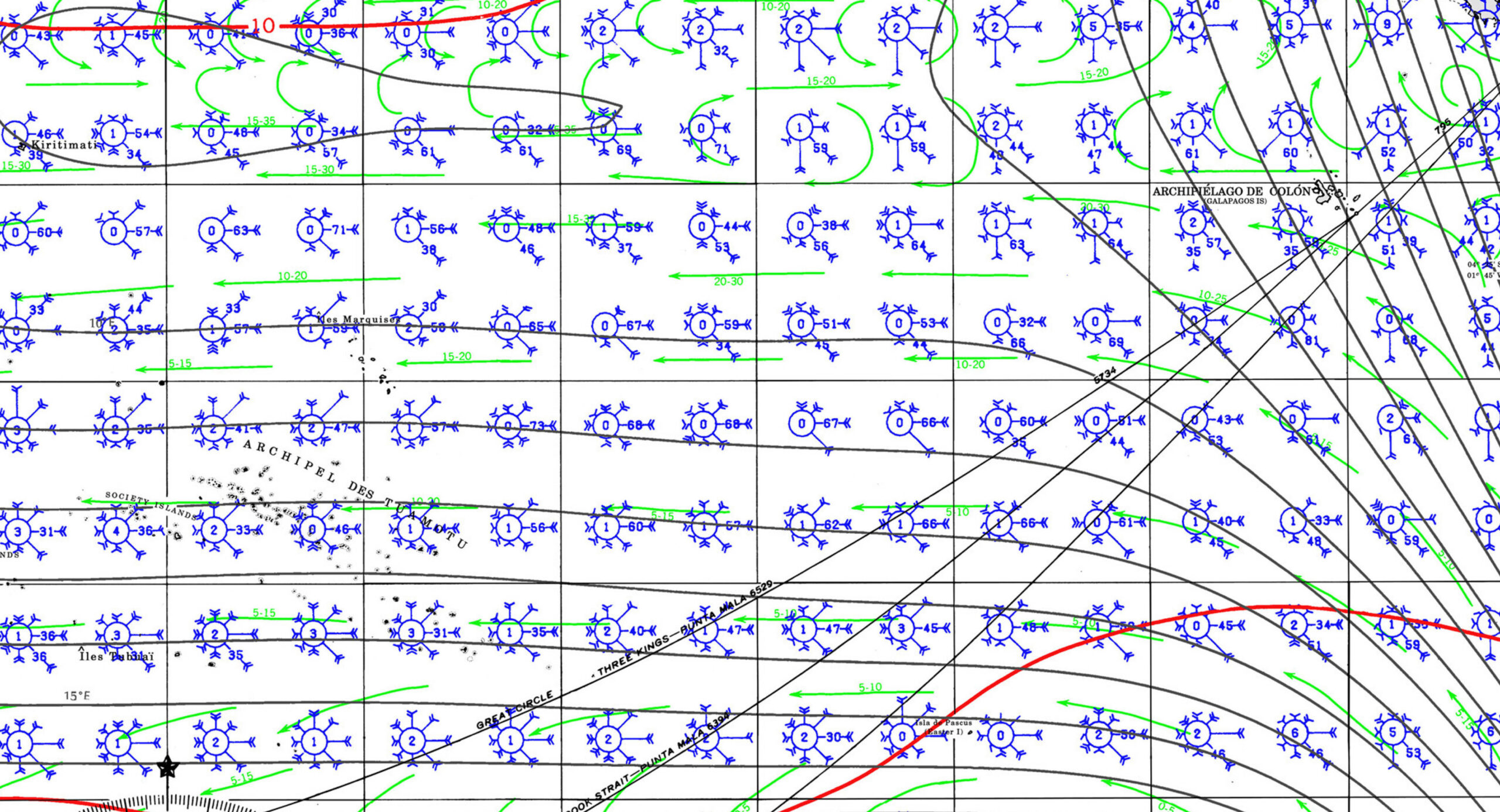
TUAMOTUS ANCHORAGES
- TIDE STATIONS
Rahiroa (Rangiroa) Island
Hao (Bow or La Harpe)
Mangareva Island - ANCHORAGES
- HEAVY WIND 25knts+ (MARAMU) ANCHORAGES

Interpolating tides between two tidal stations involves estimating tidal heights or times at a location between them based on the data from both stations. Here’s a structured approach:
1. Linear Interpolation (Basic Method)
- If the location of interest is roughly equidistant from both tidal stations and the tide follows a simple trend, a linear interpolation can be applied:
H=H1+(H2−H1)D×dH = H_1 + \frac{(H_2 – H_1)}{D} \times d
where:
- HH = interpolated tide height,
- H1,H2H_1, H_2 = tide heights at the two stations,
- DD = total distance between the stations,
- dd = distance from Station 1 to the interpolation point.
2. Time Lag Interpolation
- Tidal waves travel over time, so high/low tide times may shift.
- If the phase lag is known, adjust the time accordingly:
T=T1+(T2−T1)D×dT = T_1 + \frac{(T_2 – T_1)}{D} \times d
where T1T_1 and T2T_2 are the times of high or low tide at the two stations.
3. Harmonic Analysis (More Accurate)
- Tides are influenced by multiple harmonics (e.g., semi-diurnal, diurnal).
- If harmonic constituents (like M2, S2) are known for the two stations, you can interpolate each harmonic and sum them.
- NOAA and other agencies provide harmonic constants that can be used in tidal prediction models.
4. Nonlinear and GIS-Based Interpolation
- If coastline shape or bathymetry affects tides, use GIS-based methods like:
- Inverse Distance Weighting (IDW): Weights closer station data more heavily.
- Kriging: A geostatistical method for more accurate interpolation.
- Hydrodynamic Models: Computational models (e.g., ADCIRC) simulate tide propagation.