
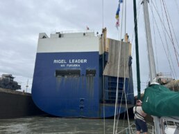
The difference between a nation that welcomes visiting yachts
and one that deters or exploits them,
is usually less than 5 degrees on the autopilot and a short passage.
and one that deters or exploits them,
is usually less than 5 degrees on the autopilot and a short passage.
CRUISING ° FLEET UPDATE & NEWS ⚓ 2025-08-03
• Pictures of the Week 📷
• Stonington ⚓ Maine
• Olbia- Sardinia 🇮🇹 Italy
• Yotspotting 🛥️
• Yachting World Marina 🇻🇺 Vanuatu
• Cyclone 🌀 Holes of the South Pacific
• 🌪️ Cyclone Preparation
• OpenCPN – Additional and Free Aid to Navigation
• Three August OpenCPN Seminars
• Winds 🌬 Puget Sound Convergence Zone
• Must See 🇲🇽 Copper Canon – Barranca Del Cobre – El Chepe
• Marina Palmira Topolobampo 🇲🇽 Mexico
• Why Join the Ocean Posse
• Marina Portobello 🇨🇴 Colombia
• Cruising the Sea of Cortez 🇲🇽 Mexico
• South Pacific – Meet the Cruising Fleet
 Brought to You by the Yacht Sales Co.
• Ocean Posse Events
• Warning ⚠️ If You Have an Ocean Signal Rescue Me Beacon
• Ocean Posse Fleet 🛰️ Tracking by Predict Wind
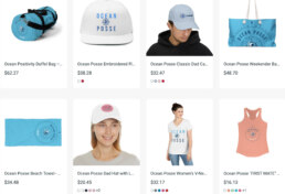
• Ocean Posse Merchandise | Shop
💬 Tidbits
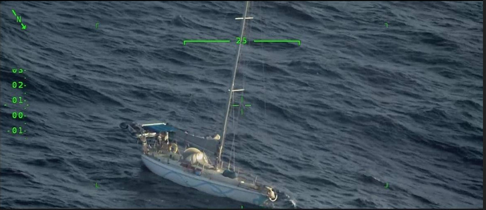
![]() Sailboat adrift @ 14° 55.409’N 062° 02.977′ W
Sailboat adrift @ 14° 55.409’N 062° 02.977′ W
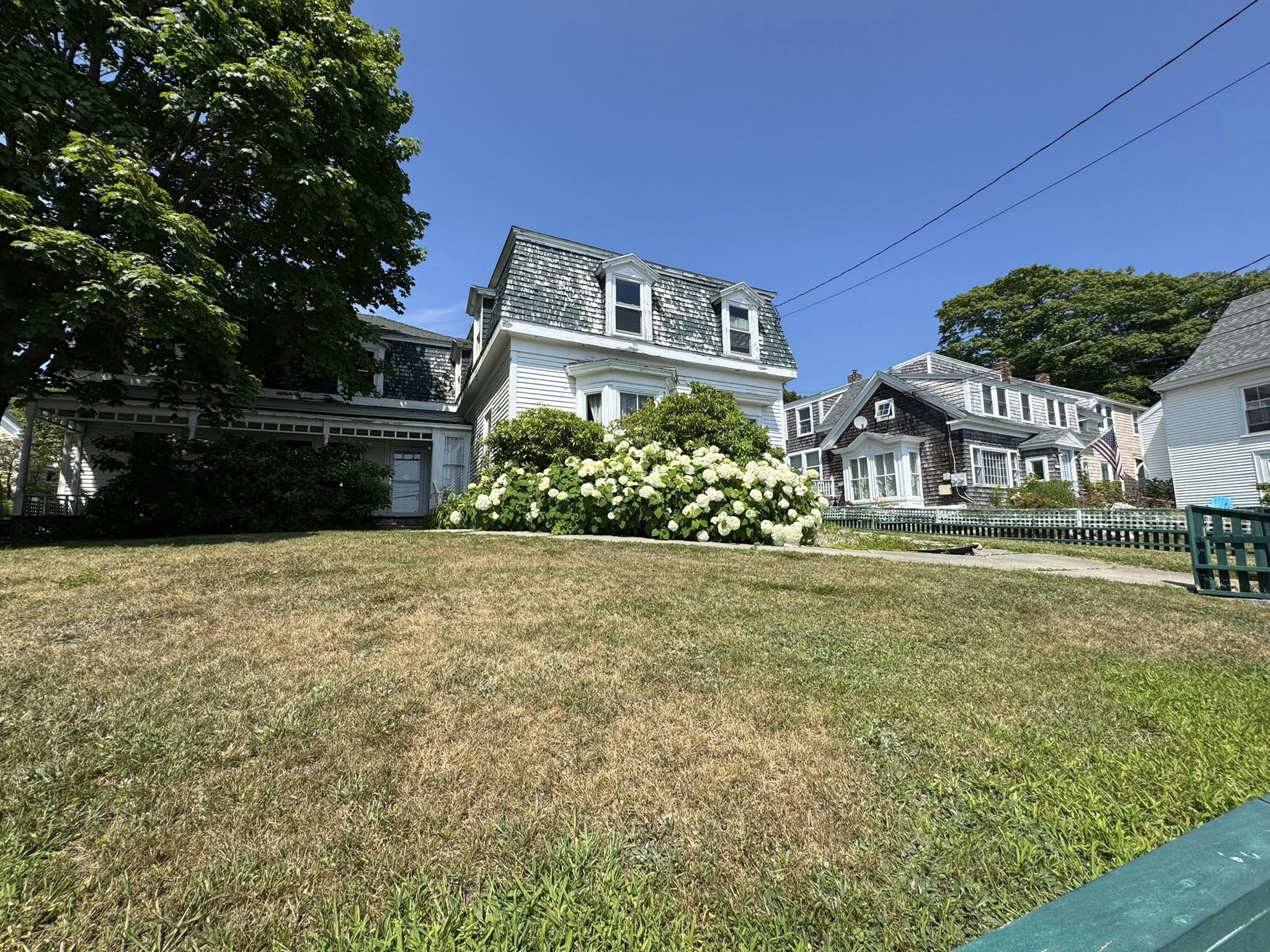
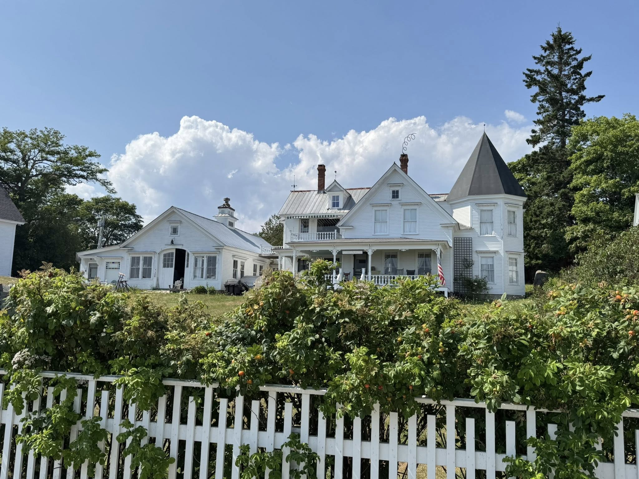
PICTURES OF THE WEEK
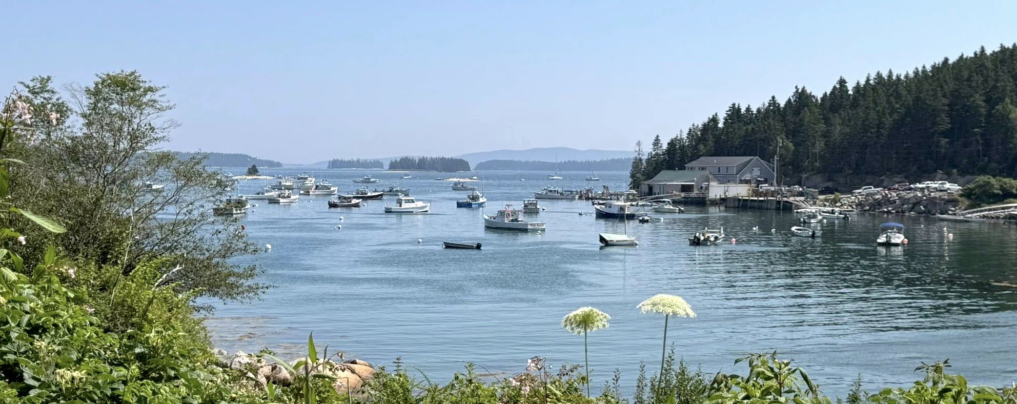
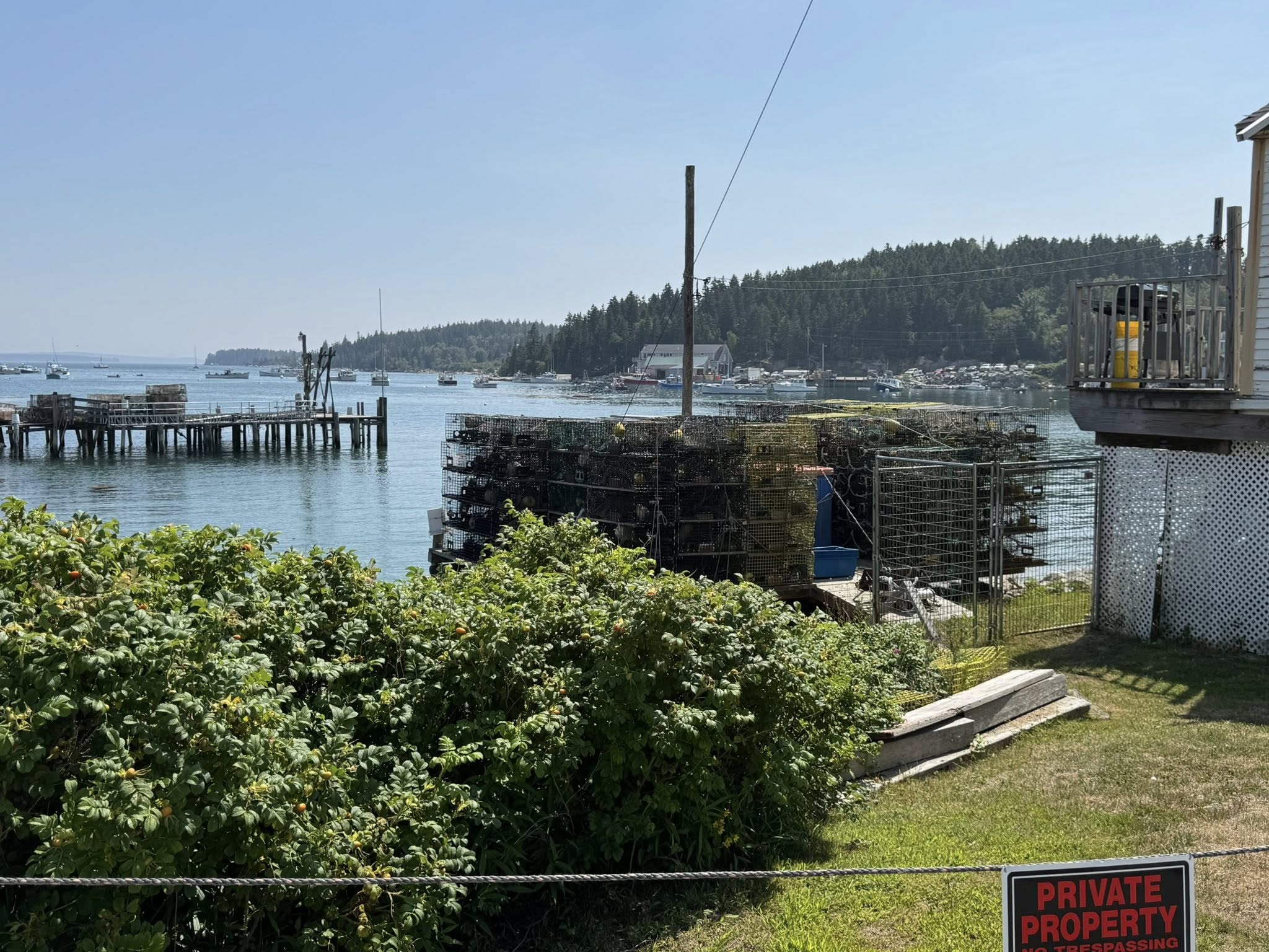
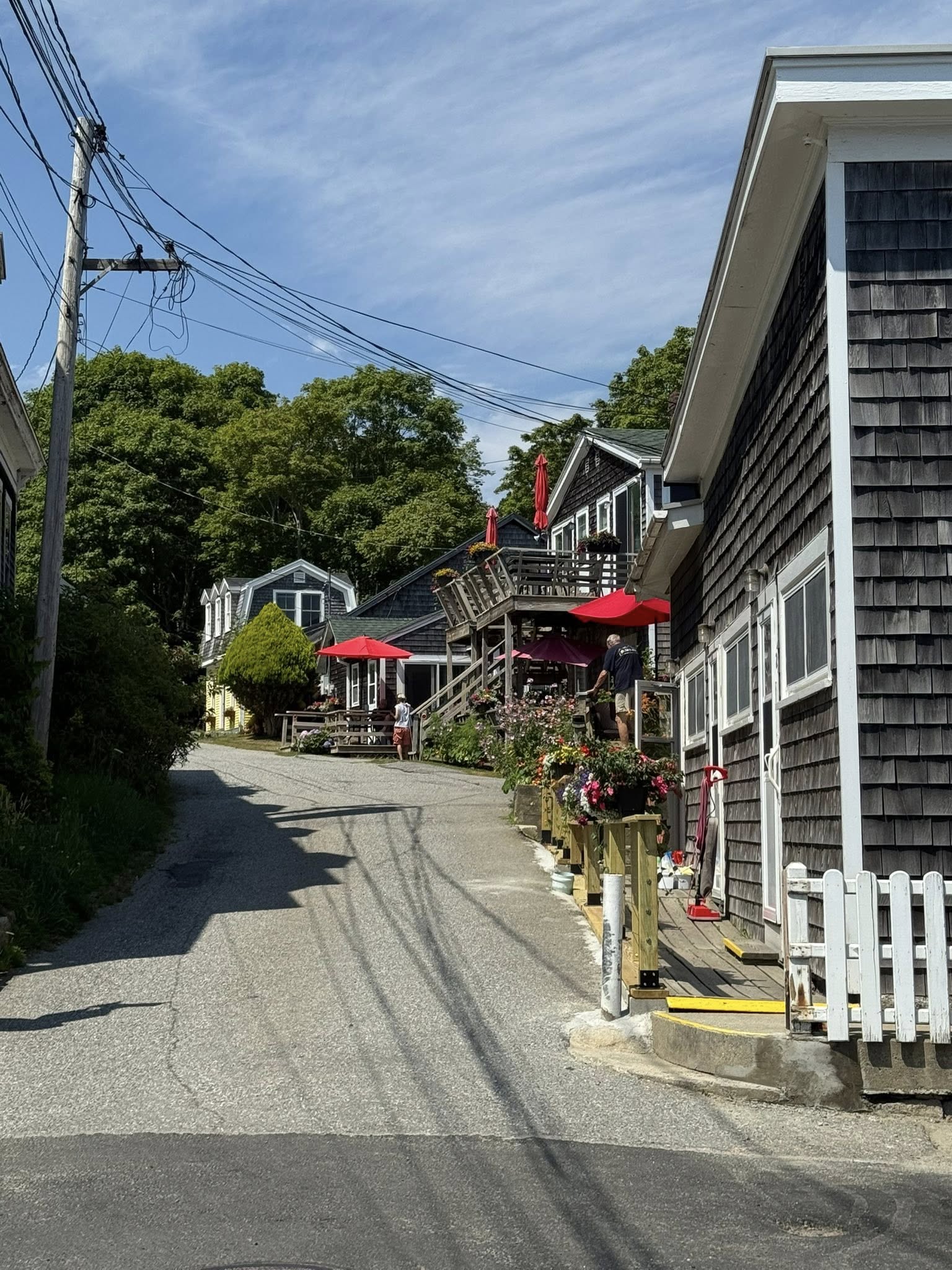
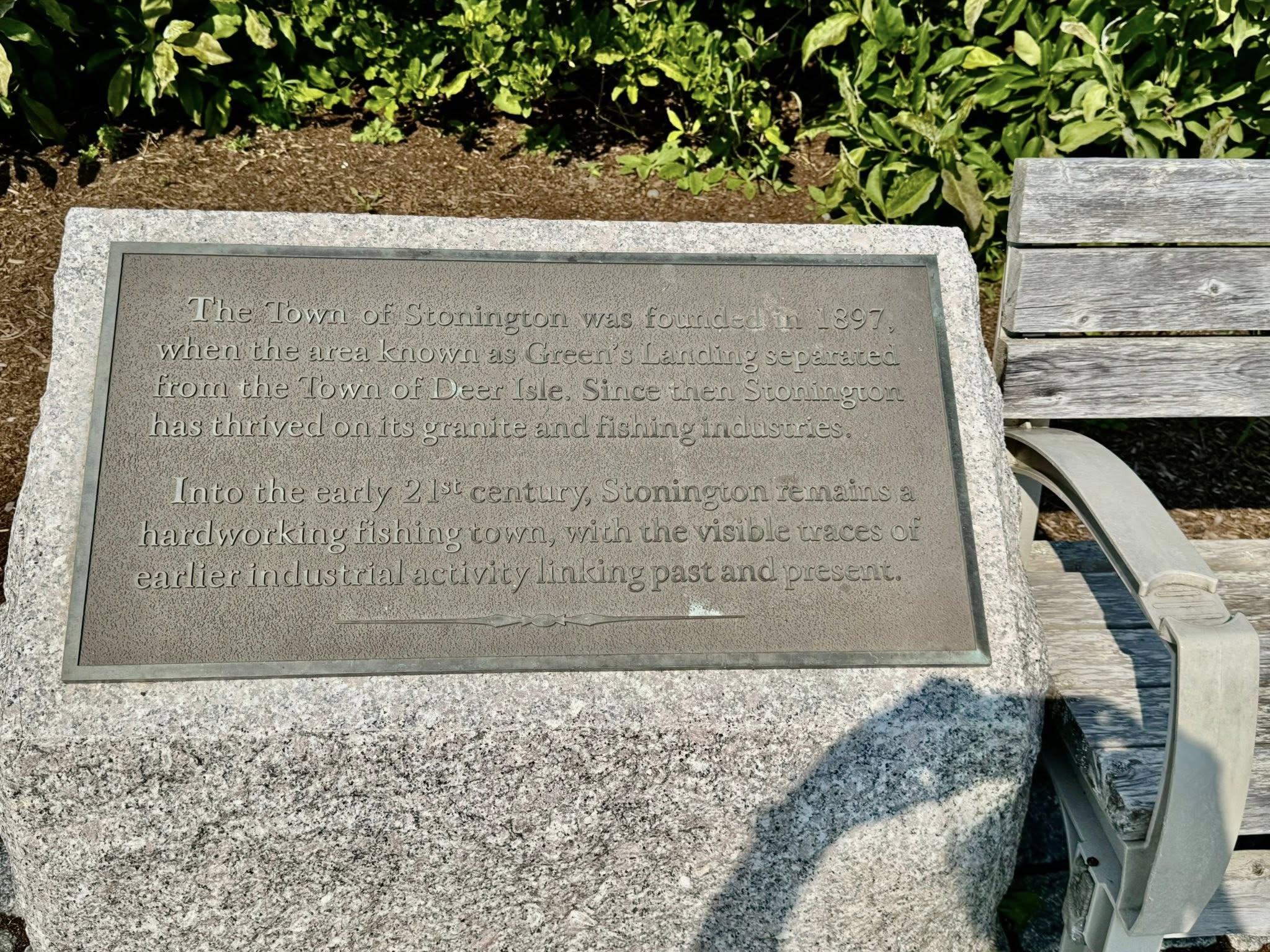
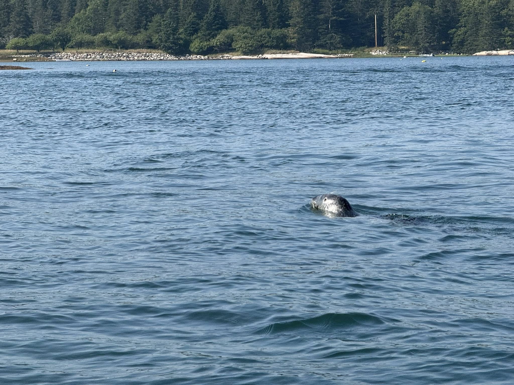
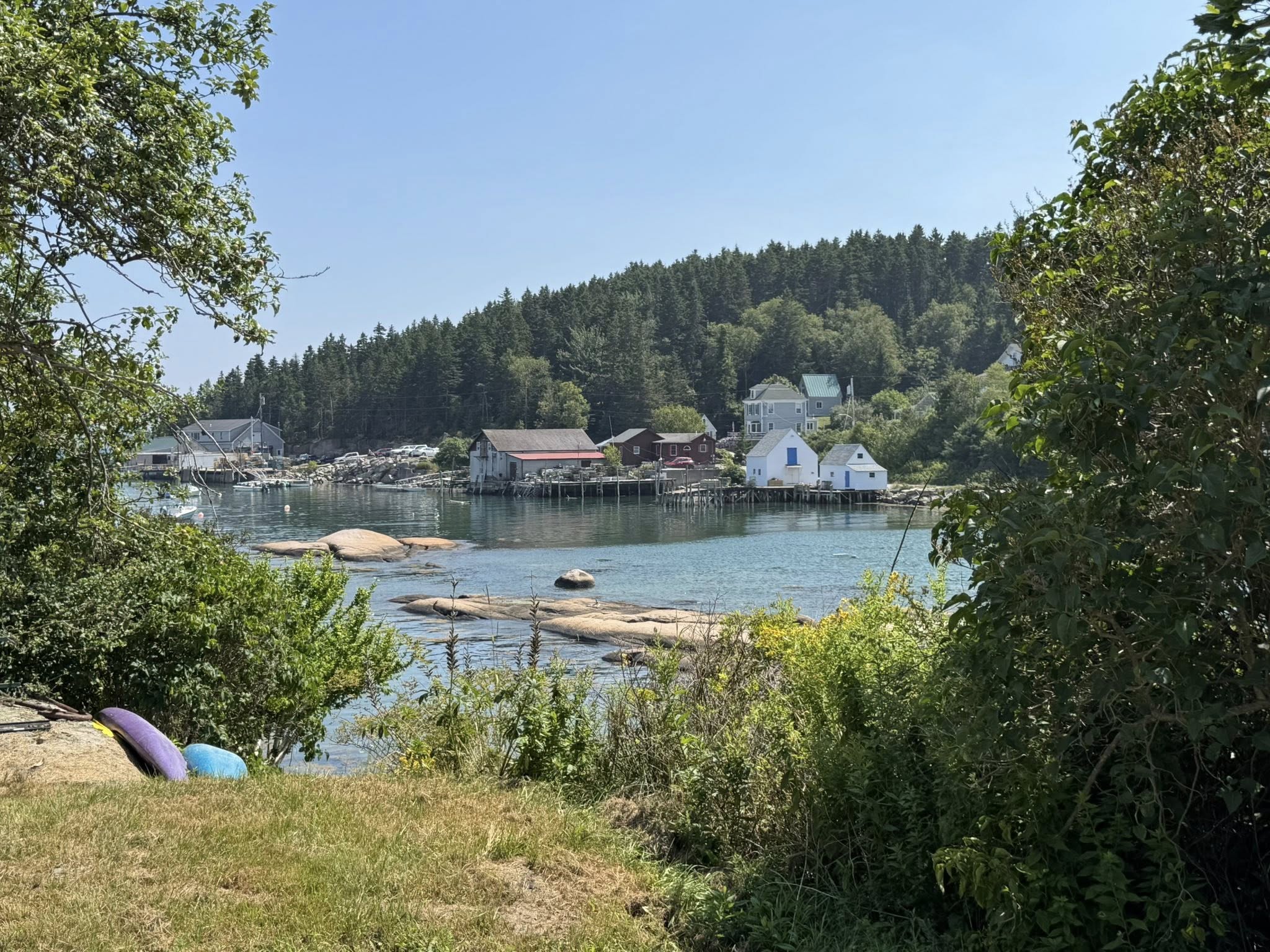
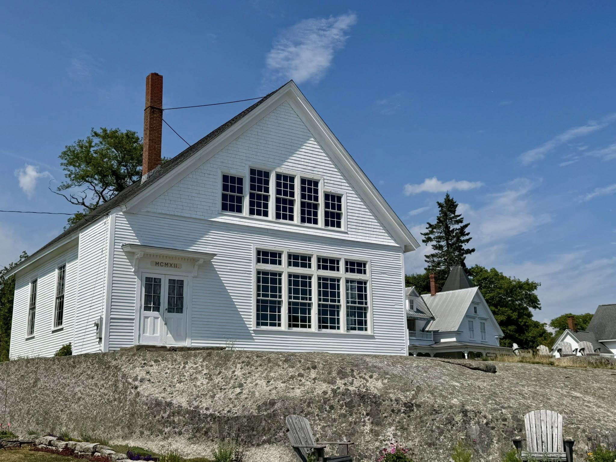
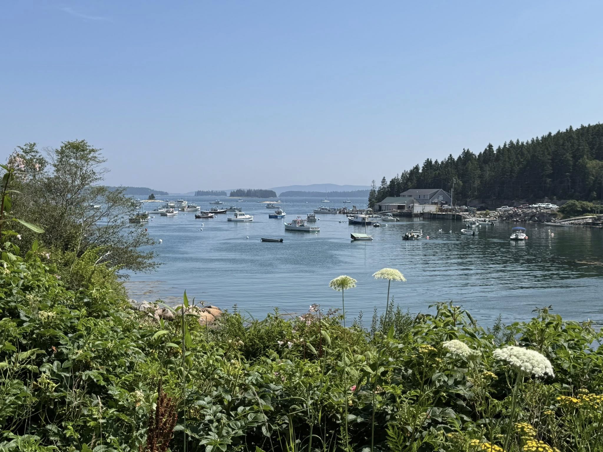
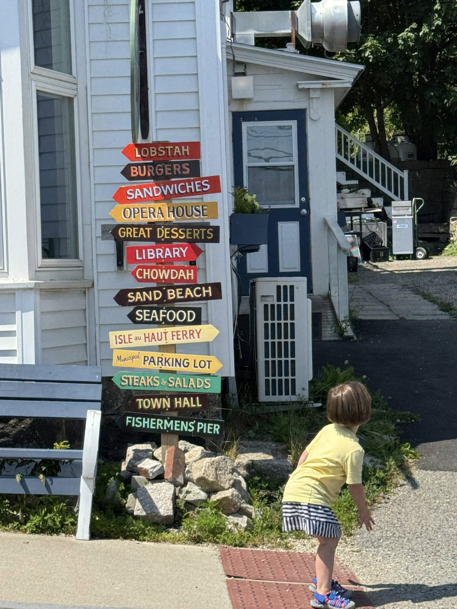
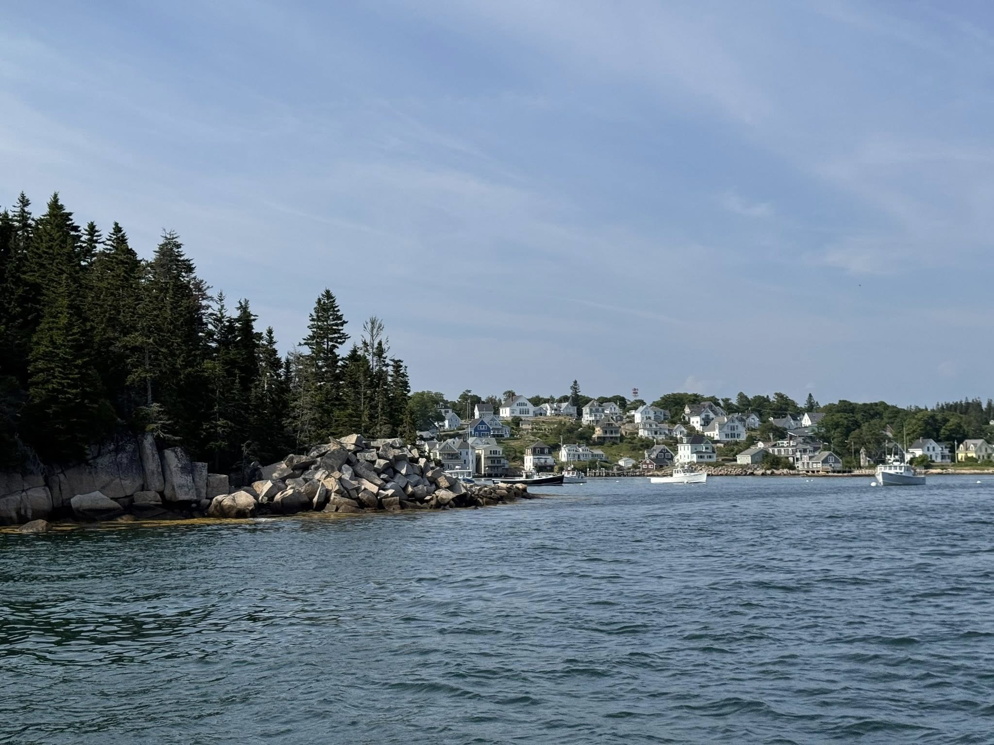
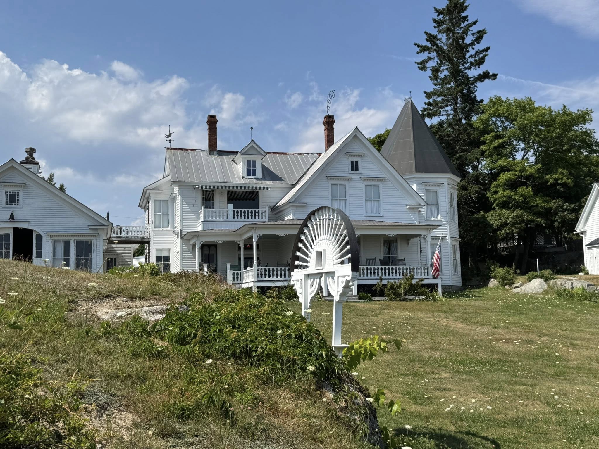
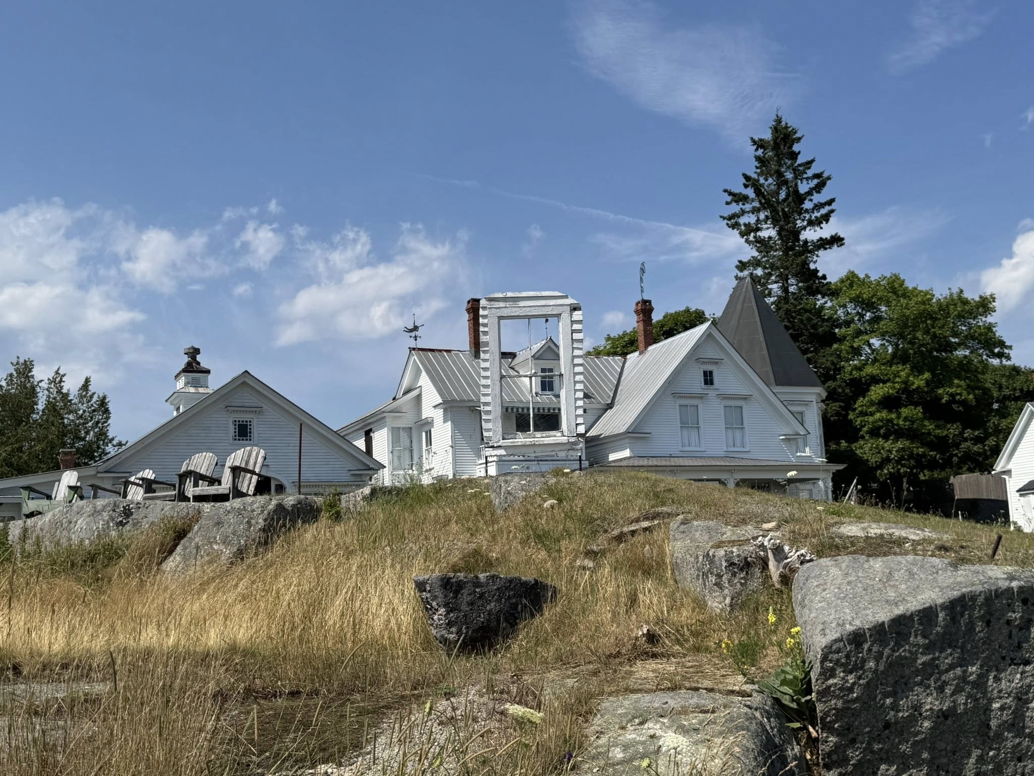
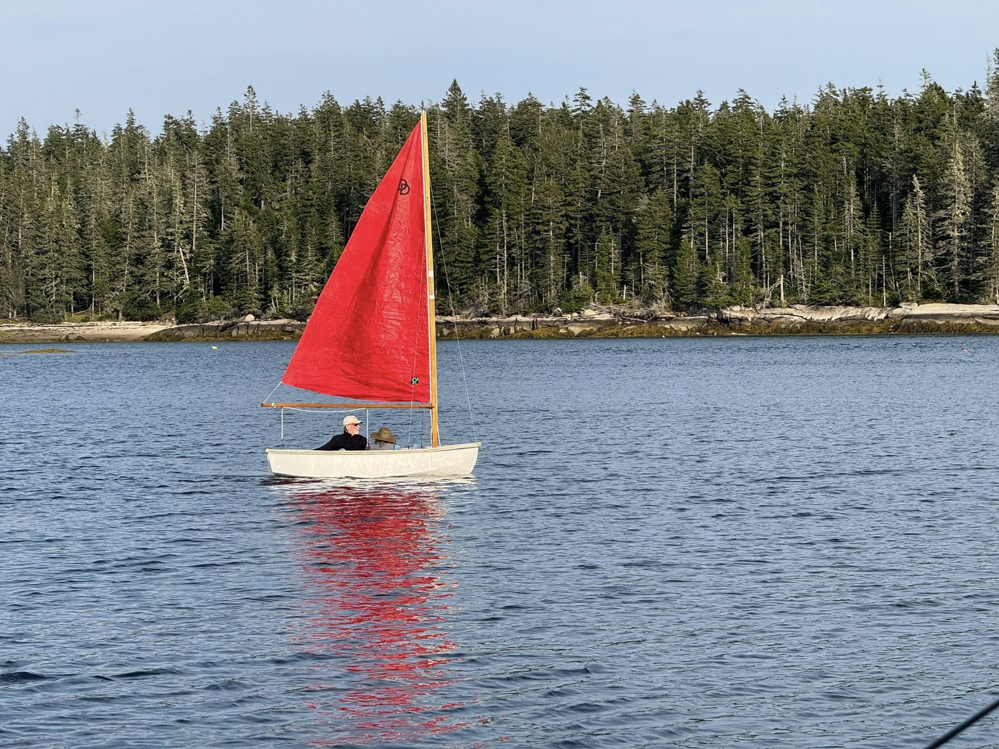
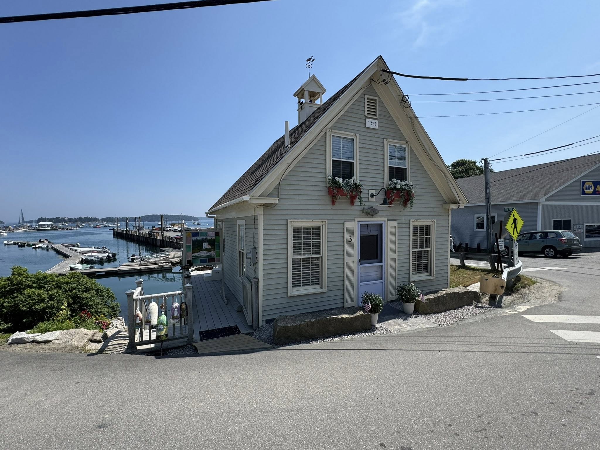
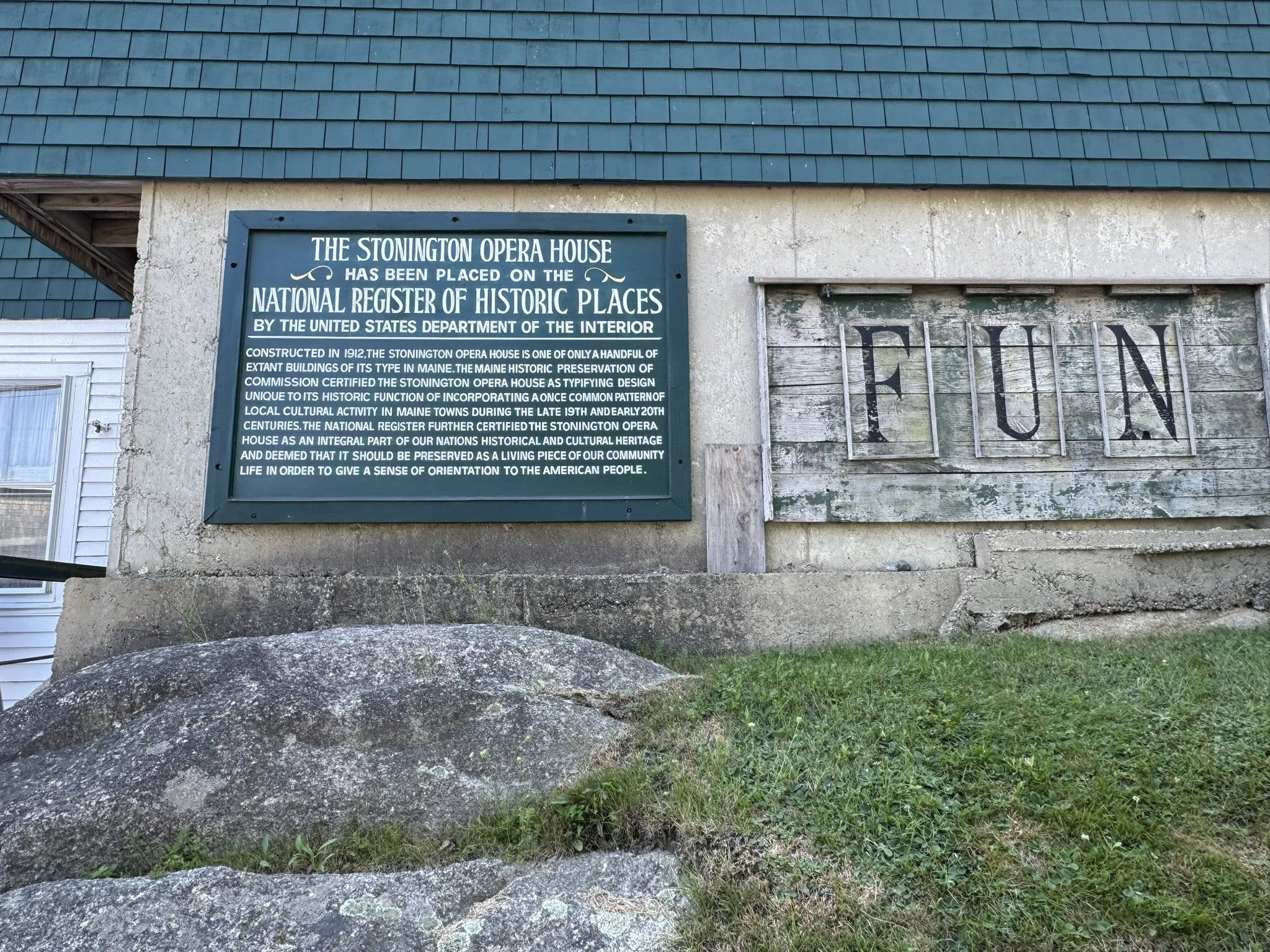
Stonington, Maine ⚓ 044° 09.1925′ N 068° 39.2571′ W is a historic and picturesque fishing village located on the southern tip of Deer Isle, in Hancock County. It’s known for its dramatic granite coastline, active lobster fleet, and arts community.
In the late 19th and early 20th centuries, the area became a major center for granite production.
• The town’s granite was quarried on Deer Isle and nearby islands, then shipped around the country.
• It was used in notable buildings, including:
• The Brooklyn Bridge
• The Boston Museum of Fine Arts
• The Smithsonian Institution buildings in Washington, D.C.
• The granite industry boomed starting in the 1870s.
• It attracted immigrant laborers (including many from Italy, Scandinavia, and Ireland).
• At its peak, hundreds of men worked the quarries, and the town thrived economically.
• Evidence of this heritage is still visible—old quarry pits, granite retaining walls, and even the Stonington town landing itself are made from local stone
Stonington today is a working fishing town with deep roots, increasingly recognized for its natural beauty and artistic spirit. It’s one of the few places on the Maine coast where you can watch lobster traps being hauled just feet from your anchorage and then spend the evening at a live performance or art show.
Stonington is connected to the mainland via a high bridge and causeway through Deer Isle.
• About 70 miles east of Bangor, or 3.5 hours from Portland by car.
• It’s relatively remote, which preserves its unspoiled feel but means services are modest.
More information:
• Population: ~1,000 (year-round), but it swells in summer.
• Main industries: Lobstering, granite quarrying (historically), tourism, and the arts.
• Vibe: Authentic working waterfront with a mix of rugged charm and creative energy.
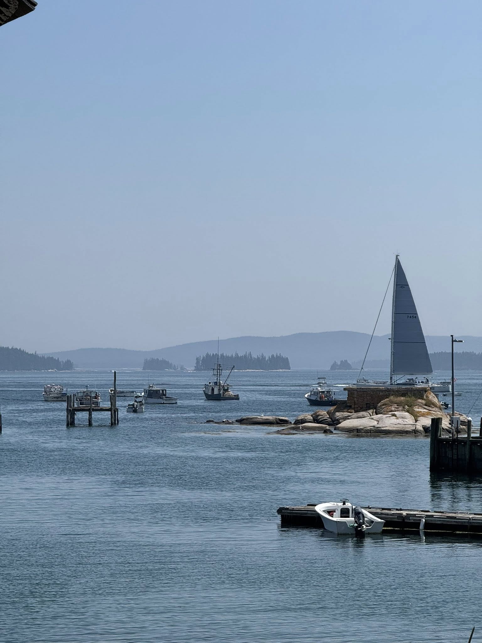
 Harbor & Waterfront
• Stonington Harbor is well protected and still home to one of the largest lobster ports in Maine by volume.
• The waterfront is lined with docks, fish houses, and boats—a blend of working wharves and visiting yachts.
• Isle au Haut Ferry departs from here, providing access to the remote and wild parts of Acadia National Park on Isle au Haut.
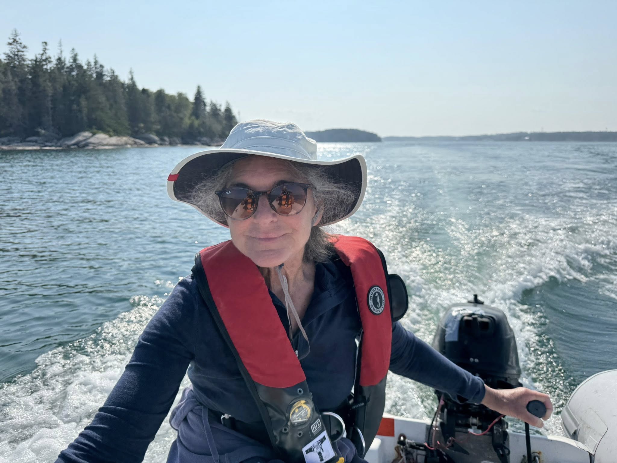
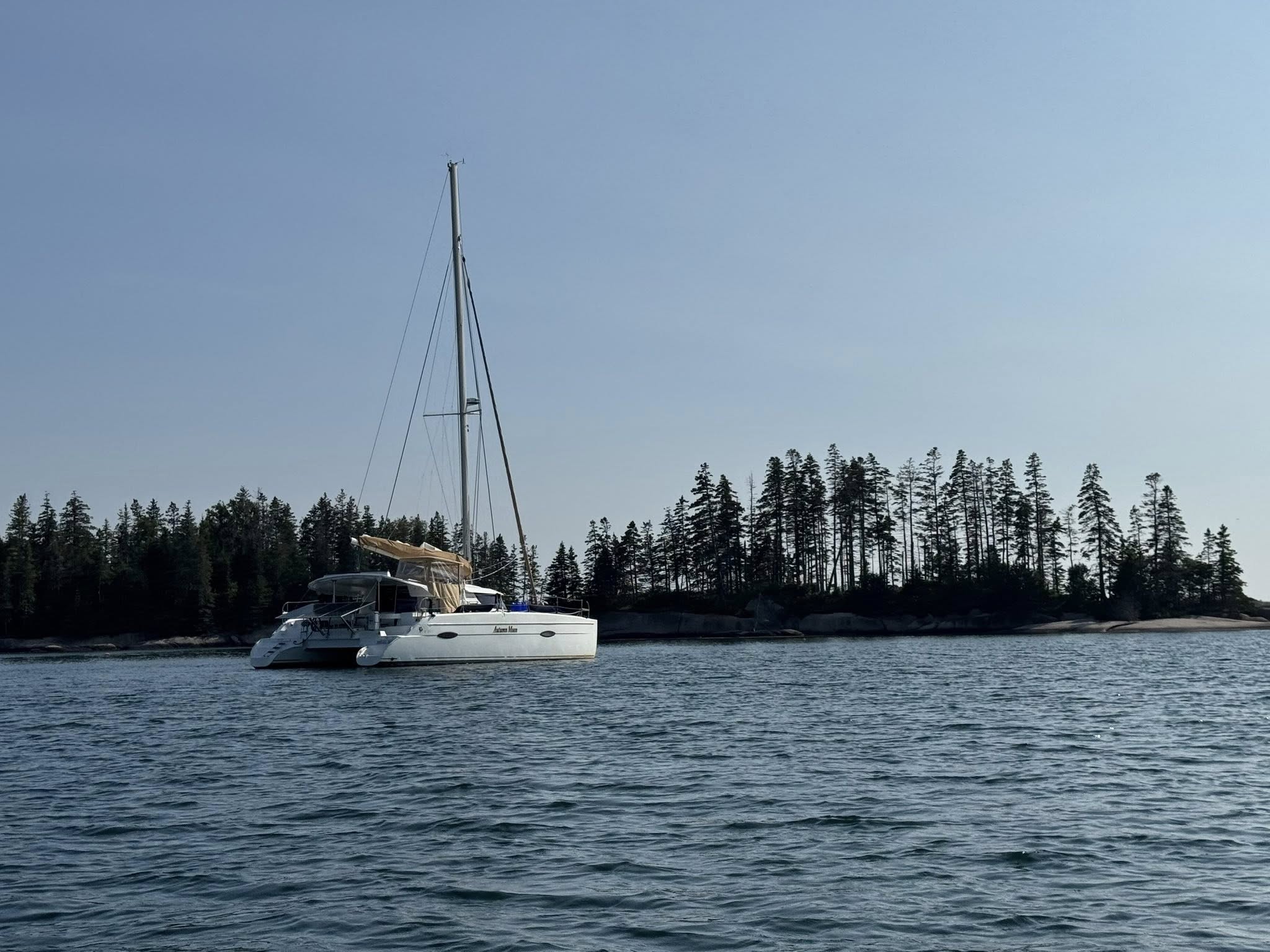
SY AUTUMN MOON Laurin & Elisa – Fountaine-Pajot 41′


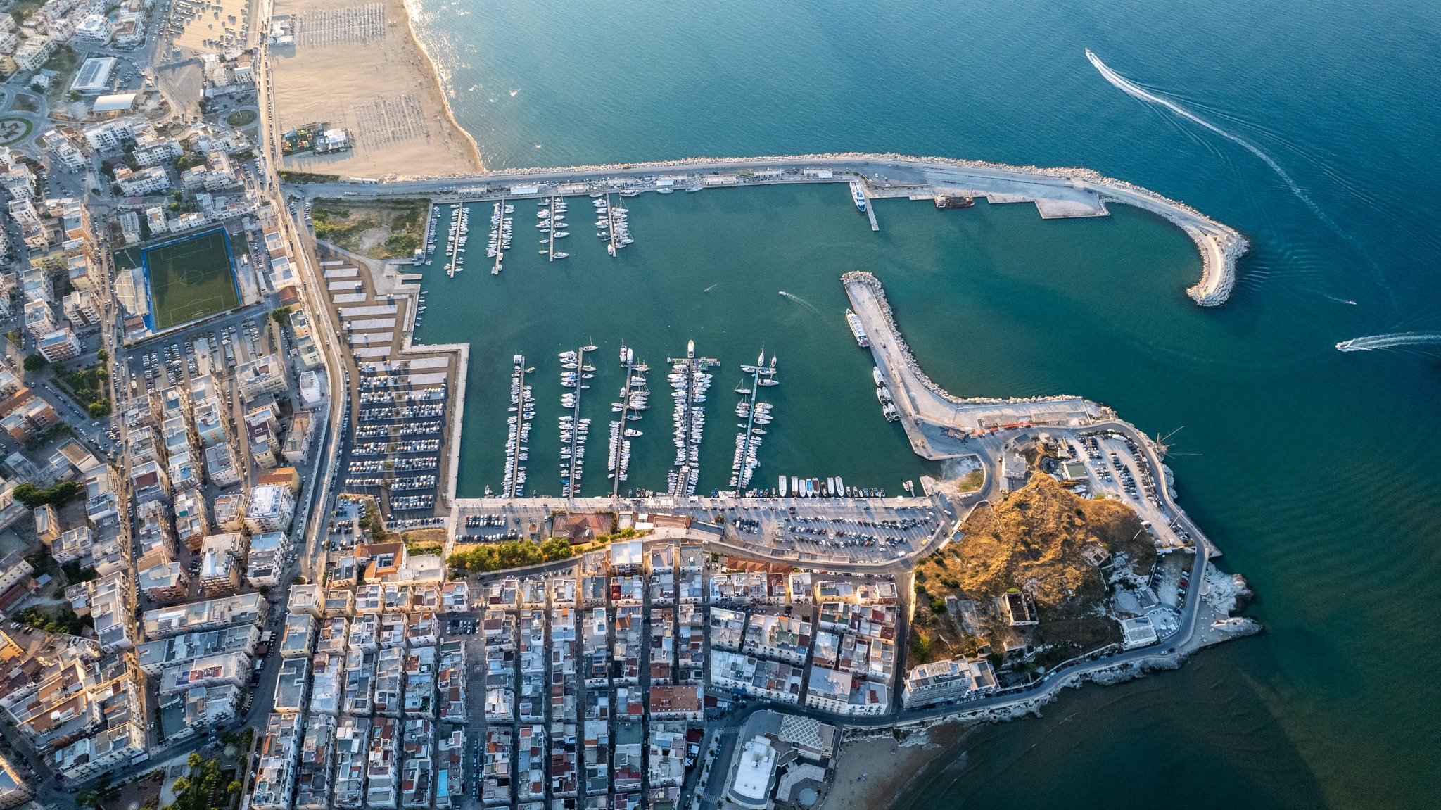
OLBIA- SARDINIA 🇮🇹 ITALY
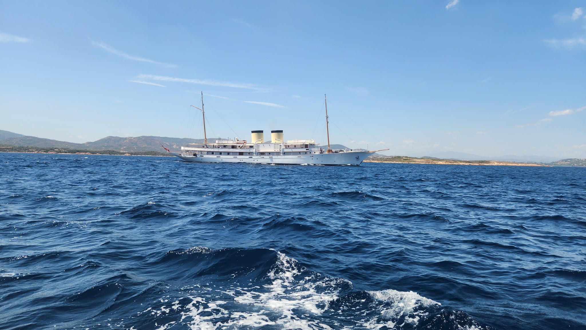
YOTSPOT MY Talitha
is a 1103 GT motor yacht owned since 2008 by Mark Getty. She was built in 1929–1930 by Krupp Germaniawerft in Kiel as Reveler for Russell Alger, chairman of the Packard Motor Car Company, and her subsequent owners include Robert Stigwood and Paul Getty. In 1942 she was purchased by the United States Navy and served as patrol gunboat USS Beaumont (PG-60) until 1946. The yacht has also carried the names Chalena, Carola, Elpetal, Jezebel a.m.o.
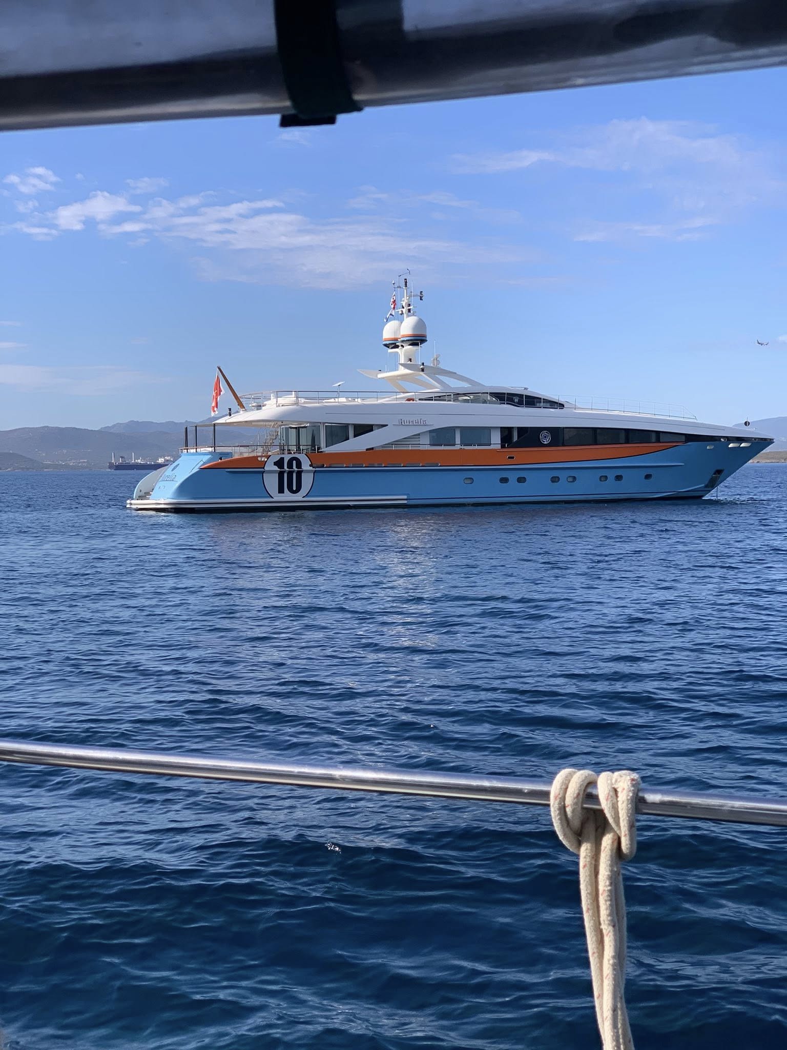
YOTSPOT MY Aurelia
The 37.3m motor yacht Aurelia launched in 2011 by Dutch shipyard Heesen her exteriors have been penned by Omega Architects. The classic orange and blue Gulf livery of the Ford GT40 racecar provided the inspiration she remains one of the most instantly recognizable yachts in the world and features exterior design
SY SAMLL WORLD III 🇻🇮 Karen & Daren – Bristol 47.7
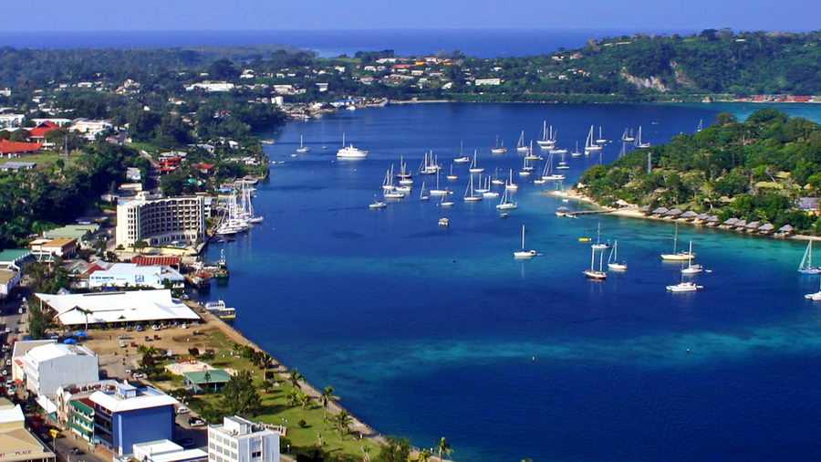
YACHTING WORLD MARINA  VANUATU SPONSORS THE OCEAN POSSE
17°44.666′ S 168°18.81′ E
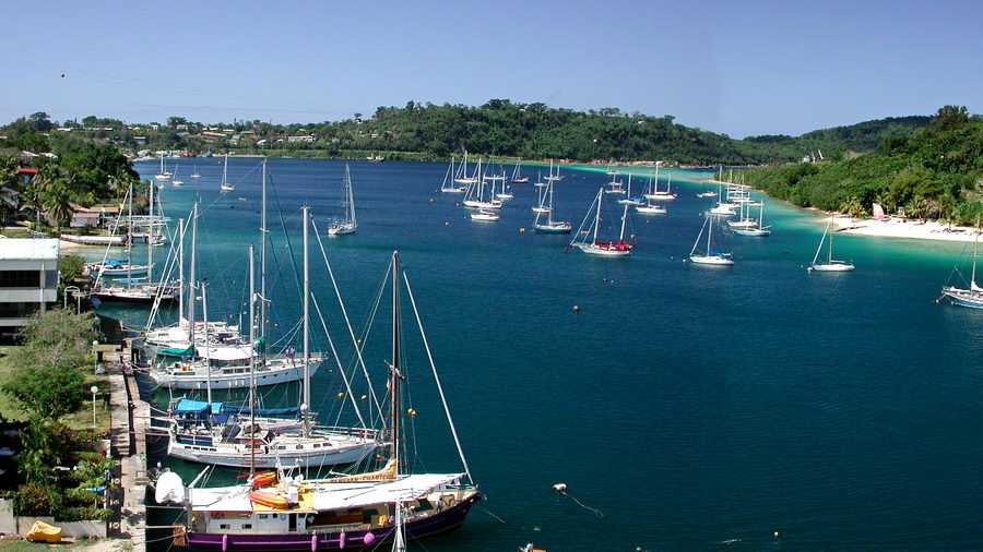
Yachting World offers cruising yachts a warm welcome to Port Vila Vanuatu.
You and your crew will be welcome here and we look forward to seeing you on arrival.
Vanuatu is the favorite cruising destination for yachts of all sizes.
We are please to offer the Ocean Posse 10% discount of our rates.
Click here to find out why Vanuatu is the most yachting-friendly cruising grounds of the Pacific
Port Vila is the only place you can easily fill your fuel tanks in Vanuatu
Yachting world is in the most protected anchorage in Vanuatu
Make Yachting World your home port in Vanuatu because ….
We
truly LOVE
Yachts!
AMENITIES
SAFE APPROACH
MUST SEE & PLACES TO VISIT IN PORT VILA 🇻🇺 VANUATU
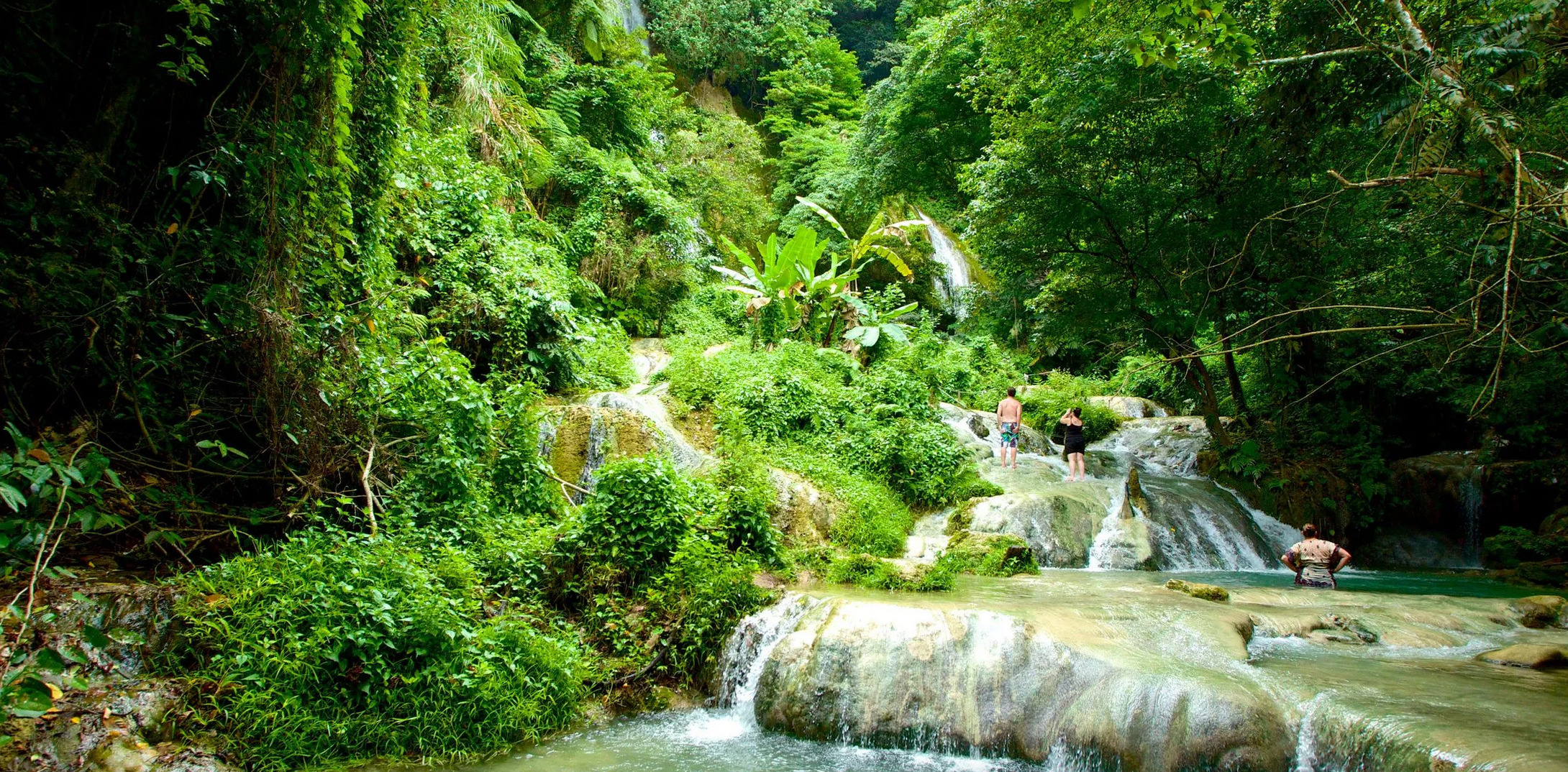
1. Mele Cascades Waterfall (land hike only)
• Location: 17°42.716′S 168°16.329′E
• A stunning multi-tiered waterfall system nestled in the jungle just outside Port Vila. While some visitors swim, the main draw is the scenic jungle walk to the top. Expect mossy paths, wooden bridges, and panoramic valley views—especially rewarding for early risers and nature photographers.
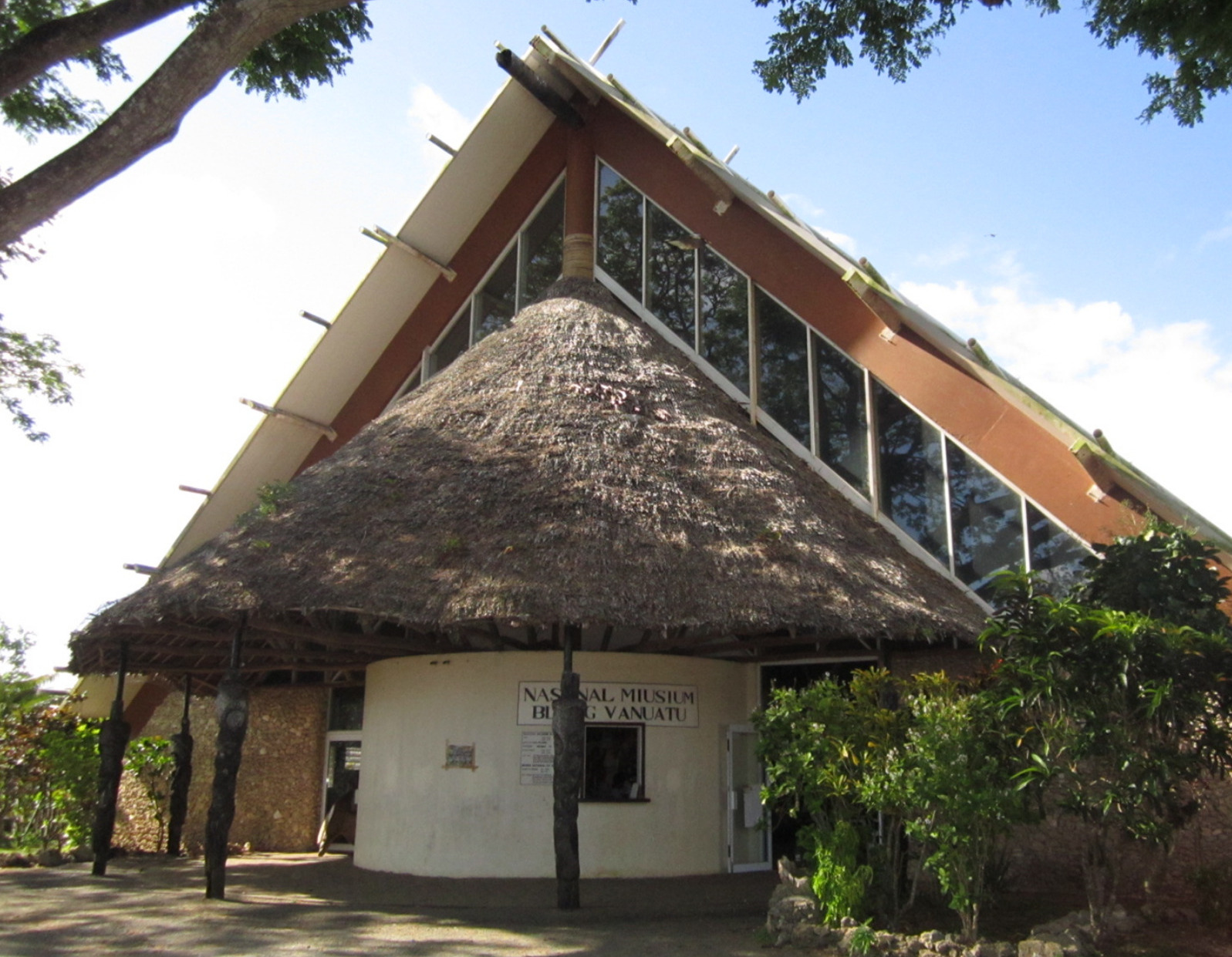
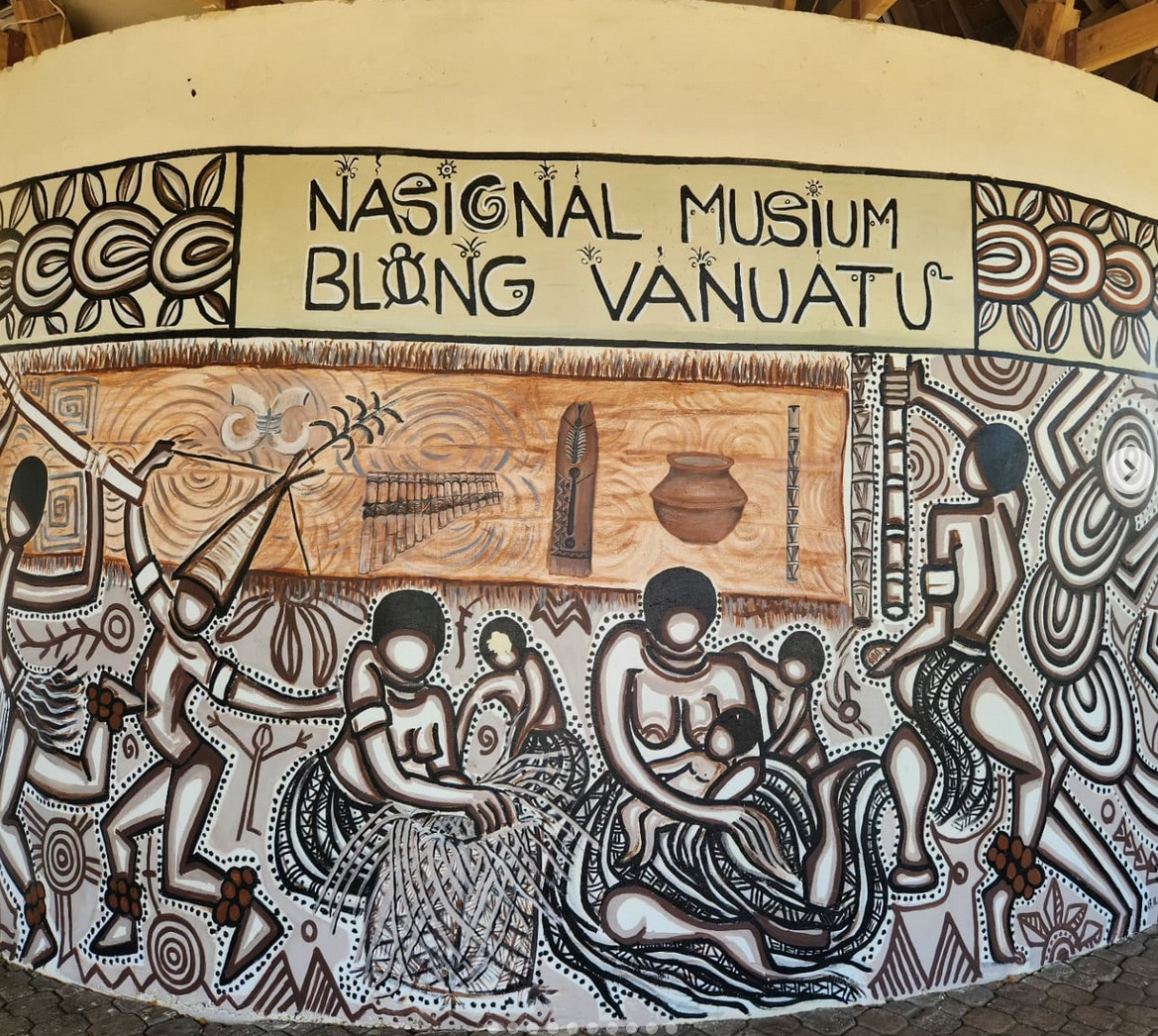
2. Vanuatu Cultural Centre and National Museum
• Location: 17°44.467′S 168°18.679′E
• This small yet insightful museum offers an immersive look at Vanuatu’s diverse cultures, kastom stories, musical traditions, sand drawings, and colonial history. Often, a local guide or elder performs storytelling or music demonstrations—well worth the time.
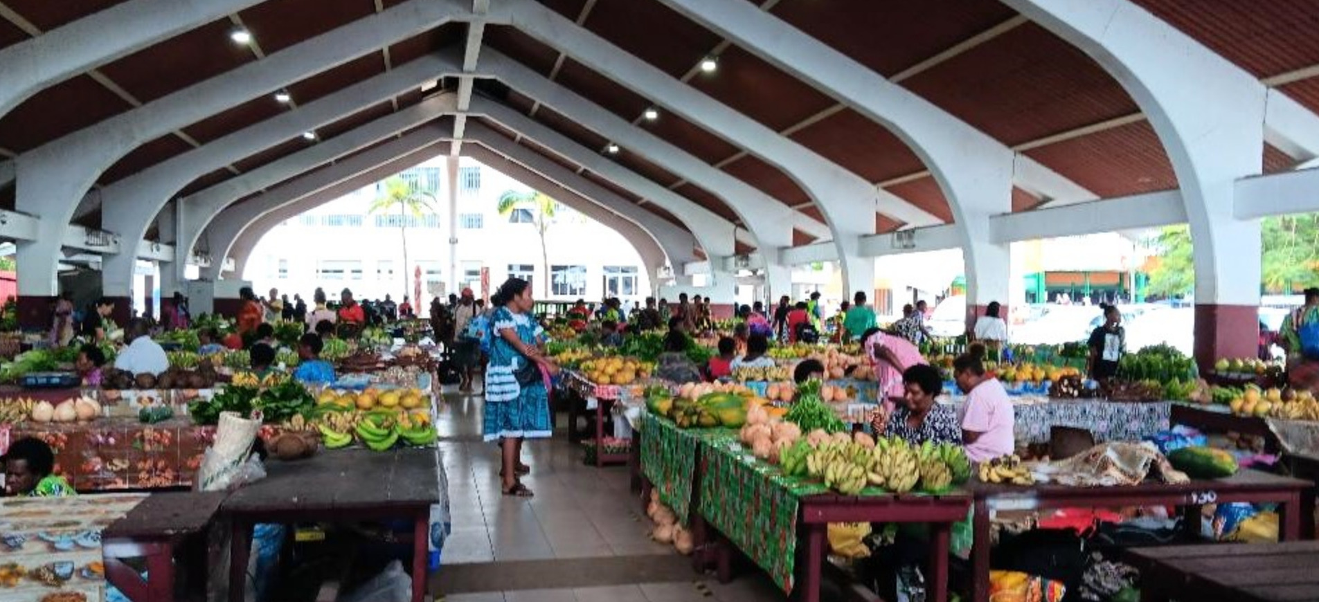
3. Etas Market & Mama’s Handicraft Markets
• Location: Downtown Port Vila
• The bustling open-air market near the waterfront is where Ni-Vanuatu women sell vibrant sarongs, island crafts, carved wooden items, and baskets made from local materials. Great for provisioning, souvenir-hunting, or supporting local artisans directly.
4. Lookout at Klem’s Hill
• Location: 17°42.880′S 168°15.880′E
• One of the best panoramic views over Port Vila Harbor, the lagoon, and the surrounding islands. Easily accessed by taxi or a long walk, it’s a quiet and contemplative place at sunrise or sunset. A great photo stop.
5. Haos Blong Parliament (Parliament House)
• Location: 17°44.272′S 168°18.593′E
• An architectural landmark and symbol of Vanuatu’s modern independence. While tours are limited, the grounds and building design (with local influence and carvings) are notable. A peaceful stop that reflects the island’s unique governance blend of modern democracy and tradition.
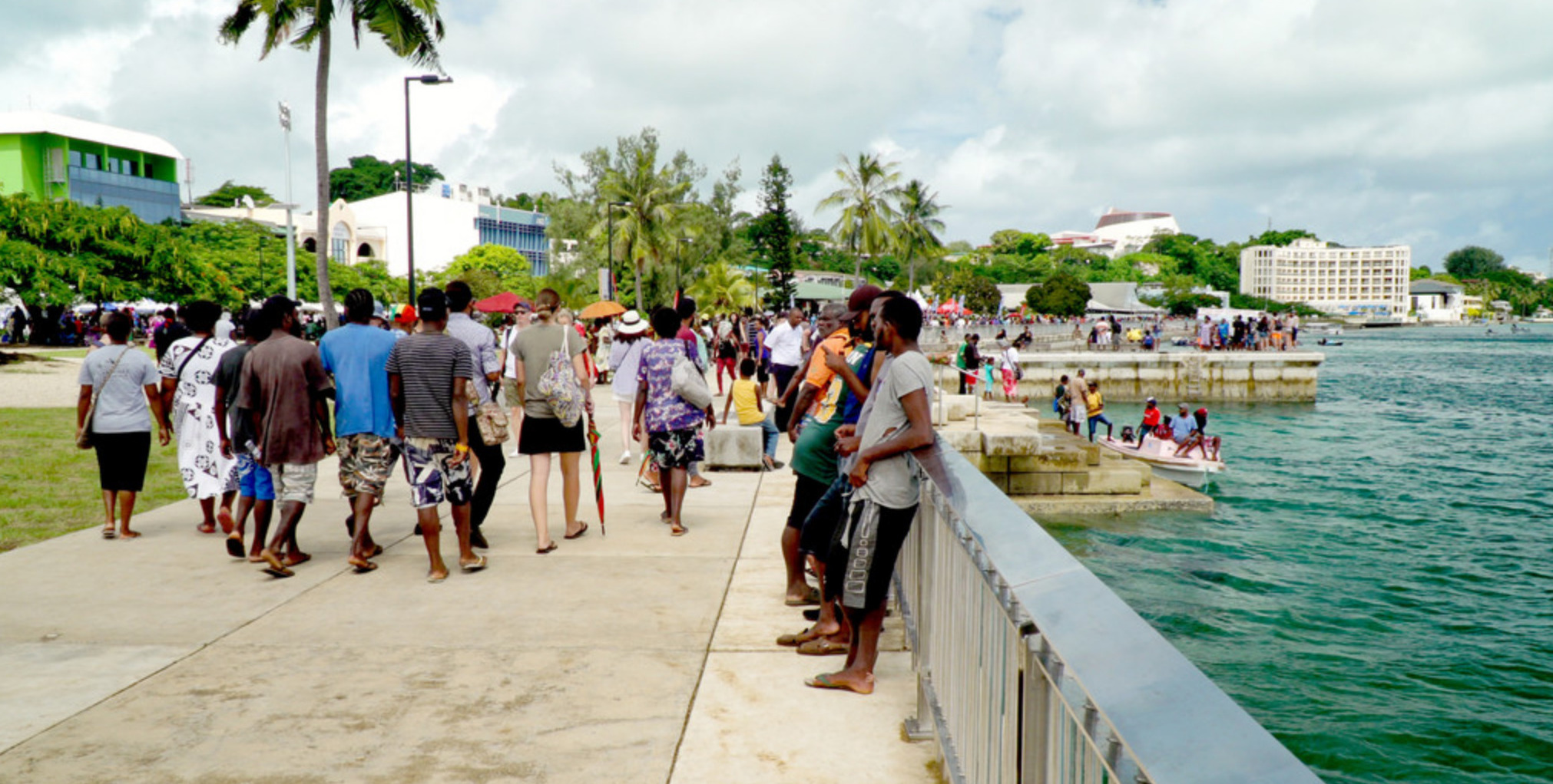
6. Pepsi Park and Seafront Promenade
• Location: 17°44.348′S 168°18.563′E
• Not for swimming, but excellent for stretching legs along the shaded pathways, people-watching, or watching the outrigger canoes from afar. Grab a local snack, coconut, or espresso and enjoy the island rhythm.
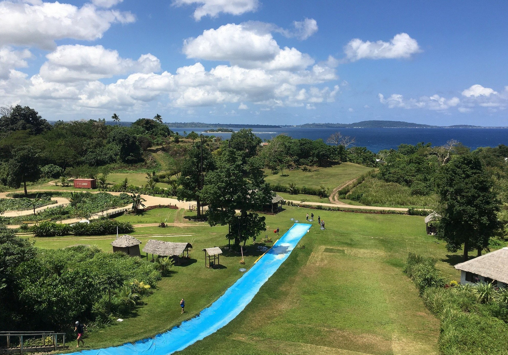
7. Secret Garden & Wildlife Cultural Park
• Location: Near Mele Bay, 10 minutes from Port Vila
• More than a garden, this is a curated open-air museum where traditional traps, kastom houses, and displays tell the stories of Vanuatu’s tribal past, cannibal history, and flora/fauna. No gimmicks, just authentic storytelling and friendly staff.
CYCLONE 🌀 HOLES OF THE SOUTH PACIFIC
🌪️ Cyclone Holes in the South Pacific
Initial List – Version 1..0.1 (expanded over time)
NOTE: Cyclone holes are never guaranteed safe — captains must always monitor weather systems and use discretion. and stay onboard
-
-
🇫🇯 Fiji
-
Mangrove Creek, Vuda Lagoon
📍 17°40.305′ S 177°23.690′ E
Sheltered mangrove-lined creek near Vuda Marina.
Excellent holding in mud, surrounded by trees, minimal fetch.
Marina access nearby; heavily used by locals during storms.
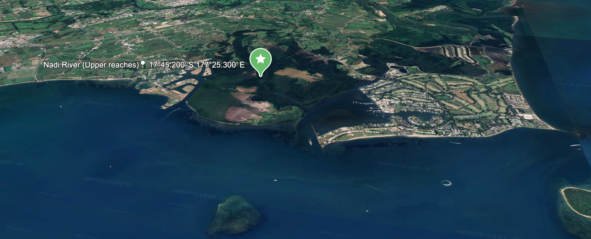
Nadi River (Upper reaches)
📍 17°45.200′ S 177°25.300′ E
Deep upriver option past the Nadi town bridge.
Mud bottom, mangrove protection, avoid during heavy rain due to runoff and debris.
Tight anchoring space, but used by locals during past systems with up to 29 yachts.
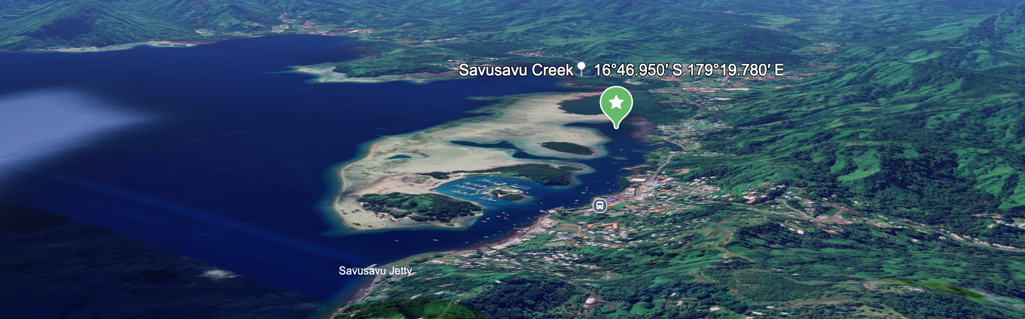
Savusavu Creek
📍 16°46.950′ S 179°19.780′ E
Behind Cousteau Resort and Waitui Marina.
Sheltered from most directions, silt/mud bottom.
Easy access to town, but prone to river flooding if cyclone is rain-heavy.
-
-
🇹🇴 Tonga
-
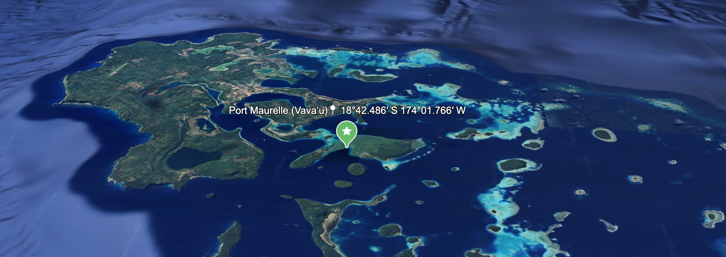
Port Maurelle (Vavaʻu)
📍 18°42.486′ S 174°01.766′ W
Good cyclone hole for smaller systems.
Surrounded by high hills, decent holding.
Limited space; better suited for early arrivals or smaller yachts.
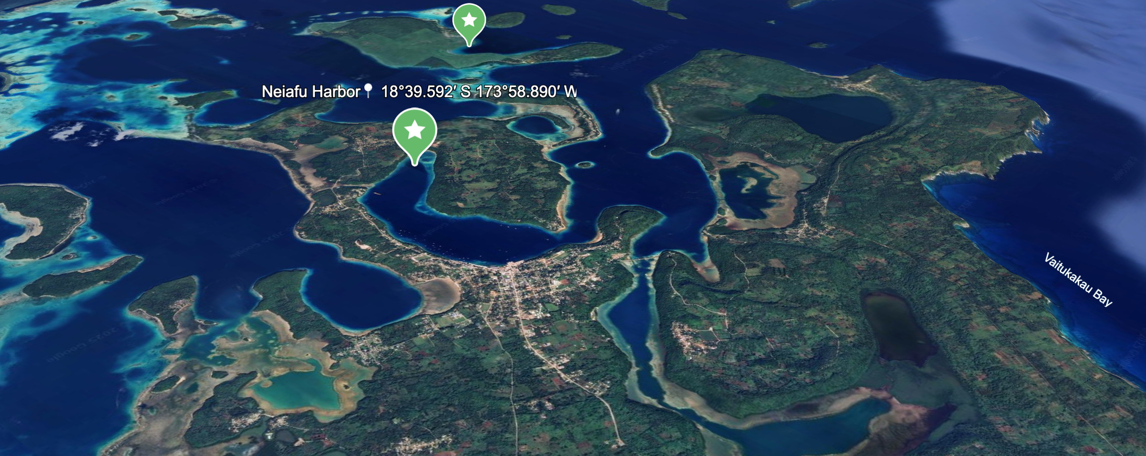
Neiafu Harbor
📍 18°39.592′ S 173°58.890′ W
Deep protected bay with marina moorings and anchorage.
Cyclone-rated moorings available.
Inland geography helps break wind, but overcrowding can be an issue.
-
-
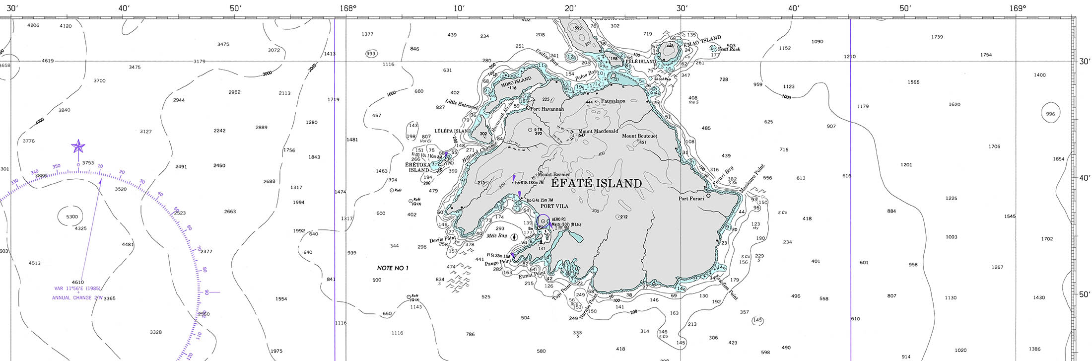
🇻🇺 Vanuatu
-
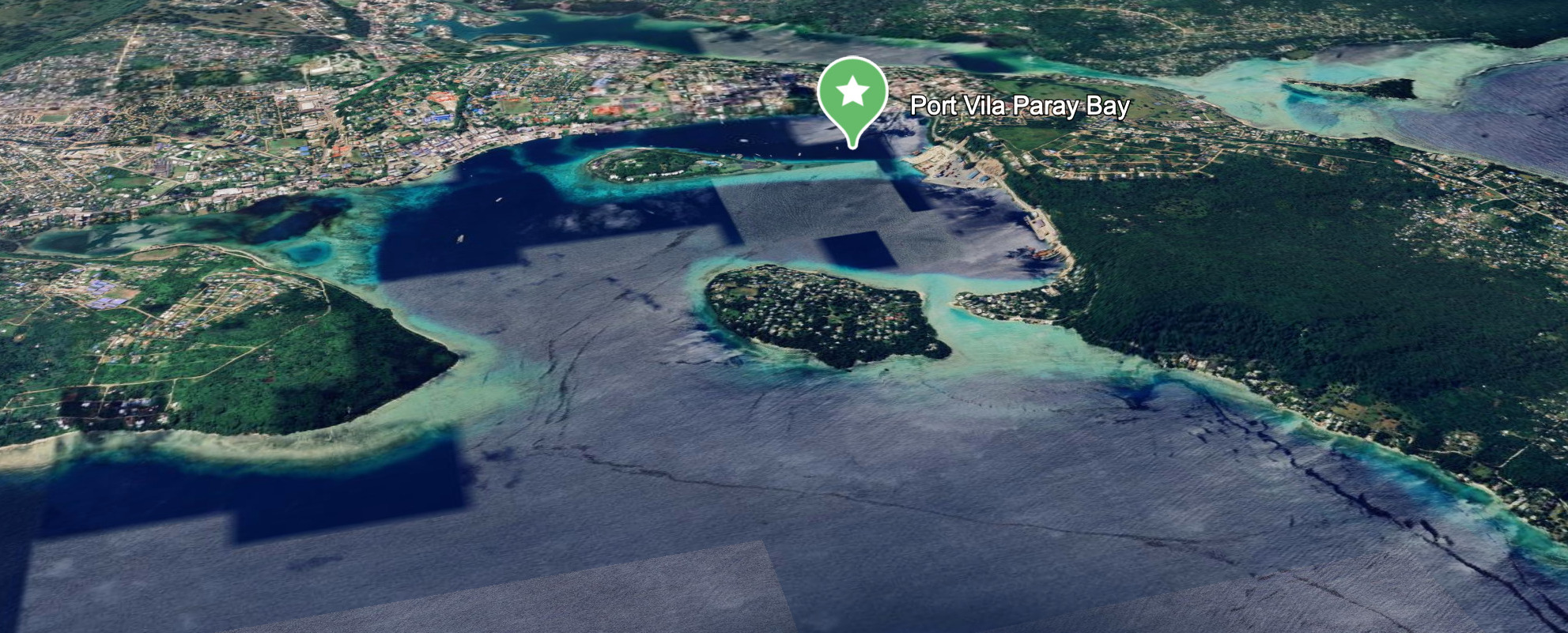
Port Vila (Paray Bay / Malapoa)
📍 17°44.930′ S 168°18.700′ E
Cyclone-rated moorings by Yachting World.
Well-protected from swell, though exposure to strong gusts possible.
Popular with cruisers seeking shelter from early cyclones.
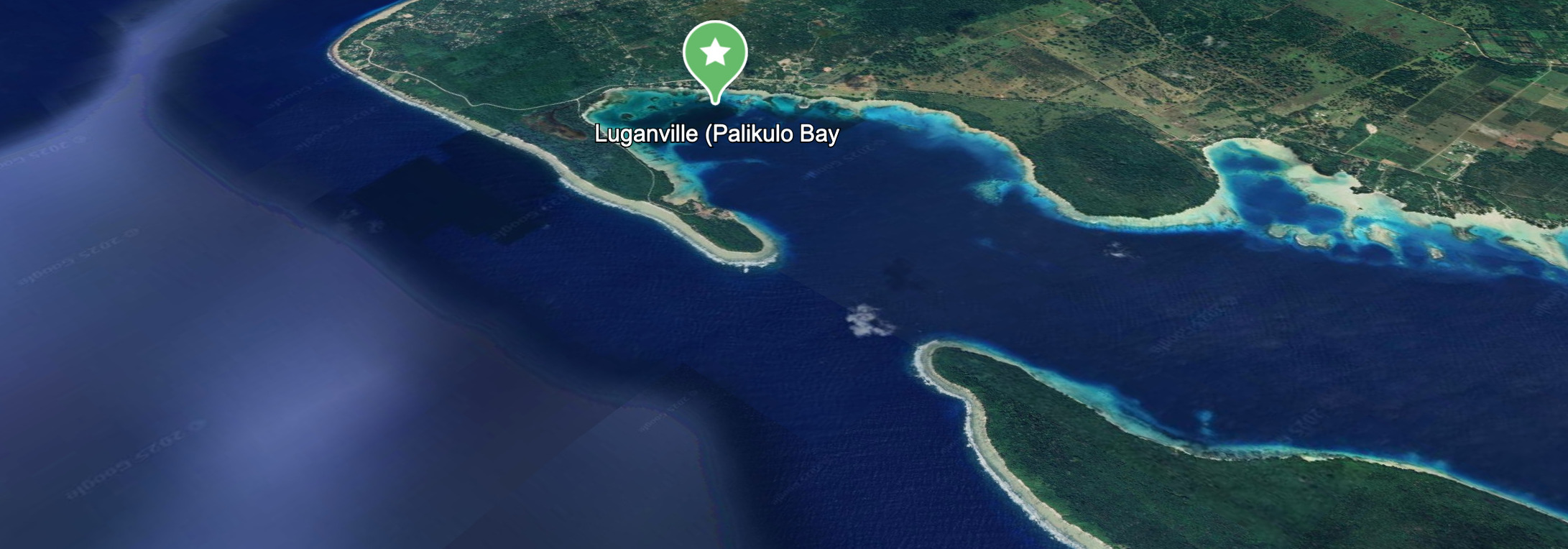
Luganville (Palikulo Bay)
📍 15°29.760′ S 167°11.700′ E
Well-protected east-facing bay, good holding, used during past cyclones.
Limited facilities, but remote and quiet.
Silt/mud bottom with mangrove perimeter.
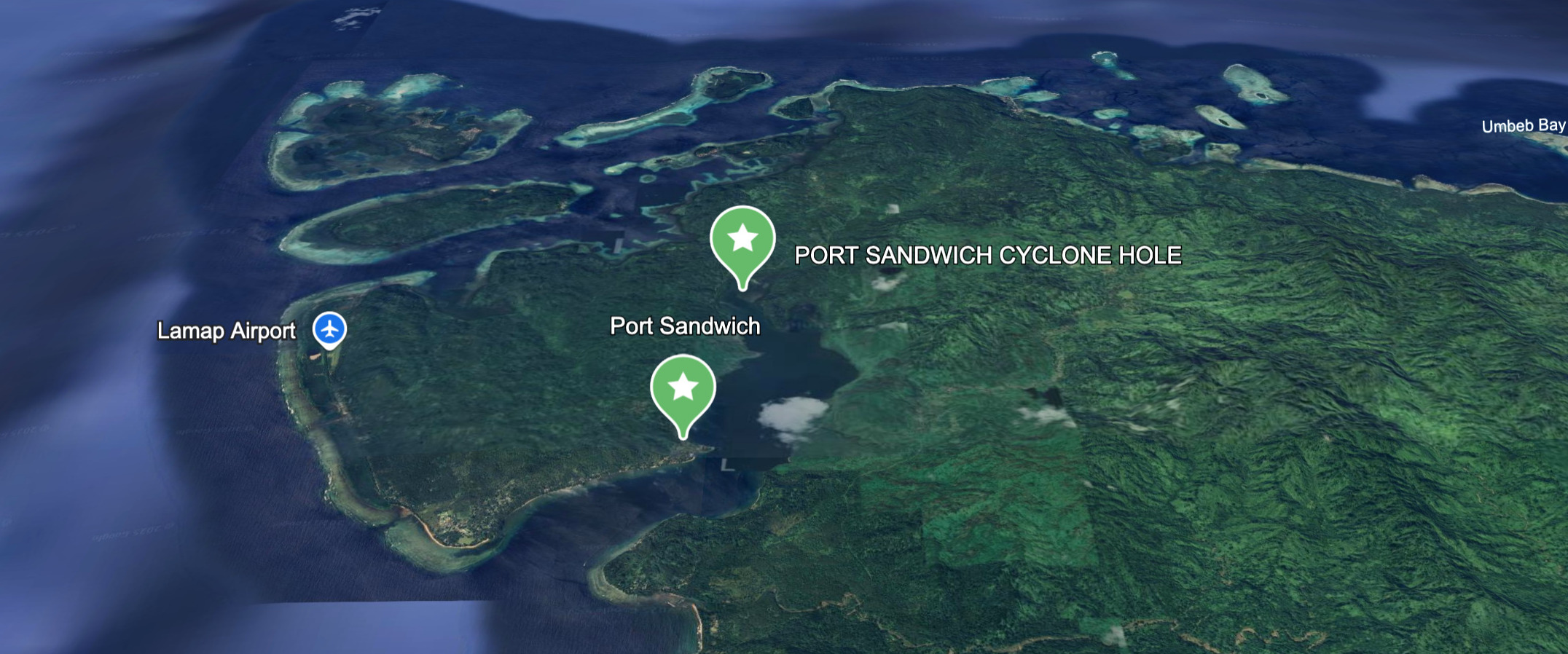
Port Sandwich 📍( Malekula ) 16°28.1783′ S 167°46.7966′ E
very deep bay ( 5 nm ) with lots of mangroves
muddy sandy bottom use mud flap dual anchor
sharks – do not swim a lot
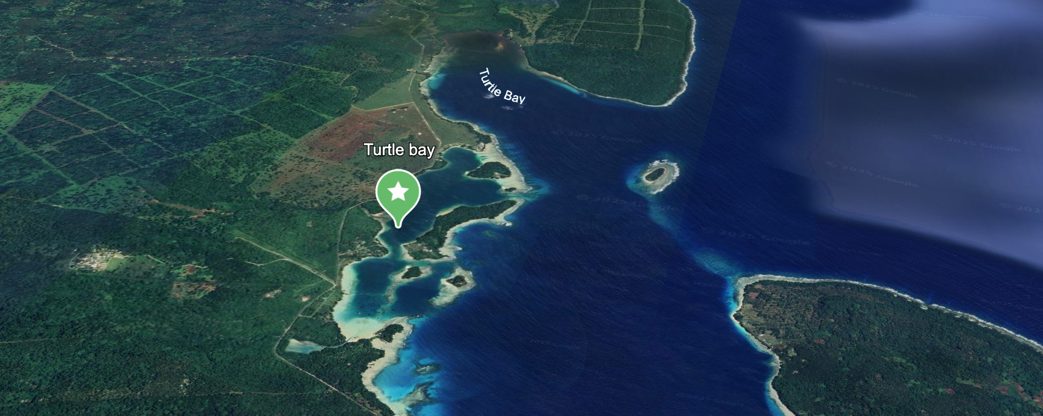
Turtle Bay 📍 ( Espiritu Santo East Coast ) 15°22’22.9″S 167°11’23.9″E
medium sandy bay inside double outer reef – good protection with some fetch
-
-
🇳🇨 New Caledonia
-
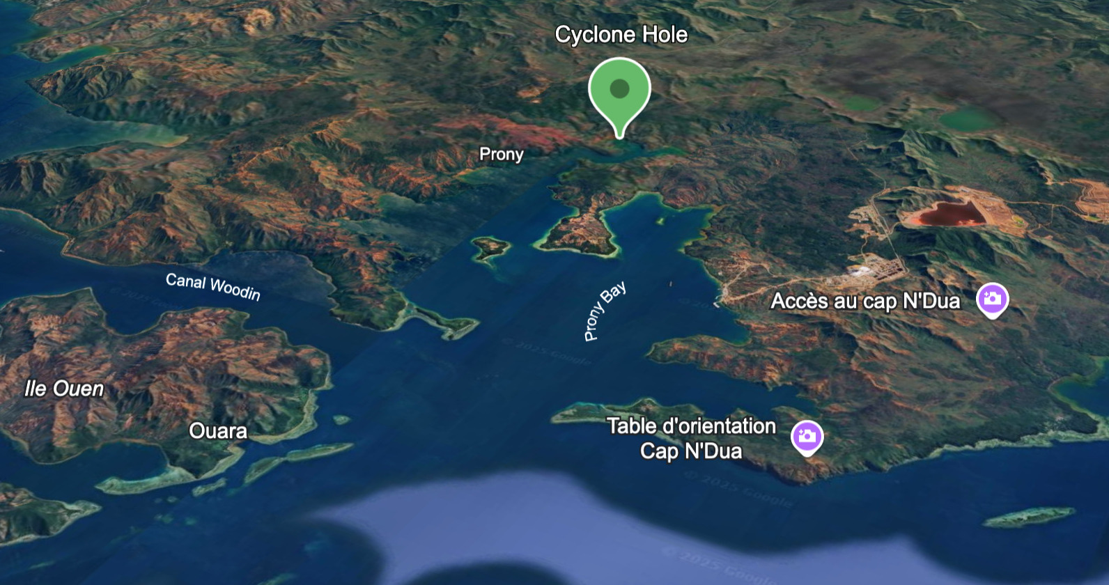
Baie de Prony (Bay of Prony)
22°21.400′ S 166°51.100′ E
Deep inlet with multiple coves and mangrove arms.
Excellent shelter options in Prony’s various branches (e.g. Baie du Carénage).
Prone to silting during prolonged rainfall.
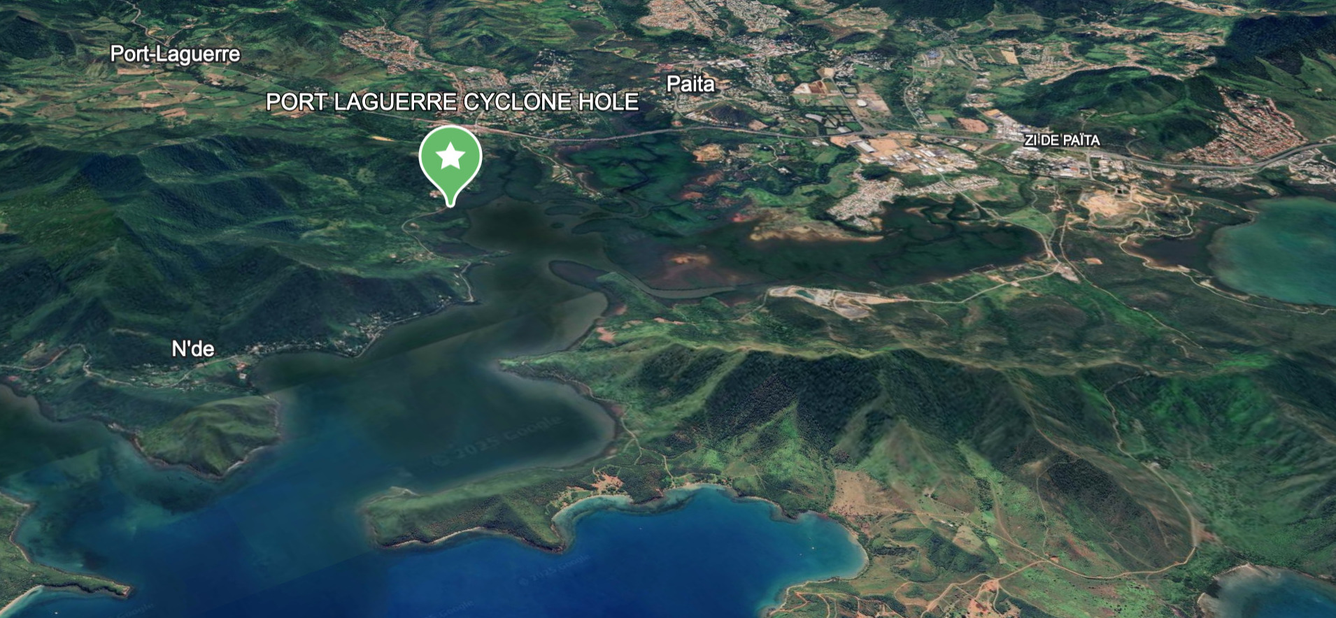
Port Bay Laguerre 📍 22° 08.5983′ S 166°19.9816′ “E
Mangrove lined river and small island basins
-
-
🇫🇷 French Polynesia
-
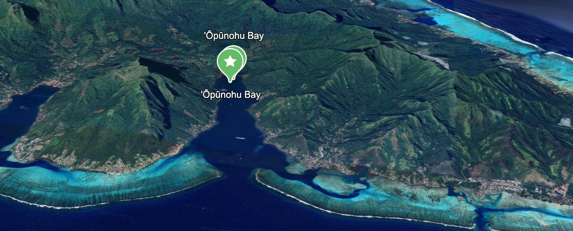
Baie d’Opunohu (Moʻorea)
📍 17°29.429′ S 149°51.994′ W
Deep and steep, but very protected.
Surrounded by lush ridgelines.
Holding can be variable; limited swing room.
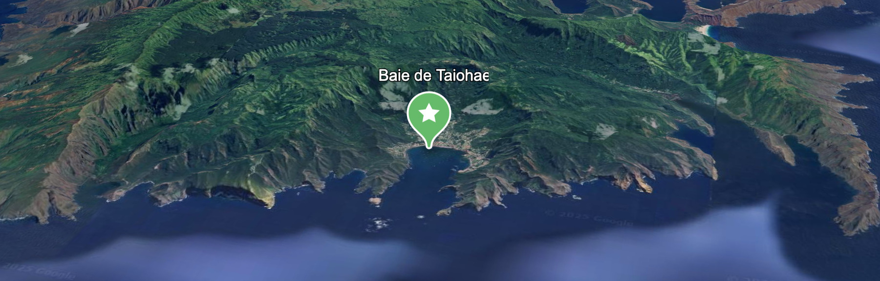
Baie de Taiohae (Nuku Hiva)
📍 8°54.812′ S 140°05.855′ W
Marquesas are out of traditional cyclone zone, but occasionally impacted.
Taiohae is a massive caldera, great shelter.
Surge can enter the bay, but wind protection is solid.
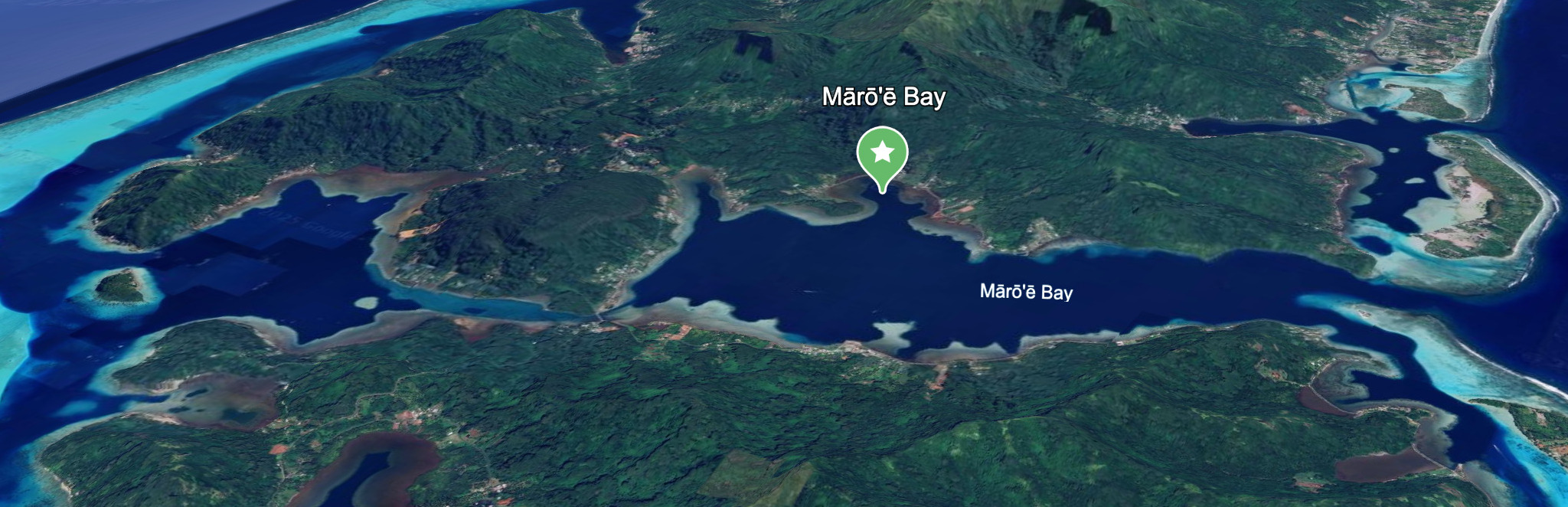
Mārō’ē Bay (Huahine
📍 16°44’57.9″S 151°00’11.8″W
Society Islands tucked in way up
-
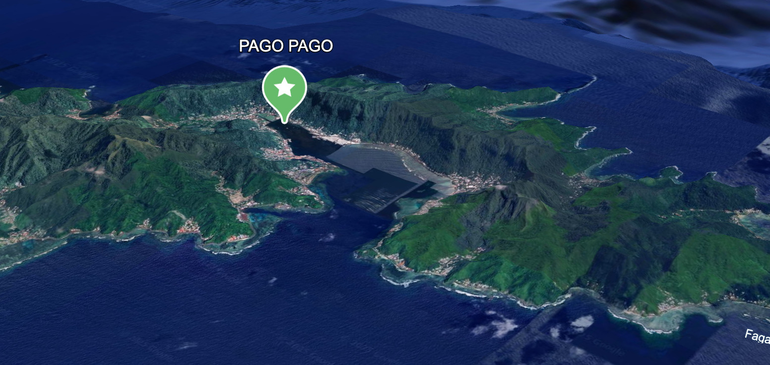
🇦🇸 AMERICAN SAMOA
- Pago Pago Harbor 📍 14°16’25.3″S 170°41’14.1″W
-
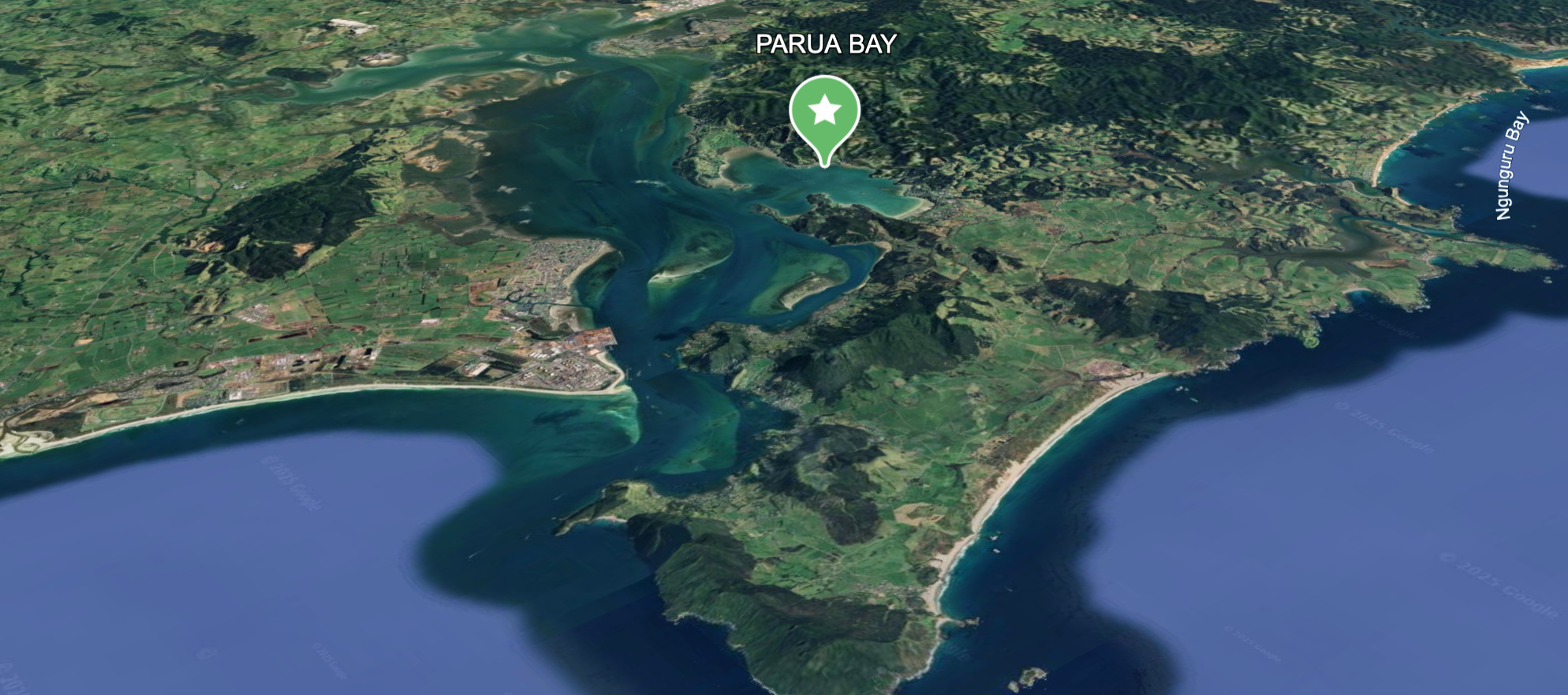
🇳🇿 NEW ZEALAND
- Parua Bay 📍 1 35°46’35.0″S 174°27’23.3″E
When preparing to ride out a South Pacific cyclone, choosing the right bay or anchorage is critical. Cyclones rotate clockwise in the southern hemisphere, and the quadrant you’re in relative to the storm center dramatically impacts wind direction, wave setup, and surge. Here’s how to decide which sides to avoid and why:
❌ Bays to Avoid
1. Northern Quadrant (Especially Northeast)
• Why: This is the dangerous semicircle in a clockwise-rotating cyclone.
• Winds are strongest and combine with the cyclone’s forward movement.
• You’ll likely experience onshore winds, extreme wave setup, and high storm surge.
• Example: If a cyclone is approaching from the north or northwest, avoid north-facing bays.
2. East-Facing Bays
• In the southern hemisphere, the eastern side of the cyclone (NE and SE) often sees increasing pressure gradients and large, confused seas.
• These bays may offer poor protection from swell or surge, even if the winds are briefly offshore.
🌪️ HURRICANE & CYCLONE SEASON PREPARATION FOR YACHTS
A Mariner’s Guide to Riding Out the Storm or Clearing Its Path
When sailing vessels venture into hurricane latitudes, the season of tempests demands forethought, seamanship, and swift decision-making. Whether you’re moored in a hurricane-rated marina, nestled in a cyclone hole, or riding to anchor, preparation makes all the difference between survival and salvage.
⚓️ 1. MAKE FOR SAFE HAVEN EARLY
The greatest variable in any storm prep is your location. There is no substitute for securing your vessel well in advance. When tropical disturbances brew, time becomes tide.
Ideal Options:
• Haul Out: A hurricane cradle on land with proper tie-downs is safest. Seek yards with proven storm protocols.
• Mangrove Cyclone Hole: Natural protection from surge and wind, best when used with multiple anchor rodes spidered in all directions. – with a Mosquito mitigation plan.
• Hurricane-Rated Marina: Reinforced docks, floating pontoons, and staff who understand storm protocol.
Avoid:
• Open anchorages, exposed moorings, or poorly maintained slips.
• Relying solely on mooring balls of unknown quality.
⚠️ The time to relocate is days before the system turns deadly – not hours.
🪢 2. DOUBLE DOWN ON SECURING YOUR VESSEL
Once you’ve chosen your haven, the vessel must be made as storm-ready as possible. This is not the time for half-measures. Strip her down, double her lines, and prepare for 360° wrath.
Standing Orders:
• Strip topsides: Remove sails (main, headsail, stack packs), dodgers, biminis, solar panels (if possible), BBQs, jerry cans, paddleboards, and all loose deck gear.
• Secure below: Latch every cabinet, seal lockers, and remove perishables.
• Chafe protection: Apply to every critical line – think firehose sleeves, leather wraps, or sacrificial lines.
• Rig lines in opposing directions: Reduce the strain on any one cleat or bollard.
• Fenders: Deploy every one you own and source more if possible. Fender boards are invaluable when against pilings.
🧭 A good prep job makes the difference between a refit and a rum toast.
⚡️ 3. PROTECT SYSTEMS & POWER
Modern yachts are dependent on batteries, pumps, and electronics. Keep your electrical and bilge systems storm-hardened.
Power Prep:
• Fully charge batteries. If evacuating, disconnect and isolate bank terminals.
• Bilge pumps: Test auto and manual modes. Ensure backup pumps are operational.
• Secure fuel and water tanks: Full tanks reduce movement and condensation.
• Shut down non-essential circuits, seal panel with plastic wrap if leaving unattended.
🌧️ 4. SEAL THE HULL – INSIDE & OUT
Keep water where it belongs. Close all through-hulls not essential for bilge drainage.
• Tape hatches, vents, and companionways with waterproof tape or shrink wrap.
• Plug exhaust ports and intakes if engine is not in use.
• Inspect and reinforce portlights, skylights, and sliding hatches.
📜 5. INVENTORY & DOCUMENTATION
Prepare as if she’ll be inspected by insurance adjusters and salvors alike.
• Take photos of everything: standing rigging, electronics, interior, bilges.
• Store copies of insurance, registration, inventory lists, and maintenance records.
• Send cloud backups to shore-based contacts.
• Notify marina, neighbors, and your rally group of your prep and location.
🎒 6. PREPARE FOR ABANDON SHIP OR EVACUATION
Every captain must know when to stay and when to go. Once winds exceed 50 knots, you should be off the dock and ashore in shelter if your location allows.
Have Ready:
• Go-bag: Passport, cash, ID, medications, hard drive, emergency contacts.
• Dry bags for phones, backups, and radios.
• Evac plan: Know your route, shelters, and timing.
• Weather feeds: Follow multiple sources—NOAA, JTWC, Windy, and local VHF.
⚓️ When the barometer drops, don’t wait for permission – move.
✅ 7. HURRICANE PREP TIMELINE
Suggested Action Plan as Storms Approach
Time Before Landfall
Action
5 Days Out
Confirm safe haven; haul out if possible. Review insurance and secure plans.
4 Days Out
Strip canvas, remove or secure topside gear. Top off fuel, water, and battery banks.
3 Days Out
Begin final tie-downs, double lines, deploy chafe gear. Haul out or enter storm slip.
2 Days Out
Seal hatches, disconnect non-essentials, backup docs. Finalize evacuation plan.
1 Day Out
Abandon vessel if required. Shelter ashore with your go-bag. Monitor storm on handheld devices.
OPEN CPN – ADDITIONAL AND FREE AID TO NAVIGATION
OpenCPN with Satellite Imagery: The Offshore Navigator’s Secret Weapon
When you’re sailing toward a jagged reef-fringed coastline, and the official chart puts your GPS position halfway up a mountain, that’s when you’ll be glad you’ve got OpenCPN loaded with satellite imagery. Because out here, far from marinas, chandleries, or known way points, your nav gear is either working with you, or you’re gambling with steel, aluminum and fiberglass.
For yachts in remote waters, OpenCPN with sat imagery isn’t just an aid to navigation, it’s your edge. It’s how you sail into the unknown and make it back out again.
1. Why the Charts Can’t Be Trusted
Let’s get this out of the way: in many parts of the world, your fancy electronic charts are full of lies. Not malicious ones, but outdated, inaccurate, and incomplete just the same.
In places like the San Blas, Tuamotus, Solomons, or Indonesia, you’ll find charts with depths from 1894, reefs in the wrong spot, and entire bays missing. Even the big names, Navionics, Garmin, C-Map, are just digitizing what the hydrographic offices give them. If those surveys were done by rowboat with a sextant and leadline, then that’s what you get. Garbage in, garbage out.
The result? Your $10,000 plotter could show you anchored safely in 20 meters when you’re actually hard aground.
But OpenCPN with satellite overlays? That shows you what’s really there, no matter what the chart says.
2. What the Hell Is OpenCPN?
It’s not an app for weekend warriors. OpenCPN is open-source nav software built by cruisers for cruisers. It runs on laptops, Raspberry Pi, old beater PCs, whatever you’ve got.
What makes it powerful isn’t just that it’s free. It’s that you can drop in satellite imagery. High-res, no-BS bird’s-eye views of anchorages, reefs, channels, and islands, pulled from sources like Google Earth or Bing and converted to KAP charts with tools like SAS.Planet or GE2KAP.
Plot your course over that, and suddenly you’re not guessing anymore. You’re seeing coral heads. You’re threading the needle between bommies with 100% visual confirmation. It’s the closest thing to a drone scout you’ve got.
3. The Satellite Advantage
In real cruising, details matter. Satellite imagery gives you the stuff that charts and guidebooks miss:
• The real pass through that reef, not the fantasy version on the chart.
• Actual bommies, not just a warning that “reefs may exist in this area.”
• Sandy vs rocky bottoms, so you know whether to drop the hook or move on.
• Landing spots for your dinghy, without chewing up your outboard on a hidden rock shelf.
• Lagoon layouts, for picking a lee anchorage when the tradewinds clock around.
One glance at a satellite overlay and you know what’s up. You can see the swell lines on a beach, the overhanging palms, even the difference in water color where a sandbar hides. That’s boots-on-deck knowledge from 500 miles away.
4. Fixing the “Chart Offset” Problem
One of the most unnerving things offshore is watching your GPS position slide up onto dry land.
No, your system isn’t broken, your chart datum’s just off. Some areas have offsets of 300 meters or more. That’s a hell of a lot when you’re trying to squeeze through a reef pass.
With satellite overlays in OpenCPN, you can literally see the mismatch between your boat and the land. You adjust your thinking. You recalibrate. You trust the imagery over the chart, because it matches what your eyes see.
And if you’re smart, you make your own waypoints from those images. Now you’re navigating from the real world, not fantasyland.
5. Route Planning You Can Trust
Plotting a course into an atoll or up a river in uncharted territory? Satellite imagery is the next best thing to a drone recon mission.
You can:
• Zoom in on an anchorage.
• Sketch your way through narrow passes.
• Identify isolated coral heads and mark them as hazards.
• Find the one sandy spot behind that headland where you might drop the hook.
It’s like looking at a living chart, one that sees through the lies and fills in the blanks.
6. AIS + Sat Imagery = Tactical Edge
OpenCPN also integrates AIS. When you layer satellite imagery behind your AIS targets, the picture gets real sharp:
• You see exactly where the other boats are anchored.
• You know where the deep water lanes are.
• You avoid looking like a muppet by anchoring on top of someone else’s anchor chain.
Throw radar into the mix, and you’ve got a full tactical chart table running from a laptop that cost less than a tank of diesel.
7. Offline Means Independence
When you’re sailing out where the fish have never seen a propeller, don’t count on 4G.
The brilliance of OpenCPN is that it works offline. You download your charts, your overlays, your routes, everything. Once it’s onboard, it stays onboard. No signal? No problem.
That’s why this system matters for expedition yachts and remote cruisers. You can navigate reef passes in the Marshall Islands without a whiff of Wi-Fi. You can reroute around a squall off Isla del Coco without calling home. You are self-reliant.
8. Reading the Reef: Real World, Not Guesswork
When you’re sneaking into a lagoon at dusk with no buoys, no beacons, and the swell on your quarter, sat imagery is gospel.
You can see:
• Where the deeper water runs.
• Where the surge is breaking.
• Where the safe landing beach is, not the cliff or mangrove swamp.
This is not the kind of information you get from vector lines and chart symbols. This is eyes-in-the-sky navigation.
9. Anchor Smarter. Sleep Better.
Satellite imagery doesn’t just help you get in, it helps you stay put.
At anchor, it shows you:
• Where the sand is.
• Where the coral heads are (so you don’t foul your gear).
• How much swing room you’ve got before you hit something sharp.
Drop the hook in the right patch, get a solid set, and sleep like the dead.
10. Community Power: The Shared Chartroom
Another major win: you can import other cruisers’ GPX tracks into OpenCPN. Combine that with satellite imagery and now you’ve got:
• A route that’s been sailed and tested.
• A visual cue of every turn and hazard.
• Confidence when entering a sketchy anchorage or pass.
It’s the power of the cruising community at your fingertips. Tracks, notes, and satellite intel from boats that have been there, done that, and lived to tell the tale.
11. Plot Your Own Safe Passage
Satellite imagery gives you what the charts can’t: freedom to explore. The confidence to try that uncharted bay. The ability to vet a potential stop before you waste half a day and 20 liters of fuel.
You’re not bound to guidebooks or outdated waypoints. You can make your own decisions. Navigate your own path.
When the trade winds pipe up or the swell wraps into your anchorage, you’ve got options. You’re not guessing. You’re adapting, with real intel.
12. Real-World Use Cases from the Fleet
• Tuamotus: Using sat overlays, a boat found a secondary, unmarked pass into an atoll. Saved them 10 miles of backtracking.
• Vanuatu: Yacht avoided fouling their anchor chain on coral heads by picking out a sand patch using imagery, confirmed with mask and snorkel.
• Colombia: Used satellite images to identify a river mouth that had shifted since the last survey. Entered safely while another yacht ran aground 100 meters away.
• Panama’s Pacific Islands: Navigated a narrow reef pass between two unmarked islands with just satellite imagery and a hand-bearing compass. No charts. No aids. Just brains and pixels.
13. Free. Flexible. Forgiving.
OpenCPN isn’t flashy. It doesn’t come with marketing brochures. It doesn’t require a subscription. It’s not for landlubbers or dockside posers.
But for the cruiser who wants maximum capability with minimum BS, it delivers:
• Total nav flexibility.
• Offline resilience.
• Visual confirmation of what’s real.
• Constant improvement from a global community.
It’s gear that works in the real world. The one with rust streaks, wet logbooks, and that constant itch to go just one anchorage further.
Why It Belongs on Every CRUISING Boat
Your navigation system is only as good as the truth it shows you. Out beyond the reach of the Coast Guard, when you’re the only mast on the horizon, you want gear that gives you the raw, unfiltered picture.
OpenCPN with satellite imagery strips away the guesswork. It shows you what’s actually out there, so you can make the call. Thread the reef. Ride out the blow. Tuck in tight behind a headland. Drop the hook in the one sandy patch for 20 miles.
This isn’t about pretty interfaces. It’s about not hitting things. About getting in safe, getting out clean, and looking smart while doing it.
If you’re heading for the edges of the map, or beyond your usual cruising grounds – OpenCPN with satellite imagery isn’t optional. It’s the difference between hoping, and knowing.
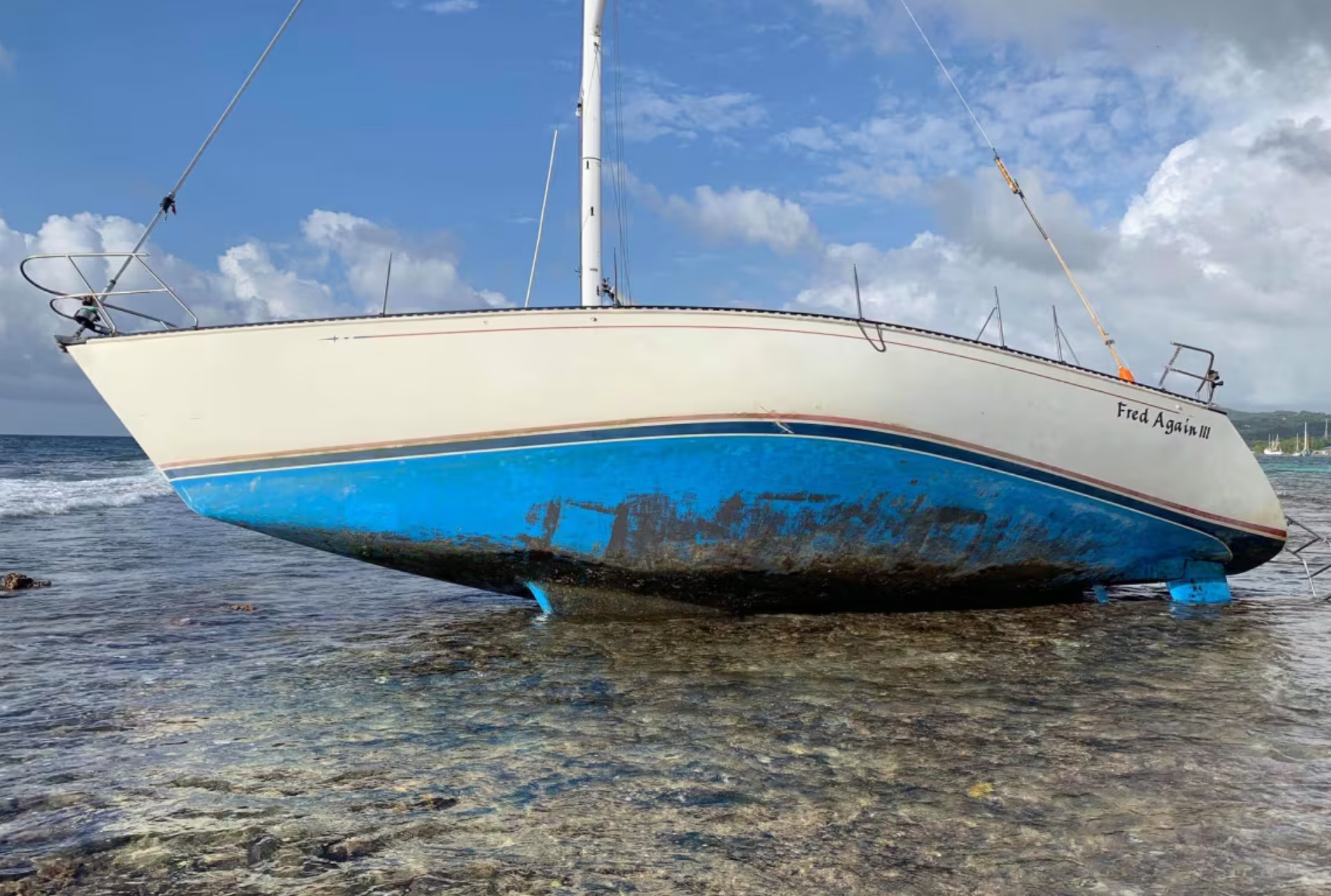
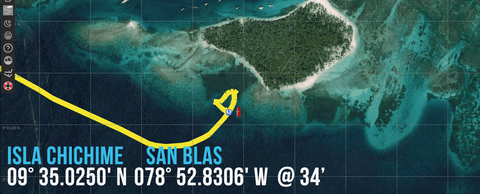
The Ocean Posse, formerly known as the Panama Posse, stopped it’s operational area in Panama, but one of our participants, Robert, chose to press on. Unfortunately, due to fatigue and over reliance on Navionics charts, his vessel ran aground on a reef near Roatán. You can read the full account of this grounding here.
This incident underscores one of the driving reasons we continue to expand the reach of the Ocean Posse: to share better, more accurate information—including satellite chartlets and local updates—that make ocean voyaging and coastal cruising safer and more viable for all.
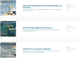
THREE AUGUST OPEN CPN SEMINARS – THESE ARE HANDS ON SEMINARS WITH Q&A
PLEASE USE YOUR PC OR MAC LAPTOPS AND JOIN WITH ZOOM –
SORRY WE WILL NOT SUPPORT IPAD TABLETS IN THESE SESSIONS !
Primary Named Winds 🌬 PACIFIC COAST OF THE AMERICAS
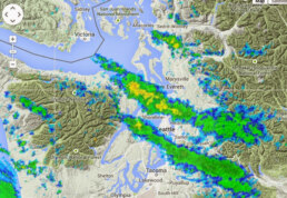
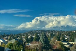
PUGET SOUND CONVERGENCE ZONE
| Puget Sound Convergence Zone | Puget Sound (Seattle to Everett) | Spring–Fall (varies) | Localized wind and rain bands due to split flow around Olympic Mountains. |
The Puget Sound Convergence Zone (PSCZ) is a distinctive and often dramatic weather phenomenon unique to western Washington State, particularly affecting the maritime and coastal areas around Puget Sound. It occurs when moist air masses from the Pacific Ocean split as they encounter the Olympic Mountains. These airflows travel around the mountains—some curving north over the Strait of Juan de Fuca and others south through Grays Harbor—before meeting again in the lee of the range, directly over the Puget Sound region.
This collision of air streams—often carrying different temperatures, pressures, and moisture levels—creates instability, turbulence, and upward motion in the atmosphere. The result is a narrow band of intensified weather, typically aligned east-west from the Kitsap Peninsula across the central and northern Puget Sound toward Everett, and sometimes as far east as the Cascade foothills. This zone can produce sudden changes in conditions, such as localized heavy rain, snow, gusty winds, small hail, or even thunderstorms—while areas just miles away remain dry or calm.
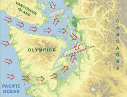
From a mariner’s perspective, the PSCZ can be particularly tricky. A sail through calm waters can quickly turn into a challenging ride with squally winds, confused seas, or reduced visibility. It’s not uncommon for vessels transiting north to encounter strong wind shear, unexpected gusts, and fast-building waves as they pass through the convergence boundary. Mariners navigating in or near the PSCZ should always monitor NOAA marine forecasts, radar, and real-time weather updates, as these micro-systems can develop quickly and without much warning.
In winter, the PSCZ can shift into a snow-producing engine. Under certain synoptic setups, especially during post-frontal cold air outbreaks, the zone focuses narrow bands of snow over specific areas while others remain clear—a challenge for both forecasters and road crews.
Pilots, sailors, and meteorologists alike have long respected the Puget Sound Convergence Zone as a prime example of topographically influenced mesoscale weather. Its presence underscores how local terrain can significantly impact weather patterns even at relatively low elevations.
For mariners and yacht owners, understanding the PSCZ is key to safe coastal cruising in the Pacific Northwest. While it’s not always active, when it is, the convergence zone demands caution, preparation, and a willingness to adjust course or schedule. As always, the call of the sea in these waters is matched by the need for good seamanship and local knowledge.
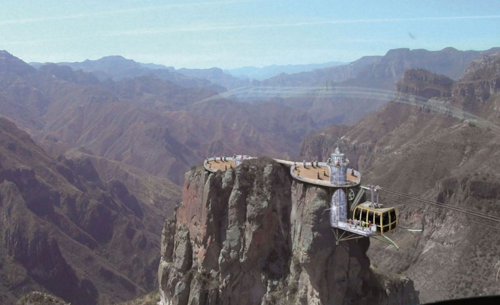
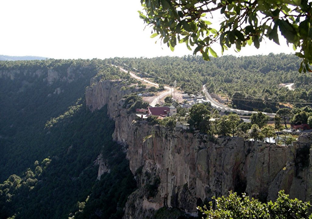
🇲🇽 COPPER CANON – BARRANCA DEL COBRE – EL CHEPE
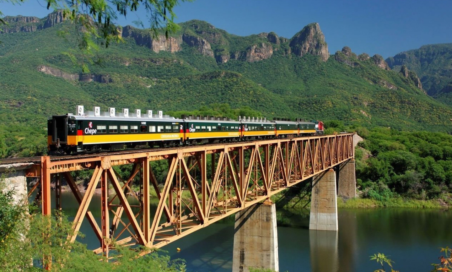
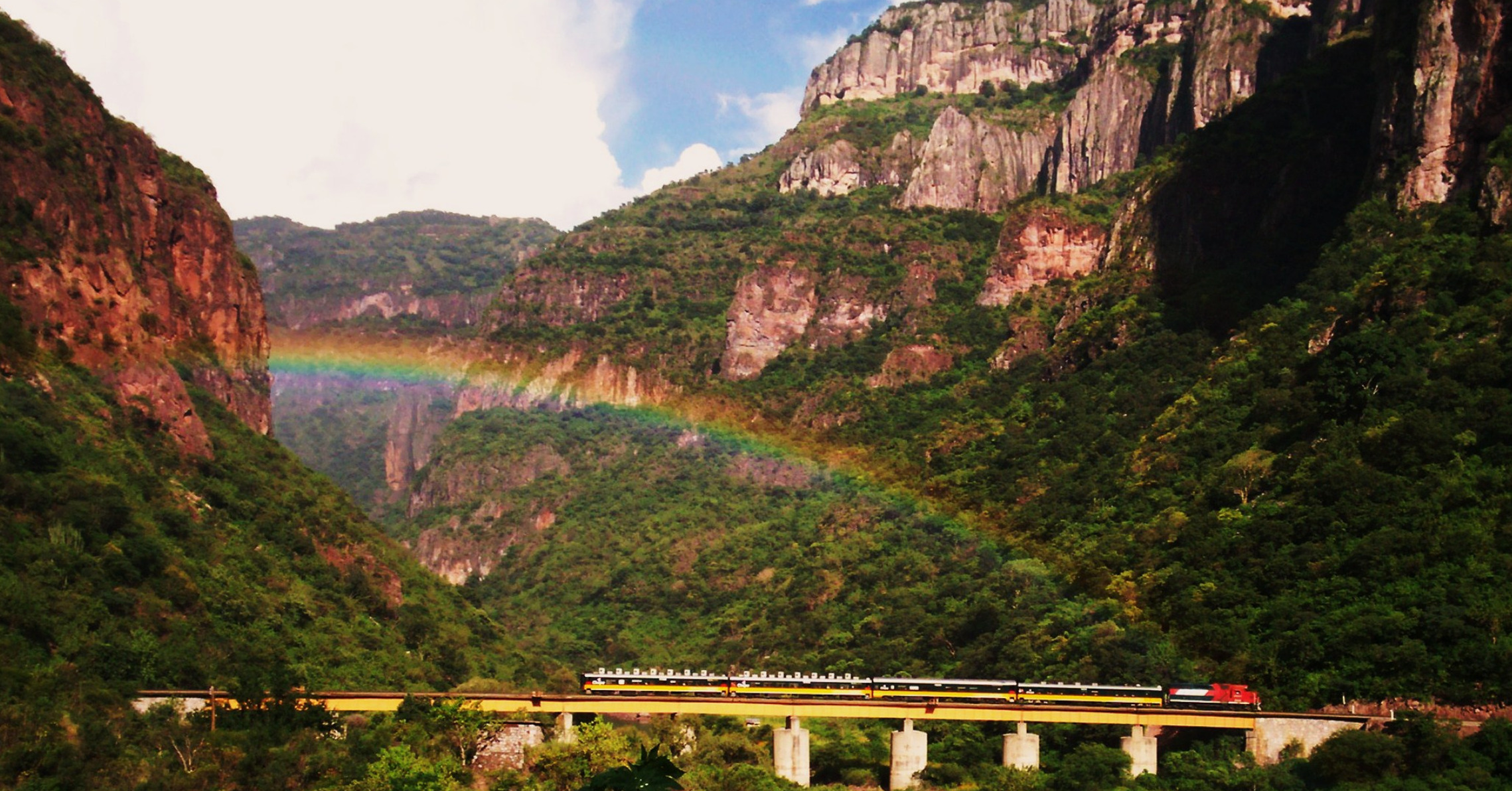
The Journey through the Copper Canyon by train is an experience of one of the most scenic train rides in the world. TAs El Chepe chugs along its 653 km (405 mi) of track, a journey which takes anywhere from 9 to 16 hours, it crosses over 37 bridges and through 86 tunnels. It crosses the Copper Canyon, called the Barranca del Cobre by Mexicans.
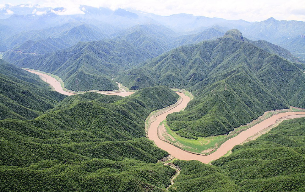
The Copper Canyon is one of Mexico’s lesser-known gems. …
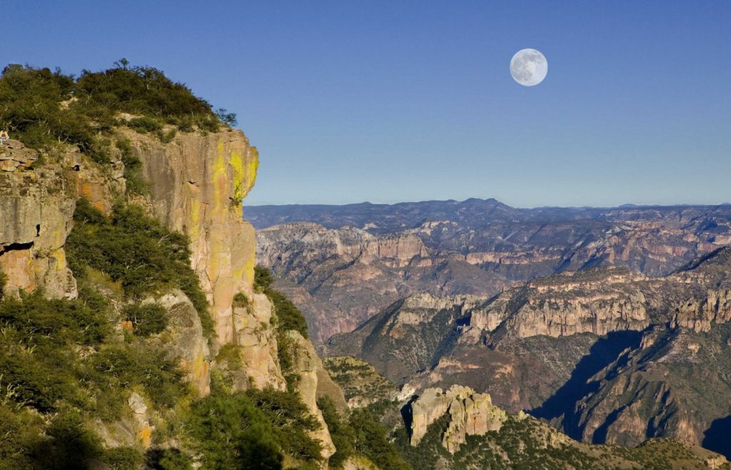
is a group of six distinct canyons in the Sierra Madre Occidental in the southwestern part of the state of Chihuahua
It is 65,000 sqk / 25,000 sqm in size.
The canyons were formed by six rivers that drain the western side of the Sierra Tarahumara (a part of the Sierra Madre Occidental).

The Spanish arrived in the Copper Canyon area in the 17th century and encountered the indigenous locals throughout Chihuahua. For these New Spanish, America was a new land to explore for gold and silver and also to spread Christianity. The New Spanish named the people “Tarahumara”, they encountered derived from the word Rarámuri, which is what the indigenous people call their men.
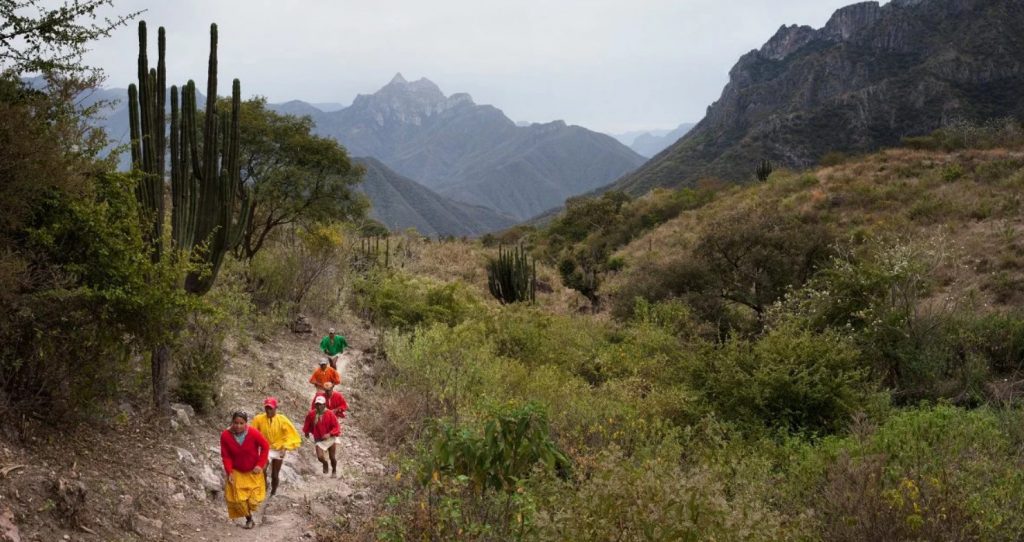
During the 17th century, silver was discovered by the Hispanic in the land of the Tarahumara tribe. Some were enslaved for mining efforts. There were small uprisings by the Tarahumara, but to little avail. They eventually were forced off the more desirable lands and up into the canyon cliffs.
The full journey takes either nine or sixteen hours
If you travel on the Chepe Express (Los Mochis to Creel and vice versa), your journey time will be nine hours, with the train leaving from Los Mochis at either 6am or 3.50pm. On the Chepe Regional (Los Mochis to Chihuahua and vice versa), the journey is around 16 hours from start to finish and the train leaves either Los Mochis or Chihuahua at 6am.
CLIMATE
The alpine climate of the mountainous regions of Copper Canyon has moderate temperatures from October to November and March to April. The bottom of the canyons are humid and warm and remain that way throughout the year. During the warmest months, April through June, drought is a chronic problem with little rainfall until July when the rainy season begins.
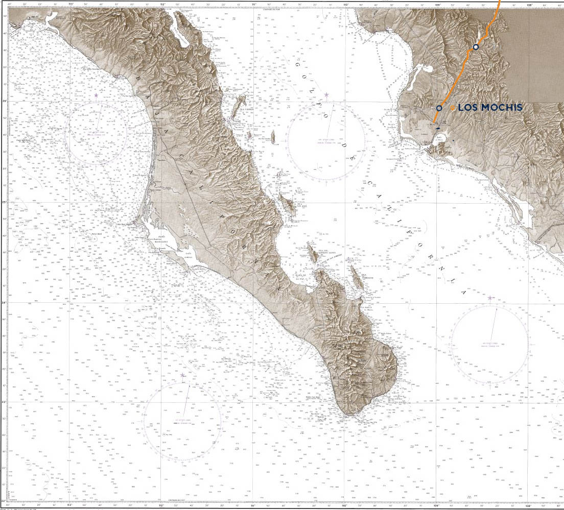
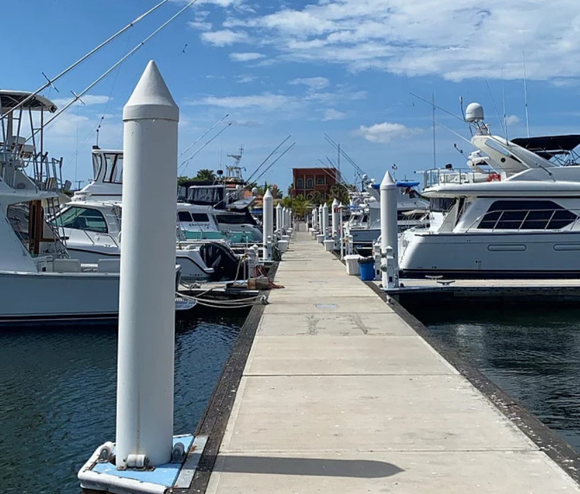
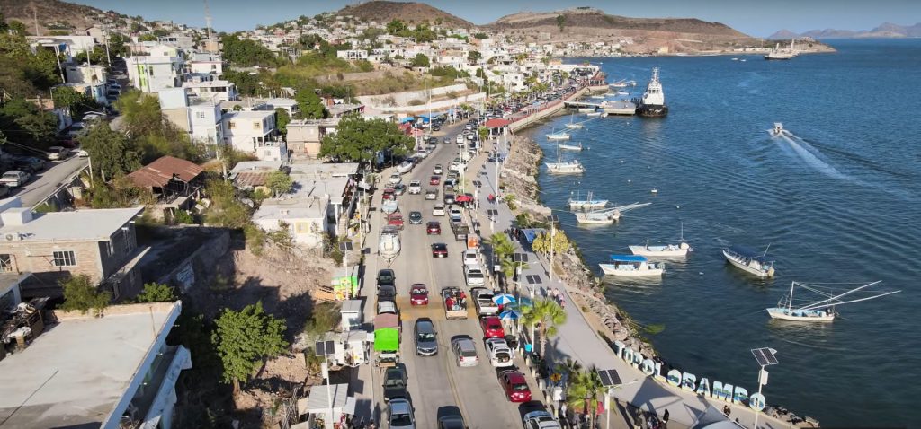
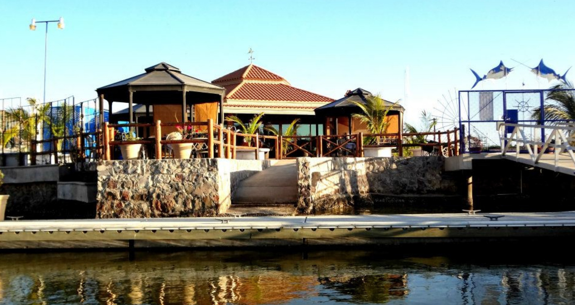
Marina Palmira Topolobampo  MEXICO Sponsors the OCEAN Posse
25° 36.0166′ N 109° 03.5333′ W
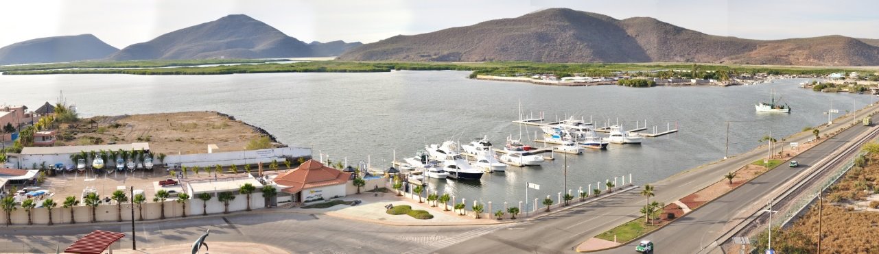
It is our pleasure to welcome you to Marina Palmira in Topolobampo, Sinaloa, México.
We are please to announce our sponsorship of the Ocean Posse and offer a 10% discount of our slip rates.
Warm regards,
Palmira Topolobampo
RATES x MONTH
| $ x ft x month + taxes | |
| up to 40 | 14.00 |
| 41 – 50 | 15.50 |
| 51 – 60 | 17.00 |
| 61 – 70 | 18.50 |
| 71 – 80 | 20.50 |
| 91+ | 23.00 |
| Electricity KW | 0.26 |
| 1,000 liters water | 4.00 |
Example let’s say is 43 foot boat for 7 days:
46 foot x $15.50 = $666.50 (30 days + taxes )
7 days = $155.54 dollars + taxes
Ocean Posse discount $139.99 dollars
MARINA PALMIRA TOPOLOBAMBO SAFE APPROACH
AMENITIES
DOCKS 24 ft., 32 ft., 40 ft., 41 ft., 48 ft., 51 ft., 56 ft., 64 ft., 120 ft., 136 ft.
Water
Power 30/50 AMP
Parking
Internet
Wifi
NEARBY
Only 16 miles to the Train Station Los Mochis to get on the EL CHEPE
Hardware store
Laundromat at Hotel Marina
Supermarket
Marine Services
Boutique Hotel
Shops
Beach
Restaurants
Bars
Join the Ocean Posse – Extraordinary °°° Cruising
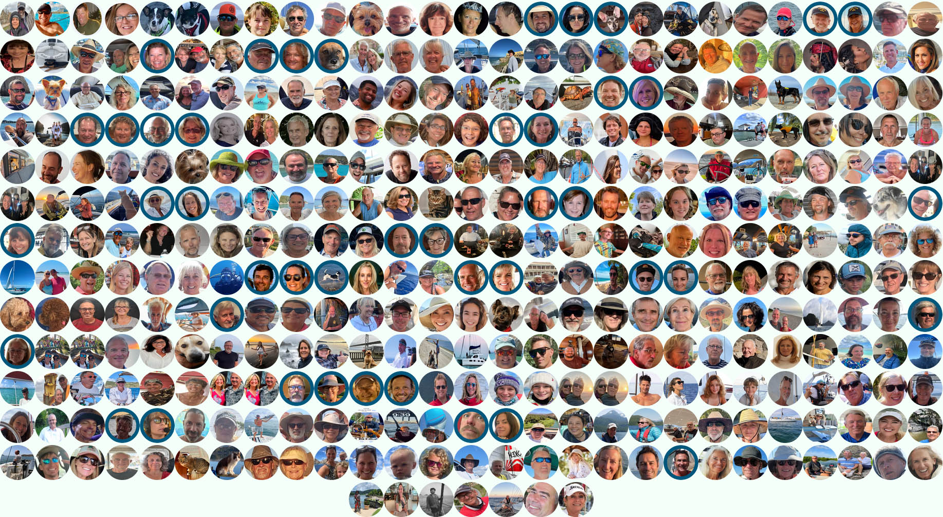
Join this independent and global fleet! Hundreds of seasoned captains and yacht owners form an intelligent network, sharing real-world experience, safe routes, and exclusive marina benefits. Be part of the community that’s redefining long-range cruising.
BENEFITS OF of joining the Ocean Posse – ANNUAL MEMBERSHIP
SAVE TIME – SAVE MONEY – and get the best and most up to date INFORMATION !
| BENEFITS FOR YOU, YOUR YACHT & YOUR CREW |
|
|
| ✔️ Up to date and verified information by fellow yachts | ✔️ | |
| 📊 Communications focused on facts, not opinions or unsolicited advice | ✔️ | |
| 💰 Save real money at 125+ Marinas with discounts * | ✔️ | |
| 🛰️ Free vessel and fleet tracking courtesy of Predict Wind | ✔️ | |
| 🚩 Free Burgee * | ✔️ | |
| 💰 Save with service providers and chandleries | ✔️ | |
| 🕵️ dedicated, experienced and discounted Canal and clearing in agents | ✔️ | |
| 🗺️ Free aid to navigation 550 Gb OpenCPN satellite charts (mac/pc/android) | ✔️ | |
| 💰 Save Money on parts with a Westmarine Pro Discount | ✔️ | |
| 💰 Save Money with a Predict Wind Pro Discount | ✔️ | |
| 🗺️ Free Printable Reference Charts emergency backup to your electronics | ✔️ | |
| 📹 Free Video Seminars on destinations from those who are there | ✔️ | |
| 🌩️ Top weather routing avail by Marine Weather Center Chris Parker | ✔️ | |
| ⛵ Community of voyagers all are welcome, kids, single-handers, pets | ✔️ | |
| ☂️ NEW Group Fleet Yacht Insurance with discounts for multi-year participants 15% and + 5% after year 3 | ✔️ | |
| ⚓ Peer support in emergencies with escalation procedures | ✔️ | |
| Fleet Updates via email – free | ✔️ | |
| 🏆 Fun Award Categories | ✔️ | |
| 📍 Free access to GOOD NAUTICAL Anchorage reports | ✔️ | |
| ☎️ Free Weekly live calls on Mondays via dedicated LINE.me group | ✔️ | |
| 💬 Free 24/7 LINE group channel | ✔️ | |
| 🌊 Benefit from the latest information and prior experience participants | ✔️ | |
| 🔭 Be part of a fleet of sensor for those who come behind you or meet | ✔️ | |
| 🚷 Always priority traffic – for participants by participants | ✔️ |
- (* as long as you do not have prior contracts or reservations in place and subject to a marina’s availability )
OCEAN POSSE HAUL OUT MAP
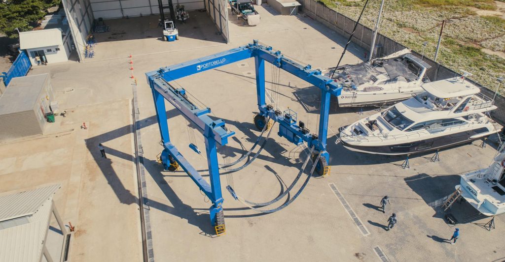
MARINA PORTOBELLO 🇨🇴 COLOMBIA SPONSORS THE OCEAN POSSE
10° 23.2066′ N 075° 31.0866′ W
We are please to offer a 10 % discount of our haul out fees and a 20 % off our future marina slips
A full service yard we lift boats up to 90 tons, 10 meters of beam with a state of the art , electronic weight measurement, 4 wheels, equalized and driven via remote control. Its lifting mechanism uses a load-sensing hydraulic system, which is adjusted according to the special requirements of each client, in order to implement different movement and maintenance jobs safely and efficiently.
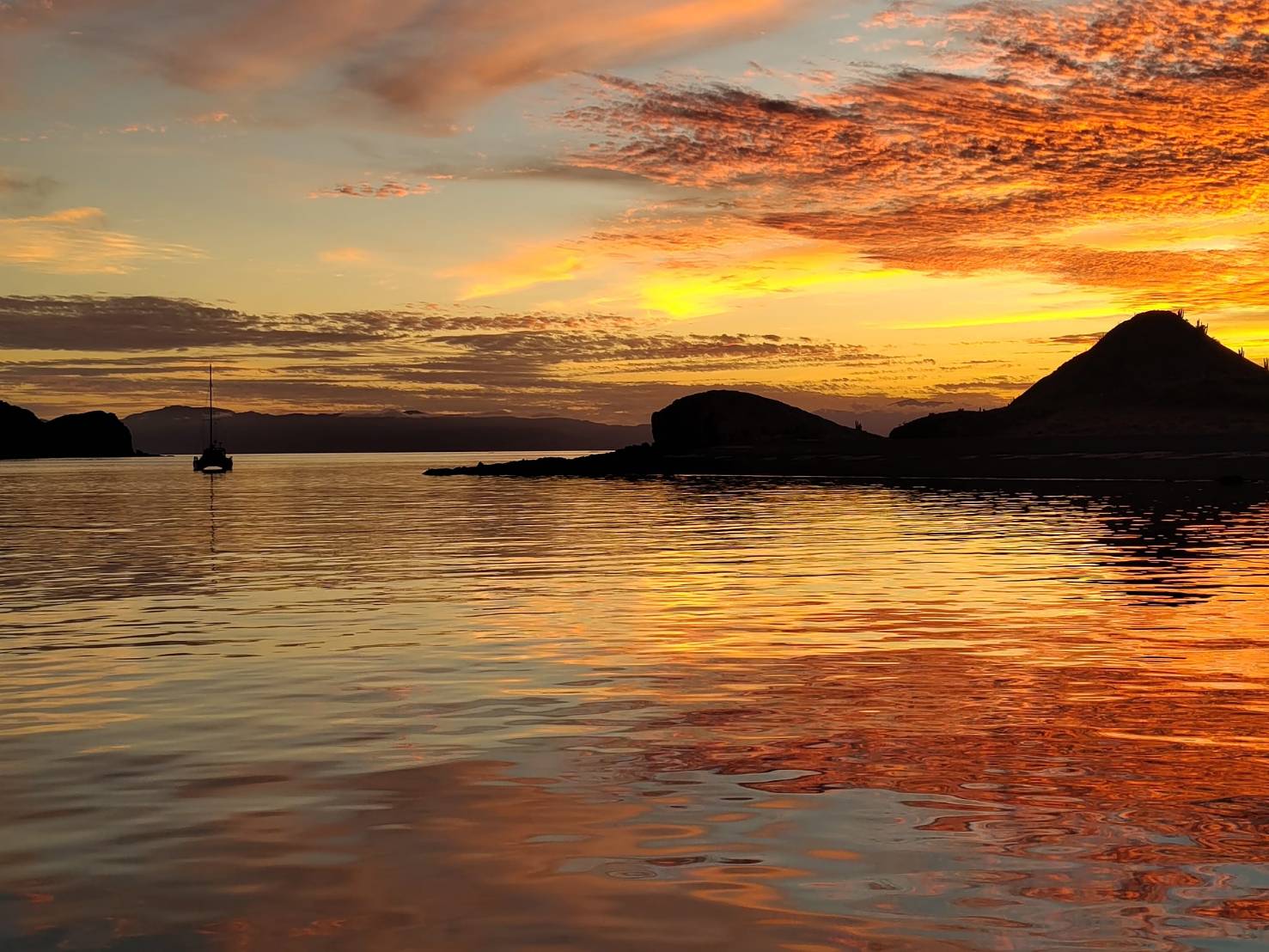
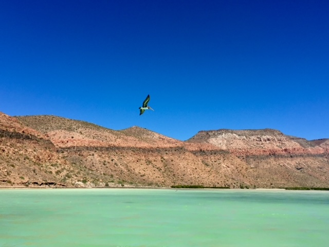
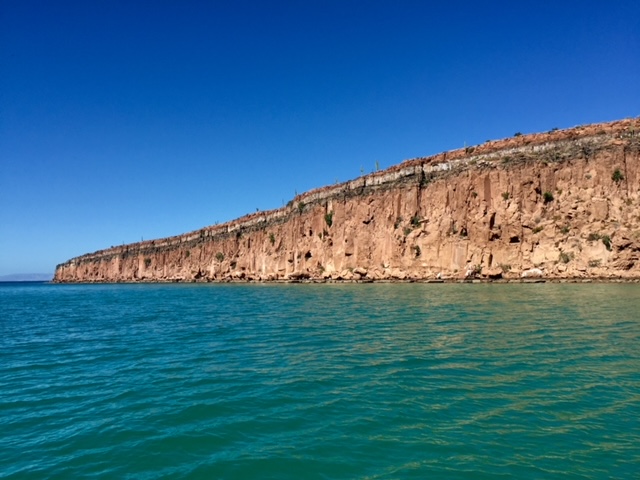
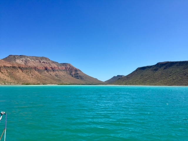
CRUISING THE SEA OF CORTEZ 🇲🇽 MEXICO
Entry to the Sea of Cortez
We entered the Sea of Cortez at Cabo San Lucas in April after sailing down the Pacific side of Baja California. Instantly, the warm waters welcomed us.
The water temperature is our guide in the winter months and dictates our positions.
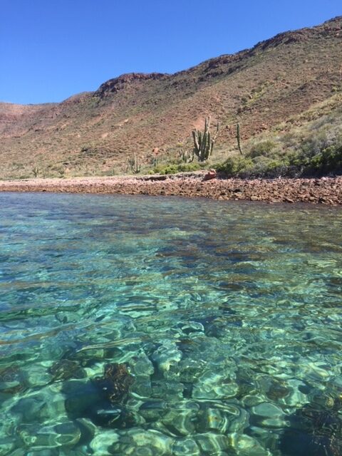
Why Visit the Sea of Cortez?
Dubbed the “aquarium of the world” by Jacques Cousteau, the Sea of Cortez rivals the Galápagos Islands in biodiversity. Its stunning desert landscapes, sandy beaches, vibrant marine life, and remote fishing villages make it a paradise for snorkelers, divers, whale watchers, bird enthusiasts, and adventurers. Whether you seek solitude, charming Mexican towns, or thrilling wildlife encounters, this region offers something special.
Seasonal Sailing Tips
To make the most of the Sea, follow the seasons:
- May to November: Use the south winds to sail north, spending summer and hurricane season in the upper Sea, north of Santa Rosalia.
- Hurricanes do enter the seas especially in LA Paz and travel as far north as Puerto Escondido
- November to April: Ride the north winds back south.
This seasonal rhythm allows for warm-water snorkeling in late spring and summer, with air temperatures around 30-35°C 86-95 F, and cooler winter hikes on the islands, with temperatures ranging from 18-25°C. 65-77 F Be prepared for the upper Sea’s extremes—hot summers and chilly winter nights.
Navigational Challenges
The Sea’s localized high winds, including Chubascos, Coromels, and Elefantes, demand vigilance. These unpredictable summer winds, coupled with strong Northern winds in winter, require sturdy anchoring techniques and reliable gear. With good planning and weather monitoring so can find safe havens among the many breathtaking anchorages. Most offer excellent sand holding, caution i at Ísla San Esteban and Ísla Isabel.
Wildlife and Cultural Highlights
Migratory birds and whales delight enthusiasts between January and April, though some species remain year-round. La Paz’s whale museum (currently relocating) provides valuable insights into the region’s marine life. For literary explorers, John Steinbeck’s The Log from the Sea of Cortez offers a compelling account of his 1941 expedition through this extraordinary ecosystem.
Exploring the Northern Sea
The Northern Sea of Cortez remains less frequented, with many cruisers venturing no further than La Paz. Beyond Puerto Escondido and Bahía Concepción lies a more remote, off-grid experience requiring careful provisioning. There are limited ATMs between Santa Rosalia and San Felipe, so bring sufficient cash. The secluded anchorages, vibrant fishing villages, and charming towns make the journey worthwhile.
Favorite anchorages included Bahía de Los Ángeles, Bahía Kino, Ísla Tiburón, Ísla Ángel de la Guarda, Ísla Salsipuedes, and Ísla San Esteban. For boat maintenance or storage, Puerto Peñasco’s Cabrales Boatyard offers affordable rates with Ocean Posse discounts.
CABO SAN LUCAS TO PUERTO PEÑASCO ~ 700 nm
- Cabo San Lucas to Los Frailes 41.8 nm
- Los Frailes to Bahia de los Muertos 43.9 nm
- Bahia de los Muertos to La Paz 52 nm
- La Paz to Bahía de San Gabriel Cove 17.8 nm
- San Gabriel Cove to Caleta Partida 11 nm
- Caleta Partida to Isla San Francisco 21 nm
- Isla San Francisco to Bahia Evaristo 9.8 nm
- Evaristo to Aqua Verde 42 nm
- Aqua Verde to Puerto Escondido 23 nm
- Puerto Escondido to Loreto 14 nm
- Loreto to Caleta de San Juanico 23.4 nm
- Caleta de San Juanico to Bahia Concepcion 43 nm
- Bahia Concepcion to Santa Rosalia 48.9 nm
- Santa Rosalia to Bahia San Francisquito 79 nm
- Bahia San Francisquito to Bahia las Animas 32.2 nm
- Bahia las Animas to Bahia los Angeles 19.8 nm
- Bahia Los Angeles to Bahia Refugio 42.1 nm
- Bahia Refugio to Puerto Penasco 107.2 nm
<!– lats longs –>
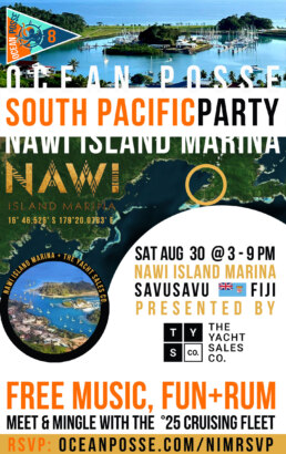
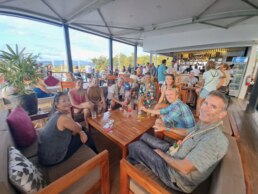
SOUTH PACIFIC – MEET THE CRUISING FLEET – SAT AUG 30 – NAWI ISLAND MARINA
Brought to you by the yacht sales co.
-
15:00 YACHT MARKET OVERVIEW FOR BUYERS AND SELLERS PRESENTED BY
THE YACHT SALES CO -
15:30 THE PASSAGE TO NEW ZEALAND – PRESENTED BY OCEAN TACTICS
-
16:00 MEET AND MINGLE AND FREE RUM
-
17:00 LET THE FEAST BEGIN …
-
19:00 KAVA AND RUM AFTER HOURS
OFFICIAL OCEAN POSSE EVENTS
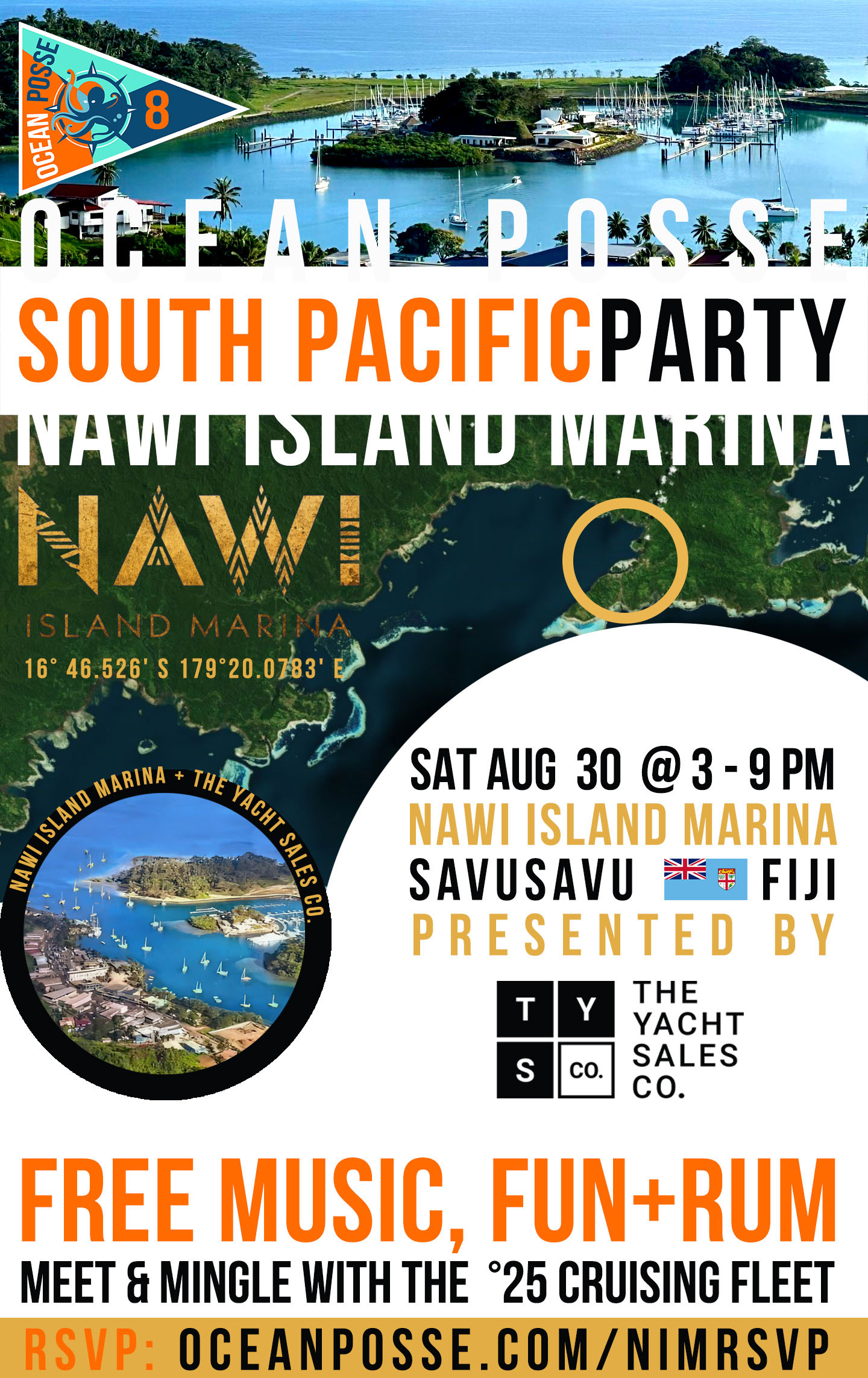
SOUTH PACIFIC CROSSING PARTY AT Nawi Island Savusavu 🇫🇯 Fiji
NAWI ISLAND MARINA & RESORT, SAVUSAVU FIJI


OCEAN POSSE & BEN TAYLOR STREET PARTY @ CANNES 🇫🇷 YACHTING FESTIVAL
TAQUERIA LUPITA, 72 Rue Meynadier, Cannes

OCEAN POSSE @ GENOA 🇮🇹 INTERNATIONAL BOAT SHOW
Genoa Boat Show, Via dei Cantieri Navali, 16128 Genova GE, Italy
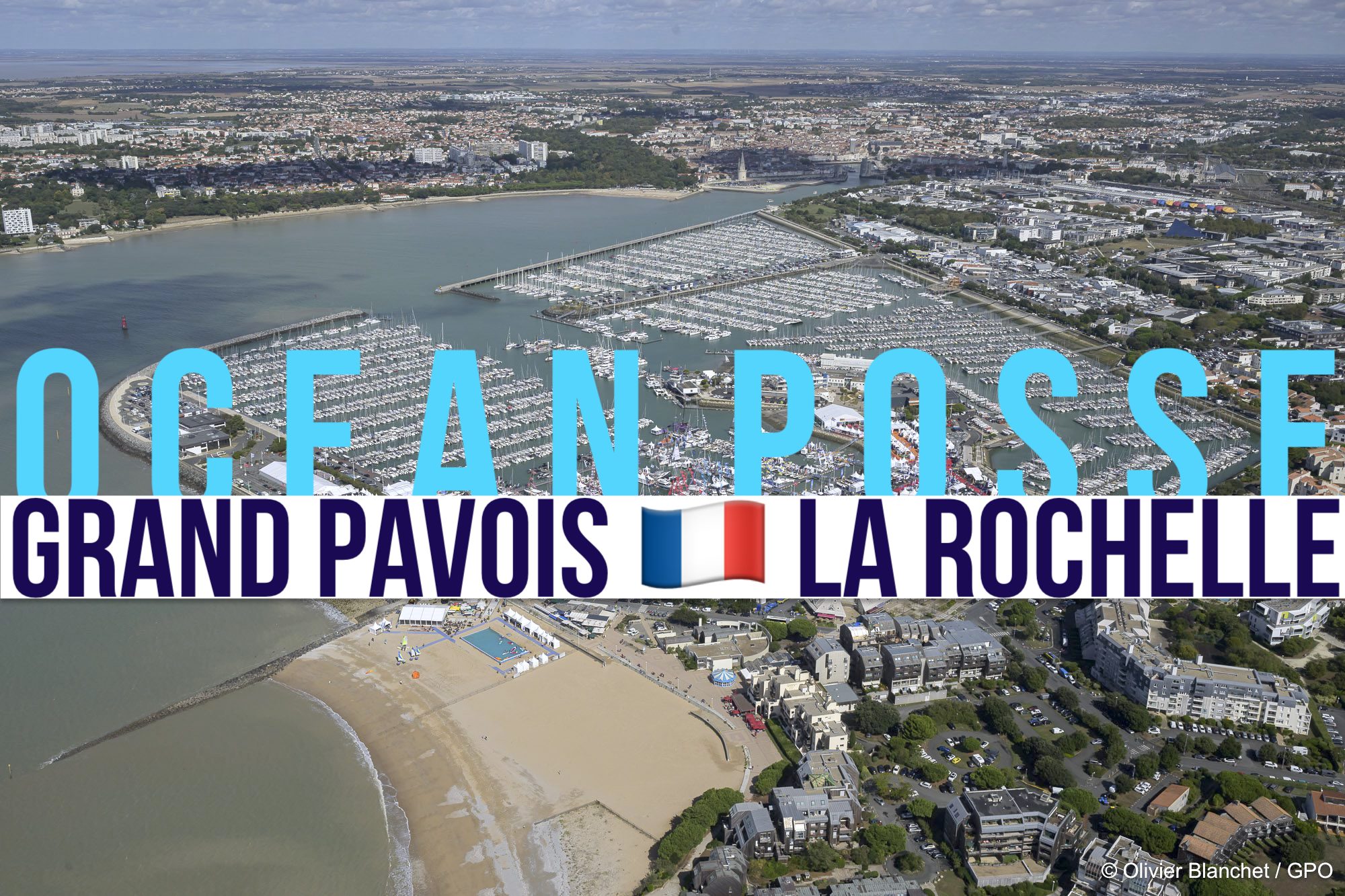
GRAND PAVOIS 🇫🇷 La Rochelle – Sep. 24 2025
Gran Pavois La Rochelle, 20 Av. de la Capitainerie, 17000 La Rochelle, France

OCEAN POSSE 🇪🇸 KICK OFF PARTY @ YACHT PORT CARTAGENA
YACHT PORT CARTAGENA SPAIN, MURCIA SPAIN

ANNAPOLIS BOAT SHOW 🇺🇸 MARYLAND USA
ANNAPOLIS, Annapolis Town Dock Booth VB 9

OCEAN POSSE 🇺🇸 SAN DIEGO BAY 4 DAY CRUISING SEMINARS SERIES @ SAFE HARBOR SOUTH BAY
SAFE HARBOR SOUTH BAY EVENT CENTER, CHULA VISTA, SAN DIEGO, CA

OCEAN POSSE KICK OFF 🇲🇽 BARRA DE NAVIDAD, MEXICO December 3-7 2025
MARINA PUERTO DE LA NAVIDAD, BARRA DE NAVIDAD, MEXICO


GRAND PAVOIS 🇫🇷 La Rochelle – Sep. 24 2025
Gran Pavois La Rochelle, 20 Av. de la Capitainerie, 17000 La Rochelle, France

FLOR DE CAÑA RUM SPONSORS THE OCEAN POSSE EVENTS
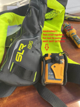
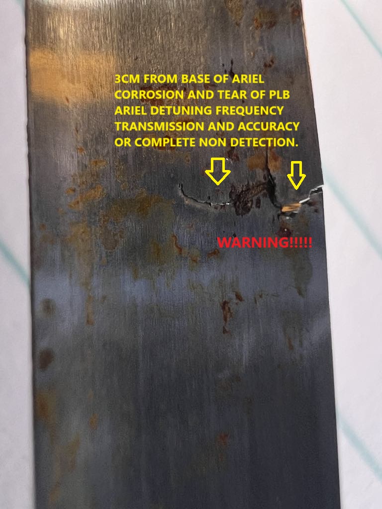
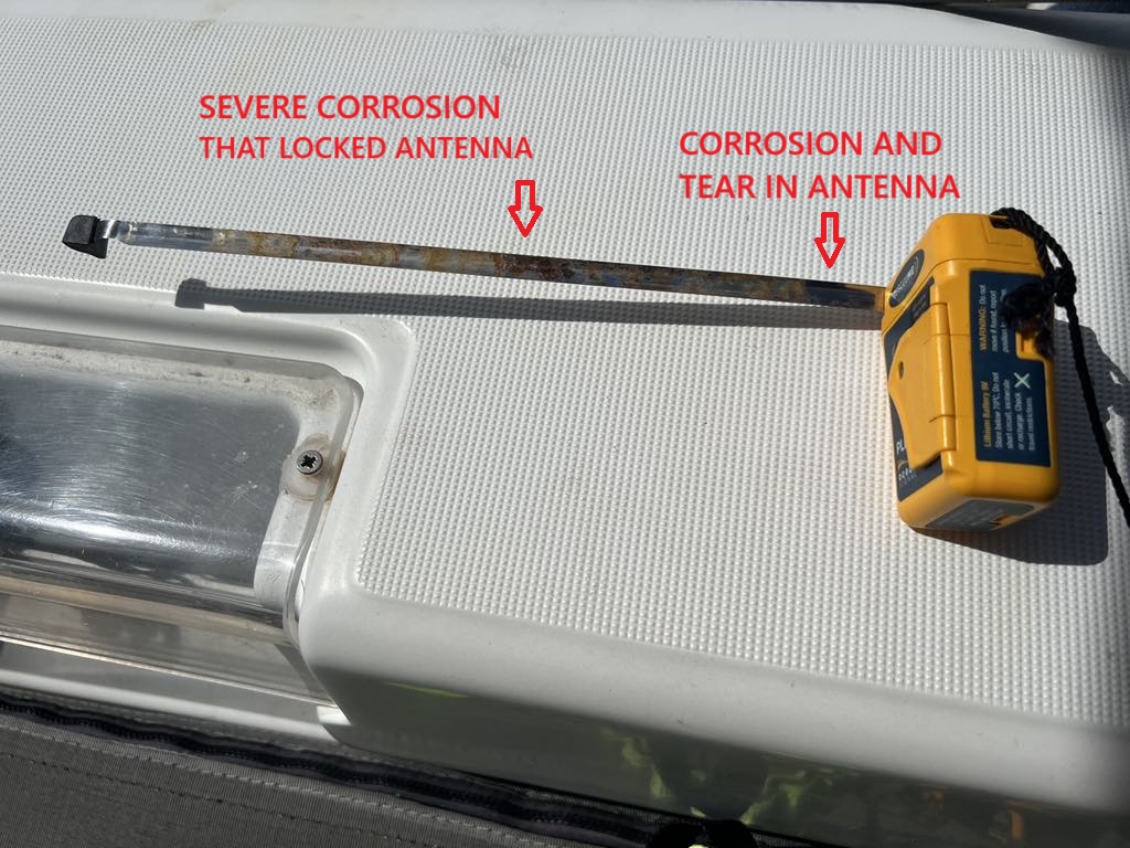
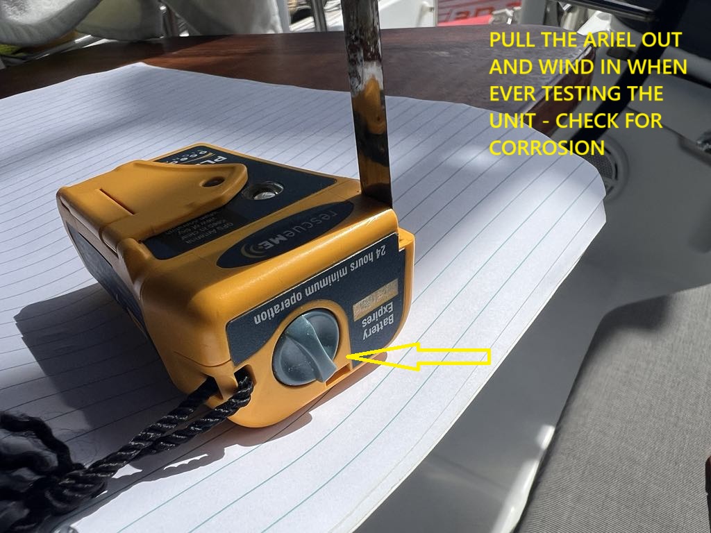
Warning!! If you have an Ocean Signal RESCUEME PLB1 ..
PLEASE CHECK YOUR ANTENNA!! In our GGR, OGR and MGR races we insist during safety inspections that all sailors can activate their PLB “eyes closed with one hand” …and recommend the units are operationally tested occasionally. Today during a crew briefing I went to demonstrate the operation of the PLB and the antenna would not unwind or extend. After 15 minutes and extreme force, I managed to slowly extend the ariel which would have been virtually impossible to achieve floating in the water, only to discover a tear at the base which would probably stop detection of the PLB signal. Now for all races we will ask to visually inspect the Antenna!! To be fair, I currently own 8 PLB’s and I am not sure of the history of this one approx. three to four years old. BUT for sure it is important to regularly inspect and clean the antenna and from now I will spray them with silicon before rewinding. Stay safe all… Don, GGR Founder…Please share the shit out of this Warning!! If you have an Ocean Signal RESCUEME PLB1 ..you have chosen a fantastic product, BUT PLEASE CHECK YOUR ANTENNA!! In our GGR, OGR and MGR races we insist during safety inspections that all sailors can activate their PLB “eyes closed with one hand” …and recommend the units are operationally tested occasionally. Today during a crew briefing I went to demonstrate the operation of the PLB and the antenna would not unwind or extend. After 15 minutes and extreme force, I managed to slowly extend the ariel which would have been virtually impossible to achieve floating in the water, only to discover a tear at the base which would probably stop detection of the PLB signal. Now for all races we will ask to visually inspect the Antenna!! To be fair, I currently own 8 PLB’s and I am not sure of the history of this one approx. three to four years old. BUT for sure it is important to regularly inspect and clean the antenna and from now I will spray them with silicon before rewinding.
Stay safe all… Don, GGR Founder…Please share the shit out of this


OCEAN POSSE SPONSORS
SAFE HARBOR SOUTH BAY @ EVENT CENTER IN SAN DIEGO
SPONSORS THE OCEAN POSSE
OCEAN POSSE SPONSORS
- ABERNATHY – PANAMA
- BELIZE TOURISM BOARD
- BOAT HOW TO
- CABRALES BOAT YARD
- CENTENARIO CONSULTING – PANAMA CANAL
- CHRIS PARKER – MARINE WEATHER CENTER
- DELTA MIKE MARINE SUPPLY PANAMA
- DIGITAL YACHT
- DOWNWIND MARINE
- EL JOBO DIST. COSTA RICA
- FLOR DE CAÑA
- HAKIM MARINA AND BOAT YARD
- HERTZ RENTAL CARS MEXICO
- HOME DEPOT PRO MEXICO
- LATITUDES AND ATTITUDES
- MARINA PAPAGAYO
- NOVAMAR YACHT INSURANCE
- PANAMA YACHT BROKER
- PREDICT WIND
- SAFE HARBOR SOUTH BAY MARINA EVENT CENTER
- SAN DIEGO MARINE EXCHANGE
- SAFETY ONBOARD COSTA RICA
- SEVENSTAR YACHT TRANSPORT
- SHAFT SHARK
- SUN POWERED YACHTS
- WESTMARINE PRO
- YACHT AGENTS GALAPAGOS
SEVEN STAR YACHT TRANSPORT SPONORS THE OCEAN POSSE
MEDIA PARTNERS
LATITUDES AND ATTITUDES

OCEAN POSSE FLEET 🛰️ TRACKING
SPONSORED BY PREDICT WIND

JOIN THE OCEAN POSSE AT THE ANNAPOLIS SAILBOAT SHOW
If you volunteer with staffing our booth VB09
You’ll get you an all access exhibitor pass , some free rum and a Ocean Posse Shirt !
Follow this link to signup >>
PANAMA CANAL
PANAMA POSSE CANAL AGENTS
To arrange for transit with the Panama Canal Authority please contact our dedicated Panama Canal agents and sponsors of the Panama Posse and the Pacific Posse
CENTENARIO CONSULTING

Erick Gálvez
info@centenarioconsulting.com
www.centenarioconsulting.com
Cellphone +507 6676-1376
WhatsApp +507 6676-1376
OCEAN POSSE MERCHANDISE | SHOP
 Tidbits
SAILBOAT ADRIFT
My sailboat AREVA MANU, which is my home and contains my entire life, has been adrift since July 20, 2025, in the Caribbean.
Got a report, scoop, story, picture, subject or contact at a marina who wishes to work with us ? Please get in touch with us.
Extraordinary Cruising °°° Join the Fleet
- Access vetted local knowledge, safety resources, and prior experiences to make your passage safer and more enjoyable.
- Unlock a Life of Adventure
Explore hidden destinations, experience new cultures, and discover the freedom of life at sea or near shore – on your terms. - Get VIP Perks & Discounts at marinas, chandleries and boatyards
Get exclusive discounts, priority access, and personalized support at partner marinas across the globe. - Observe the actions of Experienced Captains
Tap into a wealth of tips, tools, and real-world know-how from seasoned mariners to grow your skills and gain confidence. - Make Every Nautical Mile Memorable
Join events, meetups, and shared journeys that turn you voyages into unforgettable stories and lasting memories. - Cruise with a Conscience
Gain insights into sustainable practices and join a movement that protects the waters you love to explore.