
Following the light of the sun, we left the Old World.
CRUISING ° FLEET UPDATE & NEWS ⚓ 2025-07-27
• Pictures Of The Week 📷
• Introducing Marina De La Pointe Du Bout 🇲🇶
• Cool down in Bouquete ☕ Panama
• Flamenco Marina 🇵🇦 Panama
• ☸️ Partnership Marinas
• OP Group Yacht Insurance ☂️
• Named Winds 🌬️ Karaburun
• Must See – Samoa 🇼🇸 Apia
• Benefits of Joining the Ocean Posse
• Ocean Posse 🗺️ Long Line Map
• 700 nm FL. Keys to 🇺🇸 🇨🇺 🇲🇽 🇧🇿 Belize
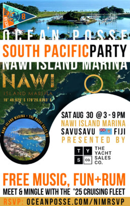
• South Pacific Party Sat Aug 30 🇫🇯 Nawi Island Marina
 Brought To You By The Yacht Sales Co.
• Official Ocean Posse Events
• I.H.O. Chart accuracy 😱 What it means
• Ocean Posse Sponsors & Fleet 📍Tracking
• Panama Canal fun facts and Agents
• Ocean Posse Merchandise 🛍️ Shop
• Ocean Posse Seminar Series 🧑🏻💻 Open CPN
💬 Tidbits
![]() USCG ⚠️ Marine Safety Alert
USCG ⚠️ Marine Safety Alert
![]() Starlink 🛰️ In Network Outage, Thu Jul 24 2025
Starlink 🛰️ In Network Outage, Thu Jul 24 2025
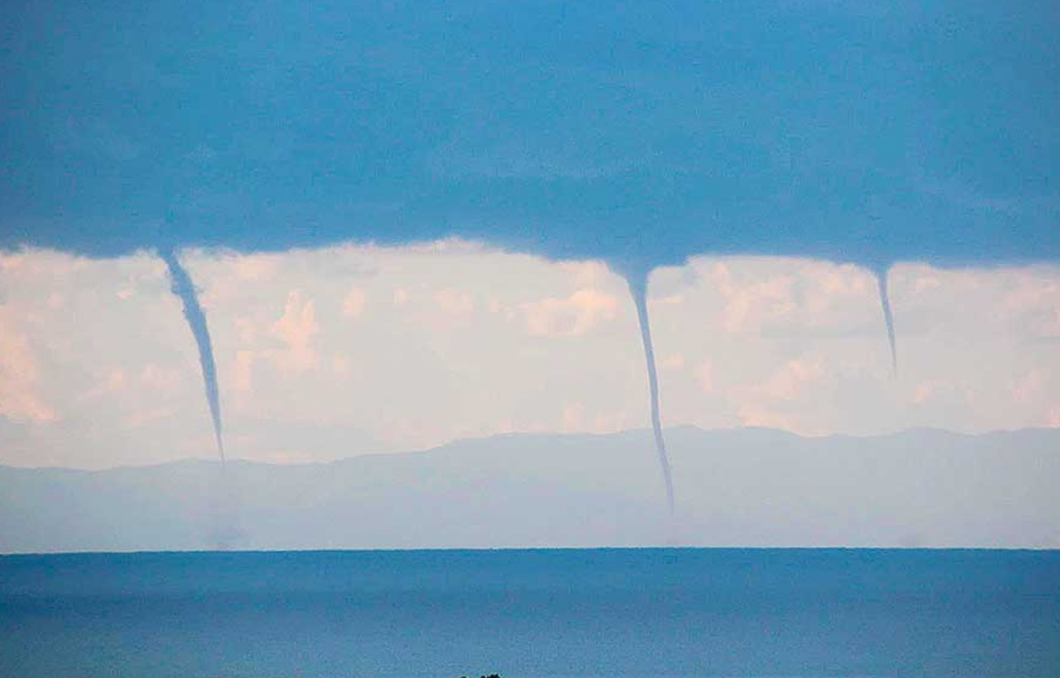
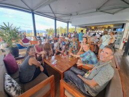
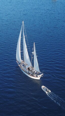
PICTURES OF THE WEEK
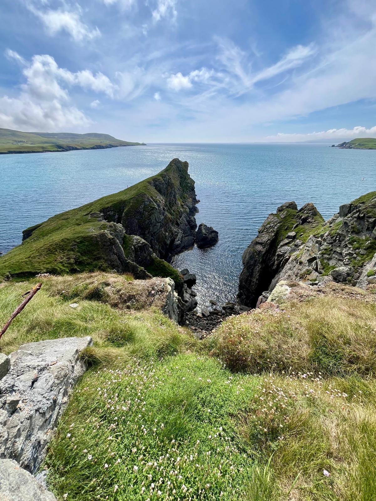
Update from Scotland 🏴 Today’s hike to the gorgeous bluffs entering Lerwick where they set up big ass guns in WW2 to guard against the Nazi’s
MY  HOKIPA Lucky Chucky & Lisa – Selene 43′


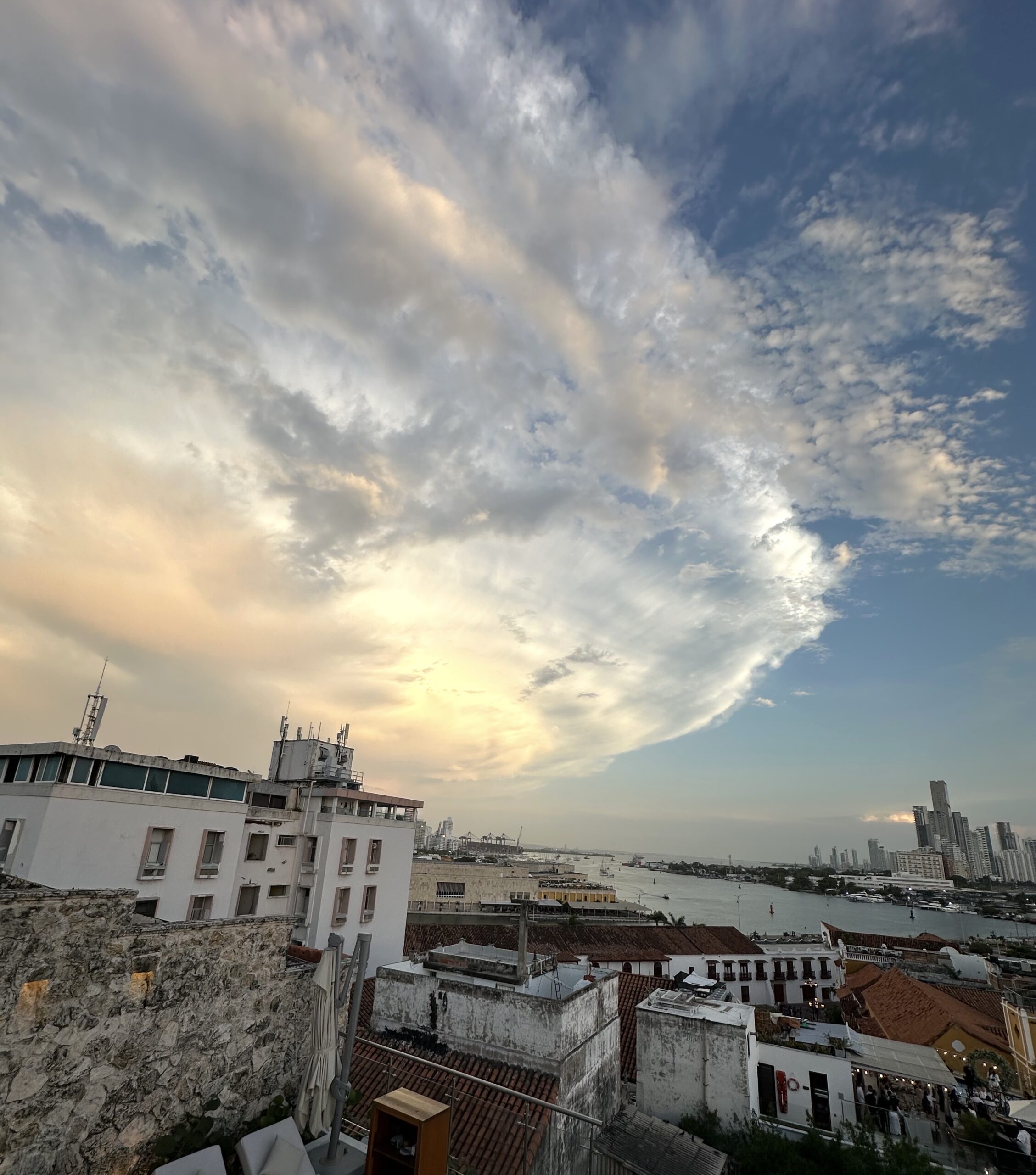
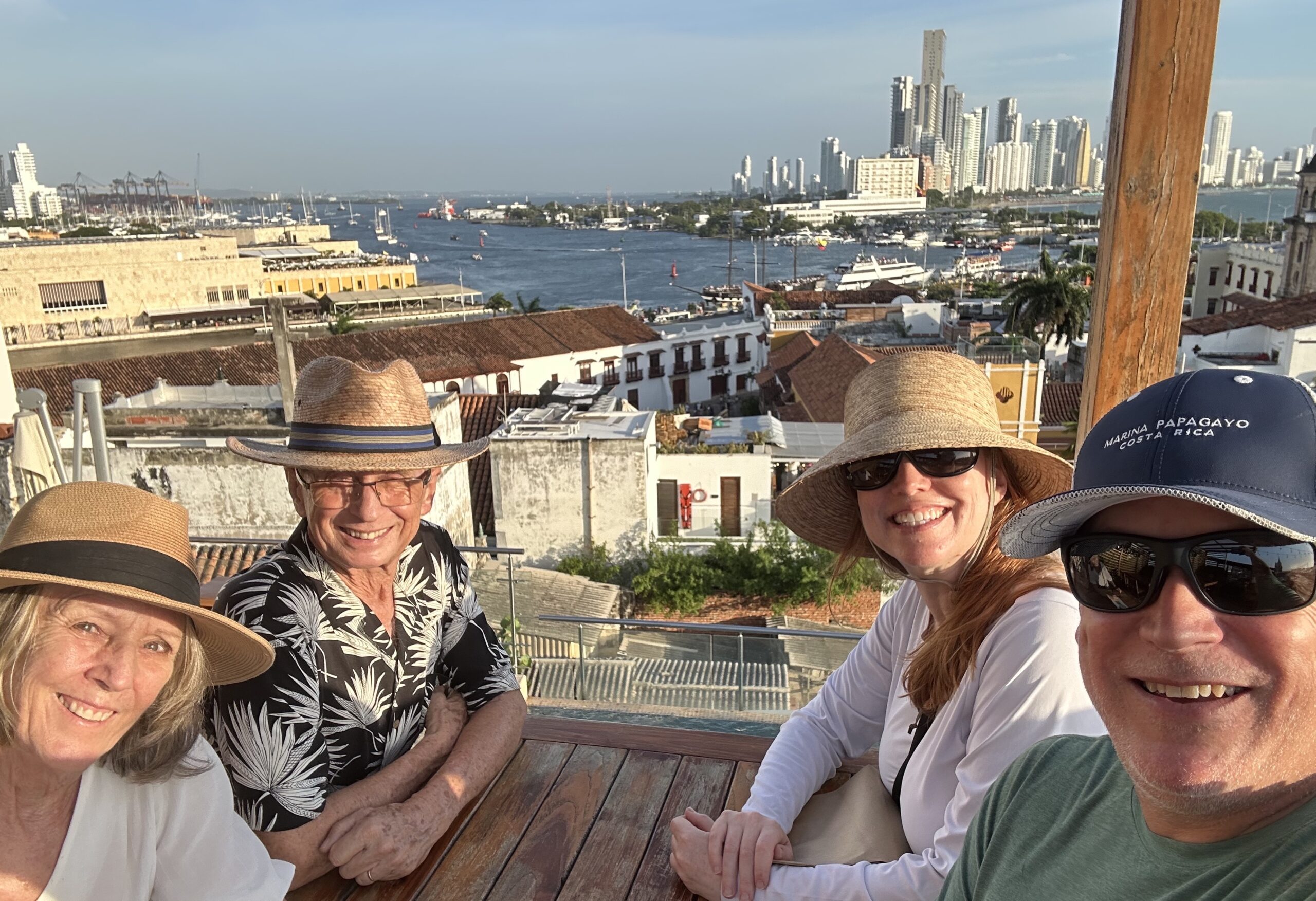
Feliz día de independencia Colombia 🇨🇴
The flags of Colombia, Ecuador, and Venezuela are similar because they all descend from the Gran Colombia flag (1819–1831), created by Francisco de Miranda during the independence movement. The yellow, blue, and red tricolor symbolized wealth, the sea, and blood shed for freedom.
After Gran Colombia dissolved:
-
Colombia kept the tricolor with a larger yellow band. 🇨🇴
-
Ecuador kept the same but added a coat of arms. 🇪🇨
-
Venezuela adopted equal stripes with stars for its provinces.🇻🇪
 Jeff & Joy -DeFever 52′ and SY BRIGADOON III
  Doug & Patty – Saga 43′
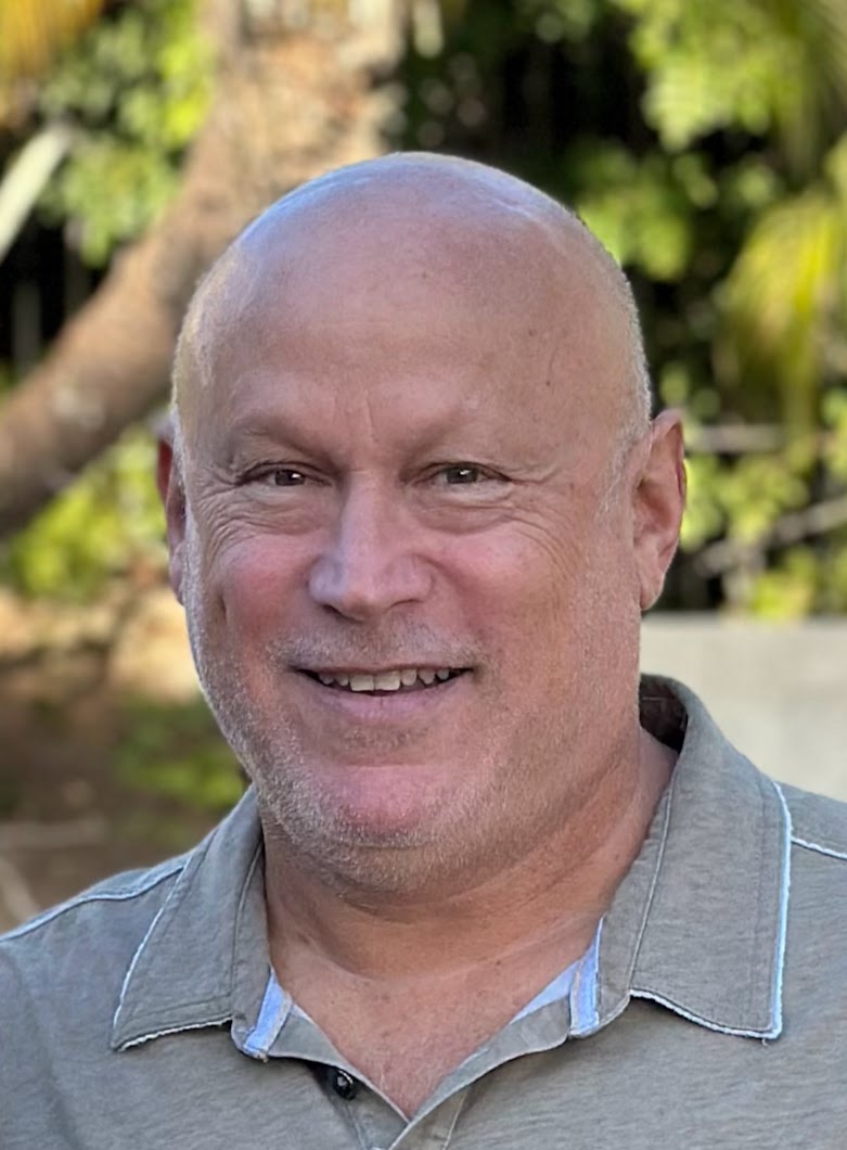


Charlie’s Angels ![]()
![]()
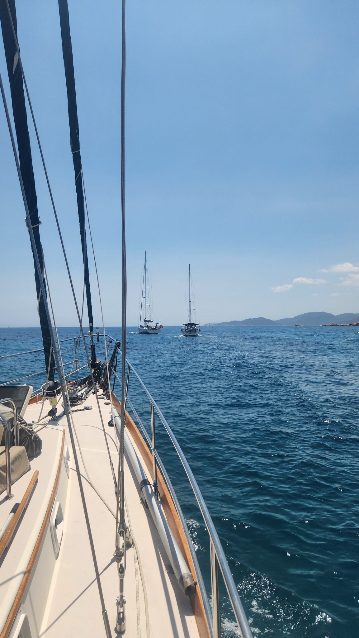
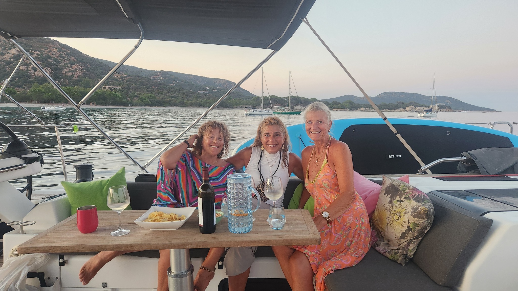
![]() in Corsica 🇫🇷 Karen w friends
in Corsica 🇫🇷 Karen w friends
SY SAMLL WORLD III 🇻🇮 Karen & Daren – Bristol 47.7

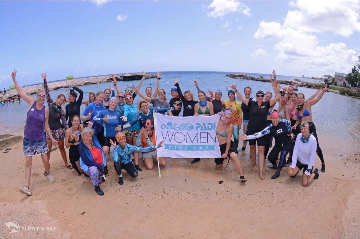
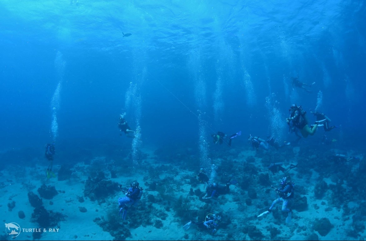
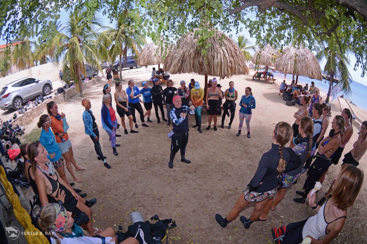
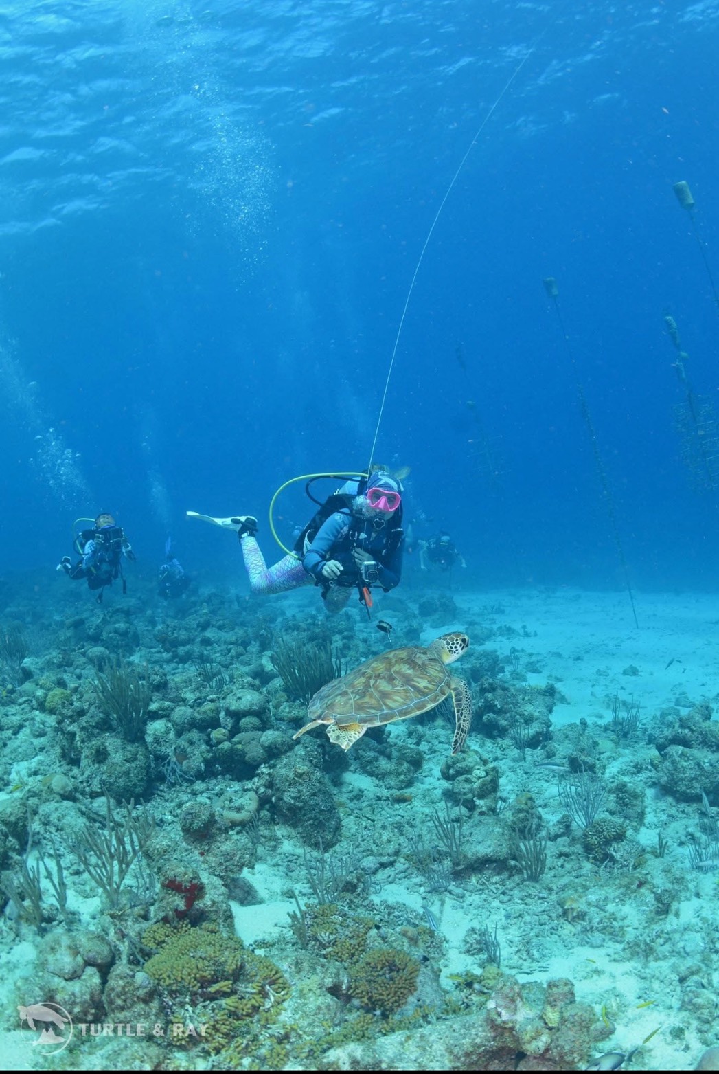
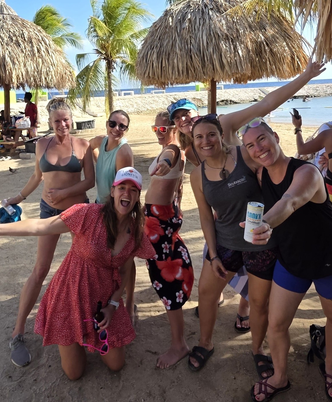
A few pics from International Women’s Dive Day July 19, 2025 event in Curacao 🇨🇼
SY MAISON DE SANTE Nicole, Keenan & Jack – Cal 46′


SY SHEARWATER
Patty & Eric – Formosa 51′

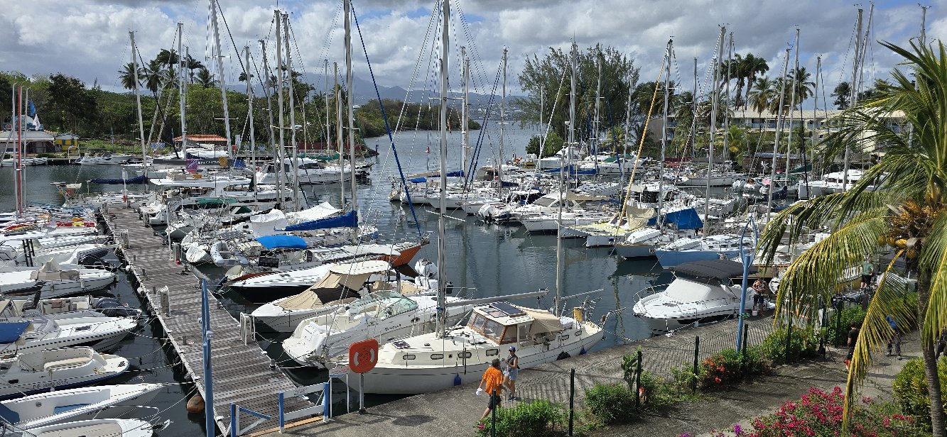
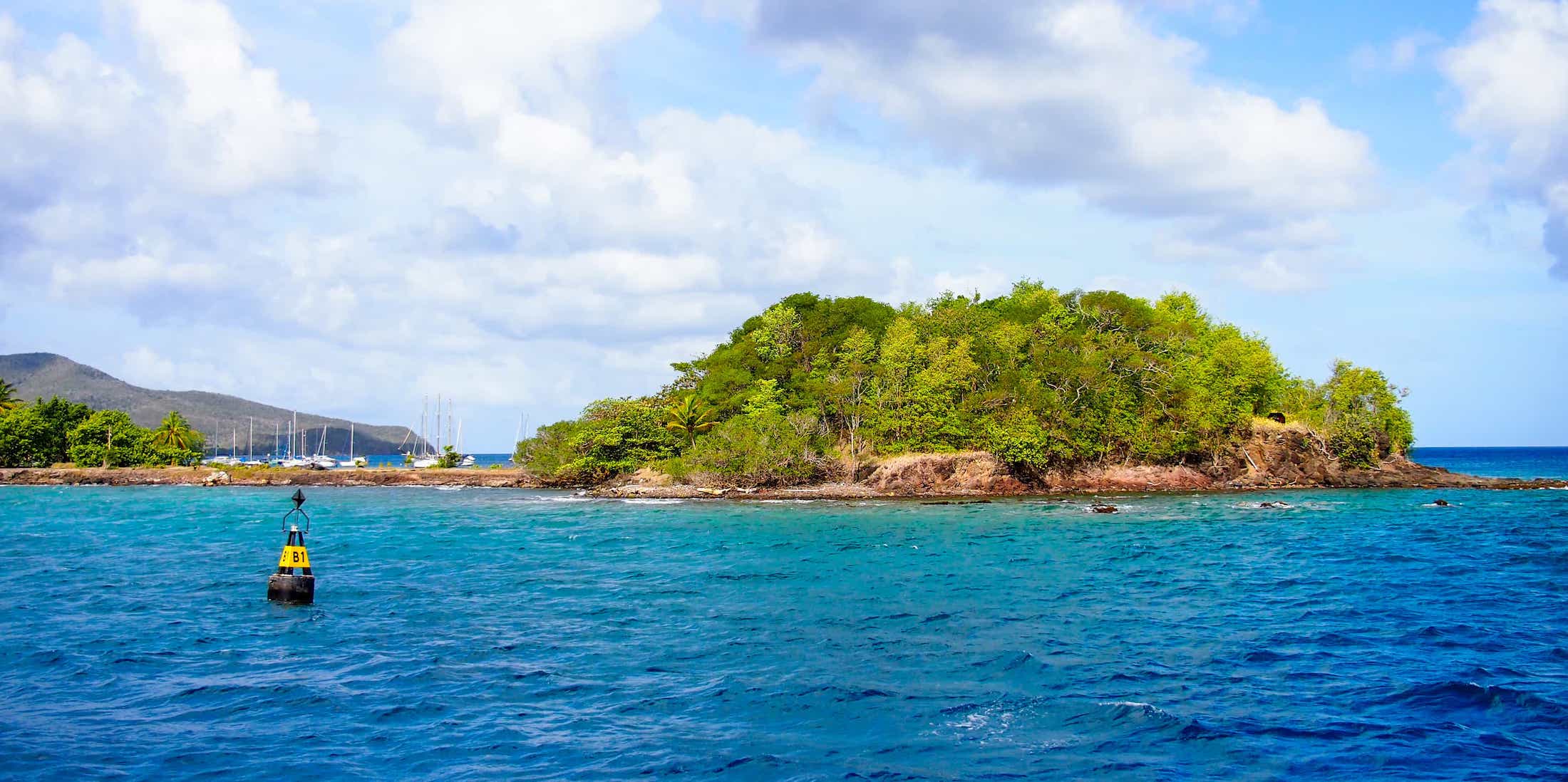
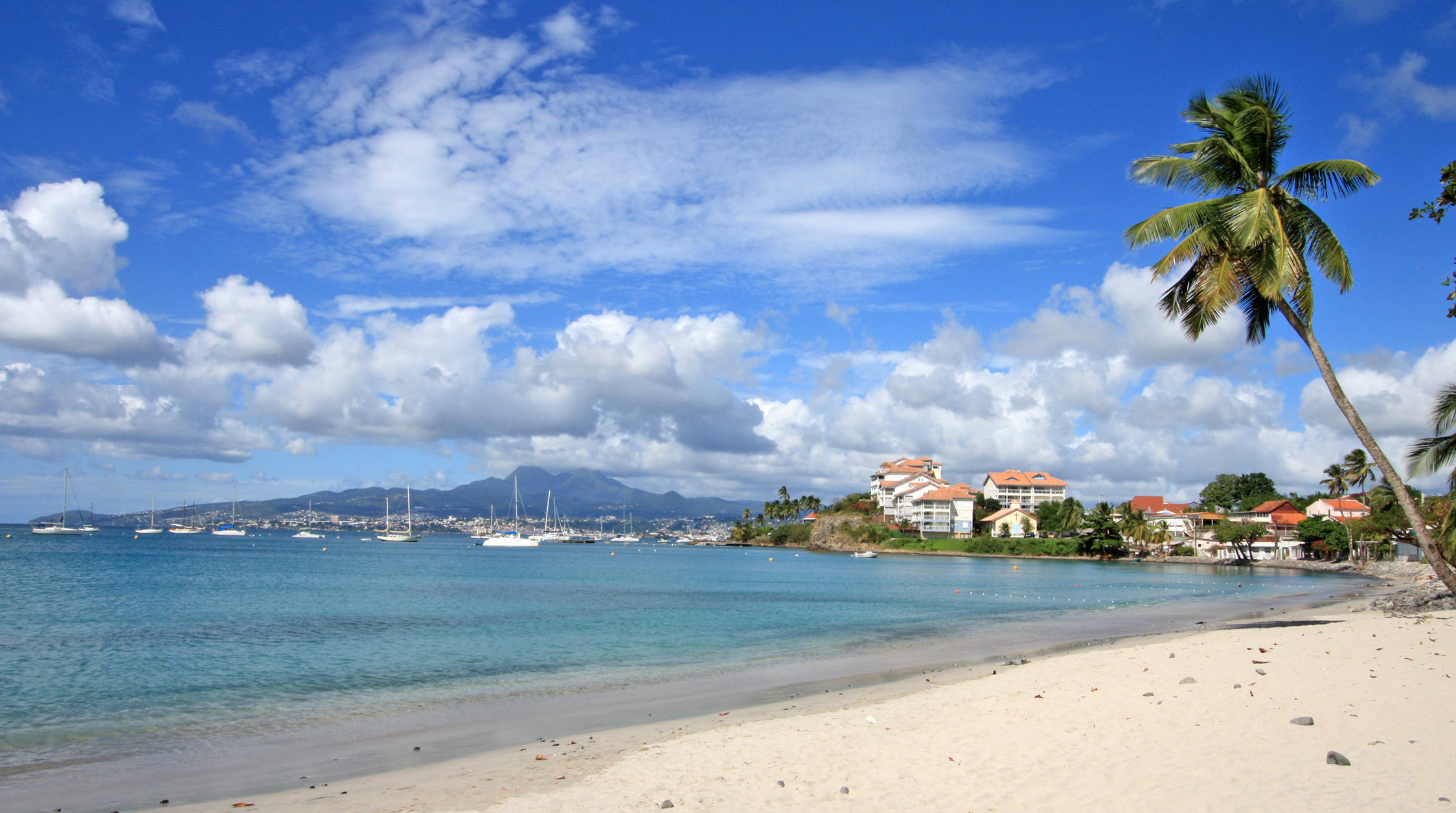
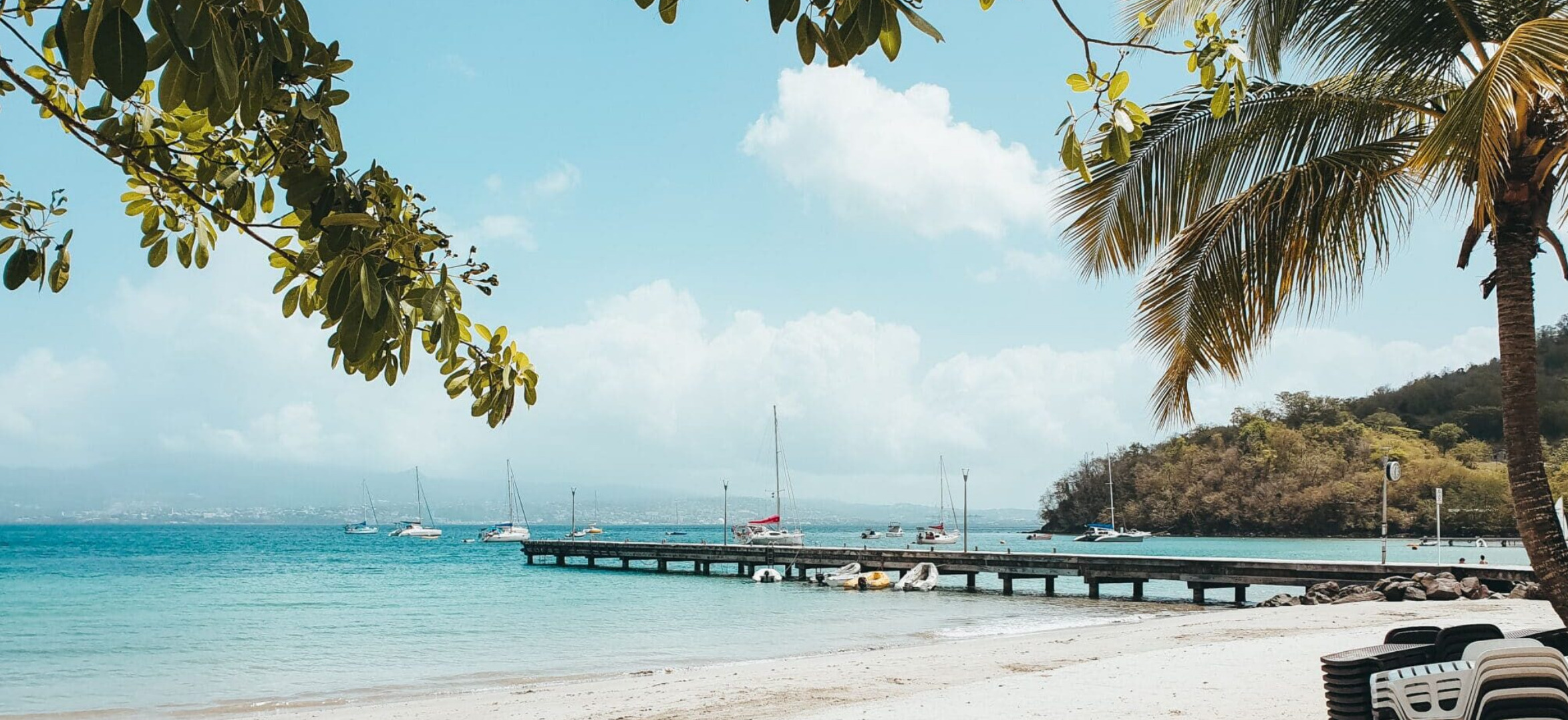
INTRODUCING OUR FIRST NEW MARINA IN MARTINIQUE
 MARINA DE LA POINTE DU BOUT
SPONSORS THE OCEAN POSSE
14° 33.4915′ N 061°03.06′ W
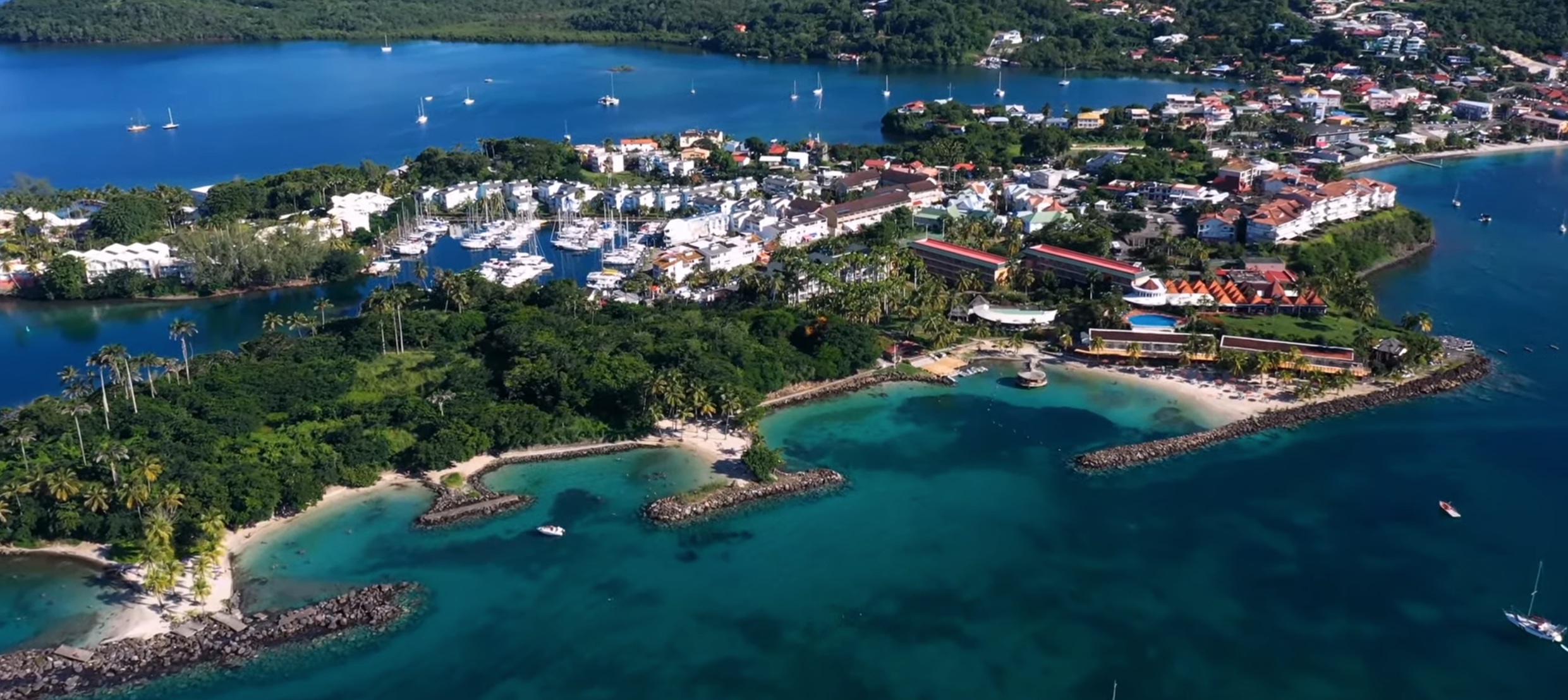
Welcome to a Marina in Transition – The Best is Yet to Come!
Dear Ocean Posse members,
As you drop anchor at the Marina de la Pointe du Bout, you may notice that some of our buildings seem outdated or no longer meet international standards. That’s because we are proudly entering a new phase: the marina is at the heart of an ambitious redevelopment project that includes the future construction of both a 4-star and a 5-star hotel on the Pointe du Bout peninsula.
We are fully aware that certain facilities may not reflect the level of comfort you are used to. However, this is only temporary. We are evolving – with the goal of offering even better services and infrastructure in the future.
In the meantime, our team remains fully committed to ensuring that your stopover is exceptional. We continue to offer the best leisure boating experience in Martinique, and we hope your stay with us will be a memorable part of your Caribbean journey.
Fair winds and following seas,
The Team at Marina de la Pointe du Bout
BOOK A SLIP:
https://www.martinique.org/fr/que-faire/sports-activites-nautiques/marina-de-la-pointe-du-bout
Harbormaster Name
Elima
MARINA Name
Marina de la Pointe du Bout
MARINA DE LA POINTE DU BOUT SAFE APPROACH
2 Available berths:
- 20 x 8 meters ( 65 x 26 feet )
- 19 x 6 ( 62 x 20 feet )
Marina Overview
Our marina is located in one of the most beautiful bays in the world: Fort-de-France Bay, in Martinique.
It lies at the heart of the island’s largest resort area, Pointe du Bout, right on the edge of the kind of turquoise waters you’ll only find in the Caribbean.
The nearby presence of our marina is no coincidence — and that’s exactly why we offer a true leisure stopover for pleasure boating.
CAPACITY
The marina can accommodate around 100 vessels up to 19 meters in length, 6 meters in beam, and with a draft of up to 3 meters.
In rough weather, the Marina of Pointe du Bout is renowned for offering excellent shelter.
We offer 15 visitor slips and welcome sailors in multiple languages (English, Spanish). You’re always welcome!
FACILITIES
All pontoons and quays are equipped with smart pedestals for water and electricity.
The pedestals provide 220V with 10-amp outlets
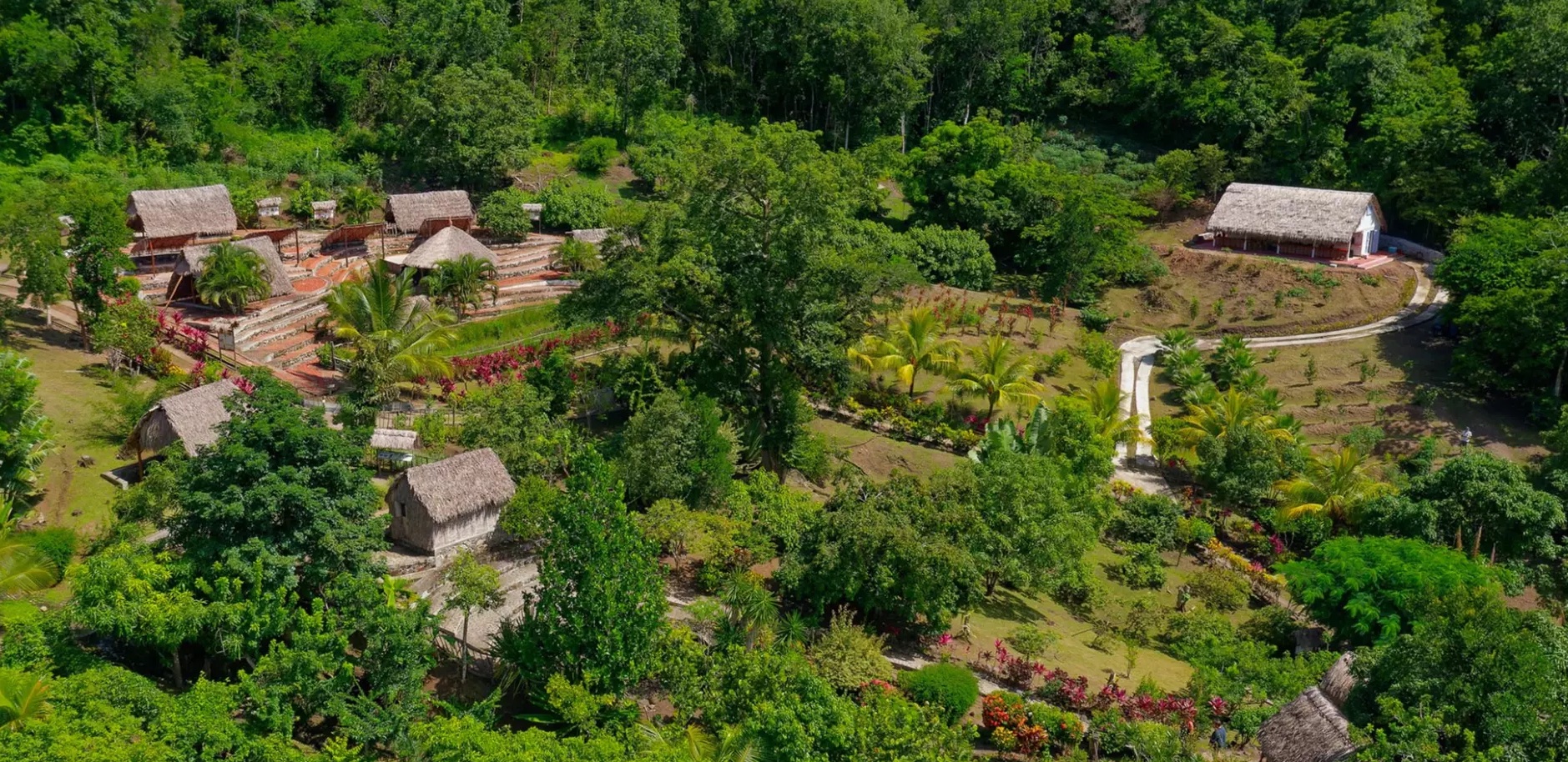
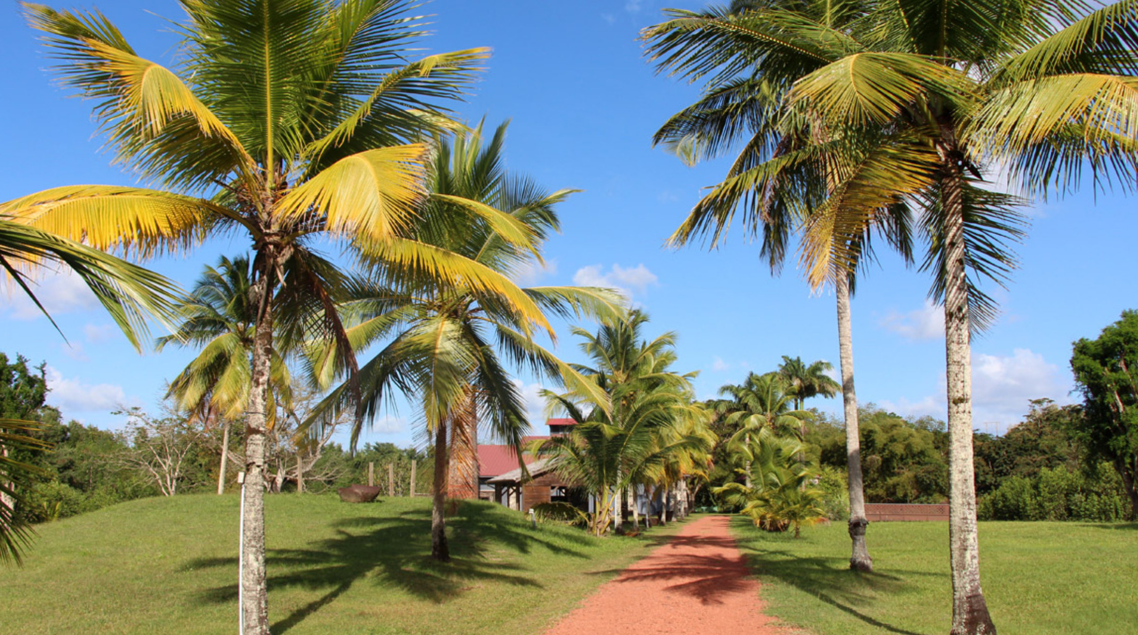
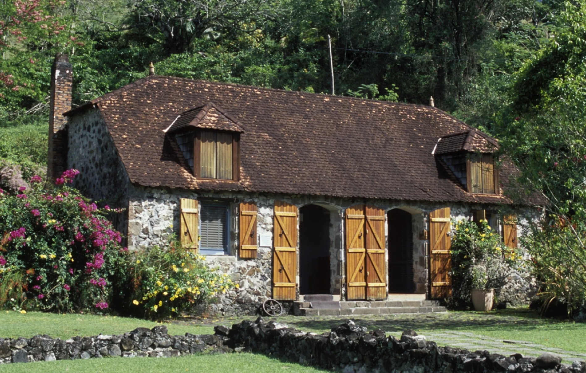
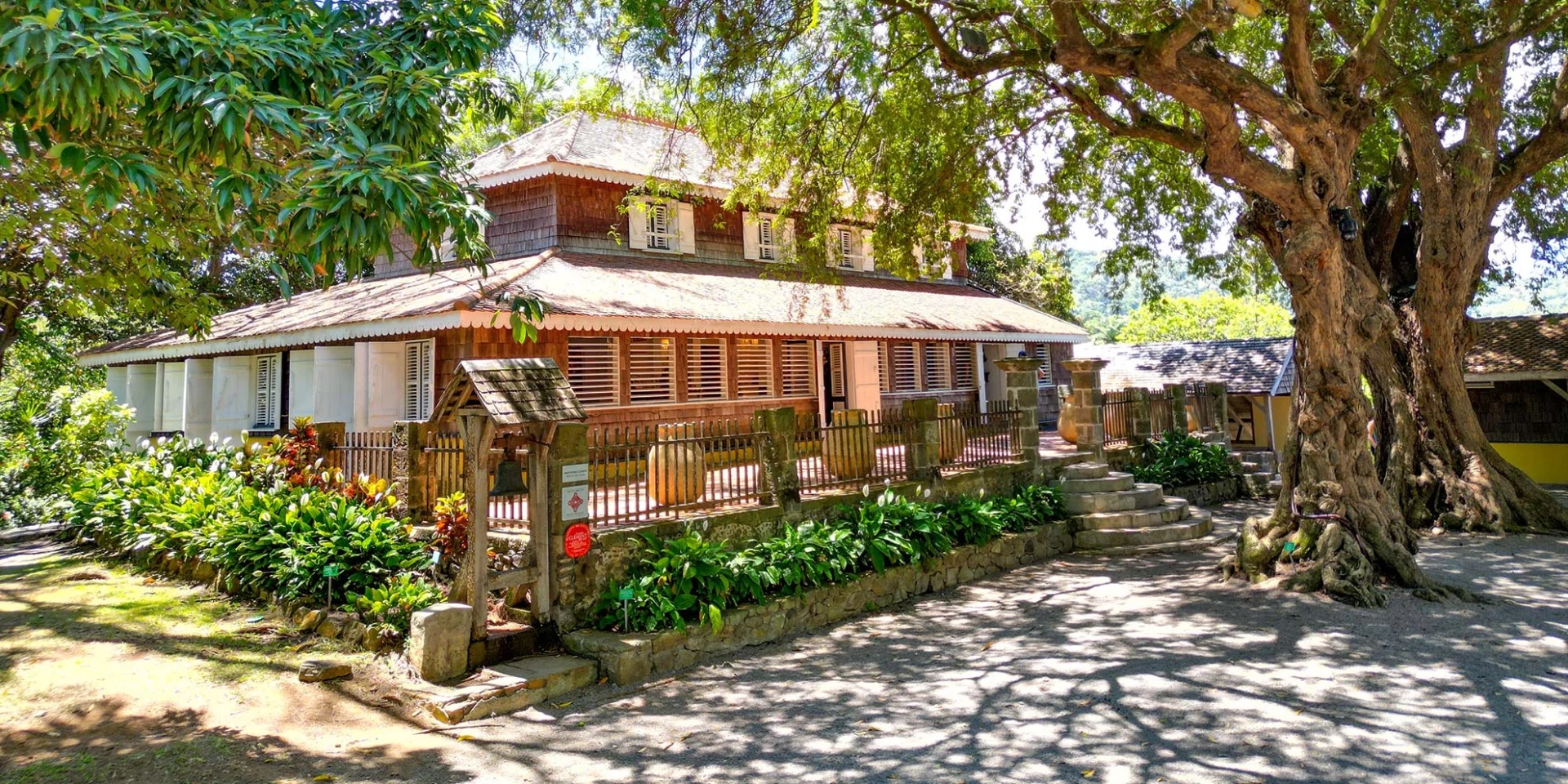
MUST SEE & PLACES TO VISIT IN TROIS-ÎLETS
- La Savane des Esclaves (heritage park / open-air museum)
- Le Village de la Poterie (craft village)
- La Maison de la Canne (historical museum)
- Le Musée de la Mer (maritime museum)
- Notre-Dame-de-la-Délivrande Church (historic church)
- La Pagerie Museum (birthplace of Empress Joséphine / history museum)
- Anse Mitan (beach / leisure area)
- Anse à l’Âne (beach / seaside village)
- Pointe du Bout (resort area / marina district)
- Trois-Îlets Golf Course (18-hole course)
- Mangrove kayak tour (eco-excursion)
- Trois-Îlets Casino (casino / entertainment venue)
- Contemporary Art Gallery (art gallery)
- Mangofil (adventure park / zipline & treetop course)
STAY COOL IN THE SUMMER TROPICS IN
BOQUETE 🇵🇦 PANAMA
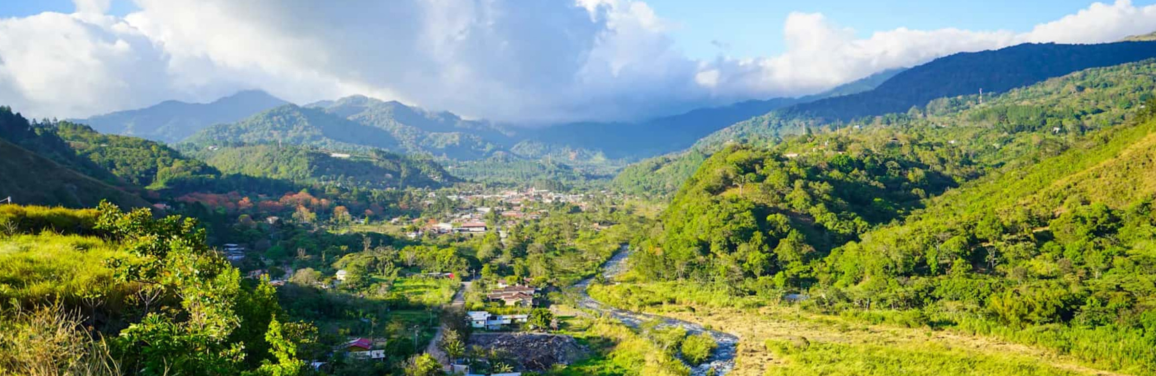
Escape the Coastal Heat – Boquete’s Cool Mountain Retreat
After days in the stifling, humid heat of Buenaventura or Bocas del Toro, few things feel better than heading inland to Boquete, Panama’s highland jewel. Nestled in the Chiriquí highlands at 1,200 to 1,800 meters above sea level, Boquete is a world apart from the steamy ports where decks shimmer under relentless sun. Up here, the air is crisp, mornings are fresh, and evenings carry a cool mountain breeze that makes you reach for a light jacket.
The contrast is immediate. Where the coast bakes under 30°C-plus temperatures and sticky humidity, Boquete sits comfortably in the mid-20s by day and drops to refreshing mid-teens at night. Mist, known locally as “bajareque,” drifts in on trade winds from the Caribbean, keeping everything lush and green without the heavy rains you might expect in the tropics. It’s the kind of place where you can actually sit outside mid-afternoon with a coffee, feel the sun on your face, and not sweat through your shirt.
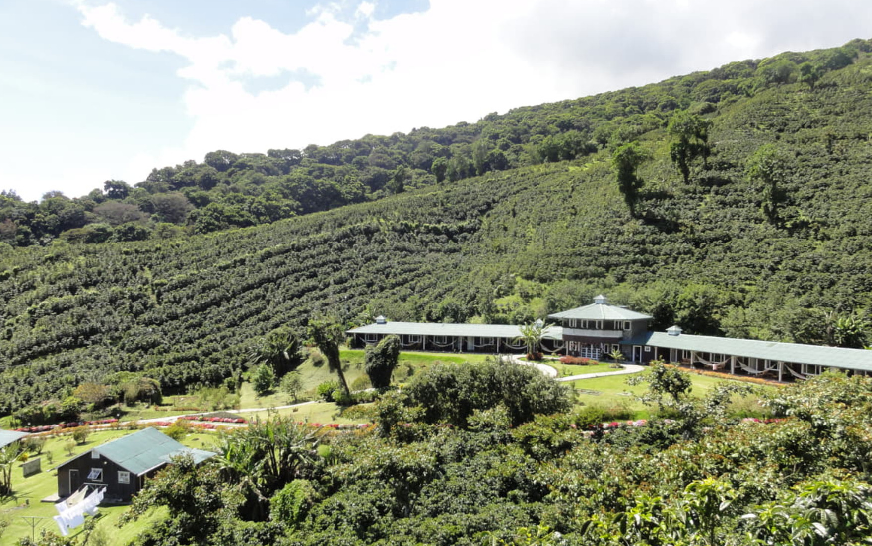
Boquete’s microclimate is one of Panama’s great natural luxuries. The volcanic soil and cool mountain air produce world-famous Geisha coffee, strawberries, citrus, and avocados. Touring a coffee estate here is a sensory experience, fragrant blossoms, ripening cherries, and the slow-roasted aroma of freshly brewed beans. After days smelling salt spray and diesel at anchor, the scent of pine, damp earth, and flowering hibiscus is a welcome change.
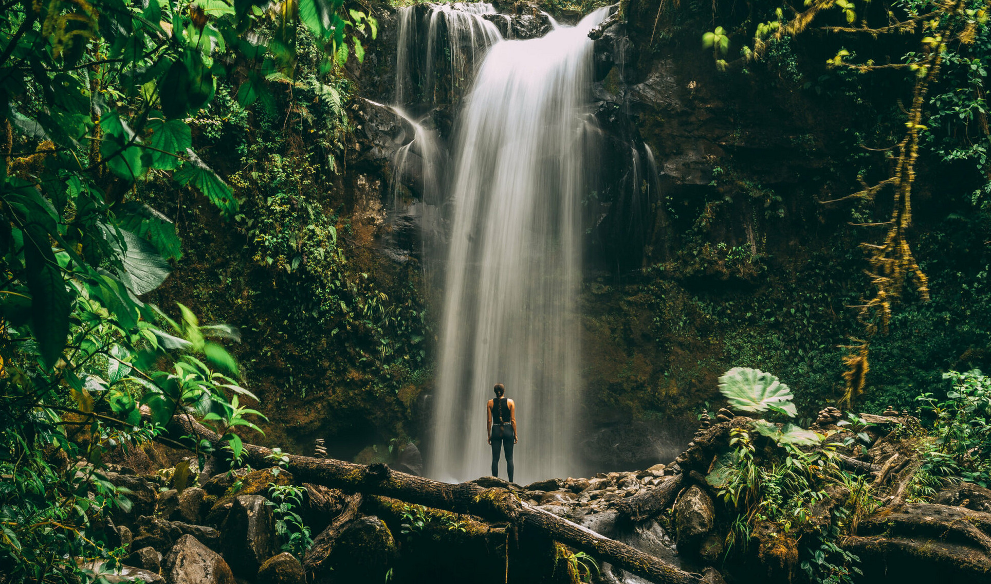
The town itself hums with a quiet energy. Hikers set out for the Quetzal Trail or attempt the summit of Volcán Barú, where on a clear day you can see both the Pacific and Caribbean at once. Others simply stroll through markets, sample fresh strawberries with cream, or wander gardens that burst with orchids and roses year-round.
For sailors and travelers who live by the rhythm of tides, Boquete is a reset button, a reminder that Panama isn’t just coastlines and canals. After a few days in its cool highlands, heading back down to the ports feels less like work and more like returning to sea with renewed energy.
Stay At Boquete Downtown Suites ~ 90 x night if you book direct in the heart of down town – walk everywhere
To get there from Bocas del Toro take a 4 1/2 hour shuttle bus $ 30 pp one way
contact Mikelda via whatsapp +507 6966 8676 via whatsapp to arrange for transport
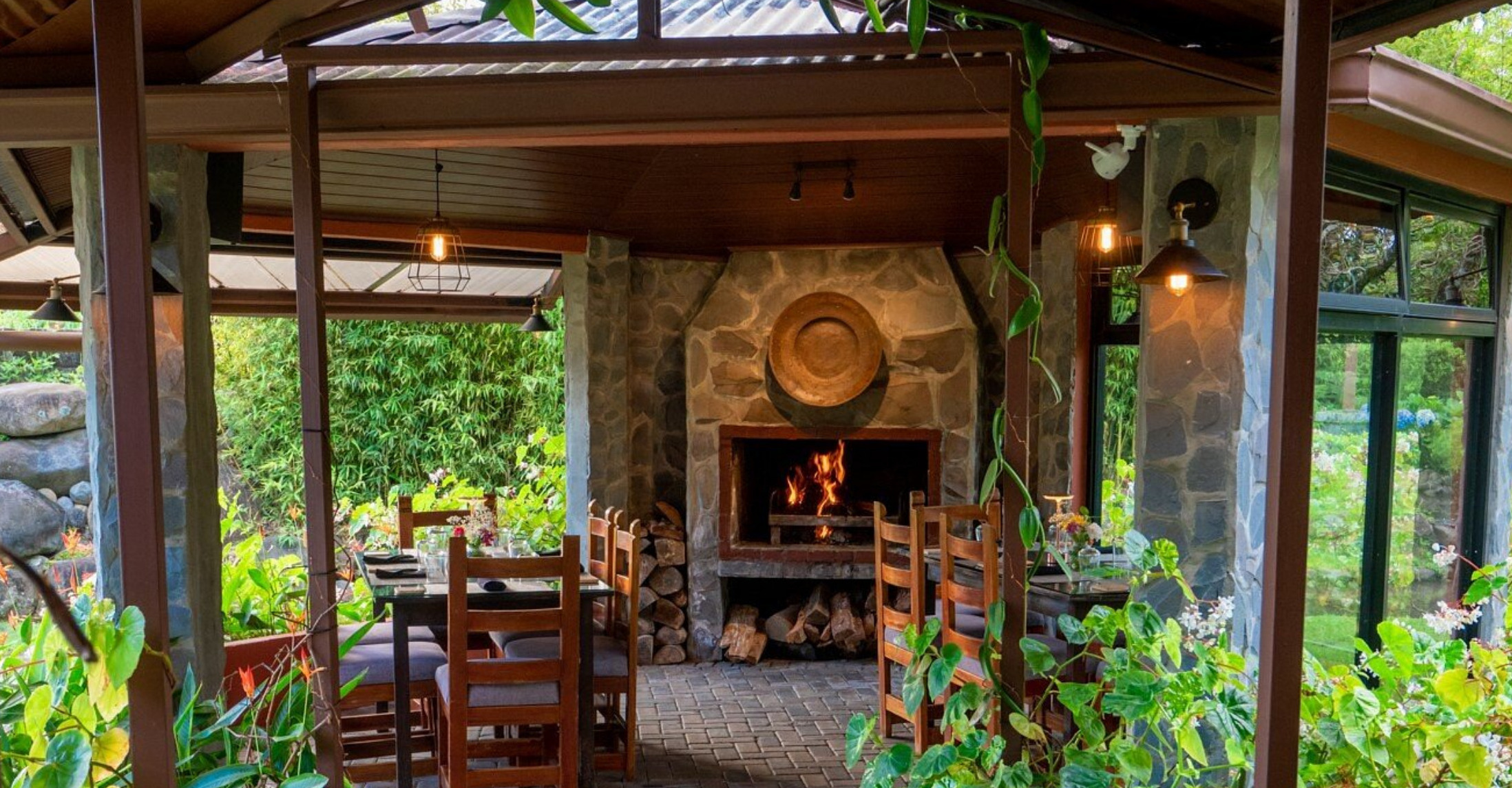
Must eat @ Nomad Restaurant & Lounge
Coffetours Don Pepe or any of the other high elevation coffe plantations.
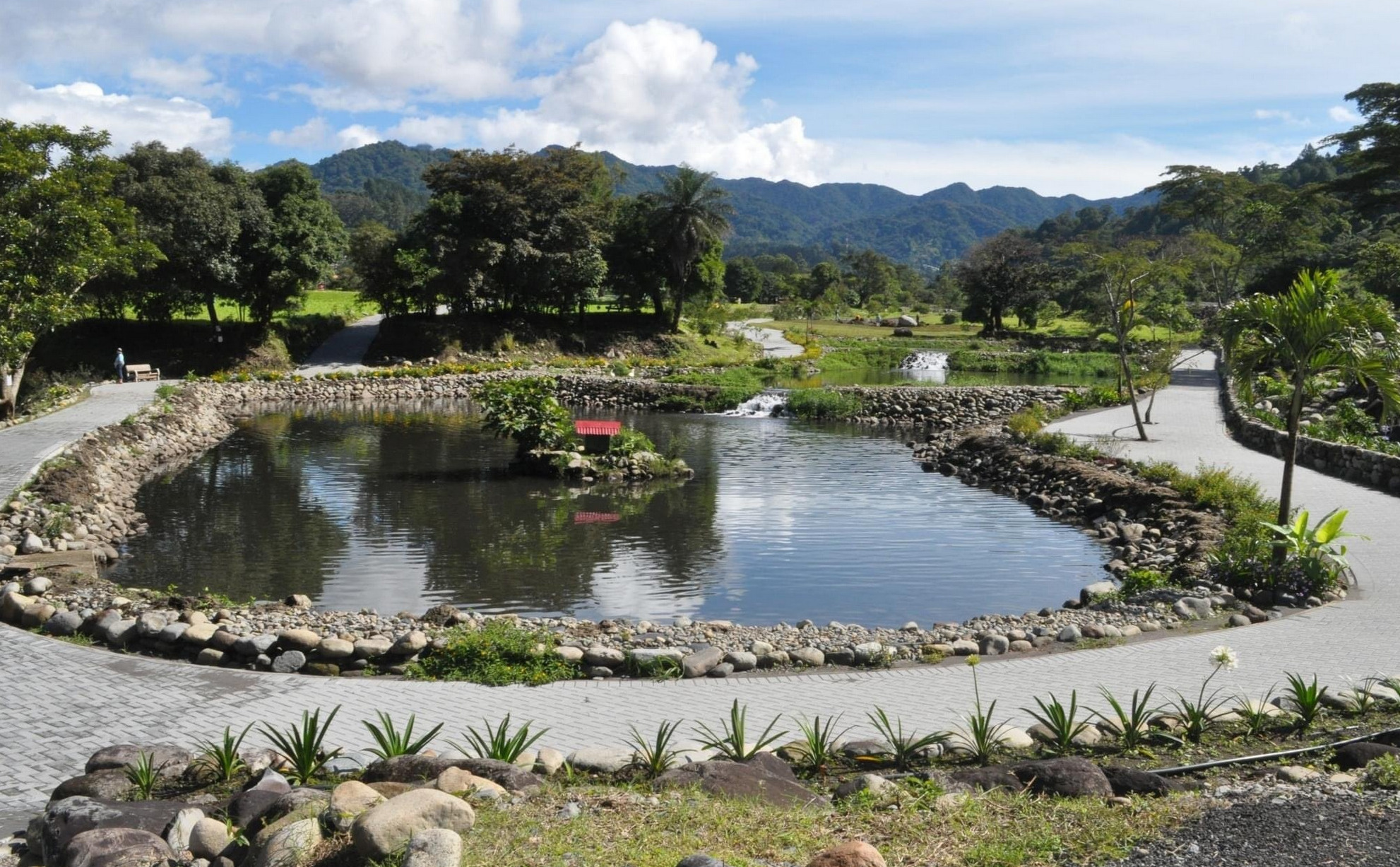
The Library Parque de Boquete, recently re-opened and is also known as El Parque Biblioteca. It encompasses 8 hectares (~ 20 acres).It includes the library building and the surrounding park, which features walking paths, waterfalls, ponds, and diverse vegetation alongside the Caldera River with lots of benches and is dog friendly ( dogs on leash ) but not open to bicycles, skateboards or scooters,
The new park transformed a swampy area into a tranquil oasis, providing a space for recreation and wildlife observation and reflection. It’s a popular spot for both residents and tourists seeking a connection with nature and a place to relax.

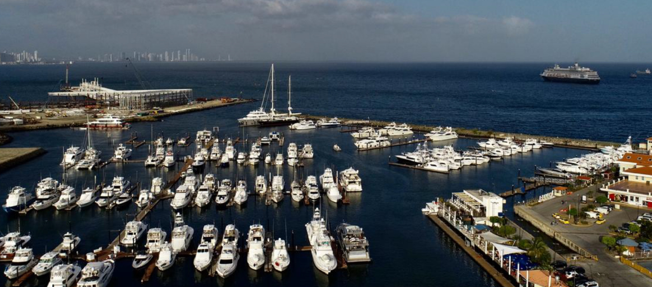
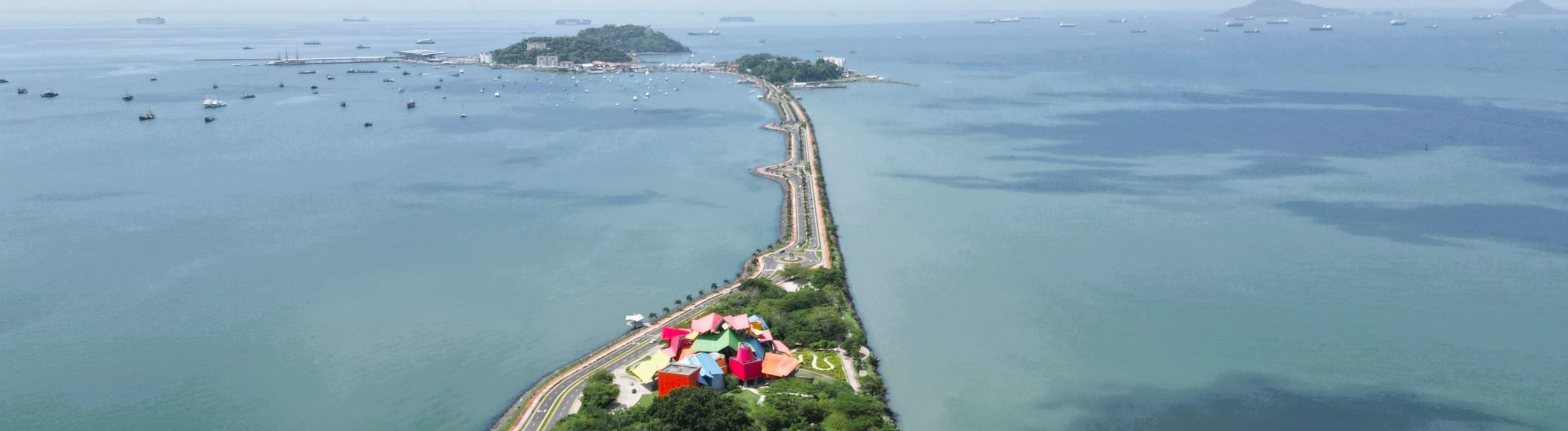
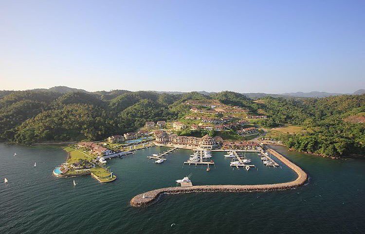
FLAMENCO MARINA PANAMA  SPONSORS THE OCEAN POSSE
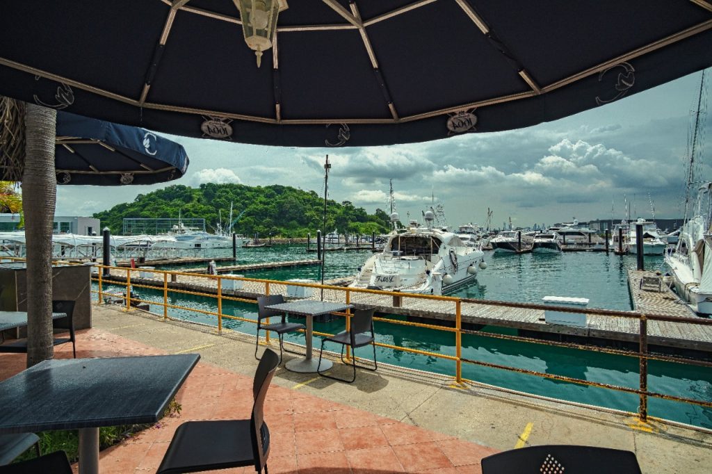
Captains and Skippers
We are going to offer you a 5% discount on our rate for temporary stays. Each participant must identify themselves in our office as part of their team.
Our rates are subject to change. Stays must be prepaid. Does not apply discount for any other service of the marina.
Stays must be reserved and are subject to dock availability.
AMENITIES
- Docks open 24/7
- Security 24/7
- Capacity up to 200 feet
- Recharge of fuel
- Shipyard for maintenance and repairs
- Laundry for yachts
- Firefighters marine
- Electric service
- Water potable
- Available foreign trash
- Charter Service Pleasure yacht
- Ice service for the boater
- Bilingual staff and qualified Customs offices, migration quarantine and Maritime Authority from Panama
SAFE APPROACH
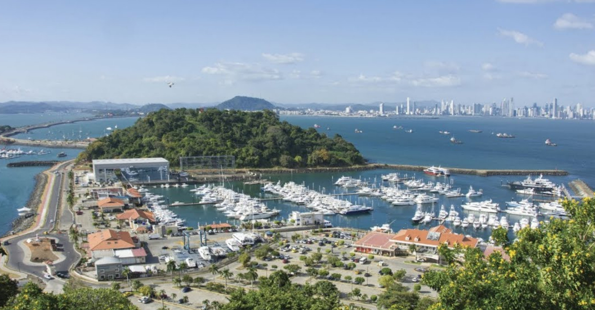
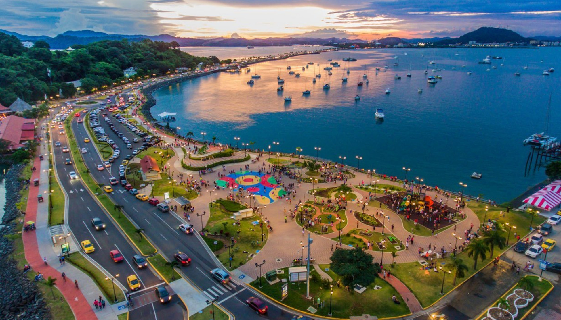
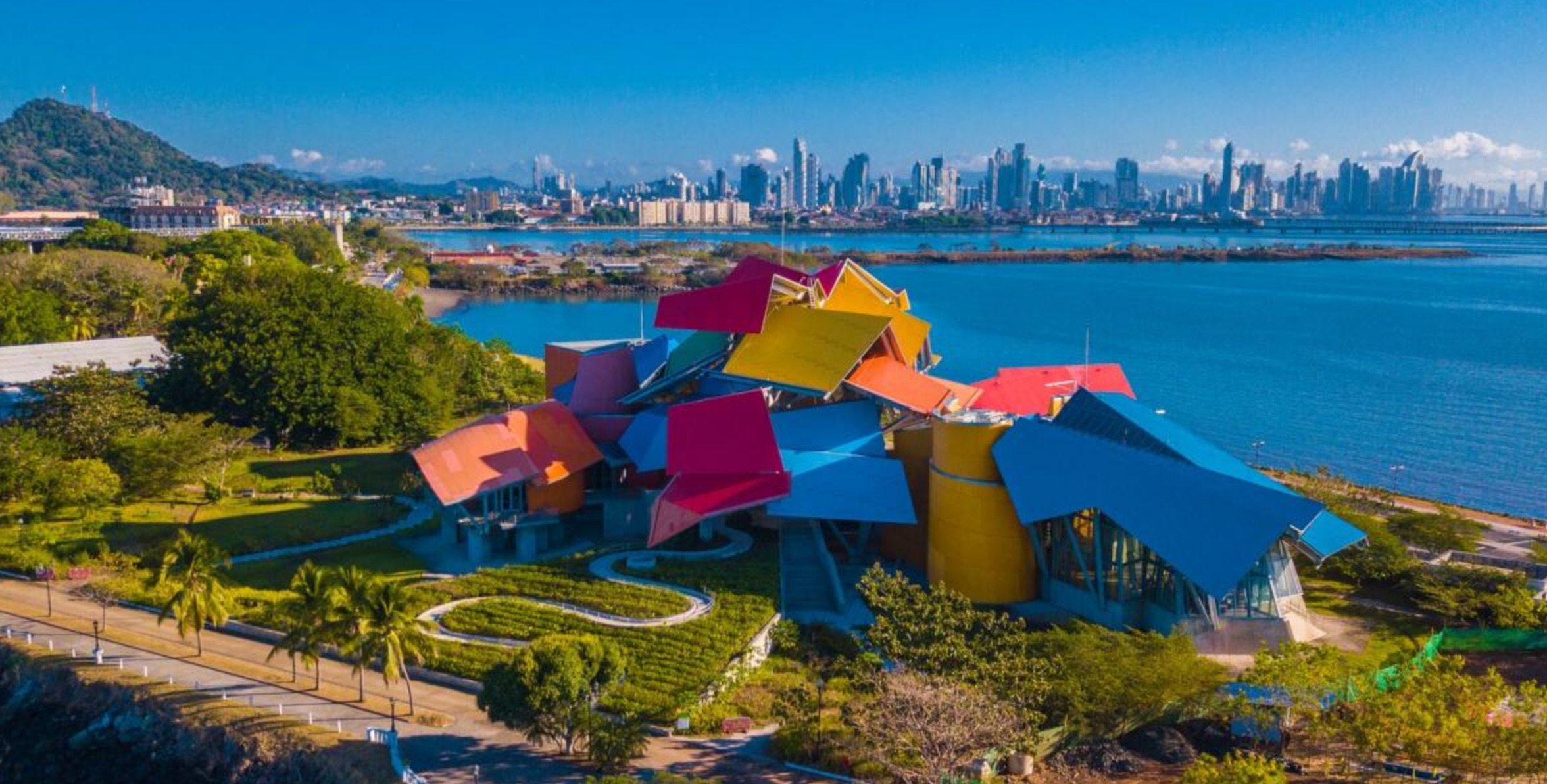
1. Amador Causeway (Calzada de Amador)
A scenic stretch connecting the mainland to the causeway islands. Perfect for walking, cycling, or enjoying sunset views of the city skyline and canal entrance.
2. Biomuseo
A striking building designed by Frank Gehry, showcasing Panama’s ecological and geological history through eight engaging galleries.
3. Flamenco Island Promenade
The area around the marina itself is pleasant for strolling, browsing small shops, and enjoying the lively atmosphere.
4. Sunday Flea Market at the Marina
Held weekly, this market features local artisans, crafts, and Panamanian snacks—a great way to pick up souvenirs and experience local culture.
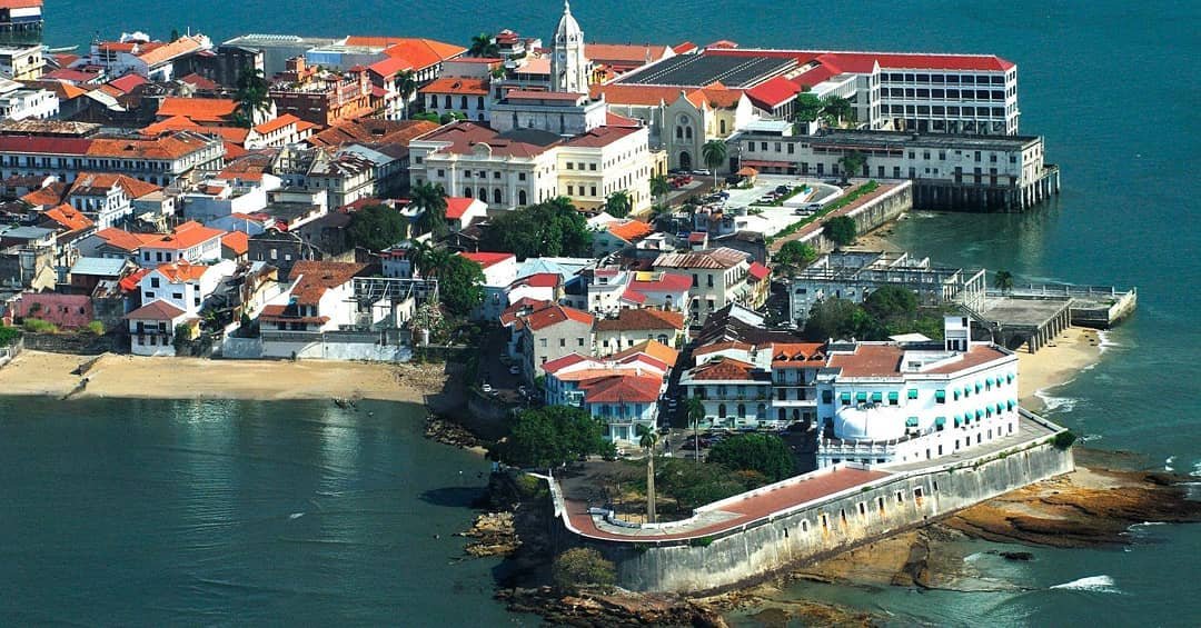
5. Casco Viejo (Old Town)
A UNESCO-listed historic district with cobblestone streets, colonial architecture, vibrant plazas, and excellent cafés and restaurants.
6. Miraflores Visitor Center & Panama Canal Locks
An iconic engineering site where you can watch vessels pass through the locks and explore exhibits on the canal’s history and impact.
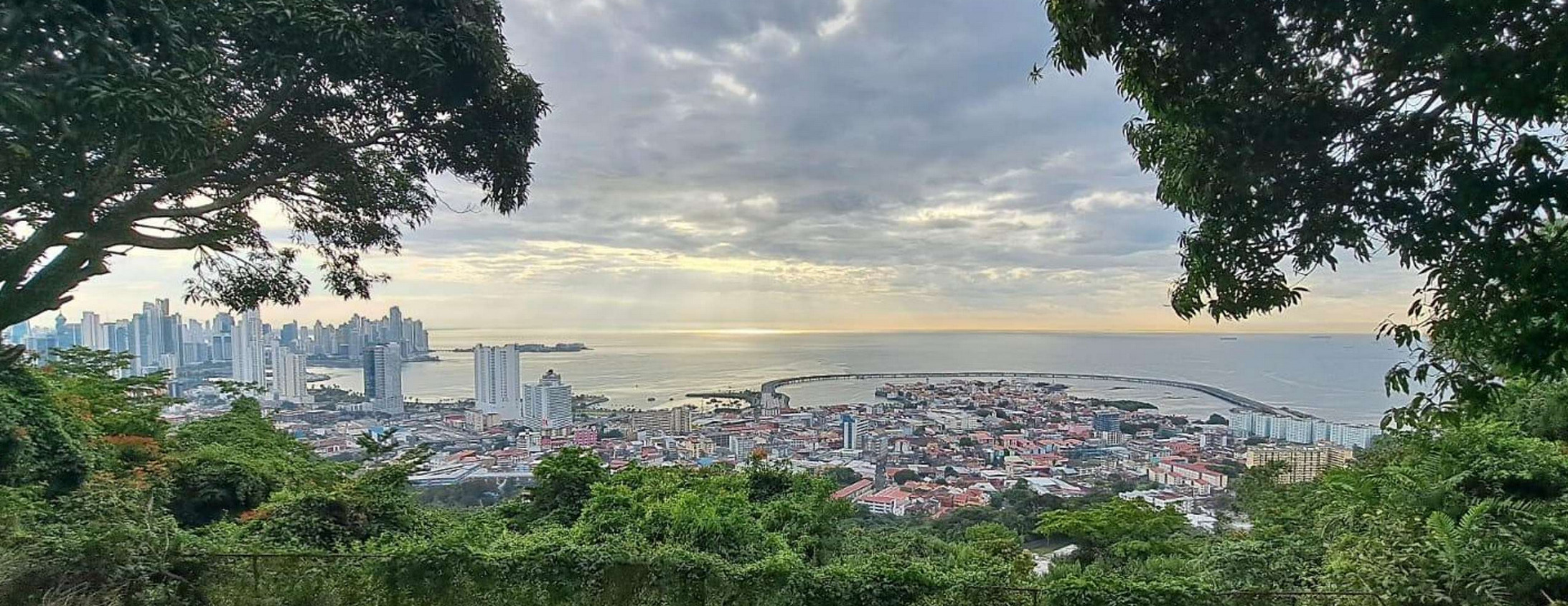
7. Ancon Hill (Cerro Ancón)
A 30-minute hike to the top offers panoramic views of Panama City and the canal. Wildlife such as sloths and coatis are often spotted along the way.
8. Causeway Islands: Naos, Perico, Culebra
These islands along the causeway feature walking trails, viewpoints, and remnants of historical fortifications, making them perfect for quiet exploration.
OCEAN POSSE PARTNERSHIP MARINAS
🇦🇺 AUSTRALIA
🇧🇸 BAHAMAS
-
 Browns Marina
 -
 Elizabeth on the Bay Marina
 -
 Blue Marlin Cove Resort & Marina
 - Great Harbour Cay Marina
-
 Romora Bay Resort and Marina
🇧🇿 BELIZE
🇧🇲 BERMUDA
🇧🇷 BRAZIL
🇻🇬 BRITISH VIRGIN ISLANDS
🇨🇻 CAPE VERDE
🇰🇾 CAYMAN ISLANDS
🇨🇱 CHILE
🇨🇴 COLOMBIA – Caribbean
-
 Club Nautico Cartagena
 -
 Club de Pesca Marina Cartagena
 -
 Marina Puerto Velero
 -
 IGY Marina Santa Marta
  Manzanillo Marina Club
🇨🇷 COSTA RICA – Pacific Coast
🇨🇺 CUBA
🇩🇲 DOMINICA
🇩🇴 DOMINICAN REPUBLIC
🇪🇨 ECUADOR
🇸🇻 EL SALVADOR
🇬🇮 GIBRALTAR
🇬🇩 GRENADA
🇬🇵 GUADELOUPE
🇬🇹 GUATEMALA – Pacific Coast
🇬🇹 GUATEMALA Rio Dulce
🇫🇯 FIJI
 Copra Shed Marina
 Nawi Island Marina
  Denarau Marina
-
 Musket Cove
  Royal Suva Yacht Club
 Sau Bay Moorings
🇭🇳 HONDURAS – Bay of Islands – Roatan
🇮🇹 ITALY
 Marina dei Presidi
  Marina di Balestrate
 Marina di Brindisi
 Marina di Cagliari
 Marina di Chiavari
 Marina di Forio
  Marina di Teulada
 -
 Marina di Policoro
 -
 Marina di Vieste
 -
 Marina de Procida
 -
 Marina de Villasimius
 - Marina di Vieste
-
 Marina Molo Vecchio
  Marina Salina
  Venezia Certosa Marina
🇯🇲 JAMAICA
🇲🇶 MARTINQUE
🇲🇽 MEXICO – Caribbean
- Marina Makax – Isla Mujeres
- Marina Puerto Aventuras
- Marina V&V – Quintana Roo
- Marina El Cid – Cancún
🇲🇽 MEXICO – Pacific Coast
- ECV Marina – Ensenada BC
- IGY Marina Cabo San Lucas BCS
- Marina Palmira Topolobampo – SI
- Marina y Club de Yates Isla Cortes – SI
- Marina el Cid – Mazatlan – SI
- Marina Vallarta, Puerto Vallarta – JA
- Marina Puerto de La Navidad – Barra de Navidad – CL
- Marina Ixtapa, Ixtapa – GE
- La Marina Acapulco, Acapulco – GE
- Vicente’s Moorings, Acapulco – GE
- Marina Chiapas – CS
🇳🇿 NEW ZEALAND
🇳🇮 NICARAGUA – Pacific Coast
🇳🇺 NIUE
🇵🇦 PANAMA – Pacific Coast
🇵🇦 PANAMA – Caribbean
- Shelter Bay Marina
- Bocas Marina
- Solarte Marina
- Linton Bay Marina /a>
- Turtle Cay Marina
- IGY Red Frog Marina
🇵🇹 PORTUGAL
🇵🇷 PUERTO RICO
🇱🇨 SAINT LUCIA
Marigot Bay Yacht Haven🇸🇽 SINT MAARTEN
🇪🇸 SPAIN
🇰🇳 ST KITTS & NEVIS
🇹🇳 TUNISIA
🇹🇴 TONGA
🇹🇨 TURCS AND CAICOS
🇻🇮 US VIRGIN ISLANDS
🇺🇸 USA – East Coast
- Safe Harbor – Marathon, FL
- Pier 66 Hotel & Marina – Ft. Lauderdale, FL
- Titusville Marina – FL
- Port 32 Marina Jacksonville – FL
- Oasis Marinas at Fernandina Harbor Marina – FL
- Morningstar Marinas Golden Isles St. Simons Isl. – GA
- Windmill Harbour Marina – Hilton Head , SC
- Coffee Bluff Marina – Savannah GA
- Hazzard Marine – Gerogetown, NC
- Holden Beach – Town Dock, NC
- Tideawater Yacht Marina, Portsmouth, VA
- Ocean Yacht Marina, Portsmouth, VA
- York River Yacht Haven – VA
- Yorktown Riverwalk Landing – VA
- Regatta Point Marina – Deltaville, VA
- Regent Point Marina – Topping, VA
🇺🇸 USA – Pacific Coast
- Safe Harbor Ventura Isle, Ventura CA
- Vintage Marina , Oxnard, CA
- Safe Harbor South Bay – Chula Vista, CA
🇻🇺 VANUATU
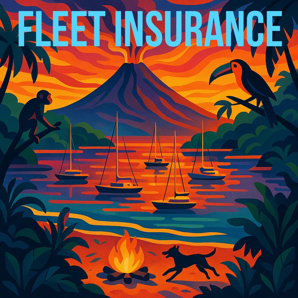
YOUR YACHT INSURANCE IN A GROUP RATE
THINK BOAT US@ outside the US

🌊 Ocean Posse Fleet Insurance Plan
We’re are, and this is rare, proud to announce the official launch of the Ocean Posse Group Insurance Program – a global, captain-forward insurance solution designed specifically for long-range cruising vessels.
Member Benefits Ocean Posse Fleet Insurance – All vessels qualify under our group rate. Members who have been with the Posse for at least one year receive 15% off in Year 2. Rates for the next season are locked in, and after 3 consecutive incident-free years, captains earn an additional 5% loyalty discount.
Key Features for Ocean Posse Members:
• ✅ Guaranteed Issue for vessels with a survey within 5 years (no automatic declines for minor issues)
• ⚡ Fast Binding – coverage issued within 48 hours in most cases
• 📍 Global Navigation, including Colombia, Panama, the South Pacific, and New Zealand
• 🌪️ Hurricane Coverage without excessive restrictions
• ⚓ Agreed Value Policies (no surprises at claim time)
• 🛥️ Includes Dinghy, Lightning, Pollution, Towing, P&I, Medical, Uninsured Boaters, and Personal Property
• 🇨🇦 No exclusions for Canadians or foreign-flagged vessels
• 🪫 Lithium batteries accepted – DIY or pro install, no red tape
• 🧭 Custom endorsements available for singlehanders, high GL needs (like New Zealand), and more
A Major Milestone This is one of the most important benefits we’ve ever added to the Ocean Posse. !
It’s designed to protect your vessel, your journey, and your freedom to roam.
We’re proud to offer a solution worthy of the miles you’ve sailed and the ones ahead.
🧭 Learn more and apply @ ( login to download the forms )
oceanposse.com/insurance >>
Captain Dietmar
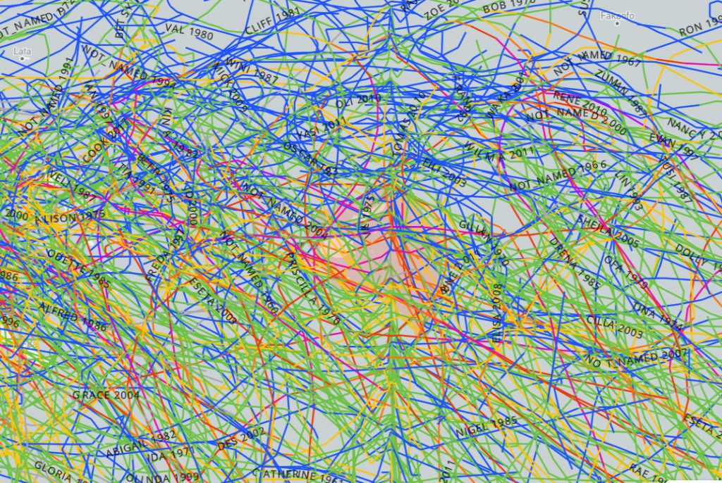
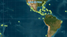
Severe weather tracks ( Jackson Pollock type ) of tropical depressions and named storm tracks thorough Fiji
Primary Named Winds in the Mediterranean 🌬 Karaburun
The Karaburun winds, specifically in the Karaburun peninsula of Turkey, are generally known for being westerly winds, meaning they blow from west to east. The peninsula’s location jutting out into the Aegean Sea makes it susceptible to these prevailing winds. The wind direction can be influenced by local topography and weather patterns, but the general trend is from the west.
These winds are primarily part of the broader Etesian (or Meltemi) wind system, but the unique geography of Karaburun amplifies and funnels these winds, giving them a distinct local character.

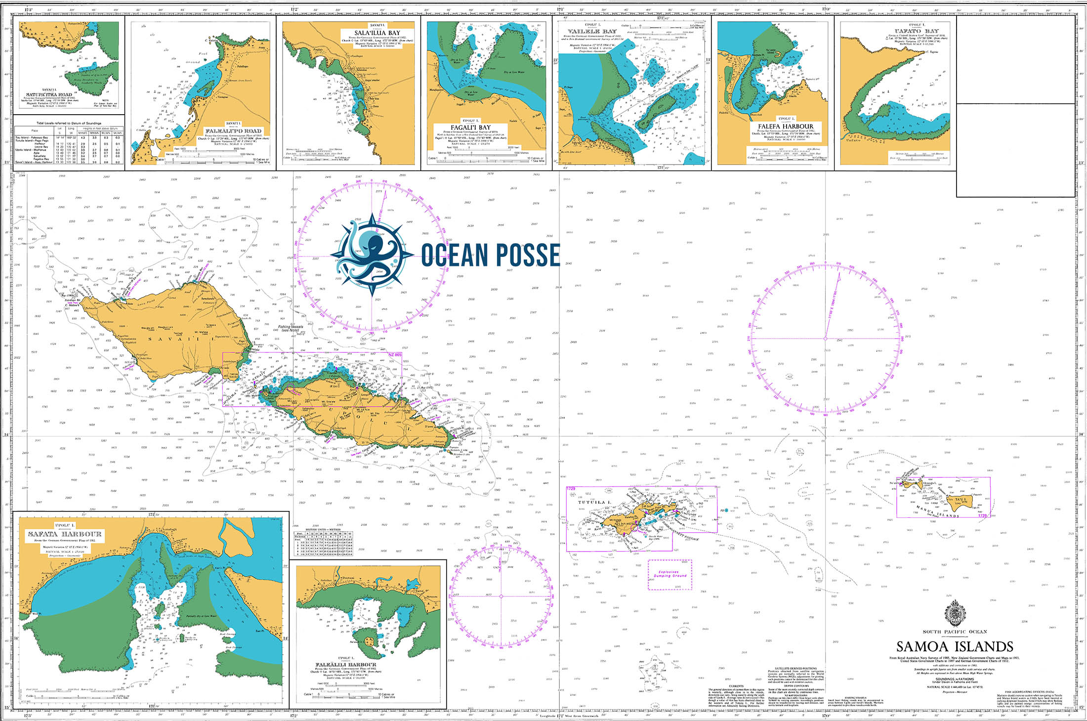
MUST SEE – SAMOA 🇼🇸 APIA
Samoa
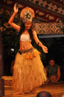
Samoan dances in Apia 🇼🇸 Samoa Samoan cultural dancing is a vibrant and integral part of Samoan heritage, particularly in Apia, the capital city of Samoa. Traditional dances in Samoa are deeply rooted in the cultural and social fabric of the island, reflecting its history, values, and communal lifestyle. One of the most prominent dances is the Siva. This graceful dance, often performed by young women, tells stories through slow, fluid movements, symbolizing the beauty and harmony of Samoan life. The Fa’ataupati, or slap dance, contrasts with its energetic and rhythmic style, typically performed by men, showcasing strength and coordination
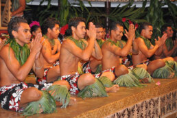
The Fa’ataupati, or slap dance, contrasts with its energetic and rhythmic style, typically performed by men, showcasing strength and coordination.
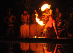
Fire Dancer The ancient art of fire (sword) dancing originated in Polynesia. Taking his inspiration from the Samoan warrior, a fire knife dancer takes center stage twirling, tossing, catching and throwing a flaming machete at high speeds. The history of Samoan fire twirling, or fire knife dancing, is rich and fascinating. The practice, known as Siva Afi or Ailao Afi, originated from the traditional Samoan knife dance called Ailao, which was performed by warriors to demonstrate their battle prowess and psych themselves up before combat. The dance involved twirling and tossing a war club called a nifo oti, which was later adapted to include fire (Wikipedia) (Old Lāhainā Lū’au). The incorporation of fire into the dance is credited to Uluao “Freddie” Letuli, a Samoan-American performer. In 1946, inspired by a Hindu fire eater and a baton twirler with lighted batons he saw at a Shriners Convention in San Francisco, Letuli decided to add fire to his knife dance routine. This innovation dramatically increased the skill and danger involved, making the dance even more captivating. Letuli’s new version of the dance quickly gained popularity and became a staple in Polynesian shows and luaus (Maui Luau Review) (Discover Hawaii). Fire knife dancing has since become a celebrated part of Samoan culture and is showcased in various cultural events, including the annual World Fire Knife Dance Competition held at the Polynesian Cultural Center in Hawaii. This competition attracts performers from around the world and highlights the skill, strength, and artistry involved in this dynamic dance (Aloha Hawaii). For a deeper dive into the history and cultural significance of Samoan fire twirling, you can explore resources such as “Flaming Sword of Samoa” by Letuli, which provides an in-depth look at the origins and evolution of this mesmerizing dance (Aloha Hawaii) (Discover Hawaii).[/caption]

A theory on Human migration from Indonesia into Micronesia, Melanesia and Polynesia. Samoa is a sovereign nation 40 miles northwest of American Samoa, a US Territory. While geographically quite close, Samoa and American Samoa are separated by 24 time difference. Samoa being more closely connected with Australia and New Zealand as primary trade partners and American Samoa with the United States. Samoa consists of the islands of Upolu, Savai’i, Apolima and Manono. During Colonial times these islands were a German protectorate from 1900 until the takeover by New Zealand forces during World War 1 in 1914. The takeover of Samoa was New Zealand’s first military action in World War I. In late August 1914 with landings by the Samoa Expeditionary Force from New Zealand on behalf of King George V. Samoan independence came in 1962.


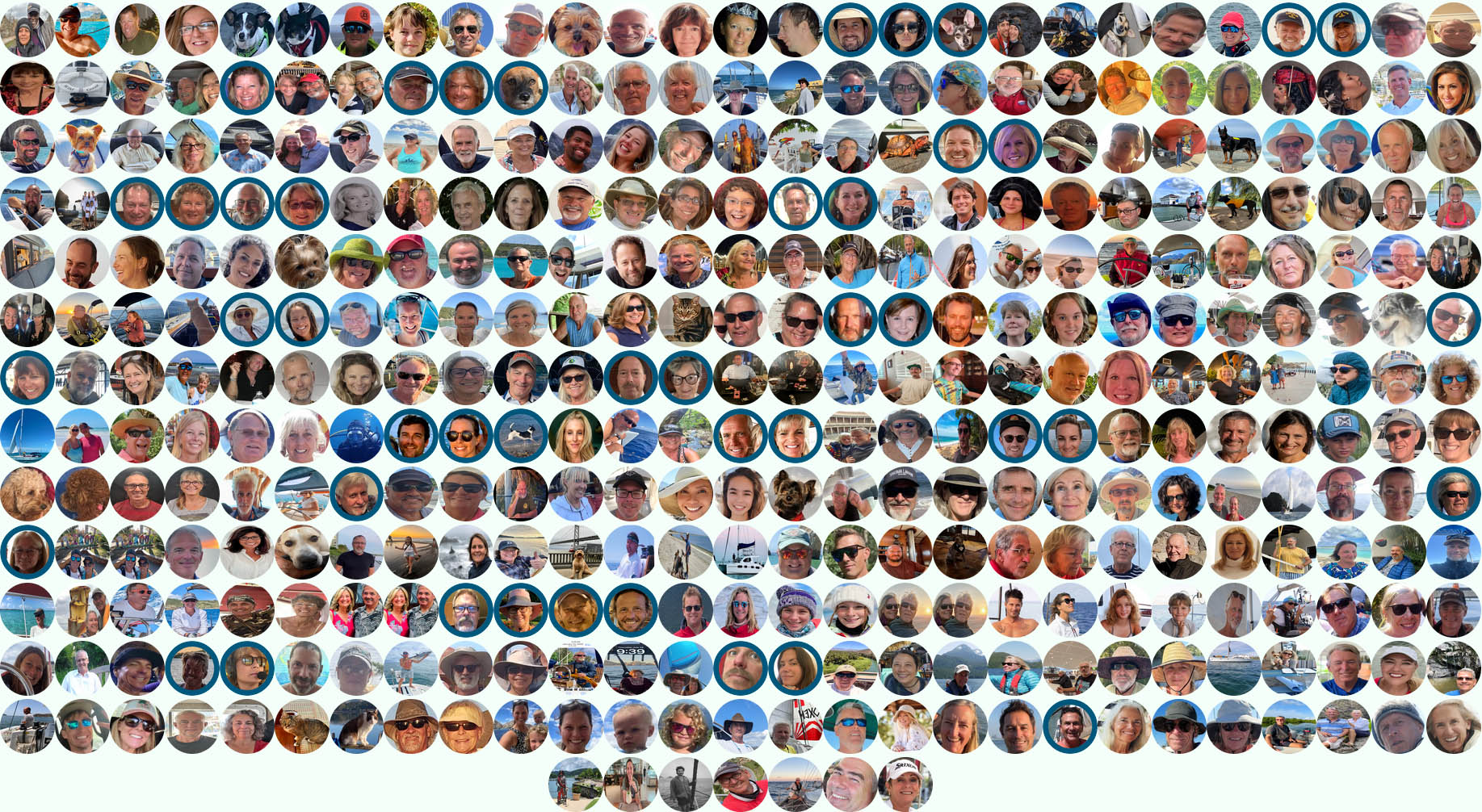
Join the Ocean Posse – Sail Smarter Together
Look at the fleet! Hundreds of seasoned captains and yacht owners form an intelligent network, sharing real-world experience, safe routes, and exclusive marina benefits. Be part of the community that’s redefining long-range cruising.
BENEFITS OF of joining the Ocean Posse
SAVE TIME – SAVE MONEY – and get the best and most up to date INFORMATION !
Here are the benefits (pre-season aka during hurricane season) vs in season ) explained
| BENEFITS FOR YOU, YOUR YACHT & YOUR CREW |
|
|
| ✔️ Up to date and verified information by fellow yachts | ✔️ | |
| 📊 Communications focused on facts, not opinions or unsolicited advice | ✔️ | |
| 💰 Save real money at 125+ Marinas with discounts * | ✔️ | |
| 🛰️ Free vessel and fleet tracking courtesy of Predict Wind | ✔️ | |
| 🚩 Free Burgee * | ✔️ | |
| 💰 Save with service providers and chandleries | ✔️ | |
| 🕵️ dedicated, experienced and discounted Canal and clearing in agents | ✔️ | |
| 🗺️ Free aid to navigation 550 Gb OpenCPN satellite charts (mac/pc/android) | ✔️ | |
| 💰 Save Money on parts with a Westmarine Pro Discount | ✔️ | |
| 💰 Save Money with a Predict Wind Pro Discount | ✔️ | |
| 🗺️ Free Printable Reference Charts emergency backup to your electronics | ✔️ | |
| 📹 Free Video Seminars on destinations from those who are there | ✔️ | |
| 🌩️ Top weather routing avail by Marine Weather Center Chris Parker | ✔️ | |
| ⛵ Community of voyagers all are welcome, kids, single-handers, pets | ✔️ | |
| ☂️ NEW Group Fleet Yacht Insurance with discounts for multi-year participants 15% and + 5% after year 3 | ✔️ | |
| ⚓ Peer support in emergencies with escalation procedures | ✔️ | |
| Fleet Updates via email – free | ✔️ | |
| 🏆 Fun Award Categories | ✔️ | |
| 📍 Free access to GOOD NAUTICAL Anchorage reports | ✔️ | |
| ☎️ Free Weekly live calls on Mondays via dedicated LINE.me group | ✔️ | |
| 💬 Free 24/7 LINE group channel | ✔️ | |
| 🌊 Benefit from the latest information and prior experience participants | ✔️ | |
| 🔭 Be part of a fleet of sensor for those who come behind you or meet | ✔️ | |
| 🚷 Always priority traffic – for participants by participants | ✔️ |
- (* as long as you do not have prior contracts or reservations in place and subject to a marina’s availability )
OCEAN POSSE LONG LINE MAP
What are Long Lines?
Long lines are an efficient and well administered, yet illegal, method of over-fishing practiced by commercial fisherman all over the world. The fishing technique uses a long main fishing line that extends sometimes dozens of miles. The line contains branch lines (snoods or gangions) which clips onto the main line. These branches of lines contain hooks for randomly catching fish that are in the area. Main line with its branches can contain as many as 3,000 hooks which target swordfish, tuna, halibut, sablefish and of valuable species. Longlines attached at the surface catch Tuna or Swordfish whereas those attached at the sea floor target ground fish such as halibut or groupers or cod.
Longline fishing is a prevalent form of commercial fishing and allows for massive fish yields. Longlines can be used near the surface (pelagic longlines) to catch open-water fish such as tuna and swordfish, or near the seafloor (demersal longlines) to catch bottom-dwelling fish such as cod or halibut. Longlines consist of a very long mainline (up to 60 miles long) that is set and dragged behind a boat. The mainline has thousands of attached branchlines, each containing baited hooks used to lure and capture target fish. An unfortunate consequence of the longline design is that it attracts and easily snags non-target marine life (known as bycatch). A wide range of animals such as sea turtles, sharks, seals, seabirds, and marine mammals can get caught on hooks or entangled in fishing line (Fig. 1). Interactions with longlines can cause non-target animals, many of which are endangered, to suffer injury and even mortality.
700 nm FLORIDA KEYS TO BELIZE 🇺🇸 🇨🇺 🇲🇽 🇧🇿
sailing directions via Dry Tortugas / Cuba / Isla Mujeres / Belize
- You will have to cross the gulf-stream twice (2 x )
- Only venture on this journey after the last hurricane of the season has passed and before the first hurricane arrives nhc.noaa.gov
- You will be sailing near the shore of Cuba – you need permission to do so it’s a 180 nm run from Marina Hemingway to the Faro Roncali.
- You need to be fully self sufficient in Cuba
- Download the Satellite charts for Cuba – many of the commercial charts are off / wrong – there is no sea tow in Cuba
- Please review USCG requirements for entering Cuba
ROUTE OVERVIEW


SOUTH PACIFIC – MEET THE CRUISING FLEET – SAT AUG 30 – NAWI ISLAND MARINA
Brought to you by the yacht sales co.
-
15:00 YACHT MARKET OVERVIEW FOR BUYERS AND SELLERS PRESENTED BY
THE YACHT SALES CO -
15:30 THE PASSAGE TO NEW ZEALAND – PRESENTED BY OCEAN TACTICS
-
16:00 MEET AND MINGLE AND FREE RUM
-
17:00 LET THE FEAST BEGIN …
-
19:00 KAVA AND RUM AFTER HOURS
OFFICIAL OCEAN POSSE EVENTS

ANNAPOLIS BOAT SHOW 🇺🇸 MARYLAND USA
ANNAPOLIS, Annapolis Town Dock Booth VB 9

OCEAN POSSE 🇺🇸 SAN DIEGO BAY 4 DAY CRUISING SEMINARS SERIES @ SAFE HARBOR SOUTH BAY
SAFE HARBOR SOUTH BAY EVENT CENTER, CHULA VISTA, SAN DIEGO, CA

OCEAN POSSE KICK OFF 🇲🇽 BARRA DE NAVIDAD, MEXICO December 3-7 2025
MARINA PUERTO DE LA NAVIDAD, BARRA DE NAVIDAD, MEXICO


OCEAN POSSE & BEN TAYLOR STREET PARTY @ CANNES 🇫🇷 YACHTING FESTIVAL
TAQUERIA LUPITA, 72 Rue Meynadier, Cannes
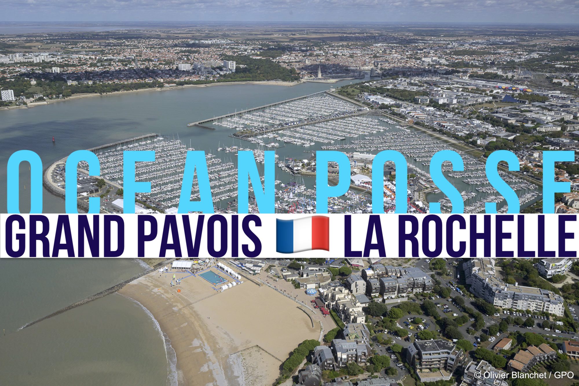
GRAND PAVOIS 🇫🇷 La Rochelle – Sep. 24 2025
Gran Pavois La Rochelle, 20 Av. de la Capitainerie, 17000 La Rochelle, France
GRAND PAVOIS 🇫🇷 La Rochelle – Sep. 24 2025
Gran Pavois La Rochelle, 20 Av. de la Capitainerie, 17000 La Rochelle, France
GRAND PAVOIS 🇫🇷 La Rochelle – Sep. 24 2025
Gran Pavois La Rochelle, 20 Av. de la Capitainerie, 17000 La Rochelle, France
GRAND PAVOIS 🇫🇷 La Rochelle – Sep. 24 2025
Gran Pavois La Rochelle, 20 Av. de la Capitainerie, 17000 La Rochelle, France
GRAND PAVOIS 🇫🇷 La Rochelle – Sep. 24 2025
Gran Pavois La Rochelle, 20 Av. de la Capitainerie, 17000 La Rochelle, France

FLOR DE CAÑA RUM SPONSORS THE OCEAN POSSE EVENTS
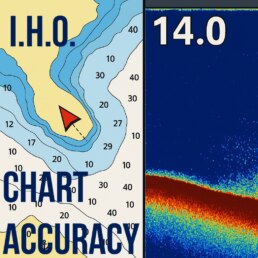
I.H.O. CHART ACCURACY BY MARITIME AREA
IHO (International Hydrographic Organization) chart accuracy is critical for navigation, especially for yachts because it directly impacts safety, route planning, and risk assessment.
1. Safe Passage and Grounding Prevention
• Accurate charts provide reliable depth soundings, coastline outlines, and seabed composition, reducing the risk of running aground or hitting uncharted hazards.
• Inaccurate or outdated charts may place your vessel on land or reefs when GPS overlays don’t match actual conditions – a known issue in poorly surveyed regions.
2. Precision in Coastal and Near-Shore Navigation
• When navigating tight channels, reefs, or harbor approaches, even small chart errors can be dangerous.
• A 200–500 m positional inaccuracy can mean the difference between a safe anchorage and a coral head strike.
3. Risk Management and Liability
• For captains, IHO accuracy categories (A1, A2, B, C, D) indicate how much trust you can place in the chart.
• Insurance companies and port authorities sometimes refer to IHO accuracy classifications to evaluate negligence in a grounding incident.
4. Passage Planning and Decision Making
• Knowing chart reliability helps skippers plan offshore vs near-shore routes.
• In poorly surveyed regions (IHO C or D), captains may:
◦ Keep larger safety margins offshore.
◦ Rely more on satellite imagery and sounder tracks than on charts.
5. Confidence for Night or Poor-Visibility Navigation
• High-accuracy charts (A1/A2) allow night passages into ports with confidence.
• In low-accuracy regions, prudent captains avoid entering unknown harbors after dark.
CHART ACCURACY BY NAUTICAL AREAS FROM THE IHO
| Country / Territory | Typical Near‑Shore ZOC | Likely Accuracy Level | Notes |
|---|---|---|---|
| Anguilla | B / C | Medium–poor | Some UKHO offshore surveys; nearshore gaps remain |
| Antigua & Barbuda | B / C | Medium–poor | UKHO modern sonar offshore, limited coastal detail |
| Aruba | A2 / B | High–medium | Dutch surveys cover main ports well |
| Bahamas | A2 / B | High–medium | Commercial channels better than inter-island shallow zones |
| Barbados | B | Medium | General survey coverage; limited recent coastal data |
| Belize | B / C | Medium–poor | Some recent work near Belize City, older data offshore and reef zones :contentReference[oaicite:2]{index=2} |
| Cayman Islands | A1 / A2 / B | High–medium | Strong port and harbor survey coverage |
| Cuba | B / C | Medium–lower | National HO data uneven; some older sketch surveys |
| Curacao | A2 / B | High–medium | Offshore and port zones well surveyed |
| Dominica | B / U | Medium–unassessed | Limited hydrographic resources; some offshore data missing |
| Dominican Republic | B / C / U | Medium–poor / unassessed | Spotty coastal coverage; gaps in many areas |
| Grenada | B | Medium | Port approaches surveyed; limited nearshore resolution |
| Guadeloupe | B / C | Medium–poor | French surveys offshore stronger than coastal zones |
| Haiti | C / U | Poor / unassessed | Hydrographic coverage limited; many areas unassessed |
| Jamaica | B / C | Medium–poor | Old coastal surveys; infrequent updating |
| Martinique | B | Medium | Some French coastal survey data; older scale maps |
| Montserrat | B | Medium | UKHO mapped offshore; nearshore data limited |
| Puerto Rico & USVI | A2 / B | High–medium | NOAA/NGA surveys; good coastal confidence in many areas |
| Saba, Sint Eustatius & Sint Maarten | B / C | Medium–poor | Dutch/Caribbean HO data moderate |
| Saint Kitts & Nevis | B | Medium | Some UKHO survey support; missing shallow-water detail |
| Saint Lucia | B / C | Medium–poor | Spotty depth coverage; ports better than open coast |
| Saint Vincent & the Grenadines | B | Medium | Port areas surveyed; islands and reefs less detailed |
| Suriname | B / C | Medium–poor | Government ENC production expanding; gaps offshore |
| Trinidad & Tobago | B / C | Medium–lower | Industrial port zones better than open shelf |
| Turks & Caicos | B / C | Medium–poor | Limited coastal resolution; offshore better charted |
🧭 Interpretation Guide: ZOC Categories
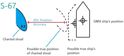
From IHO S‑67 and S‑57:
• A1 (6★): Very high accuracy: ± 5 m horizontal, depth tolerance ~0.5 m (95% CI); full seafloor search
• A2 (5★): High accuracy: modern surveys with multi‑beam or mechanical sweep; good depth precision but slightly less positional accuracy than A1
• B (4★): Medium accuracy: modern echo sounder surveys without full sweep; position ± 50 m, depth up to ~2 m variance; uncharted hazards unlikely but possible.
• C / D (3★ or fewer): Poor accuracy or un-assessed: limited or opportunistic data; positional variance up to 500 m, depth anomalies expected; hazards may not be charted
⚠️ Key Considerations for Mariners
• Many Caribbean areas still rely on older or opportunistic surveys, especially around smaller islands or remote locations.
• The Mach‑Caribbean ENC scheme (MACHC region) shows coverage gaps and inconsistent ENC scales or navigational purposes across different providers
• Always activate the ENCs “ZOC” display in ECDIS to visualize CATZOC ratings before planning or changing routes (especially important nearshore).
• In ZOC B or lower areas, adopt higher safety margins for under‑keel clearance and cross‑track distance; assume possible uncharted depth features
NOTE:
For countries seeking yachting tourism, improving chart accuracy is where countries could justify increases in their cruising fees and improve =yachting safety.
OCEAN POSSE SPONSORS
YOUR MEMBERSHIP SAVES YOU
MONEY WITH THESE SPONSORS
OCEAN POSSE SPONSORS
- ABERNATHY – PANAMA
- BELIZE TOURISM BOARD
- BOAT HOW TO
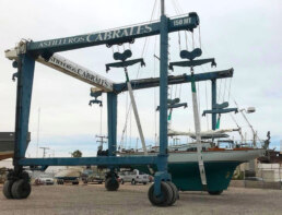
- CABRALES BOAT YARD
- CENTENARIO CONSULTING – PANAMA CANAL
- CHRIS PARKER – MARINE WEATHER CENTER
- DELTA MIKE MARINE SUPPLY PANAMA
- DIGITAL YACHT
- DOWNWIND MARINE
- EL JOBO DIST. COSTA RICA
- FLOR DE CAÑA
- HAKIM MARINA AND BOAT YARD
- HERTZ RENTAL CARS MEXICO
- HOME DEPOT PRO MEXICO
- LATITUDES AND ATTITUDES
- MARINA PAPAGAYO
- NOVAMAR YACHT INSURANCE
- PANAMA YACHT BROKER
- PREDICT WIND
- SAFE HARBOR SOUTH BAY MARINA EVENT CENTER
- SAN DIEGO MARINE EXCHANGE
- SAFETY ONBOARD COSTA RICA
- SEVENSTAR YACHT TRANSPORT
- SHAFT SHARK
- SUN POWERED YACHTS
- WESTMARINE PRO
- YACHT AGENTS GALAPAGOS
SEVEN STAR YACHT TRANSPORT SPONORS THE OCEAN POSSE
MEDIA PARTNERS
LATITUDES AND ATTITUDES

OCEAN POSSE FLEET 🛰️ TRACKING
This page is designed to give interesting parties an overview. For specific vessel details including their floatplan, latest updates, changes, positions and specific location related questions please contact each vessel directly. Due to privacy we do not provide vessel contact information. You may track vessels via it’s own tracker or request AIS tracking from https://www.marinetraffic.com/ please note that this is also not accurate. There are many reasons why a vessel’s position is not updated and please do not conclude that a vessel has an emergency or is in need of assistance because it has not reported in lately. Sometimes they may just want to get away from it all and not tell you where they are. It is the responsibility of each vessel to file a float and check in plan and escalation procedures.
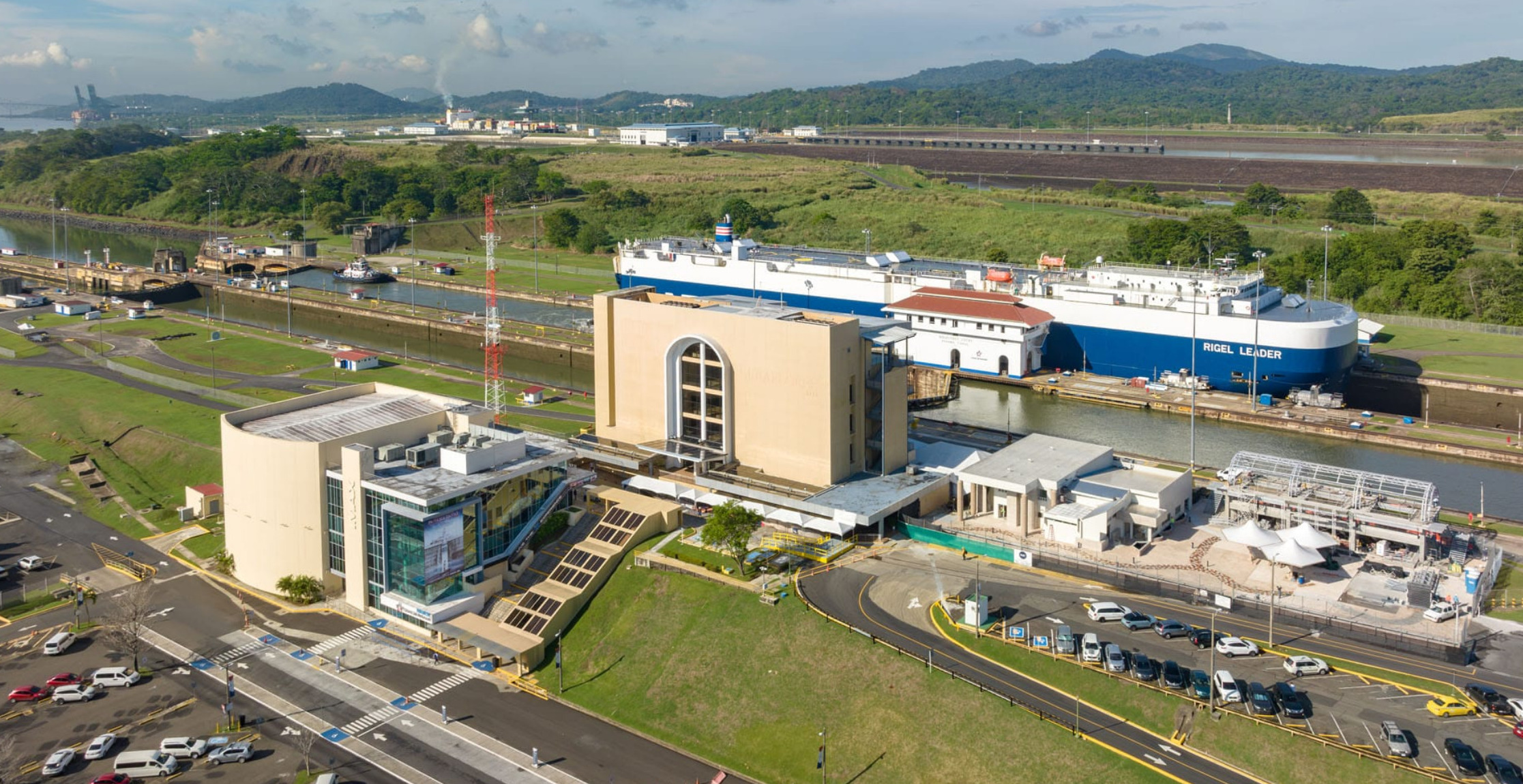
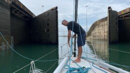
PANAMA CANAL
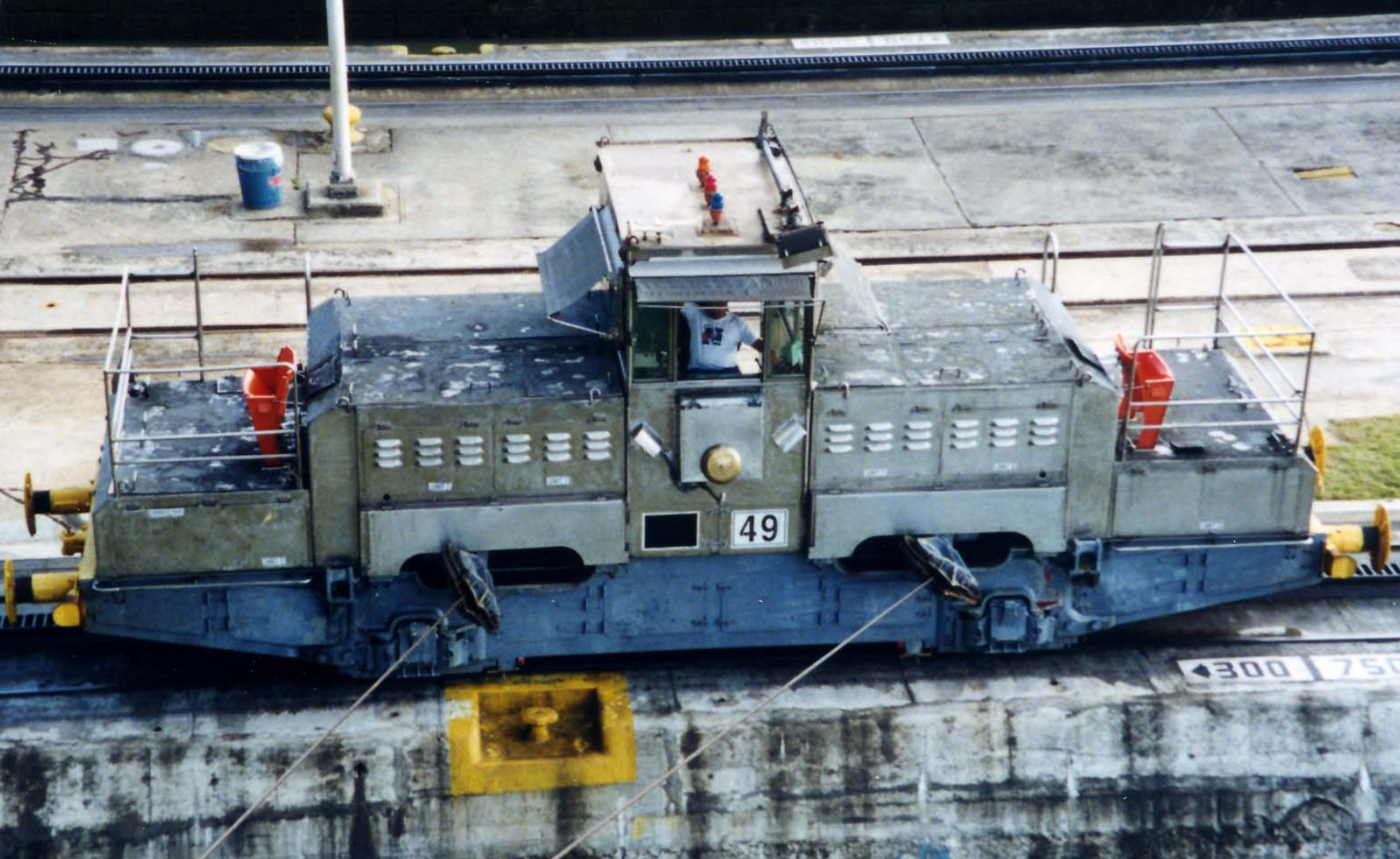
The “Mules” Aren’t Animals
The ships are guided through the locks by electric locomotives called “mules”, named after the sure-footed pack animals once used to haul cargo across the Isthmus. These mules run on tracks alongside the locks, keeping massive vessels steady and centered as water levels rise and fall.
The Locks Set the Size Standard for Ships Worldwide
The original locks determined the maximum dimensions of thousands of ships—known as the “Panamax” size (965 ft long, 106 ft wide). The 2016 expansion introduced the “Neopanamax” locks, allowing even bigger vessels up to 1,200 ft long and 161 ft wide to transit. Many modern shipbuilders design vessels specifically to fit these dimensions.
No Pumps
The Panama Canal locks work like giant water elevators, but here’s the fun twist: they use no pumps at all. Instead, the locks rely entirely on gravity and 52 million gallons of fresh water per lockage from Gatun Lake, which sits higher than sea level. When a ship is raised or lowered, huge culverts under the chambers simply let water flow in or out, moving vessels up to 85 feet between the ocean and the lake.
PANAMA POSSE CANAL AGENTS
To arrange for transit with the Panama Canal Authority please contact our dedicated Panama Canal agents and sponsors of the Panama Posse and the Pacific Posse
CENTENARIO CONSULTING

Erick Gálvez
info@centenarioconsulting.com
www.centenarioconsulting.com
Cellphone +507 6676-1376
WhatsApp +507 6676-1376
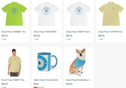
OCEAN POSSE MERCHANDISE | SHOP
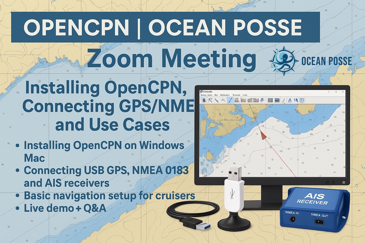
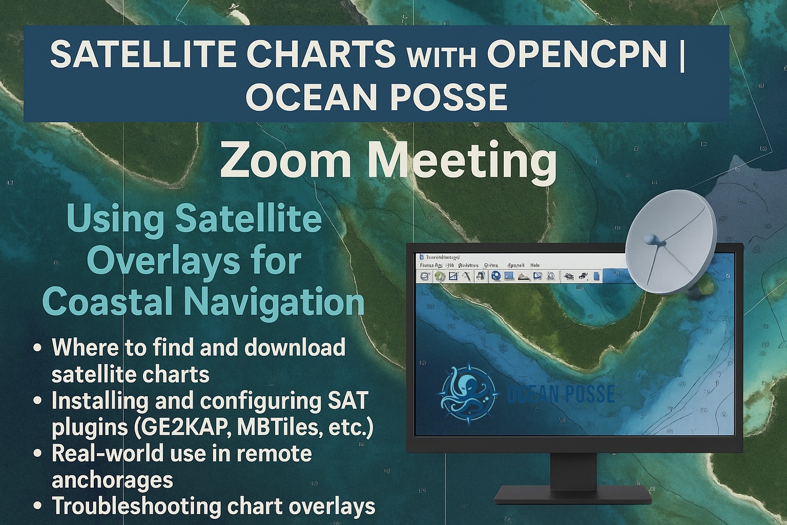
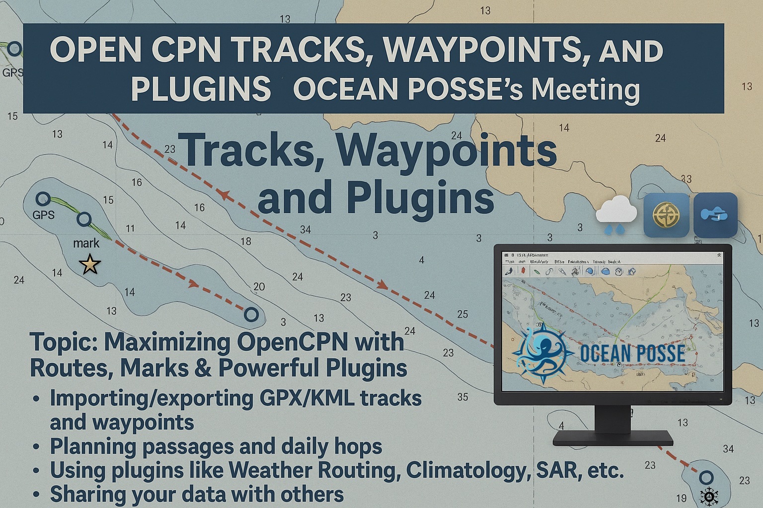
OCEAN POSSE ONLINE ZOOM SEMINARS
THREE OPEN CPN SESSIONS IN AUGUST
OpenCPN is the ultimate navigation tool for cruisers. It’s free, open-source, and customizable with global chart support, real-time GPS, AIS, radar overlays, and powerful plugins. Whether you’re coastal hopping or ocean crossing, OpenCPN delivers reliable navigation without vendor lock-in—trusted by sailors worldwide for its flexibility, accuracy, and community-driven innovation.
AUG 7
 Tidbits
USCG MARINE SAFETY ALERT
An integrated Li-ion battery bank recently caught fire onboard an inspected passenger vessel when loosely crimped lugs overheated. While no one was injured and the vessel sustained minimal damage, this casualty highlights safety hazards unique to Li-ion batteries. All integrated (installations used for propulsion and electrical power) Li-ion battery systems on inspected vessels must undergo engineering plan review, be fitted with supporting safety systems, be tested and inspected at installation and periodically afterward, and be properly maintained by competent mariners, regardless of the battery bank size or end consumer.
Unique Safety Considerations
Energy Density: Li-ion batteries are used on vessels because their high energy densities allow for longer voyages and full electrification. However, high energy density increases risk because if a fire occurs, it will burn hotter and longer.
Thermal Runaway: Upon internal failure or short circuit, Li- ion batteries may release high-temperature flammable gases that can catch fire or explode. The heat output of a fire can increase the rate of off-gassing, and those off-gasses in turn increase the size of the fire in an uncontrolled chain reaction.
Fire Suppression Resistance: A thermal runaway fire is very difficult to suppress once it has begun to propagate to other battery modules. Instead, fire management strategies focus on early detection, fire containment, and heat absorption with a water-based suppression system.
Toxic Off-Gasses: In thermal runaway, Li-ion batteries
release varied toxic gases, many in excess of their “Immediately Dangerous to Life or Health” thresholds,
placing passengers and crew in potential danger. Further, the composition of off-gasses varies dramatically across different Li-ion battery chemistries and manufacturer makes and models.
Battery Management: Li-ion batteries will often have a battery management system to prevent degradation from overcharging, undercharging, or over-cycling. Propulsion, electrical loads, topping loads, and recharging cycles are managed by complex integration systems, which are key in mitigating the increased risks of Li-ion battery systems.
Design Requirements
The Coast Guard provided design guidance for integrated Li-ion battery systems in CG-ENG Policy Letter 02-19 (PL 02-19), Design Guidance for Li-Ion Battery Installations Onboard Commercial Vessels, which incorporates American Society for Testing and Materials (ASTM) F3353-19, Standard Guide for Shipboard Use of Li-ion Batteries. These “integrated” systems are hardwired to power the ship’s electrical loads; plug-in electronics and Li-ion batteries as cargo are not addressed by this Safety Alert. (See Safety Alert 01-22 for more information on Li-ion batteries as cargo.) As Li-ion battery technology evolves, additional guidance may be released.
PL 02-19 and ASTM F3353-19 address the following major safety considerations for Li-ion battery hazards: ship specific risk/safety assessments, battery management systems, qualitative failure analyses for vital ship systems, design verification test procedures (DVTPs), periodic safety test procedures (PSTPs), hazardous area plans (for toxic off-gasses), structural fire protection, fire/smoke/gas detection systems, water-based fixed fire suppression systems, and exhaust ventilation. Due to the unique safety risks and design considerations, the Coast Guard does not conduct expedited plan review under Navigation and Vessel Inspection Circular (NVIC) 10-92.
Owner and Operator Guidance
Li-Ion Battery Identification: Packaged Li-ion batteries often visually resemble traditional lead acid batteries, regardless of type, so the best way to identify them is by reading the nameplate specifications. Li-ion batteries can be identified in a variety of ways depending on electrode, electrolyte, and separator materials. Some common types in maritime use are Lithium Iron Phosphate (LFP), Lithium Nickel Manganese Cobalt Oxide (NMC), Lithium Cobalt Oxide (LCO), Lithium Nickel Cobalt Aluminum Oxide (NCA), and Lithium Titanate (LTO). New chemistries continue to emerge as technology advances.
Plan Review: Plan review and proper design testing procedures (DVTPs and PSTPs) should be completed early in the construction process. If plan review and system design testing have not been approved by delivery, marine inspectors may require plan review to be completed through the Marine Safety Center.
Material Condition: Batteries should be visually inspected for signs of deterioration, such as bulging cells or corroded electrical connections. Documentation on the completion of required maintenance should be maintained.
Operational and Maintenance Procedures: Crew members responsible for battery operation and maintenance should be well-trained in the manufacturer’s guidelines and operational procedures and familiar with the functioning of the battery management system. They should also know how to respond to abnormal battery conditions or fires. Safety drills for Li-ion battery fires should be performed, and Li-ion battery system arrangements and risks should be taken into account when conducting other drills.
This Safety Alert is provided for informational purposes only and does not relieve any domestic or international safety, operational, or material requirement. It has been developed by the Marine Safety Center and distributed by the Office of Investigations and Casualty Analysis. Questions may be sent to msc@uscg.mil.

STARLINK IN Network Outage, Affecting Tens of Thousands of Users – THU JUL 24 2025
Starlink, the satellite internet service operated by Elon Musk’s SpaceX, experienced a rare global network outage on Thursday, leaving tens of thousands of users offline for several hours.
“Starlink is currently in a network outage, and we are actively implementing a solution,” the company confirmed in a post on X (formerly Twitter). Musk himself responded shortly afterward, stating: “Service will be restored shortly. Sorry for the outage. SpaceX will remedy the root cause to ensure it doesn’t happen again.”
According to Downdetector, which aggregates real-time outage reports, more than 25,767 users had reported connectivity issues by 4:18 p.m. ET, with complaints peaking in North America, Europe, and parts of Australia. Reports surged shortly after the outage began at approximately 3:13 p.m. ET.
Doug Madory, Director of Internet Analysis at Kentik, described the event as a “total outage,” noting that Starlink was not carrying any traffic worldwide at the time. “Such a sweeping interruption is highly unusual,” Madory told Reuters. “They haven’t had one like this in a long time, possibly since early deployment phases in 2021.”
While neither Musk nor SpaceX provided technical details, network analysts speculate the problem may have originated from ground station synchronization issues or satellite software updates, as global satellite constellations rely heavily on precise timing and routing tables.
Starlink, which now operates over 6,000 satellites and serves more than 2.6 million users worldwide, has become a critical broadband alternative, particularly in rural and remote regions. For many customers, especially in maritime, aviation, and emergency response sectors, the outage underscores how dependent global communications have become on satellite-based networks.
As of 5:15 p.m. ET, some users reported service gradually returning, though SpaceX has not yet released a post-mortem or detailed timeline for full restoration.
Got a report, scoop, story, picture, subject or contact at a marina who wishes to work with us ? Please get in touch with us.
Extraordinary Cruising °°° Join the Fleet
- Access vetted local knowledge, safety resources, and prior experiences to make your passage safer and more enjoyable.
- Unlock a Life of Adventure
Explore hidden destinations, experience new cultures, and discover the freedom of life at sea or near shore – on your terms. - Get VIP Perks & Discounts at marinas, chandleries and boatyards
Get exclusive discounts, priority access, and personalized support at partner marinas across the globe. - Observe the actions of Experienced Captains
Tap into a wealth of tips, tools, and real-world know-how from seasoned mariners to grow your skills and gain confidence. - Make Every Nautical Mile Memorable
Join events, meetups, and shared journeys that turn you voyages into unforgettable stories and lasting memories. - Cruise with a Conscience
Gain insights into sustainable practices and join a movement that protects the waters you love to explore.