

PASSAGE REPORT: SV WANDERLUST FIJI TO NEW ZEALAND
PASSAGE REPORT: SV WANDERLUST
FIJI TO NEW ZEALAND
SV WANDERLUST crossed the Pacific Ocean and spent last season in French Polynesia. This season they cruised west through many islands with plans to spend cyclone season 2024/2025 in New Zealand. For the final leg of this part of their voyage, they sailed from Fiji to New Zealand. Here they share their Passage Report and Log:
The Fiji to New Zealand passage is notorious for its challenging weather scenarios. An approximately 1100 nm journey across open ocean with lows marching west to east every 5-7 days. Sailors typically depart on the tail of a low, enduring challenging conditions in the beginning in order to avoid getting smacked by a low with unknown conditions in the final stretch. Our situation has an added layer of complexity as we’re sailing with a dog that we’re exporting from Fiji to New Zealand. I’ll spare you the details but essentially we had to select our departure date 8 weeks ahead of time to start the testing and treatment required to import Yoda to New Zealand. We could not depart until the blood test results were issued from a lab in the United States which took 3 weeks and NZ Biosecurity regulations state the blood tests expire after 26 days which meant we had a 5 day departure window. Pair that with a nice bout of flu morphed into pneumonia for the captain and our departure options were slim. New Zealand Biosecurity confirmed Yoda’s blood tests would expire on 10/27 so we checked the weather and saw the winds were a bit patchy on a few days but we wouldn’t get clobbered, so decided to depart on Friday 10/25. Ship’s Log 10/25-10/26 Vuda Marina’s staff tied a beautiful floral wreath to Wanderlust for good luck and serenaded us with a beautiful song accompanied by guitar. Fijian lyrics told a tale of how wonderful it was to meet and spend time together, how they will miss us but wish us fair winds on our journey. Tears sprang to my eyes even though I’ve heard this sound countless times over the past week as nearly half the boats in the marina left for New Zealand and Australia. We met customs at 2:30pm in Vuda Marina and departed Fiji shortly after with the bow pointed towards Auckland! It’s not the ideal weather window but it’s good enough and Yoda’s (our French Bulldog) blood tests expire tomorrow so we’re off!

In true sailing fashion the first overnight was a fair amount of reefing and hoping the lightning stayed far
away but we were able to shake the reefs early this morning and are heading upwind at 8/9 knots. Our
wind instruments are acting up so we don’t have any true wind data but have apparent wind so as long as
that sticks around we’re good. 😊
10/26-10/27
Yesterday was one of the most beautiful sailing days we’ve had in a long time! Sunny skies, winds up to
20 knots on the beam or just forward so we could sail with the screecher most of the day. Our top speed
so far is 13 knots and our average for the first 263 miles is 7.5.


This morning the wind died so we had to engage the iron sails. 🤣 This was expected and we planned to use this time to finish cleaning our hull for NZ. Apparently you’re not supposed to clean your hull in Fijian waters and we were in a marina until we left so we had to do it at sea. I DO NOT recommend this. It was really tough even though the seas were calm and there was very little wind. First and last time for sure, but it’s done and the hulls & props are clean.


A bit before jumping in to clean the hull we caught a good size skipjack tuna! Needless to say we motored for about an hour from where we caught the fish before jumping in to clean the hull. Wind should fill in tomorrow morning. Until then we’ll be resting up!


10/27-10/28 Upwind Climb
We’ve been sailing upwind since midnight last night. Bashing into short choppy waves up to 22 knots
made for an uncomfortable night. Thankfully, the winds have eased up now and the ride is more
comfortable. Hopefully a better night’s sleep is in the forecast tonight.


10/29-10/30 Every Day is Different Out Here
We’re on Day 5 of our Fiji to NZ passage and every day has been different! Yesterday the wind died and
the ocean was like glass so we motored until early this morning when the wind picked up. Earlier today
we went through some squalls associated with the low passing to our south. Now we’ve got apparent
wind to 22 knots and we’re cruising along. ⛵🌊🙌

10/31-11/1 Happy Halloween
Happy Halloween from the high seas! It has been slow going with low wind and now no wind but we
suppose that’s better than getting hit by the low that went by to the south of us. We’re getting closer

11/1-11/2 Schizophrenic Day 8 & Land Ho
The day started out with no wind, then filled in a bit so we were able to hoist the sails. The breeze
continued to increase throughout the day, up to 27 knots but at least it was from behind. There’s a front
coming across New Zealand around midnight tonight with sustained winds of 25 knots gusting to 35. We’ll
probably get a bit of this but hope to make it to Auckland in the early morning hours.
11/2-11/3 We Made it to Auckland!
8 days 14 hours and 1227 nm later we are in Auckland! We arrived early this morning around 6am and
tied up to the customs dock. Customs, Biosecurity and the quarantine facility will be by this afternoon as
many of the streets are closed this morning for a marathon. We had winds to just over 30 knots on the
nose last night so it was like riding a bucking bronco for a few hours but other than that the trip was quite
comfortable. Though, we did motor more than we’d hoped. That’s what happens when you’re sailing with
a dog. You pick a window and usually stick with it. Overall we are thrilled with the outcome of this
notoriously challenging passage and are looking forward to our time in beautiful New Zealand!
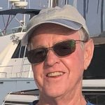
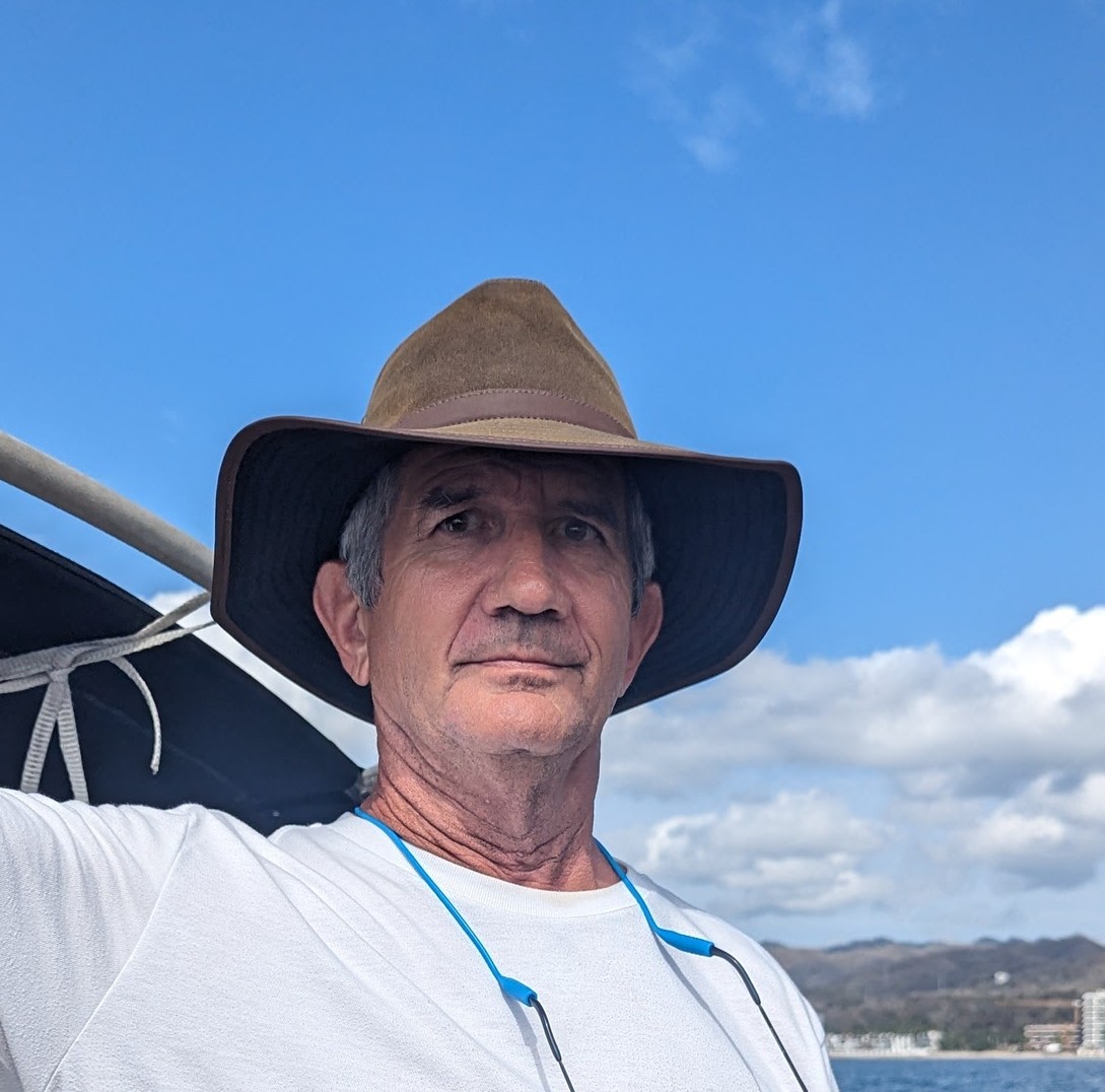
SY WANDERLUST 🇺🇸 Kristin, Fabio, & dog Yoda - Seawind 1600


THANK YOU FOR SHARING YOUR ADVENTURES ON THE HIGH SEAS!

BUNDLED C'S POSSE PERK: COMMUNICATION, COMRADERIE, COMMUNITY
OCEAN POSSE PERK:
BUNDLED C'S
(COMMUNICATION, COMRADERY, COMMUNITY)
Some Ocean Posse Perks don't fit into one liners. Some are the product of the fleet and the way the Posse is purposely set up. Hence "The Bundled C's": this perk is really the result of the serendipitous, inner workings of many Posse Perks which include Communication, Comradery, and Community.
The Ocean Posse is a community of voyagers on their own schedules. Each member participates in one or all of several format options for communication undeniably developing comradery over the course of their conversations, meet ups, shared anchorages, sunsets, and information exchanges. This week was one of many examples between three vessels each in a different part of the ocean along their voyage connecting over where one might drop their hook after crossing into Panamanian Pacific waters from Costa Rican waters.
When a vessel checks out of Costa Rica in Golfito the authorities expect that, weather permitting, the vessel will then leave Costa Rican waters without stopping. Leaving Golfito, Costa Rica for Panama vessels go south to round Punta Burica and east into Panamanian waters. Punta Burica protects the waters and islands to the east from a lot of weather making for a pleasant cruise out of Costa Rica into Panama. Many vessels will tuck into one of the small, less travelled, and spectacular islands of Western Panama en route east to Panama City.

Today, there are a dizzying amount of chat groups out there for wherever you are.. The Ocean Posse uses the LineAp to have a focused, real time format for communicating among the fleet. General communication is usually short lest people take their conversations directly to one another. As rounding Punta Burica is a milestone along the Pacific Central American route, this week MV PAUSE reported :
Just rounding Punta Burica and are now in Panama from West Coast Cost Rica, headed to Isla Parida for the night. It has been pretty much non stop rain for 4 or 5 days now but fortunately no lightning.
This message came as an update on their progress. Fellow fleet member SV RAAJA replied from further east:
I spent several days anchored off of Isla Gomez. It is a tiny uninhabited island with a beautiful beach. Highly recommended if you are headed for Parida!
Another vessel SV JUBEL who spent time cruising this area last season replied from the north side of Panama:
Second this
MV PAUSE apparently swayed and please with the recommendations:
Just dropped the hook at Isla Gomez. Beautiful

THANKS FOR BUNDLING THE C'S TOGETHER & ENJOY THE ISLANDS!
MV PAUSE 🇺🇸 Beth & Larry - Nordhavn 55′, SV RAAJA 🇺🇸 Skip – J boat 46’, & SY JUBEL 🇨🇦 Leah & Kyle - Gulfstar 44'


TURNING WASTE INTO OPPORTUNITY AT FINCA HAMBURGO CHIAPAS, MEXICO
TURNING WASTE INTO OPPORTUNITY
FINCA HAMBURGO, CHIAPAS, MEXICO

Re-Creativa Sustentable Finca Hamburgo
At Re-Creativa, we are more than just a recycling project—we are a community of six women from Finca Hamburgo, deeply committed to turning waste into opportunity. What started as a simple idea has grown into a powerful initiative where we transform plastic waste into beautiful, functional products. Not only are we making a positive impact on the environment, but we are also creating economic opportunities for ourselves and other women in rural communities, right here in the heart of Chiapas, Mexico.

Our Journey to Sustainability
Living in the lush mountains of Chiapas, surrounded by breathtaking natural beauty, we’ve seen firsthand the challenges posed by plastic waste. There is little infrastructure here for waste management, and much of the plastic ends up in rivers or lands in open dumps, damaging our environment. We knew something had to change.
That’s when we teamed up with In Mocean and Finca Hamburgo, our home. Finca Hamburgo is a historic coffee farm in the heart of Chiapas, and it became the perfect foundation for us to build something meaningful. Together, we began the journey to create a space where we could recycle plastic waste and turn it into useful, sell'able products—helping the planet and creating opportunities for our community.

Transforming Plastic into Creativity
It all started with a workshop. Nike, a passionate sailor and founder of In Mocean, reached out to us and offered to lead an introductory workshop at Finca Hamburgo. We invited women and children from the community to join, and together we learned how to make simple drafts from shredded plastic. Over two days, the idea of Re-Creativa started to take shape. We realized we could turn plastic waste into something more—something creative, useful, and impactful.
From that moment on, we knew we had to build something lasting: a community-led recycling workspace where we could create, learn, and contribute to a cleaner, greener future.

Setting Up Our Workspace
With support from In Mocean, the REESE Gruppe, and generous donors, we received the equipment we needed—machines like a shredder and an extruder. Just two weeks after our first workshop, Nike and Maria (co-founder of In Mocean) returned to Finca Hamburgo, and we got to work. We learned how to operate the machines, sort plastics, and use our creativity to make products that would not only help the environment but also generate income.
Our first creations were colorful earrings made from shredded plastic. We quickly began to experiment, crafting bowls and beams using the extruder. But it wasn’t just about making things—it was about learning how to run our new workspace as a small business. We discussed how to generate income, market our products, and sustain this new venture for the long term.

Early Successes and Growing Together
As we took ownership of Re-Creativa, we named our workspace and even designed our logo. We set up an Instagram account to showcase our creations, and soon, the sales started rolling in. The money we earned helped support our families and fueled our passion for the project. With each new product, we saw our skills grow, and we began working on a new goal: our first prototype for a chair made from recycled beams.
What makes Re-Creativa so special is the sense of community we’ve built together. We are no longer just recycling plastic—we are creating something bigger than ourselves. The bond we share as we work, learn, and grow together is the heart of this project. We’ve even begun hosting workshops in schools and cultural centers in Tapachula, sharing our journey and encouraging others to join the movement.

A Beacon of Sustainable Change
For us, Re-Creativa is more than just a workspace—it’s a beacon of hope. It shows that even small, simple actions can lead to big changes. By turning waste into valuable products, we’re not only helping the environment, but we’re also creating opportunities, building a sense of community, and inspiring others to act.
As we continue to grow, we are more determined than ever to transform waste into creativity, opportunity, and empowerment. We know that this is just the beginning, and we’re excited to see where this journey takes us.

Join Us for a Recycling Workshop and Visit Finca Hamburgo
We’d love for you to come and visit us at Finca Hamburgo. Experience the beauty of our home and see firsthand the work we’re doing at Re-Creativa. Join us for a hands-on recycling workshop, where you’ll learn how we turn plastic waste into creative, functional products. It’s a chance to connect with our community, see the impact of our work, and be part of the positive change we’re building together.

ANNOUNCING: THREE SHEETS REGATTA IN THE VIRGIN ISLANDS
ANNOUNCING: THREE SHEETS REGATTA
SAILING AND PARTIES COMING UP IN THE VIRGIN ISLANDS

The organizers invite you to join them for some spectacular sailing during the Three Sheets Regatta this December.
The Three Sheets Regatta, officially organized by the Virgin Islands Sailing Association (VISA) with sponsorship from the three island yacht clubs—St. Thomas, St. Croix, and St. John—promises an unforgettable experience on the water.
This year’s regatta will feature two signature races:
- The Three Island Race
- December 6: St. John to Frederiksted, St. Croix
- December 7: Frederiksted to St. Croix Yacht Club
- December 8: St. Croix Yacht Club to St. Thomas Yacht Club
- The Around the Island Challenge
- December 6: St. Croix Yacht Club to Frederiksted
- December 7: Frederiksted to St. Croix Yacht Club

We’re particularly proud to have VISA as the official race organizer, bringing its dedication to promoting sailing in the Virgin Islands. The full support of the three major island yacht clubs adds an extra layer of community and collaboration to this year’s regatta.
You’ll get to experience the stunning Virgin Islands from the water while connecting with a vibrant community of fellow sailors.
For more details, please check out our website: www.threesheetsvi.com. If you have any questions or need assistance with arrangements, feel free to reach out—I’d be thrilled to help.
Hope to see you on the water in December!
Juliet San Martin, President
Virgin Islands Sailing Association
Teamwork makes dreams work.

PASSAGE REPORT SV GARGOYLE GREECE TO SICILY
SV GARGOYLE BIDS FAREWELL TO GREECE & HELLO TO SICILY


SV GARGOYLE 🇨🇦 Kevin & Carla – Beneteau 50’

THANK YOU FOR SHARING THIS SPECIAL PLACE!

NEW BOOK BY LIN PARDY
Lin Pardey's New Book
Passages: Cape Horn and Beyond -
*hot off the shelf*

Join Lin as she shares challenging sailing, gentle voyages, the shoreside encounters that await once you venture into the world of cruising under sail. Far more than just a sailing adventure, this book is also a true memoir. As she and Larry sailed north from Cape Horn to Canada, then westward across the Pacific, they had to weather the emotional passages that come with growing older. Lin chronicles the last years she shared with Larry, the solo adventure that followed and, eventually, the romance and challenge of building a new life and voyaging onward with a different partner after David sailed in to anchor near her island home. Passages: Cape Horn and Beyond will appeal to sailors of all generations as Lin pours her heart out to tell tales of sailing through gales and calms, adventures small and large. It is a love story -- of sailing, of the sea, and of the two men who have shared Lin’s life.
Currently Lin's latest book is available for purchase in two locations. Click the location for purchase link:
- Paradise Cay Publications (Lin earns double the royalty from books purchased here) The book is a best seller on Paradise Cay Publications.
- Amazon also has the book available in Kindle or Paperback formats
What the reviewers say:
“Lin Pardey's Passages: Cape Horn and Beyond is a passionate and well-told recounting of the adventures and triumphs, as well as the trials and tribulations, since rounding the Horn "the wrong way" with her husband, Larry, in 2002. It's a remarkable book — fierce, honest, truthful and heartbreaking. And as with every Pardey book, extremely open and well-written. Passages succeeds as a touching memoir and a deep love story (in two parts), but most of all, as a rollicking good sea tale. I forgot how much I loved a good old-fashioned Lin Pardey first-person nautical narrative until I opened this one.”
- Herb McCormick, author and roving editor – Cruising World

"This is a brave book, written by an indomitable woman and sailor who, now 80 years old, continues to live life “all the way up.” It honors the man with whom she shared more than 50 years of that life voyaging the world’s oceans and inspiring generations of sailors. And though it sails straight on into the hardest of life’s passages, it also celebrates the light that emerges when one has had the strength and courage to endure the storm."
- Wendy Mitman Clarke, Editor-in-Chief, SAIL Magazine
“The title reflects both the thrilling sailing adventures of Lin and Larry Pardey and the profound changes in Lin's life. Sail with them around Cape Horn and across the Pacific, then follow Lin's inspiring journey as she navigates Larry's failing health and begins a new chapter with David Haigh aboard Sahula. I absolutely loved this!”
- Carolyn Shearlock – Creator of TheBoatgalley.com
“This isn’t just a bold sea story of a brave couple taking on Neptune — it’s a saga of the race against
the true universal ruler herself, Mother Nature. Author and adventurer Lin Pardey takes readers on a
gripping journey as she herself comes to grips with the inevitable forces that control all our lives. You
won’t be disappointed. Trust me.”
- Elaine Lembo, editor in chief, Caribbean Compass
“Lin Pardey’s new book just may be her best. It’s a classic Pardey voyaging narrative, as Lin and Larry
sail to the far south and round Cape Horn, but it’s so much more. It’s filled with wisdom and love, as
Lin chronicles Larry’s slow decline with perspective and deep gratitude for the life they were able to
share. And it’s filled with hope and optimism for the future, a blueprint for how to keep living as we get
older. It’s a terrific story.”
— John Kretschmer, adventurer/author, Sailing a Serious Ocean

Ready, Aye, Ready!
Ready, Aye, Ready!
“Ready Aye Ready” is the motto of the Canadian Navy. It implies that the Canadian Navy is always “ready”.
By Rob Murray on SV AVANT

We have been sailing Avant in Mexico and Central America for 11 years now, and one of the most common questions we get is “Do you feel safe?”
Yes, we do. We have not suffered a loss, seen a crime committed, or otherwise been bothered by crime. Ever. We do know of other cruisers that have suffered losses, though:
- Dinghy theft. (Really, it’s outboard motor theft. By far the most common loss suffered by cruisers.)
- Casual theft (thieves sneak aboard, usually when no one is aboard, and grab any valuables they can and dash off. Most common at a dock).
- Pick pockets (in Guaymas, a cruiser had her wallet stolen from her purse in the grocery store – but that could have happened anywhere in the world).
Not to say it doesn’t happen, it does. But the violent crimes that make the news in Canada and the USA do not seem to happen on the coast or where the cruising community congregates. Most if not all of the murders are gang related, and mostly gang on gang events. We take normal 21st Century precautions; we don’t walk in strange neighborhoods at night, we don’t flash wads of cash, we don’t wear expensive jewelry or watches, etc. and we have not had a problem.
There are, however, security concerns and we have taken some simple steps to protect ourselves.
You don’t need to make it impossible to be a victim, you don’t need to make it impossible for someone to steal from you. You just need to make it harder. You just need to make your boat a less inviting target than the one next door. If you have locked your boat and hoisted your dinghy and outboard out of the water, cleared valuables from the cockpit, and a neighboring boat has all their hatches open and their dinghy floating beside their boat tied on with a rope painter, guess who is more likely to be a victim? It’s like the old joke about bears, you don’t need to be able to outrun a bear, you just need to outrun the person you’re with.
The strategy we have employed for our personal security is pretty simple and pretty unobtrusive. It doesn’t impact our day to day lives by much, and we aren’t working hard to stay safe.
-
- Lock the boat, and tidy up. Simple. Free. Easy. When we’re away from the boat for a while, whether at the dock or at anchor, we lock the boat. Close and latch the hatches. Even if we haven’t seen another human being for days. We also have the means to lock ourselves in the boat, in the event we feel threatened and think that’s the safest option (boats with the hatches locked by padlocks may not have the means to do this, but it’s pretty easy to add an internal barrel bolt or similar lock). We changed out our lovely louvered wooden companionway boards for a simple sheet of plexiglass, far more resistant to being kicked in or carved open with a knife or chisel. We don’t stow anything within reach of the portlights we usually leave open. We stow winch handles and other deck gear below as appropriate when anchored or at the dock, and don’t leave things sitting around on deck or in the cockpit. We also lock the computer at the navigation station to the boat with a computer cable lock.
- Hide stuff. In the event someone does get aboard, we have some of our valuables and some spare cash hidden. We use a variety of means, including ‘diversion safes’ (food cans, boxes or jars, varnish or paint cans or bottles, hollowed out books, etc., that disguise a secret compartment to stash valuables in). These can be purchased or home made (paint the inside of an old mayonnaise jar white, and there you go!). More than one is a good idea, in various places around the boat. The downside is they can be taken as they are portable. Don’t use a WD-40 can as a diversion safe in your tool bag, as they may take the whole bag!

- Secret compartments/ hidey-holes. False drawer or locker bottoms, behind velcroed-on cabinet fronts or vinyl trim, envelopes taped behind or under drawers, the inside of the paper towel roller, shower curtain rod or toilet paper roller, false electric sockets, the inside of hollow closet rods, and other strategies can be employed.

- Use decoys. We have a ‘muggers wallet’ prepared and left in plain sight on the navigation station, next to the companionway. A muggers wallet is a decoy wallet, an old, used one filled with expired credit cards and identification, receipts and small denomination bills of assorted currencies. The hope is a sneak thief will come aboard, see and seize the wallet and dash off, satisfied they have ‘scored’, while truly valuable goods remain unmolested.

- Have backups. We have backup credit and ATM cards, connected to a separate bank account at a different bank from our primaries, safely stashed aboard. If our primary cards are lost, compromised or stolen, or if our primary bank has a bad hair day in the computer department, we can dig out the backups and be good to go until replacements can be sourced or the accounts reactivated.
- Know what’s there. We take pictures of our passports and the contents of our wallets and the interior of the boat and email them to ourselves so we have a record that we can access from any computer on the internet if they are lost.
- Be ready with active deterrents. In the extremely unlikely event we meet serious thieves intent on a face to face encounter and committing a violent crime against us, we are ready to meet the threat (at least with bravado). We have:
-
- Heavy flashlights (3 cell D battery Maglites) mounted in clips next to the companionway and our berth. As well as being handy, blinding flashlights, these make great clubs.

- Fire extinguishers will discharge a large cloud of fine white dust that can disorient and confuse bad guys.
- Machetes. We have a couple of machetes aboard, stored in a locker where they can be reached quickly and waved around to make a show of resistance. Easily seen from a distance, waving machetes is a distinctly unwelcoming gesture in every culture. Machetes are inexpensive and readily available in hardware stores. They can also be used to open coconuts.

-
- Baseball bat. We also have a t-ball bat (mini baseball bat), which doubles as a fish bonker.
- Flares. We have a white handheld flare mounted in clips in the companionway. In the event we are intercepted at sea or boarded at anchor, we can light it and toss it in an attacker’s boat. We don’t have a flare gun aboard, but one might be useful. Be aware that the flare shot from a flare gun will not light until the flare has burned for a while (they are designed to light in the air, not as they are discharged). They are not particularly powerful, and the flares with their propellant tend to bounce off what they hit. The muzzle energy of a 12g flare gun is less than that of a 22 caliber rifle and it is unlikely to penetrate just about anything due to its wide nosed projectile. Any damage it may cause will be due to the flare itself burning. Flare guns may also be illegal in certain jurisdictions (and if used in an offensive or defensive manner as a weapon, are considered weapons or firearms under the laws of many countries).
- We have Bear Spray aboard, too (while wasp spray is often suggested as a deterrent, apparently it is largely ineffective).
-
- (Note: In most countries south of the USA, Mace, Dog and Bear Sprays are illegal, but we’re living on the edge).
- We keep our VHF on 24/7, and keep a handheld next to our berth, so we can raise an alarm with other cruisers (or heed their call) if we feel unsafe.
All of these strategies are designed around the idea that you don’t have to make it impossible to be attacked, you just have to make it unpleasant for would-be attackers, encouraging them to look elsewhere or take the rest of the day or night off.
Dinghy Outboard Theft
This is, by far, the most common loss suffered by cruisers. An outboard is a very valuable item in a fishing community, and all coastal villages are fishing communities. A simple 8-10 hp outboard can increase a fisherman’s ability to feed his family tenfold by allowing him to get further offshore when fishing. We always hip-hoist our dinghy at night, and do so with a wire cable harness with legs long enough to be far above reach, where they are attached to the halyard snap shackle, even when standing on deck (so a would-be thief can’t simply release the shackle and drop the dinghy). We lock the outboard to the dinghy’s transom with a heavy stainless lock, and use the same lock to lock the motor to the rail mount when it is stored aboard. We employ locals (usually children or the proprietors of beachfront restaurants) as watch keepers whenever possible when leaving the dinghy ashore, and use a long stainless cable to secure the dinghy ashore when it’s in an isolated or unsupervised location.
We don’t really notice that we’re doing these things on a day to day basis, they are just ‘habits or ‘housekeeping’. But we feel that these measures collectively decrease our chance of being victims (and losses if we are), as well as increase our ability to bounce back should we be targeted.
EDITORS NOTE:
Additionally, there is a huge resource in the Caribbean Safety and Security Net available for private cruising vessels. Their website is extensive and their incident reports are kept up to date. Their guidelines for precautions are applicable across all oceans.
https://safetyandsecuritynet.org/regional-piracy-infographics/
https://safetyandsecuritynet.org/piracy-passage-precautions-central-america/
STAY SAFE - STAY ALERT - HAVE FUN

CARIBBEAN LAP REPORT SV JUBEL
SV JUBEL'S CARIBBEAN LAP

SV JUBEL just finished their 1 year lap around the Caribbean. BRAVO ZULU! Here they share their story:
We are currently in progress building an HH44 Catamaran in Cebu, Philippines, which will be completed in January 2026. It's our plan to cross the Pacific to meet the boat so we can move aboard directly from JUBEL. But we didn’t come all this way from Vancouver island to skip the Caribbean. Having crossed the (Panama) Canal in September 2023, we spent some time in Bocas del Toro, the San Blas, Panama, and Cartagena, Columbia. Knowing we wanted to see the Caribbean, we decided to do a speed loop of the Windward and Leeward Islands.
The trip started from Cartagena, Colombia and we set off for Puerto Rico, or maybe the DR, on March 26th, 2024. We didn’t know where we would end up. We had heard this passage was notoriously bad, and that we may have to divert westward. So loaded with 8 extra jerry cans of diesel, we set off, along with our friends on SV VIA, a Caliber 40LRC (that holds 400+ gallons of diesel!) This trip was exactly what they say it was. We motored for 700 miles, into the wind and the waves. At times doing 3 knots. We broke our davits due to the constant slamming into the waves. We also had some flat calm days. Overall, we sailed about 10 hours out of the entire 6 days.
We ended up in Boquerón, Puerto Rico. We spent time cruising Puerto Rico for a month along the southern side of Puerto Rico, and flew home in (to Canada) in May. Our highlights are Isla Caja De Muertos, where you can hike up to the top of an abandoned lighthouse, and Isla Culebra for its snorkeling and coral farms, and of course, Costco in San Juan.

With our boat loaded with a years worth of Costco supplies in Puerto Rico we made our way to the USVI’s where it was a surprise that they drive on the opposite side of the road. We spent a few days in St. Thomas, of course, stopping at the pizza boat where we attended a massive memorial day party hosted on a catamaran while we floated in the water.

A few days on the northern side of St. Johns before making our way to the BVIs. We have a dog on board so this was pretty difficult to sort out, as you have to have a lot of paperwork and health check proofs. We met the vet in Soper’s hole where he had to inspect Ricky, our dog, in person. Once that was dealt with we made our way to pussers for a rum! This was the first island we considered “the Caribbean”, and we made it!
We spent three weeks bouncing around the BVIs including Norman Island (and the infamous Willy Ts, where we floated behind it in our Sunchill, met friends, and had beers thrown into our pool!

Anchoring at the Baths, (where our engine died coming into the anchorage, that turned out to be ricky leaning on the shutoff button!), and spending time in Virgin Gorda was also great. Our favorite anchorages were Savannah bay, and the north side of Prickly Pear Island. Having the Rum Runner bring us blended cocktails right to our boat was (also) a highlight, along with visits to Saba Rock.
From The BVIs we checked out and headed to St. Martin, stopping at the French side first. The beaches here were phenomenal. While a little run down, its very pretty, and the French food supply is amazing. We had FKG rigging come out to the boat by dinghy to give us an estimate for the standing rigging replacement that we needed. They gave us a very, very reasonable estimate and we headed over to their dock on the dutch side to have the work done. A week later, everything was brand new. Highly recommend them! We also had a new generator motor shipped here and replaced that, as our previous one had water ingress due to a manufacturing defect. St. Maarten is an amazing location for boat work and supply, especially since its all tax free. There are also great restaurants here, where we met up with some other Young Cruisers and talked shop, so we will definitely come back at some point. St. Maarten is a hit on our list!
Our next stop was Guadeloupe. It was here that we rode out hurricane Beryl. On the west side of the island behind the mountain, we set out a 10-1 scope in 20 feet of water. Luckily (for us, certainly not the islands south of us) it headed south. We were hit with 35 knots of wind and a ton of rain, but otherwise, unscathed. After the weather cleared, the view was beautiful.

We worked our way down Guadeloupe, and anchored in some very rolly anchorages - There is not much for protection on this side of the island. We stopped in several hot springs and enjoyed the natural hot water that comes out all over the island. After an absolutely brutal sail crossing from Guadeloupe to Terre-de-Haut, a group of small islands south of Guadeloupe, we went to explore and island and old fort. There is a really cute little town (but not much for food available) that you can explore.

From there we made our way to the jewel of the Caribbean, Dominica. I can not say enough about this place. It is, by far, our favourite locale in the caribbean. Absolutely untouched and unspoiled. There were no tourists, the locals were the friendliest people we have ever met, and would do anything for you. The natural beauty of this island is absolutely stunning.Waterfalls, valleys, hot springs, gorges - It has it all.

What it doesn’t have are services, restaurants, fuel docks, or supply shops. You are on your own. So bring what you need, and stay as long as you can. We grabbed a mooring ball in Portsmouth bay for $10 a night, where the PAY (Portsmouth Association of Yacht Services) will come out to the boat and give you anything you need, and help you check in. We rented a car from a local company (that we had to swap out three times because they were not in great shape - Old cars imported from Japan), they also drive on the British side of the road (in Dominica). Its like driving in the game “crazy taxi”. We drove all over the island over 5 days.


We went to visit Titou gorge where they filmed parts of the Pirates of the Caribbean

Overall, Dominica gets a 10/10 for us. We will be back to this island before our cruising career is over. Its got so much to offer, and so much that we haven’t seen, for a small island. Our provisions were running low so it was time to carry on. We made our way to Martinique from here, where we knew we could provision. And provision we did. Wine, cheese, butter, oh my. The French have food nailed down. We were here during a summer festival and I have never seen so many boats on the move, ever.

Martinique was the busiest place we’d ever been. The bays were full, with hundreds if not thousands of boats. It was way too busy for us. And they’re very not dog friendly. So after we provisioned, we carried on down to Grenada. We skipped St. Lucia for safety concerns, and therefore had to skip St. Vincent and the Grenadines due to our dog and rabies rules. That, and its been hit hard by Beryl at this point.
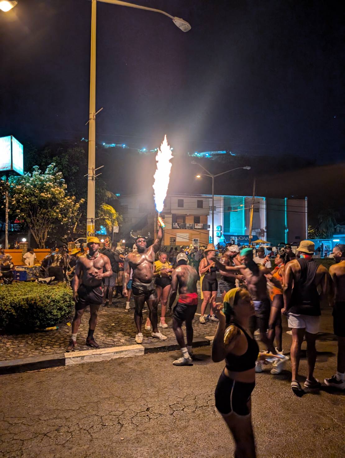
Grenada became our home for about a month and a half while we waited for hurricane season to subside slightly. The next stop after this was Bonaire, so hurricanes weren’t a big concern. We met up with friends, enjoyed copious wing nights, went snorkeling, and hauled out because we had won a free haul out from Spice Island Marine at the Young Cruisers Association Cruisers Awards. We were here for Carnival which was amazing.

We had tried out all the anchorages and there was a weather window coming. It was September at this point, so it was time to carry on to Bonaire. After a sporty 3 day sail downwind (oh how nice it was to go downwind finally, after beating our way east all the way to Dominica), we arrived in Bonaire. The water clarity blew our minds.


However, the lack of Starlink was frustrating after having it for so long. So back to a cell phone data plan we went, we spent our days snorkeling and swimming. We rented a car and drove around the whole island, stopping to feed the roadside donkeys apples and carrots.

Bonaire was definitely another highlight. The freediving and snorkeling is amazing. Its everything its cracked up to be.
We skipped Curacao and headed to Aruba to meet friends and for my parents to fly in. We loved Aruba - Dove on a shipwreck, swam with turtles, went out to fantastic restaurants, played some slot machines, had some pool days at the Hyatt pool, and even found a Canadian bar that had Poutine and took Canadian money!
Now here we are in Cartagena once again, having crossed our track when we left 8 months ago, so very happy we traveled where we did and saw what we saw. The experiences will stick with us forever, and we hope to go back to some of the islands once again in the future. Now, its time to go back to San Blas one more time before we prepare for our grand adventure across the Pacific!
SY JUBEL 🇨🇦 Leah & Kyle - Gulfstar 44'
THANK YOU FOR SHARING YOUR HIGHLIGHTS FROM YOUR 8 MONTH CARIBBEAN LOOP


Different Ways of Eating Raw Fish Across the Oceans
Different Ways of Eating Raw Fish
Across the Oceans
People living coastally or on islands are deeply connected to the ocean for their sustenance. Eating raw fish is common across many cultures around the globe, each with its own unique traditions and methods for preparing and enjoying this delicacy. Here are several different ways raw fish is eaten as a main dish across the Oceans that the Ocean Posse cruises:
1. Ceviche (Latin America)

Ceviche has it’s roots in the northwestern region of South America that are now
known as Ecuador and Peru. Overtime the dish has spread throughout Central America with each country, each region, each family adding their own touch of individuality. Ceviche is the result of fish (often Mahi mahi, snapper, or corvina) and/or other seafood (for example shrimp, conch, or Octopus) being submerged in salt and lime juice. The chemical process that occurs is similar to fish getting ‘cooked’ in which the flesh turns opaque and gets firm…although the fish is not truly cooked.
The additional ingredients, the presentation, the size, and the accompaniments vary greatly depending on where you are. For instance, along the Gold Coast in Mexico ceviche is commonly a mix of fish or mixed seafood with tomatoes, onions, jalapenos, and cilantro served on a large platter with a basket overflowing with various large corn disks called tostados. Further south, in Panama, ceviche is commonly served in small individual servings with diced onions and lots of juice and a small singular packet of crackers. Further south still to Peru, the birthplace of ceviche, raw fish is marinated in lime juice, as well as thinly sliced onion. The dish is served with sweet potato slices, small portions of toasted corn, and plantain chips. They are all DELICIOUS ….just different….and sampling ceviche along the route is highly recommended.
2. Poisson Cru (Polynesian and South Pacific Islands)

The name poisson cru literally translates to "raw fish" in French. For many centuries native Polynesians and people of the South Pacific Islands were harvesting reef fish and pelagic fish and coconuts as a mainstay of their diet. The preparation was once as simple as pouring fresh squeezed coconut milk over raw fish and has evolved to include lime juice after the Europeans introduced citron (limes). Poisson Cru has a distinctive flavor and texture that is generally more mild that ceviche. While it is sometimes compared to ceviche due to the use of raw fish and citrus juice, poisson cru has its own unique preparation and cultural significance. Poisson Cru is often served with or over rice or taro with cucumbers and/or tomatoes. Seasonal and regional twists include adding fruits like mango or papaya or other vegetables like carrots or avocados. Salt and Pepper may be added for flavor.
Poisson Cru is made at home, during celebrations, and often served at communal gatherings or feasts. It is considered a symbol of hospitality and represents a longstanding connection to the sea. The preparation and sharing of poisson cru are deeply embedded in the social fabric of Polynesian life.
Overall, poisson cru is more mild and creamy while ceviche is more tangy and snappy. Both are fresh, crunchy, and scrumptious.
3. Poke (Hawaiian Islands)

The word 'poke' (like 'okay') was a Hawaiian word that meant 'to cut crosswise into pieces'. The dish that has taken on the name Poke is one that stems from one of the staple foods of the early Polynesian people of Hawaii. The early Polynesian people of the Hawaiian Islands lived off the sea. It is said they often cut crosswise and salted raw reef fish cutoffs and seasoned this with seaweed and roasted kokui nuts. Over time, after the arrival of people from the continents to the east and the west, this staple food began to evolve and take on tastes and flavors from both sides of the ocean. For example in the late 19th century many Japanese workers immigrated to Hawaii as sugar and pineapple plantation laborers. Instead of using salt and seaweed to season their raw fish they used shoyu (soy sauce) and sesame oil. They would eat this fish with white rice. In this way, some say that the Japanese immigrants also introduced the rice base to the modern day Poke. Westerners are said to have introduces spices, onions, and chili peppers. Poke of today is a serious fusion of flavor traditions that appeals to the culinary tastes across many cultures. While the dish has evolved greatly and spread far from Hawaii, Poke is still known as an adaptable delicious Hawaiian dish. Poke can be savory and sweet, spicy or mild. The fish is still marinated in a salty medium with seaweed is often served in bowl over rice with an added assortment of fresh, thinly cut colorful vegetables, fruit, and roasted nuts.
4. Pickled Herring (Northern Europe)

Eating raw fish is a global practice, with each culture putting its unique spin on how the fish is prepared, seasoned, and served. Whether marinated in citrus, salted and dried, or simply sliced fresh, raw fish continues to be an essential and cherished part of culinary traditions worldwide.
POSSE PERK: Free vessel and fleet tracking courtesy of Predict Wind
POSSE PERK: 🛰️ Free vessel and fleet tracking courtesy of Predict Wind
https://oceanposse.com/tracking/
Ocean Posse Members: Sign Up your vessel for free tracking:
ADD YOUR VESSEL TO THIS FLEET TRACKING PAGE >> |
For Help and to review the different options :
TECHNICAL SUPPORT ABOUT THE FLEET TRACKING PROCESS >>
About Fleet Tracking:
Tracking is designed to give interesting parties an overview of where vessels may be on their voyage. For specific vessel details including their float plan, latest updates, changes, positions and specific location related questions please contact each vessel directly. If you are on passage all of us and the fleet can monitor your progress.
![]()
*The Ocean Posse is not responsible for the accuracy, frequency or validity of any individual vessel's report. This report is not necessarily accurate. Due to privacy we do not provide vessel contact information. To more accurately track vessels via it's own tracker or request AIS tracking from https://www.marinetraffic.com/ please note that this is also not accurate. There are many reasons why a vessel's position is not updated and please do not conclude that a vessel has an emergency or is in need of assistance because it has not been reported lately. Sometimes they may just want to get away from it all and not tell you where they are. It is the responsibility of each vessel to file a float and check in plan and escalation procedures.