
Fleet Update 2025-07-06
“I wanted freedom, open air and adventure. I found it on the sea.”
CRUISING ° FLEET UPDATE & NEWS ⛵ 2025-07-06
-
Pictures Of The Week 📷
-
San Francisco To San Diego 🇺🇸 California Bliss
-
Water Maker 💧 seminars
-
San Diego Bay October 👁️ 4 Days of Cruising Seminars
-
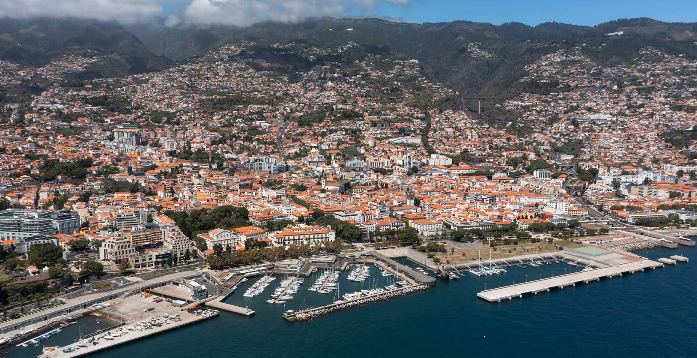
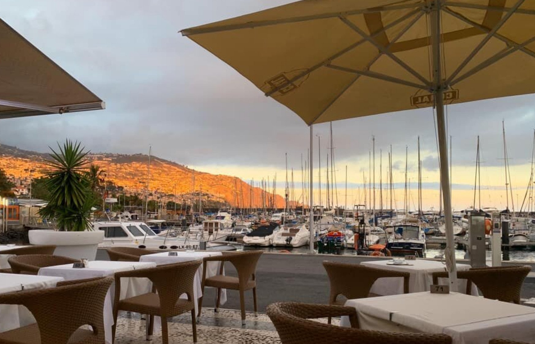
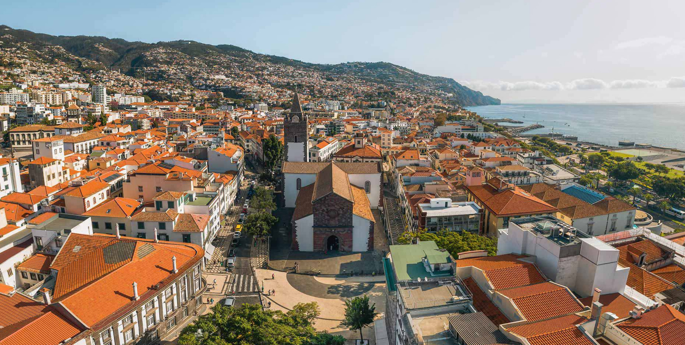
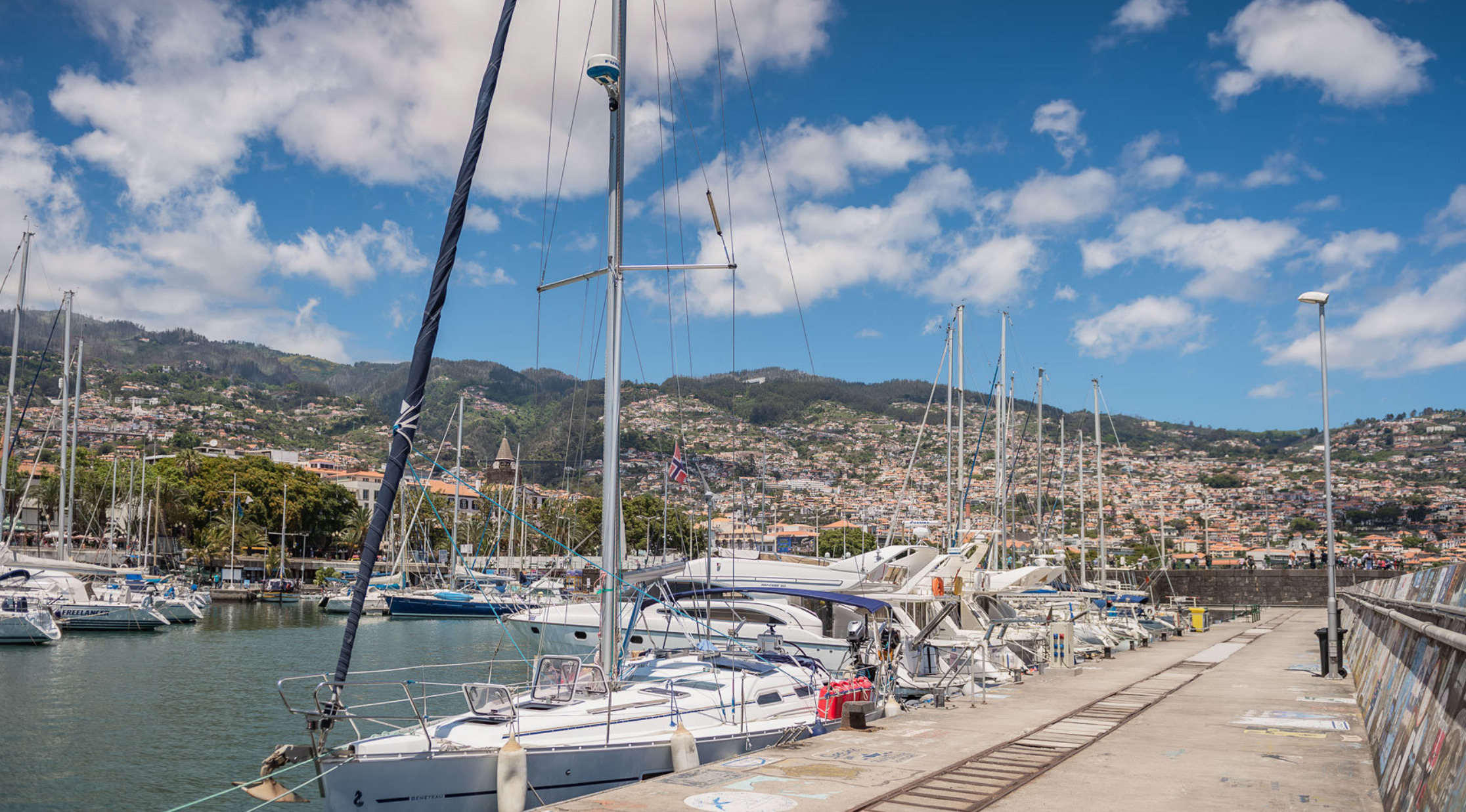
Marina Funchal 🇵🇹 Madiera
-
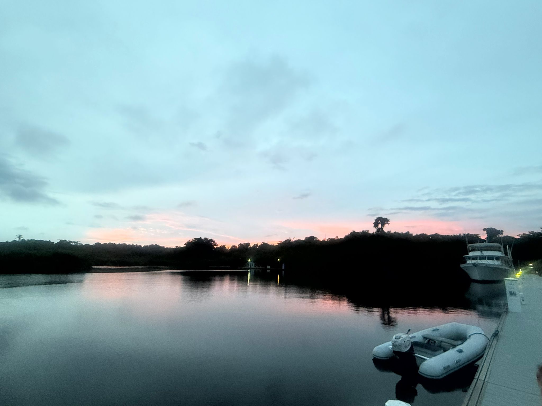
Ocean Posse BBQ Meet Up Marina Tahina 🇵🇫 Tahiti
-
⚙️ Rigging Check
-
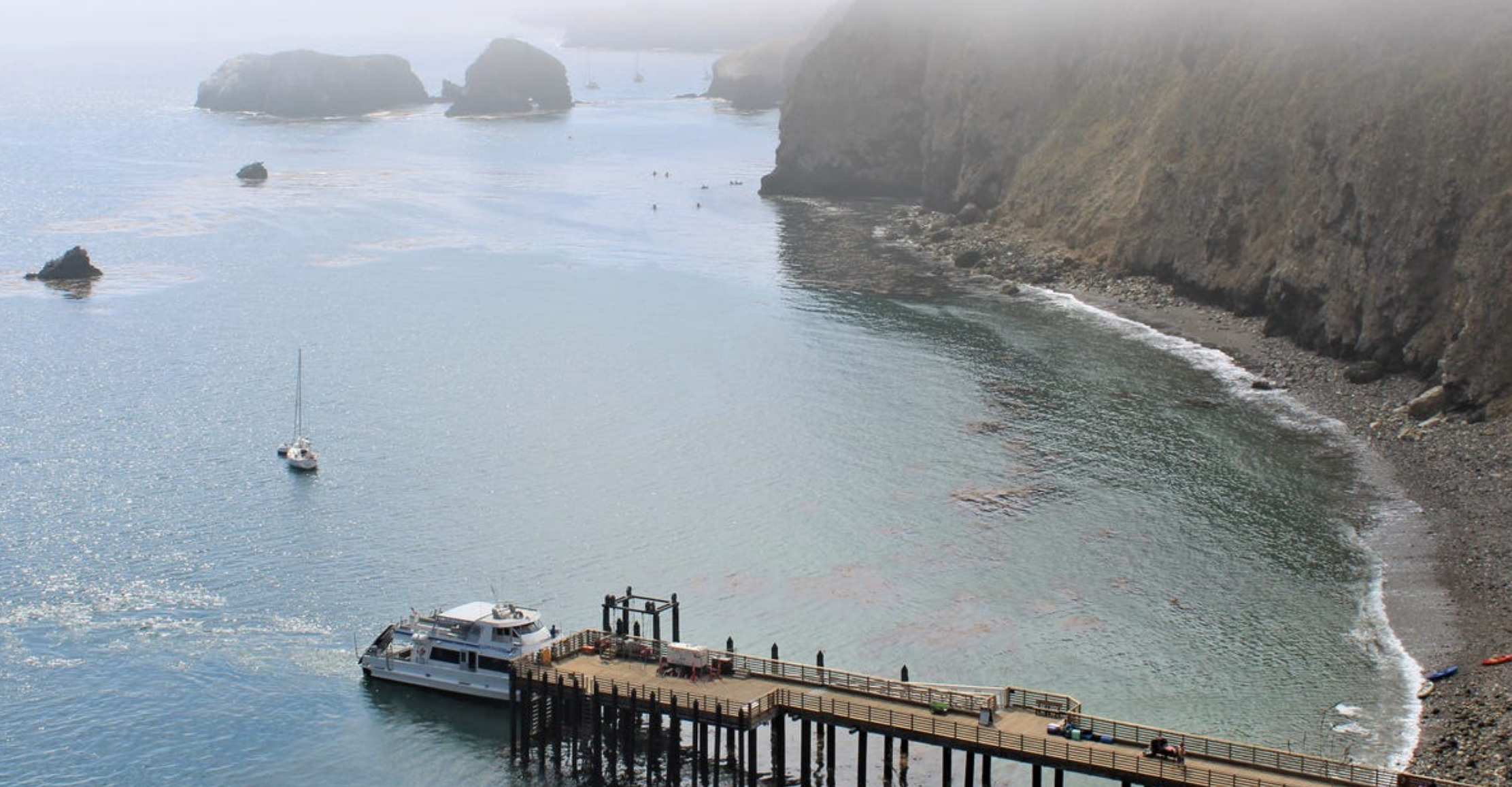
Cook Islands
 Arutunga Harbor Approach
 -
Named Winds 🌪️ Levante
-
Castillo San Marcos 🏰 St Augustine
-
Season 9 Registration ☑️ Is Now Open
-
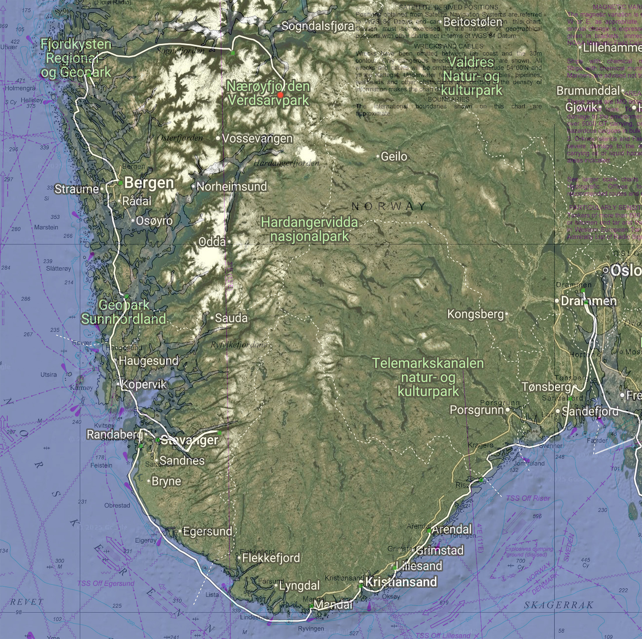
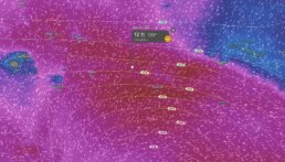
FIJI 📍 GPX Tracks Good Nautical
-
Meet The Fleet 🌅 SY Kaliyah
-
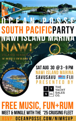
Meet The South Pacific Cruising Fleet 🎉 Sat Aug 30
@ Nawi Island Marina broguth to you by the Yacht Sales Co
-
Official Ocean Posse Events 🗓️
-
Musket Cove Marina 🗓️ Sponsors The Ocean Posse
-
Ocean Posse Fleet 🛰️ Tracking
-
Tidbits
• The End of the Revolution
• Five named storms in 1 month
• Persistent Malaria Hotspot in Guna Yala territory
• Ahoy Posse Friends
• Hammerhead Shark Migration Galapagos
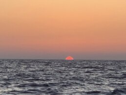
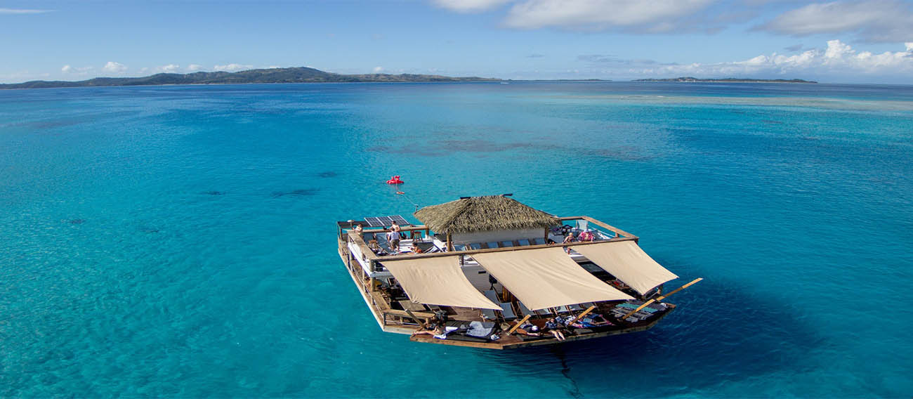
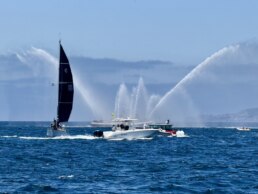
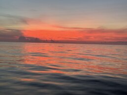
PICTURES OF THE WEEK
Red Frog Marina Sunset Alert 🇵🇦 Panama
SY ALICORN  Kevin & Devona – Lagoon 440′

Tikehau Sunset Tuamotus 🇳🇴 French Polynesia
SY ILIOHALE Allan & Rina – Lagoon 450s

Sorry I’ve missed the last few check ins. We have been a bit distracted at the all you can eat wave buffet.
SY PHOENIX Zach – Balance 52′

MY TIDINGS OF JOY Jeff & Joy -DeFever 52′

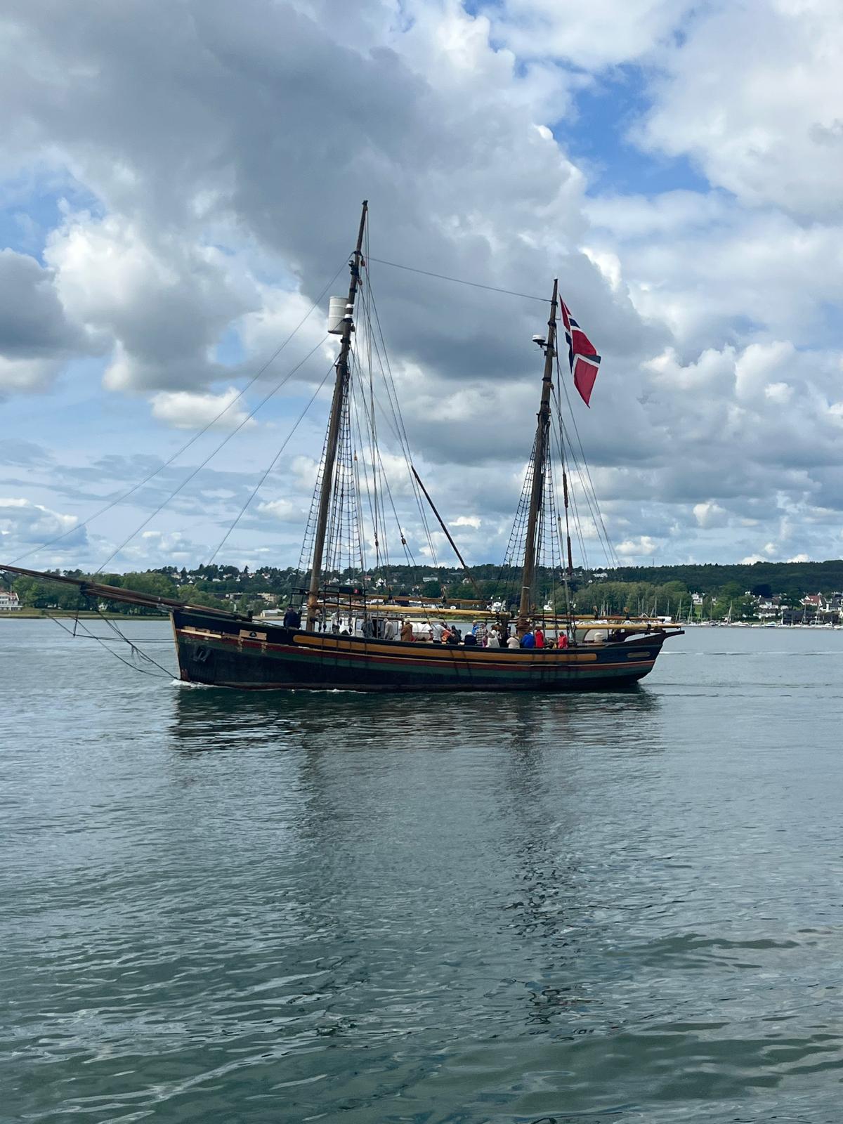
Made it safely thru the wickedly awesome and magical UNESCO Naeroyfjord to Gudvangen 🇳🇴 NORWAY
and this place is so friendly!!!
MY HOKIPA Lucky Chucky & Lisa – Selene 43′
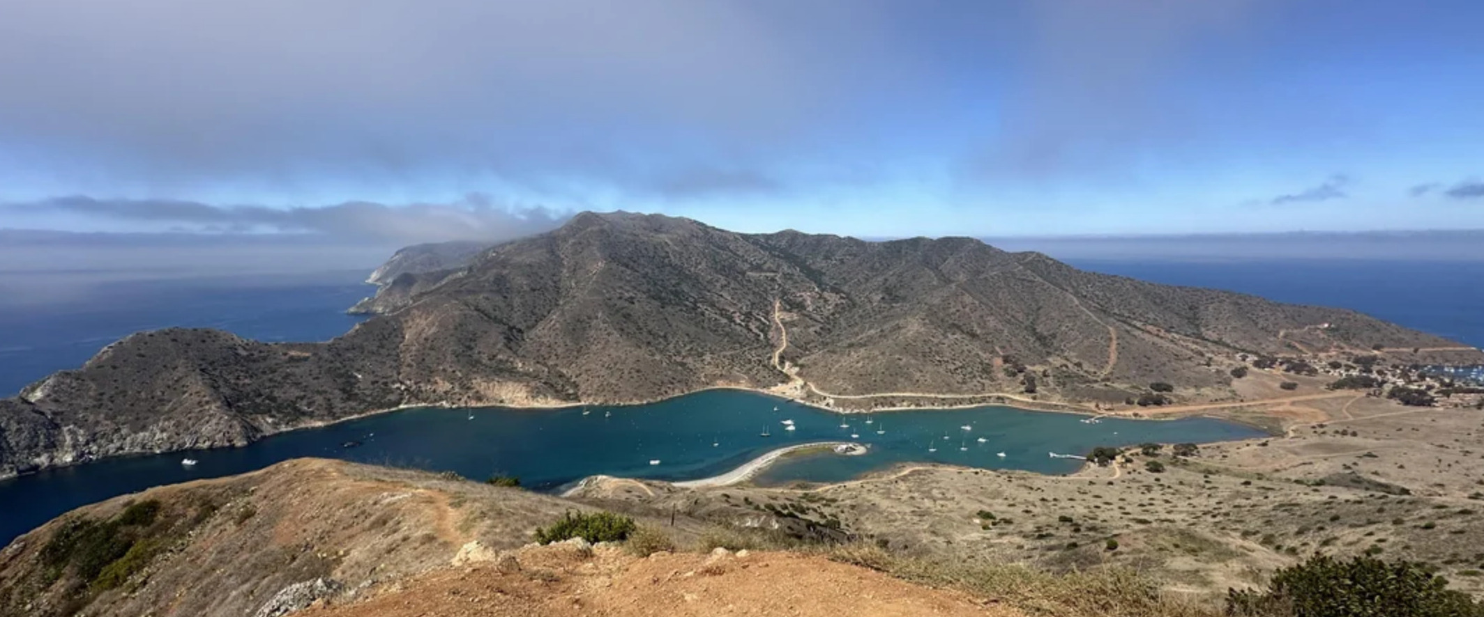
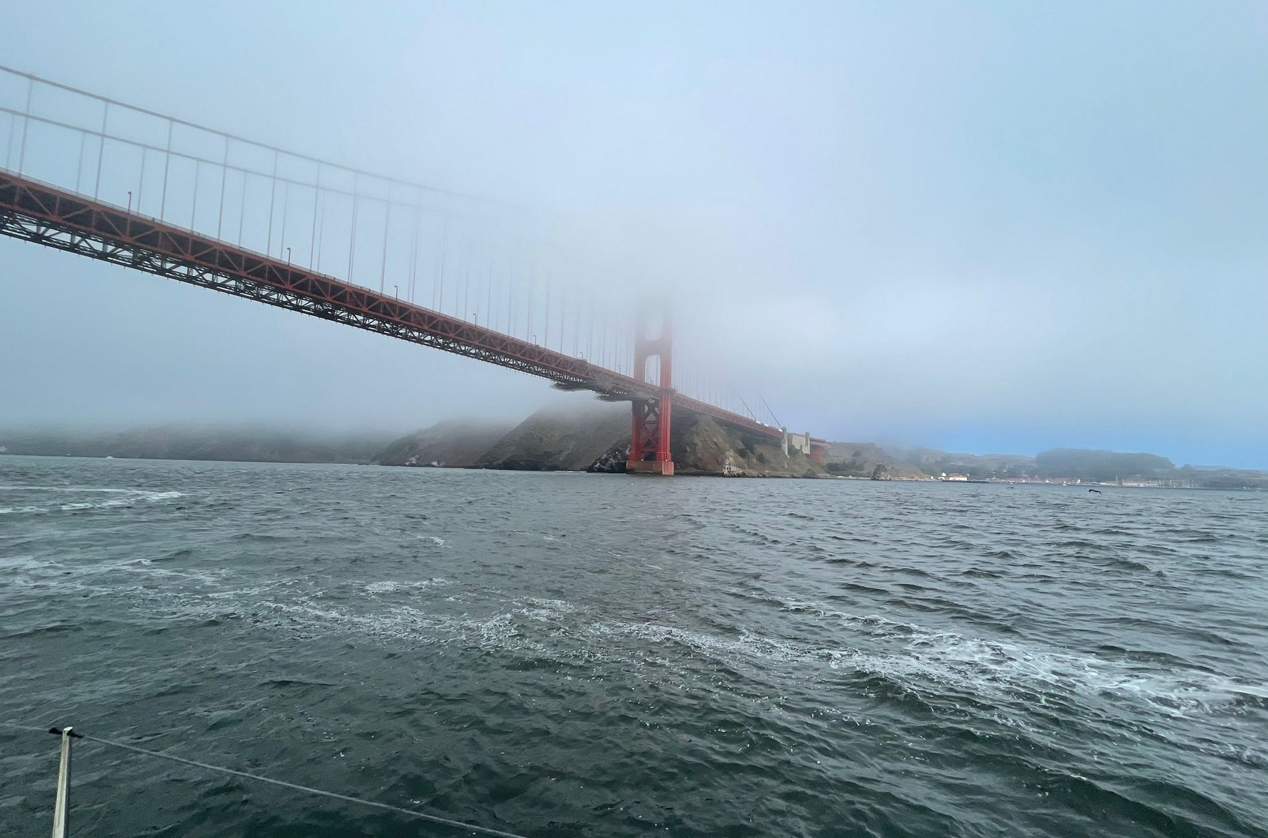
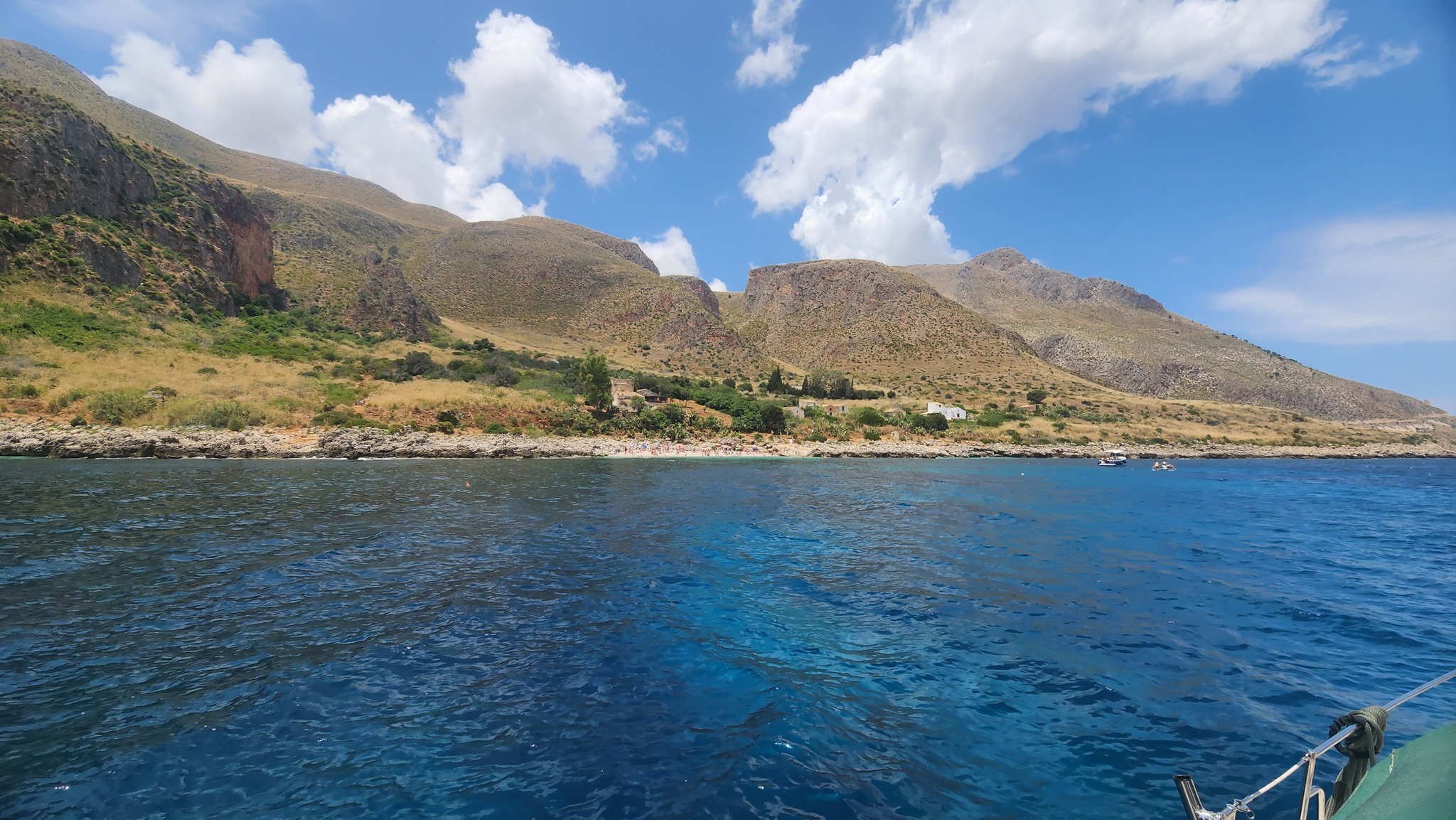
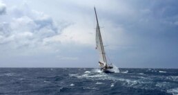
SAN FRANCISCO To SAN DIEGO 🇺🇸 550 NM & CALIFORNIA BLISS
DAYHOP VIA 25 anchorages and marinas along the way
Sailing south from San Francisco to San Diego in August and September offers a generally begning blend of Pacific weather systems. August often starts with persistent coastal fog—especially north of Point Conception—where cold water and inland heat create dense marine layers that can reduce visibility to near zero. Radar and AIS and listening for northbound ships become essential tools during these stretches.
Rain is rare this time of year, but drizzle from fog can soak sails and decks. As you move further south, the fog generally thins, giving way to sunny skies and warmer air, particularly past Point Conception. That point itself marks a climatic boundary north of it, the California Current drives cool, moist air; south of it, conditions trend warmer, drier, and more stable.
Wind is typically out of the northwest, 10 to 25 knots, building in the afternoons. Mornings can be calm, and sailing is often best timed to take advantage of the early light air or ride the afternoon push. Swells also come predominantly from the northwest, ranging from gentle rollers to short-period chop, especially near points and capes.
Santa Ana winds do not develop till later those are hot, dry offshore blasts, can make rare early appearances in late September. If they arrive, expect dramatic shifts in wind direction and velocity, especially near Southern California’s coastal valleys. These winds can turn calm anchorages into lee shores and should be watched closely especially vessels anchoring in the Channel Islands or on moorings off Catalina Islands…
learn more here >>>


WATER MAKER 💧 ZOOM SEMINARS
JULY 10-17-24

Topics:
How a marine watermaker works (reverse osmosis, prefilters, high-pressure pumps, membranes)
System types:
- Manual vs. automated
- AC vs. DC vs. engine-driven vs. belt-driven
- Capacity needs vs. real-world usage (liters/gallons per hour vs. cruising crew size)
- Space, power draw & installation considerations
- Top brands & comparisons (Spectra, Schenker, Rainman, Eco-Sistems, DIY builds)
- Case studies from cruisers – real usage feedback from different boat types

Topics:
- Planning your install:
- Where to mount filters, pump, membrane
- Seawater intake, brine discharge, electrical wiring, thru-hulls
- Electrical & power considerations:
- Running on solar/wind/battery banks
- Generator integration
- Operating the system:
- Startup sequence, flushing, water testing (TDS meters)
- Manual vs. auto flush
- Tips for conserving water onboard
- Demo or video of a full operation cycle if possible

Topics:
-
Routine maintenance schedule:
-
Prefilter changes
-
Membrane care & cleaning
-
Storage & pickling
-
-
Common issues & how to fix them:
-
Loss of pressure
-
High TDS water
-
Pump failures
-
Air leaks
-
-
Spare parts to carry offshore
-
Emergency desalination options & redundancy:
-
Manual watermakers
-
Portable kits
-
Crew survival considerations 3liters per person per day
-

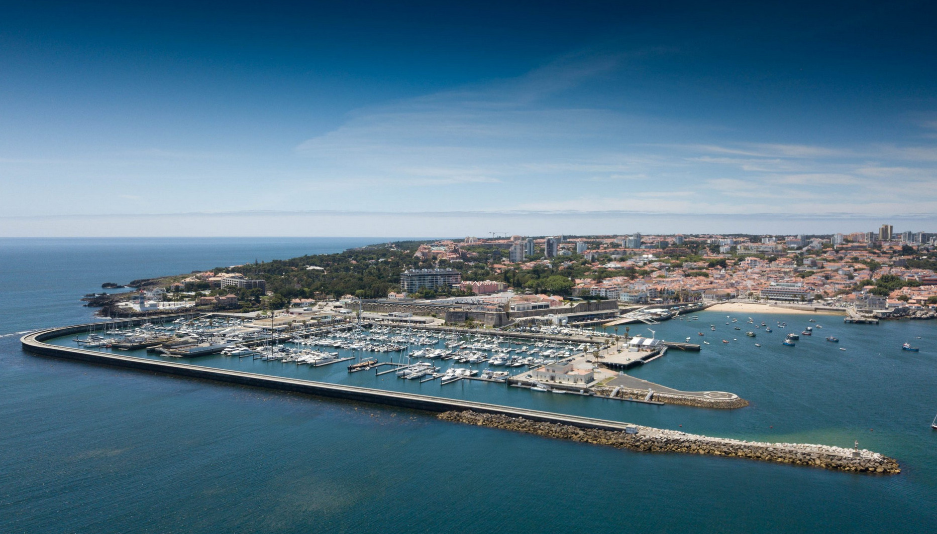
Marina Funchal  Madiera PORTUGAL
SPONSORS THE OCEAN POSSE
32°38’42.1″N 16°54’38.8″W
SERVICES
- Showers
- Water
- Laundry
- Electricity 16/32 220 V
- Internet
- Port of entry
- Fuel Dock open 7 days a week from 8:00 am to 17:30 pm
- 24 hour surveillance
- Offices open MON – FRI 9:00 am to 18:30 pm
AMENITIES
- Bar
- Restaurants
- Historical Sites
- Sail Repair
- Chandleries
- Mechanics
- Supermarkets
- Bakery
SAFE APPROACH MARINA FUNCHAL
NEARBY
🌊 Waterfront & Nautical Charms
• Stroll along Avenida do Mar & Praça do Povo
A scenic promenade lining the marina with cafés, sculptures, and harbor view . It’s ideal at sunset, offering a real maritime vibe plus glimpses of cruise liners and local boats .
• Funchal Marina
With over 200 berths and full amenities—fuel, water, power, shops, bars—this marina is a sea‑lover’s hub right in Funchal Bay
🏛️ Historic & Cultural Gems
• Fortaleza de São Tiago
A 17th‑century yellow‑walled fort right by the marina, offering free entry and panoramic ocean views—also a cultural venue today
• Sé Cathedral (Cathedral of Funchal)
Located a short walk uphill in the Old Town, this Gothic‑Manueline cathedral from 1514 is a beautifully preserved jewel of Portuguese maritime heritage
🌳 Parks & Gardens with a View
• Santa Catarina Park
Overlooking the marina, this leafy 36,000 m² public park features fountains, benches, aviaries, and a chapel—perfect for a relaxing stroll and city views
• Madeira Botanical Garden & Monte Cable Car
Ride the cable car from the marina up to Monte, where you’ll find the stunning Botanical Garden showcasing endemic flora and an exotic bird collection Don’t miss the famous toboggan ride back down!
🎨 Old Town & Local Life
• Mercado dos Lavradores
A colorful Art Deco market of fresh fruit, flowers, fish, and local products—an excellent spot to soak up local rhythms
• Rua de Santa Maria Street‑Art Project
Wander through Funchal’s Old Town to see creative painted doors and walls—an urban art initiative that brings character and charm
🚤 Sea & Adventure Excursions
• Whale & Dolphin Watching Catamarans
Tours depart right from the marina, offering high‑rating eco‑friendly excursions to see marine life
• Boat Trips & Evening Cruises
Sunset or private charter cruises are easy to arrange from the marina. Ideal for a relaxed maritime adventure under the stars.
🥘 Day Trips & Nearby Towns
• Câmara de Lobos
Just 10–15 minutes away by cab or bus—this traditional fishing village inspired Churchill’s paintings and offers authentic local ambiance
• Cabo Girão Skywalk
One of the world’s highest ocean cliffs with a glass‑bottom viewing platform–perfect for breathtaking views, reachable by tour or car


OCEAN POSSE BBQ MEET UP 🔥
MARINA TAHINA 🇵🇫 TAHITI
SAT JUL 12 15:00 – 18:00
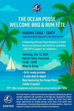
Captain Alan of SY Cyrolia and Marina Tahina are hosting an impromptu BBQ this Sunday at Marina Tahina. 🧭 Bring Your finest grill-worthy protein anda side dish or treat to share with the fleet
🍹 Free Rum will be provided for all
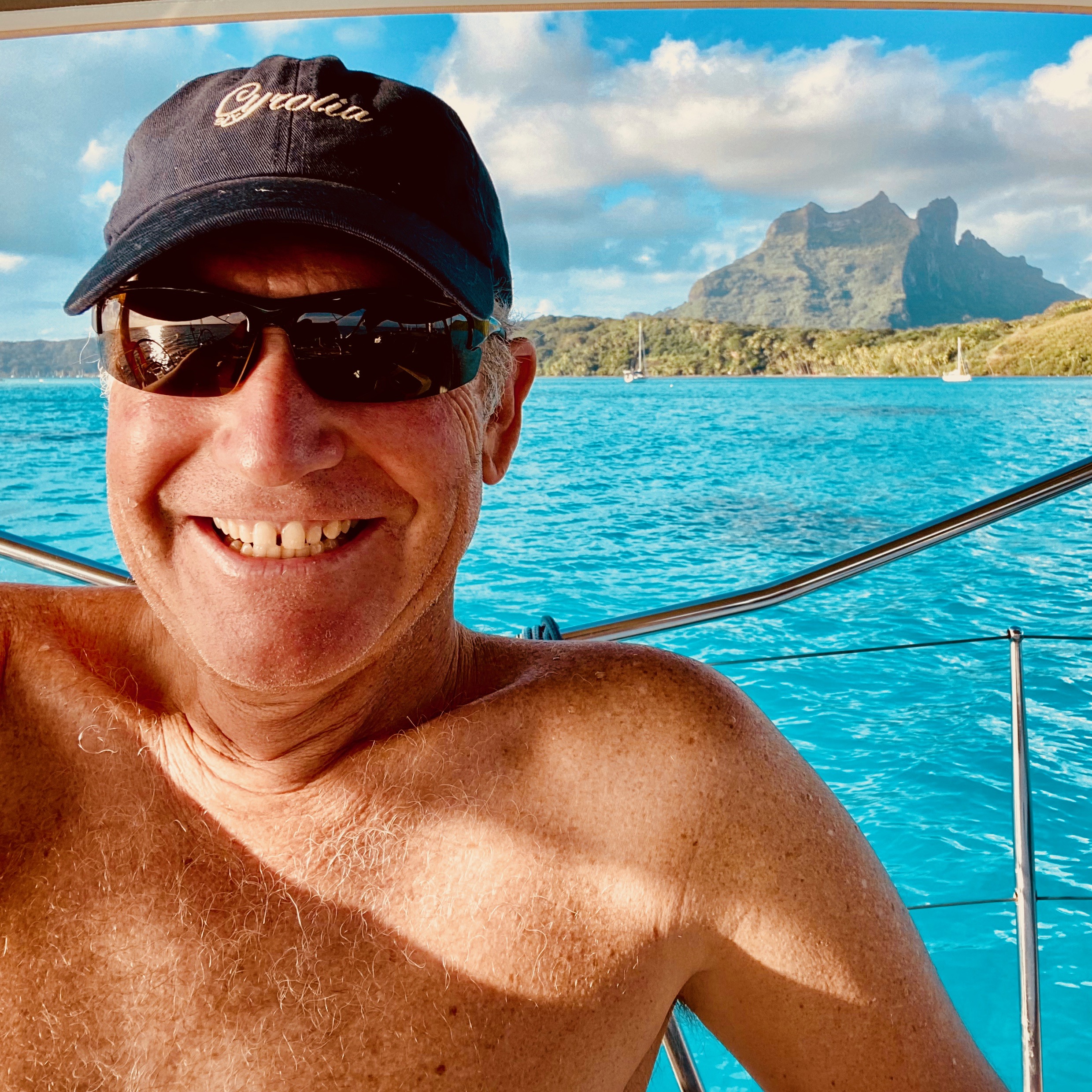
SY CYROLIA Allan Jeanneau 52

PRE SEASON ⚙️ RIGGING CHECK

⚓ STANDING RIGGING: Structural Integrity
1 Shroud and Stay Tension
◦ Use a tension gauge or check leeward shroud slack under sail. Too tight? Overloaded; too loose? Poor support.
2 Visual Inspection for Cracks/Corrosion
◦ Pay special attention to swage fittings, turnbuckles, and chainplates.
3 Wire/Strand Integrity
◦ Look for broken strands, “meat hooks,” or bird-caging near terminals.
4 Turnbuckle Condition and Locknuts
◦ Check for galling, seizing, or movement. Lubricate threads with Tef-Gel or Lanocote.
5 Chainplates
◦ Check for movement, corrosion at deck level, and water intrusion inside the boat.
6 Deck Compression and Mast Step
◦ Look for sagging decks, mast collar deformation, or cracks around the step.
7 Backstay Tension (Adjustable or Fixed)
◦ Proper backstay tension affects forestay sag and headsail shape.
8 Forestay Sag and Headstay Length
◦ Too much sag ruins pointing ability; too tight stresses the rig. Adjust according to sail cut.
⛵ RUNNING RIGGING: Control and Safety
9 Halyards (Main, Jib, Spinnaker)
◦ Inspect for chafe, UV damage, or hard spots. Replace worn tails or frayed sections.
10 Sheets and Blocks
◦ Check blocks for smooth rotation and shackles for seizing. Sheets should be free of core slippage.
11 Furling Gear Function
◦ Spin the drum, inspect halyard wrap preventers, and confirm easy deployment and furling under load.
12 Boom Vang (Rigid or Line)
◦ Check tension and operation. A failed vang can allow uncontrolled boom rise.
13 Traveler and Car Controls
◦ Clean, lubricate, and ensure smooth side-to-side and vertical travel.
14 Reefing Systems
◦ Test each reef point under light wind or dockside. Check for tangled lines or failed blocks.
15 Running Backstays or Checkstays (if applicable)
◦ Inspect toggles, tails, and winch gear. Confirm proper stow and deployment practices.
🧭 MAST TUNE & ALIGNMENT
16 Mast Centering (Side-to-Side)
◦ Measure from chainplates to mast — both sides should be equal.
17 Mast Rake
◦ Measured from masthead to transom; affects balance and helm pressure.
18 Pre-Bend (for Fractional Rigs)
◦ Controlled by the cap shrouds and lowers; essential for proper mainsail shape.
19 Tuning Progression
◦ Always adjust port and starboard evenly. Use a known tuning guide or manufacturer’s spec.
20 Final Under-Sail Observation
◦ Check leeward shrouds, mast pumping, sail shape, and helm balance while sailing in 10-15 knots.
🛟 Pro Tip:
Mark your tuned turnbuckle positions with permanent marker or rig tape once you’re happy with the settings. It’ll help you spot slippage or return to baseline settings later.

OCEAN POSSE PARTNERSHIP MARINAS

🇦🇺 AUSTRALIA
🇧🇸 BAHAMAS
-
 Browns Marina
 -
 Elizabeth on the Bay Marina
 -
 Blue Marlin Cove Resort & Marina
 - Great Harbour Cay Marina
-
 Romora Bay Resort and Marina
🇧🇿 BELIZE
🇧🇲 BERMUDA
🇧🇷 BRAZIL
🇻🇬 BRITISH VIRGIN ISLANDS
🇨🇻 CAPE VERDE
🇰🇾 CAYMAN ISLANDS
🇨🇱 CHILE
🇨🇴 COLOMBIA – Caribbean
-
 Club Nautico Cartagena
 -
 Club de Pesca Marina Cartagena
 -
 Marina Puerto Velero
 -
 IGY Marina Santa Marta
  Manzanillo Marina Club
🇨🇷 COSTA RICA – Pacific Coast
🇨🇺 CUBA
🇩🇲 DOMINICA
🇩🇴 DOMINICAN REPUBLIC
🇪🇨 ECUADOR
🇸🇻 EL SALVADOR
🇬🇮 GIBRALTAR
🇬🇩 GRENADA
🇬🇵 GUADELOUPE
🇬🇹 GUATEMALA – Pacific Coast
🇬🇹 GUATEMALA Rio Dulce
🇫🇯 FIJI
 Copra Shed Marina
 Nawi Island Marina
  Denarau Marina
-
 Musket Cove
  Royal Suva Yacht Club
 Sau Bay Moorings
🇭🇳 HONDURAS – Bay of Islands – Roatan
🇮🇹 ITALY
 Marina dei Presidi
  Marina di Balestrate
 Marina di Brindisi
 Marina di Cagliari
 Marina di Chiavari
 Marina di Forio
  Marina di Teulada
 -
 Marina di Policoro
 -
 Marina di Vieste
 -
 Marina de Procida
 -
 Marina de Villasimius
 - Marina di Vieste
-
 Marina Molo Vecchio
  Marina Salina
  Venezia Certosa Marina
🇯🇲 JAMAICA
🇲🇶 MARTINQUE
🇲🇽 MEXICO – Caribbean
- Marina Makax – Isla Mujeres
- Marina Puerto Aventuras
- Marina V&V – Quintana Roo
- Marina El Cid – Cancún
🇲🇽 MEXICO – Pacific Coast
- ECV Marina – Ensenada BC
- IGY Marina Cabo San Lucas BCS
- Marina Palmira Topolobampo – SI
- Marina y Club de Yates Isla Cortes – SI
- Marina el Cid – Mazatlan – SI
- Marina Vallarta, Puerto Vallarta – JA
- Marina Puerto de La Navidad – Barra de Navidad – CL
- Marina Ixtapa, Ixtapa – GE
- La Marina Acapulco, Acapulco – GE
- Vicente’s Moorings, Acapulco – GE
- Marina Chiapas – CS
🇳🇿 NEW ZEALAND
🇳🇮 NICARAGUA – Pacific Coast
🇳🇺 NIUE
🇵🇦 PANAMA – Pacific Coast
🇵🇦 PANAMA – Caribbean
- Shelter Bay Marina
- Bocas Marina
- Solarte Marina
- Linton Bay Marina /a>
- Turtle Cay Marina
- IGY Red Frog Marina
🇵🇹 PORTUGAL
🇵🇷 PUERTO RICO
🇱🇨 SAINT LUCIA
🇸🇽 SINT MAARTEN
🇪🇸 SPAIN
 Alcaidesa Marina
  IGY Málaga Marina
  Marina Del Odiel
  Nautica Tarragona
  Puerto Sotogrande
 Yacht Port Cartagena
🇰🇳 ST KITTS & NEVIS
🇹🇳 TUNISIA
🇹🇴 TONGA
🇹🇨 TURCS AND CAICOS
🇻🇮 US VIRGIN ISLANDS
🇺🇸 USA – East Coast
- Safe Harbor – Marathon, FL
- Pier 66 Hotel & Marina – Ft. Lauderdale, FL
- Titusville Marina – FL
- Port 32 Marina Jacksonville – FL
- Oasis Marinas at Fernandina Harbor Marina – FL
- Morningstar Marinas Golden Isles St. Simons Isl. – GA
- Windmill Harbour Marina – Hilton Head , SC
- Coffee Bluff Marina – Savannah GA
- Hazzard Marine – Gerogetown, NC
- Holden Beach – Town Dock, NC
- Tideawater Yacht Marina, Portsmouth, VA
- Ocean Yacht Marina, Portsmouth, VA
- York River Yacht Haven – VA
- Yorktown Riverwalk Landing – VA
- Regatta Point Marina – Deltaville, VA
- Regent Point Marina – Topping, VA
🇺🇸 USA – Pacific Coast
- Safe Harbor Ventura Isle, Ventura CA
- Vintage Marina , Oxnard, CA
- Safe Harbor South Bay – Chula Vista, CA
🇻🇺 VANUATU
COOK ISLANDS 🇨🇰 Aitutaki – Arutunga Harbor
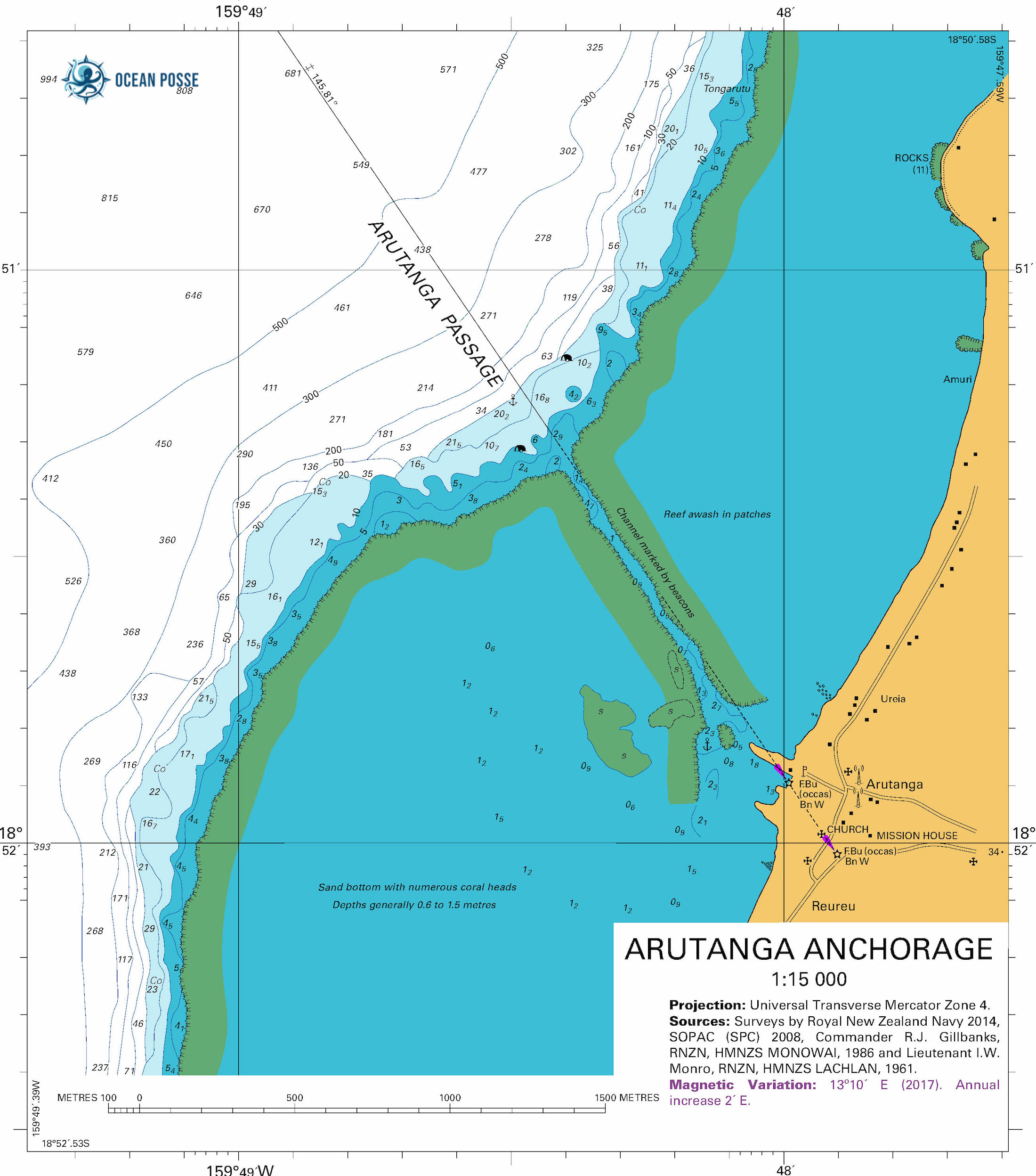
The entrance is marked by a red nun buoy. The red nun should not be used for accessing the channel as it is not directly on the channel but will be well to port as you enter. Navionics has the channel correctly positioned and once lined up is straight and long. It feels very narrow and the current can be strong depending on the tides. The channel was dredged to 4 meters or more while the harbor varies between 2-4 meters. The channel is basically a square ditch carved out of the coral. The dirt berm directly to starboard as entering the harbor is known as mono alley and is more exposed but deeper. The rest of the harbor is good for drafts of around 1.3 meters or less. You will need two stern lines of 30meters or more. Fenders deployed on both sides as boats come and go and it is close quarters. Drop anchor as far forward as possible. Be sure to set the anchor before backing up the last couple of boat length to the berm. The bottom is loose mud with clay that will give good holding. The stern lines are tied to large coral rocks or old sewage culverts, depending on where you are. While we were there the wind managed to go full circle, so do not set just for the wind at the moment as it will probably change. Reach out to see if there is an active
Aitutaki welcoming committee, look on NFL and contact the boats that are there to make them aware of your arrival so they can organize dinghies and shore people. One big help was to have a dingy meet the incoming boat in the channel and grab your +30 meter lines that have been readied. The shore crew can go ahead and tie them to suitable rocks. As you are backing up your boat the dingy will hand the tied shore lines to you. We then helped subsequent boats coming in, it was a good community feeling and fun.
Formalities are the way they should be every where! In no particular order you will be visited by:
-Customs Bob – explains costs and other formalities landing fee $10nz / pp
-Bio Security – I have no fruits and vegetables $25nz
-Health – I have no sickness $25nz
When departing;
-Pay $20nz / day anchorage fee to Aitutaki council
-Pay all above charges to Customs Bob at checkout
Be sure to ask Customs Bob for his hours and Holidays so you can depart when planned.
Ashore NFL is a great resource, activities that we really enjoyed were;
-Every fortnight on Thursday 5pm there is a market on the green with a “band”, great local food choices, and people watching.
-Teking tours we snorkeled with giant Napoleon fish, giant clams, and had a great meal on a motu.
-Tava’e resort happy hour 4p-5p they had good pizza and towers of beer and Jen C the server was super fun.
-Bubbles cafe for coffee and camaraderie
Aitutaki is super friendly, beautiful, English speaking, has stores that are open more than they are closed, enjoy!
Cook Islands are in he IALA AVbuoyage system, specifically Region A, red buoys mark the port side of a channel when entering from the sea or heading upstream.
SY HOMECOMING Peter & Colleen – Lagoon 45′

Primary Named Winds in the Mediterranean 🌬LEVANTE
| Name | Direction | Region | Effect on Sailing |
Levante |
E | Strait of Gibraltar & Alboran Sea |
Can trap boats in Gibraltar; builds large swell and fog. Long-lasting.
|
The Levante wind, also known as Levanter, is a warm, easterly wind prevalent in the western Mediterranean, particularly in the Strait of Gibraltar. It’s known for its strength and persistence, often causing rough seas and reducing visibility due to mist or dust
Sailing Implications:
• Direction: It blows westward – from the eastern Mediterranean toward the west.
• Usefulness: This favors westbound sailing – yachts heading from the Balearic Islands toward mainland Spain, or from the Mediterranean into the Atlantic (through Gibraltar), benefit from this wind.
• Why sailors like it:
◦ It typically creates long, steady waves, which are easier to sail.
◦ It tends to be predictable and sustained, which is ideal for passage planning.
◦ It supports beam reach or broad reach sailing for boats headed west – two of the most comfortable and efficient points of sail.
Caveats:
• In the Strait of Gibraltar, the Levante can funnel through and intensify, sometimes exceeding 30 knots and creating tricky conditions with fog and low visibility.
• On occasion, it can last several days, impacting schedules for vessels trying to head east (against it).
MUST SEE IN FLORIDA 🇺🇸 CASTILLO SAN MARCOS – ST AUGUSTINE
The Castillo de San Marcos is the oldest masonry fort in the continental United Statesand is located on the western shore of Matanzas Bay in the city of St. Augustine, Florida. The Castillo was designed by the Spanish engineer Ignacio Daza and construction begn in 1672, 107 years after the city’s founding by Spanish Admiral and conquistador Pedro Menéndez de Avilés, when Florida was part of the Spanish Empire.

Castillo de San Marcos was for many years the northernmost outpost of Spain’s vast New World empire. It is the oldest masonry fort and the best-preserved ex-ample of a Spanish colonial fortification in the continental United States. It anchored East Florida’s defenses, which extended northward to the St. Marys River, westward to the St. Johns, and southward to Fort Matanzas. It protected St. Augustine from pirate raids and from Spain’s major rival, Great Britain, during a time when the Florida-Georgia-Carolina coastline was an explosive international battleground.
![When Britain gained control of Florida in 1763 pursuant to the Treaty of Paris, St. Augustine became the capital of British East Florida, and the fort was renamed Fort St. Mark[8] until the Peace of Paris (1783) when Florida was transferred back to Spain and the fort's original name restored. In 1819, Spain signed the Adams–Onís Treaty which ceded Florida to the United States in 1821; consequently, the fort was designated a United States Army base and renamed Fort Marion, in honor of American Revolutionary War hero Francis Marion. The fort was declared a National Monument in 1924, and after 251 years of continuous military possession, was deactivated in 1933. The 20.48-acre (8.29 ha) site was subsequently turned over to the United States National Park Service. In 1942 the original name, Castillo de San Marcos, was restored by an Act of Congress.](https://oceanposse.s3.us-east-2.amazonaws.com/wp-content/uploads/2021/05/castillossanmarcos-1024x637.jpg)
The roots of the Castillo’s history reach back to the years just after Christopher Columbus’s final transatlantic voyage, when conquistadors carved out a vast and wealthy overseas empire for Spain, first in the Caribbean and then on the mainlands of Mexico, Central America, Colombia, Venezuela, and Peru. Products of these tropical and mountainous territories brought high prices on the Continent, and Spanish galleons sailed home laden with exotic dyes, sugar, tobacco, chocolate, pearls, hardwoods, and silver and gold. These so-called “treasure fleets” made Spain the most powerful and envied nation in Renaissance Europe.

Thanks to the travels of Ponce de Leon in 1513, Spanish navigators knew that the best return route from Spain’s rich Caribbean possessions was along the Gulf Stream, through the Bahama Channel, and past the shores of Florida. The Spanish knew they must defend this peninsula to prevent enemies from using its harbors as havens from which to raid the passing treasure fleets.

In 1513 Spain claimed Florida through the expedition of Ponce de Leon, but France gained the first foothold there by establishing Fort Caroline on the St. Johns River in 1564. Seeing this as both a challenge to Spain’s claims and a menace to the treasure fleets, King Philip II sent an expedition under Don Pedro Menendez de Aviles to eliminate the French threat and establish settlements in Florida. It arrived at the mouth of the St. Johns River in September 1565.
After attempting unsuccessfully to board the French ships anchored there, Menendez sailed to a harbor farther south and established St. Augustine as a base for further operations. Almost immediately a French fleet sailed south to attack. But the ships were driven southward and wrecked by a violent storm and the mission failed. Realizing that Fort Caroline would be lightly guarded, the Spaniards marched north, captured the fort, and executed most of the inhabitants.

The same fate befell survivors from the French fleet, whom the Spaniards captured and killed at an inlet 14 miles south of St. Augustine. The episode gave a name to the area: Matanzas, Spanish for “slaughters.”

England became Spain’s next contender for Florida. The Spanish had watched the English warily ever since Sir Francis Drake attacked and burned St. Augustine in 1586. They became even more watchful after English-men settled Jamestown in 1607. British pirates sacked St. Augustine again in 1668, and this hit-and-run attack, followed by the English settlement of Charleston in 1670, caused Spain to build the Castillo de San Marcos.


Begun in 1672 and completed by 1695, the Castillo replaced nine successive wooden fortifications that had protected St. Augustine since its founding. The fort’s commanding location on the west bank of Matanzas Bay allowed its guns to protect not only the harbor entrance but the ground to the north against a land attack.

The Castillo’s baptism of fire came in 1702 during the War of the Spanish Succession, when the English occupied St. Augustine and unsuccessfully besieged the fort for 50 days. The English burned the town before they left, but the Castillo emerged unscathed, thereby making it a symbolic link between the old St. Augustine of 1565 and the new city that rose from the ashes.

When Britain gained control of Florida in 1763 pursuant to the Treaty of Paris, St. Augustine became the capital of British East Florida, and the fort was renamed Fort St. Mark[8] until the Peace of Paris (1783) when Florida was transferred back to Spain and the fort’s original name restored. In 1819, Spain signed the Adams–Onís Treaty which ceded Florida to the United States in 1821; consequently, the fort was designated a United States Army base and renamed Fort Marion, in honor of American Revolutionary War hero Francis Marion. The fort was declared a National Monument in 1924, and after 251 years of continuous military possession, was deactivated in 1933. The 20.48-acre (8.29 ha) site was subsequently turned over to the United States National Park Service. In 1942 the original name, Castillo de San Marcos, was restored by an Act of Congress.

Castillo SAN MARCOS Timeline
- 1513 Sailing from Puerto Rico, Spanish claim Florida.
- 1565 Spanish found St. Augustine and destroy French at Fort Caroline and Matanzas Inlet.
- 1672 Ground is broken on October 2 for Castillo de San Marcos.
- 1695 Castillo de San Marcos (curtain walls, bastions, living quarters, moat, ravelin, and sea-wall) is finished in August.
- 1702 War of the Spanish Succession pits Spain and France against Austria, Great Britain, and others. Coastal Georgia missions are destroyed by Carolinians en route to St. Augustine. Carolinians occupy and burn St. Augustine but the Castillo successfully resists their siege.
- 1738 Spanish governor at St. Augustine grants freedom to runaway British slaves. Black families settle at new town called Fort Mose.
- 1740 St. Augustine successfully endures siege by British, Georgian, and South Carolinian forces. Spanish attack and de-feat British Highland troops camped at Fort Mose.
- 1740-42 Fort Matanzas is built to block southern approach to St. Augustine.
- 1756-62 Fort Mose re-built in masonry. Earth-works at Mose extended to complete northern-most defense.
- 1763 Peace of Paris gives Florida to Great Britain in exchange for La Habana. Castillo becomes known as Fort St. Mark.
- 1783 Peace of Paris recognizes independence of the United States and returns Florida to Spain.
- 1821 Spain cedes Florida to the United States.
- 1825 Castillo de San Marcos renamed Fort Marion.
- 1924 Fort Marion and Fort Matanzas are proclaimed national monuments
- 1933 Transferred to the National Parks Service
- 1942 Original name Castillo San Marcos is restored
GET THERE BY YACHT

SEASON 9 REGISTRATION IS NOW OPEN >>>
NEW VESSEL ON BOARDING ZOOM CALL
SATURDAY JULY 26, 2025
YOU ARE CORDIALLY INVITED TO MEET YOUR PEERS
MONTHLY ON-BOARDING ZOOM CALL
@
20:00 UTC
16:00 EASTERN
15:00 PANAMA
14:00 MEXICO
13:00 PACIFIC
• Introductions
• Meet your peers
• Meet Nicole
• Values, goals and expectations
• Resources and perks
• Ongoing information
• Participation and involvement
• Social events and activities
• Check-ins and feedback
• Meet the editor
• Milestones & Awards
• Ongoing learning
• Q&A
• Blue Sky
FIJI GPX TRACKS 🇫🇯 GOOD NAUTICAL

With 24+ tracks in the Fiji Lau Group and Kadavu added by SY Seaglub everyone is empowered to see this amazing part of Fiji avoiding treacherous reefs and coral heads.

With many tracks in the Fiji Lau Group and Kadavu added by SY Seaglub everyone is empowered to see this amazing part of Fiji avoiding treacherous reefs and coral heads –here is the track >>> DETAILS : https://goodnautical.com/route/fulaga-lagoon-malokua-anchorage
The underlying chart data of FIJI including existng coastlines, seabed details, positions for the Lau Group dates back to 2012. However, safety-critical changes (e.g. submerged hazards, buoy relocations) are incorporated continuously through NTMs. To be fully compliant and safe, mariners should use the latest print-on-demand or digital version, ensuring it has the most recent NTM corrections applied.
There haven’t been more recent large-scale multibeam bathymetric surveys published for Lau since that original 2012-era data. Some deep-sea geological mapping (like Lau Basin tectonics) has been updated, but no public nautical-grade bathymetric update for navigation in the Lau Islands.
1. Hydrographic Operations by Fiji Hydrographic Service (2023)
In September and August 2023, the Fiji Maritime Safety Authority reported hydrographic survey operations in Vanua Levu–Savusavu “Nakama Creek–Nawi Island” and Nadi Waters (including Yakuilau Island & Denarau) These missions used modern multibeam sonar vessels to update coastal charting and navigation data.
2. Beqa Lagoon Conservation Mapping (2024–2025)
A recent collaborative bathymetric survey of Beqa Lagoon was conducted in 2024, led by organizations like Map the Gaps and the Pacific Blue Foundation, working alongside Fiji’s Hydrographic Service. The aim was to develop high-resolution, community-shared seabed models for conservation. This initiative was highlighted in reports published in early 2025
3. Ongoing Hydrographic Capacity and Seabed 2030 Projects
As of early 2025, Fiji’s Hydrographic Service is operating up to IHO (International Hydrographic Organization) standards, boasting new vessels equipped with multibeam echo sounders, and actively contributing to the Seabed 2030.

2024 Fiji Yachting Tourism Data
MEET THE FLEET SY KALIYAH
One year ago today (July 3rd,2024) we launched Kaliyah in Somes Sound, Maine. The boat was new to us, so we spent those early days getting familiar with all the systems and quirks — while also finding time to explore some beautiful parts of Maine.
Of course, the journey wasn’t without its challenges. Just one month in, we snagged a lobster buoy line around our prop! That was one of many “learning moments” — and definitely a story best told over a beer when we see you! 😁
Our original plan was to sail south toward the Eastern Caribbean. As we made our way down the East Coast, we enjoyed exploring different harbors and towns. But delays with our new sails ended up shifting our plans. By the time everything was ready, we were already in Florida — and not keen on taking the infamous “thorny path” to the Eastern Caribbean
Along the way, we joined several sailing clubs, including the Salty Dawgs, Seven Seas Cruising Association, and Ocean Posse. It was a pleasure meeting fellow cruisers from these groups—their experiences and knowledge were truly inspiring. Some even became close friends, making our journey all the more meaningful. They suggested heading for the South Pacific instead-and the idea stuck. It sounded like the kind of adventure we were looking for .
After leaving Florida, we sailed to the Bahamas and set our sights on Panama. But the Windward Passage had other ideas… Rough weather forced us to divert to Jamaica and then Colombia. That stretch brought one of the most intense experiences yet — a gale with winds over 40 knots and 15-foot seas! Definitely another story for cocktail hour! 🍹😁
We spent a couple of months in Panama before making another big move: we transited the Panama Canal and began exploring the Pacific coast — from Panama and Costa Rica all the way up to Mexico. After leaving Chiapas, Mexico, we encountered a fierce lightning storm squall along the Pacific coast—it was intense and terrifying! Right now, we’re in Baja, heading north to haul out and do some work on our rudder.
Come October, we’ll head south again, with our sights set on the South Pacific!
SY KALIYAH Greg & Dieu – Kelly-Peterson 46′


SOUTH PACIFIC POSSE – MEET THE CRUISING FLEET – SAT AUG 30 – NAWI ISLAND MARINA
-
15:00 YACHT MARKET OVERVIEW FOR BUYERS AND SELLERS PRESENTED BY
THE YACHT SALES CO -
15:30 THE PASSAGE TO NEW ZEALAND – PRESENTED BY OCEAN TACTICS
-
16:00 MEET AND MINGLE AND FREE RUM
-
17:00 LET THE FEAST BEGIN …
-
19:00 KAVA AND RUM AFTER HOURS
OFFICIAL OCEAN POSSE EVENTS

ANNAPOLIS BOAT SHOW 🇺🇸 MARYLAND USA
ANNAPOLIS, Annapolis Town Dock Booth VB 9

OCEAN POSSE 🇺🇸 SAN DIEGO BAY 4 DAY CRUISING SEMINARS SERIES @ SAFE HARBOR SOUTH BAY
SAFE HARBOR SOUTH BAY EVENT CENTER, CHULA VISTA, SAN DIEGO, CA

OCEAN POSSE KICK OFF 🇲🇽 BARRA DE NAVIDAD, MEXICO December 3-7 2025
MARINA PUERTO DE LA NAVIDAD, BARRA DE NAVIDAD, MEXICO


OCEAN POSSE & BEN TAYLOR STREET PARTY @ CANNES 🇫🇷 YACHTING FESTIVAL
TAQUERIA LUPITA, 72 Rue Meynadier, Cannes
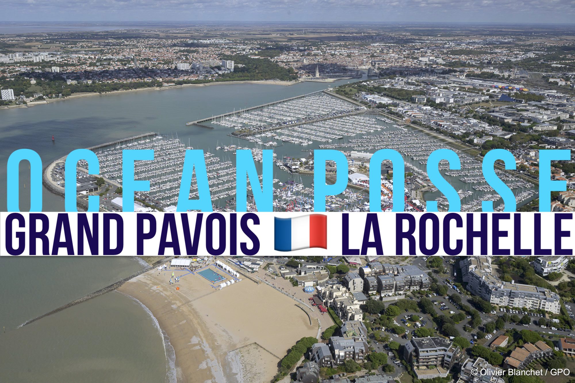
GRAND PAVOIS 🇫🇷 La Rochelle – Sep. 24 2025
Gran Pavois La Rochelle, 20 Av. de la Capitainerie, 17000 La Rochelle, France
GRAND PAVOIS 🇫🇷 La Rochelle – Sep. 24 2025
Gran Pavois La Rochelle, 20 Av. de la Capitainerie, 17000 La Rochelle, France
GRAND PAVOIS 🇫🇷 La Rochelle – Sep. 24 2025
Gran Pavois La Rochelle, 20 Av. de la Capitainerie, 17000 La Rochelle, France
GRAND PAVOIS 🇫🇷 La Rochelle – Sep. 24 2025
Gran Pavois La Rochelle, 20 Av. de la Capitainerie, 17000 La Rochelle, France
GRAND PAVOIS 🇫🇷 La Rochelle – Sep. 24 2025
Gran Pavois La Rochelle, 20 Av. de la Capitainerie, 17000 La Rochelle, France

MUSKET COVE MARINA  SPONSORS THE OCEAN POSSE
We welcome any of the Ocean Posse to Musket Cove at any time. We’re pleased to offer a Free Berthing Day for 5 Paid Days to all of your Posse Members.

Wayne Deed
- Director of Sales & Marketing
- Musket Cove Island Resort & Marina
- Malolo Lailai Island
- Fiji Islands
- m| +64 21 824266
- P | +679 666 2215

AMENITIES
At Musket Cove you’ll find the pace of life smooth and unhurried. The resort is owned
and operated by Fiji’s oldest resort company, with 400 acres of palm fringed beaches
and tropical gardens. You will be hosted by 150 extremely warm and dedicated staff,
who will endeavour to ensure your visit is one to cherish. Take a moment to familarize yourself
with the following;
No animals are allowed on shore.
We care for our environment so please help with careful disposal of waste water, pollutants
and rubbish. Rubbish bins are located behind the Marina Office.
Charge It! Yacht visitors are welcome to open an account at the Marina office for all
transactions. Including, the
- Trader General Store
- Dick’s Place Bistro & Bar
- Trade Cafe
- Island Bar
- Dive Shop
- Fuel
Marine Sanctuary: All waters in and around Musket Cove, including moorings are a Marine
Sanctuary with all fishing prohibited.
The Trader General Store is open daily between 8am -7pm.
Musket Cove Yacht Club Island Bar: The iconic Island Bar is a great meeting place. With coin
operated BBQ’s available.
Open 10am till late. BBQ Packs can be purchased at the Trader Cafe
Bottle Shop: Bulk discount Beer, Wine & Sprits can be purchased from Dicks Place Bar between
the hours of 9am till 11am & 3pm to 5pm
Dick’s Place Bistro & Bar: Open daily Breakfast:7.00am – 1100am, Lunch: 11.30am –2.00pm,
Dinner: 7pm – 9pm. Daily a la carte and check out our famous Theme night buffets. Reservations
required.
Swimming Pool: You are welcome to use the pool, excluding Regatta Week. Resort guests
have priority on sun lounges. Lounge and restaurant area is for wining and dining only. Please do
not use these areas to place your belongings. You must follow the pool rules.
Makare Spa: Our dedicated spa offers a full range of beauty and relaxation treatments. The Spa
is open daily from 8am to 5pm.
Scuba Diving: Subsurface Fiji specializes in making diving fun for all. They offer a full range of
PADI Scuba Diving. Check out Fiji’s famous and fantastic dive spots, day trips departing daily
from Musket Cove Marina.
Ducks & Dingies: Please tie up at the end of the marina towards the MCYC Island Bar so that
they are not in the way of vessels berthed at the Marina.
Drinking Water: Available at the Marina for 10 cents per liter.
Mail: Incoming mail is kept at the Marina Office. The outgoing mail bag is in the
boutique where stamps are available
Malolo Cat: The Malolo Cat operates 4 times daily. Purchase tickets at the resorts front
office and be ready for boarding 30 minutes prior to departure
WIFI: Paid WIFI is available throughout the resort and MCYC Island Bar via Tomizone
and can be purchased from Front office and the Trader General Store
Note: Musket Cove is a functioning resort and all visitors must respect the comfort of all. Shirts
and appropriate clothing must be worn in public areas and children must be accompanied and
well behaved. Poor or disrespectful behaviour will not be tolerated and Management reserve
the right to deny service for infringements deemed unacceptable
RATES
MARINA BERTHING
DAILY BERTHING RATE
F$4.80 PER METRE MONOHULLS
F$8.50 PER METRE MULTIHULLS
PLEASE ENQUIRE FOR MONTHLY AND LONG TERM BERTHING RATES
SWING MOORINGS – VESSELS UPTO 25 TONS
F$25.00 PER NIGHT
PAID IN ADVANCE & NON-REFUNDABLE
Rates expressed in Fiji Dollars and Include VAT.

SAFE APPROACH TO MUSKET COVE MARINA
NEARBY
1. Cloud 9 Floating Bar & Surf Spot
A vibrant platform‑bar anchored over the lagoon where you can sip cocktails, enjoy pizza, and soak in island vibes. Just 20 min boat ride from Musket Cove, it’s a social hub for surfers and sailors ( and couples )
2. Surf Breaks: Cloudbreak & Restaurants
World‑class surf breaks accessible via dinghy from Musket Cove. These legendary breaks are only ~20 minutes away .
3. Sandbank Snorkelling and sunset drinks
Daily low‑tide trips out to a nearby sandbank for snorkelling in clear lagoons
4. Island Hiking & Nature Trails
Explore kilometers of paths winding through tropical gardens, coconut plantations, and along ridgelines with views across the Mamanucas. Look out for local birdlife and medicinal plants on guided “medicine walks”
5. Fijian Cultural Experience at Shell Village
Visit a nearby Fijian village, learn traditional crafts like coconut husking, basket‑weaving, join in a kava ceremony, and support the community often through arranged excursions
6. Cycling & Organic Garden Tour: Rent a bike to cruise island trails and visit Musket Cove’s organic gardens
7. Golf next to Musket Cove is Plantation Island’s 9 hole golf course complete with sand crabs who will move your ball around before you can putt.
OCEAN POSSE SPONSORS
OCEAN POSSE SPONSORS
- ABERNATHY – PANAMA
- BELIZE TOURISM BOARD
- BOAT HOW TO
- CABRALES BOAT YARD
- CENTENARIO CONSULTING – PANAMA CANAL
- CHRIS PARKER – MARINE WEATHER CENTER
- DELTA MIKE MARINE SUPPLY PANAMA
- DIGITAL YACHT
- DOWNWIND MARINE
- EL JOBO DIST. COSTA RICA
- FLOR DE CAÑA
- HAKIM MARINA AND BOAT YARD
- HERTZ RENTAL CARS MEXICO
- HOME DEPOT PRO MEXICO
- LATITUDES AND ATTITUDES
- MARINA PAPAGAYO
- NOVAMAR YACHT INSURANCE
- PANAMA YACHT BROKER
- PREDICT WIND
- SAFE HARBOR SOUTH BAY MARINA EVENT CENTER
- SAN DIEGO MARINE EXCHANGE
- SAFETY ONBOARD COSTA RICA
- SEVENSTAR YACHT TRANSPORT
- SHAFT SHARK
- SUN POWERED YACHTS
- WESTMARINE PRO
- YACHT AGENTS GALAPAGOS

MEDIA PARTNERS
LATITUDES AND ATTITUDES

OCEAN POSSE FLEET 🛰️ TRACKING
This page is designed to give interesting parties an overview. For specific vessel details including their floatplan, latest updates, changes, positions and specific location related questions please contact each vessel directly. Due to privacy we do not provide vessel contact information. You may track vessels via it’s own tracker or request AIS tracking from https://www.marinetraffic.com/ please note that this is also not accurate. There are many reasons why a vessel’s position is not updated and please do not conclude that a vessel has an emergency or is in need of assistance because it has not reported in lately. Sometimes they may just want to get away from it all and not tell you where they are. It is the responsibility of each vessel to file a float and check in plan and escalation procedures.
JOIN THE OCEAN POSSE
|
||||||||||||||||||||||||||||||||||||||||||||||||||||||||||||||||||||||||||||||||||||||||||||||||||||||||||||||||||||||||||||||||||||||||||
| MEET UP @ BOAT SHOWS AROUND THE WORLD | ||||||||||||||||||||||||||||||||||||||||||||||||||||||||||||||||||||||||||||||||||||||||||||||||||||||||||||||||||||||||||||||||||||||||||
| SAVE MONEY, TIME AND REDUCE BOAT STRESS | ||||||||||||||||||||||||||||||||||||||||||||||||||||||||||||||||||||||||||||||||||||||||||||||||||||||||||||||||||||||||||||||||||||||||||
|

In Panama, sloths can swim faster than they can walk.
While they may be famously slow on land—moving at just 0.24 km/h—three-toed sloths are surprisingly agile in water. Thanks to their long arms and natural buoyancy, they can move three times faster while swimming. In the jungles near the coast or in mangrove estuaries, you might even spot one crossing a river or drifting along the tide.
So if you’re anchored off Isla Bastimentos or exploring the waterways of Bocas del Toro, keep an eye out—you just might catch a sloth doing the breaststroke!
PANAMA POSSE CANAL AGENTS
To arrange for transit with the Panama Canal Authority please contact our dedicated Panama Canal agents and sponsors of the Panama Posse and the Pacific Posse
CENTENARIO CONSULTING

Erick Gálvez
info@centenarioconsulting.com
www.centenarioconsulting.com
Cellphone +507 6676-1376
WhatsApp +507 6676-1376

Stocking Island 23°31.3683′ N 75°45.4733′ W
Just off the cruising epicenter and harbor of George Town on Great Exuma 🇧🇸 Bahamas, is a narrow, nearly three-mile-long barrier island famed for its pristine beaches, marine life, and eco‑rich landscapes.
 Tidbits
1 month 5 named storms
- This June, the Eastern Pacific saw five named tropical cyclones, with four forming and peaking entirely within the month — Barbara, Cosme, Dalila, and Erick (a powerful Category 4 hurricane). Flossie also formed at month’s end, pushing the count even higher.
📈 That makes June 2025 one of the most active Junes on record, tying with 1985 and 2018 for the highest number of named storms ever recorded in the month in over a century of data. For seafarers in the Eastern Pacific, it’s a clear signal: the season is off to a fast and furious start.
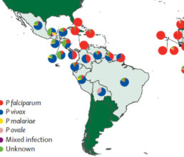
🩺 Guna Yala: A Persistent Hotspot for Malaria in Panama
- • Endemic and persistent region
Though Panama overall has largely eliminated malaria, the Comarca Guna Yala remains a notable persistent focus. Less than 3% of the national population lives there, yet it accounts for nearly 90% of Panama’s malaria cases—primarily from Plasmodium vivax
• Interventions underway The Ministry of Health has piloted expanded use of long‑lasting insecticide‑treated nets, including hammock nets and community health workers equipped with rapid diagnostics and treatment—actively engaging Guna leaders to boost acceptance and effectivenessGuna Yala remains one of the most vulnerable malaria zones in Panama—marked by high levels of asymptomatic infection, entrenched transmission driven by outdoor mosquitoes, and incomplete coverage by prevention measures. However, culturally respectful programs, are now being implemented to tackle these challenges head-on.
THE END OF THR REVOLUTION in BOCAS DEL TORO
- The government lifts the state of emergency in Bocas del Toro;
Security forces have maintained surveillance in Changuinola. EFE/Bienvenido Velasco This was announced by the Secretary General of the Ministry of Public Security, Juan Carlos Rodríguez, during a press conference. In the same appearance, the Director General of the National Police, Jaime Fernández, explained that Operation Omega will continue throughout the country until viability and public order are fully restored nationwide .
Ahoy Posse Friends
We have been quietly healing and still waiting on insurance to respond to our loss of Path finder in French Polynesia. All of you have been in our thoughts especially as we try different types of water therapy to help us look forward. We’re currently staying on our friend’s boat at the Cabrillo Marina in San Pedro, California to feel at home again. We were invited to sail for the start of the TransPac race and even enjoyed exploring the local aquarium to get a glimpse of our beloved ocean neighbors.
We miss all of you and we miss Pathfinder deeply. Grateful to be here to celebrate life in every way.
n i c o l e & j p
YOUTUBE NUGGET :
Tracking a hammerhead shark in the Galapagos reveals a possible migration to Panama to give birth.
Extraordinary Cruising °°° Join the Fleet
- Access vetted local knowledge, safety resources, and prior experiences to make your passage safer and more enjoyable.
- Unlock a Life of Adventure
Explore hidden destinations, experience new cultures, and discover the freedom of life at sea or near shore – on your terms. - Get VIP Perks & Discounts at marinas, chandleries and boatyards
Get exclusive discounts, priority access, and personalized support at partner marinas across the globe. - Observe the actions of Experienced Captains
Tap into a wealth of tips, tools, and real-world know-how from seasoned mariners to grow your skills and gain confidence. - Make Every Nautical Mile Memorable
Join events, meetups, and shared journeys that turn you voyages into unforgettable stories and lasting memories. - Cruise with a Conscience
Gain insights into sustainable practices and join a movement that protects the waters you love to explore.
CRUISING ° FLEET UPDATE & NEWS ° 2025-06-29
“The very basic core of a man’s living spirit is his passion for adventure.
The joy of life comes from our encounters with new experiences,
and hence there is no greater joy than to have an endlessly changing horizon,
for each day to have a new and different sun.”
CRUISING ° FLEET UPDATE & NEWS ⛵ 2025-06-29
-
Pictures Of The Week 📷
-
NW Siciliy 🇮🇹 Italy – Golfo Di Castella to San Vito Lo Capo
-
Midnight Sun 🇳🇴 Voyage from Oslo to Bergen
-
Central South Pacific
 da’ F^&*~’g MIDDLE
 -
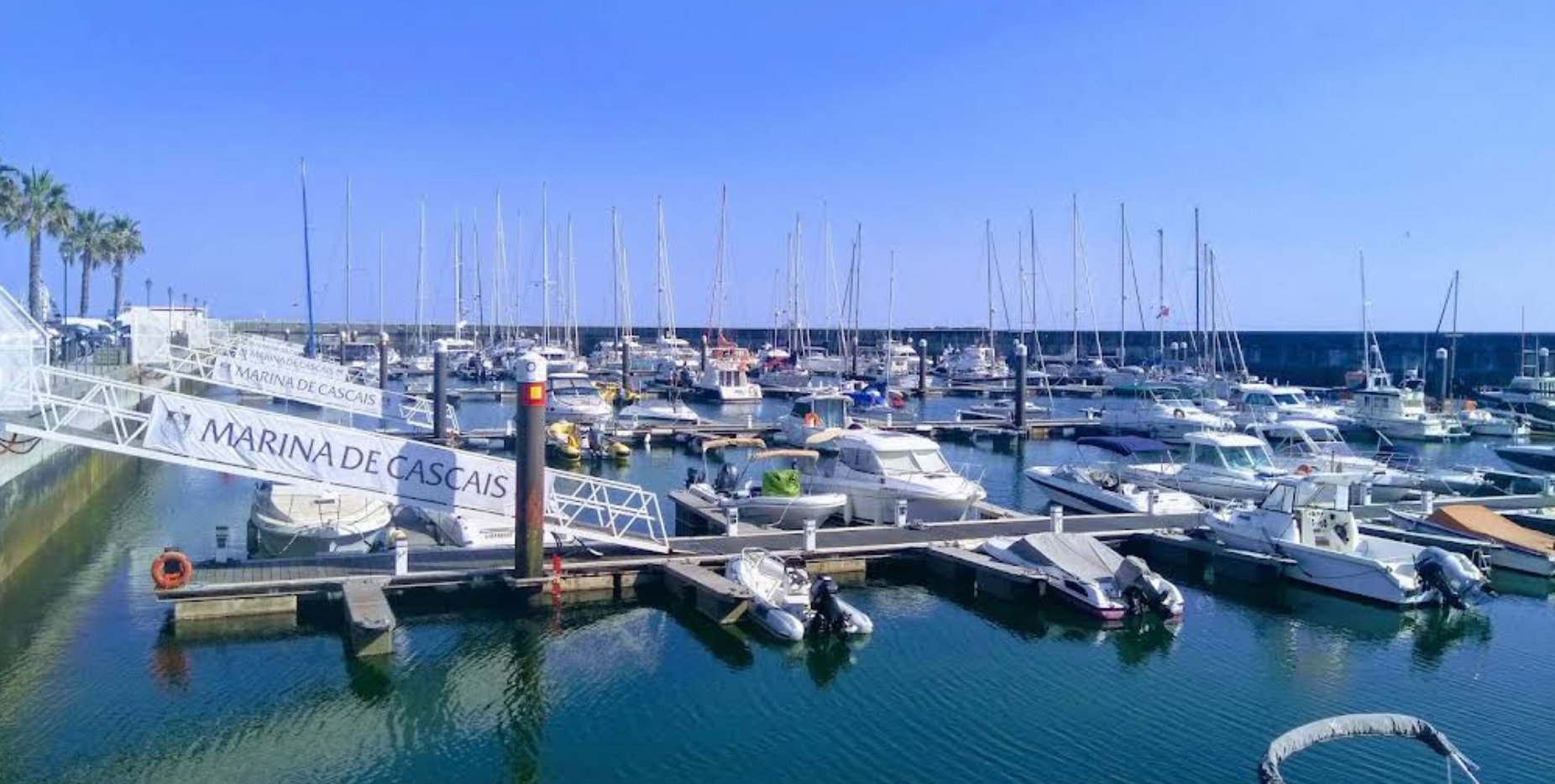
Marina De Cascais
Portugal -
Rare Earth
 Minamitorishima Island
 -
Heiva’i Tahiti 2025
 FRENCH POLYNESIA
 -
Ocean Posse BBQ 🇵🇫 in Tahiti
-
Rogue Waves 🌊
-
SY Galatea ⛵ Ocean Posse Yacht For Sale in Panama
-
Bora 🌬️ Wind
-
Must See 🇲🇽 Sierra De San Francisco Sea Of Cortez
-
Meet the Fleet – SY KNOT RIGHT & MV EPIC
-
Rum & Kava Fiji 🇫🇯 Nawi Island Marina brought to you by the Yacht Sales Co.
-
Noumea Yacht Services

 New Caledonia
 -
💬 Tidbits
-
Dock Party 🎉 Red Frog Marina
-
Petty Thefts 🥷 Bocas del Toro
-
Ocean Posse info strikes again – where is Zuckerberg’s Yacht ?
-
PICTURES OF THE WEEK

Perception at anchor near Lady Liberty yesterday.
SY PERCEPTION Jim & Melinda – Lagoon 42′


Becalmed waters and Nice motoring conditions around Cape Hatteras:
As we pass over about 15 shipwrecks in the area.
Above header image – red skies and a Little color on our ride up to Chesapeake Bay.
MY KOSMOS Eric, Christi & Keith – Nordhavn 43′

Becalmed waters and Nice motoring conditions around Cape Hatteras:
( header image – red skies and a Little color on our ride up to Chesapeake Bay.)
SY KALIYAH Greg & Dieu – Kelly-Peterson 46′

Late sunset over Red Frog Marina yesterday. Starlink’s back! 🙂
SY SERENITY Mark & Kathryn – Antares 44′

check their blog here https://www.sailblogs.com/member/pacificnomads/
SY ILIOHALE
Allan & Rina – Lagoon 45′

NW Siciliy 🇮🇹 Italy Golfo Di Castella to San Vito Lo Capo


Pictures along the way from Mondello, Golfo di Castella and now San Vito lo Capo. North West Coast of Sicily Italy . This place has white sand beach, and I can’t wait to get my feet in it!
SY SMALL WORLD III  Daren & Karen – Bristol 47.7′

Midnight Sun 🇳🇴 VOYAGE FROM Oslo to Bergen


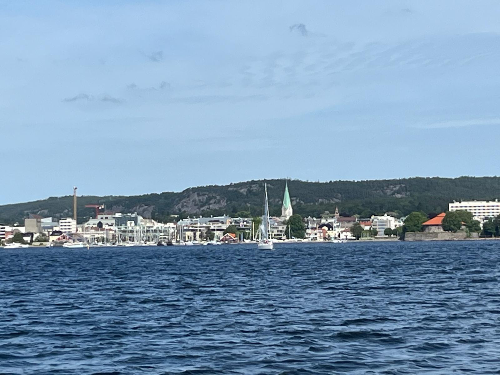


Lucky Chucky and LIsa on their epic voyage up the cost of Norway
MY HO’OKIPA 🇺🇸 Lucky Chukcy & Lisa –Selene 43′


CENTRAL SOUTH PACIFIC 🌐 F^&*~’g MIDDLE🇨🇰 COOK ISLANDS
THE DANGEROUS MIDDLE
Between French Polynesia and Tonga/Fiji lies a notorious stretch of open ocean often called The Dangerous Middle. Unlike the well-defined tradewind routes to the east, this part of the South Pacific is unpredictable, uncomfortable, and occasionally unforgiving. Here’s what makes it challenging:
1. Weather Systems & Pacific Lows
-
Unstable Trade Winds: The reliable SE trades start breaking down in this zone. Expect calms, unexpected shifts, and squalls.
-
Frequent Lows: Every 6-7 days, mid-latitude lows brew in the Tasman Sea and sweep east toward Chile. When they arc north into this area, they can bring gale-force winds, heavy rain, and messy seas.
-
SPCZ Hazards: The South Pacific Convergence Zone is often in play, shifting north or south unpredictably. It’s a factory for squalls, thick cloud, and wind instability—hard to avoid and harder to forecast.
2. Swell Conflicts & Sea State
-
Southern Ocean Swells: Long-period swells from deep south storms frequently reach this area, often crossing the direction of prevailing wind waves.
-
Confused Seas: The clash of south swells and east wind waves creates short-period, choppy conditions that can wear down crew and gear. Forecast models often fail to show the true state of the sea.
3. Route Planning & Strategy
-
Timing Is Everything: May to October offers the most stable trades and the fewest lows pushing north.
-
Weather Routing Required: This is not a set-it-and-forget-it passage. Real-time updates, weather routers, or tools like Starlink and PredictWind can help you dodge the worst.
-
Latitude Choice: Some head north near the equator to avoid the SPCZ, others drop south around 20°S for more consistent trades. Either way, flexibility is key – and plenty of diesel to motor through the calms.
Seafarers can be challenged by this leg of a Pacific crossing but with timing, it’s manageable. Most choose to break it up with stops in places like Suwarrow (Cook Islands) as you enter from the north pass it is doable in most conditions.
Aututaki, Beverage Reef or Niue, require good weather windows. You have 300 – 600 nm legs to do between each low passes you on the bottom – the further north you voyage the more settled the wave and conditions will be.
Beneath The Dangerous Middle runs a weekly a conveyor belt of powerful low-pressure systems
It moves from the west to east across the Southern Ocean. These lows form primarily in the Tasman Sea and roll out under New Zealand every 6 to 7 days, heading toward Chile. Their path may seem distant on the chart, but the long-period swell trains they produce don’t respect boundaries and even creates treacherous conditions for the bar entries in El Salvador.
( See KNOT RIGHT’S image in meet the the fleet)
• Southern Ocean Storm Tracks: These lows generate gale force winds over vast fetches, pushing up deep, energy-rich swells. Even if the center of the low stays far far south in the 40-and 50’s , the swell propagates thousands of miles northward into the tropical South Pacific – and all the way to provide surf in Cost Rica and Panama.
• Arrival in the Middle: By the time these swells reach the region between French Polynesia and Fiji/Tonga, they’re typically 2–4 meters and still packing long periods – 12 to 20 seconds isn’t uncommon. When they meet opposing wind waves from easterly trades or squalls from the SPCZ, the sea state becomes disorganized and steep.
• Confused Cross-Seas: Add a second swell from another direction, and you’ve got a 3-way sea: trade chop, south swell, and remnants of a prior system. Not dangerous in isolation—but relentless in motion, tiring for crew, and hard on autopilots and rigging.
• Routing Tip: GRIB files show wind and pressure, but not always the full picture of cross-swells. Use swell overlays and regional models (e.g. FNMOC or WW3) to spot these long-period pulses before they arrive.

MARINA DE CASCAIS PORTUGAL
SPONSORS THE OCEAN POSSE
38° 41.5466′ N 009° 24.935′ W

Marina Cascais has been the setting for some of the most important sailing events in the world.
We are proud to offer a special 15 % discount to all the Ocean Posse recipients.
Reservations must be made with advance so that we can check availability with time.
CONTACT
Marina de Cascais
Casa de S. Bernardo, 2750-800 Cascais
T (+351) 214 824 800
E info@marinacascais.pt
E reception@marinacascais.pt
Reception Hours Winter 9:00 – 18:00
Reception Hours Summer 08:30 – 20:00
T (+351) 214 824 800
F (+351) 214 824 860
SERVICES
- Fuel Dock
- Restaurants
- Catering
- Automatic Laundry Facilities
- Showers
- Heliport
- Wifi
- Mail & Receiving of correspondence
- 70 Ton Gantry Crane
- 2 Ton Crane
- Ramp
- Hull cleaning
- Trailers
- Jet ski package
- Dry docking
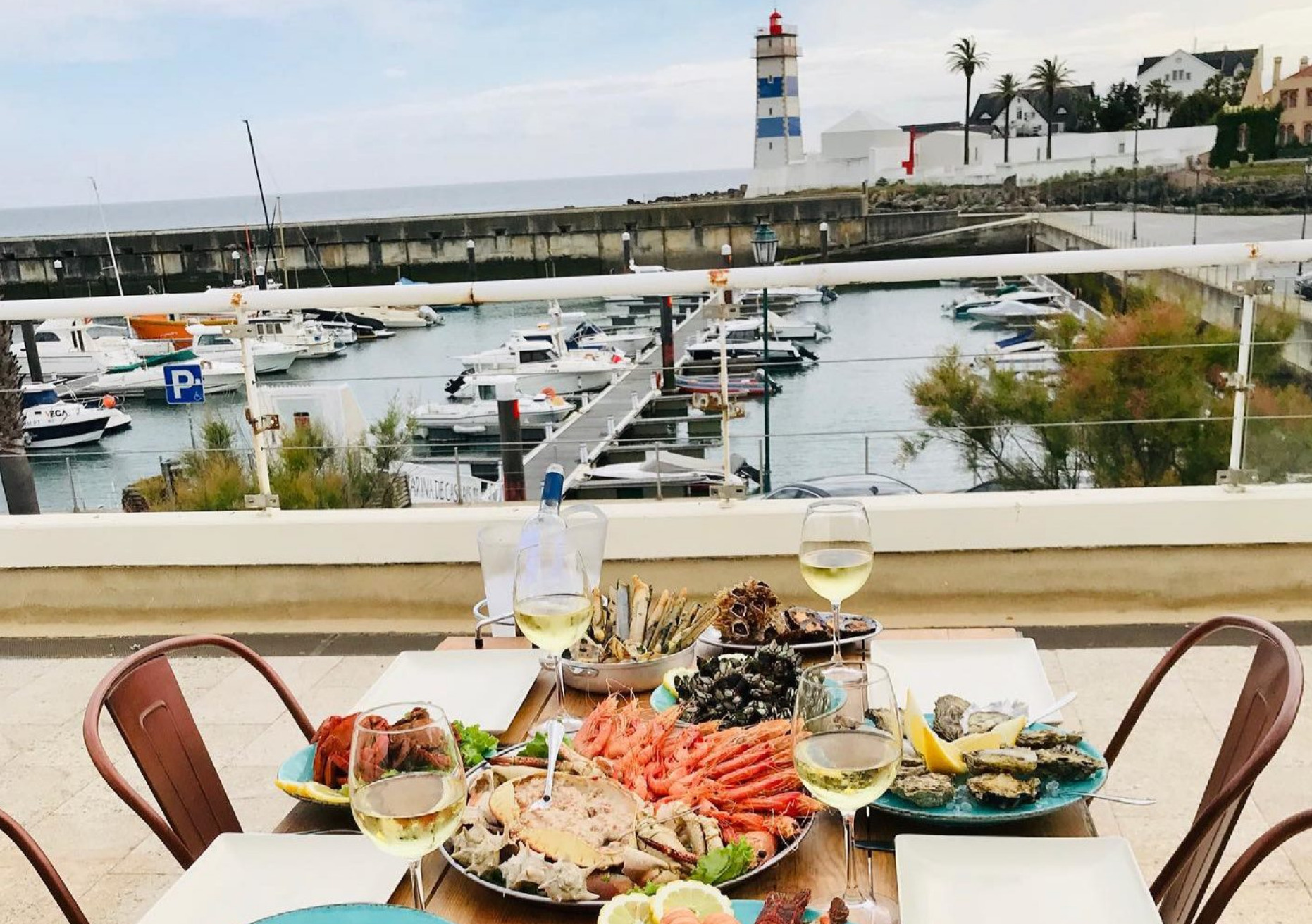
NEARBY MUST SEE
1. Boca do Inferno (Hell’s Mouth)
A dramatic seaside cliff formation where waves crash into a natural chasm. Spectacular in rough weather, it’s a favorite for photographers and sea-watchers.
2. Santa Marta Lighthouse & Museum
Just steps from the marina, this 19th-century lighthouse now includes a museum with maritime exhibits and stunning views from the tower.
3. Cascais Citadel (Cidadela de Cascais)
A historic fortress overlooking the marina, now home to an art center, restaurants, and a boutique hotel. Great for a sunset walk.
4. Palácio da Cidadela
Located within the citadel, this former royal summer residence is now a museum showcasing Portugal’s regal past.
5. Condes de Castro Guimarães Museum
A fairytale-style palace by the sea, filled with antiques, artwork, and a rich library. The surrounding gardens are perfect for a quiet stroll.
6. Casa de Santa Maria
A charming early 20th-century villa with tilework and period interiors. Guided tours give insight into Cascais’ aristocratic era.
7. Cascais Beaches: Praia da Rainha, Ribeira, Duquesa & Conceição
These small, sandy beaches are steps from the marina and ideal for a swim, SUP, or just sunning with a view of anchored yachts.
8. Seafront Promenade to Estoril (Paredão)
A beautiful 3 km coastal path perfect for walking or biking past beaches, tidepools, and cafés all the way to Estoril.
9. Guincho Beach & Cabo Raso
About 10 km west, this wilder coastline is famous for windsurfing, kitesurfing, and dramatic Atlantic views. Great by e-bike or rental car.
10. Poço Velho Prehistoric Caves
A lesser-known archaeological site right in town, offering a glimpse into Cascais’ ancient past through guided visits of the burial caves.

ON THE SUBJECT OF RARE 💎 MATERIALS

Minamitorishima Island 🇯🇵 Japan
24° 16.9360′ N 153° 58.6173′ E
Minamitorishima or Marcus Island is a tiny, triangular coral atoll belonging to Japan- the easternmost point of the country- located in the northwestern Pacific about 1000 nm southeast of Tokyo
🗺️ Geography & Strategic Status
• Shape & Size: Roughly equilateral triangle, covering 370 acres with a 3.5 nm coastline. It lies directly on the Pacific Plate beyond the Japan Trench
• Elevation & Reef: Flat, sitting 5–9 m above sea level with a sunken central depression. Surrounded by fringe reefs and deep contrast waters plunging ~1,000 m below
Under Japan’s jurisdiction, it anchors a massive exclusive economic zone
.
🏛️ History & Human Use
• Early Sightings: First recorded by a Spanish captain in 1543, sighted again in 1864 by a Hawaiian missionary ship, and marked by American and French surveyors later in the 19th century
• WWII: Militarized by Japan, bombed during 1942–43, and surrendered in 1945 after U.S. naval attacks
• Post-war Control: Handed to U.S. in 1952, returned to Japan in 1968. Hosted U.S. Coast Guard LORAN‑C station (1964–93), now supports Japanese meteorological, JSDF, and coast guard operations
🚀 Modern Significance
• Access: No civilian access; staffed by Japan Meteorological Agency, Self-Defense Forces, and Coast Guard on rotations
• Research: Recent seabed surveys revealed rich polymetallic nodules in the EEZ- containing nickel, cobalt, copper- attracting deep‑sea mining interest

A 2018 study (University of Tokyo and JAMSTEC) revealed extremely high concentrations of rare earth elements in deep-sea mud about 6,000 meters below the ocean surface near Minamitorishima.
Over 16 million tons of rare earth oxides.
Enough to supply global demand for yttrium, europium, terbium, and dysprosium for hundreds of years.
🧭 Why It Matters:
These rare earth elements (REEs) are crucial for:
High-efficiency magnets (used in electric vehicles and wind turbines)
Smartphones, electronics, optics, lasers
Defense systems (missile guidance, sonar)
🌐 Strategic Implications
China controls ~90% of the world’s REE supply chain. Japan seeks to reduce dependency by tapping its own resources- Minamitorishima is key to that.
• The island’s EEZ (430,000+ km²) gives Japan exclusive rights to explore and extract.

Heiva i Tahiti 2025 🎉 FRENCH POLYNESIA

🎭 Heiva i Tahiti – Competitions & Cultural Interpretations
🔥 Dance Competitions (‘Ori Tahiti)
Main Divisions:
-
Hura Tau: Professional dance troupes, often over 100 dancers, delivering powerful performances with elaborate staging and intense choreography.
-
Hura Ava Tau: Amateur ensembles focused on grace, storytelling, and traditional themes, though still highly polished.
Core Dance Styles:
-
‘Ōte’a: High-energy group dance featuring rapid hip movements and synchronized percussion. Themes often depict war, navigation, harvest, or nature.
-
Aparima: Slower, graceful dance emphasizing hand gestures that narrate love stories or myths—comparable in tone to hula.
-
‘Ahupūrotu: Characterized by detailed, layered costumes and elegant movement. Often used to convey deeper, ceremonial messages.
-
Hivinau: A circular formation dance performed around musicians. Typically used to open or close a performance, referencing community unity and the sea.
Performance Flow:
Each troupe develops a full-length narrative expressed through movement, percussion, costume, and chant. Judging focuses on creativity, authenticity, expression, and cohesion across music, costume, choreography, and staging.

🥏 Traditional Sports
Often dubbed the “Polynesian Olympics,” Heiva’s sports segment—called Heiva Tu’aro Mā’ohi—features:
• Stone-lifting
• Javelin throwing
• Ou-trigger canoe (va’a) races around Pointe Venus and Papeete waters
• Coconut climbing and cracking
• Horse racing, spear throwing, fire-walking, fruit-lifting contests

🎙️ Interpretation & Cultural Resonance
• Heiva derives from hei (“assemble”) and va (“community”), making it a “celebration of life” and cultural unity
• Performances weave together ancient Polynesian values, legends, language, and heritage—ostensibly ritualistic, yet fiercely modern and evolving
• Groups and soloists undergo months of intense rehearsal (thousands of hours each year), reflecting both discipline and devotion .
• While debate exists about tourism’s influence, many Tahitians see Heiva as a vital vessel for preserving and celebrating living traditions

OCEAN POSSE BBQ MEET UP 🔥
MARINA TAHINA 🇵🇫 TAHITI
SAT JUL 12 15:00 – 18:00
Captain Alan of SY Cyrolia and Marina Tahina are hosting an impromptu BBQ this Sunday at Marina Tahina. 🧭 Bring Your finest grill-worthy protein anda side dish or treat to share with the fleet
🍹 Free Rum will be provided for all
SY CYROLIA Allan Jeanneau 52
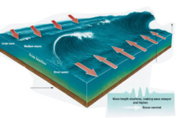
Rogue Waves 🌊 AN Overview
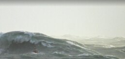
1. What Is a Rogue Wave?
A rogue wave is an unusually large and unexpected ocean wave that is more than twice the height of the surrounding waves. These waves appear suddenly and in extreme cases have reached heights exceeding 25 meters, posing risks to even larger ships and offshore structures.
2. How Rogue Waves Form
a) Constructive Interference
When several smaller waves traveling at different speeds and directions intersect, their crests can align, temporarily forming one much larger wave. This phenomenon is random and not sustained, but it explains many rogue wave events.
b) Nonlinear Focusing
In certain sea conditions, wave energy can be transferred between waves in a way that one wave becomes sharply amplified. This is described by nonlinear wave theories that show how energy can become concentrated in a single, massive crest.
c) Wind Amplification
Strong and persistent winds can add energy to existing waves, boosting their size. When wind and wave direction align for long distances (fetch), significant wave height increases, creating conditions ripe for rogue wave formation.
d) Current Focusing
Rogue waves are more likely in areas where waves meet strong opposing currents. The interaction causes the waves to slow down and steepen, compressing their wavelengths and increasing their height. This is commonly observed in places like the Agulhas Current off South Africa.
3. How Rare Are They?
Rogue waves were once thought to be maritime myths, but they are now recognized as real and surprisingly frequent. Modern satellite and buoy data show they can occur more often than previously assumed. Notable examples include a 25.6-meter wave off Norway and a 17.6-meter wave recorded off the coast of British Columbia.
4. Why They Matter
Rogue waves are extremely powerful and unpredictable. Their steep walls and deep troughs exert immense force on structures, often exceeding what vessels are designed to withstand. Ships may encounter such waves without warning, and offshore platforms must be engineered to handle the potential impact.
5. Can We Predict Them?
While full prediction remains a challenge, progress is being made. Advances in satellite imaging, wave modeling, and artificial intelligence are helping scientists identify ocean regions with elevated rogue wave risk. Key factors being monitored include:
• Areas with strong, opposing currents
• Rapid weather changes
• Convergence zones and long wave fetches
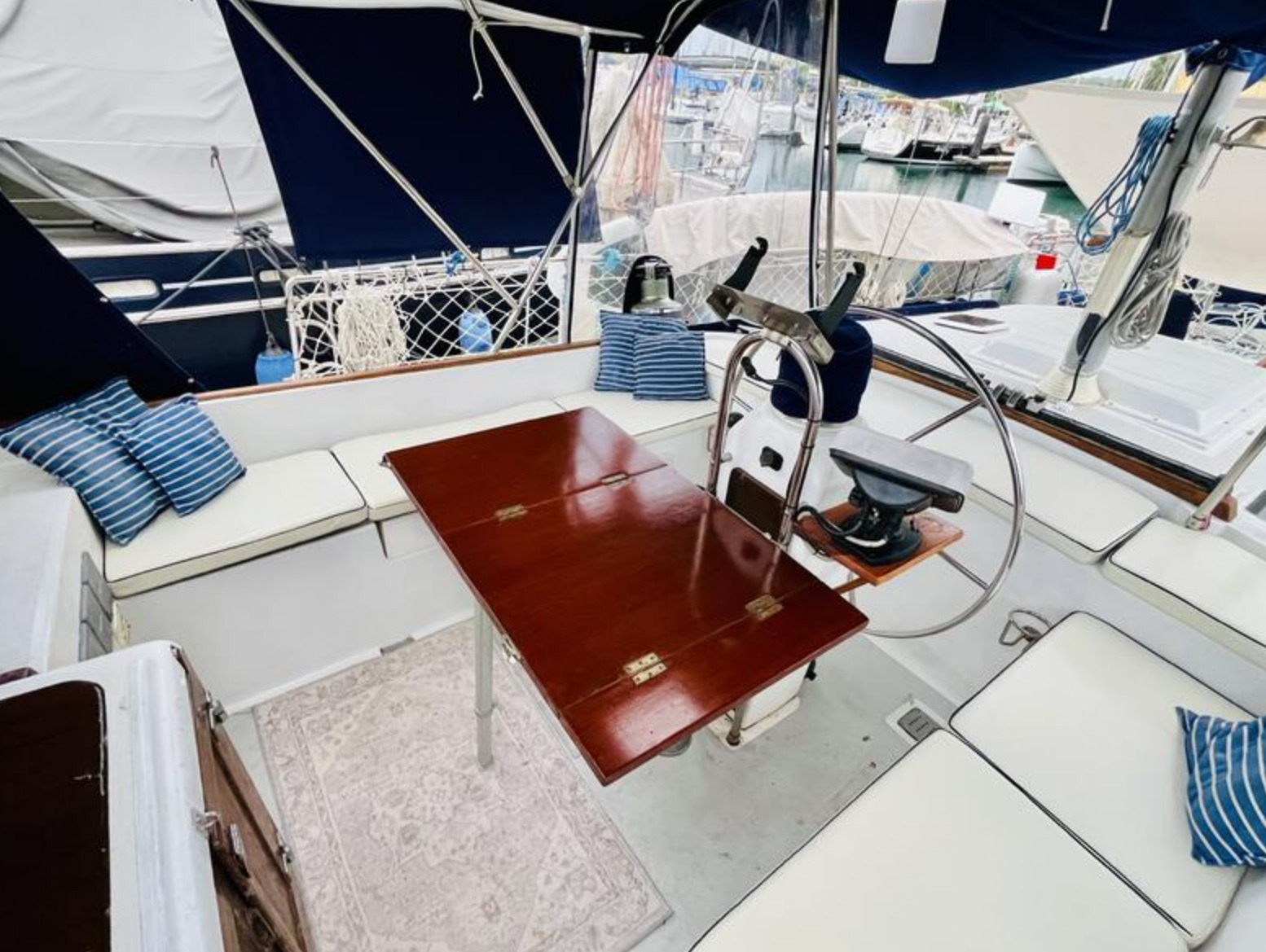
OCEAN POSSE YACHT FOR SALE 🇵🇦 PANAMA
SY 🇺🇸 GALATEA – 1982 MorgaN 462 KETCH
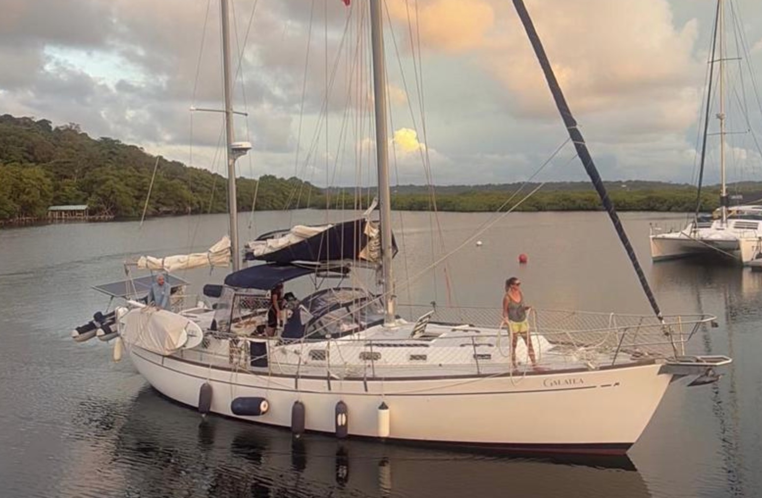
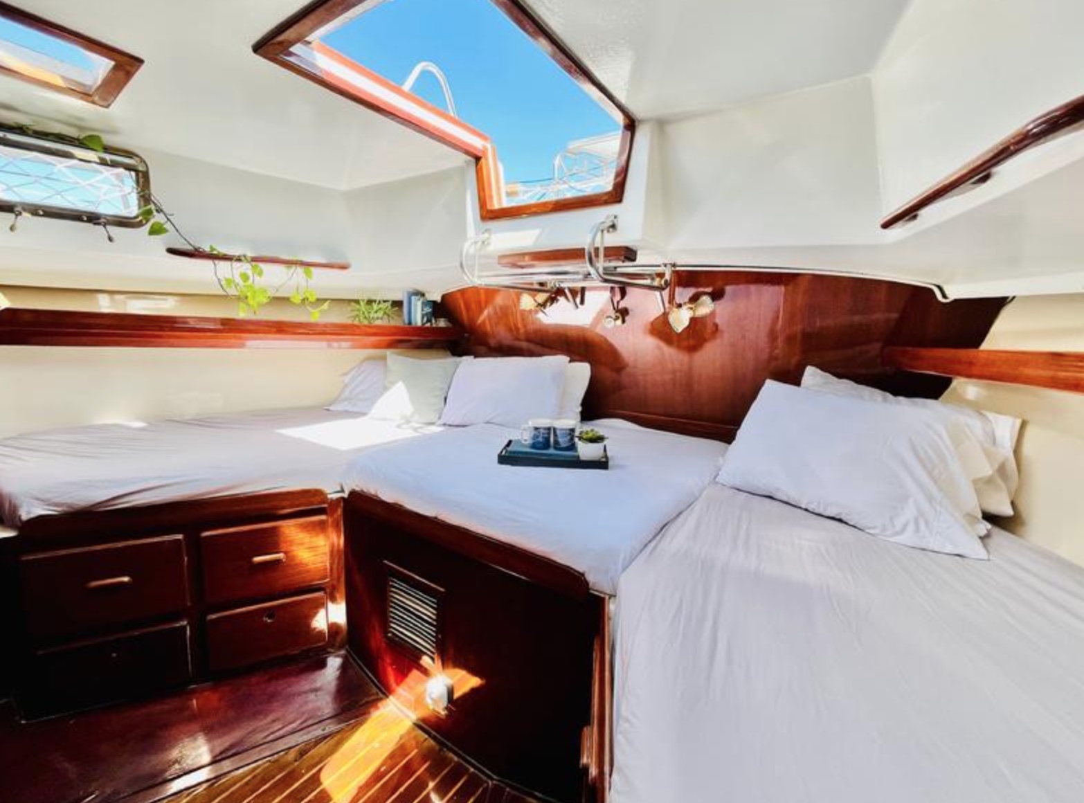
$114,500 Fully Loaded
Offered for sale is a beautifully upgraded NEW PRICE FOR A SUMMER SALE and currently cruising, this Morgan 462, a center-cockpit, world-capable cruiser renowned for her strength, comfort, and versatility, is waiting for you to sea trial.
Step aboard the lovely refit yacht with its perfect blend of classic design and modern upgrades. Designed by Charley Morgan and built for serious offshore cruising, this center cockpit cutter rigged ketch is known for her robust construction, spacious interior and impressive passage making capabilities.
This yacht has undergone extensive refits and modernization, making her an exceptional choice for bluewater sailing or liveaboard life. Her two cabin design with port side extra settee make a comfortable boat for a family or a couple.
Click here for details >>
OCEAN POSSE PARTNERSHIP MARINAS
🇦🇺 AUSTRALIA
🇧🇸 BAHAMAS
- Browns Marina
- Elizabeth on the Bay Marina
- Blue Marlin Cove Resort & Marina
- Great Harbour Cay Marina
- Romora Bay Resort and Marina
🇧🇿 BELIZE
🇧🇲 BERMUDA
🇧🇷 BRAZIL
🇻🇬 BRITISH VIRGIN ISLANDS
🇨🇻 CAPE VERDE
🇰🇾 CAYMAN ISLANDS
🇨🇱 CHILE
🇨🇴 COLOMBIA – Caribbean
- Club Nautico Cartagena
- Club de Pesca Marina Cartagena
- Marina Puerto Velero
- IGY Marina Santa Marta
- Manzanillo Marina Club
🇨🇷 COSTA RICA – Pacific Coast
🇨🇺 CUBA
🇩🇲 DOMINICA
🇩🇴 DOMINICAN REPUBLIC
🇪🇨 ECUADOR
🇸🇻 EL SALVADOR
🇬🇮 GIBRALTAR
🇬🇩 GRENADA
🇬🇵 GUADELOUPE
🇬🇹 GUATEMALA – Pacific Coast
🇬🇹 GUATEMALA Rio Dulce
🇫🇯 FIJI
- Copra Shed Marina
- Nawi Island Marina
- Denarau Marina
- Musket Cove
- Royal Suva Yacht Club
- Sau Bay Moorings
🇭🇳 HONDURAS – Bay of Islands – Roatan
🇮🇹 ITALY
- Marina dei Presidi
- Marina di Balestrate
- Marina di Brindisi
- Marina di Cagliari
- Marina di Chiavari
- Marina di Forio
- Marina di Teulada
- Marina di Policoro
- Marina di Vieste
- Marina de Procida
- Marina de Villasimius
- Marina di Vieste
- Marina Molo Vecchio
- Marina Salina
- Venezia Certosa Marina
🇯🇲 JAMAICA
🇲🇶 MARTINQUE
🇲🇽 MEXICO – Caribbean
- Marina Makax – Isla Mujeres
- Marina Puerto Aventuras
- Marina V&V – Quintana Roo
- Marina El Cid – Cancún
🇲🇽 MEXICO – Pacific Coast
- ECV Marina – Ensenada BC
- IGY Marina Cabo San Lucas BCS
- Marina Palmira Topolobampo – SI
- Marina y Club de Yates Isla Cortes – SI
- Marina el Cid – Mazatlan – SI
- Marina Vallarta, Puerto Vallarta – JA
- Marina Puerto de La Navidad – Barra de Navidad – CL
- Marina Ixtapa, Ixtapa – GE
- La Marina Acapulco, Acapulco – GE
- Vicente’s Moorings, Acapulco – GE
- Marina Chiapas – CS
🇳🇿 NEW ZEALAND
🇳🇮 NICARAGUA – Pacific Coast
🇳🇺 NIUE
🇵🇦 PANAMA – Pacific Coast
🇵🇦 PANAMA – Caribbean
- Shelter Bay Marina
- Bocas Marina
- Solarte Marina
- Linton Bay Marina /a>
- Turtle Cay Marina
- IGY Red Frog Marina
🇵🇹 PORTUGAL
🇵🇷 PUERTO RICO
🇱🇨 SAINT LUCIA
🇸🇽 SINT MAARTEN
🇪🇸 SPAIN
- Alcaidesa Marina
- IGY Málaga Marina
- Marina Del Odiel
- Nautica Tarragona
- Puerto Sotogrande
- Yacht Port Cartagena
🇰🇳 ST KITTS & NEVIS
🇹🇳 TUNISIA
🇹🇴 TONGA
🇹🇨 TURCS AND CAICOS
🇻🇮 US VIRGIN ISLANDS
🇺🇸 USA – East Coast
- Safe Harbor – Marathon, FL
- Pier 66 Hotel & Marina – Ft. Lauderdale, FL
- Titusville Marina – FL
- Port 32 Marina Jacksonville – FL
- Oasis Marinas at Fernandina Harbor Marina – FL
- Morningstar Marinas Golden Isles St. Simons Isl. – GA
- Windmill Harbour Marina – Hilton Head , SC
- Coffee Bluff Marina – Savannah GA
- Hazzard Marine – Gerogetown, NC
- Holden Beach – Town Dock, NC
- Tideawater Yacht Marina, Portsmouth, VA
- Ocean Yacht Marina, Portsmouth, VA
- York River Yacht Haven – VA
- Yorktown Riverwalk Landing – VA
- Regatta Point Marina – Deltaville, VA
- Regent Point Marina – Topping, VA
🇺🇸 USA – Pacific Coast
- Safe Harbor Ventura Isle, Ventura CA
- Vintage Marina , Oxnard, CA
- Safe Harbor South Bay – Chula Vista, CA
🇻🇺 VANUATU
Primary Named Winds in the Mediterranean 🌬️BORA
| Wind Name | Direction | Temperature | Notes |
Bora |
NE | Cold & dry |
Katabatic wind, especially violent in N Adriatic; sudden gusts, winter stronger.
|
The Major Bora Wind Funnels Areas in the Adriatic
1. Southern Gulf of Trieste
2. Bay of Rijeka with the Kvarner Gulf
3. Coastline of Senj and the strait between Krk and Prvić
4. Velebit Channel between the eastern coast of Rab and Jablanac
5. Šibenik to Cape Ploča
6. Vrulje Bay between Omiš and Makarska
7. Northwest exit of the Mljetski Channel
The Bora is one of the most infamous winds in the Mediterranean — especially for sailors in the Adriatic Sea, and particularly along the coast of Croatia, Slovenia, and NE Italy. Here’s a breakdown of its effects on sailing:
🌬️ Bora Wind – Quick Facts
-
Direction: Blows from the northeast (NE) — offshore in most of the Adriatic.
-
Temperature: Cold and dry, especially in winter.
-
Origin: A katabatic wind, meaning it funnels down from high elevations (like the Dinaric Alps) and accelerates downhill toward the sea.
⛵ Effects on Sailing
✅ Advantages (if timed carefully):
-
Great downwind sailing from NE to SW if you’re headed south along the Adriatic.
-
Clear skies and visibility often accompany it once the wind stabilizes.
-
Flat seas may briefly appear at onset — before wave build-up begins.
⚠️ Risks & Challenges:
-
Sudden onset… the Bora can go from 5 knots to 45+ knots in minutes.
-
Gusts over 60 knots are not uncommon near Trieste, Senj, and Velebit Channel.
-
Dangerous crosswinds when sailing parallel to the coast, especially for boats exiting or entering harbors.
-
Short steep waves build up quickly in open water and become very uncomfortable and hazardous.
-
Anchor dragging is a common hazard; the wind can blow straight offshore and expose poor holding.
⚓ Strategy
-
Shelter on the lee side of islands or in well-protected harbors with NE protection.
-
Use Bora forecasts: many services (e.g., Croatia’s met service) provide alerts.
-
Secure anchorage with extra scope, especially in exposed NE-facing bays.
-
Avoid passages from Italy to Croatia (upwind slog ) during a strong Bora.
MUST SEE IN THE SEA OF CORTEZ 🇲🇽 MEXICO

Rock Paintings of the Sierra de San Francisco 🇲🇽
From c. 100 B.C. to A.D. 1300, the Sierra de San Francisco (in the El Vizcaino reserve, in Baja California) was home to a people who have now disappeared but who left one of the most outstanding collections of rock paintings in the world. They are remarkably well-preserved because of the dry climate and the inaccessibility of the site.
The central part of Baja California peninsula is a region of Mexico that concentrates one of the most extraordinary repertoires of rock art in the country, the Rock Paintings of the Sierra de San Francisco. The region is insular-like and kept the native peoples relatively isolated from continental influences, allowing the development of local cultural complex. One of the most significant features of the peninsular prehistory is the mass production of rock art since ancient times and the development of rock art tradition of the Great Murals.

The Sierra de San Francisco is the mountain range which concentrates the most spectacular and best preserved Great Mural sites, scale wise one of the largest prehistoric rock art sites in the world. Hundreds of rock shelters, and sometimes huge panels with hundreds and even thousands of brightly painted figures, are found in a good state of conservation. The style is essentially realistic and is dominated by depictions of human figures and marine and terrestrial fauna, designed in red, black, white and yellow, which illustrate the relationship between humans and their environment, and reveal a highly sophisticated culture. The paintings are found on both the walls and roofs of rock shelters in the sides of ravines that are difficult of access. Those in the San Francisco area are divided into four main groups – Guadalupe, Santa Teresa, San Gregorio and Cerritos. The most important sites are Cueva del Batequì, Cueva de la Navidad, Cerro de Santa Marta, Cueva de la Soledad, Cueva de las Flechas and Grutas del Brinco.
The landscape of the area is another significant attribute, understood as the extensive physical space in which, through rock art, the thoughts of their early dwellers, hunter-gatherers people who living here from the terminal Pleistocene (10,000 BP) until the arrival of Jesuit missionaries in the late seventeenth century, are expressed.North of San Ignacio lies a mountain wilderness, the deeply eroded remains of layer upon layer of volcanic outpourings. This rugged mass rises from the surrounding desert to heights of more than 5,000 feet and covers an area 35 miles from north to south and half of that from east to west. From its uplands, there are views west to Scammon’s Lagoon and the Vizcaíno Desert, northwest to the even taller Sierra de San Borja, and east to the abrupt eminences of Las Tres Vírgenes, taller and more recent volcanos that tower in front of the Gulf. The sierra embraces a world that would never be suspected from the low, barren lands outside. Groves of palms and pools of water are set between walls of vertical grandeur water-carved from rich-colored rock. A few ranches, built by rustic and hospitable people, nestle near the few water sources. Here also are the grandest reminders of the Painters, corridors decorated by their hands and haunted by their spirits.

Showing human figures and many animal species and illustrating the relationship between humans and their environment, the paintings reveal a highly sophisticated culture. Their composition and size, as well as the precision of the outlines and the variety of colors, but especially the number of sites, make this an impressive testimony to a unique artistic tradition.
ROCK ART ON A LARGE SCALE
The Rock Paintings of the Sierra de San Francisco encompass an area of 183, 956 ha, where more than 400 sites have been recorded, the most important of them within the reserve, near San Francisco and Mulege, over 250 in all. The inscribed property contains an exceptional repertoire of rock art that convey its Outstanding Universal Value. The sites have remained virtually intact and still have a good state of conservation. The integrity of rock painting sites and their surroundings has been maintained largely due to the situation of isolation and the low population density that prevails in the region.
Protection and management requirements
The Rock Paintings of the Sierra de San Francisco are protected by the 1972 Federal Law on Historic, Archaeological and Artistic Monuments and Zones and fall under the protective and research jurisdiction of National Institute of Anthropology and History (INAH). In addition, the property is entirely within the Vizcaino Biosphere Reserve; which grants it with additional protection. The Management Plan has been in operation since 1994 and has proved a successful strategy in the administration of cultural resources of the property. This model emphasizes the importance of defining the meaning of this heritage site, so that all management strategies are consistently directed toward the preservation of the values that make it important. Another key feature is the total involvement of all those groups that have an interest in the area under discussion. The Management Plan focuses on issues such as mitigation of the impact of visitors on sites and control and monitor of access. Some measures included the installation of reversible infrastructure in seven of the most visited rock painting sites and the definition of authorized access paths, the areas open to the public or restricted, and four levels of access for tourists. This system allows visitors to experience a wide range of sites and at the same time protects the majority of those who are very well preserved. In this sense the most popular sites have remained open under this Management Plan. Threats remain that have to be addressed, including those derived from the proposals to construct roads within the protected area which would jeopardize the existing integrity between the landscape and the rock art sites.

The medium and long term management expectations include obtaining additional legal protection through the presidential declaration of the area; allocating permanent custodian positions to improve monitoring, enhance the administrative and technological infrastructure of Sierra de San Francisco Information Unit located in San Ignacio town, capacity building for the custodians and guides and improvement of low-impact infrastructure for services.


more at https://www.bradshawfoundation.com/baja/great_mural_styles/index.php
MEET THE FLEET SY KNOT RIGHT
Walt & Jeariene
Current Location: Red Frog Marina, Bocas del Toro, Panamá
Vessel Name: SV Knot Right
Backstory: Walt’s daughters coined the name—claiming he’s “not right”—and the pun stuck. The name reflects both the humor and the freedom-loving spirit aboard.
A Call to the Sea
Both Walt and Jeariene were drawn to the cruising lifestyle through fond memories of earlier sailboat charters. For Jeariene, it’s the thrill of adventure and unknown horizons; for Walt, it’s about the sense of freedom that only open water can bring. What started as a pastime became a way of life, one that changes your perspective, with every calm stretch and every sudden squall.
“The sea teaches you quickly. One moment you’re sailing smooth, the next you’re in confused seas—it’s a mirror of our chaotic world,” Walt reflects.
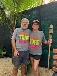
Moments That Shift the Soul
They’ve both experienced defining moments offshore. For Walt, it was the surprise of shifting conditions that made him see just how unpredictable and raw the world can be. For Jeariene, the magic was quieter but no less powerful: watching dolphins swim beside the hull at night, lighting up the water with bio-luminescence.
“That glow reminded me, we’re caretakers of this planet. And we’d better not screw it up.”
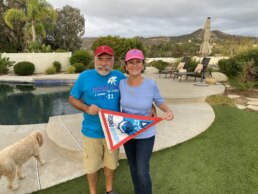
Lessons Learned & Horizons Ahead
Living aboard Knot Right has brought its share of surprises. Walt laughs: “Everything on your boat is broken, you just haven’t found it yet.” The biggest lesson? Stay humble, stay alert, and keep moving forward.
The duo still has their eyes on the rest of the Caribbean, and their favorite destination is “TBD.” That’s the beauty of it, Knot Right isn’t just a name. It’s a reminder that sometimes the best course is the one not yet charted.
OP NOTE: Knot Right is part of the Original Gangsters and has been part of the Ocean Posse since the first Panama Posse t-shirt was printed back in 2017

SOFT LAUNCH: OCEAN POSSE MERCHANDISE
MEET THE FLEET MV EPIC
Marco & Karen
Current Location: PNW, Alaska.
Vessel Name: Epic
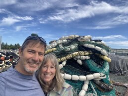
We were both born with an extra fin — or at least it feels that way. The sea has always called to us, and taking on the cruising life wasn’t so much a decision as it was an inevitability. It’s shaped how we see the world, stripped away the noise, and let us focus on what matters: the adventure, the simplicity, and the connection that comes from sharing it all together.
Right now, we’re sailing through the Pacific Northwest and Alaska — a place that still feels raw and untamed. But one of the most powerful moments we’ve ever experienced was much farther south, watching the sun sink into the horizon from the flybridge at Shroud Cay in the Exumas. That sunset — unhurried and immense — reminded us how small we are and how vast the world remains.
Cruising has taught us a lot, often the hard way. Like the time we were way off the beaten path and realized we didn’t have duck bills for the head. You learn quickly how the smallest things can turn into real problems out here. Still, the trade-off is worth it. We’ve crossed canals, rivers, and oceans, and every place has offered something: a lesson, a laugh, or a local who left an impression just by taking the time to connect. We try to do the same — to be present, to offer help, and to always say hello.
Our chart is far from full. Mexico, Panama, and maybe beyond — east, west, or south — all still lie ahead. So far, we’ve completed the Platinum Loop, navigated the Erie Canal, the Great Lakes, and the river systems three times. We’ve crossed the Gulf of Mexico, transited Lake Okeechobee, followed the Hudson River, and made our way through the Chambly, Richelieu, Saint Lawrence, Ottawa, Rideau, and Trent-Severn Canals. We’ve explored the Georgian Bay, North Channel, and the Bahamas. We’ve run the Inside Passage, the Gulf of Alaska, the Aleutian Chain, Semisopochnoi Island, False Pass, the Bering Sea, and the Pribilofs — even Dutch Harbor to Newport, Oregon.
And somehow, with all of that behind us, we still feel like we’re just getting started.
SOUTH PACIFIC POSSE – MEET THE CRUISING FLEET – SAT AUG 30 – NAWI ISLAND MARINA
-
15:00 YACHT MARKET OVERVIEW FOR BUYERS AND SELLERS PRESENTED BY
THE YACHT SALES CO -
15:30 THE PASSAGE TO NEW ZEALAND – PRESENTED BY OCEAN TACTICS
-
16:00 MEET AND MINGLE AND FREE RUM
-
17:00 LET THE FEAST BEGIN …
-
19:00 KAVA AND RUM AFTER HOURS
OFFICIAL OCEAN POSSE EVENTS
ANNAPOLIS BOAT SHOW 🇺🇸 MARYLAND USA
ANNAPOLIS, Annapolis Town Dock Booth VB 9
OCEAN POSSE 🇺🇸 SAN DIEGO BAY 4 DAY CRUISING SEMINARS SERIES @ SAFE HARBOR SOUTH BAY
SAFE HARBOR SOUTH BAY EVENT CENTER, CHULA VISTA, SAN DIEGO, CA
OCEAN POSSE KICK OFF 🇲🇽 BARRA DE NAVIDAD, MEXICO December 3-7 2025
MARINA PUERTO DE LA NAVIDAD, BARRA DE NAVIDAD, MEXICO
OCEAN POSSE & BEN TAYLOR STREET PARTY @ CANNES 🇫🇷 YACHTING FESTIVAL
TAQUERIA LUPITA, 72 Rue Meynadier, Cannes
GRAND PAVOIS 🇫🇷 La Rochelle – Sep. 24 2025
Gran Pavois La Rochelle, 20 Av. de la Capitainerie, 17000 La Rochelle, France
GRAND PAVOIS 🇫🇷 La Rochelle – Sep. 24 2025
Gran Pavois La Rochelle, 20 Av. de la Capitainerie, 17000 La Rochelle, France
GRAND PAVOIS 🇫🇷 La Rochelle – Sep. 24 2025
Gran Pavois La Rochelle, 20 Av. de la Capitainerie, 17000 La Rochelle, France
GRAND PAVOIS 🇫🇷 La Rochelle – Sep. 24 2025
Gran Pavois La Rochelle, 20 Av. de la Capitainerie, 17000 La Rochelle, France
GRAND PAVOIS 🇫🇷 La Rochelle – Sep. 24 2025
Gran Pavois La Rochelle, 20 Av. de la Capitainerie, 17000 La Rochelle, France
INTRODUCING A NEW SPONSORSHIP AGENCY

NOUMEA YACHT SERVICES 🇫🇷 🇳🇨 NEW CALEDONIA – OUR SERVICES
We are pleased to offer a 10% discount on arrival and departure formalities for registered vessels this year.
- Arrival & Departure Formalities
We handle all formalities to ensure a seamless entry and exit from New Caledonian ports :
• Coordination with local authorities
• Pre-arrival preparation
• Immigration, customs, and biosecurity clearance
• Berth reservations
Special Offer : Enjoy a 10% discount this year exclusively for all South Pacific Posse participants. - Yacht Support & Technical Assistance
From quick fixes to full-scale refits, we’ve got you covered :
• Coordination of repairs and regular maintenance
• Access to a trusted network of skilled local technicians and suppliers
• Comprehensive refit services – minor upgrades to complete overhauls - Bunkering & Provisioning
We ensure your yacht stays stocked and fueled :
• Fuel arrangements, including duty-free fuel on departure
• Coordination with reliable bunkering facilities
• Provisioning of fresh food, beverages, spare parts, and more - Trip Organization & Land Logistics
We manage all logistics for your crew and guests :
• Car and van rentals, including chauffeured and VIP transfers
• Travel and accommodation arrangements
• Local SIM cards, entertainment bookings, and more - Entry Letters : I
n collaboration with immigration services, we provide entry letters for crew or guests arriving on a one-way flight to join your yacht - Tourist & Onshore Support
Enhance your New Caledonian experience with : - Our tailor-made itineraries
• Recommendations for anchorage, diving, sightseeing, and island excursions - Freight & Spare Parts
• Use our Noumea address as your local delivery point
• Assistance with customs-free clearance of spare parts - Yacht Keeping Agreement
Need to leave the territory for a while ? We take care of your yacht during your absence :
• Regular check-up visits
• Rapid response in case of any issue
• Coordination with service providers when needed
And much more !
Need something else ? Just ask, we’re here to help 😊
Clementine Givre
email: contact@nys.nc
tel: +687 79 56 01

DOWNLOAD THE NEW CALEDONIA RESOURCE MAP
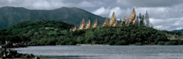
Visit the nearby Jean-Marie Tjibaou Cultural Centre, Nouméa, New Caledonia
A striking fusion of modern architecture and Melanesian heritage, the Tjibaou Cultural Centre stands as a powerful tribute to Kanak identity. Designed by Renzo Piano, the centre’s soaring wooden structures evoke traditional “great houses,” yet are engineered with passive ventilation to withstand the South Pacific climate.
Inside, curated exhibitions, audio-visual displays, and a series of pavilions unfold the story of New Caledonia’s indigenous culture—from ancient myths and clan traditions to the political life of Jean-Marie Tjibaou, who championed cultural recognition and autonomy.
NEARBY
1. Îlot Amédée
A classic day trip from Nouméa, this small coral islet is home to a historic lighthouse and protected marine reserve. Its surrounding waters are famously clear, with excellent snorkeling—sea turtles, reef sharks, and a wide variety of tropical fish glide through shallow coral gardens.
2. Îlot Canard (Duck Island)
Just offshore from Anse Vata, this islet features an underwater snorkeling trail with informative buoys and healthy coral. It’s a quick hop by water taxi, popular for half-day excursions. Expect parrotfish, butterflyfish, and the occasional octopus beneath calm, shallow seas.
3. Signal Island & Îlot Larégnère
Both part of a marine park network, these islets lie slightly farther out but offer excellent reef exploration, beach walks, and a serene anchorage. Picnic tables and shaded huts invite a full-day visit. Snorkeling reveals eagle rays, clownfish, and soft coral fans.
4. Anse Vata Bay
Nouméa’s most famous beach is not only a hub for windsurfing and paddleboarding, but also offers decent snorkeling right off the beach. Its reef flats support schools of reef fish, and visibility is usually good in the mornings before the tradewinds pick up.
5. Baie des Citrons (Lemon Bay)
This protected crescent bay has easy entry points for swimmers and is often used by locals for snorkeling and night diving. The marine life includes pipefish, nudibranchs, and the occasional stingray. Cafés and palm-lined walks add to its urban charm.

OCEAN POSSE SPONSORS
OCEAN POSSE SPONSORS
- ABERNATHY – PANAMA
- BELIZE TOURISM BOARD
- BOAT HOW TO
- CABRALES BOAT YARD
- CENTENARIO CONSULTING – PANAMA CANAL
- CHRIS PARKER – MARINE WEATHER CENTER
- DELTA MIKE MARINE SUPPLY PANAMA
- DIGITAL YACHT
- DOWNWIND MARINE
- EL JOBO DIST. COSTA RICA
- FLOR DE CAÑA
- HAKIM MARINA AND BOAT YARD
- HERTZ RENTAL CARS MEXICO
- HOME DEPOT PRO MEXICO
- LATITUDES AND ATTITUDES
- MARINA PAPAGAYO
- NOVAMAR YACHT INSURANCE
- PANAMA YACHT BROKER
- PREDICT WIND
- SAFE HARBOR SOUTH BAY MARINA EVENT CENTER
- SAN DIEGO MARINE EXCHANGE
- SAFETY ONBOARD COSTA RICA
- SEVENSTAR YACHT TRANSPORT
- SHAFT SHARK
- SUN POWERED YACHTS
- WESTMARINE PRO
- YACHT AGENTS GALAPAGOS
MEDIA PARTNERS
LATITUDES AND ATTITUDES
OCEAN POSSE FLEET 🛰️ TRACKING
This page is designed to give interesting parties an overview. For specific vessel details including their floatplan, latest updates, changes, positions and specific location related questions please contact each vessel directly. Due to privacy we do not provide vessel contact information. You may track vessels via it’s own tracker or request AIS tracking from https://www.marinetraffic.com/ please note that this is also not accurate. There are many reasons why a vessel’s position is not updated and please do not conclude that a vessel has an emergency or is in need of assistance because it has not reported in lately. Sometimes they may just want to get away from it all and not tell you where they are. It is the responsibility of each vessel to file a float and check in plan and escalation procedures.
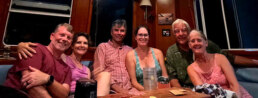
JOIN THE OCEAN POSSE
|
||||||||||||||||||||||||||||||||||||||||||||||||||||||||||||||||||||||||||||||||||||||||||||||||||||||||||||||||||||||||||||||||||||||||||
| MEET UP @ BOAT SHOWS AROUND THE WORLD | ||||||||||||||||||||||||||||||||||||||||||||||||||||||||||||||||||||||||||||||||||||||||||||||||||||||||||||||||||||||||||||||||||||||||||
| SAVE MONEY, TIME AND REDUCE BOAT STRESS | ||||||||||||||||||||||||||||||||||||||||||||||||||||||||||||||||||||||||||||||||||||||||||||||||||||||||||||||||||||||||||||||||||||||||||
|
Fun Fact about Panamanian Culture:
In Panama, the national dress — the “pollera” — isn’t just clothing, it’s an art form. A single hand-embroidered pollera can take over a year to make and cost up to $10,000. It’s worn during festivals and parades with pride, often passed down through generations, and paired with intricate gold jewelry and decorative hair combs called tembleques that shimmer as the wearer dances. It’s one of the most elaborate traditional dresses in the Americas.

PANAMA POSSE CANAL AGENTS
To arrange for transit with the Panama Canal Authority please contact our dedicated Panama Canal agents and sponsors of the Panama Posse and the Pacific Posse
CENTENARIO CONSULTING
Erick Gálvez
info@centenarioconsulting.com
www.centenarioconsulting.com
Cellphone +507 6676-1376
WhatsApp +507 6676-1376
Tidbits
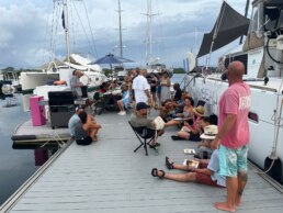
- Dock Party Thursday nights @ Red Frog Marina Bocas del Toro 🇵🇦
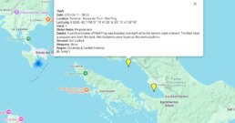
Petty Thefts Bocas del Toro
- PYTHIA 🦜Caleb I contacted the number a cruiser in the anchorage gave me as Aeronaval and someone else said was local police, but no answer yet. I called and texted both. I filed a report with CSSN. We’ll survive, it’s more an annoying violation than anything. I’m more than happy to buy from locals and hire them to do work, but it wasn’t enough this time. I’m sure that the thief watched us leave and took their shot. Second time I’ve been robbed on my boat now. And everything was locked. They just broke it.They stole almost nothing that will be useful to them since we immediately locked down the Kindles, tablet, and phone. He stole my brand new clothes and my swim trunks, leaving me with few clothes to wear myself now. It’s just dumb, he did damage and risked himself and barely got anything of value. He did more harm to us than good for himself. It will cost me thousands to replace what he stole that won’t do him any good.Pixel Buds Pro, Fire Tablet 8, Motor Power G phone, two Kindle Paper Whites (both that I have owned have been stolen now by different people in different places), two pairs of swim trunks, two button up shirts, two pairs of shorts one brand new, a towel, a fan, a mirror, a headlamp…all stuff he could carry in a canoe in a bag or pockets.We’ll be alright. More annoying than anything
DIDN’T GET YOUR INVITE TO BEZOS’ WEDDING?
Yeah… neither did Zuckerberg.
But his heli-on-deck toyship Wingman could’ve made the 450 nm hop to Venice without breaking a sweat.
One of our own, SY GARGOYLE II, caught the scene in Corfu
@ Garitsa Bay 39° 37.0833′ N 019° 55.6766′ E – and sent back proof:
“We’re rubbing shoulders with the zillionaire set here in Corfu today. Zuckerberg’s fleet is anchored nearby… but all eyes are on Opera — the 10th largest yacht in the world. Snagged a quick video scan for you.”
NOTE: In truth, these mega-yachts are often held in complex structured companies, making it tricky to pinpoint the precise owners of OPERA . But it’s undeniably an Al Nahyan family asset either Sheikh Abdullah or Sheikh Mansour who are high-ranking Abu Dhabi royals.
📍 Real sightings. Real stories. Just another day in the Ocean Posse.
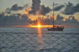
Extraordinary Cruising °°° Join the Fleet
- Access vetted local knowledge, safety resources, and prior experiences to make your passage safer and more enjoyable.
- Unlock a Life of Adventure
Explore hidden destinations, experience new cultures, and discover the freedom of life at sea or near shore – on your terms. - Get VIP Perks & Discounts at marinas, chandleries and boatyards
Get exclusive discounts, priority access, and personalized support at partner marinas across the globe. - Observe the actions of Experienced Captains
Tap into a wealth of tips, tools, and real-world know-how from seasoned mariners to grow your skills and gain confidence. - Make Every Nautical Mile Memorable
Join events, meetups, and shared journeys that turn you voyages into unforgettable stories and lasting memories. - Cruise with a Conscience
Gain insights into sustainable practices and join a movement that protects the waters you love to explore.