EXPANDING POSSE PERKS: YACHT PORT CARTAGENA, SPAIN💰 Save real money at Marinas with discounts
ANNOUNCING: NEW MARINAS SIGNING ON WITH THE OCEAN POSSE
EXPANDING POSSE PERK:💰 Save real money at Marinas with discounts


SV QUESO GRANDE II and Captain Dietmar kicked off the first Ocean Posse event in Yacht Port Cartagena, Spain!
Dietmar says: Thank you Sherri for all the event support and promotion to the international cruisers who came! AND THANK YOU LANCE FOR SOME SUCCULENT RIBS !!!
Sherri from SV QUESO GRANDE II says: Great fun, great cruisers, and great grilled meat by my darling husband Lance.

Currently, the Ocean Posse has ????some number of marinas in ????some number of countries bla bla bla. This represents great savings bla bla bla
TRIP REPORT: COLUMBIA INLAND
TRIP REPORT: COLUMBIA INLAND
WITH MV NEXT CHAPTER
MV NEXT CHAPTER sailed from Shelter Bay Marina in August to Cartagena, Colombia. They explored the city and then travelled inland off the boat. Their photos and enthusiastic report of their time so far in Colombia follows:

Colombia exceeded our expectations in every way! We weren’t 100% sure what to expect but what we found was incredible people, safe walkable cities, delicious food and affordable prices for work and goods.


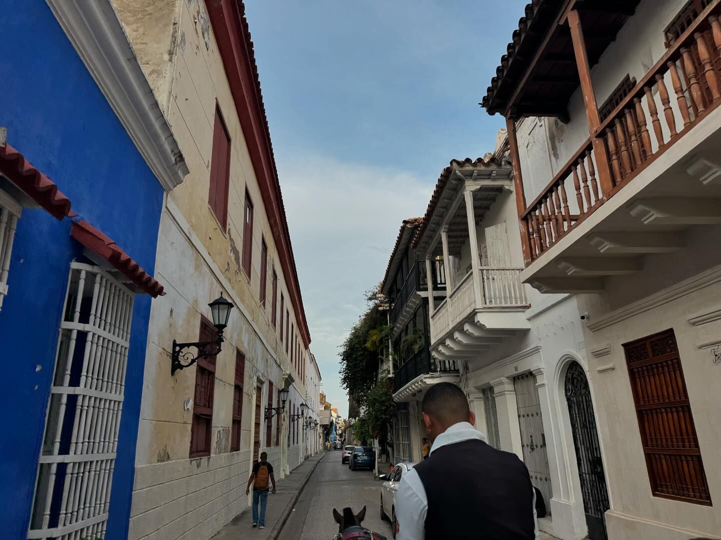
We stayed at Club de Pesca (they are a posse sponsor and a great marina) if you message their WhatsApp, Maricela Speaks great English and can help with your reservations) book very early as their marina is small and space fills up quickly.
Also at Club de Pesca is phenomenal workers! We had our bright work completely redone, some small fiberglass repairs, a wash and wax. Javier and his team were the best we have ever worked with! If you are stopping there and want his contact info I would be happy to pass it along
We also took side trips (it’s super affordable to fly within Colombia) to Medellín and Bogota. Both cities were incredible, rich culture so much to see and do!
Checking into the city/country was also pretty easy- Jose our agent was $300 and handled all of our paperwork and brought the officials to our boat, applied for our cruising permit and TIP. You have to check into and out of every major port in Colombia but it’s pretty quick and easy.

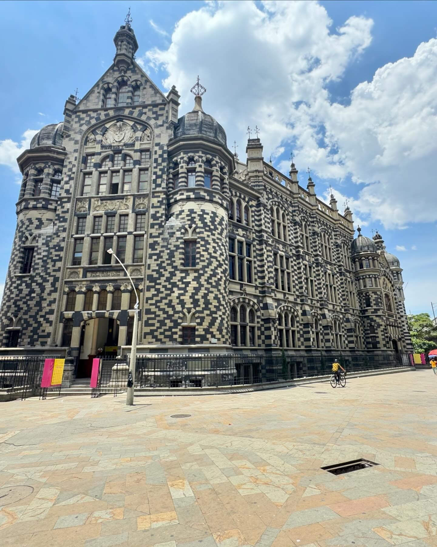


Hope this helps other boaters feel comfortable stopping into Colombia! It’s in my opinion and must see country.

MY NEXT CHAPTER 🇺🇸 Chris & Shawna & crew - Selene 59′
Fair winds MV NEXT CHAPTER, thank you for sharing your inland adventures!
SHARING YOUR ADVENTURES
is the heart and soul of the Ocean Posse
Please share pictures of your adventures, your award entries, your breathtaking sunsets, and picturesque anchorages on our group communications platform for others to enjoy in real time and/or email Maurisa at editor@oceanposse.com to share in the upcoming newsletter. Maurisa is a sailor among us. She is part of the Ocean Posse crew and enjoys writing fun and helpful updates to the Ocean Posse.
SUN POWERED YACHTS SPONSORS THE OCEAN POSSE
☀️ SUN POWERED YACHTS ☀️
⛵SPONSORS THE OCEAN POSSE⛵
|
We are exited and pleased to sponsor the Panama Posse with a special 10% discount off SunPower solar panel bundles. Just use promocode PANAMAPOSSE at checkout www.sunpoweredyachts.com/shop and start enjoying clean & quiet solar aboard your boat.
We also offer free consultations so please email or call and let us help you go solar today. PRODUCTS
|
|
|
|
|
Sun Powered Yachts
T: +1 808 825 2670
Lyall is from the UK and has travelled to 50 countries backpacking and sailing. With a background in Hospitality and Event Management he found sailing in 2004 has logged over 55,000 miles and qualified as an RYA Yachtmaster Ocean.
Katie is from Maine and has been working in the solar industry in Hawaii for over a decade, most recently for Sunspear Energy. Her knowledge of solar products and system design will be an asset to your yacht’s system. |
|
|
Based on our time and experience sailing, on short trips and living at sea, we have created a Power Usage Chart below. You can see more details on what each system could power on your weekend or live aboard sailing adventure. Create your own power usage table and see what your power needs are aboard your own yacht then choose the number of solar panels accordingly |
|
|
|
|
|
SV REMEDY DOUBLES BACK OVERLAND TO NICARAGUA
SV REMEDY DOUBLES BACK OVERLAND TO NICARAGUA
WARNING: Do not read while hungry or thirsty (for Rum or Adventure)

Karl and Natalie Leibensperger, from SV REMEDY, are currently exploring Nicaragua overland from Costa Rica and shares some details and highlights of their experiences along the way:
Due to time constraints we were not able to visit the Port of Puesta Del Sol in Northern Nicaragua but instead headed directly to Costa Rica. While staying in Marina Papagayo we planned a 10 day trip to Nicaragua with Va Pues Travel. The company organizes custom private tours of Nicaragua. Our trip started with a transfer from Liberia to Peñas Blancas. There are several transfer companies and the prices range from $85 to $120 each way. We used Best Ride Costa Rica, +506 8629 0242 with a rate of $85 each way. The transfer takes about 90 minutes. It is a pretty interesting drive north to the border. The craziest thing is that there is 9km of backed up semi trucks that wait days to get into Nicaragua. We drove most of the 9km on the wrong side of the road swerving in and out of traffic. It made for an eventful ride.
Once at the border the Costa Rican immigration office is within a few steps of where your transfer is able to drive. Our English speaking border agent took our passports, instructed us to pay our exit taxes at a bank machine ($8 US PP) and then once paid he stamped our passports and sent us on our way towards Nicaragua. There is a marked walkway to the border and the entire walk is about 300 meters. Before getting to the Nicaraguan immigration office you must show your passport to an official at a check point. They are looking for your exit stamp from Costa Rica. The Nicaragua immigration office is a huge blue and white building, really impossible to miss. You will need $1 US PP cash to get in the door. Once inside, the immigration official will need your passport, your hotel name, and your profession. The cost is $13 US PP in cash. They will give you two official papers that are needed to exit the country. Once this is completed all luggage is placed through an X-ray machine and then you are on your way. Welcome to Nicaragua!
We had a tour guide waiting for us but there is an Enterprise Car Rental at the Nicaraguan border. I'll add that there is also one on the Costa Rican Border also. Our first stop was Rivas, here we caught a very crowded transport ferry to Ometepe Island.
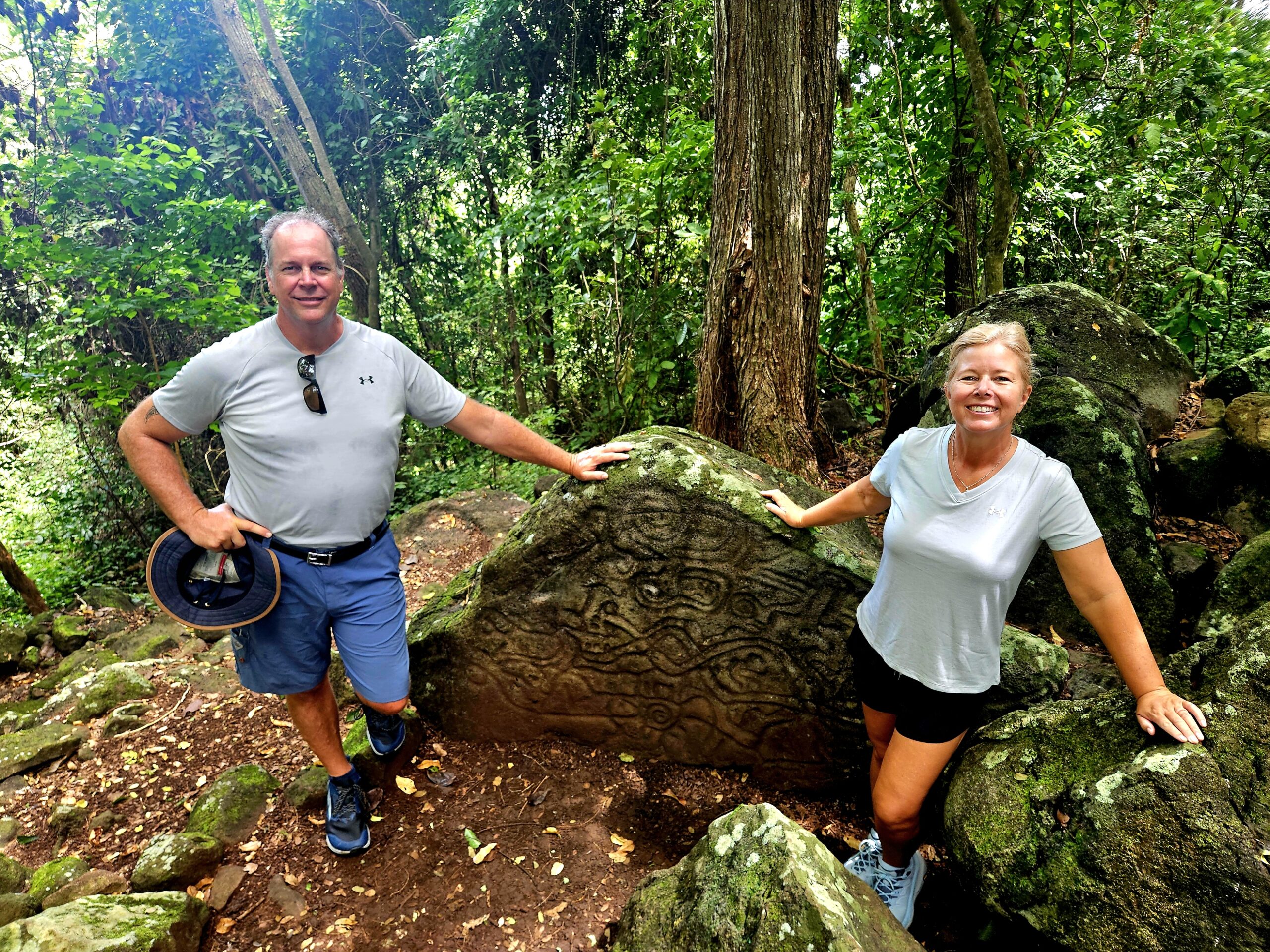

After the return ferry ride back to Rivas we moved on to the Capital City of Granada. We stayed at the Hotel Plaza Colon, which is a beautifully refurbished colonial house overlooking Granada's Central Park. Bring your bathing suit to cool off in their wonderful center court pool.
On the drive to Granada we stopped in Catarina for a ceramic pottery factory tour. The indigenous population has handed down this artwork to the current generation and it is their main livelihood in this area. The pottery in some of the shops is very detailed and exquisite. We did buy several pieces for our home in Florida.

distance is Lake Nicaragua. The picture was taken from the city of
Catarina, which is famous for their handmade pottery. The pottery is
absolutely beautiful. We purchased quite a few pieces that will be
shipped to the US.

Granada is a Colonial City with a rich history. If you visit Granada I highly recommend having a city tour, as without a guide I would not have learned as much of her History. Since it was so hot we cheated on our walk and hired a horse and carriage for $20. I told Karl it was the best $20 I've spent in a long time. An interesting stop was at a tile factory that has been in business since 1905. They make all of the colorful tile around the city, both in buildings and on the sidewalks. They were kind enough to show us their tile making process during our impromptu stop.


Two suggestions.


After two nights in Granada our trip led us to Estili. It is the location of most of the cigar factories in Nicaragua. Karl's goal was to visit the Padron Cigar Factory but to his disappointment they are extremely private and do not have tours. In fact, they do not sell their cigars in Nicaragua. They are all exported. (So, we found a) cigar factory tour in Estili and (found) some good quality cigars to bring back with us.
(We had) an amazing tour of AJ Fernandez Cigar Factory. Mario was our English speaking guide. After working for AJ Fernandez for 7 years, he has learned and is able to explain the cigar process in detail. His background is that he has an Agriculture Degree, so he can answer specific questions about the process that I don't think you would get in other locations. It takes about 5 years and 300 hands to produce one cigar. The facility is enormous and the process is just as complicated as making wine or whiskey. He used those analogies throughout the tour. I was not aware of the detail that goes into each batch of cigars. The tour lasted about an hour and I would rate this as one of our top factory tours. Technically, purchasing cigars is not possible, but in Nicaragua everything is possible. Estili is a bit out of the tourist zone but completely worth the stop.


This is just one of the rooms that processes the tobacco. This is sorting room for the tobacco that becomes the wrapper.
As of this publication, Karl and Natalie are continuing north to Leon, Nicaragua. Karl and Natalie finish by sharing:
As Posse members we are making our way to Flor de Caña hoping to purchase some well aged rum. (Excellent idea!!)
Southern and middle Nicaragua have been beautiful and I am thankful we are able to spend 10 days touring this wonderful country.
 Karl & Natalie Leibensperger - 2019 Leopard 45

THANK YOU SV REMEDY FOR SHARING YOUR ADVENTURE ALONG THE WAY!
Ocean Posse Members, please share your stories by sending them to editor@oceanposse.com.
Maurisa, the editor, is always happy to receive your stories and share them out. Together we can inspire one another!
POSSE PERK: 🗺️3 DAYS OF LEARNING SEMINARS
POSSE PERK: 🗺️3 DAYS OF LEARNING SEMINARS
INCLUDED WITH OCEAN POSSE SIGN UPS
coming up in Safe Harbor, San Diego
October 23-25, 2024 @ Safe Harbor South Bay, San Diego
https://oceanposse.com/events/san-diego-seminar-series/
Sneak a Peak at the Seminars and Schedule...
WEDNESDAY OCTOBER 23rd, 2024 ● SEMINARS
$ 45 per person x day or FREE
FOR OCEAN ° PANAMA ° SOUTH PACIFIC POSSE PARTICIPANTS
09:00
Cruising down Pacific Mexico

10:00
Water Makers + Plumbing in Paradise

11:30
Diesel Engines & Generators and preventative Maintenance

12:30 LUNCH
Open CPN – installation and integration (PC + MAC )
14:00
Rigging 101 Standing and Running
15:30
Weather Weather Weather – planning – routing – underway

16:30
Crew the good the bad and the ugly

17:00
Destination Costa Rica and Nicaragua

THURSDAY OCTOBER 24th, 2024 ● SEMINARS
09:00
South Pacific – French Polynesia – Cook Islands – Tonga & Fiji

10:00
Safety Security and Emergencies outside the US and what to expect

11:00
Electrical Systems – Batteries, Chargers, Alternators, Solar Panels
12:30 LUNCH
Cruising in Panama + the Panama Canal

14:00
Where and how to repair boats outside the US
15:30
The tropics – Refrigeration, AC, Shading, Airflow + other ways to stay cool

17:00
Destination Colombia, Jamaica & Bay of Islands Honduras

FRIDAY OCTOBER 25th, 2024 ● SEMINARS + PARTY
09:00
Destination Belize & Rio Dulce Guatemala

10:00
Communications onboard, underway and on shore

11:30
The fundamentals of wires, connectors and fuses

12:30 LUNCH
Open CPN – Satellite Charts – Use Cases and Satellite Chart creation

14:00
Chart Accuracy, Navigation Trips and Tricks & Tracking
15:30
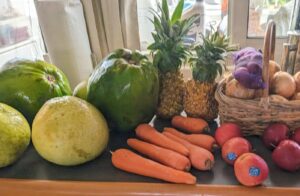
Provisioning, Propane and Fuel – where to replenish
17:00 – 21:00 PPPPARTY

FLEET UPDATE 2024-09-16
|
|
|
|
|
|
|
|
|
|
|
|
|
|
|
|
|
|
|
|
|
|
|
|
|
|
|
|
|
|
|
|
|
|
|
|
|
|
|
|
|
|
|
|
|
|
|
![]()
EXPLORING INLAND TO BELGIUM
AFTER CROSSING THE ATLANTIC OCEAN
SV QUESO GRANDE II GOES INLAND TO BELGIUM


SV QUESO GRANDE II 🇺🇸 Lance & Sherri – Seawind 1260 41′
Looks like your sea legs are taking you far; Thanks for sharing!
: The Venice of the North
Nestled in the northwest of Belgium, Bruges is a city that seems to have been plucked straight out of a fairy tale. With its picturesque canals, medieval architecture, and cobbled streets, it is no wonder that Bruges is often referred to as the “Venice of the North.” This enchanting city has preserved its medieval charm, making it one of Europe’s most beloved destinations.
A Historical Tapestry
Bruges’ history dates back to the 9th century when it was founded by the Vikings. By the 12th century, Bruges had become a bustling trading hub, thanks to its strategic location and access to the North Sea. The city’s prosperity peaked in the 14th century when it was one of the leading cities of the Hanseatic League, a powerful commercial and defensive confederation of merchant guilds and market towns in Northwestern and Central Europe.
The wealth generated by trade is still evident today in Bruges’ stunning architecture. The city is a treasure trove of Gothic, Renaissance, and Baroque buildings, many of which have been meticulously preserved. The Belfry of Bruges, a medieval bell tower in the city’s heart, is one of its most iconic landmarks. Climbing the 366 steps to the top offers panoramic views of the city and is well worth the effort.
The Canals of Bruges
Bruges is famous for its network of canals, which wind their way through the city and have earned it the nickname “Venice of the North.” These waterways were once vital for trade, allowing goods to be transported easily throughout the city. Today, they provide a scenic way to explore Bruges. A boat tour along the canals offers a unique perspective of the city’s stunning architecture and charming bridges.
Art and Culture
Art lovers will find plenty to admire in Bruges. The city is home to several world-class museums, including the Groeningemuseum, which houses an impressive collection of Flemish Primitive art. Works by masters such as Jan van Eyck and Hans Memling can be found here, offering a glimpse into the rich artistic heritage of the region.
In addition to its museums, Bruges is famous for its lace-making tradition. Lace has been made in Bruges for centuries, and visitors can learn about this delicate craft at the Lace Center, where demonstrations are held regularly.
Culinary Delights
No visit to Bruges would be complete without indulging in its culinary offerings. Belgian chocolate is renowned worldwide, and Bruges is home to some of the country’s best chocolatiers. A stroll through the city’s streets will reveal numerous chocolate shops, each offering a tempting array of pralines, truffles, and other sweet treats.
Bruges is also a great place to sample traditional Belgian cuisine. Mussels and fries, known as “moules-frites,” are a must-try dish, as is the hearty Flemish beef stew, “carbonade flamande.” Of course, no meal in Belgium is complete without a glass of locally brewed beer. Bruges has several breweries, each producing unique and flavorful beers that are sure to delight any connoisseur.
A Timeless Charm
What makes Bruges truly special is its ability to transport visitors back in time. The city’s medieval architecture, cobbled streets, and tranquil canals create an atmosphere that is both romantic and timeless. Whether you’re exploring the historic Markt square, visiting the Basilica of the Holy Blood, or simply enjoying a leisurely boat ride, Bruges offers an experience unlike any other.
Bruges is more than just a city; it is a journey through history, art, and culture. Its charm lies in its ability to blend the old with the new, offering visitors a glimpse into the past while still being a vibrant and lively place to explore. Whether you’re a history buff, an art lover, or simply looking for a romantic getaway, Bruges has something to offer everyone.

ISLAND ADVENTURES ASHORE
SV VIVA'S ISLAND ADVENTURES ASHORE

SV VIVA is in French Polynesia in the South Pacific. Their recent report shares a few different ways to explore the islands of Moorea and Tahiti:
We rented a scooter and toured the island of Moorea yesterday and did a 9-mile hike up to Belvedere and back on the 3-cocotier trail a few days ago...found many amazing views. Today, we took the ferry across to Tahiti at 7 am, rented a scooter and toured the whole island with several beautiful stops along the way. We sprinkled this tour with some provisioning that we could fit in backpacks and boxes on our rented scooter.


VIVASweet bike lane!
SV VIVA 
Adventurous and Practical! Thank you for sharing VIVA!
FLEET UPDATE 2024-08-25
|
|
|
|
|
|
|
|
|
|
|
|
|
|
|
|
|
|
|
|
|
|
|
|
|
|
|
|
|
|
|
|
|
|
|
|
|
|
|
|
|
|
|
|
|
|
|
|
|
|
|
|
|
|
BIRDS NESTING ABOARD IN COSTA RICA
BIRDS NESTING ABOARD IN COSTA RICA
SV FIREFLY, currently moored at Marina Papagayo in Costa Rica, recently had the opportunity to have some visitors aboard that made themselves right at home....and then up and left. No harm, no foul, and enjoyed being witness to such a precious time in a birds life.


Brenda shares the story:


SV FIREFLY 


![Hurricane Beryl (/ˈbɛr.əl/) was a deadly and destructive Category 5 Atlantic hurricane that impacted parts of the Caribbean, the Yucatán Peninsula, and the Gulf Coast of the United States in late June and early July 2024. It was the earliest-forming Category 5 hurricane on record and the second such storm in the month of July, the other being 2005's Hurricane Emily. Beryl was also the strongest hurricane to develop within the Main Development Region (MDR) of the Atlantic before the month of July. The second named storm, first hurricane, and first major hurricane[nb 1] of the 2024 Atlantic hurricane season, Beryl broke many meteorological records for the months of June and July, primarily for its unusual location, intensity, and longevity.]( https://oceanposse.s3.us-east-2.amazonaws.com/wp-content/uploads/2024/08/25/content_036.jpg)


