CRUISING ° FLEET UPDATE & NEWS ⚓ 2025-08-24
No pessimist ever discovered the secret of the stars or sailed to an uncharted land or opened a new heaven to the human spirit.
In the South Pacific, the old rhythm of low follows high is breaking apart; warmer seas are turbocharging storms, windows are tighter, and every passage now demands sharper seamanship.
CRUISING ° FLEET UPDATE & NEWS ⚓ 2025-08-24
Centurie Corsica 🇫🇷 France
It’s That Time Again – the Ocean Posse Annual Survey Has Dropped ⚓️
for Centuries
Marina Di Procida 🇮🇹 Sponsors the Ocean Posse
💬 Tidbits
– UTC Tim
Centurie Corsica 🇫🇷 France
It’s That Time Again – the Ocean Posse Annual Survey Has Dropped ⚓️
Annapolis Boat Show
Press Summary – Ocean Posse Season 9
Are the Different Ocean Posse ⚓ Route Pods
Circumnavigation of 🇳🇨 New Caledonia
Primary Named Winds 🌬 Pacific Coast of the Americas
Marina Mindelo 🇨🇻 Sponsors the Ocean Posse
Must See: Cidade Velha 🇨🇻 Cape Verde
Join the Ocean Posse – Extraordinary °°° Cruising
So You Are Leaving the Marina and Renting a Car 🚙 to Go See …
There is a Great App 📱for Your Travel Risks
South Pacific – Meet the Cruising Fleet – Sat Aug 30 – Nawi Island
Official Ocean Posse Events
Flor De Caña Rum Sponsors the Ocean Posse Events
Termites 🐜 Risks, Causes, and Prevention
Abernathy Chandlery Panama
Media Partners Latitudes and Attitudes
Ocean Posse Fleet 🛰️ Tracking by Predict Wind
Panama Posse Canal Agents
Ocean Posse Merchandise | Shop
Mariners Have Been Using the Gulf Stream for Centuries
Marina Di Procida 🇮🇹 Sponsors the Ocean Posse
💬 Tidbits
– UTC Time vs Ships Time
– ⚓ Provisioning the Long list
– Narco sub # 2
– Intl. Parcel Restrictions Affecting Boat Parts Shipments to the U.S.
– On the ground in one of the largest Starlink repair shops
– Get in Touch With Us Anytime
It’s That Time Again – The Ocean Posse Annual Survey Has Dropped ⚓️
Ahoy Captains and Crew,There’s nothing quite like a good maritime survey to get your day started – a little honesty, a little embarrassment, and a whole lot of truth. We’re excited (yes, really excited) to hear what you really think.
This is your chance to weigh in – anonymously – and help shape the course of the Ocean Posse fleet. No names, no judgments, just your salty insights.Grab a coffee, drop anchor, and take a few minutes to fill it out. 👉
We’re counting on you – and there might just be a $250 prize at the end of your honesty.Stay informed, The Ocean Posse Team
ANNAPOLIS BOAT SHOW
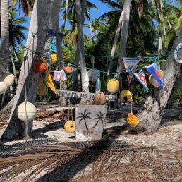
Services include: trash burn pit, coconut farm, Geo caches and a good place to snorkel
RE-INTRODUCING THE OCEAN POSSE ⚓ ROUTE PODS
This season we’re bringing back Pods — think of them as your route tattoos for the journey ahead.
Each pod has its own emoji tag so you can mark your cruising plans and spot kindred spirits. If you invent a new route you can pick your own symbol and pod name.
💰 GOLD RUNNERS
Florida / Bahamas / Turks and Caicos / Windward Passage / Jamaica / Panama / South Bound Treasure seekers sailing Panama and beyond, plotting their own legendary route.
🍹 RUM RUNNERS
Colombia / Caribbean Panama Via Jamaica / Cayman Islands / Cuba / Yucatan / Florida Keys / North Bound Sunset lovers tracing the classic Caribbean rum trail, bar to bar, bay to bay.
🌿 SPICE RUNNERS
Lesser Antilles via Colombia –-> Panama Canal Bound - East to West Bold passages east–west through the Lesser Antilles, full of flavor, rum, and following seas.
☠️ PIRATE RUNNERS
Bocas del Toro –-> Cayman Islands / Roatan / Rio Dulce / North Bound Adventurers hopping islands and uncovering hidden coves in the Western Caribbean avoiding the pirate alley or swashbuckling though it
🥥 COCONUT RUN
San Diego / Ensenada / Cabo / La Paz / Mazatlan / PV -–> Barra de Navidad -South Bound Southbound cruisers chasing coconuts, tacos, and warm anchorages down the Pacific coast.
☸️ COUNTER POSSE
Pacific Panama / Costa Rica –-> North Bound Northbound sailors along the Central American coast, making their way to the Sea of Cortez or homeward bound for California.
🦜 ORIGINAL POSSE
Barra de Navidad -–> Panama Canal South Bound The classic southbound run from Barra de Navidad to the Panama Canal, retracing the Panama Posse’s founding route.
🌊 BASHERS
Barra / Cabo / La Paz / PV --> San Diego / LA / SFO - North Bound Northbound crews grinding it out from Barra, Cabo, La Paz, and PV back up the Baja coast to San Diego, LA, San Francisco, Oregon & Seattle.
🦀 CRAB POD
Maryland, Virginia, North Carolina, South Carolina, Georgia & Florida Bahamas– north or south bound, coastal hops ont he outside or via the ICW Bay huggers moving slow and steady, savoring each harbor’s charm and local flavors.
🌵 CACTUS POSSE
La Paz / Mazatlan / Sea of Cortez - North and South Bound Baja explorers reveling in desert cliffs, whale sightings, and quiet anchorages.
🌺 HIBISCUS POSSE
Panama - Jamaica - South Coast of Cuba - South Coast of Haiti - South Coast of Dominican Republic - South Coast of Puerto Rico - to the Virgin Islands - East Bound Tropical dreamers island-hopping turquoise lagoons and reef-fringed paradises.
🪸 CORAL POD
GUATEMALA - BELIZE - YUACATAN PENINSULA - FLORIDA KEYS Reef seekers diving headfirst into crystal waters, snorkeling, and coral-rimmed anchorages.Find your pod, tag yourself, and let’s ink this season’s routes together.
🐚 SHELL POD
BAHAMAS - GREATER ANTILLES - LESSER ANTILLES Easygoing cruisers collecting calm bays, beach bonfires, and seashell souvenirs.
🏝️ MILK RUN - SOUTH PACIFIC POSSE
Pacific Coast --> Galapagos --> Marquesas / French Polynesia - South Pacific Bound Bluewater dreamers sailing the Pacific coast to the Galápagos, then onward to the Marquesas and French Polynesia.
🦑ATLANTIC POD
Atlantic Islands and crossings Island hoppers and ocean crossers linking the Canaries, Azores, Cape Verde, and beyond on their way across the Atlantic.
⚓ 👉 Each pod = your Route Tattoo : just drop the emoji in chat to tag yourself and show your season’s cruising vibe.
Extra DIY points for stitching or painting your emoji on this season’s burgee .
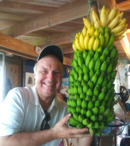
Here is Hans contemplating the Banana Pod route for the Ocean Posse ( alert: banana sap stains gel coat real good )
MARINA MINDELO  SPONSORS THE OCEAN POSSE
16° 53.135′ N 024°59.5316′ W
We are extremely please to sponsor the Ocean Posse witha discount of 10% for each yacht.
Best Regards
Jackie & Kai !
SERVICES
- Up to 50 meter boat length
- 24 hour service and security
- 220 V at 16, 32 and 63 Amp on the pontoons
- Water supply to the columns
- Diesel Station
- Internet: Wireless WIFI
- Modern showers and toilets
- Floating Bistro / Sailor’s Bar
- Weather forecast
- Contracting repair and supply works and purchases for yachts
- Drop Ship location
- Support for local administrative services (immigration, Police, Customs)
MARINA MINDELO SAFE APPROACH
MUST SEE: CIDADE VELHA 🇨🇻 CAPE VERDE
Cidade Velha, once known as Ribeira Grande, lies on the southwest coast of Santiago Island in Cape Verde. Coordinates for the anchorage are 14°54.144′ N 23°36.221′ W. This bay was the first European colonial settlement in the tropics and the launching point for Portugal’s Atlantic empire. Founded in 1462, it became a hub for trade, exploration, and the grim realities of the transatlantic slave routes. Today, Cidade Velha is a UNESCO World Heritage site (since 2009) and one of the most atmospheric anchorages in the archipelago.
For sailors, Cidade Velha is not just another stop on the Atlantic run , it is a historic roadstead where caravels once prepared for the Guinea coast, where Francis Drake raided in 1585, and where towering walls of Fort Real de São Filipe still look down on the anchorage.
For the Ocean Posse, Cidade Velha offers a mix of anchoring challenges, history, and culture worth exploring. While not a place for long-term marina-style comfort, it rewards those who stop for a day or two on their way to Mindelo, the Caribbean, or Brazil.
Coordinates & Approach
• Cidade Velha Anchorage: 14°54.144′ N 23°36.221′ W
• Depths: 5 to 8 meters in sand patches, but holding can vary.
• Bottom: Mostly sand with rock outcrops. Set the anchor well.
• Distance from Praia: 6 NM west along the coast
Anchorage & Holding
Anchoring at Cidade Velha is best described as “historic but exposed.”
• Depths: 6–8 meters.
• Bottom: Mostly sand with rocky patches. Dig the anchor in hard and consider using two anchors in a V if you expect swell.
• Protection: Open to the south and southwest. The NE trades are usually fine, but wrap-around swell makes it rolly.
Best Practice:
• Treat this as a day stop anchorage. Go ashore, explore the town, and either return to Praia or continue onward.
• Overnighting is possible in settled weather, but crews should stay alert.
Several Ocean Cruising Club and Noonsite reports warn of thefts from yachts at both Praia and Cidade Velha. Lock dinghies, avoid leaving gear out, and consider paying a local boatman to watch your tender.
Weather & Seasonal Considerations
Northeast Trade Winds
The NE trades dominate from November to May. Cidade Velha lies on the lee side of Santiago, so gusts tumble down the ridges. Holding is tested in squalls, but the trades are generally steady.
Harmattan
From December through February, the Harmattan winds carry dust from the Sahara. Visibility drops, skies turn hazy, and instruments may be coated with fine red grit. Solar panels are less effective, and rigging requires rinsing.
Swell
Southwest swell — though rare — can make Cidade Velha untenable. Check forecasts carefully before anchoring. Mindelo or Tarrafal on the north coast are safer alternatives in such conditions.
Local Services & Provisions
Cidade Velha is small, and services are limited compared to Praia or Mindelo. Still, the essentials can be found:
• Dinghy Landing: The best spot is near the old quay at the foot of the town square. Swell may make this wet.
• Shops & Markets: Small groceries sell basics (rice, flour, fish, vegetables when available).
• Fuel & Water: No direct fuel dock. Arrange jerry cans via Praia. Water from Praia as well.
• Restaurants: Several small restaurants and cafés line the seafront. Fresh grilled fish is the highlight.
• Security: Do not leave dinghies unattended. Hire a boat boy if possible.
History & Cultural Significance
Cidade Velha is the cradle of Cape Verde’s history. Every stone seems to carry echoes of caravels, merchants, and sailors from centuries past.
• Founded: 1462, as Ribeira Grande.
• UNESCO World Heritage (2009): Recognized for its preserved colonial layout and role in Atlantic history.
• Slave Trade: Cidade Velha was one of the first and largest slave markets in the tropics. Thousands of enslaved Africans passed through before being shipped to Europe and the Americas.
• Francis Drake’s Raid: In 1585, English privateer Drake attacked and plundered the settlement.
• Decline: With time, Ribeira Grande was abandoned in favor of Praia.
Today, the town’s cobbled streets, ruined convents, and fortress stand as reminders of both glory and tragedy.
Key Sites to Visit
1 Fort Real de São Filipe
◦ Built in 1590 after Drake’s raid, this massive hilltop fort dominates the bay. Its bastions, walls, and cisterns are largely intact. The view across the anchorage is superb.
2 Igreja de Nossa Senhora do Rosário
◦ One of the oldest colonial churches in the tropics, built in 1495. Its Manueline doorway is a rare architectural jewel.
3 Pelourinho (Pillory)
◦ The stone column in the main square where slaves were once punished and displayed. A sobering reminder of Cidade Velha’s role in the slave trade.
4 Rua Banana
◦ Said to be the first European-style street built in the tropics. Lined with small pastel-colored houses.
5 Monastery of São Francisco
◦ Ruins of a Franciscan convent overlooking the town.
6 Town Square
◦ The center of Cidade Velha life, with cafés and locals gathering in the shade.
Culture & Daily Life
Cape Verde’s Creole culture is alive in Cidade Velha. Portuguese colonial influence is blended with African roots. Music drifts from bars — morna and coladeira rhythms that Cesária Évora made world famous.
• Language: Portuguese (official) and Kriolu (widely spoken).
• Hospitality: Warm but cautious. Visitors should respect local customs.
• Cuisine: Fresh fish, cachupa (slow-cooked stew), and grogue (sugarcane rum).
Security & Cautions
Yacht security is a recurring theme in reports from Santiago:
• Praia: Known for dinghy thefts and occasional boardings.
• Cidade Velha: Safer, but still lock up. One report mentions a French yacht robbed while anchored here.
Advice for Captains:
• Lock dinghies and outboards.
• Do not leave valuables visible.
• Stay aboard overnight or organize a watch.
• Consider safer long-term anchorages (Mindelo, Tarrafal).
Passage Planning
Cidade Velha is most often used as:
• A day stop on the way from Praia to Tarrafal or Mindelo.
• A historical excursion for crews transiting the Atlantic.
• A weather waiting point for yachts heading west to the Caribbean or south to Brazil.
Routing Options:
• To Mindelo (São Vicente): ~130 NM NW.
• To Tarrafal (Santiago N): ~35 NM along the coast.
• To Caribbean (Barbados): ~2,000 NM W.
• To Brazil (Recife): ~1,600 NM SW.
THE ATLANTIC GULF STREAM

Juan Ponce de León first encountered and documented the Gulf Stream in 1513 during his exploration of Florida, though the term “Gulf Stream” and a detailed map weren’t established until Benjamin Franklin’s charting in the early 1770s. Franklin became interested in the current to improve mail delivery times and used knowledge from whaling captain Timothy Folger to create the first widely known chart of the phenomenon.
Historical Use by the Spanish Treasure Fleet
The Spanish fleet, during the Age of Exploration, particularly in the 16th and 17th centuries, relied heavily on the Gulf
Stream to sail from the New World (the Americas) back to Europe. After collecting goods, especially from the Caribbean and the Gulf of Mexico,
the Spanish galleons would navigate northward along the coast of Florida.
Once they reached the vicinity of the present-day Florida Keys, they would turn eastward into the Gulf Stream. The current, which flows northeastward from the Gulf of Mexico across the Atlantic, would provide a significant boost in speed, helping the heavily laden ships make the long journey back to Spain more quickly and efficiently.
Speed and Safety:
The Gulf Stream allowed the Spanish fleet to increase their average speed by several knots, reducing the overall time
at sea. This was crucial not only for the safety of the crew but also for the preservation of perishable goods like foodstuffs and other
valuable commodities.
Additionally, the route via the Gulf Stream was relatively safe from the deadly doldrums of the equatorial Atlantic, which could trap ships in windless areas for days or weeks, leading to shortages of food and water.
Strategic Naval Route:

PredictCurrent is the world’s most comprehensive high resolution tidal currents model
pirates and privateers.
Modern Use of The Gulf Stream by Sailors
Optimizing Sailing Routes:
Modern sailors, whether on recreational voyages or racing yachts, use the Gulf Stream to optimize their routes across the
Atlantic. Advanced navigation tools, such as GPS and weather routing software, allow sailors to plot courses that maximize the benefits of
the current especially with the new Predict Wind Models .
By entering the Gulf Stream at the right location and angle, sailors can significantly reduce their passage time across the Atlantic, just as the Spanish fleet did centuries ago. This is particularly useful for transatlantic crossings from the Caribbean or the southeastern United States to Europe.
Weather and Climate Considerations:
Unlike the Spanish fleet, modern sailors have access to detailed weather forecasts, which allow them to use the Gulf Stream more effectively. For example, they can avoid the dangers of tropical storms or hurricanes, which are common in the regions where the Gulf Stream flows.
Additionally, modern sailors can monitor water temperatures and the strength of the current in real-time, allowing them to make adjustments to their course as needed to take full advantage of the Gulf Stream’s power.

St Augustine. the original jump off point for the Spanish Fleet heading back to Europe

Join the Ocean Posse – Extraordinary °°° Cruising
Join this independent and global fleet! Hundreds of seasoned captains and yacht owners form an intelligent network, sharing real-world experience, safe routes, and exclusive marina benefits. Be part of the community that’s redefining long-range cruising.
BENEFITS OF of joining the Ocean Posse – ANNUAL MEMBERSHIP
SAVE TIME – SAVE MONEY – and get the best and most up to date INFORMATION !
| BENEFITS FOR YOU, YOUR YACHT & YOUR CREW |
|
|
| ✔️ Up to date and verified information by fellow yachts | ✔️ | |
| 📊 Communications focused on facts, not opinions or unsolicited advice | ✔️ | |
| 💰 Save real money at 125+ Marinas with discounts * | ✔️ | |
| 🛰️ Free vessel and fleet tracking courtesy of Predict Wind | ✔️ | |
| 🚩 Free Burgee * | ✔️ | |
| 💰 Save with service providers and chandleries | ✔️ | |
| 🕵️ dedicated, experienced and discounted Canal and clearing in agents | ✔️ | |
| 🗺️ Free aid to navigation 550 Gb OpenCPN satellite charts (mac/pc/android) | ✔️ | |
| 💰 Save Money on parts with a Westmarine Pro Discount | ✔️ | |
| 💰 Save Money with a Predict Wind Pro Discount | ✔️ | |
| 🗺️ Free Printable Reference Charts emergency backup to your electronics | ✔️ | |
| 📹 Free Video Seminars on destinations from those who are there | ✔️ | |
| 🌩️ Top weather routing avail by Marine Weather Center Chris Parker | ✔️ | |
| ⛵ Community of voyagers all are welcome, kids, single-handers, pets | ✔️ | |
| ☂️ NEW Group Fleet Yacht Insurance with discounts for multi-year participants 15% and + 5% after year 3 | ✔️ | |
| ⚓ Peer support in emergencies with escalation procedures | ✔️ | |
| Fleet Updates via email – free | ✔️ | |
| 🏆 Fun Award Categories | ✔️ | |
| 📍 Free access to GOOD NAUTICAL Anchorage reports | ✔️ | |
| ☎️ Free Weekly live calls on Mondays via dedicated LINE.me group | ✔️ | |
| 💬 Free 24/7 LINE group channel | ✔️ | |
| 🌊 Benefit from the latest information and prior experience participants | ✔️ | |
| 🔭 Be part of a fleet of sensor for those who come behind you or meet | ✔️ | |
| 🚷 Always priority traffic – for participants by participants | ✔️ |
- (* as long as you do not have prior contracts or reservations in place and subject to a marina’s availability )
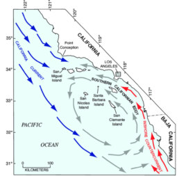
Primary Named Winds 🌬 PACIFIC COAST OF THE AMERICAS
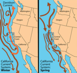
CALIFORNIA CURRENT WINDS
1. The Dominant Winds• Northeast Trade Winds:
Blow steadily from the northeast to the southwest, especially strong in spring and summer. These winds push surface waters offshore (via the Coriolis effect), which is what triggers the famous coastal upwelling.
• Northwesterlies: Along the California coast, the prevailing surface winds in summer are strong NW winds, especially between Point Conception and Cape Mendocino. These winds can blow at 15–25 knots for days, building steep seas and making southbound passages faster and northbound ones harder.
2. Seasonal Behavior
• Spring and Summer (March–July)
◦ Winds are strongest and most consistent from the northwest.
◦ They accelerate around coastal headlands (Point Conception is notorious).
◦ This is the season of maximum upwelling—cold fog, rough seas, and strong breezes are common.
• Late Summer to Early Fall (August–October)
◦ Winds start to weaken and shift slightly.
◦ Coastal fog remains but less persistent.
◦ Eddies may form near the coast, altering local wind patterns.
• Winter (November–February)
◦ The dominant northwesterlies relax.
◦ Southerly storm winds from the North Pacific move in, tied to passing low-pressure systems.
◦ This is when the Davidson Current flows northward, counter to the California Current. For sailors, this means warmer water and easier northbound passages, though winter storms can be severe.
3. Practical Effects for Mariners
• Summer southbound runs are fast, with strong NW winds pushing you along—but often cold, foggy, and rough.
• Summer northbound runs are a slog, with headwinds and choppy seas; mariners often wait for short weather windows.
• Winter sailing brings more variable winds, sometimes southerly with storms, but calmer between systems. Northbound passages are easier in this season, though storm risk is higher.
The California Current runs south along the Pacific coast from British Columbia to Baja California. It is a cold current, fed by waters descending from the Aleutians, and is part of the world’s great upwelling systems.
Driven by steady trade winds, surface waters are pushed westward, pulling up colder, nutrient-rich water from below. This upwelling is strongest in summer, especially near 35° and 41°N, and it fuels rich plankton blooms that support thriving fisheries and abundant sea life. Mariners often notice fog, cooler sea surface temperatures, and strong coastal winds during this season.
By late summer, eddies spin off the coast, carrying water offshore. In winter, when upwelling weakens, the Davidson Current sets northward close to shore, bringing warmer water.
Sailors crossing these waters can expect seasonal shifts: cold, nutrient-filled currents in summer that support sea life but bring chillier sailing conditions, and a gentler, warmer countercurrent in winter.
SO YOU ARE LEAVING THE MARINA AND RENTING A CAR 🚙 TO GO SEE …

Here are some practical and captain-tested anti-theft strategies you can use when renting.
Many apply generally, but they’re especially useful in regions where opportunistic theft is common.
Before You Drive Away
• Choose wisely
Rent from a reputable, established company (international chains or well-reviewed locals). Avoid very cheap rentals that may have poor security or hidden risks.
• License plate rental decal removal
remove the frame which identifies it’s a rental car from the license plate or tape over it with black electrical tape
• Check locks & alarms
Ensure all doors, windows, and the trunk lock properly. Only rent a car that has an alarm or immobilizer.
• Photograph the car
Take detailed pictures and video of the exterior and interior before leaving the lot. This protects you from false claims and helps if something happens.
Parking & Stopping
• Park smart
We use secure, guarded parking lots (parqueos vigilados). Many cost only a few dollars and are much safer than street parking. There are often se;f apointed “guardias” – nod ad them and when you come back to the car give him a propina
• Avoid dark or isolated spots or spots on the far side of the parking lot
In towns, park near lights and where people are around. At marinas or hotels, ask where security recommends.
• No valuables in sight ( duh)
Never leave bags, electronics, or gear visible. Even cheap-looking backpacks can tempt a smash-and-grab. Put everything in the trunk before arriving at your stop.
• Thieves usually look for easy, fast opportunities. If they think there’s even a small chance of valuables inside, a messy car increases risk.
Buy local potato chips and snacks and leave the empty bag on the dashboard – make the car look messy –
If it’s clearly just garbage, it’s not as tempting the thief moves on .
-
Extra Precautions
• Steering wheel lock (The Club)
A visible deterrent. Thieves prefer easier targets. There are Auto zone or auto zone type shops in most countries
• Hidden valuables strategy
If carrying cash, cards, or passports, use a money belt or a decoy wallet with a few small bills.
• Keep copies of documents
Carry photocopies of your passport, driver’s license, and rental contract. Store originals securely.
• Emergency plan
Save the rental company’s emergency number and know the nearest police station or security checkpoint.
Mindset
The goal isn’t to make your rental impossible to steal (a determined thief can always try),
but to make your car a less attractive target than the one next to it. Opportunists go for the easy win.
On the Road
• Keep doors locked, windows up
Especially in traffic or at stoplights. Grab-and-run thefts do happen.
• Blend in
Don’t make the car look like a tourist target. Avoid leaving nautical gear, big cameras, or luggage in view.
• Limit night driving
More accidents and higher theft risk happen after dark in rural areas.
• Paranoid or just worried about getting kidnapped ? This is situational awareness tool.
-
If you suspect you’re being followed, make three consecutive left turns (or right turns, depending on the road layout).
-
After three turns, you should be back roughly where you started and in normal traffic flow, there’s no reason for the same car to still be behind you.
-
If that vehicle is still there, chances are they’re following you.
-
Make your way immediately to a large chain hotel ( Sheraton / Hilton / Marriott / Riu / etc ) pull up to the valet and ask to speak with the hotels security officer . Do not drive into a parking lot. If you can not find a high end hotel go to a malls, or busy gas station ( with cameras) and with attendants – do not drive to your hotel, marina or Airbnb.

1. Blend, Don’t Brand
• Avoid flashy clothes, watches, and gear.
• Ditch yacht shirts/hats with big logos , they scream “wealthy foreigner.”
• Use a nondescript day bag, not a high-end pack.
2. Control Your Pattern
• Don’t walk or drive the same routes every day from your high en marina
• Vary the time you leave your marina, hotel, or rental unti
• “Predictable = vulnerable.”
3. Communications & Cover
• Don’t overshare yacht positions, plans, or valuables in public. Turn off AIS when you do no need it
• Use generic language with strangers , “I’m traveling” vs. “I’m the captain of a 50’ yacht headed to Costa Rica.”
• Do shre your travel plans with yoru buddy boat or the Ocean Posse chat so if something does happen we can contact the authorities.
4. Profile Lowering
• Carry a “decoy” wallet with a bit of cash and expired cards.
• Main money/cards stay separated (money belt, hidden pouch).
• Use cheap local phone case, not shiny new iPhone exposed.
5. Safe Movement
• After dark, move in pairs.
• Choose restaurants and bars near your marina or in busy zones.
• Trust your gut , if a street or taxi feels wrong, abort.
6) ⚠️ Key mindset: You don’t need to be invisible, just boring.
Thieves, robbers, and carjackers look for “easy, obvious, lucrative.”
Don’t advertise, don’t pattern, and you’ll usually slide under the radar.
THERE IS A GREAT APP 📱FOR YOUR TRAVEL RISKS
1. Personalized Risk Profiles at Sea and Shore
Safe‑xplore isn’t just another generic safety tool—it’s designed to tailor its risk assessments based on your unique traveler profile—including demographics, visitor status, and precise location Whether you’re planning a stop in a well‑known harbor or scouting remote anchorages, Safe‑xplore gives you context‑aware insights that reflect real‐world variables—not just averages.
2. Combination of Crime, Health, and Accident Risks
When you’re managing a yacht, safety isn’t limited to theft or storms. Safe‑xplore evaluates multiple dimensions—crime, health, and accidents—and distills them into a single, intuitive risk score It even allows you to compare a destination’s risk against your home port, helping you understand relative hazards before navigating new waters
3. Wide Coverage with Hyper-Local Precision
With data spanning 190+ countries and hundreds of cities, including regional and city-level detail, Safe‑xplore offers both global scope and hyperlocal insight That means if you’re preparing to enter lesser-charted bays or islands, you still get relevant safety intelligence—not a blind guess.
4. Rapid, AI-Generated Risk Briefs
Time can be tight—coordinating crew, supplies, or weather windows. Safe‑xplore delivers AI‑generated destination risk briefs in real‑time, outperforming traditional human-generated ones in speed and efficiency A captain friendly with technology will appreciate having fast, actionable intelligence on hand.
5. Trusted by Professional Security and Travel Teams
This tool isn’t just for casual travelers—it’s built for people with high responsibility in travel and security sectors, such as executive protection and duty of care teams As a yacht captain, you’re responsible for crew, guests, and your vessel’s operations. Safe-xplore offers professional-grade reliability and clarity to support that mission.
SOUTH PACIFIC – MEET THE CRUISING FLEET – SAT AUG 30 – NAWI ISLAND MARINA
Brought to you by the yacht sales co.
-
15:00 YACHT MARKET OVERVIEW FOR BUYERS AND SELLERS PRESENTED BY
THE YACHT SALES CO -
15:30 THE PASSAGE TO NEW ZEALAND – PRESENTED BY OCEAN TACTICS
-
16:00 MEET AND MINGLE AND FREE RUM
-
17:00 LET THE FEAST BEGIN …
-
19:00 KAVA AND RUM AFTER HOURS
OFFICIAL OCEAN POSSE EVENTS
OCEAN POSSE KICK OFF 🇲🇽 BARRA DE NAVIDAD, MEXICO December 3-7 2025
MARINA PUERTO DE LA NAVIDAD, BARRA DE NAVIDAD, MEXICO
OCEAN POSSE & BEN TAYLOR STREET PARTY @ CANNES 🇫🇷 YACHTING FESTIVAL
TAQUERIA LUPITA, 72 Rue Meynadier, Cannes
GRAND PAVOIS 🇫🇷 La Rochelle – Sep. 24 2025
Gran Pavois La Rochelle, 20 Av. de la Capitainerie, 17000 La Rochelle, France
OCEAN POSSE 🇺🇸 SAN DIEGO BAY 4 DAY CRUISING SEMINARS SERIES @ SAFE HARBOR SOUTH BAY
SAFE HARBOR SOUTH BAY EVENT CENTER, CHULA VISTA, SAN DIEGO, CA
GRAND PAVOIS 🇫🇷 La Rochelle – Sep. 24 2025
Gran Pavois La Rochelle, 20 Av. de la Capitainerie, 17000 La Rochelle, France
GRAND PAVOIS 🇫🇷 La Rochelle – Sep. 24 2025
Gran Pavois La Rochelle, 20 Av. de la Capitainerie, 17000 La Rochelle, France
GRAND PAVOIS 🇫🇷 La Rochelle – Sep. 24 2025
Gran Pavois La Rochelle, 20 Av. de la Capitainerie, 17000 La Rochelle, France
GRAND PAVOIS 🇫🇷 La Rochelle – Sep. 24 2025
Gran Pavois La Rochelle, 20 Av. de la Capitainerie, 17000 La Rochelle, France
GRAND PAVOIS 🇫🇷 La Rochelle – Sep. 24 2025
Gran Pavois La Rochelle, 20 Av. de la Capitainerie, 17000 La Rochelle, France
FLOR DE CAÑA RUM SPONSORS THE OCEAN POSSE EVENTS
CIRCUMNAVIGATING 🇳🇨 NEW CALEDONIA
A circumnavigation of New Caledonia is an extremely rewarding undertaking. New Caledonia features the world’s largest coral lagoon, a 24,000 square kilometer protected area teeming with marine life, including 350 coral and 1,600 fish species. It is recognized as a UNESCO World Heritage site due to its exceptional biodiversity, which includes diverse reef structures, coral, seagrass, and species like sea turtles, dolphins, dugongs, and whales. The lagoon is also home to the second-largest coral reef barrier in the world, stretching for 1,600 kilometers. Here’s a breakdown from a captain’s perspective starting at the main POE of NOUMEA:
NEW CALEDONIA CHART
Overview
Distance: Roughly 600–700 nautical miles to circle the main island (Grande Terre), inside the reef with 2 doglegs to the Loyalty Islands and Isle de Pins.
Timeframe: 4-6 weeks at a comfortable cruising pace, with time for stops and weather waiting.
Charts & Navigation: OpenCPN, Navionics, and SHOM charts are essential. Google Earth overlays are widely used for tricky reef passes.
Anchorage Sources: Good Nautical
MORE DETAILS HERE >>
Located north of the small island of Koutomo, southeast of the Isle of Pines, Upi Bay features huge rocks on the water, which seem to float as if by magic. But here, all is quiet: only a few traditional pirogues a small dugouts with canvas bob quietly on the water. All you can hear is the gentle lapping of the water, a few birds. This is is one of New Caledonia’s gems.
TERMITES 🐜 Risks, Causes, and Prevention

Termites on a boat in the tropics can be a nightmare — they thrive in warm, humid conditions and can cause serious structural damage if not dealt with quickly. Here’s a breakdown of approaches yacht owners typically use:
1. Identify the Infestation
• Look for frass (fine wood dust or droppings) in lockers, bilges, or under furniture.
• Tap wooden structures for hollow sounds.
• Spotting mud tunnels or winged termites (alates) is a clear warning.
2. Immediate Actions
• Remove infected wood if possible. Small trim pieces or panels can often be replaced.
• Vacuum and clean the area thoroughly to reduce active colonies.
• Expose affected areas to sunlight and airflow when possible — termites hate dry, hot conditions.

3. Chemical Treatments
• Boric acid or borax solutions: Safe for use in confined boat spaces, applied as sprays or gels.
• Termiticide foams (fipronil or imidacloprid): These penetrate voids and kill colonies hidden in structural members.
• Tim-bor (disodium octaborate tetrahydrate): A water-soluble powder mixed and brushed/sprayed on wood; excellent for long-term prevention.
4. Professional Options
• Spot fumigation/tenting: Effective but expensive. The entire boat may need to be wrapped and gassed — usually only practical if the infestation is severe.
• Heat treatment: Raising internal temps to 120–140°F (49–60°C) for several hours kills termites without chemicals.
5. Preventative Measures
• Keep bilges and lockers as dry and ventilated as possible.
• Apply marine-safe wood sealers or epoxy to exposed timber.
• Store cardboard, paper, and untreated wood off the boat — termites often start in stowed supplies.
• Regularly inspect when in tropical marinas or mangrove areas (common hotbeds).
⚓ On yachts in the tropics, I’ve seen termites hitch a ride aboard via dockside lumber, cardboard boxes, or even woven palm mats. Once they’re inside, they spread quietly. The sooner you deal with them, the less drastic (and expensive) the fix.
OCEAN POSSE SPONSORS
ABERNATHY CHANDLERY PANAMA
SPONSORS THE OCEAN POSSE WITH A SPECIAL DISCOUNT
OCEAN POSSE SPONSORS
- ABERNATHY – PANAMA
- BELIZE TOURISM BOARD
- BOAT HOW TO
- CABRALES BOAT YARD
- CENTENARIO CONSULTING – PANAMA CANAL
- CHRIS PARKER – MARINE WEATHER CENTER
- DELTA MIKE MARINE SUPPLY PANAMA
- DIGITAL YACHT
- DOWNWIND MARINE
- EL JOBO DIST. COSTA RICA
- FLOR DE CAÑA
- HAKIM MARINA AND BOAT YARD
- HERTZ RENTAL CARS MEXICO
- HOME DEPOT PRO MEXICO
- LATITUDES AND ATTITUDES
- MARINA PAPAGAYO
- NOVAMAR YACHT INSURANCE
- PANAMA YACHT BROKER
- PREDICT WIND
- SAFE HARBOR SOUTH BAY MARINA EVENT CENTER
- SAN DIEGO MARINE EXCHANGE
- SAFETY ONBOARD COSTA RICA
- SEVENSTAR YACHT TRANSPORT
- SHAFT SHARK
- SUN POWERED YACHTS
- WESTMARINE PRO
- YACHT AGENTS GALAPAGOS
OCEAN POSSE FLEET 🛰️ TRACKING
SPONSORED BY PREDICT WIND
MARINA SPONSORS
🇦🇺 AUSTRALIA
🇧🇸 BAHAMAS
-
 Browns Marina
 -
 Elizabeth on the Bay Marina
 -
 Blue Marlin Cove Resort & Marina
 -
 Great Harbour Cay Marina
 -
 Romora Bay Resort and Marina
🇧🇿 BELIZE
🇧🇲 BERMUDA
🇧🇷 BRAZIL
🇻🇬 BRITISH VIRGIN ISLANDS
🇨🇻 CAPE VERDE
🇰🇾 CAYMAN ISLANDS
🇨🇱 CHILE
🇨🇴 COLOMBIA – Caribbean
-
 Club Nautico Cartagena
 -
 Club de Pesca Marina Cartagena
 -
 Marina Puerto Velero
 -
 IGY Marina Santa Marta
  Manzanillo Marina Club
🇨🇷 COSTA RICA – Pacific Coast
🇨🇺 CUBA
🇩🇲 DOMINICA
🇩🇴 DOMINICAN REPUBLIC
🇪🇨 ECUADOR
🇸🇻 EL SALVADOR
🇬🇮 GIBRALTAR
🇬🇩 GRENADA
🇬🇵 GUADELOUPE
🇬🇹 GUATEMALA – Pacific Coast
🇬🇹 GUATEMALA Rio Dulce
🇫🇯 FIJI
 Copra Shed Marina
 Nawi Island Marina
  Denarau Marina
-
 Musket Cove
  Royal Suva Yacht Club
 Sau Bay Moorings
🇭🇳 HONDURAS – Bay of Islands – Roatan
🇮🇹 ITALY
 Marina dei Presidi
  Marina di Balestrate
 Marina di Brindisi
 Marina di Cagliari
 Marina di Chiavari
 Marina di Forio
  Marina di Teulada
 -
 Marina di Policoro
 -
 Marina di Vieste
 -
 Marina de Procida
 -
 Marina de Villasimius
 -
 Marina di Vieste
 -
 Marina Molo Vecchio
  Marina Salina
  Venezia Certosa Marina
🇯🇲 JAMAICA
🇲🇶 MARTINQUE
🇲🇽 MEXICO – Caribbean
- Marina Makax – Isla Mujeres
- Marina Puerto Aventuras
- Marina V&V – Quintana Roo
- Marina El Cid – Cancún
🇲🇽 MEXICO – Pacific Coast
- ECV Marina – Ensenada BC
- IGY Marina Cabo San Lucas BCS
- Marina Palmira Topolobampo – SI
- Marina y Club de Yates Isla Cortes – SI
- Marina el Cid – Mazatlan – SI
- Marina Vallarta, Puerto Vallarta – JA
- Marina Puerto de La Navidad – Barra de Navidad – CL
- Marina Ixtapa, Ixtapa – GE
- La Marina Acapulco, Acapulco – GE
- Vicente’s Moorings, Acapulco – GE
- Marina Chiapas – CS
🇳🇿 NEW ZEALAND
🇳🇮 NICARAGUA – Pacific Coast
🇳🇺 NIUE
🇵🇦 PANAMA – Pacific Coast
🇵🇦 PANAMA – Caribbean
- Shelter Bay Marina
- Bocas Marina
- Solarte Marina
- Linton Bay Marina /a>
- Turtle Cay Marina
- IGY Red Frog Marina
🇵🇹 PORTUGAL
🇵🇷 PUERTO RICO
🇱🇨 SAINT LUCIA
🇸🇽 SINT MAARTEN
🇪🇸 SPAIN
 Alcaidesa Marina
  IGY Málaga Marina
  Marina Del Odiel
  Nautica Tarragona
  Puerto Sotogrande
 Yacht Port Cartagena
🇰🇳 ST KITTS & NEVIS
🇹🇳 TUNISIA
🇹🇴 TONGA
🇹🇨 TURCS AND CAICOS
🇻🇮 US VIRGIN ISLANDS
🇺🇸 USA – East Coast
- Safe Harbor – Marathon, FL
- Pier 66 Hotel & Marina – Ft. Lauderdale, FL
- Titusville Marina – FL
- Port 32 Marina Jacksonville – FL
- Oasis Marinas at Fernandina Harbor Marina – FL
- Morningstar Marinas Golden Isles St. Simons Isl. – GA
- Windmill Harbour Marina – Hilton Head , SC
- Coffee Bluff Marina – Savannah GA
- Hazzard Marine – Gerogetown, NC
- Holden Beach – Town Dock, NC
- Tideawater Yacht Marina, Portsmouth, VA
- Ocean Yacht Marina, Portsmouth, VA
- York River Yacht Haven – VA
- Yorktown Riverwalk Landing – VA
- Regatta Point Marina – Deltaville, VA
- Regent Point Marina – Topping, VA
🇺🇸 USA – Pacific Coast
- Safe Harbor Ventura Isle, Ventura CA
- Vintage Marina , Oxnard, CA
- Safe Harbor South Bay – Chula Vista, CA
🇻🇺 VANUATU
PANAMA POSSE CANAL AGENTS
To arrange for transit with the Panama Canal Authority please contact our dedicated Panama Canal professional
CENTENARIO CONSULTING

Erick Gálvez
info@centenarioconsulting.com
www.centenarioconsulting.com
Cellphone +507 6676-1376
WhatsApp +507 6676-1376

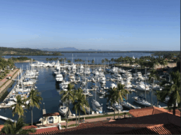
MARINA DI PROCIDA  SPONSORS THE OCEAN POSSE
AMENITIES
- Electricity 220
- 380 volts, up to 125 amps
- Fuel station on quay (08:00/19:00)
- Moorings
- Divers
- Anti-pollution equipment
- Recycling
- 24-hour surveillance
- Fire-fighting service
- Toilets and showers
- Weather service

LOCAL SERVICES
MARINA DI PROCIDA, A LANDING ON THE ISLAND OF YOUR DREAMS! At the mouth of the Gulf of Naples, beyond Cape Miseno, you will find the Isle of Procida, the smallest island in the Neapolitan archipelago, with its sisters Ischia and Capri. The yellow dip of the volcanic rocks harmoniously counter- balances the colorful variety of its lively villages, the green of the lush Mediterranean scrub – which dominates the na- tural reserve of Isle Vivara in the south – and the blue of the clear and shining sea that surrounds it. Dwelling of kings and nobles of the past, more recently residence of intellectuals and artists, the island has always been the theater for historical events and often the magnificent set of unforgettable movies, and offers its fascinating tourists paths through churches, monasteries, abbeys, squares and palaces swathed in an enchanted and unique atmosphere king. A maze of colorful and lively alleys runs through its villages, from Terra Murata to Corricella, that end in short taking views of the Neapolitan Gulf. These paths meet in the picturesque Marina Grande, landing place for visiting people and explosion of the island’s industriousness. Marina di Procida fits into this scenery without upsetting its beauty and harmony, offering its clients moorings complete with all facilities, all-day professional assistance, in a charming location, easily accessible from the mainland thanks to the many connections, also of international kind, and from the nearby islands and seaside resorts. The island’s beaches and attractions guarantee a wide range ge of choices to suit all tastes. The beach of the Silurenza, with the dive from the famous Scoglio del Cannone. The beach of the Lingua, well-known for underwater fishing. The beach of the Asino, described by Elsa Morante in “Ar- turo’s Island”. The beach of the Chiaia, protected by the wind and known for its delicious restaurants. And finally the beach of Pozzo Vecchio, immortalized by Massimo Troisi in “The Postman”. Fairs, rich both in gourmet and handicraft pro- ducts, and a nightlife rich in fun
MARINA DI PROCIDA SAFE APPROACH
NEARBY
1. Marina Corricella
Procida’s most iconic spot, this fishing village is a postcard-perfect maze of pastel-colored houses, narrow alleyways, and small fishing boats. It’s the best place to soak in the island’s authentic charm and enjoy fresh seafood at a seaside trattoria.
2. Terra Murata
The highest point on the island, Terra Murata is a medieval fortress district with breathtaking panoramic views. Here, you’ll find Palazzo d’Avalos, a former prison with a fascinating history, and Abbazia di San Michele Arcangelo, a historic abbey with underground crypts.

3. Chiaiolella Beach & Ciraccio Beach
Procida’s best beaches are on the western side of the island. Chiaiolella is perfect for swimming and sunset views, while Ciraccio has dramatic rock formations and fewer crowds.

4. Vivara Nature Reserve
Connected to Procida by a small bridge, Vivara is a tiny, protected island with hiking trails through Mediterranean vegetation and ancient ruins. It’s a must for nature lovers and birdwatchers.
5. Ischia (Nearby Island)
If you have time, take a short ferry ride to Ischia, Procida’s larger neighbor, known for its hot springs, Aragonese Castle, and stunning beaches. It’s a great day trip to complement Procida’s laid-back vibe.

 Tidbits
UTC time vs ships time
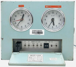
UTC zones work for sailors because they provide a single, universal reference for navigation, communication, and coordination across the seas. Here’s why they’re essential:
1. Navigation and Charts
• Tide tables, celestial navigation tables, and GPS systems all use Coordinated Universal Time (UTC).
• This prevents confusion when plotting courses, taking noon sights, or calculating positions, since sailors may cross multiple time zones in a single passage.
2. Communication and Safety
• Distress signals (e.g., GMDSS, EPIRBs, and Mayday calls) are logged in UTC, ensuring clarity for rescue coordination centers worldwide.
• Radio schedules, weather bulletins, and traffic separation schemes also publish times in UTC, so sailors know exactly when to tune in regardless of local time.
3. Weather Forecasting
• Global weather models (like GRIB files, hurricane advisories, and synoptic charts) use UTC.
• This keeps forecasts consistent across oceans, letting sailors interpret and share weather data without converting between local zones.
4. Ship’s Time
• Purpose: Local, practical clock for daily life aboard.
• Usage:
◦ Crew routines (meals, watches, maintenance).
◦ Coordination with local ports, marinas, customs, and shore services.
◦ Social sanity — sunrise at 0600, dinner at 1800, instead of odd UTC hours.
• Set By: Captain’s discretion. Typically aligned with the nearest time zone or with the port of destination.
• Flexibility: On long ocean passages, captains often adjust ship’s time gradually (e.g., shifting an hour every few days) to match the natural rhythm of daylight.
5. How They Work Together
• Logs & Navigation: Recorded in UTC for consistency and accuracy.
• Crew & Operations: Run on Ship’s Time for normal human rhythm and local dealings.
• Bridge Practice: A good habit is to write: “1200 UTC / 0800 Ship’s Time” in the logbook to avoid ambiguity.
⚓ In short: UTC is the common language of time at sea, ensuring that navigation, safety, weather, and communication remain synchronized for sailors across the globe.
⚓ THE Provisioning MEGA LIST
Every voyage is only as strong as its stores. This list is a sailor’s reminder — food, spares, medicine, and comforts — to keep crew safe, fed, and steady until the next harbor.
ACCESS DOWNLOAD AND EDIT FOR YOUR OWN SHIP >>>
NARCO SUB # 2
Mystery Deepens as Second Narco-Sub Washes Ashore in Solomon Islands For the second time in a year, an abandoned narco-sub has washed ashore in the Solomon Islands, baffling authorities and residents alike.
It has been three weeks since a narco-sub was spotted drifting in the turquoise waters off this remote Pacific nation, and authorities have yet to conclude their investigation, leaving residents with more questions than answers about how such a vessel, built for clandestine drug runs, ended up here — thousands of miles from its usual routes.
And it’s the second one in a year. Last August, a nearly identical craft appeared near a coral atoll about 400 kilometers north of Isabel Island, where the latest sub washed ashore. Maritime officials suspect both vessels may have traveled — or drifted — more than 13,000 kilometers from Latin America to the Solomons, a journey that covers more than a quarter of the planet’s circumference.
Countries NOW with parcel restrictions to the United States
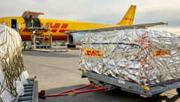
- 🇩🇪 Germany – Parcels paused – Deutsche Post/DHL stopped most business parcels; only documents and small gifts under ~$100 allowed.
Marine companies: Fischer Panda (gensets), Torqeedo (electric outboards), ZF Marine (gearboxes), Lewmar (Germany distribution). - 🇫🇷 France – Parcels paused – La Poste suspended parcels, except small gifts under €100 and documents.
Marine companies: Plastimo (safety gear, compasses), Wichard (stainless hardware), Facnor (furlers), Bénéteau & Jeanneau (boatbuilders). - 🇮🇹 Italy – Parcels paused – Poste Italiane halted acceptance of parcels with goods; only documents still accepted.
Marine companies: FPT/Iveco Marine (engines), Opacmare (passerelles), Besenzoni (deck gear), Azimut & Ferretti (yachtbuilders). - 🇳🇱Netherlands – Parcels paused – PostNL stopped all parcel shipments; documents may still pass via express.
Marine companies: Vetus (diesel engines, thrusters), Mastervolt (electrical systems), Heesen & Amels (shipyards), Van Oossanen (naval architects). - 🇬🇧 United Kingdom – Most parcels paused – Royal Mail halted merchandise shipments; letters and documents unaffected.
Marine companies: Raymarine (electronics), Lewmar (HQ in Havant), Harken UK (hardware), Spinlock (safety gear). - 🇸🇪 Sweden – Parcels paused – PostNord suspended shipments of goods; only letters and documents still possible.
Marine companies: Volvo Penta (engines), Seldén (masts & spars), Rutgerson (deck hardware), Harken Sweden. - 🇩🇰 Denmark – Parcels paused – PostNord blocked merchandise shipments; documents and letters unaffected.
Marine companies: Jefa (steering systems), Andersen (winches), X-Yachts (builders). - 🇦🇹 Austria – Parcels paused – Austrian Post stopped goods shipments; exceptions for gifts under $100 and premium couriers.
Marine companies: Fischer Panda (also operates out of Austria/Germany), niche stainless fittings. - 🇪🇸 Spain – Parcels paused – Correos suspended most parcels with goods; letters and documents unaffected.
Marine companies: Refit hubs in Palma & Barcelona, custom rigging, Osculati Spain distribution. - 🇦🇺 Australia – Transit parcels paused – Australia Post no longer forwards U.S.-bound parcels from third countries; direct AU→U.S. shipments still operating.
Marine companies: Ronstan (deck hardware), Coursemaster (autopilots), Muir (windlasses), Barz Optics (marine eyewear). - 🇳🇿 New Zealand – Parcels paused – NZ Post suspended economy, courier, and express parcels; only letters and documents allowed.
Marine companies: Southern Spars (rigging), Doyle Sails, Fusion Marine (stereo/electronics), Alloy Yachts (builders). - 🇰🇷 South Korea – Parcels paused – Korea Post suspended most parcels; premium express services still available.
Marine companies: Hyundai Marine (diesels), shipyard-scale suppliers (Daewoo, Samsung Heavy). - 🇸🇬 Singapore – Parcels paused – SingPost halted standard parcels to the U.S.; letters and documents still possible.
Marine companies: Regional distribution hub for Lewmar, Raymarine, Volvo Penta; chandlers like Singapore Marine Supplies. - 🇹🇭 Thailand – Parcels paused – Thailand Post suspended goods shipments; documents and letters unaffected.
Marine companies: Refit centers in Phuket (Asia Marine, Precision Shipwright Services), chandlery importers. - 🇮🇳 India – Parcels paused – India Post stopped most parcel services; exceptions for letters, documents, and gifts under $100.
Marine companies: Marlow Ropes (production partner), stainless steel fittings, OEM suppliers for western brands.
On the ground in one of the world largest Starlink repair shop
Elon Musk’s satellite internet service has been absolutely critical …. read on>>>
On the ground in one of the worlds largest Starlink repair shops
Starlink is absolutely critical.

Got a report, scoop, story, picture, subject or contact at a marina who wishes to work with us ? Please get in touch with us.
Extraordinary Cruising °°° Join the Fleet
- Access vetted local knowledge, safety resources, and prior experiences to make your passage safer and more enjoyable.
- Unlock a Life of Adventure
Explore hidden destinations, experience new cultures, and discover the freedom of life at sea or near shore – on your terms. - Get VIP Perks & Discounts at marinas, chandleries and boatyards
Get exclusive discounts, priority access, and personalized support at partner marinas across the globe. - Observe the actions of Experienced Captains
Tap into a wealth of tips, tools, and real-world know-how from seasoned mariners to grow your skills and gain confidence. - Make Every Nautical Mile Memorable
Join events, meetups, and shared journeys that turn you voyages into unforgettable stories and lasting memories. - Cruise with a Conscience
Gain insights into sustainable practices and join a movement that protects the waters you love to explore.

FLEET UPDATE 2025-08-17
The cure for anything is saltwater: sweat, tears, or the sea,
CRUISING ° FLEET UPDATE & NEWS ⚓ 2025-08-17
Take the Survey ⚓️ Win $ 250
Pictures of the Week
Calvi Corsica 🇫🇷 France
Marinas De España & Ocean Posse
Marina Puerto Velero 🇨🇴 Colombia Sponsors the Ocean Posse
Ocean Posse & Ben Taylor 🍸🍹 Street Party 🇫🇷 Cannes
Another Ocean Posse Perk Fisheries Supply Pro
Celestial Navigation Demystified – Navigation at Sea by Tim Brill
Primary Named Winds 🌬 Santa Ana
Ocean Posse Award Categories & 2 Award Entries This Week !
Marina Bizerte 🇹🇳 Sponsors the Ocean Posse
Must See in Near Marina Bizerte 🇹🇳
Join the Ocean Posse – Extraordinary °°° Cruising
The Lau Group 🇫🇯 Fiji
South Pacific – Meet the Cruising Fleet – Sat Aug 30 – Nawi Island Marina
Flor De Caña Rum Sponsors the Ocean Posse Events
Sixt Rental Cars Ocean Posse Special Discount
Ocean Posse Fleet 🛰️ Tracking by Predict Wind
💬 Tidbits
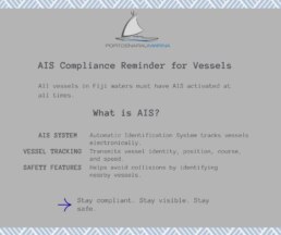
– Fiji Requires AIS
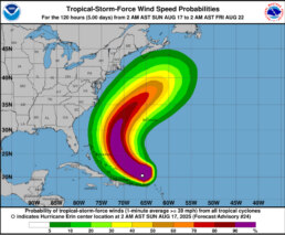
– Hurricane Erin
– Narco Subs Found Abandoned in the Solomon Islands
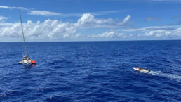
– Shipwreck in the Leeward Islands: Two Yachtsmen Rescued
– San Diegan Makes Sailing History at the Transpacific Yacht Race
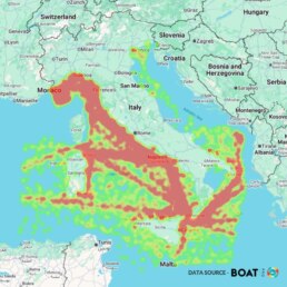
– Italy Super Yacht density in July
It’s That Time Again – The Ocean Posse Annual Survey IS LIVE ⚓️
Ahoy all Captains, Skippers, Admirals and Crew !
We need your voice now.
And need your insights from those at the helm, and that’s you.
This is your chance to speak up, shape our course, and steer the future of the Ocean Posse.
It’s quick. It’s anonymous. And it matters.
No names. No filters. Just straight-up seamanship and truth.
“ONCE YOU COMPLETE THE SURVEY, YOU’LL BE REDIRECTED TO ENTER THE $250 PRIZE DRAW.”
Only answer what you feel comfortable in answering.
Steady as she goes, The Ocean Posse Team !
PICTURES OF THE WEEK
Sunset and moon over Bonaire- RIP Ozzy!
MY MARTINI 🇺🇸 Bryan & Mary – Nordhavn 63′
Full moon at Ruby Lake British Columbia Canada
SY STRAY CAT 2 

CALVI – CORSICA 🇫🇷 FRANCE
42° 33.9033′ N 008°45.6733′ E
SY SAMLL WORLD III 🇻🇮 Karen & Daren – Bristol 47.7
Calvi lies on the northwest coast of Corsica, the dramatic “mountain in the sea” in the Mediterranean.
A historic port town, its Genoese citadel from the 13th century perches on a rocky headland, offering commanding views over the azure bay—a scenic and protective landmark for approaching yachts
Heritage & Seafaring Link
Steeped in Genoese and maritime legacy, Calvi’s fortress, old streets, and tales—like that of Christopher Columbus’s alleged birthplace—impart character and conversation-worthy history for visiting captains and crews. The town’s pedestrian zones, harborside cafes, and local markets invite gentle exploration after arrival
Cruising & Coastal Features
The coastline around Calvi is rugged and quintessentially Mediterranean—steep cliffs, hidden coves, and crystalline waters set the stage for ideal anchoring and sightseeing. Notably, the nearby Scandola Nature Reserve, with dramatic volcanic formations rising from the sea, is an unforgettable day-sail destination
Cruising Logistics & Atmosphere
Calvi maintains a well-equipped marina, navigable anchorage, and infrastructure friendly to ocean voyagers. The climate is Mediterranean: warm, sunny summers and mild winters Its combination of natural majesty, cultural intrigue, and practical harbor access makes it an outstanding seasonal hub or waypoint for Ocean Posse routes in the western Mediterranean.
Cultural Experiences for the Fleet
Visiting yachts can immerse in Corsican culture: the citadel, market stalls, and aromatic shrubs (rosemary, juniper, lavender) all enhance the sense of place The Citadel’s ramparts offer panoramic views and are a walkable highlight, while harborside dining offers a relaxing, convivial atmosphere to connect with crew and fellow sailors .
Ithaca 🇬🇷 is not only known for its anchorages but also for its association with the myth of Odysseus, the hero of Homer’s Odyssey. The island is characterized by its verdant landscapes, stunning coastlines, and hidden gems like beautiful, unspoiled beaches. Main Anchorage at Vathy.
 Kevin & Carla – Hanse 57′
Yachting Tourism News:
Marinas De España Strengthen Global Ties
With Ocean Posse Partnership

The collaboration includes the organization of a webinar in the fall and support to increase Ocean Posse’s presence among Spanish marinas.
Marinas de España has signed a collaboration agreement with Ocean Posse, the international network of more than 300 active yachts cruising the Mediterranean, Atlantic, Caribbean, Pacific, and beyond. The main objective of this strategic alliance is to connect Spanish marinas and ports with experienced sailors from around the world, facilitating the exchange of knowledge and promoting Spain as a benchmark for maritime tourism internationally.
The agreement includes the joint organization of a specialized webinar in the fall of 2025, which will address best practices for attracting and serving the international cruise fleet. Furthermore, Marinas de España will support Ocean Posse in its expansion throughout Spain, promoting the benefits of being part of this global network.
This collaboration reinforces Marinas de España’s internationalization strategy and its commitment to promoting quality maritime tourism. Spanish marinas will have the opportunity to connect with vessels averaging 47 feet in length, owned by self-sufficient sailors seeking safe, transparent ports with quality services for both short, technical stops and longer ones so sailors can enjoy the destination.
“The partnership with Ocean Posse represents an exceptional opportunity to position our marinas on the international map of high-end maritime tourism. This agreement will not only increase the visibility of our facilities globally, but will also attract experienced sailors who value quality services and will significantly contribute to the local economy. The webinar we will organize this fall will be an ideal platform to share knowledge and establish direct connections with this prestigious international community,” says Tomás Azcárate, President of Marinas de España.
For his part, Captain Dietmar Petutschnig of Ocean Posse emphasizes: “Spain has exceptional port infrastructure and a strategic location for sailors crossing the Atlantic and the Mediterranean. Our collaboration with Marinas de España will allow us to strengthen our presence in this key market and offer our members access to top-quality ports. We are convinced that this alliance will benefit both Spanish ports and our global community of sailors.”
About Marinas de España
Marinas de España is the Spanish Federation of Associations of Sports and Tourist Ports (FEAPDT), which comprises the associations of nine key coastal regions in Spain: Andalusia, Asturias, the Balearic Islands, the Canary Islands, Cantabria, Catalonia, Galicia, Murcia, and Valencia, representing more than 150 sports and tourist ports and, in turn, more than 46,000 berths.
The main objective of Marinas de España is to promote the continuous development and improvement of marinas, marinas, and marinas in all activities related to the sector, including nautical, tourism, environmental, training, and management aspects, thus ensuring that these facilities not only meet international quality standards but also contribute positively to the local and regional environment where they are located.
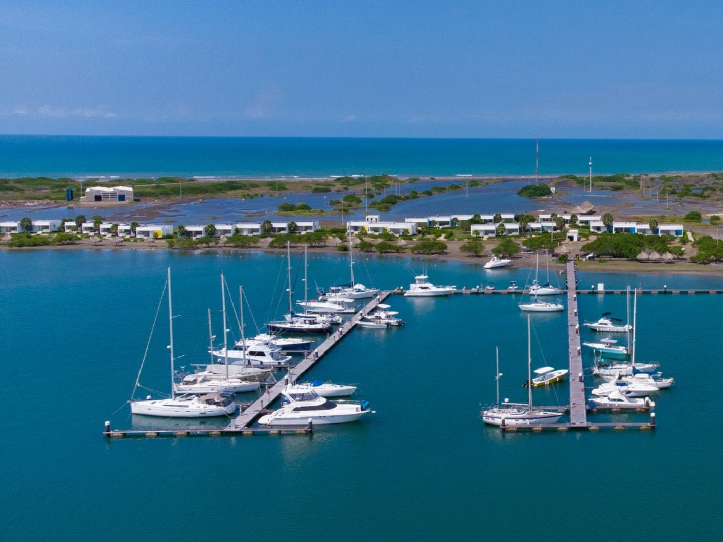
MARINA PUERTO VELERO  COLOMBIA SPONSORS THE OCEAN POSSE
10° 56.85′ N 075° 02.1833′ W
Hello Ocean Posse, thanks for the interest with our marina.
The rates are on our website and we can offer your affiliates a 10% discount on these rates.
For reservations and details follow this link
AMENITIES
- 460 berths
- 210 are currently available to boaters, either for rent or for purchase
- from six (18 ft) to twenty meters (66 ft) in length
- drinking water
- Wi-Fi, and 110 or 220 volt
- 32 or 64 amp electricity
- 24-hour surveillance and security services, every day of the year
- Access to the entire property, including the 40-meter-long pool
- Showers and restrooms available 24 hours a day
- Laundry facilities
- Restaurant with special menu prices for boaters
- 24-hour security
- Wi-Fi
- Ping-pong table
- Paddleboards and kayaks (additional cost).
NEARBY
1. Tubará’s Ecotourism & Archaeological Sites
Just inland lies Tubará, a municipality rich in heritage and ecological appeal. Explore archaeological sites, enjoy hillside viewpoints like the ones in El Morro, and visit the Casa del Artesano to see local crafts—immersions into indigenous Mokaná culture
2. Castillo de San Antonio de Salgar (Salgar Castle)
A historic 19th-century fortress near Puerto Colombia, built originally for customs control and later transformed into a cultural venue—now restored and host to family events and dining under its colonial architecture
3. Gran Malecón del Río & ‘Ventana al Mundo’ in Barranquilla
Back in the city, enjoy a pleasant riverside promenade with parks, eateries, and clear views of the Magdalena River. Nearby, “Ventana al Mundo” is a modern, eye-catching monument that symbolizes Barranquilla’s cultural openness
4. Casa del Carnaval & Bolivarian Museum
The Casa del Carnaval, in Barranquilla’s Abajo neighborhood, houses vibrant carnival costumes, masks, and presentations of local culture. The nearby Bolivarian Museum highlights contemporary Caribbean art and the legacy of Simón Bolívar
YOUR SPECIAL INVITATION
OCEAN POSSE & BEN TAYLOR

 STREET PARTY
@ CANNES  YACHTING FESTIVAL
Captains & Yacht Owners
Join us for the most laid-back marine industry networking event of the year.
Thursday, September 11, 2025 | 18:00 – 21:30
Lupita’s – 72 Rue Meynadier
Enjoy legendary Flor de Caña rum cocktails and authentic
Barra de Navidad–style tacos, courtesy of Ocean Posse & Taylor Media.
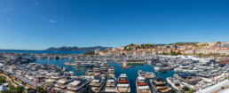
The Cannes Yachting Festival, founded in 1977, is Europe’s leading in-water boat show held every September in Vieux Port and Port Canto. It gathers nearly 700 boats from 20′ to 165′ with 600+ exhibitors, and 55,000 visitors. Divided into zones for motor yachts, sailing vessels, tenders, toys, and luxury, it offers sea trials and global premieres. The 2025 show runs from September 9–14.
ANOTHER OCEAN POSSE PERK
FISHERIES SUPPLY PRO ACCOUNT FOR THE OCEAN POSSE
Get your PRO discount – Follow this link to sign up and order directly with pro pricing >>>
Celestial Navigation Demystified 🧭 by Tim Brill, USCG Master and Circumnavigator
Learn Terminology, the Tools, the Big Picture, Time, the Noon Site for Latitude, Latitude by Polaris, the Five Steps for Solving for Latitude and Longitude using the Marcq St. Hilaire Intercept method and more, all while having fun 🙂.
Brought to you by our very own Ocean Posse Circumnavigator
Captain Tim Brill
Primary Named Winds 🌬 PACIFIC COAST OF THE AMERICAS
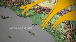
Santa Ana Winds – The Desert Breath That Meets the Sea
Every coastal sailor from San Diego to Santa Barbara has a Santa Ana story. These winds are not the gentle sea breezes we welcome on a hot afternoon, they are the desert’s breath sweeping downhill, gathering speed through canyons, and rushing out over the Pacific, just as you are trying to get to Mexico
They can give you a fast push offshore or punish an ill-prepared yacht at anchor. Like the tides and currents, they’re part of the rhythm of this coast – and respecting them is as essential as charting your course.
Where They Begin
Santa Anas are born inland. When high pressure settles over the Great Basin and low pressure lingers offshore, the gradient pulls air downslope toward the coast. As that air compresses through mountain passes, it warms and accelerates.
By the time it pours out near Los Angeles or San Diego, what began as cool desert air is now hot, dry, and forceful – sometimes steady, sometimes violent. For mariners, it means the wind doesn’t come from the sea, but from the land, reversing the normal pattern and changing the game entirely.
When They Blow
These winds can turn up any month, but the prime season runs September through April, with fall , especially October and November, notorious for the strongest bursts.
A Santa Ana event can last a single night or blow for days. Often the fiercest hours come at 1 AM, you go to sleep with calm seas at anchor and wake up with your rigging howling. By midday, they sometimes ease, but not always.
What to Expect on the Water
Unlike many wind systems, Santa Anas flatten seas near the shoreline. At first glance, it can look like dream sailing , flat water, brisk winds, and a quick reach out of the harbor.
But offshore the story shifts. Pacific swell keeps marching in from the west, and when it collides with strong offshore wind, you get steep, confused chop. The further you press out – toward Catalina, San Nicolas, or beyond, the rougher and more unpredictable it gets. The Chanel Islands are just far enugh of shore that they are in the brunt of this onslaught.
Closer to shore, gusts funnel through canyons. In one cove it may be dead calm, in the next bay a full gale. Sailors who’ve tried to anchor off Malibu or Newport during a Santa Ana have learned how quickly a secure night can turn into a dragging-anchor nightmare
More Than Wind: Fire and Haze
The Santa Anas are infamous on land for fueling wildfires, and at sea the byproduct is smoke. Ash can drift far offshore, coating decks and dimming horizons. In heavy fire years, visibility drops to a few miles, even in mid-day.
In those conditions, VHF radio, radar and AIS become necessities, after all Long Beach commercial traffic is relentless and playing frogger getting across these busy shipping lanes with smoke is hazardous.
Tactics
Check the pressure map:
A strong gradient from the Great Basin to the coast is your early warning. NOAA will issue advisories, but the chart tells the story best.
Reef early, reef deep:
If Santa Anas are in the forecast, set conservative sails before you clear the breakwater. It’s easier to shake a reef out than to claw one in under a surprise gust.
Don’t trust the flat seas near shore:
They lull you into a sense of security. Nine miles offshore, it’s a different ocean.
Anchor with the wind in mind:
Harbors that are snug in a westerly swell may be exposed when the wind howls out of the east. Choose your basin accordingly and double your lines.
Fatigue:
The hot, dry wind gnaws at crew morale. Hydrate, rotate watches, and keep tempers cool even when the wind is not.
Sailor’s Dilemma:
One of the great temptations is to let a Santa Ana carry you south. From Los Angeles to San Diego, the offshore push can feel like magic – just do not try to get back into port !
Santa Ana tales float around every gunkhole
A racing fleet bound for Ensenada scattered by a surprise blow, half the boats towed back in by dawn.
A ketch in Newport Harbor dragging across the anchorage at 3 a.m., clattering into half a dozen boats before the crew could reset.
Yachts heading to Catalina enjoying champagne sailing downwind, only to fight back through chop and gale the following day.
OCEAN POSSE AWARD CATEGORIES
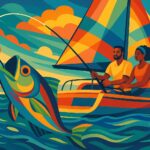
BIGGEST FISH CAUGHT
*no billfish
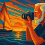
PICTURE OF THE YEAR
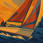
SPEEDY AWARD

THE CAPTAIN RON AWARD
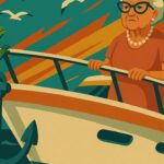
UNINVITED VISITOR ONBOARD
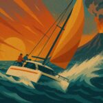
HIGHEST WIND RECORDED
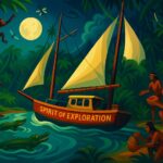
SPIRIT OF EXPLORATION

GOOD SAMARITAN OF THE YEAR

BOAT YOGA POSE OF THE YEAR

COURAGE AWARD

SAILING SLOTH AWARD
we have 2 award entries this week !
MARINA BIZERTE  SPONSORS THE OCEAN POSSE
37° 16.55′ N 009°52.8633′ E
We are happy to welcome the participants of the Ocean Posse with a 15 % discount off our slip fees.
With the sea on our doorstep and the magnificent old town on its left, Marina Bizerte combines an outstanding destination with a world-class marina and services. Located in the heart of the Mediterranean Sea, French Heritage site and northern point of Africa, the marina features more than 800 secure berths up to 450 feet
AMENITIES
-
10 berths ranging 80-150m
-
Short and long term berth lease / license options
-
Tax and duty-free fuel
-
Onsite customs and immigration
-
Outside of EU tax and import regulations
-
Single and 3-phase electricity
-
Local repair and maintenance facilities
-
24-hour security
-
Refuse / grey and black water disposal
-
WiFi
-
Yacht Club
-
Sports Club
-
Walking – shopping and entertainment
MARINA BIZERTE SAFE APPROACH
MUST SEE – near Marina Bizerte
Vieux Port (Old Harbor) & Medina
The heart of Bizerte’s maritime life—colorful fishing boats line the quay, edged by whitewashed buildings, cafés, and classic harbor activity. Right beside it, the Medina unfolds as a labyrinth of winding alleys full of authentic artisan workshops.
Kasbah of Bizerte
Overlooking the harbor, this 17th‑century fortress sits atop Byzantine foundations and offers sweeping views of the medina, lake, and sea—plus a glimpse into the city’s layered past.
Fort Sidi el Hani
A compact golden-stone fort directly across from the Kasbah, housing a small oceanographic museum and offering a lovely terrace view over the harbor.
Fort d’Espagne (Spanish Fort)
Perched on a hill northeast of the Kasbah, this 16th-century stronghold was built by an Ottoman pirate to guard against Spanish attacks. It now offers panoramic views of the medina and harbors below—and has been revitalized as an open-air theater.
Oceanographic Museum
Housed within the Old Fort, this maritime museum delights with fish displays, historical maps, boat models, and a charming café where you can sip tea with a harbor view.
Ichkeul National Park (Lake Ichkeul)
About 20–25 km southwest of Bizerte lies this UNESCO World Heritage Site—an extraordinary wetland and lake ecosystem that attracts migratory birds including flamingoes, storks, and ducks.
Cape Angela (Northernmost Point of Africa)
Roughly 15 km away, Cape Angela (Ras Ben Sakka) marks the northernmost tip of the African continent. The rocky headland provides breathtaking coastal views and a memorable photo spot.
Utica Ruins
Just outside Bizerte, explore the Phoenician-founded city with Roman villas, mosaics, and a Punic necropolis.
Cap Blanc & Cap Farina
Dramatic coastal headlands perfect for nature lovers.
Cap Blanc Nature Park & Beaches
Relax on golden sands like Sidi Salem Beach or enjoy scenic hikes/cliff views at Cap Blanc.
Join the Ocean Posse – Extraordinary °°° Cruising
Join this independent and global fleet! Hundreds of seasoned captains and yacht owners form an intelligent network, sharing real-world experience, safe routes, and exclusive marina benefits. Be part of the community that’s redefining long-range cruising.
BENEFITS OF of joining the Ocean Posse – ANNUAL MEMBERSHIP
SAVE TIME – SAVE MONEY – and get the best and most up to date INFORMATION !
| BENEFITS FOR YOU, YOUR YACHT & YOUR CREW |
|
|
| ✔️ Up to date and verified information by fellow yachts | ✔️ | |
| 📊 Communications focused on facts, not opinions or unsolicited advice | ✔️ | |
| 💰 Save real money at 125+ Marinas with discounts * | ✔️ | |
| 🛰️ Free vessel and fleet tracking courtesy of Predict Wind | ✔️ | |
| 🚩 Free Burgee * | ✔️ | |
| 💰 Save with service providers and chandleries | ✔️ | |
| 🕵️ dedicated, experienced and discounted Canal and clearing in agents | ✔️ | |
| 🗺️ Free aid to navigation 550 Gb OpenCPN satellite charts (mac/pc/android) | ✔️ | |
| 💰 Save Money on parts with a Westmarine Pro Discount | ✔️ | |
| 💰 Save Money with a Predict Wind Pro Discount | ✔️ | |
| 🗺️ Free Printable Reference Charts emergency backup to your electronics | ✔️ | |
| 📹 Free Video Seminars on destinations from those who are there | ✔️ | |
| 🌩️ Top weather routing avail by Marine Weather Center Chris Parker | ✔️ | |
| ⛵ Community of voyagers all are welcome, kids, single-handers, pets | ✔️ | |
| ☂️ NEW Group Fleet Yacht Insurance with discounts for multi-year participants 15% and + 5% after year 3 | ✔️ | |
| ⚓ Peer support in emergencies with escalation procedures | ✔️ | |
| Fleet Updates via email – free | ✔️ | |
| 🏆 Fun Award Categories | ✔️ | |
| 📍 Free access to GOOD NAUTICAL Anchorage reports | ✔️ | |
| ☎️ Free Weekly live calls on Mondays via dedicated LINE.me group | ✔️ | |
| 💬 Free 24/7 LINE group channel | ✔️ | |
| 🌊 Benefit from the latest information and prior experience participants | ✔️ | |
| 🔭 Be part of a fleet of sensor for those who come behind you or meet | ✔️ | |
| 🚷 Always priority traffic – for participants by participants | ✔️ |
- (* as long as you do not have prior contracts or reservations in place and subject to a marina’s availability )
THE LAU GROUP 🇫🇯 FIJI
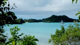
The Lau Group – Fiji’s Remote Maritime Frontier
For centuries, the Lau Group has been a sailor’s dream and a mariner’s challenge, a scattering of more than 50 islands in Fiji’s far east, bridging the blue expanse between Fiji and Tonga. This is a place where the Pacific’s prevailing trade winds meet ancient voyaging routes, where volcanic peaks rise above turquoise lagoons, and where reef-studded atolls demand respect from even the most experienced navigator.
From a sailor’s perspective, Lau is unlike any other part of Fiji. Supplies are scarce, navigation is intricate, and the rewards are unforgettable. You’re not just visiting a chain of islands – you’re entering a cultural corridor shaped by Melanesian roots, Polynesian influence, and centuries of open-ocean exchange. The villages here are small and tightly knit, and the sevusevu, the ceremonial presentation of kava root to the local chief – is more than a formality; it’s your welcome into the community.
The Lau Group is typically divided into three regions – Northern Lau, Central Lau, and Southern Lau – each with its own landscapes, anchorages, and cultural flavors.
SY Wanderlust Exploring the Northern Lau Group
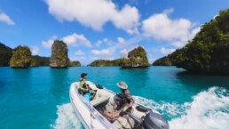
The Bay of Islands and Beyond
The Northern Lau is often the first landfall for cruisers approaching from Fiji’s main islands. Dominated by Vanua Balavu, this section offers some of the most celebrated anchorages in the South Pacific. Vanua Balavu’s Bay of Islands is a labyrinth of sheltered waterways, limestone cliffs, and hidden coves, perfect for days of dinghy exploration. The village of Lomaloma is the main settlement, where you can arrange provisions, meet friendly locals, and take part in community events.
North of Vanua Balavu lies Qilaqila, a geological wonder of jagged limestone formations and sea caves. These waters are teeming with marine life – ideal for spearfishing and snorkeling – but also require vigilant navigation as reefs can rise abruptly from deep water. In favorable weather, the sail here is exhilarating, with steady trade winds filling your sails and sweeping you across channels used by Pacific voyagers for generations.
For mariners, Northern Lau offers relatively more anchorages than the central and southern sections, but charts can be incomplete, and eyeball navigation remains essential. The reward is access to one of Fiji’s most pristine cruising grounds, where you might share an anchorage with only one or two other yachts.
Use Good Nautical to download the GPX tracks made my SEAGLUB a Hylas 46′
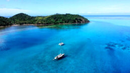
Central Lau – Lakeba and the Heart of Tradition
The Central Lau islands are where Fiji’s history and Tonga’s influence meet most visibly. Lakeba, the traditional seat of the Tui Nayau (the paramount chief of Lau), played a central role in the region’s political and cultural exchanges. The architecture here reflects a mix of Fijian and Tongan styles – steep-pitched roofs, handwoven mats, and intricate carvings. The local dialect carries Tongan inflections, and you’ll often hear stories of the maritime ties between the two nations.
For sailors, Central Lau is less visited, partly due to fewer sheltered anchorages and the challenges of navigating between shallow reefs. Lakeba has a reasonable anchorage in calm conditions, but strong trades can make it rolly. The payoff for making the effort is a warm reception ashore and a deep dive into Lauan culture. Villages are proud of their heritage, and visiting mariners are often invited to join meke performances (traditional song and dance) or share in a communal lovo (earth oven feast).
Nearby islands such as Nayau and Cicia offer a glimpse into subsistence life. Farming, fishing, and weaving dominate daily activities, and the rhythm of life here is dictated more by the tide than the clock. For provisioning, expect the basics – taro, cassava, coconuts, and fresh fish – but little in the way of modern stores, so yachts should arrive well-stocked.
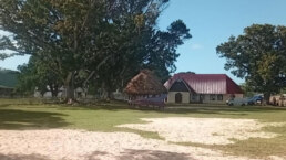
Southern Lau – The Remote Coral Kingdom
Southern Lau is where Fiji dissolves into the blue and meets the open ocean toward Tonga. The islands here are some of the most beautiful and remote in the South Pacific, with Ono-i-Lau and Fulaga standing out as iconic destinations. Fulaga, in particular, is a sailor’s paradise: a ring of coral surrounding a lagoon dotted with hundreds of mushroom-shaped limestone islets. The entrance pass is narrow and must be taken at slack tide, but once inside, you’ll find glassy anchorages and postcard-perfect scenery.
Ono-i-Lau is the easternmost inhabited part of Fiji, and the people here maintain close ties with Tonga, both culturally and through intermarriage. The sailing between these southern islands demands careful timing – strong southeast trades, long passages between safe anchorages, and ocean swell wrapping around the reefs can test seamanship. But the isolation also means you’ll often be the only yacht for days, and your arrival will be noticed and welcomed.
Provisioning here is minimal, with most goods arriving on infrequent supply ships. Fuel is not available, and water must be collected or made onboard. This is bluewater cruising at its most self-reliant – where preparation, weather awareness, and a healthy respect for local knowledge are essential.
SOUTH PACIFIC – MEET THE CRUISING FLEET – SAT AUG 30 – NAWI ISLAND MARINA
Brought to you by the yacht sales co.
-
15:00 YACHT MARKET OVERVIEW FOR BUYERS AND SELLERS PRESENTED BY
THE YACHT SALES CO -
15:30 THE PASSAGE TO NEW ZEALAND – PRESENTED BY OCEAN TACTICS
-
16:00 MEET AND MINGLE AND FREE RUM
-
17:00 LET THE FEAST BEGIN …
-
19:00 KAVA AND RUM AFTER HOURS
OFFICIAL OCEAN POSSE EVENTS
OCEAN POSSE KICK OFF 🇲🇽 BARRA DE NAVIDAD, MEXICO December 3-7 2025
MARINA PUERTO DE LA NAVIDAD, BARRA DE NAVIDAD, MEXICO
OCEAN POSSE & BEN TAYLOR STREET PARTY @ CANNES 🇫🇷 YACHTING FESTIVAL
TAQUERIA LUPITA, 72 Rue Meynadier, Cannes
GRAND PAVOIS 🇫🇷 La Rochelle – Sep. 24 2025
Gran Pavois La Rochelle, 20 Av. de la Capitainerie, 17000 La Rochelle, France
OCEAN POSSE 🇺🇸 SAN DIEGO BAY 4 DAY CRUISING SEMINARS SERIES @ SAFE HARBOR SOUTH BAY
SAFE HARBOR SOUTH BAY EVENT CENTER, CHULA VISTA, SAN DIEGO, CA
GRAND PAVOIS 🇫🇷 La Rochelle – Sep. 24 2025
Gran Pavois La Rochelle, 20 Av. de la Capitainerie, 17000 La Rochelle, France
GRAND PAVOIS 🇫🇷 La Rochelle – Sep. 24 2025
Gran Pavois La Rochelle, 20 Av. de la Capitainerie, 17000 La Rochelle, France
GRAND PAVOIS 🇫🇷 La Rochelle – Sep. 24 2025
Gran Pavois La Rochelle, 20 Av. de la Capitainerie, 17000 La Rochelle, France
GRAND PAVOIS 🇫🇷 La Rochelle – Sep. 24 2025
Gran Pavois La Rochelle, 20 Av. de la Capitainerie, 17000 La Rochelle, France
GRAND PAVOIS 🇫🇷 La Rochelle – Sep. 24 2025
Gran Pavois La Rochelle, 20 Av. de la Capitainerie, 17000 La Rochelle, France
FLOR DE CAÑA RUM SPONSORS THE OCEAN POSSE EVENTS
Puffins in Orkney
The Orkney Islands, off the north coast of Scotland, are one of the best places in the UK to see puffins in their natural habitat.
These charismatic seabirds, often called “clowns of the sea,” nest in burrows along the cliffs and grassy headlands of Orkney from late spring to mid-summer.
Puffins usually arrive in April and stay until early August. The peak viewing season is May to July when they’re raising their chicks (called pufflings). They prefer grassy cliff tops where they can dig burrows. You’ll often spot them perched with beaks full of sand eels. Puffins are surprisingly small in real life, about 26–29 cm tall. They spend most of the year out at sea, only coming ashore to breed.
MY HO’OKIPA – Lucky Chucky & Lisa – Selene 43′


OCEAN POSSE SPONSORS
SPONSORS
-
ABERNATHY

-
BOAT HOW TO

-
BELIZE TOURISM BOARD

-
CABRALES BOAT YARD

-
CHRIS PARKER MARINE WEATHER CENTER

-
DELTA MIKE MARINE SUPPLY PANAMA

-
DIGITAL YACHT

-
EL JOBO DISTRIBUIDORA COSTA RICA

-
FISHERIES SUPPLY

-
HERTZ RENTAL CARS MEXICO

-
HOME DEPOT PRO MEXICO

-
NAVILY

-
OCEAN TACTICS

-
PANAMA YACHT BROKERS

-
PREDICT WIND

-
SAN DIEGO MARINE EXCHANGE

-
Safety onboard costa rica

-
SEVENSTAR YACHT TRANSPORT

-
SHAFT SHARK

-
SINBAD MARITIME SERVICES

-
SIXTH RENTAL CARS

-
SUN POWERED YACHTS

-
YACHTAGENTSGALAPAGOS.COM

-
WEST MARINE PRO

SIXT RENTAL CARS
SPONSORS THE OCEAN POSSE WITH A SPECIAL DISCOUNT
OCEAN POSSE FLEET 🛰️ TRACKING
SPONSORED BY PREDICT WIND
JOIN THE OCEAN POSSE AT THE ANNAPOLIS SAILBOAT SHOW
If you volunteer with staffing our booth VB09
You’ll get you an all access exhibitor pass , some free rum and a Ocean Posse Shirt !
Follow this link to volunteer and signup >>
PANAMA POSSE CANAL AGENTS
To arrange for transit with the Panama Canal Authority please contact our dedicated Panama Canal agents and sponsors of the Panama Posse and the Pacific Posse
CENTENARIO CONSULTING

Erick Gálvez
info@centenarioconsulting.com
www.centenarioconsulting.com
Cellphone +507 6676-1376
WhatsApp +507 6676-1376
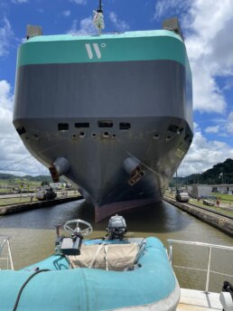
MY DELTA SWIZZLER – Mark & Cindy – Vantare 58′
 Tidbits
FIJI REQUIRES AIS
AIS COMPLIANCE REMINDER
“All vessels in Fiji waters must have AIS activated at all times ”
HURRICANE ERIN
Friday Aug 15 2025 –
Hurricane Erin formed into a Category 1 storm on August 15, 2025, becoming the first hurricane of the Atlantic season with sustained winds of about 75 mph Guided west-northwest, it swept past the northern Leeward Islands and stirred heavy rains, flooding and deadly swells—from Puerto Rico to the Virgin Islands Meteorologists warn of rapid intensification into a major Category 5, hurricane over the weekend as it traverses unusually warm waters . Though landfall isn’t expected, thousands of miles of coastline could still face hazardous surf, rip currents, and beach erosion
NARCO SUBS FOUND ABANDONED IN THE SOLOMON ISLANDS
Shipwreck in the Leeward Islands: Two Yachtsmen Rescued
Updated on 08/15/2025
On Friday, August 15, at 7:50 a.m., the JRCC Tahiti received a distress call from the Swedish-flagged sailing vessel “ITORNIA,” which had suffered a water ingress after colliding with an unidentified floating object. The distress beacon located the vessel and its two occupants 55 nautical miles west of Mopelia, in the Society Archipelago, in the Leeward Islands.
The JRCC Tahiti immediately took over coordination of the operation. It confirmed with the two sailors, aged 64 and 69, their ability to evacuate aboard their life raft with food, safety equipment, and their personal belongings. At the same time, JRCC Tahiti made contact with two nearby merchant vessels, the chemical tanker “HAFNIA CHEETAH” (Singapore-flagged) and the cargo vessel “INTREPID” (Cayman Islands-flagged). After analyzing the response times and conditions, JRCC Tahiti diverted the supply vessel “INTREPID,” located three hours away, to pick up the shipwrecked victims and transport them to Tahiti.
Following the abandonment of the sailboat, JRCC Tahiti prepared and issued an urgent notice to mariners to warn of the danger posed by the semi-submerged wreck adrift.
The High Commissioner of the Republic in French Polynesia would like to thank all those involved, and in particular the crew of the “INTREPID“, whose professionalism and rapid and decisive intervention enabled a favorable outcome, demonstrating once again the exemplary solidarity of seafarers.|
Shout out to Alli Bell
for making history in winning the Transpac race on her vintage Cal boat!!!
https://sandiegomagazine.com/everything-sd/transpacific-yacht-race-2025-alli-bell/
JULY SUPER YACHT DENSITY IN ITALY
According to BOATPro AIS data, Italy in July experienced heavy superyacht activity this July, with Costa Smeralda and La Maddalena recording the highest concentrations, closely followed by Capri, the Amalfi Coast, and the Aeolian Islands.
The heatmap highlights key cruising hotspots, showing busy anchorages and dense yacht traffic along Italy’s most popular summer routes.
For smaller vessels, this means navigating crowded ports, dodging movements between destinations, and adapting to the high density of yachts along the coastline.
Got a report, scoop, story, picture, subject or contact at a marina who wishes to work with us ? Please get in touch with us.
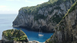
Extraordinary Cruising °°° Join the Fleet
- Access vetted local knowledge, safety resources, and prior experiences to make your passage safer and more enjoyable.
- Unlock a Life of Adventure
Explore hidden destinations, experience new cultures, and discover the freedom of life at sea or near shore – on your terms. - Get VIP Perks & Discounts at marinas, chandleries and boatyards
Get exclusive discounts, priority access, and personalized support at partner marinas across the globe. - Observe the actions of Experienced Captains
Tap into a wealth of tips, tools, and real-world know-how from seasoned mariners to grow your skills and gain confidence. - Make Every Nautical Mile Memorable
Join events, meetups, and shared journeys that turn you voyages into unforgettable stories and lasting memories. - Cruise with a Conscience
Gain insights into sustainable practices and join a movement that protects the waters you love to explore.


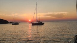
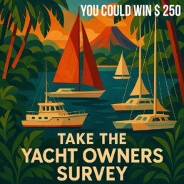


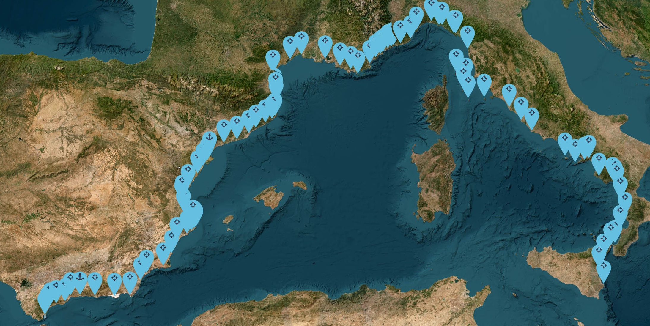
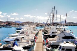
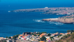
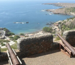
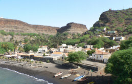
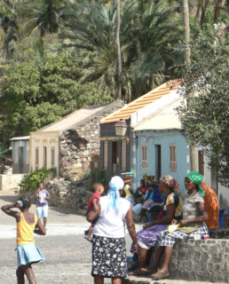
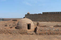
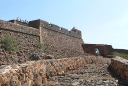
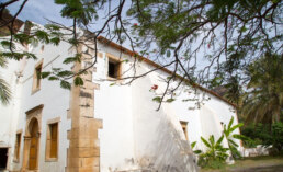



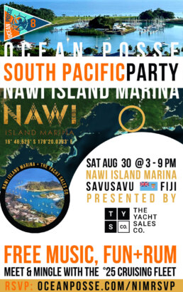
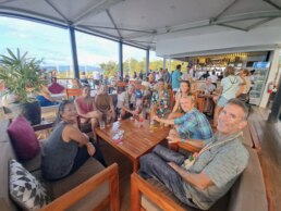


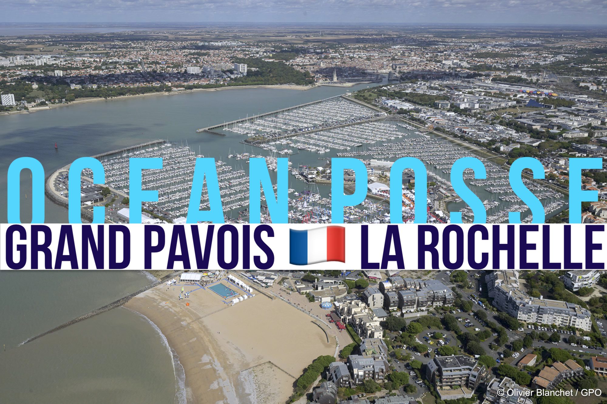


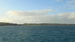
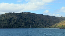
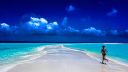

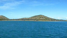
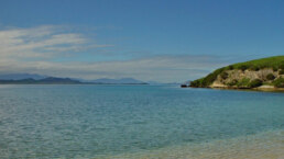
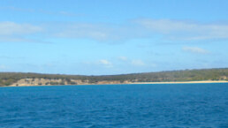
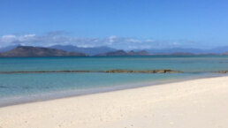
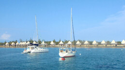
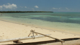
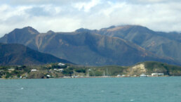
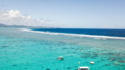
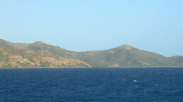
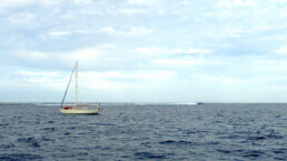
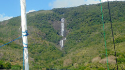
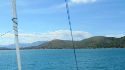
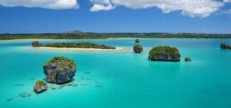


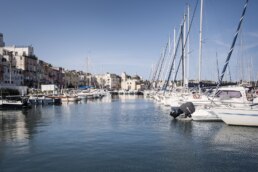



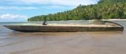
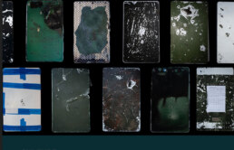
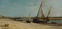
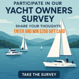
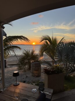
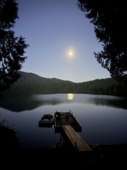
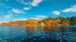
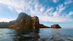
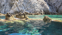
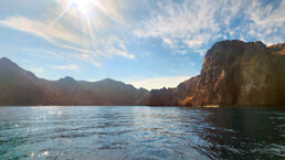
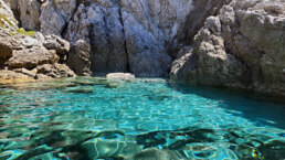
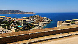
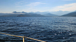
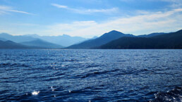
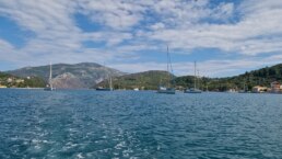
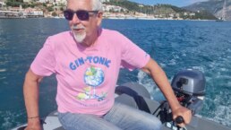

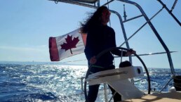
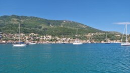
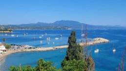
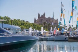
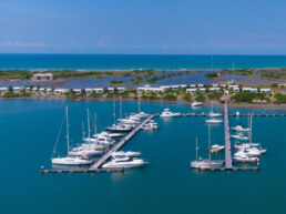
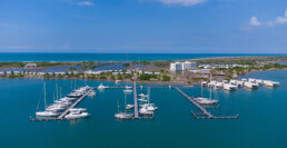
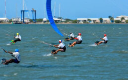
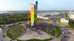
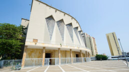
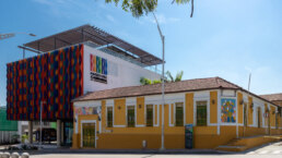
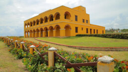


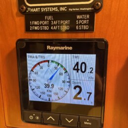

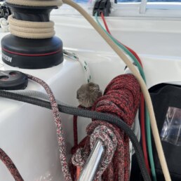

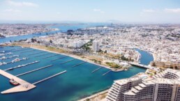
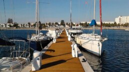
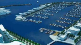
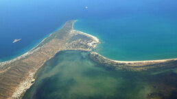
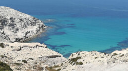
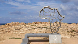
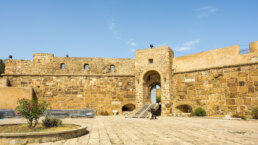
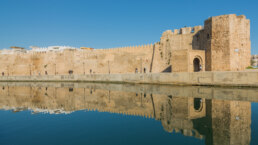

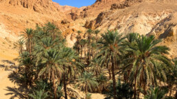
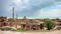
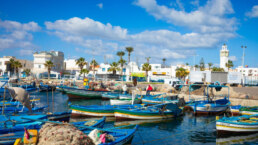
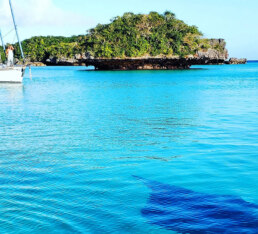
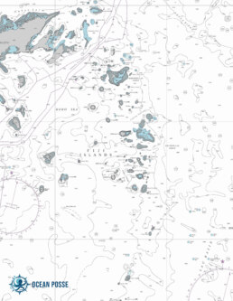
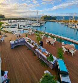

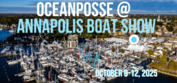
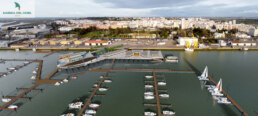
 SPAIN – SPONSORS THE OCEAN POSSE