

CRUISING ° FLEET UPDATE & NEWS ⚓ 2025-09-14
In Cannes it was clear, a tide of northern European yacht owning entrepreneurs and wealthier retirees are preparing their exits. Dutch, Belgian, and British owners are again looking outward, with eyes on shores rich in opportunity and maritime tradition. Our gathering in Cartagena, Spain on Sept 27, is the place to chart these courses together, toward new ventures and new horizons in the new world.
CRUISING ° FLEET UPDATE & NEWS ⚓ 2025-09-07
Ocean Posse Burgees 🚩 Flying in Cannes 🇫🇷 France
Recap Ocean Posse & Ben Taylor 🍸🍹 Street Party
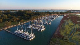
St Croix 🇻🇮 USVI
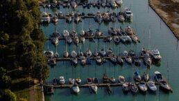
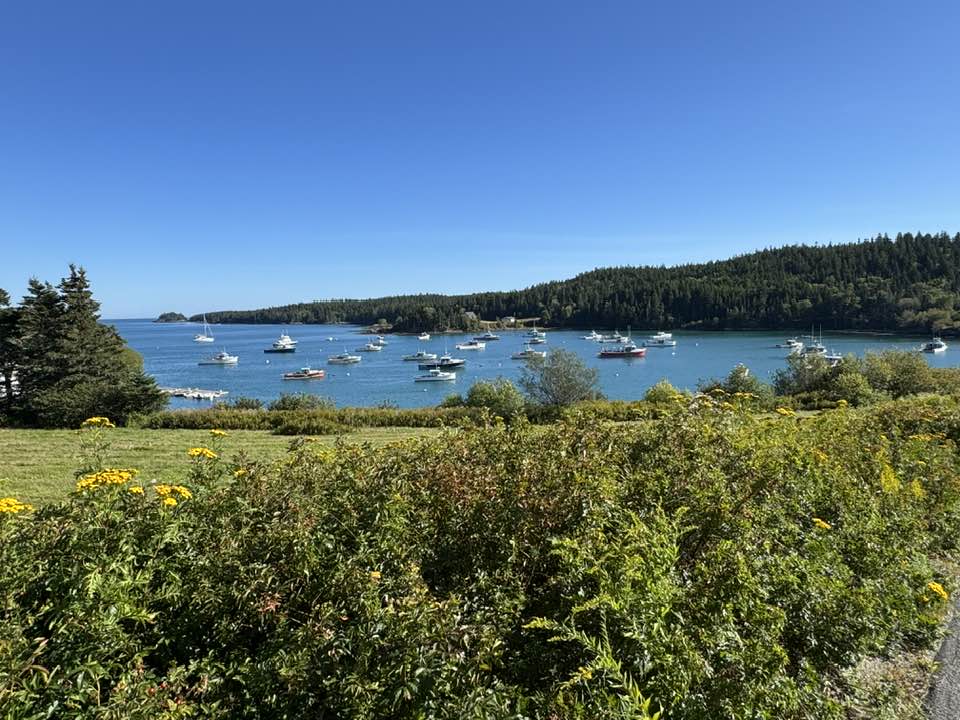
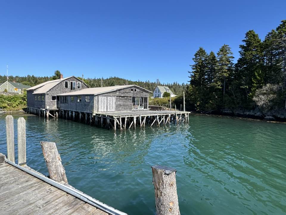
Southwest Harbor 🇺🇸 Maine
Share the Joy of Cruising Without a Set Schedule
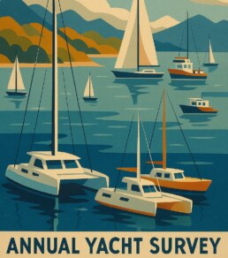
Ocean Posse Annual Survey
⚓ Route Pods
Ocean Posse Cartagena Kick Off Event 🇪🇸 Cartegna Spain
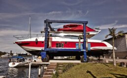
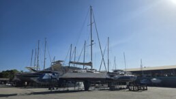
Introducing a New Sponsorship Marina Marina Da Gloría 🇧🇷 Brasil
Meet the Fleet 🇨🇦 SY Whispering Winds
4 Days of Cruising Seminars 🇺🇸 San Diego Oct 14 – 17 2025
Coromuel Winds 🌬️ La Paz 🇲🇽 Mexico
Must See: Isla Isabella 🇲🇽 Mexico
Ocean Posse Fleet 🛰️ Tracking
Ocean Posse Panama 🇵🇦 Canal Agents
💬 Tidbits
— Unlocked Dinghy Theft Bocas
— Turning ( Beach Combing ) Plastic Into Art
— Introducing chat.oceanposse.com
OCEAN POSSE BURGEES 🚩 FLYING IN CANNES 🇫🇷 FRANCE
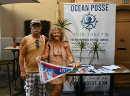
A fine start to the season and a clear signal that the Posse spirit stretches from the Med to every ocean horizon.”
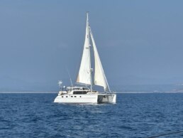
SY SAMLL WORLD III 🇻🇮 Karen & Daren – Bristol 47.7
RECAP OCEAN POSSE & BEN TAYLOR

 STREET PARTY
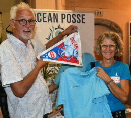
SY SALAVIDA 🇫🇷 Sylvie & Laurent – GARCIA Exploration 45
We received our 1st burgee in 2019 in Mexico soon after leaving Los Angeles. Six years later, on a different continent, having cruised to 14 countries, we have evolved with the Posse and expanded our horizons. It means so much to receive another burgee, in Cannes no less! We’ve come a long way baby and it’s been a blast! The Posse has been inspirational and confidence building. You cannot put a price on that. It comes with the Posse camaraderie.
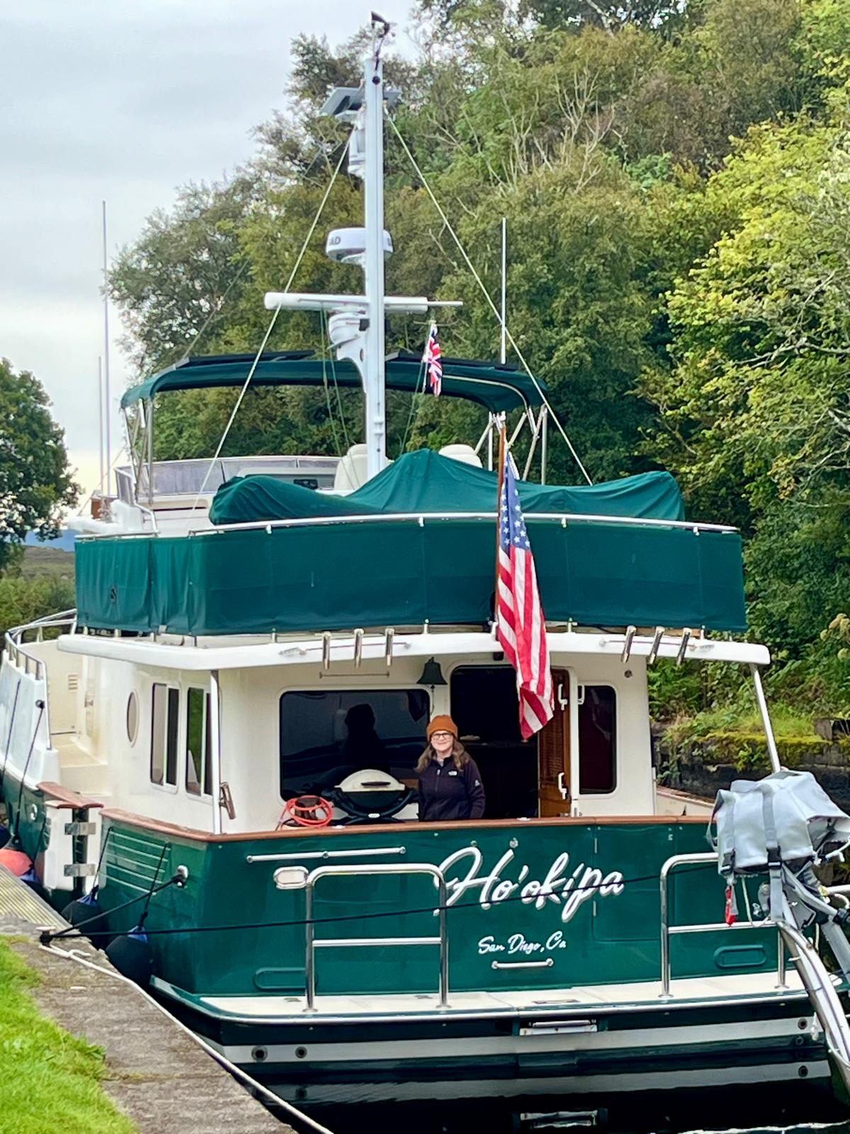
MY HO’OKIPA 🇺🇸 Lisa & Lucky Chucky – Selene 43′


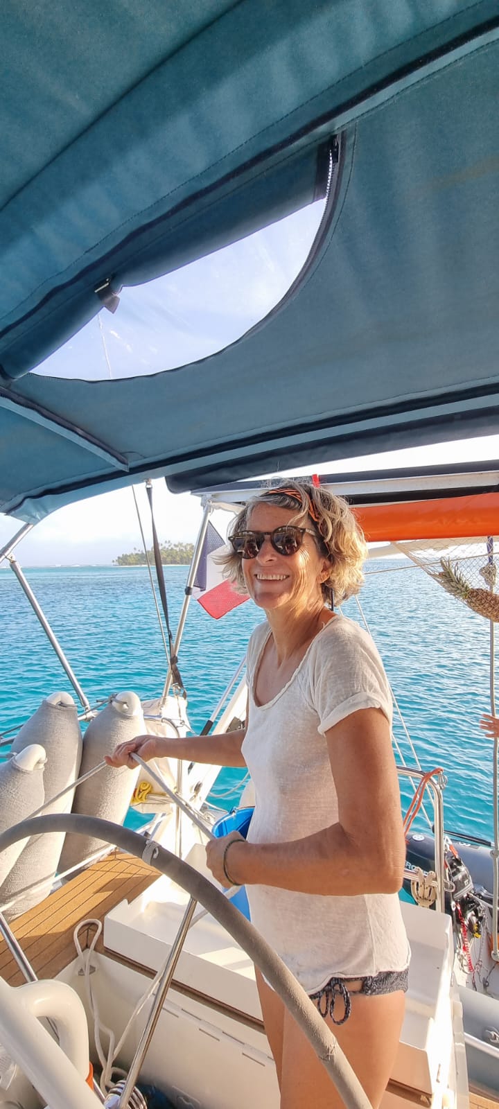
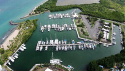
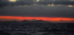
ST CROIX 🇻🇮 USVI
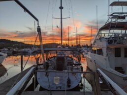
At Green Cay Marina in St. Croix, sunsets carry extra weight during hurricane season. The sky often glows with dramatic reds and golds, a reminder of the power of shifting weather. For the Ocean Posse fleet, it’s both reflection and vigilance—honoring calm evenings while preparing for storms on the horizon.
SY TOKETTE 🇺🇸 Dar & Diane – Skookum 53′


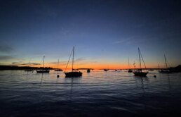
Southwest Harbor, Maine, rests quietly on Mount Desert Island’s “working coast.” Known for its classic boatbuilding and lobster fleet, it offers Ocean Posse skippers and yachts a genuine Down East welcome. Calm waters, sturdy docks, and nearby Acadia National Park make it a fine stop. Tradition, seamanship, and exploration all converge in this harbor at the edge of the Atlantic.
SY AUTUMN MOON 🇺🇸 Laurin & Elisa – Fountaine-Pajot 41′


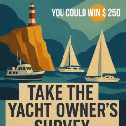
It’s That Time Again – The Ocean Posse Annual Survey Has Dropped ⚓️
Ahoy Captains and Crew,There’s nothing quite like a good maritime survey to get your day started – a little honesty, a little embarrassment, and a whole lot of truth. We’re excited (yes, really excited) to hear what you really think.
This is your chance to weigh in – anonymously – and help shape the course of the Ocean Posse fleet. No names, no judgments, just your salty insights.Grab a coffee, drop anchor, and take a few minutes to fill it out. 👉
We’re counting on you – and there might just be a $250 prize at the end of your honesty.Stay informed, The Ocean Posse Team
THE OCEAN POSSE ⚓ ROUTE PODS
This season it’s time for you to choose your Pods – or mini Posse’s think of them as your route tattoos for your voyage ahead.
Each pod has its own emoji tag so you can mark your cruising plans and spot kindred spirits. If you invent a new route you can pick your own symbol and pod name.
⚓ 👉 Each pod = your Route Tattoo : just drop the emoji in chat to tag yourself and show your season’s cruising vibe.
Extra DIY points for stitching or painting your emoji on this season’s burgee . Your annual membership of $ 349
gives you full support along any of these routes and your membership gives you full access to resources in 50 + maritime areas !
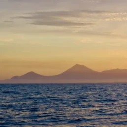
The sun rose on the distant shore we could see the Nicaraguan volcanoes and ahead we could see where we had to enter the river. 🌋

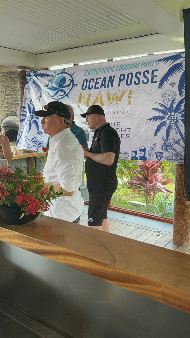
OCEAN POSSE CARTAGENA KICK OFF EVENT
SATURDAY SEPTEMBER 27 ’25 @ 16:00 -21:00
brought to you BY
YACHT PORT CARTAGENA
Flor De CAÑA RUM

RSVP HERE


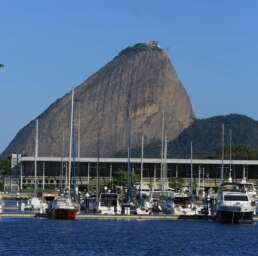
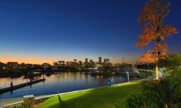
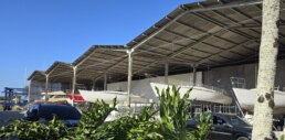
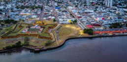
INTRODUCING A NEW SPONSORSHIP MARINA
MARINA DA GLORÍA 🇧🇷 BRASIL
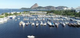
22° 55.0666′ S 043° 10.2133′ W
We are pleased to welcome the Ocean Posse with the following discount:
-
- MARINA GLORIA IS PROUD TO WELCOME THE OCEAN POSSE
We offer a 5% discount on the daily package price, based on the current rate at the time of use, for members of the Ocean Posse. Energy, water, and other services provided to vessels during the daily rate will be charged separately at the current rate and will be agreed upon arrival between BR Marinas and the vessel.
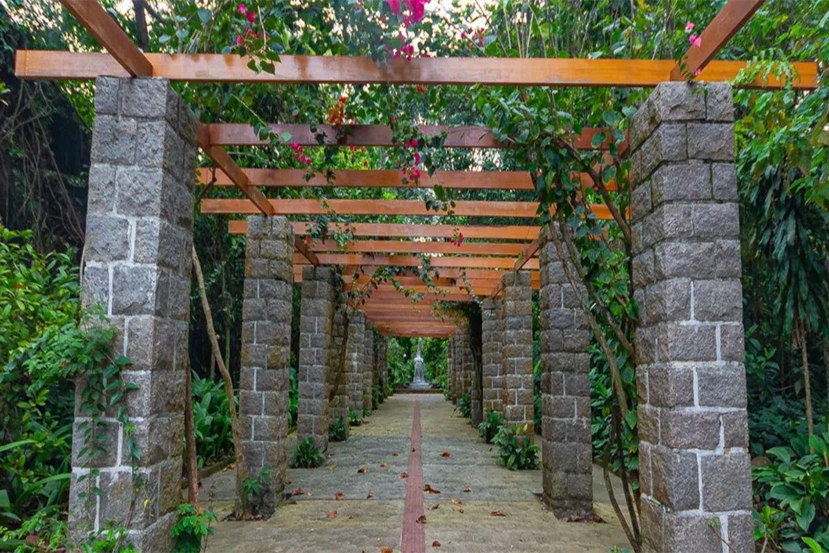
Marina da Glória combines several qualities in a single location. With a privileged location, it offers its users comfort, tranquility, and the convenience of being close to the city center and next to Rio de Janeiro’s Santos Dumont Airport.
Amenities
- Electricity
- Water
- Showers
- Restrooms
- Fuel
- Wifi
- Restaurants
- Laundry Machines
- Security
- Pharmacy
- Sailing School
MARINA DA GLORIA SAFE APPROACH
NEARBY
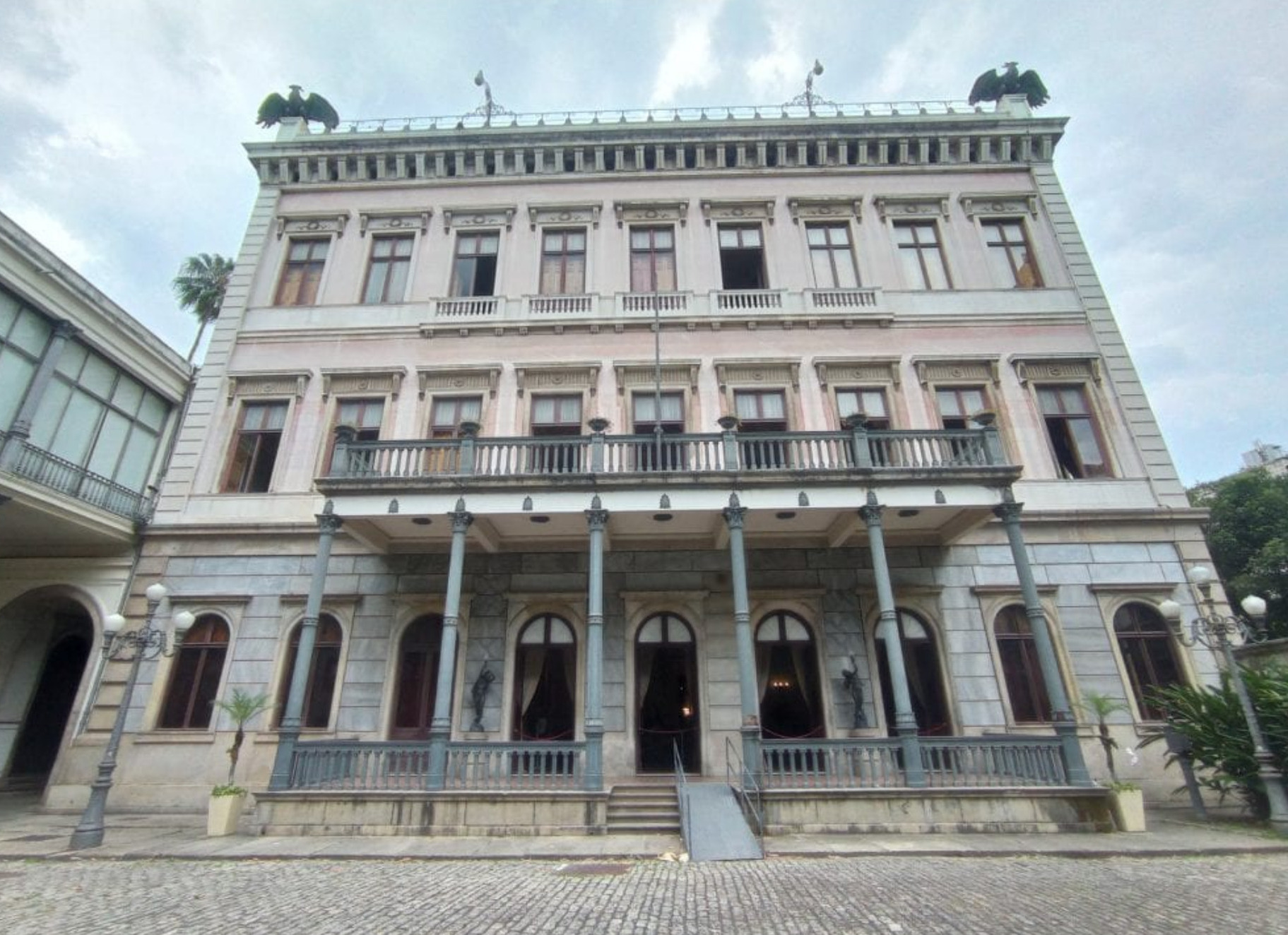
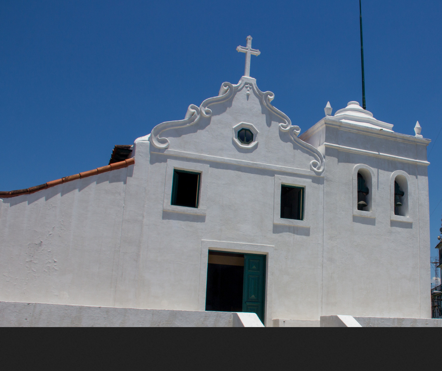
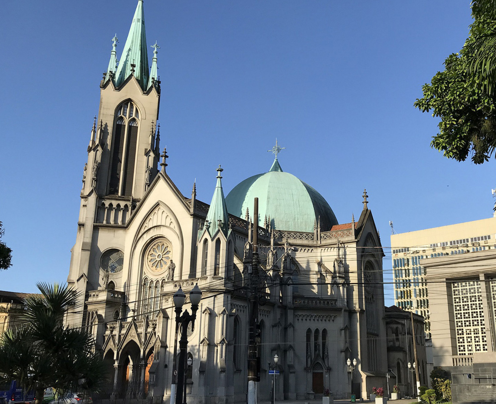
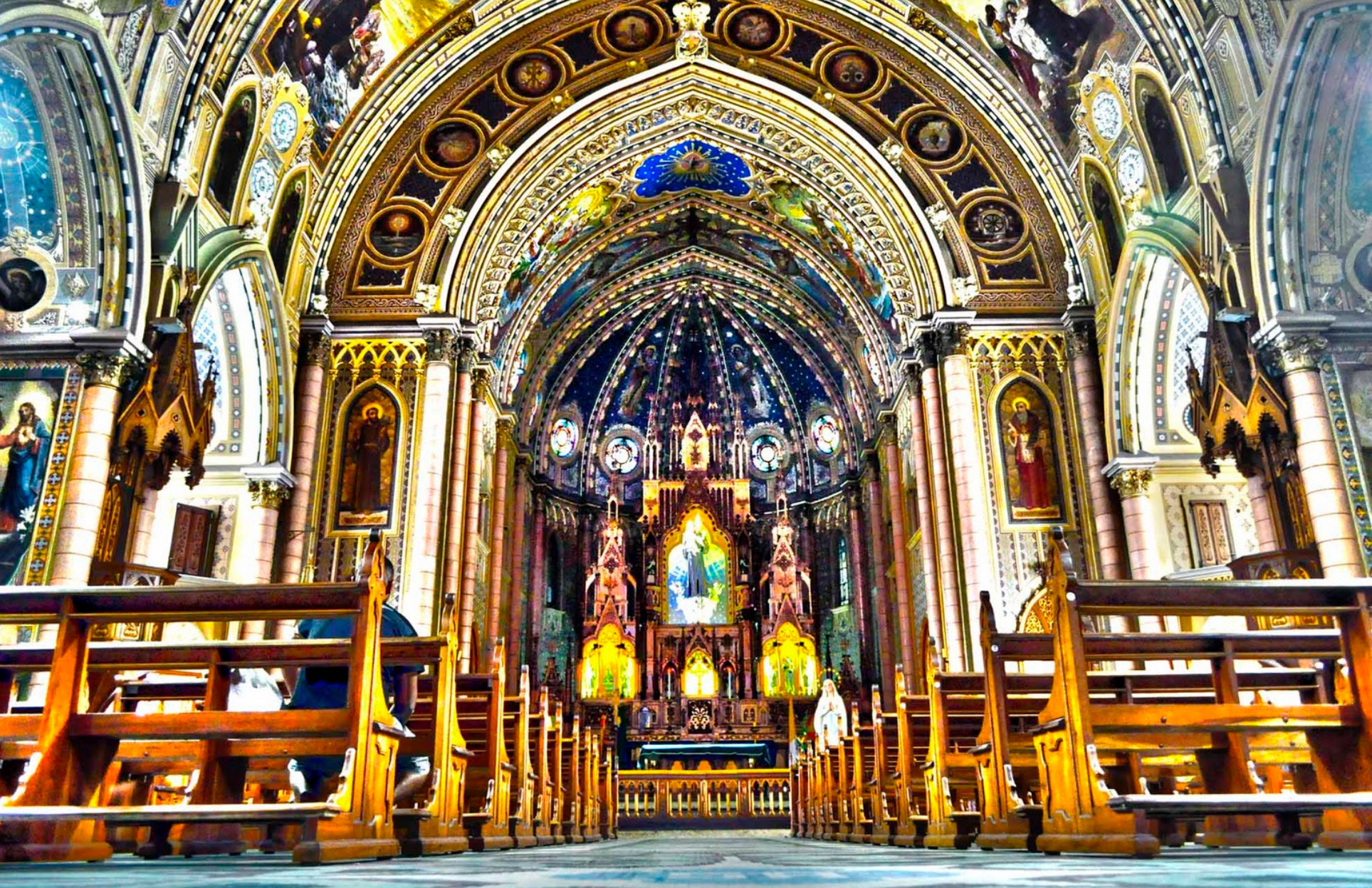
Igreja de Nossa Senhora da Glória do Outeiro
Built in 1739, this hilltop Baroque church is one of Rio’s most beautiful colonial landmarks. Its whitewashed façade and gilded interior reflect the Portuguese influence, while the elevated site gives sweeping views of Guanabara Bay.
Praça Paris (Paris Square)
A formal French-style garden designed in the 1920s, complete with symmetrical walkways, fountains, and manicured flowerbeds. It was modeled after the gardens of Versailles and restored to its original elegance in recent years.
Monument to the Dead of World War II
A striking modernist memorial erected in the 1960s, honoring Brazilian forces who fought in WWII. Its solemn architecture and eternal flame make it an important national remembrance site.
Museum of Modern Art (MAM Rio)
Housed in a landmark building designed by Affonso Eduardo Reidy, the museum features Brazilian modern and contemporary art. Its permanent collection and rotating exhibitions make it a cultural centerpiece of Flamengo Park.
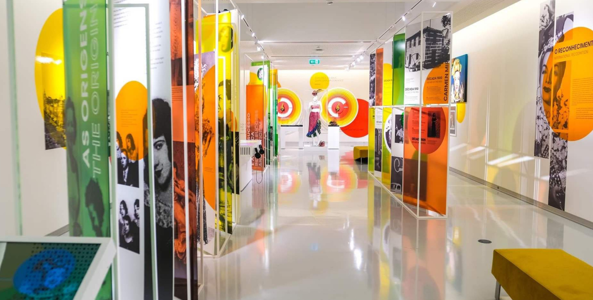
Carmen Miranda Museum
A quirky and colorful museum dedicated to Brazil’s beloved samba singer and Hollywood star. It showcases her costumes, jewelry, and stage memorabilia—perfect for a deep dive into Brazilian popular culture.
Glória Neighborhood Streets
Wandering the sloping streets of Glória reveals a mix of colonial townhouses, early 20th-century mansions, and traditional bars. It’s one of Rio’s oldest neighborhoods, full of atmosphere and a sense of lived history.
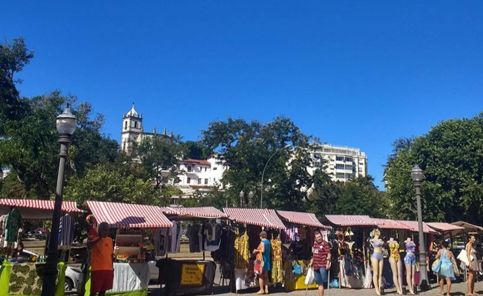
Glória Fair (Feira da Glória)
Held every Sunday since the 1940s, this bustling open-air market offers fresh produce, tropical fruits, and typical Brazilian street food. It’s as much a cultural immersion as it is a local shopping tradition.
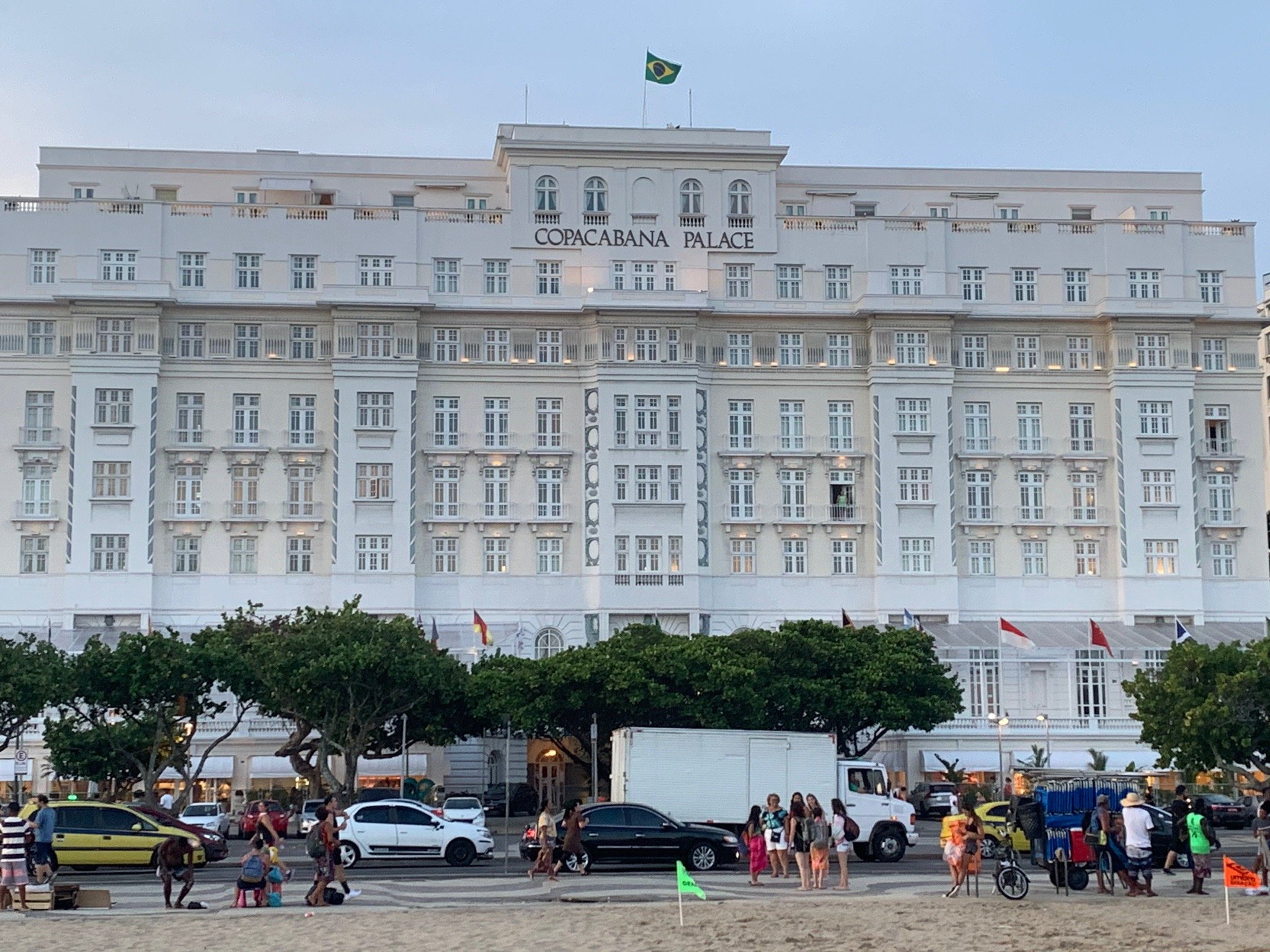
Hotel Glória (Historic Facade)
Opened in 1922, this Art Deco-influenced hotel was once Rio’s most glamorous address, hosting heads of state and celebrities. Although currently closed, its elegant exterior remains an architectural highlight of the neighborhood.
Catete Palace (Palácio do Catete)
Just a short walk from Glória, this 19th-century neoclassical palace was Brazil’s presidential residence until 1960. Today it houses the Museum of the Republic, showcasing artifacts from Brazil’s political history.
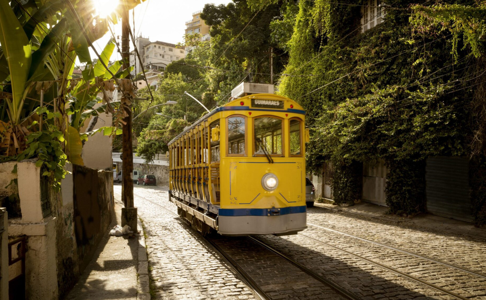
Santa Teresa Tram & Neighborhood (Nearby)
A historic tramway runs from downtown into Santa Teresa, a bohemian district perched on a hill above Glória. Its colonial houses, ateliers, and murals make it one of Rio’s most charming cultural quarters.


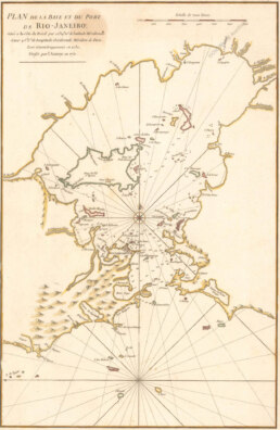
This harbour chart of Rio de Janeiro, published in 1775 by the French navigator and hydrographer Jean-Baptiste d’Après de Mannevillette, captures the Bay and Port in remarkable detail. Drawn in block plan form, it marks islands, coastal features, soundings, and anchorages throughout Guanabara Bay. Across from Rio, near the bay’s mouth, appears the lagoon Lagoa de Pirate Ningo.
D’Après de Mannevillette (1707-1780) employed new instruments to refine earlier latitude measurements, raising the accuracy of navigation in these waters.
His Le Neptune Oriental, first issued in 1745, became an essential atlas for mariners of the 18th century – a trusted guide for voyages across oceans and into harbours such as Rio. This 1775 map remains a striking record of seafaring history.
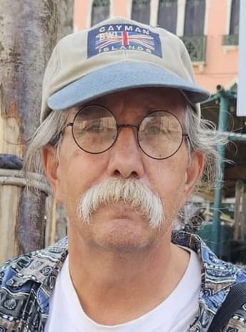
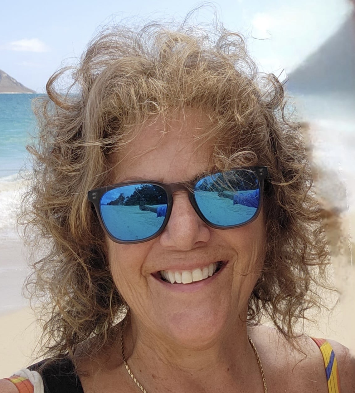
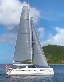
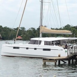
MEET THE FLEET 🇨🇦 SY Whispering Winds
Ahoy – we’re Andrew and Brenda. Our boat is named Whispering Winds, after a song Andrew’s son recorded with lyrics written by his daughter. That music carries meaning for us, and the name felt like the right spirit for our voyage.
At the moment, we’re hauled out in Trinidad for hurricane season, but come October we’ll be back in the water, getting ready for our next big goal – crossing the Pacific.
⚓ Our Journey
Andrew grew up sailing with his dad, and six years ago I joined him in this passion. What began as a pastime has become our life’s adventure. Every day we sail, we learn more about ourselves and each other.
One moment that changed my perspective forever was a dark night at sea, with nothing but clear skies and stars overhead. Out there, you feel how small you are in the universe – and how much of a gift it is to live this way.
🌍 Lessons Learned & What’s Ahead
The sea has taught us that everything can change in an instant. How those moments end depends on our reaction and preparedness. We’ve also found joy in connecting with the people we meet, always approaching locals with respect and kindness. Those relationships stay with us long after we leave port.
As for what’s still on our bucket list?
That’s an easy one – sailing across the Pacific.
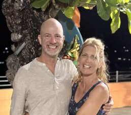
SY WHISPERING WINDS 🇨🇦Andrew & Brenda & – Nautitech 46′


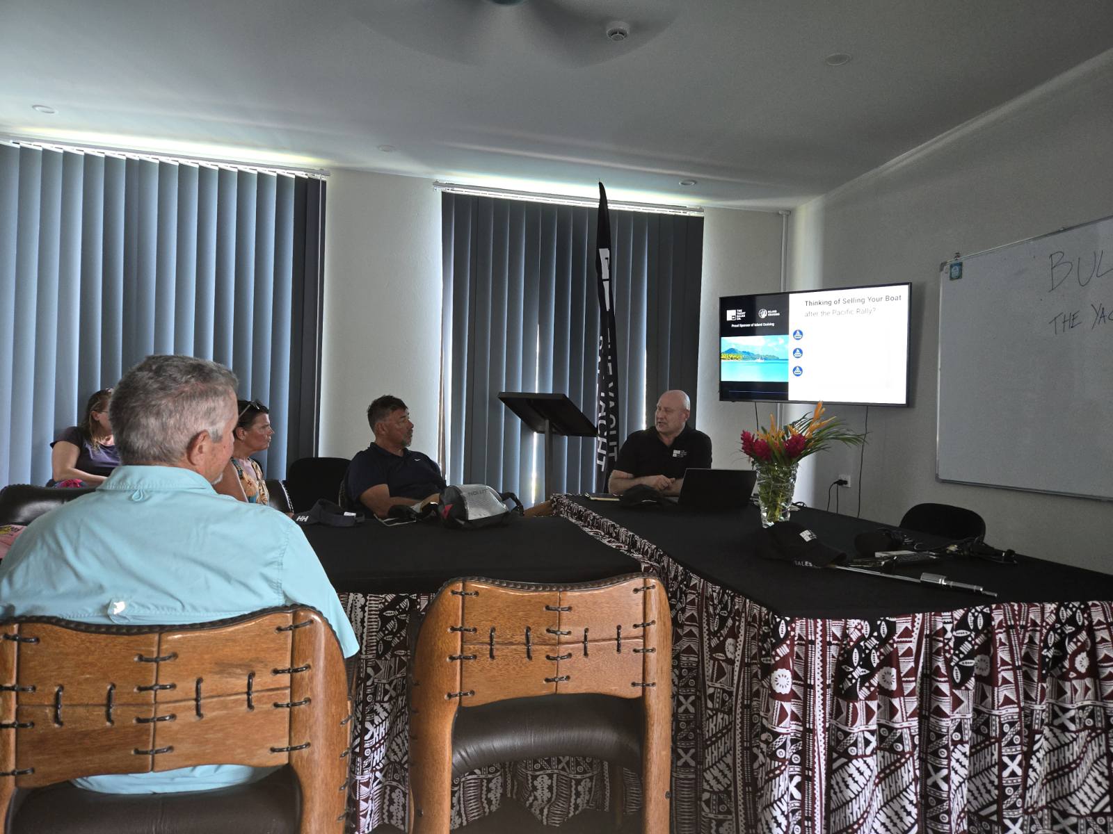
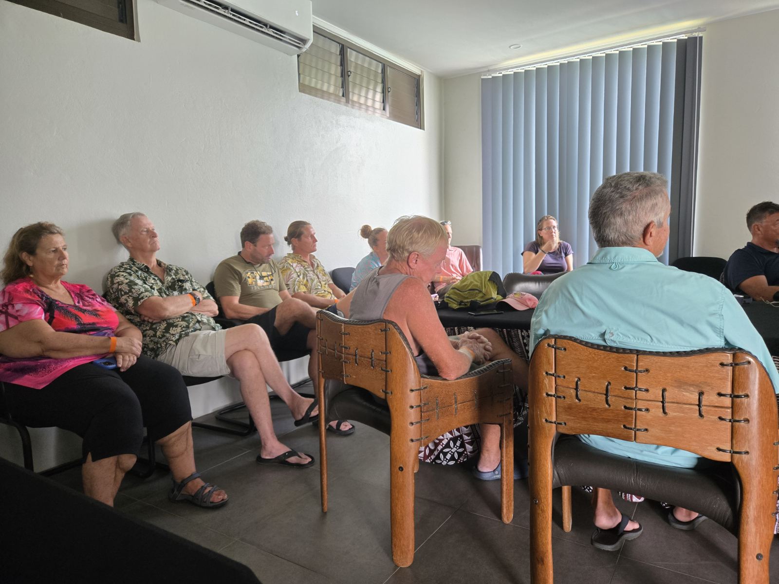
REMINDER 4 DAYS OF CRUISING SEMINARS 🇺🇸 SAN DIEGO Oct 14 – 17 2025
RESERVE YOUR SEAT TODAY >>
- Tuesday, October 14, 2025 – Seminars
- 10:00 – 12:00 Watermakers & Plumbing in Paradise – Rich Boren
- 12:00 – 14:00 Working Lunch (Uber Eats, etc.)
- 13:00 Diesel Engines & Generators – Preventive Maintenance
- 14:00 Rigging 101 – Standing & Running
- 15:00 Weather – Planning, Routing, Underway
- 16:00 Crew – The Good, the Bad & the Ugly
- 17:00 Cruising Pacific Mexico – Check-In/Out & Sea of Cortez
Wednesday, October 15, 2025 – Seminars
- 09:00 South Pacific – FP, Cooks, Tonga & Fiji
- 10:00 Safety, Security & Emergencies Abroad
- 11:00 Electrical Systems – Batteries, Chargers, Solar
- 12:00 – 14:00 Lunch Break
- 14:00 Boat Repairs Outside the US
- 15:00 Staying Cool – Refrigeration, AC, Shading, Airflow
- 16:00 Anchoring
- 17:00 Destinations – Costa Rica & Nicaragua
Thursday, October 16, 2025 – Seminars<
- 09:00 Destination Belize & Rio Dulce (Blue Hole & Routes)
- 10:00 Communications Onboard & Ashore (Starlink, etc.)
- 11:00 Electrical Fundamentals – Wires, Connectors, Fuses
- 12:00 – 14:00 Lunch Break
- 14:00 Chart Accuracy – Navigation Tips & Tricks
- 15:00 Provisioning, Propane & Fuel Logistics
- 16:00 Yacht Insurance
- 17:00 Destinations – Colombia, Jamaica & Bay Islands (Roatán)
Friday, October 17, 2025 – Seminars & Party
- 10:00 Cruising Panama & the Canal (San Blas)
- 11:00 OpenCPN – Satellite Charts & Use Cases
- 12:00 – 14:00 Lunch Break
- 14:00 Ocean Crossing – Pacific & Gulfstream
- 15:00 Safety & Security
- 16:00 Crew – The Good, the Bad & the Ugly
- 17:00 – 21:00 Rum & Music Party 🎶🍹
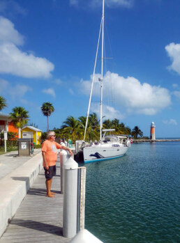
COROMUEL WINDS 🌬️ LA PAZ 🇲🇽 MEXICO
Coromel Winds – A Cruiser’s Gift in La Paz
The Coromuel wind is a weather phenomenon unique to the La Paz area of the Baja California peninsula and the adjoining Gulf of California (Sea of Cortéz). Most common in late spring and summer, it is a south to southwest wind that typically rises in the late afternoon or early evening, blowing steadily through the night and easing by mid-morning. Its arrival can be sudden, and in the Bay of La Paz the Coromuel is often both strong and persistent.
The mechanism behind this wind is relatively straightforward. Cool, moist marine air from the Pacific side of the peninsula is drawn across the arid desert and funneled into the comparatively warmer waters of the Gulf of California. La Paz is the only region where this occurs because elsewhere along the peninsula a mountain spine blocks such airflow.
The name “Coromuel” traces back to the 19th century sailor Samuel Cromwell, often rumored to have been a pirate. Cromwell was a frequent visitor to La Paz, and legend holds that he buried treasure on a beach that now bears his name. Local residents, unable to pronounce “Cromwell,” adapted it to “Coromuel,” a name that has endured in both lore and seamanship.
Among the many localized wind patterns sailors encounter, the Coromel winds of La Paz, Baja California Sur, are a phenomenon well worth understanding. These evening and nighttime breezes sweep down from the Pacific side of the peninsula, funneled through the low mountain passes west of La Paz, and spill out into the Bay of La Paz. For yachtsmen anchored in this protected body of water, the Coromel can feel like a steady, almost magical wind that appears with predictability after sundown.
During the daytime, the Bay of La Paz is often calm or subject to light local thermals, but as the sun sets, the pressure differential between the cooler Pacific air and the warmer waters of the Sea of Cortez takes over. Air is drawn across the spine of the Baja peninsula and pours into La Paz Bay. These winds typically begin in the late evening and may continue through the night into the early morning hours, often blowing at 10 to 15 knots, sometimes more in certain conditions.
For sailors, Coromels bring both benefits and considerations. Their cooling effect is welcome during hot summer months, providing natural ventilation at anchor when the daytime heat lingers well into the night. Many a cruiser has been grateful for the steady breeze that makes sleep aboard more comfortable. In addition, they can help clear out haze and keep mosquitoes at bay.
Yet the same winds also demand careful anchoring. Since they arrive with regularity and can hold for hours, they exert sustained pressure on ground tackle. Vessels anchored too close to shoals or other yachts may find themselves uncomfortably close if the Coromel sets in stronger than expected. A good scope of chain and thoughtful positioning are essential.
From a historical perspective, the winds have long been known to locals. The name “Coromel” is said to come from an English sailor, Ritchie, nicknamed “El Coromuel,” who settled in La Paz in the 19th century. Stories say he named these evening breezes after himself, and the moniker stuck.
For today’s cruisers, Coromel winds remain a signature feature of the La Paz anchorage. They are a reminder of how geography shapes weather on a local scale and how attentive seamanship turns natural forces into allies. Properly anticipated, the Coromel is less a hazard than a nightly gift – one more reason sailors are drawn to the Sea of Cortez.
Image of Marina de la Paz below – if the Coromuel waltz get’s to you and you can get a slip …
OFFICIAL OCEAN POSSE EVENTS

OCEAN POSSE KICK OFF 🇲🇽 BARRA DE NAVIDAD, MEXICO December 3-7 2025
MARINA PUERTO DE LA NAVIDAD, BARRA DE NAVIDAD, MEXICO


OCEAN POSSE & BEN TAYLOR STREET PARTY @ CANNES 🇫🇷 YACHTING FESTIVAL
TAQUERIA LUPITA, 72 Rue Meynadier, Cannes
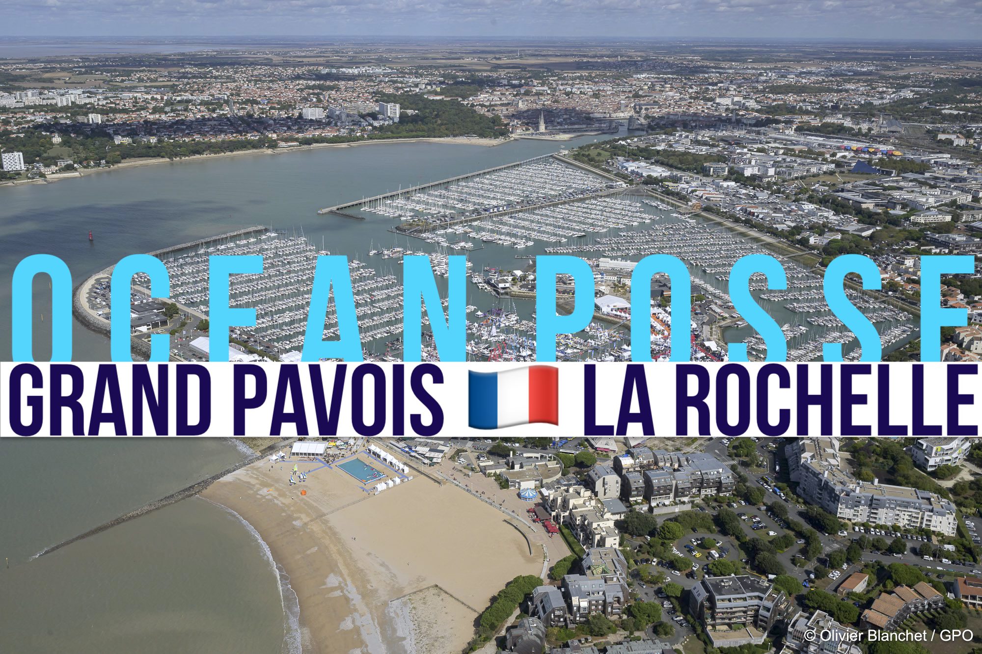
GRAND PAVOIS 🇫🇷 La Rochelle – Sep. 24 2025
Gran Pavois La Rochelle, 20 Av. de la Capitainerie, 17000 La Rochelle, France

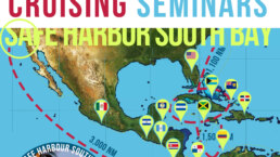
OCEAN POSSE 🇺🇸 SAN DIEGO BAY 4 DAY CRUISING SEMINARS SERIES @ SAFE HARBOR SOUTH BAY
SAFE HARBOR SOUTH BAY EVENT CENTER, CHULA VISTA, SAN DIEGO, CA
GRAND PAVOIS 🇫🇷 La Rochelle – Sep. 24 2025
Gran Pavois La Rochelle, 20 Av. de la Capitainerie, 17000 La Rochelle, France
GRAND PAVOIS 🇫🇷 La Rochelle – Sep. 24 2025
Gran Pavois La Rochelle, 20 Av. de la Capitainerie, 17000 La Rochelle, France
GRAND PAVOIS 🇫🇷 La Rochelle – Sep. 24 2025
Gran Pavois La Rochelle, 20 Av. de la Capitainerie, 17000 La Rochelle, France
GRAND PAVOIS 🇫🇷 La Rochelle – Sep. 24 2025
Gran Pavois La Rochelle, 20 Av. de la Capitainerie, 17000 La Rochelle, France
GRAND PAVOIS 🇫🇷 La Rochelle – Sep. 24 2025
Gran Pavois La Rochelle, 20 Av. de la Capitainerie, 17000 La Rochelle, France
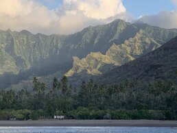
🇲🇽 ISLA ISABELLA

Isla Isabella, Isla Isabel National Park is a national park and protected area located off the coast of Nayarit.
It was one Jacques Cousteau’s favorite places and that Cousteau himself made the recommendation to the
Mexican government to designate this island as a National Park.
He spent a great deal of time here and has aired many specials on this fabulous gem.
The Undersea World of Jacques Cousteau aired in 1975

The park was established in 1980 and is approximately 1.94 square kilometers and offers 2 anchorages to access the park.
Isla Isabel is one of the main nesting islands for seabirds in the Pacific, including large colonies of Magnificent Frigate birds over 11,000 Fregata magnificens , Blue-footed Boobies Sula nebouxii, Brown Boobies Sula leucogaster and Sooty Terns Sterna fuscata. Marine life is rich, with over 24 shark and ray species, three species of sea turtles, the California Sea Lion Zalophus californianus, Humpback Whale Megaptera novaeangliae and Killer Whale Orcinus orca. The island is uninhabited, though there is a seabird reproductive research program run by UNAM and tourists visit to camp, fish and bird watch. After having depleted a huge colony of Sooty Terns, which in 1978 had over 150,000 pairs, cats were finally eradicated from the island in 1995 and the Terns are slowly recovering.


ISLA ISABELLA, NAYARIT, MEXICO ANCHORAGES

It is a breeding ground for Frigate Birds

NESTING

OCEAN POSSE SPONSORS
YACHT SERVICES NUKU HIVA
SPONSORS THE OCEAN POSSE WITH A SPECIAL DISCOUNT
OCEAN POSSE SPONSORS
- ABERNATHY – PANAMA
- BELIZE TOURISM BOARD
- BOAT HOW TO
- CABRALES BOAT YARD
- CENTENARIO CONSULTING – PANAMA CANAL
- CHRIS PARKER – MARINE WEATHER CENTER
- DELTA MIKE MARINE SUPPLY PANAMA
- DIGITAL YACHT
- DOWNWIND MARINE
- EL JOBO DIST. COSTA RICA
- FLOR DE CAÑA
- HAKIM MARINA AND BOAT YARD
- HERTZ RENTAL CARS MEXICO
- HOME DEPOT PRO MEXICO
- LATITUDES AND ATTITUDES
- MARINA PAPAGAYO
- NOVAMAR YACHT INSURANCE
- PANAMA YACHT BROKER
- PREDICT WIND
- SAFE HARBOR SOUTH BAY MARINA EVENT CENTER
- SAN DIEGO MARINE EXCHANGE
- SAFETY ONBOARD COSTA RICA
- SEVENSTAR YACHT TRANSPORT
- SHAFT SHARK
- SUN POWERED YACHTS
- WESTMARINE PRO
- YACHT AGENTS GALAPAGOS
MEDIA PARTNERS
LATITUDES AND ATTITUDES

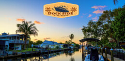
OUR 📻 New Media Partner: Dockside Live Radio
We’re pleased to welcome Dockside Live Radio as an official media partner of the Ocean Posse Fleet.
Led by lifelong boater Brian Burns, Dockside Live brings music, stories, and conversations from the waterfront directly to the airwaves. Brian grew up on the lakes of Wisconsin and later sailed a 28’ O’Day before dedicating himself fully to radio. His program reaches boaters across the U.S. and beyond — with the motto:
“Where the music meets the water…”
Stay tuned — LISTEN at DockSideLive.com or download from your favorite App Store.
📡 Dockside Live Radio >>>
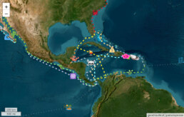
OCEAN POSSE FLEET 🛰️ TRACKING
SPONSORED BY PREDICT WIND
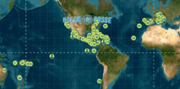
MARINA SPONSORS
🇦🇺 AUSTRALIA
🇧🇸 BAHAMAS
-
 Browns Marina
 -
 Elizabeth on the Bay Marina
 -
 Blue Marlin Cove Resort & Marina
 - Great Harbour Cay Marina
-
 Romora Bay Resort and Marina
🇧🇿 BELIZE
🇧🇲 BERMUDA
🇧🇷 BRAZIL
🇻🇬 BRITISH VIRGIN ISLANDS
🇨🇻 CAPE VERDE
🇰🇾 CAYMAN ISLANDS
🇨🇱 CHILE
🇨🇴 COLOMBIA – Caribbean
-
 Club Nautico Cartagena
 -
 Club de Pesca Marina Cartagena
 -
 Marina Puerto Velero
 -
 IGY Marina Santa Marta
  Manzanillo Marina Club
🇨🇷 COSTA RICA – Pacific Coast
🇨🇺 CUBA
🇩🇲 DOMINICA
🇩🇴 DOMINICAN REPUBLIC
🇪🇨 ECUADOR
🇸🇻 EL SALVADOR
🇬🇮 GIBRALTAR
🇬🇩 GRENADA
🇬🇵 GUADELOUPE
🇬🇹 GUATEMALA – Pacific Coast
🇬🇹 GUATEMALA Rio Dulce
🇫🇯 FIJI
 Copra Shed Marina
 Nawi Island Marina
  Denarau Marina
-
 Musket Cove
  Royal Suva Yacht Club
 Sau Bay Moorings
🇭🇳 HONDURAS – Bay of Islands – Roatan
🇮🇹 ITALY
 Marina dei Presidi
  Marina di Balestrate
 Marina di Brindisi
 Marina di Cagliari
 Marina di Chiavari
 Marina di Forio
  Marina di Teulada
 -
 Marina di Policoro
 -
 Marina di Vieste
 -
 Marina de Procida
 -
 Marina de Villasimius
 - Marina di Vieste
-
 Marina Molo Vecchio
  Marina Salina
  Venezia Certosa Marina
🇯🇲 JAMAICA
🇲🇶 MARTINQUE
🇲🇽 MEXICO – Caribbean
- Marina Makax – Isla Mujeres
- Marina Puerto Aventuras
- Marina V&V – Quintana Roo
- Marina El Cid – Cancún
🇲🇽 MEXICO – Pacific Coast
- ECV Marina – Ensenada BC
- IGY Marina Cabo San Lucas BCS
- Marina Palmira Topolobampo – SI
- Marina y Club de Yates Isla Cortes – SI
- Marina el Cid – Mazatlan – SI
- Marina Vallarta, Puerto Vallarta – JA
- Marina Puerto de La Navidad – Barra de Navidad – CL
- Marina Ixtapa, Ixtapa – GE
- La Marina Acapulco, Acapulco – GE
- Vicente’s Moorings, Acapulco – GE
- Marina Chiapas – CS
🇳🇿 NEW ZEALAND
🇳🇮 NICARAGUA – Pacific Coast
🇳🇺 NIUE
🇵🇦 PANAMA – Pacific Coast
🇵🇦 PANAMA – Caribbean
- Shelter Bay Marina
- Bocas Marina
- Solarte Marina
- Linton Bay Marina /a>
- Turtle Cay Marina
- IGY Red Frog Marina
🇵🇹 PORTUGAL
🇵🇷 PUERTO RICO
🇱🇨 SAINT LUCIA
🇸🇽 SINT MAARTEN
🇪🇸 SPAIN
 Alcaidesa Marina
  IGY Málaga Marina
  Marina Del Odiel
  Nautica Tarragona
  Puerto Sotogrande
 Yacht Port Cartagena
🇰🇳 ST KITTS & NEVIS
🇹🇳 TUNISIA
🇹🇴 TONGA
🇹🇨 TURCS AND CAICOS
🇻🇮 US VIRGIN ISLANDS
🇺🇸 USA – East Coast
- Safe Harbor – Marathon, FL
- Pier 66 Hotel & Marina – Ft. Lauderdale, FL
- Titusville Marina – FL
- Port 32 Marina Jacksonville – FL
- Oasis Marinas at Fernandina Harbor Marina – FL
- Morningstar Marinas Golden Isles St. Simons Isl. – GA
- Windmill Harbour Marina – Hilton Head , SC
- Coffee Bluff Marina – Savannah GA
- Hazzard Marine – Gerogetown, NC
- Holden Beach – Town Dock, NC
- Tideawater Yacht Marina, Portsmouth, VA
- Ocean Yacht Marina, Portsmouth, VA
- York River Yacht Haven – VA
- Yorktown Riverwalk Landing – VA
- Regatta Point Marina – Deltaville, VA
- Regent Point Marina – Topping, VA
🇺🇸 USA – Pacific Coast
- Safe Harbor Ventura Isle, Ventura CA
- Vintage Marina , Oxnard, CA
- Safe Harbor South Bay – Chula Vista, CA
🇻🇺 VANUATU
OCEAN POSSE PANAMA 🇵🇦 CANAL AGENTS
info@centenarioconsulting.com
www.centenarioconsulting.com
Cellphone +507 6676-1376
WhatsApp +507 6676-1376

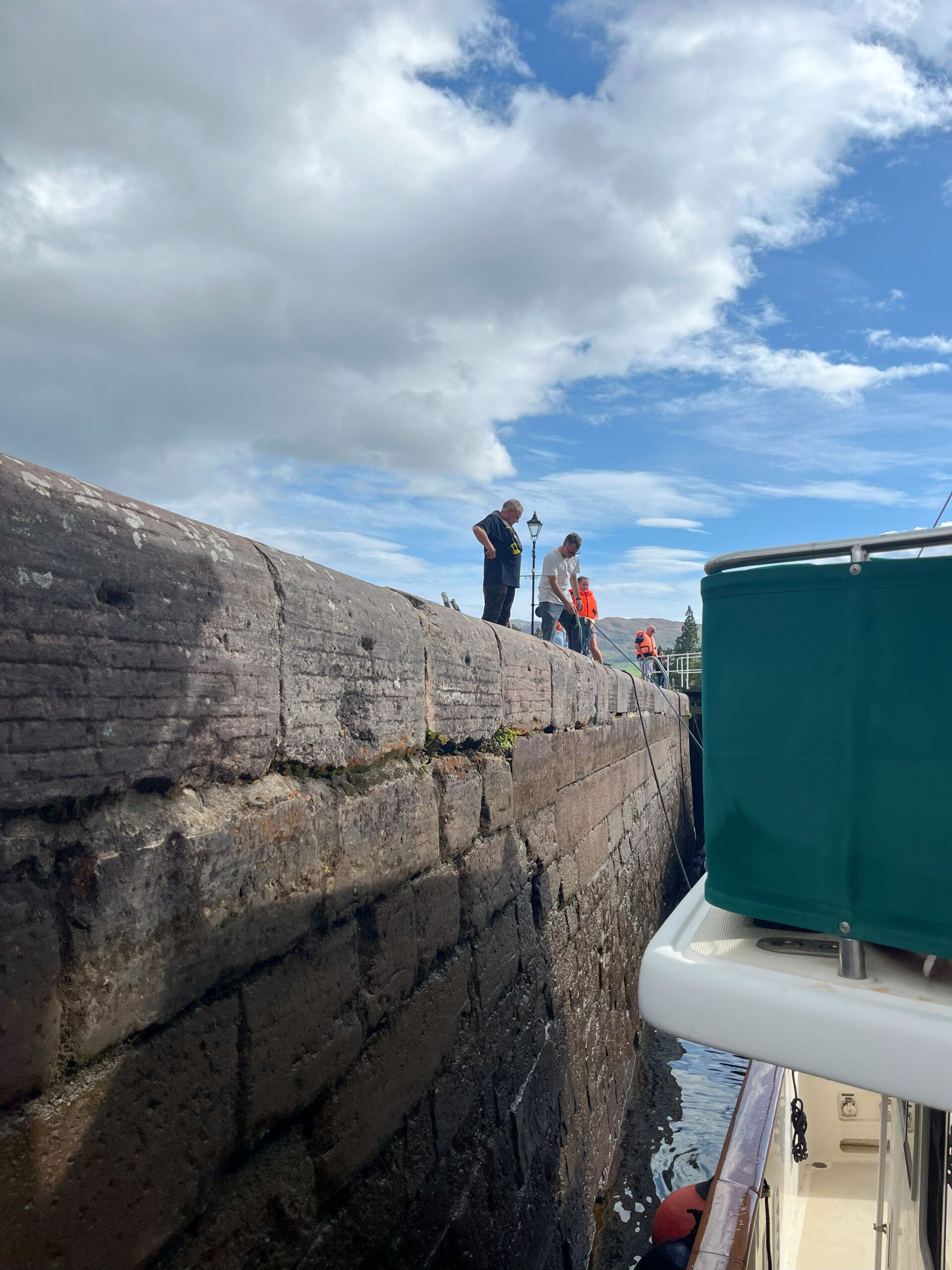
The old locks of the Panama Canal remain one of the greatest engineering achievements ever entrusted to saltwater and steel. Since their inauguration in 1914, the Gatun, Pedro Miguel, and Miraflores locks have lifted and lowered countless vessels between the Caribbean Sea and the Pacific Ocean, bridging two mighty oceans across the isthmus. For sailors, they are not just machinery and chambers but gateways to new seas, a passage that saves weeks of voyaging around Cape Horn.
Each lock chamber, massive concrete basins nearly 1,000 feet long, operates on gravity alone. Fresh water from Gatun Lake fills or empties the chambers through culverts beneath the floor, raising or lowering a ship in a controlled ballet of hydraulics. The lock gates, resembling fortress doors of riveted steel, swing open and shut with a precision that has stood the test of more than a century.
For yacht captains, the old locks are a rite of passage. As the locomotives – the “mules” – guide vast freighters with cables, smaller vessels are rafted together and managed by hand lines, demanding practiced seamanship and calm coordination. The turbulence as the chamber floods or drains tests fenders, lines, and crew alike.
What makes the old locks extraordinary is their resilience. Built in an age before modern computers, they continue to function with reliability that inspires respect. To transit them is to feel part of history, to stand where generations of mariners have felt the surge of water and the anticipation of emerging into a new ocean.
Though the new, wider locks now accommodate supertankers and post-Panamax ships, the old locks remain alive with character, carrying cruising yachts, merchant vessels, and naval ships alike. They are the enduring heart of the Panama Canal, monuments to both human ingenuity and the eternal pull of the sea.

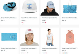
OCEAN POSSE MERCHANDISE | MADE TO ORDER ONLY
 Tidbits

| Incident Date | 2025-09-12 at 01:00 |
| Event Type | Dinghy Theft |
| Stolen Items | Dinghy / outboard. Dinghy later recovered minus the outboard. |
| Secured | Not Locked |
| Source Type | 2nd Hand Report |
| Incident Details | Overnight a thief cut the lines and stole a lifted dinghy/outboard from the davits of an unoccupied yacht anchored near the marina. |
TURNING ( BEACH COMBING ) PLASTIC INTO ART
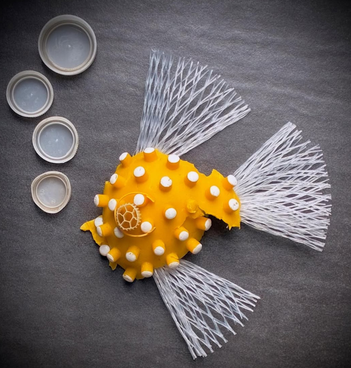
To get inspired and share your own plastic art go to
https://www.instagram.com/telka_plasticfish/
Every single part saved from the sea 🌊 #plasticfish #plasticfishing #plastic #plasticart #trash #trashfish #savetheplanet #savetheocean #🐟#🌊 instagram.com/planetcare_smallsteps
Why We’re Moving to chat.oceanposse.com
The Challenge with WHATSAPP – LINE – MESSENGER – DISCORD – ETC
- Difficult to enforce vessel naming standard (VESSEL NAME FLAG First Name Pod – example CARINTHIA 🇺🇸 Dietmar 🌺 )
- New joiners cannot scroll back — they miss out on years of shared seamanship and fleet knowledge.
- Install and setup issues frustrate new captains.
- Hard to search and organize past discussions.
Why chat.oceanposse.com Works Better
- Organized by topic & vessel – conversations are threaded, searchable, and structured.
- Fleet knowledge is preserved – new captains see the entire history, not just the last few messages.
- Cross-platform access – works in any web browser, iPhone, Android, and desktop.
- Identity clarity – easy to keep vessel identity consistent (VESSEL NAME – First Name).
- Our own server – hosted at chat.oceanposse.com for stability, reliability, and independence.
The Result
- Stronger signals, clearer comms.
- Easier to find answers when you need them.
- A permanent record of seamanship, routes, and resources for every Posse member.
In our chat , streams determine who gets a message. Each conversation within a stream is labeled with a topic, which keeps everything organized. You can read one conversation at a time, seeing each message in context, no matter how many other conversations are going on. If anything is out of place, it’s easy to move messages, rename and split topics, or even move a topic to a different stream. A well-organized chat that shows each message in context, it’s easier to stay informed and connected. Everyone can follow and contribute to discussions that matter to you, without wasting time reading every message, or stressing about missing something important.
- Read each message in context. With each conversation in its own space, you can coordinate multiple projects, hold a virtual standup, and plan the next team social — all in one place. No more scrolling up and down through dozens of messages to track down all parts of a conversation. No more context-switching again and again as you catch up on your chat messages.
- Find the conversations that matter to you. Conversations are well-organized and labeled, so you will never again wade through hundreds of messages to avoid missing the few that are important. Leaders and cross-functional collaborators can quickly review busy communication channels for places where their input is needed.
- Never miss an important message. New messages will pop a long-running thread to the top, rather than languishing in a forgotten sidebar. You’ll never create a new channel (and later forget to check it) because your team’s main channel is busy — a busy stream works just fine in chat.oceanposse.com ! For timely messages, Zulip alerts you with fully customizable mobile, email and desktop notifications.

Got a report, scoop, story, picture, subject or contact at a marina who wishes to work with us ? Please get in touch with us.

Extraordinary Cruising °°° Join the Fleet
- Access vetted local knowledge, safety resources, and prior experiences to make your passage safer and more enjoyable.
- Unlock a Life of Adventure
Explore hidden destinations, experience new cultures, and discover the freedom of life at sea or near shore – on your terms. - Get VIP Perks & Discounts at marinas, chandleries and boatyards
Get exclusive discounts, priority access, and personalized support at partner marinas across the globe. - Observe the actions of Experienced Captains
Tap into a wealth of tips, tools, and real-world know-how from seasoned mariners to grow your skills and gain confidence. - Make Every Nautical Mile Memorable
Join events, meetups, and shared journeys that turn you voyages into unforgettable stories and lasting memories. - Cruise with a Conscience
Gain insights into sustainable practices and join a movement that protects the waters you love to explore.
CRUISING ° FLEET UPDATE & NEWS ⚓ 2025-09-07
In the South Pacific, the old rhythm of low follows high is breaking apart; warmer seas are turbocharging storms, windows are tighter, and every passage now demands sharper seamanship.
CRUISING ° FLEET UPDATE & NEWS ⚓ 2025-09-07
🇮🇹 Italian and French Riviera 🇫🇷
Special Invitation 🍸🍹 Street Party @ Cannes 🇫🇷
Cutler – Maine 🇺🇸 USA
The Yacht Owners Annual Survey ⚓️
Ocean Posse ⚓ Route Pods
Introducing Marina Pier 26 Marina & Boatyard 🇧🇷 Brazil
Must See and Sail the Amazon 🇧🇷
Meet the Fleet 🇺🇸 SY Serenity
The Long List 📋 What to Bring if your going Cruisin’
4 Days of Adventure Prep 🇺🇸 San Diego Oct 14 – 17
Chubascos 🌩️ in the Sea of Cortez
Journey 🇳🇴 Across the North Sea 🏴
Recap South Pacific 🇫🇯 Party in Fiji
Traversing French Polynesia 🇵🇫 Without a Long Stay Visa
French Polynesia 🇵🇫 Looking Ahead to Next Season
What Riggers ⚙️ Can Miss
Yacht Services Nuku Hiva
Latitudes & Attitudes + Dockside Radio Live
Lake Gatun 🇵🇦 Panama
Ocean Posse Fleet 🛰️ Tracking Sponsored by Predict Wind
Ocean Posse Merchandise | made to order
Venezia Certosa Marina 🇮🇹 Italy
💬 Tidbits
— Smithsonian Research Institute Weather
— The U.S. Coast Guard Cutter ‘Eagle’
— Squirrel on Board 🐿️ Uninvited Visitor
— Turning Beach Combing Plastic Into Art
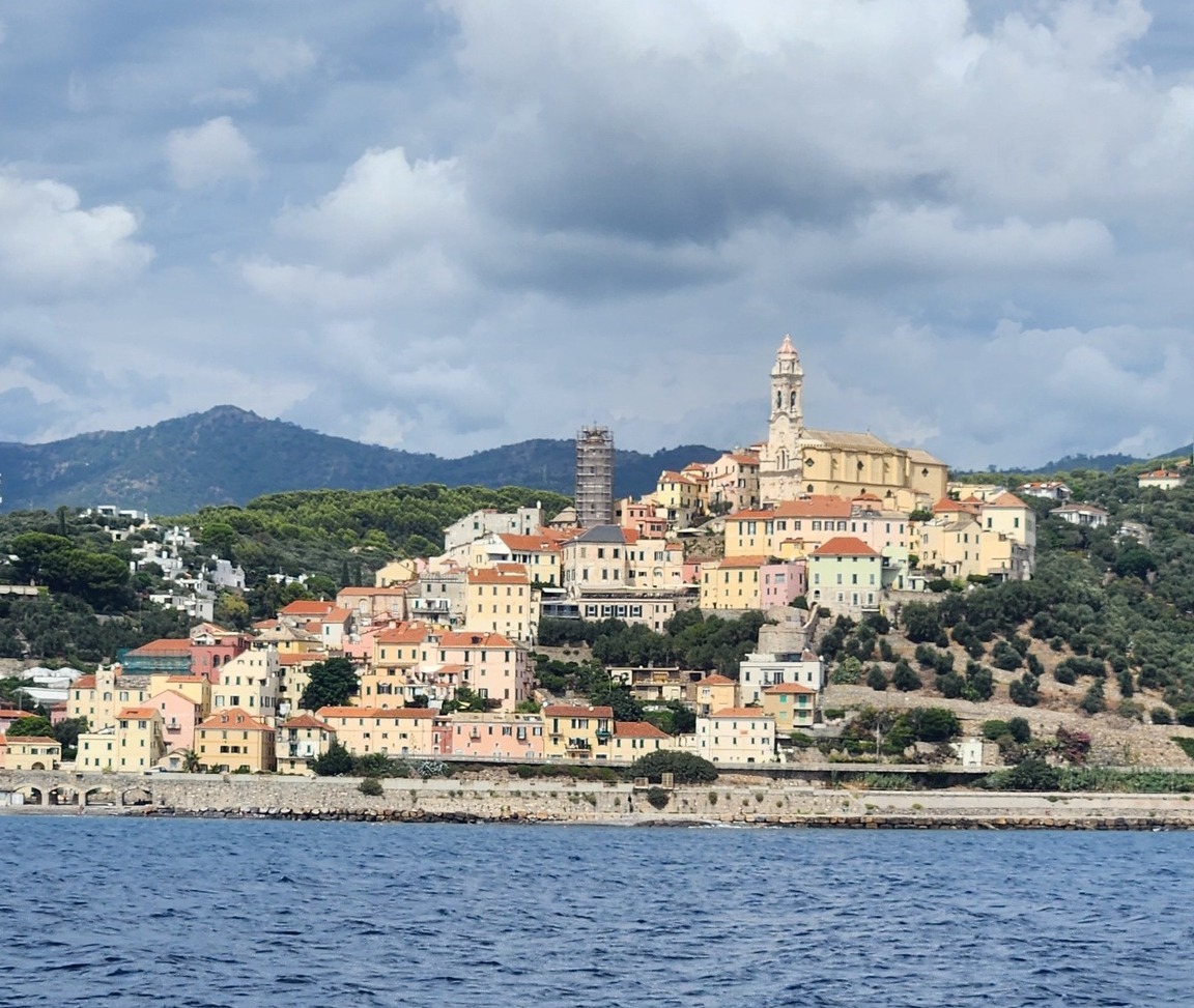
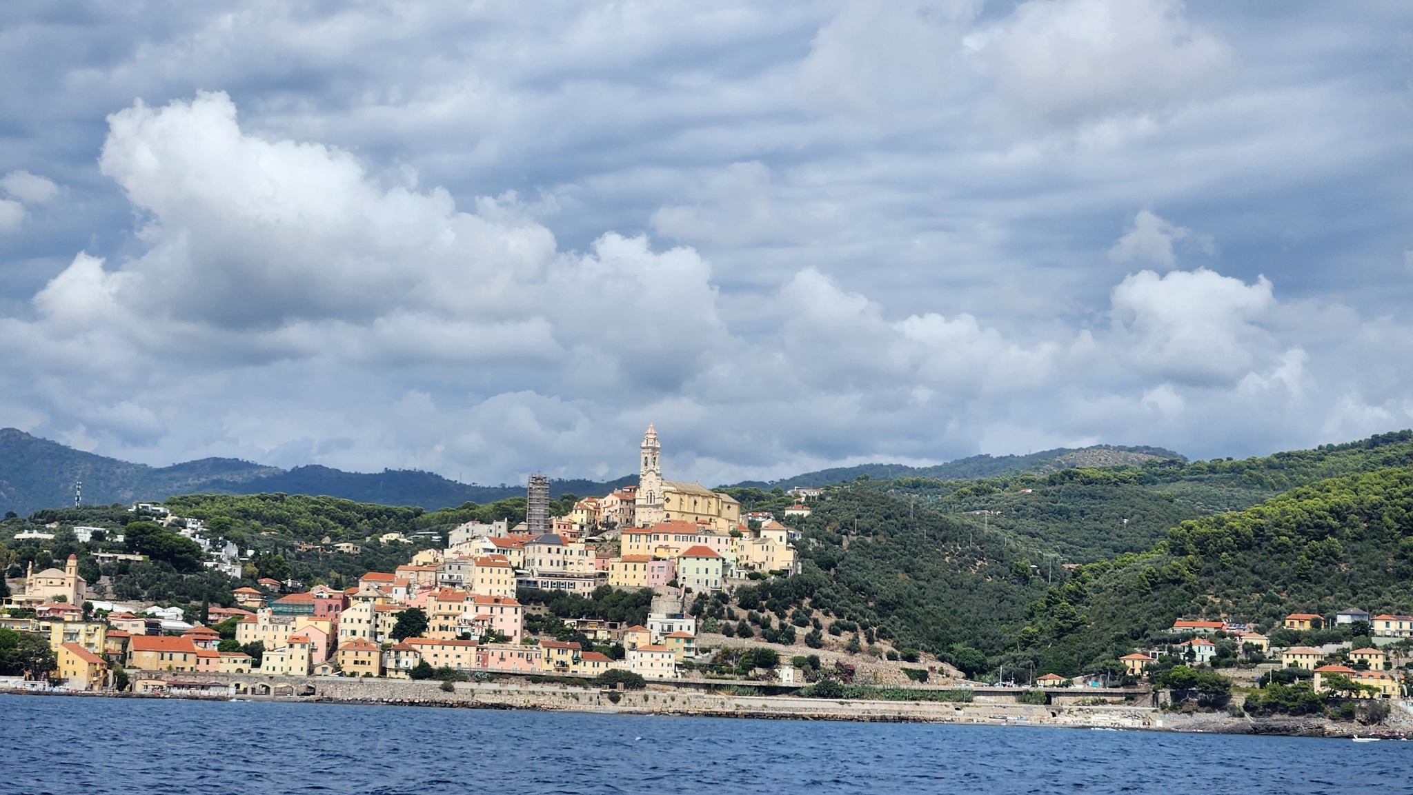
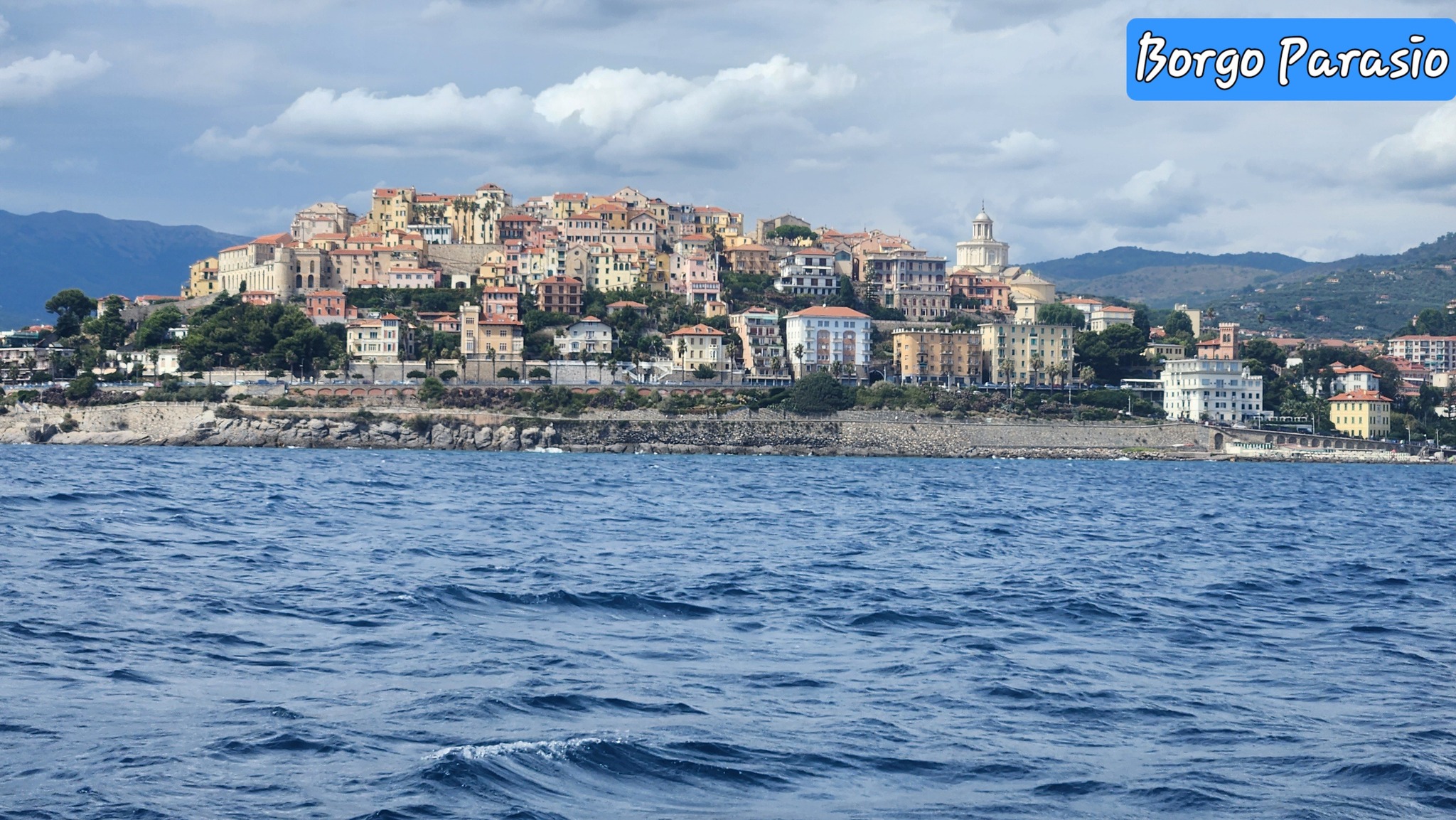
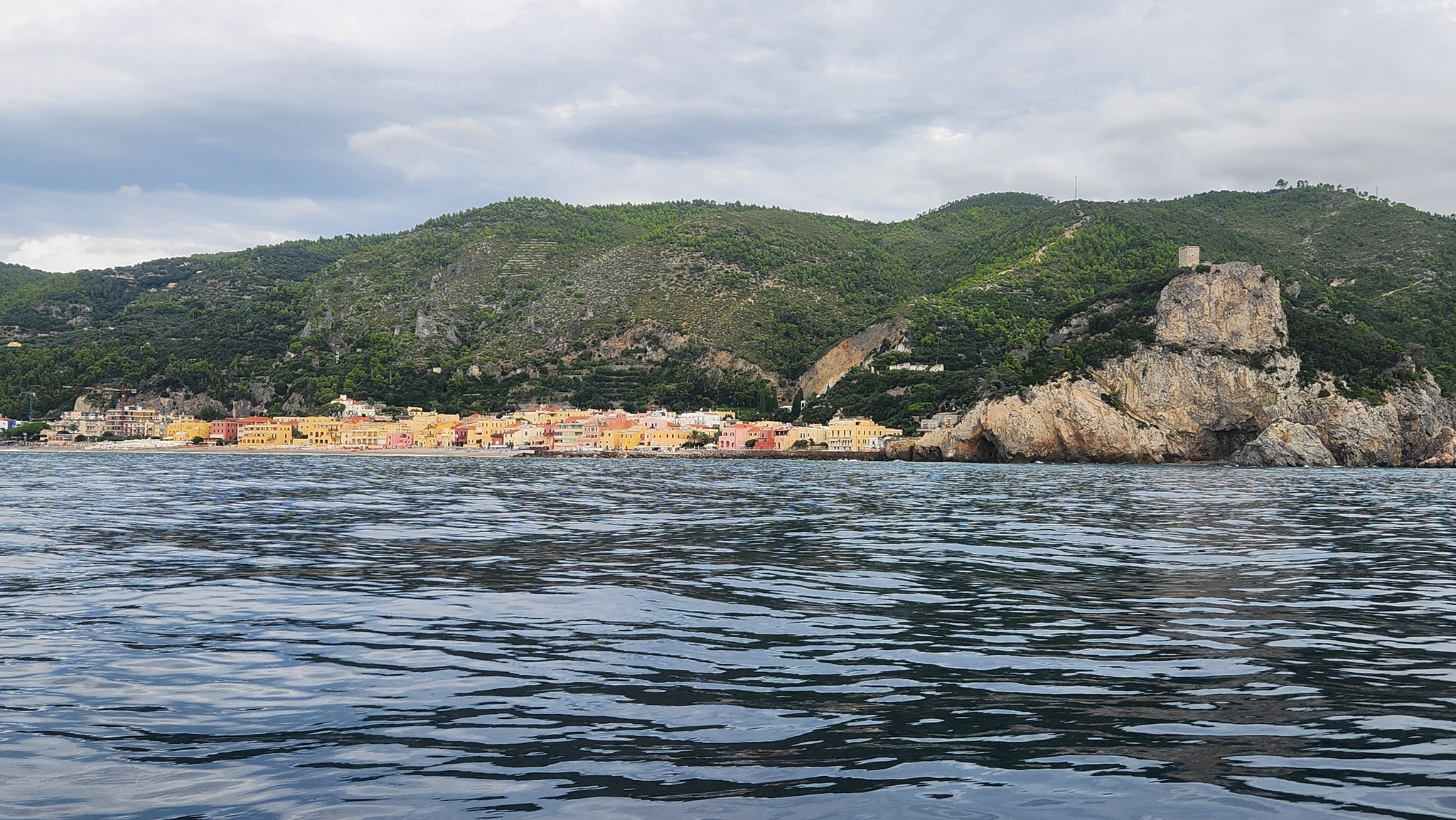
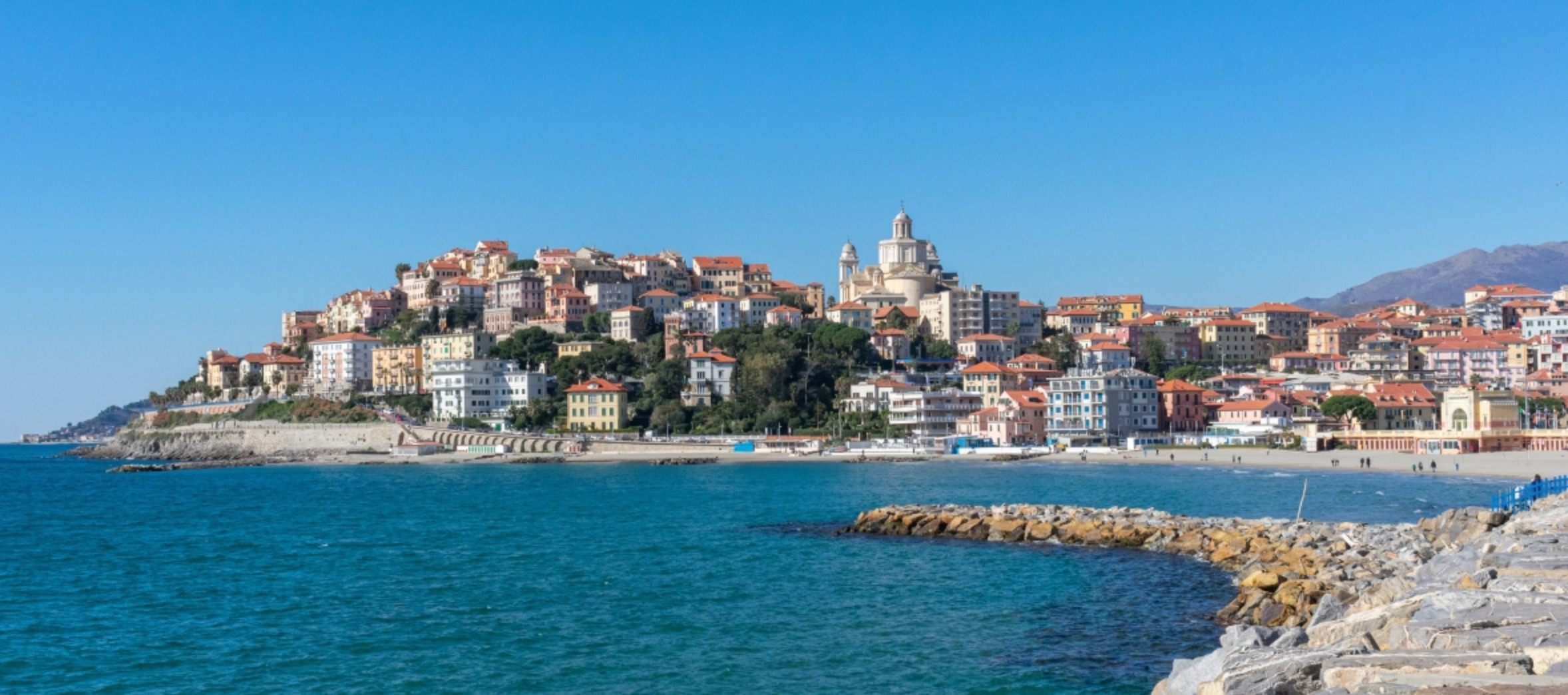
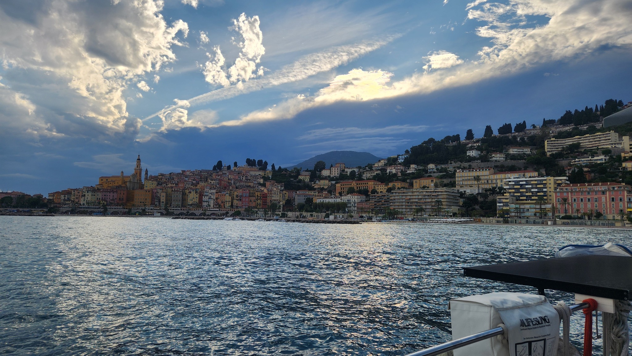
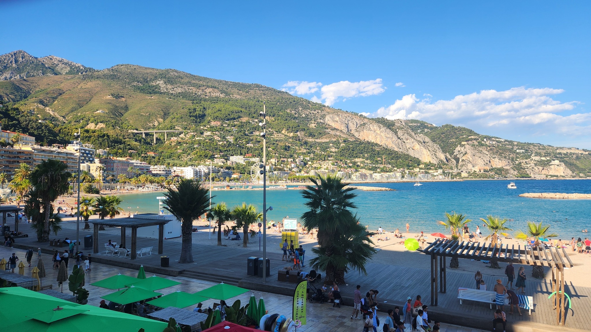
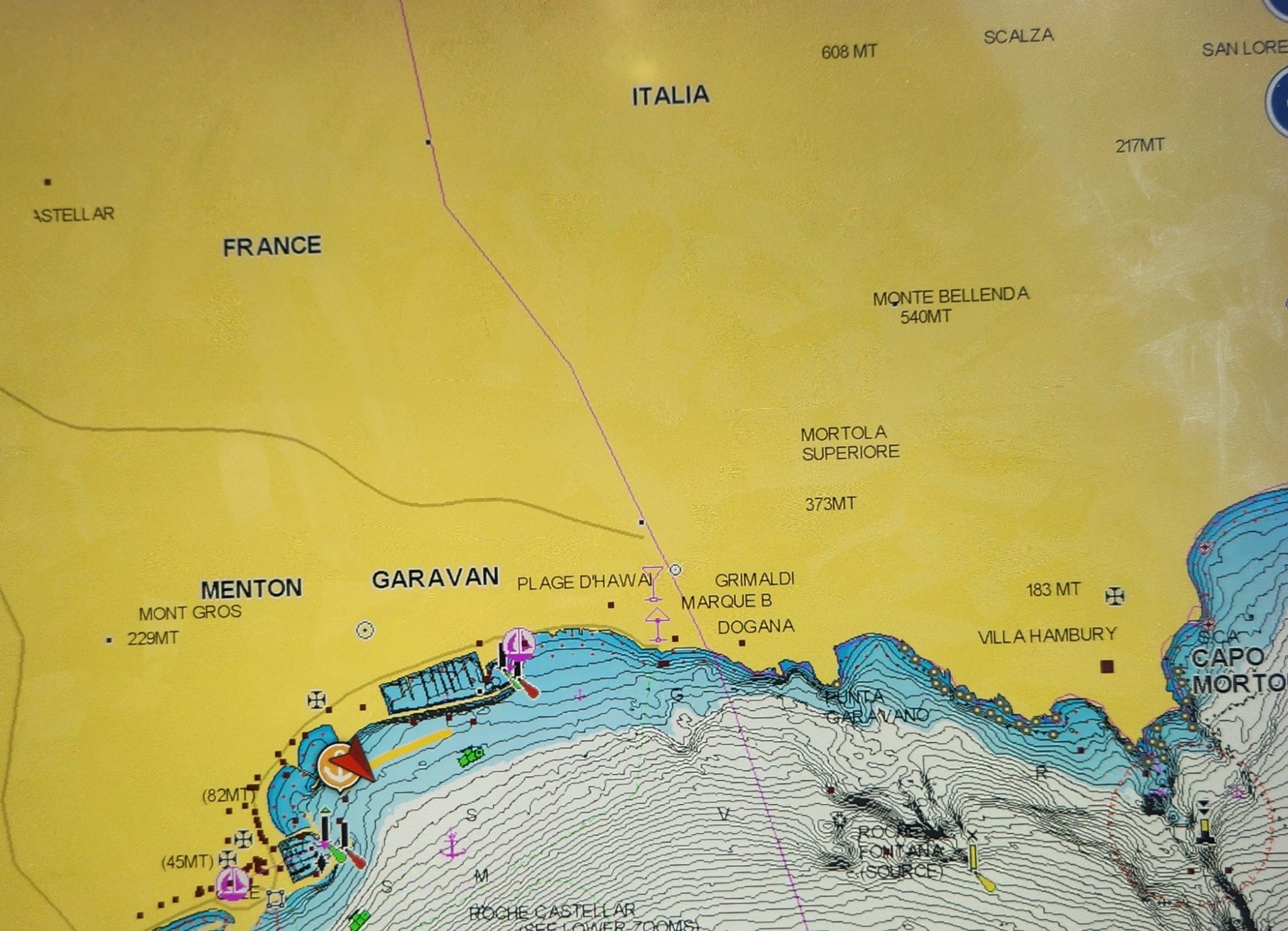
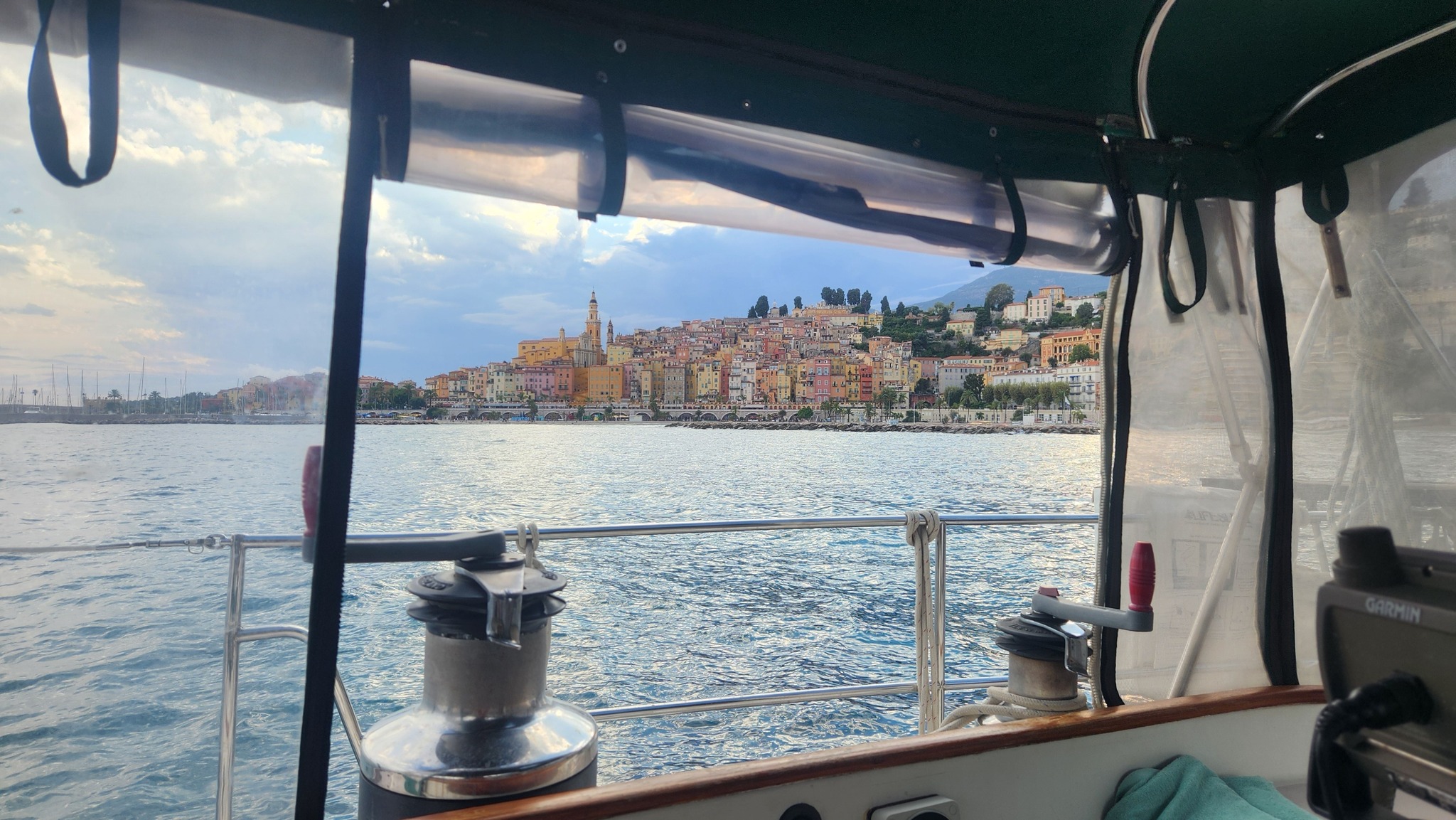
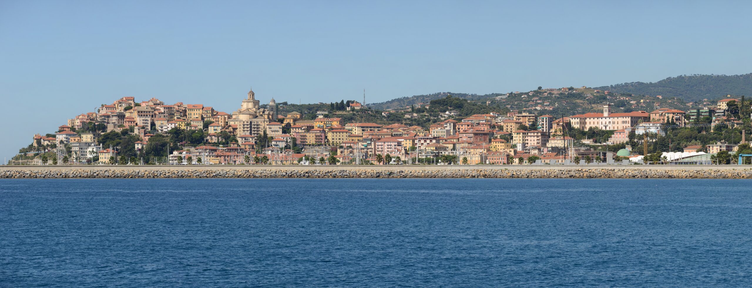
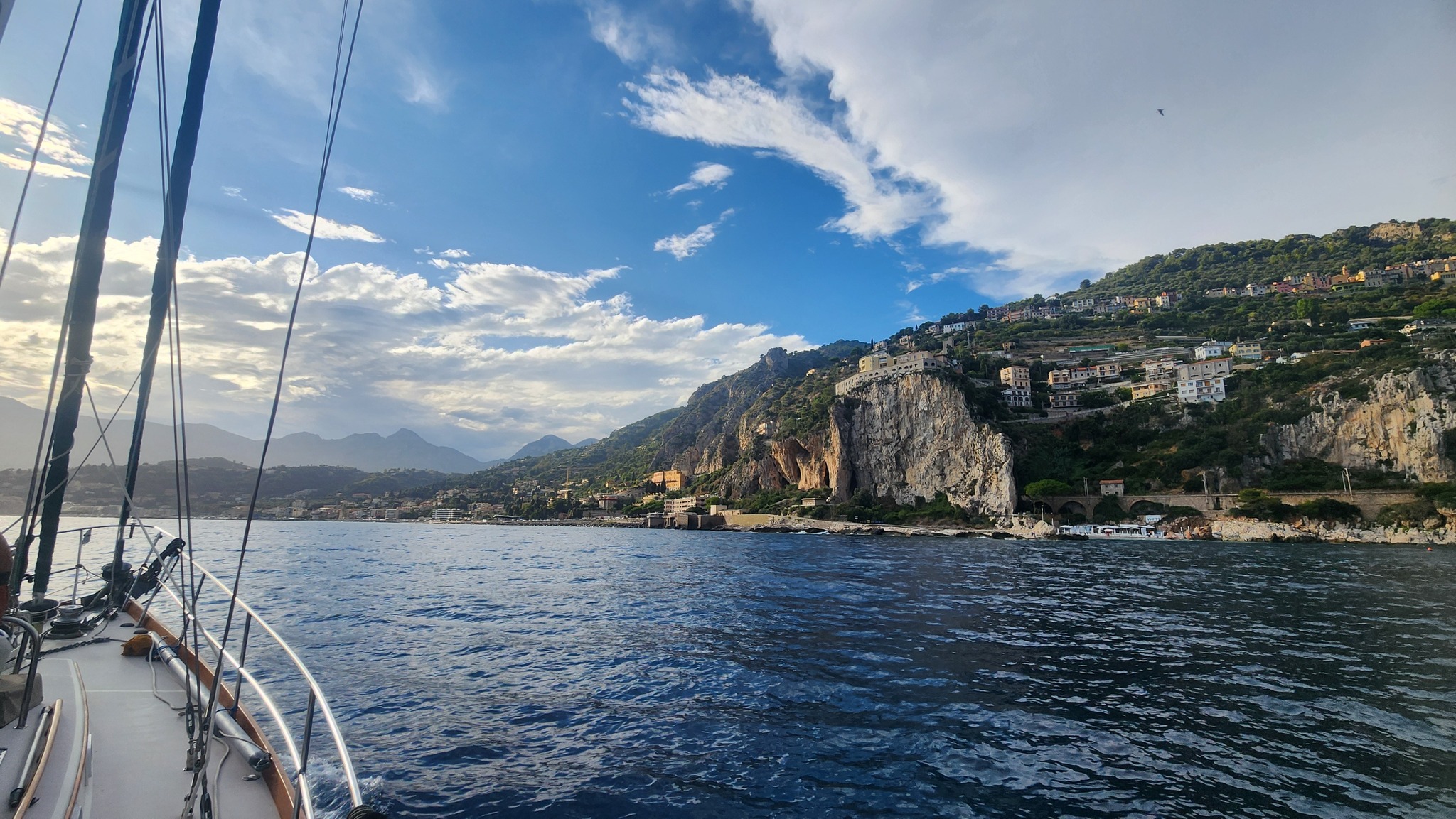
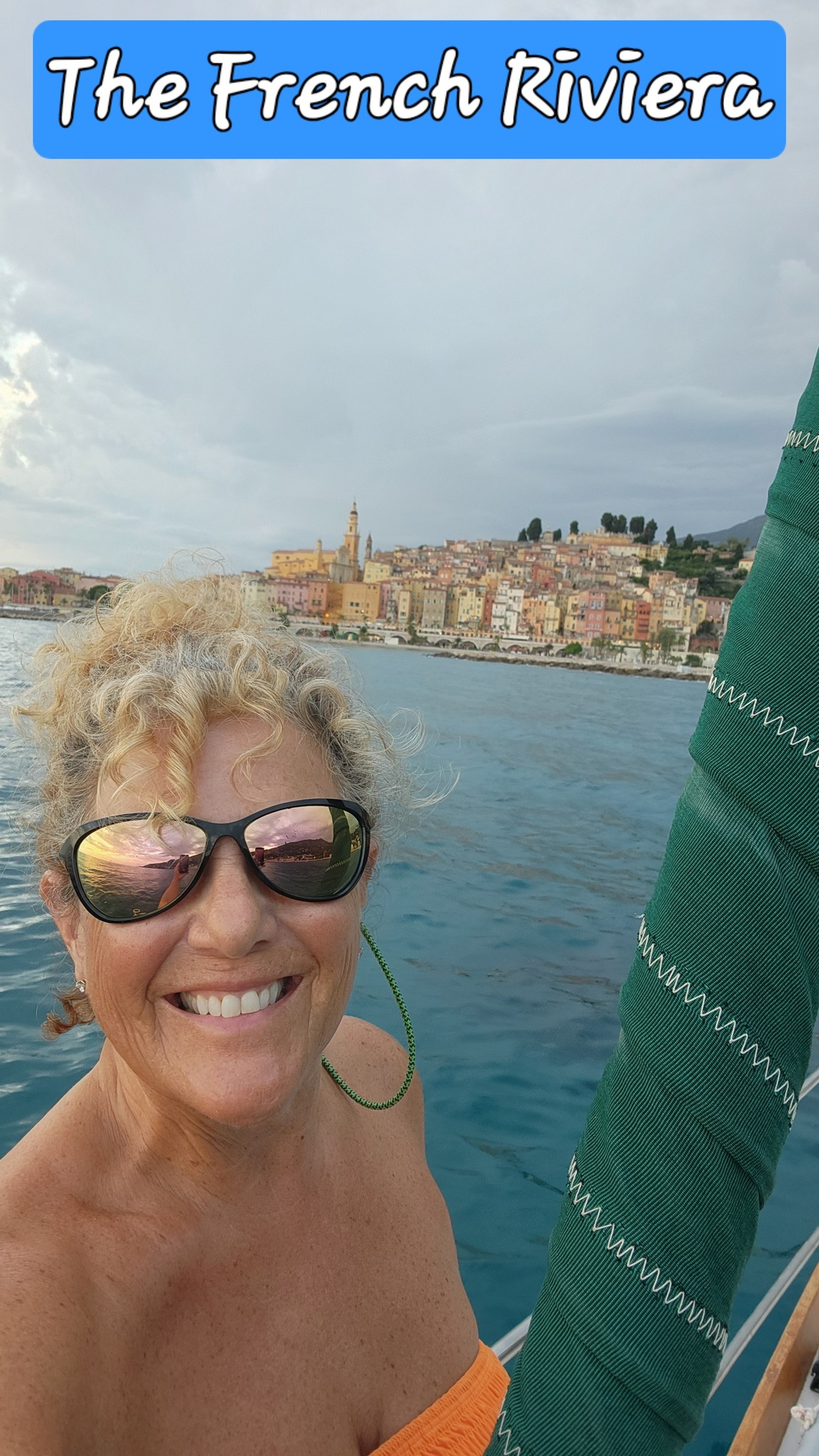
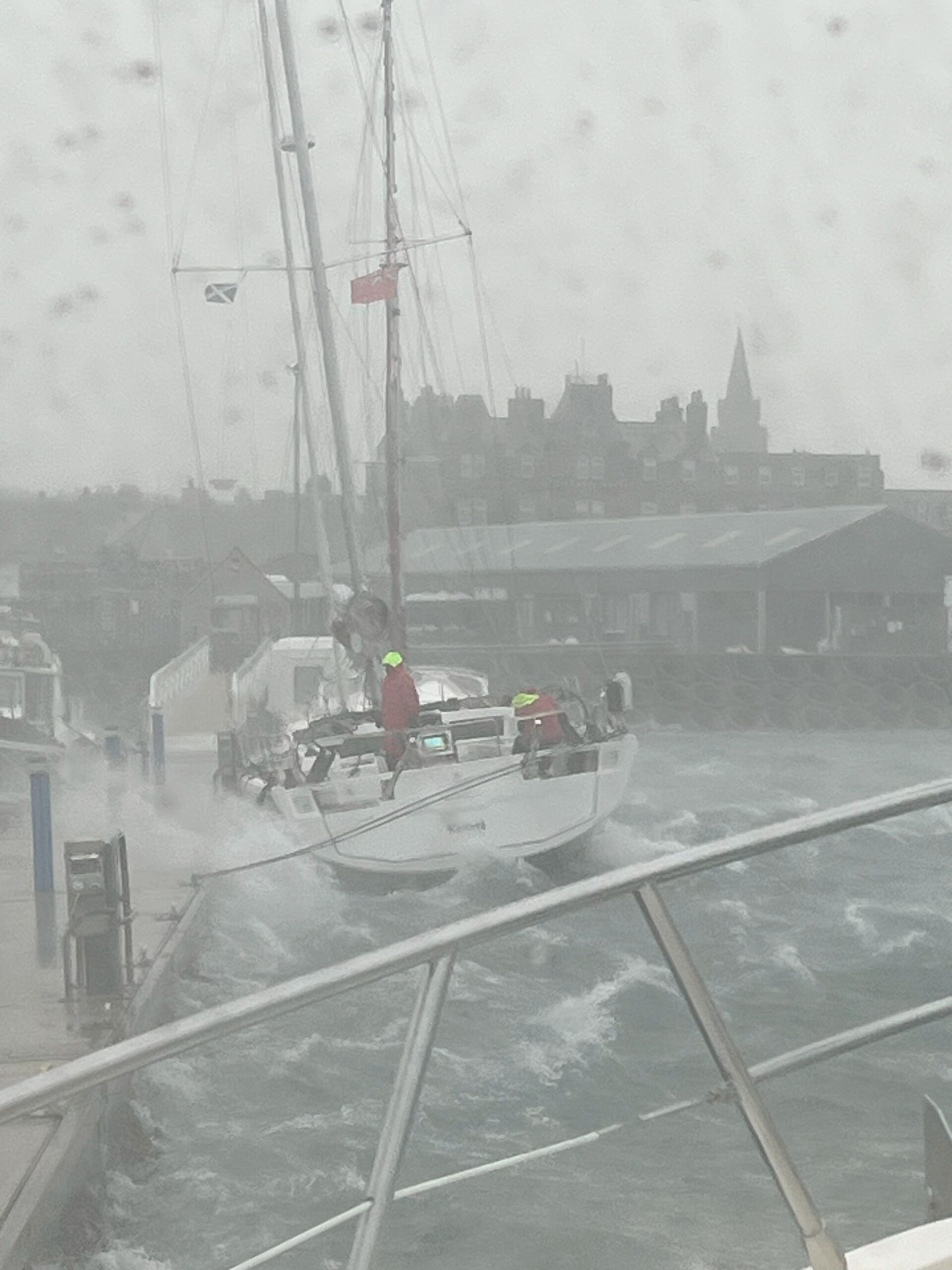
🇮🇹 ITALIAN AND FRENCH RIVIERA 🇫🇷
SY SAMLL WORLD III 🇻🇮 Karen & Daren – Bristol 47.7

YOUR SPECIAL INVITATION
OCEAN POSSE & BEN TAYLOR
STREET PARTY
@ CANNES  YACHTING FESTIVAL
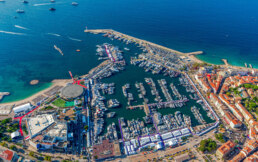
The Cannes Yachting Festival, founded in 1977, is Europe’s leading in-water boat show held every September in Vieux Port and Port Canto. It gathers nearly 700 boats from 20′ to 165′ with 600+ exhibitors, and 55,000 visitors. Divided into zones for motor yachts, sailing vessels, tenders, toys, and luxury, it offers sea trials and global premieres. The 2025 show runs from September 9–14.
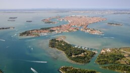
VENEZIA CERTOSA MARINA 🇮🇹 ITALY – SPONSORS THE OCEAN POSSE
45°26.2616′ N 012°22.44 E
WE ARE PLEASED TO PARTNER WITH THE OCEAN POSSE AND OFFER A 10% discount off our mooring rates
CONTACT
AMENITIES
- Video Security
- Recycling
- Reception and hospitality
- Accessibility
- Pier lighting
- Electricity with three-pha
- se and single-phase connection
- Wifi Venice Connected
- Water
- 24/24h surveillance and mooring assistance
- Bar
- Fire prevention service
- Connection to the city center
- Laundry
- Shower
- Toilet
SAFE APPROACH
NEARBY
. 1) Piazza San Marco (St. Mark’s Square)
-
Why Go: It’s the beating heart of Venice, where you’ll find the stunning Basilica di San Marco, the Campanile, and the Doge’s Palace.
-
Highlights: Byzantine mosaics, the bronze horses, and panoramic views from the bell tower.
-
Best Time: Early morning or evening to avoid crowds and acqua alta.

2. Doge’s Palace (Palazzo Ducale)
-
Why Go: Once the seat of Venetian power, this Gothic masterpiece reflects Venice’s status as a maritime republic.
-
Highlights: Golden staircase (Scala d’Oro), Tintoretto’s artworks, and the Bridge of Sighs.
-
Insider Tip: Book the “Secret Itineraries” tour to see the interrogation rooms and Casanova’s prison cell.

3. Rialto Bridge & Market
-
Why Go: The oldest bridge over the Grand Canal, bustling with energy and offering classic postcard views.
-
Highlights: Fresh seafood at the market, gondolas gliding below, and hidden wine bars (bàcari) nearby.
-
Timing: Morning for the market, sunset for the views.

4. Grand Canal (Canal Grande)
-
Why Go: Venice’s main artery—best experienced by vaporetto (water bus) or private water taxi.
-
Highlights: Palaces like Ca’ d’Oro and Ca’ Rezzonico line this historic waterway.
-
Best Experience: Take Vaporetto #1 from Piazzale Roma to San Marco for a front-row canal tour.

5. Islands of Murano & Burano
-
Why Go: A maritime escape within the lagoon—Murano for glassmaking, Burano for lace and vibrant colors.
-
Highlights:
-
Murano: Watch glassblowers at work.
-
Burano: Rainbow-hued houses and the leaning bell tower.
-
-
Pro Tip: Combine both in a half-day trip by vaporetto.

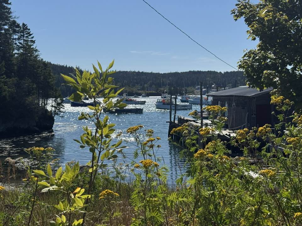
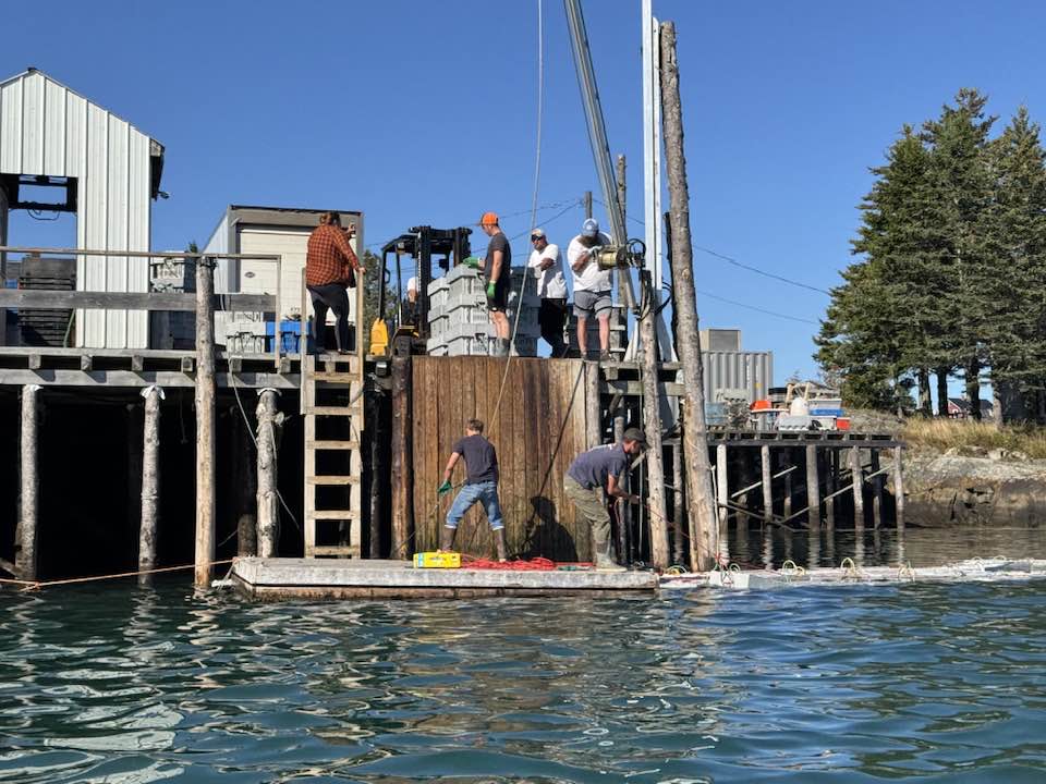
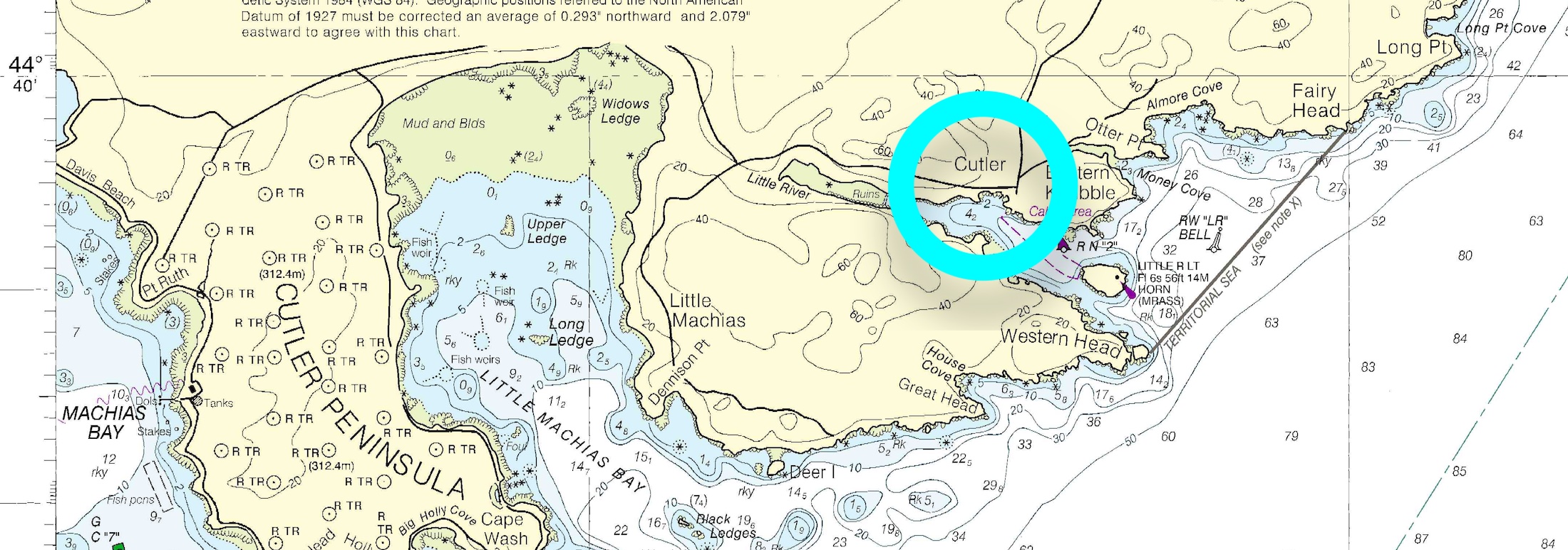
Cutler – Maine 🇺🇸 USA
Cutler, Maine, located on the rugged coast of Washington County, is a small but historic fishing village known for its deep natural harbor and rich maritime heritage. With a population of fewer than 600 residents, it embodies the quiet resilience of coastal New England life. The town is home to one of the U.S. Navy’s VLF transmitter sites, which supports submarine communications. Beyond its naval role, Cutler is surrounded by pristine natural beauty, including bold cliffs, seabird nesting sites, and remote hiking trails. Its working waterfront reflects a tradition of lobstering and seafaring that continues to define the community today.
SY AUTUMN MOON 🇺🇸 Laurin & Elisa – Fountaine-Pajot 41′

It’s That Time Again – The Ocean Posse Annual Survey Has Dropped ⚓️
Ahoy Captains and Crew,There’s nothing quite like a good maritime survey to get your day started – a little honesty, a little embarrassment, and a whole lot of truth. We’re excited (yes, really excited) to hear what you really think.
This is your chance to weigh in – anonymously – and help shape the course of the Ocean Posse fleet. No names, no judgments, just your salty insights.Grab a coffee, drop anchor, and take a few minutes to fill it out. 👉
We’re counting on you – and there might just be a $250 prize at the end of your honesty.Stay informed, The Ocean Posse Team
THE OCEAN POSSE ⚓ ROUTE PODS
This season it’s time for you to choose your Pods – or mini Posse’s think of them as your route tattoos for your voyage ahead.
Each pod has its own emoji tag so you can mark your cruising plans and spot kindred spirits. If you invent a new route you can pick your own symbol and pod name.
⚓ 👉 Each pod = your Route Tattoo : just drop the emoji in chat to tag yourself and show your season’s cruising vibe.
Extra DIY points for stitching or painting your emoji on this season’s burgee . Your annual membership of $ 349
gives you full support along any of these routes and your membership gives you full access to resources in 50 + maritime areas !
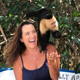
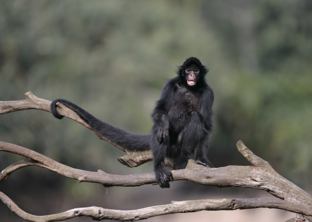
We sail where the monkeys roam free !
Let’s join a troupe of monkeys 🐒
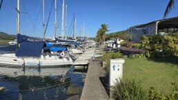
INTRODUCING A NEW SPONSORSHIP MARINA
PIER 26 MARINA & BOATYARD 🇧🇷 BRAZIL
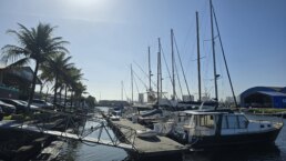
24° 00.115′ S 046° 17.567′ W
We are pleased to welcome the Ocean Posse with the following discount:
- 1 day free
- 10% off Off-Season slip fees (January – April)
- 5% off In-Season slip fees (May – December)
Services
- Official Customs ad Quarantine Port of Entry for Santos
- Lifting and movement of vessels up to 30tons
- Single and 3 phase power up to 32 amp
- Vessel Maintenance
- Removal of motors and masts
- Secure gated site monitored by patrols and CCTV cameras
- Nautical and related equipment store
- Equipment Leasing
- Technical assistance
- Onsite storage
- Environmental license
Amenities
- Concierge service 7 days a week
- Free Wi-Fi
- Snack bar
- Canteen
- Washrooms with showers

PIER 26 SAFE APPROACH
NEARBY
- Praia Branca (Branca Beach)
- Praia Preta (Preta Beach)
- Praia de Iporanga (Iporanga Beach)
- Trilha das Ruínas da Ermida do Guaibê (Trail of Ruins of Guaibê Chapel)
- Museu do Café de Santos (Santos Coffee Museum)
- Museu Pelé (Pelé Museum)
- Santos Port

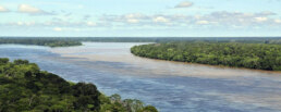
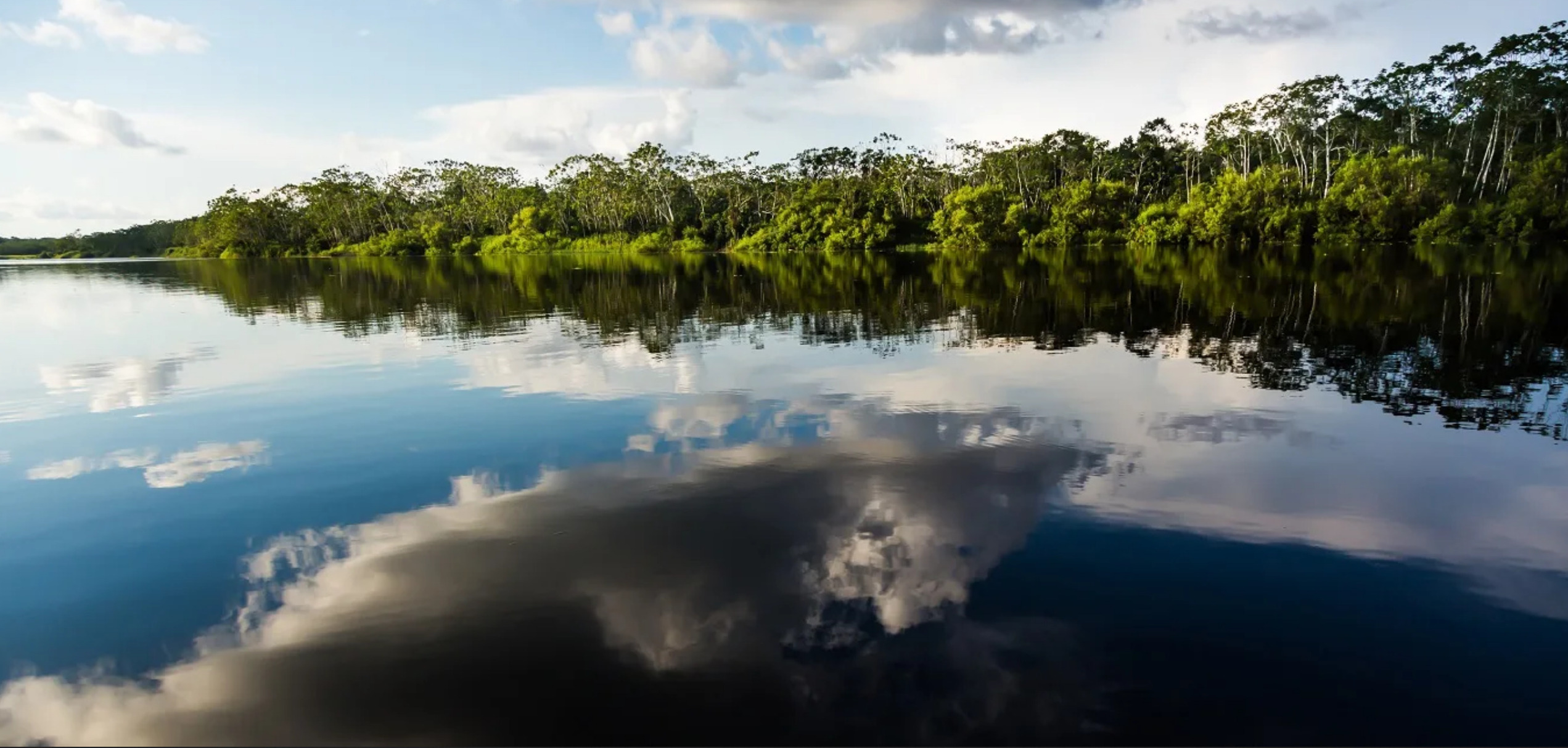
Must See and Sail the Amazon 🇧🇷

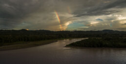
The Call of the River Sea
Few waterways on Earth carry the weight and mystery of the Amazon River. To cruising sailors accustomed to oceans and coastal passages, the Amazon with over 4,000 nm in length offers a different voyage altogether, a journey not defined by horizons and swell but by endless freshwater, jungle canopies, and currents that rival trade winds in strength. For those answering the call of the sea upriver, the Amazon is as much about seamanship as it is about discovery. It demands respect, careful planning, and a willingness to navigate both bureaucracy and nature. But in return, it offers unique encounters with cultures, wildlife, and landscapes to explorer type yacht owners and cruisers.
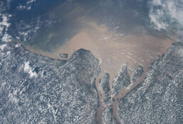
How to Approach the Mouth
The Amazon’s estuary is immense, more like a sea than a river. Its mouth stretches more than 150 miles wide, with tidal flows strong enough to push or hold a yacht at four knots. The pororoca—the famous tidal bore—sends walls of water racing inland with thunderous power, and while spectacular, it can overwhelm an unprepared vessel.
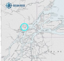
Entering from the Atlantic, most yachts aim for Macapá, situated near the equator on the northern bank. This is where many clear in with Brazilian authorities. Anchoring here requires care: mud bottoms, heavy tidal currents, and limited holding make dragging a real risk. Double anchors, preferably set in opposite directions, are recommended.
Timing is everything. Arrive near slack water, and plan anchoring strategies with the same seriousness you’d devote to reefing a mainsail before a squall. Captains accustomed only to coastal cruising will find the Amazon’s tidal hydraulics sobering.
Clearance and Bureaucracy
Patience is a virtue when dealing with Amazonian formalities. Immigration and customs in Macapá or Belém can take a full day. Officers are generally polite and professional, though procedures are slow and sometimes involve multiple offices. Captains should bring all ship’s papers, crew passports, and—crucially—a sense of calm.
Brazil issues visas of varying length depending on nationality, often between 90 and 180 days. Ensure passports have adequate validity and crew lists are accurate. Most yachtsmen recommend anchoring for at least two nights before starting upriver, to both recover from the Atlantic approach and finish paperwork.
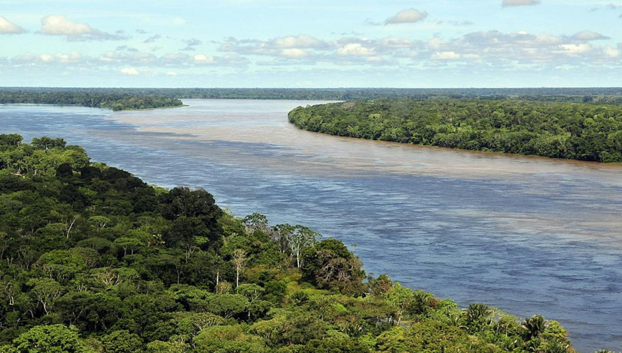
The River Itself—Currents, Depths, and Tides
The Amazon flows with the force of an ocean. Expect currents of three to five knots in the main channel, less in backwaters, but always present. Unlike ocean passages, where wind is your adversary or ally, here it is water movement that rules. An engine in good condition is essential. Relying on sail alone is possible in places but impractical against the steady push of the current.
Depth is seldom an issue—the river is deep enough for container ships bound for Manaus, nearly 800 miles inland. What is an issue are sandbanks, floating debris, and shifting channels. Radar helps, but so does a sharp bow watch. Heavy rains can release entire trees into the current, making collisions a hazard.
Must-See Towns and Cities
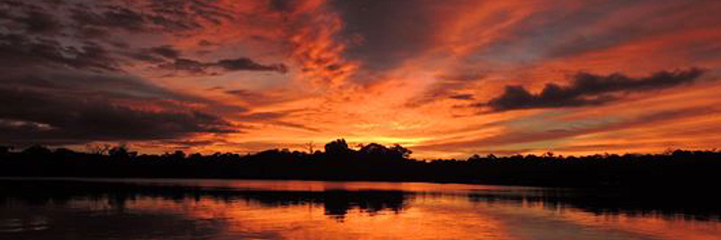
Belém—Gateway to the River
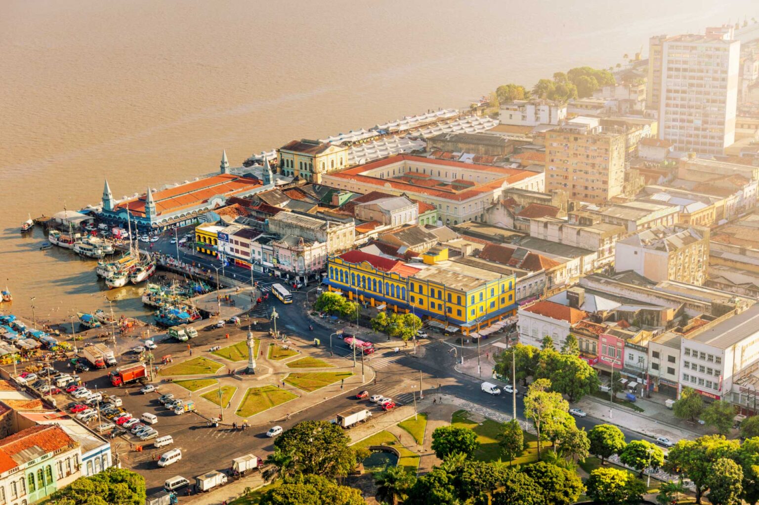
Known as the “City of Mango Trees,” Belém lies at the edge of the estuary. Founded in 1616 as a Portuguese stronghold, it remains a lively colonial port with a bustling waterfront market at Ver-o-Peso. Here, sailors find a vivid introduction to Amazonian life: stalls overflow with açaí berries, river fish, and medicinal plants harvested deep in the jungle. Belém’s cathedral and fortress remind visitors of its maritime past, while its modern marinas offer respite for yachts.
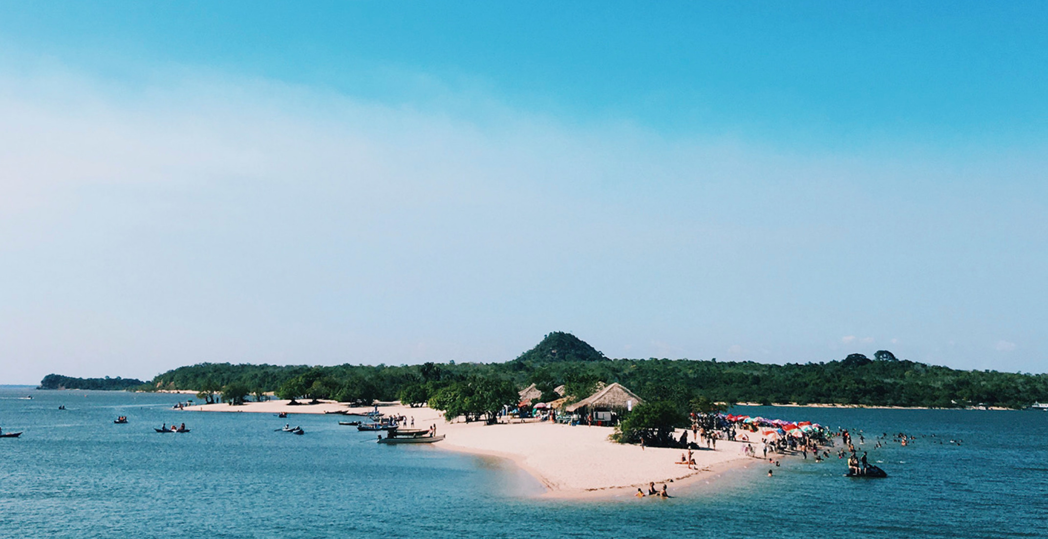
Santarém and Alter do Chão
Roughly 500 miles upriver lies Santarém, where the Rio Tapajós meets the Amazon. The waters of the Tapajós are strikingly clear, contrasting with the Amazon’s sediment-rich flow. Just nearby is Alter do Chão, a river town famous for its white-sand beaches. When water levels drop between August and December, islands emerge, creating natural anchorages that resemble Caribbean lagoons—only surrounded by rainforest instead of palm-fringed coasts.
Manaus—The Opera House in the Jungle
The great city of Manaus is perhaps the Amazon’s most remarkable urban landmark. Once the heart of the rubber boom, its wealth built the ornate Teatro Amazonas, an opera house completed in 1896 with Italian marble, French glass, and European artistry—all transported at staggering expense. To arrive by yacht at this inland metropolis, after more than 800 miles of river navigation, is to witness firsthand the scale of human ambition in the heart of the jungle. Manaus is also the practical turnaround point for most yachts. Beyond it, the river narrows, and formalities increase near the Colombian and Peruvian borders.
Must-See Natural Wonders
The Meeting of the Waters
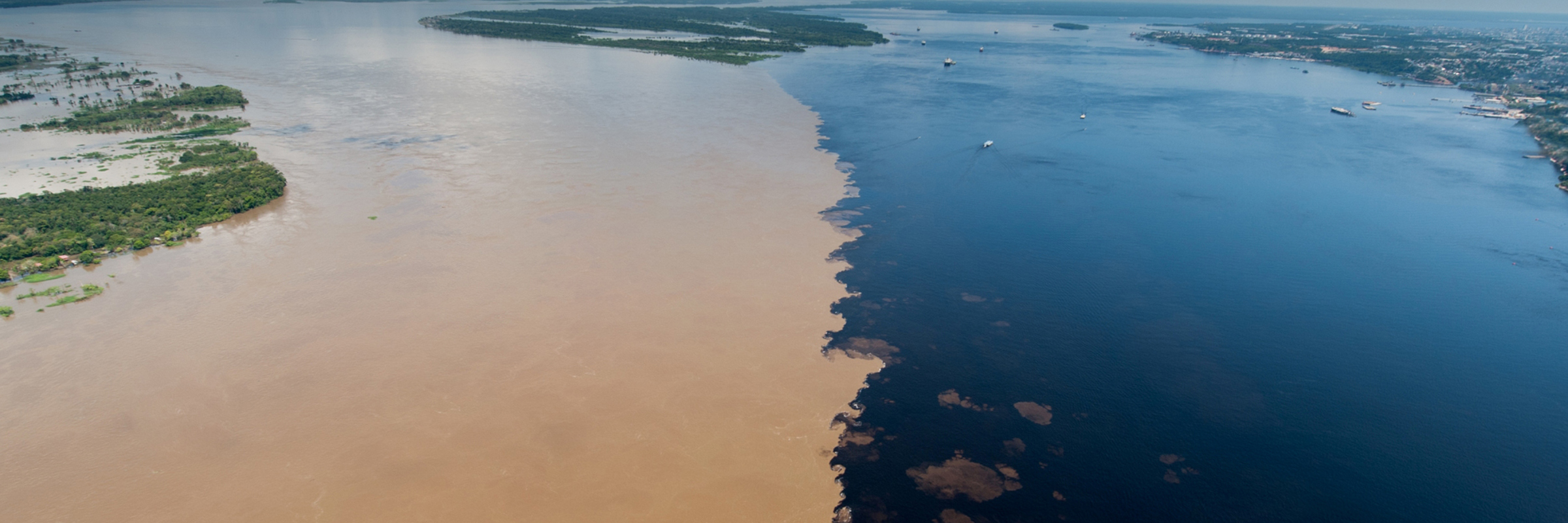
Just outside Manaus lies one of the Amazon’s most famous spectacles—the confluence of the Rio Negro and the Amazon (Solimões). For miles, black and brown waters flow side by side without mixing, creating a natural boundary visible from the deck. This phenomenon is due to differences in temperature, speed, and sediment load, and it is one of the must-photograph moments of any Amazon voyage.
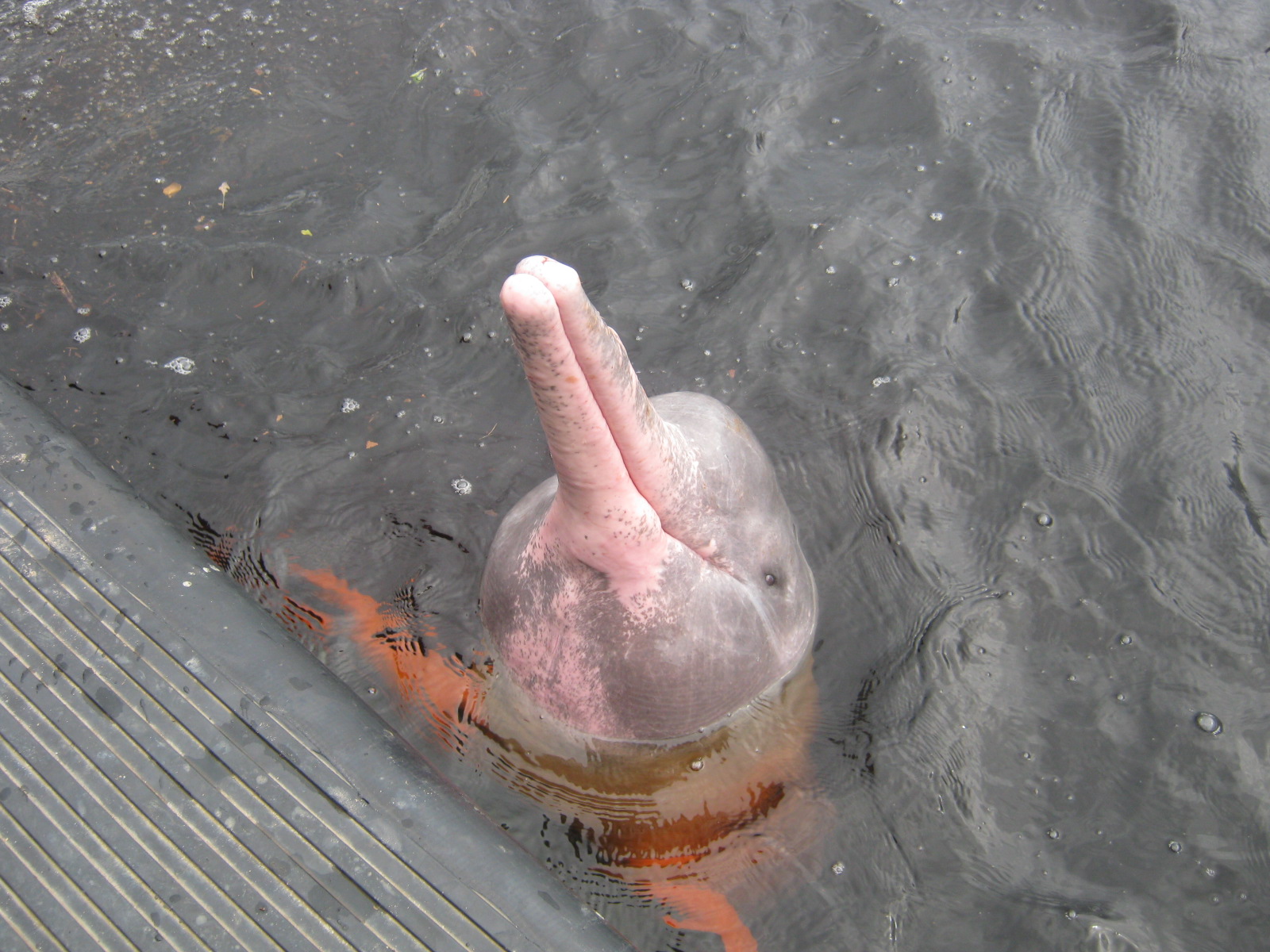
Wildlife of the Flooded Forests
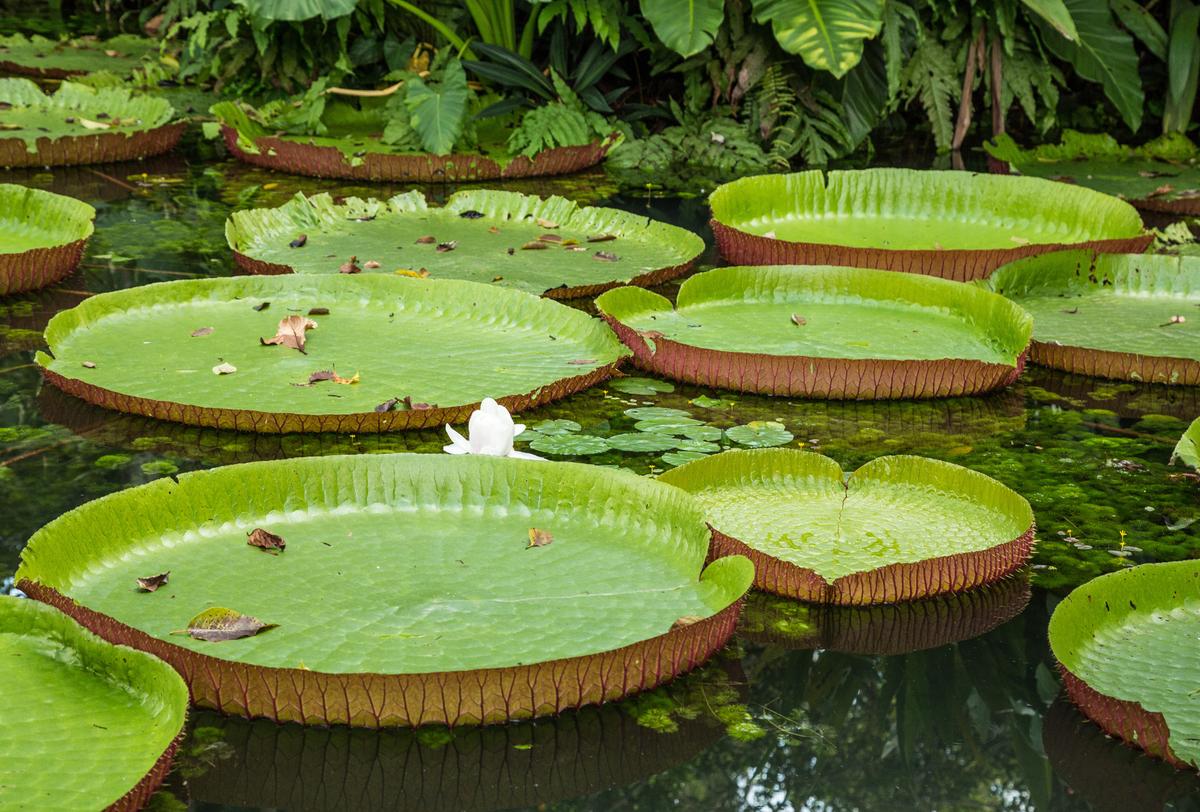
The Amazon is alive with creatures. Macaws flash scarlet and cobalt overhead. Pink river dolphins surface near bows. Sloths cling to riverside branches. For those with dinghies or kayaks, the flooded igapó forests offer a chance to glide silently under the canopy, surrounded by birdsong and the hum of insects. Unlike ocean crossings, where sightings are rare and distant, here every bend in the river brings new life into view.
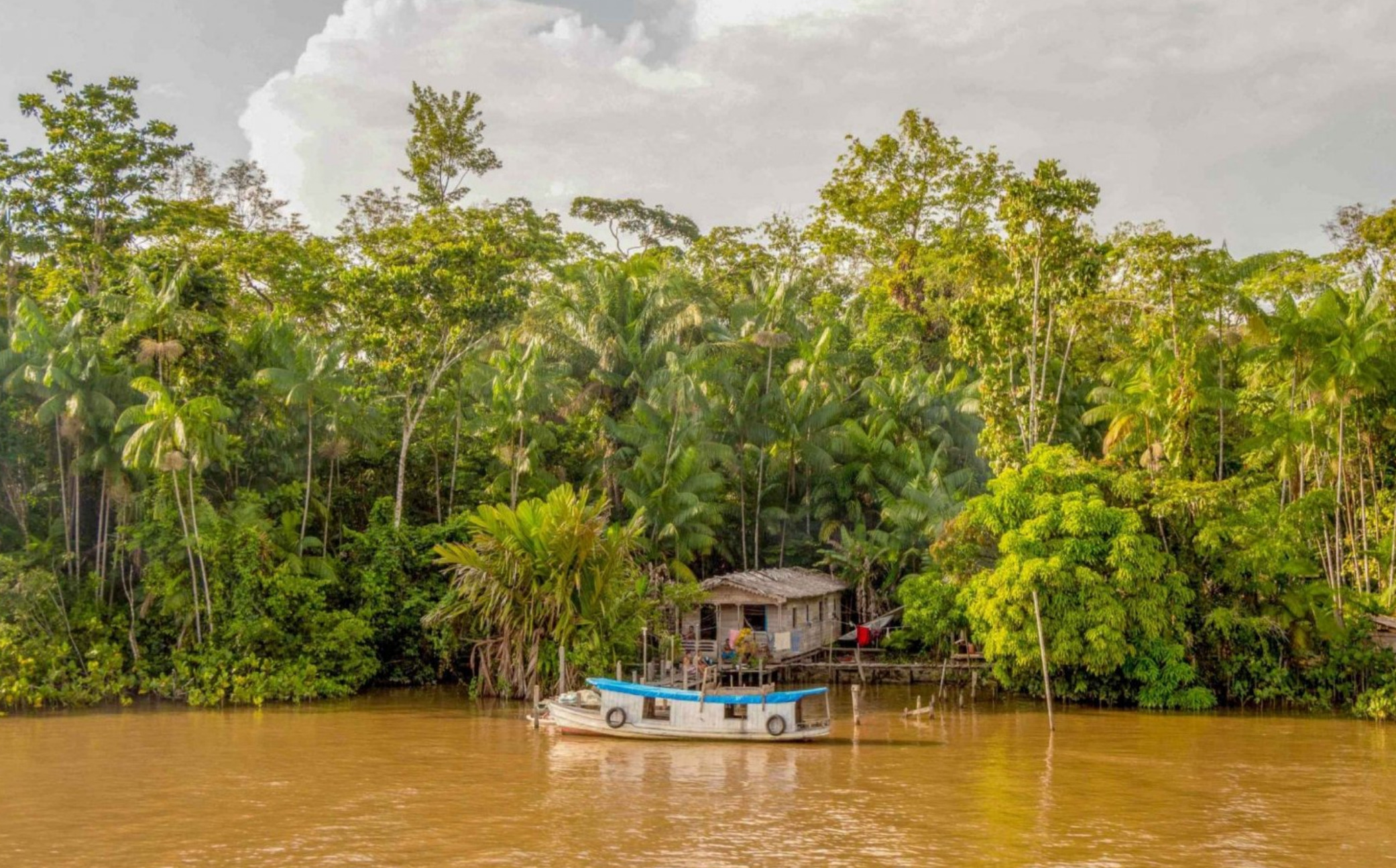
The Varzea—Life on the Floodplain
Seasonal floods create vast wetlands where houses rise on stilts, and people travel by canoe. Visiting varzea communities provides a window into resilience and adaptation: families fish, farm floating plots, and live attuned to the rhythms of the river. Captains are often welcomed with curiosity, though gifts of useful items (fishing line, batteries, school supplies) are appreciated.
Seasons and Weather
The Amazon has two seasons: rainy and less rainy. From December to May, rains swell the river, raising levels by as much as 30 feet. During this time, currents are strongest, and floodwaters inundate the forest. From June to November, waters recede, beaches appear, and currents ease slightly. For sailors, the drier season is generally easier for upriver passages, though both offer their own rewards.
Temperatures hover around 27–32°C (80–90°F) year-round, with high humidity. Tropical squalls are common, bringing intense downpours and gusts. Careful deck preparation and watertight hatches are non-negotiable.
Seamanship Tips
Anchoring: Use two anchors set in a V or Bahamian moor. Currents can reverse with tides in the lower stretches.
Engine Readiness: Carry spare parts, fuel filters, and impellers. Expect debris in water intakes.
Charts and Navigation: Electronic charts are helpful but often imprecise. Satellite imagery and local pilots can be invaluable.
Mosquitoes and Health: The riverbanks are mosquito country. Malaria prophylaxis is recommended, and screens for hatches are essential.
Provisioning: Major cities like Belém, Santarém, and Manaus offer good provisioning. Between them, expect only local markets. Stock long-term staples before leaving.
The Dark Side of the River—Piracy and Security
No essay about the Amazon is complete without addressing security. While most encounters are benign, there are risks. Small-scale river piracy, particularly targeting local boats, does occur. Yachts should avoid isolated anchorages near major towns, and anchor closer to communities rather than in desolate stretches. Sir Peter Blake’s death in 2001 underscored these dangers. read more about this historic sailing & exploration incident here >>
Why Sail the Amazon?
To sail the Amazon is to test seamanship in a new dimension. Unlike trade-wind passages or coral navigation, it demands patience with bureaucracy, constant vigilance against currents, and flexibility in the face of changing conditions. But the rewards are immense.
You will see dolphins leap beside your hull in freshwater. You will anchor off towns that blend Portuguese colonial charm with jungle survival. You will drift past forests alive with creatures found nowhere else. And you will, if only for a season, join the pulse of the greatest river on Earth.
Conclusion—Answering the Call
The Amazon is not for every sailor. It is demanding, humid, and unpredictable. Yet for those who long for adventure beyond the familiar trade routes, it offers something profound. It is not just a river; it is a world entire, a river sea that dwarfs imagination. To sail it is to measure oneself not against storms or oceans, but against time, current, and the patience required to let a river reveal its wonders.
Sailors who have ventured there speak not of miles logged but of sights etched into memory: the meeting of the waters, the songs of macaws, the grandeur of Manaus, the humility of small river villages, and the sheer sense of having carried a yacht into the beating heart of South America.
To must-see the Amazon is one thing. To must-sail it is another. Together, they form a journey few forget, and fewer still regret.
MEET THE FLEET 🇺🇸 SY SERENITY
Ahoy we are Mark and Kathryn and our baot is named SV Serenity, Antares 44 catamaran. Moved aboard from Denmark (Mark) and Idaho (Kathryn) in San Diego in December 2020 as our floating home, since we couldn’t agree on a terrestrial one.
We are currently sailing in Bocas del Toro, Panama. We loved the San Blas and Channel islands (though they are very different).
What motivated us to take on the cruising lifestyle was the freedom of living wherever our vessel happens to be, learning about different geographies and cultures along the way. Cruising has taught us that surrendering is the key to enjoyment.
We see the cruising lifestyle as a shared adventure – everything is better together, Baby!
Being on night watch in a moonless night with bioluminescence stirred by accompanying dolphins, looking up at the vast starlit sky, realizing how tiny we are compared to the universe, and how privileged we are to enjoy such peaceful splendor – that was the moment that changed the way we see the world.
There are more opportunities for marital disputes than ever imagined. 5 years on and we still wouldn’t trade this lifestyle for another! We try to interact by talking, supporting local businesses by purchasing goods and/or donating what we can. Visiting Kennedy in Bahia Honda is one small example.
Looking ahead we are excited about, crossing the Pacific, says Mark. Exploring the Caribbean, says Kathryn. See “marital disputes” above. 😂
Overall, the Posse has been a great vehicle for meeting people, sharing solutions / best practices / passage advice. This is our third year as members and we love the community! Please feel free to follow us on Instagram: sv.serenity NFL: @sv.serenit
SY SERENITY 🇺🇸 Mark & Kathryn & Lapa – Antares 43′

HERE IS THE LONG LIST 📋
WHAT TO BRING IF YOU ARE GOING CRUISING
With Ocean Crossings up to 3000 nm without assistance between stops.
Experienced skipper and competent crew
Money and Credit Cards ( budget between 1,900 and 7,500 x month x vessel / average 4,500 x month )
Time
Vessel Documentation
Passports
Drivers License
Proof of Covid Vaccination
Third Party Liability Insurance
Windows or Mac Laptop wih keyboard and mouse
REMINDER 4 DAYS OF CRUISING SEMINARS 🇺🇸 SAN DIEGO Oct 14 – 17 2025
RESERVE YOUR SEAT TODAY >>
- Tuesday, October 14, 2025 – Seminars
- 10:00 – 12:00 Watermakers & Plumbing in Paradise – Rich Boren
- 12:00 – 14:00 Working Lunch (Uber Eats, etc.)
- 13:00 Diesel Engines & Generators – Preventive Maintenance
- 14:00 Rigging 101 – Standing & Running
- 15:00 Weather – Planning, Routing, Underway
- 16:00 Crew – The Good, the Bad & the Ugly
- 17:00 Cruising Pacific Mexico – Check-In/Out & Sea of Cortez
Wednesday, October 15, 2025 – Seminars
- 09:00 South Pacific – FP, Cooks, Tonga & Fiji
- 10:00 Safety, Security & Emergencies Abroad
- 11:00 Electrical Systems – Batteries, Chargers, Solar
- 12:00 – 14:00 Lunch Break
- 14:00 Boat Repairs Outside the US
- 15:00 Staying Cool – Refrigeration, AC, Shading, Airflow
- 16:00 Anchoring
- 17:00 Destinations – Costa Rica & Nicaragua
Thursday, October 16, 2025 – Seminars<
- 09:00 Destination Belize & Rio Dulce (Blue Hole & Routes)
- 10:00 Communications Onboard & Ashore (Starlink, etc.)
- 11:00 Electrical Fundamentals – Wires, Connectors, Fuses
- 12:00 – 14:00 Lunch Break
- 14:00 Chart Accuracy – Navigation Tips & Tricks
- 15:00 Provisioning, Propane & Fuel Logistics
- 16:00 Yacht Insurance
- 17:00 Destinations – Colombia, Jamaica & Bay Islands (Roatán)
Friday, October 17, 2025 – Seminars & Party
- 10:00 Cruising Panama & the Canal (San Blas)
- 11:00 OpenCPN – Satellite Charts & Use Cases
- 12:00 – 14:00 Lunch Break
- 14:00 Ocean Crossing – Pacific & Gulfstream
- 15:00 Safety & Security
- 16:00 Crew – The Good, the Bad & the Ugly
- 17:00 – 21:00 Rum & Music Party 🎶🍹
Join the Ocean Posse – Extraordinary °°° Cruising
Join this independent and global fleet! Hundreds of seasoned captains and yacht owners form an intelligent network, sharing real-world experience, safe routes, and exclusive marina benefits. Be part of the community that’s redefining long-range cruising.
chubascos 🌩️ in the sea of cortez
Chubascos in the Sea of Cortez – What Every Captain Must Know
The Sea of Cortez, also known as the Gulf of California, is one of the most breathtaking yet demanding bodies of water a sailor can experience. Towering desert mountains plunge into cobalt seas, isolated anchorages abound, and the wildlife is as rich as anywhere on Earth. But woven into this natural splendor is a weather phenomenon that has tested sailors for centuries: the chubasco. To voyage here is to court both wonder and risk, and chubascos stand as one of the defining challenges of summer sailing in this region.
What is a Chubasco?
The term chubasco comes from the Spanish word for “squall” or “sudden storm.” In the Sea of Cortez, a chubasco is typically a violent, short-lived wind event that originates late in the afternoon or evening and often strikes at night. Unlike predictable trade winds, chubascos are localized, powerful downdrafts of air driven by intense heat over the Baja Peninsula and mainland Mexico during the summer months. They carry high winds, often from the south or southeast, accompanied by sudden bursts of rain, lightning, and steep, confused seas.
They begin, more often than not, as early evening thunderstorms sparked by rising heat over the Sierra Madre mountains along the eastern shore of the Sea of Cortez. Many of these cells fade away as evening sets in, but when conditions align, they march westward across the sea as chubascos.
For cruisers tucked into anchorages along the northern Sea during hurricane season, this can mean sudden, unwelcome company. Chubascos often make their arrival between “oh-dark-thirty” and the gray hours before dawn, precisely the wrong time to be jolted from a bunk into violent, shifting winds and steep seas. What began as distant lightning on the horizon may become a test of ground tackle and seamanship in the dead of night.
The Anatomy of a Chubasco
Understanding the anatomy of a chubasco is essential for preparation. Typically, a chubasco forms when hot air rises over the land in the afternoon, building towering thunderheads that can be seen from many miles away. These cumulonimbus clouds draw in moisture from the gulf and grow throughout the day.
As the sun sets and the land cools, the energy built in these storm systems collapses. The result is a powerful downdraft, a wall of wind and rain that barrels outward over the sea. Unlike gradual weather shifts, a chubasco often strikes with little warning. The first sign is usually a sudden gust – what seemed like a gentle breeze seconds before becomes a roaring squall. Lightning flashes illuminate the horizon, heavy rain pelts the deck, and the sea turns chaotic as wind-driven chop builds rapidly.
Winds can exceed 50 knots in extreme cases, though 30–40 knots is more common. Rainfall is torrential but often brief, lasting an hour or two before the storm exhausts itself. Once it passes, calm may return almost as suddenly as the storm appeared.
Where They Strike
Chubascos are most notorious in the central Sea of Cortez, particularly around popular cruising grounds like La Paz, Loreto, and the islands of Espíritu Santo, San José, and Carmen. These areas have long fetches of open water and steep mountain valleys where wind funnels toward the sea. However, chubascos can strike anywhere in the gulf, and their localized nature means one anchorage may be hammered while another just 10 miles away remains calm.
Sailors in the northern gulf near Bahía de los Ángeles also report frequent summer chubascos. In the southern gulf, areas around Mazatlán and Los Mochis sometimes experience violent squalls rolling off the mainland.
The Dangers for Sailors
For captains, the danger lies in the suddenness and ferocity of these storms. A vessel at anchor can quickly find itself dragging if the hook is not well set. Anchors buried in sand during calm weather may rip free when 40-knot gusts blow broadside against the hull. Poor holding ground, such as gravel or rock, becomes a serious liability in a chubasco.
At sea, the risk is equally high. Chubascos can kick up short, steep seas that test even seaworthy yachts. Reduced visibility in driving rain complicates navigation, and lightning poses an added threat to masts and electronics. Exhaustion also plays a role – many chubascos strike after midnight, catching crews unprepared or asleep. A storm that lasts only an hour can still leave a boat and its crew battered.
Lessons from History and Local Lore
Mexican fishermen and pearl divers of earlier centuries knew the chubascos well. Oral tradition warns that “the gulf sleeps with one eye open” in summer, a reminder that calm seas may hide sudden fury. Historical records tell of fishing fleets destroyed by unexpected night squalls, and to this day, local pangas will often return to port by mid-afternoon during peak season.
Yacht captains, too, share stories: dinghies blown off the beach, sails shredded, and nights spent hand-steering under bare poles. For every tale of damage, there are also stories of good seamanship – of a double-anchored boat riding out the gale safely, or of a crew spotting thunderheads in time to reef down before the storm hit.
Strategies for Preparation
Experienced cruisers in the Sea of Cortez adopt a simple rule: respect the chubasco season. That means anchoring with more caution, checking weather constantly, and preparing for the worst even on tranquil evenings. Practical strategies include:
Anchor set firmly. Ue an oversized Rocna, Spad for exceptional holding in sand. Setting two anchors in a V-formation provides extra security.
Allow for swing. Gusts may shift direction during the storm, so adequate scope and swing room are critical.
Secure the deck. Dinghies, awnings, cushions, and loose gear must be lashed or stowed. A chubasco can turn deck clutter into dangerous projectiles.
Reef early. If sailing, reduce canvas at the first sign of thunderheads. It is far easier to shake out a reef later than to wrestle a flogging sail at night.
Monitor weather. VHF, Social media nets, and satellite weather services provide warnings, but often visual observation – watching cloud build-up over the mountains – is the best predictor.
Stay vigilant at night. Many crews keep a rotating anchor watch during peak season.
The Rewards of Awareness
Ironically, the very heat and instability that generate chubascos also create the stunning desert-sea environment that draws sailors to the Sea of Cortez. After a storm, the air is clear, stars blaze overhead, and the sea often settles into a calm, mirror-like state by dawn. Dolphins return to play in the bow wave, frigate birds wheel over rocky cliffs, and the anchorage feels renewed.
OFFICIAL OCEAN POSSE EVENTS
OCEAN POSSE KICK OFF 🇲🇽 BARRA DE NAVIDAD, MEXICO December 3-7 2025
MARINA PUERTO DE LA NAVIDAD, BARRA DE NAVIDAD, MEXICO
OCEAN POSSE & BEN TAYLOR STREET PARTY @ CANNES 🇫🇷 YACHTING FESTIVAL
TAQUERIA LUPITA, 72 Rue Meynadier, Cannes
GRAND PAVOIS 🇫🇷 La Rochelle – Sep. 24 2025
Gran Pavois La Rochelle, 20 Av. de la Capitainerie, 17000 La Rochelle, France
OCEAN POSSE 🇺🇸 SAN DIEGO BAY 4 DAY CRUISING SEMINARS SERIES @ SAFE HARBOR SOUTH BAY
SAFE HARBOR SOUTH BAY EVENT CENTER, CHULA VISTA, SAN DIEGO, CA
GRAND PAVOIS 🇫🇷 La Rochelle – Sep. 24 2025
Gran Pavois La Rochelle, 20 Av. de la Capitainerie, 17000 La Rochelle, France
GRAND PAVOIS 🇫🇷 La Rochelle – Sep. 24 2025
Gran Pavois La Rochelle, 20 Av. de la Capitainerie, 17000 La Rochelle, France
GRAND PAVOIS 🇫🇷 La Rochelle – Sep. 24 2025
Gran Pavois La Rochelle, 20 Av. de la Capitainerie, 17000 La Rochelle, France
GRAND PAVOIS 🇫🇷 La Rochelle – Sep. 24 2025
Gran Pavois La Rochelle, 20 Av. de la Capitainerie, 17000 La Rochelle, France
GRAND PAVOIS 🇫🇷 La Rochelle – Sep. 24 2025
Gran Pavois La Rochelle, 20 Av. de la Capitainerie, 17000 La Rochelle, France
Ahoy Captains & Admirals and crew,
If you’re bringing a great dish to share, don’t forget to enter it into the Galley God(dess) Award contest! Show off your culinary skills, and you could sail away with the prize – a fine bottle of Flor de Caña rum.
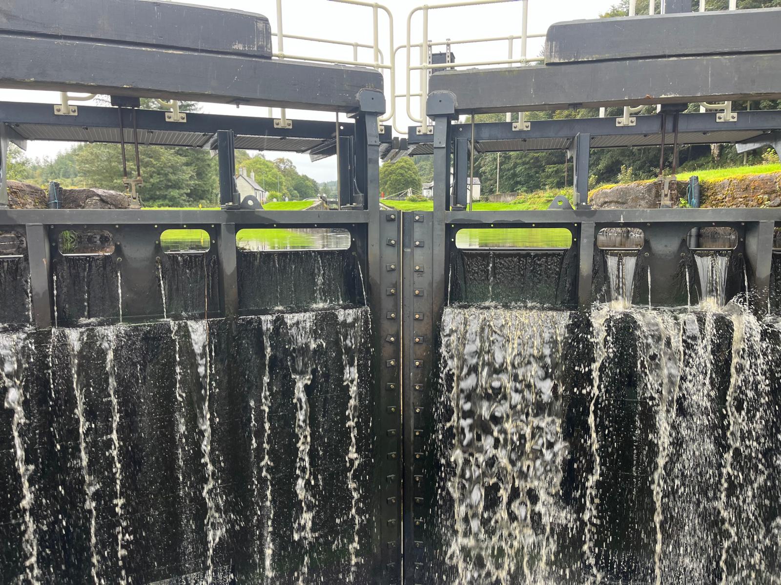
THE JOURNEY 🇳🇴 ACROSS THE NORTH SEA 🏴
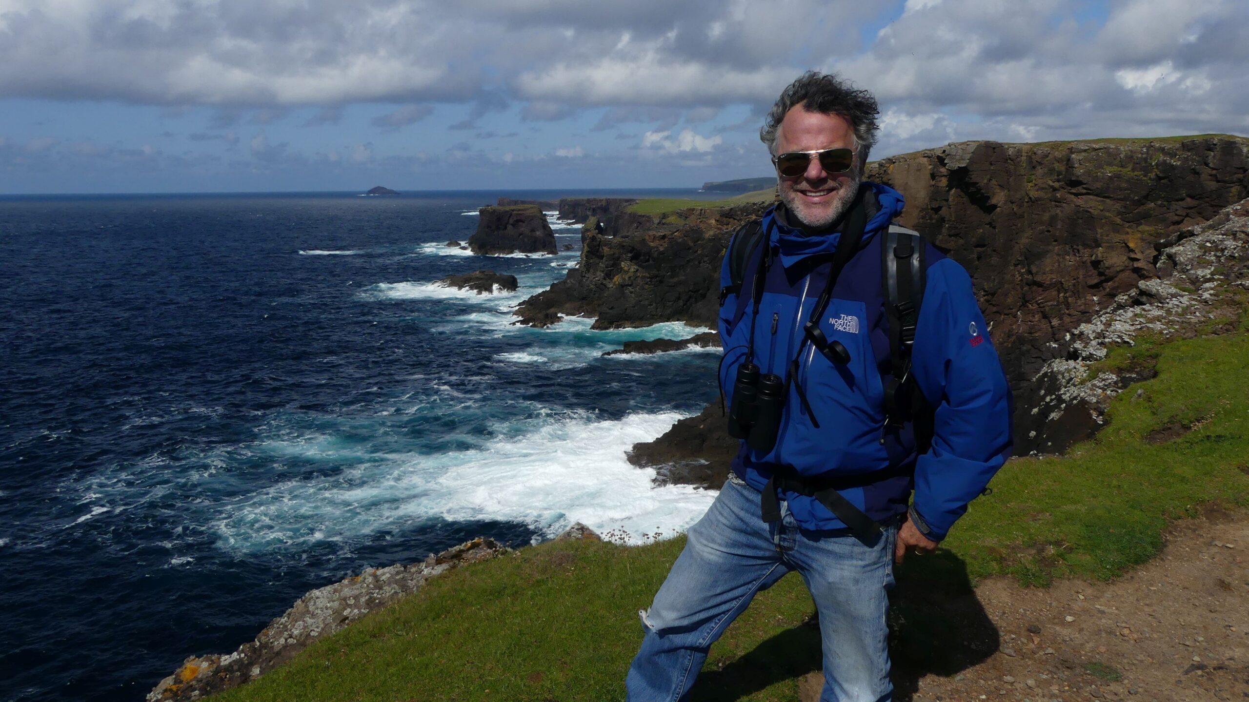
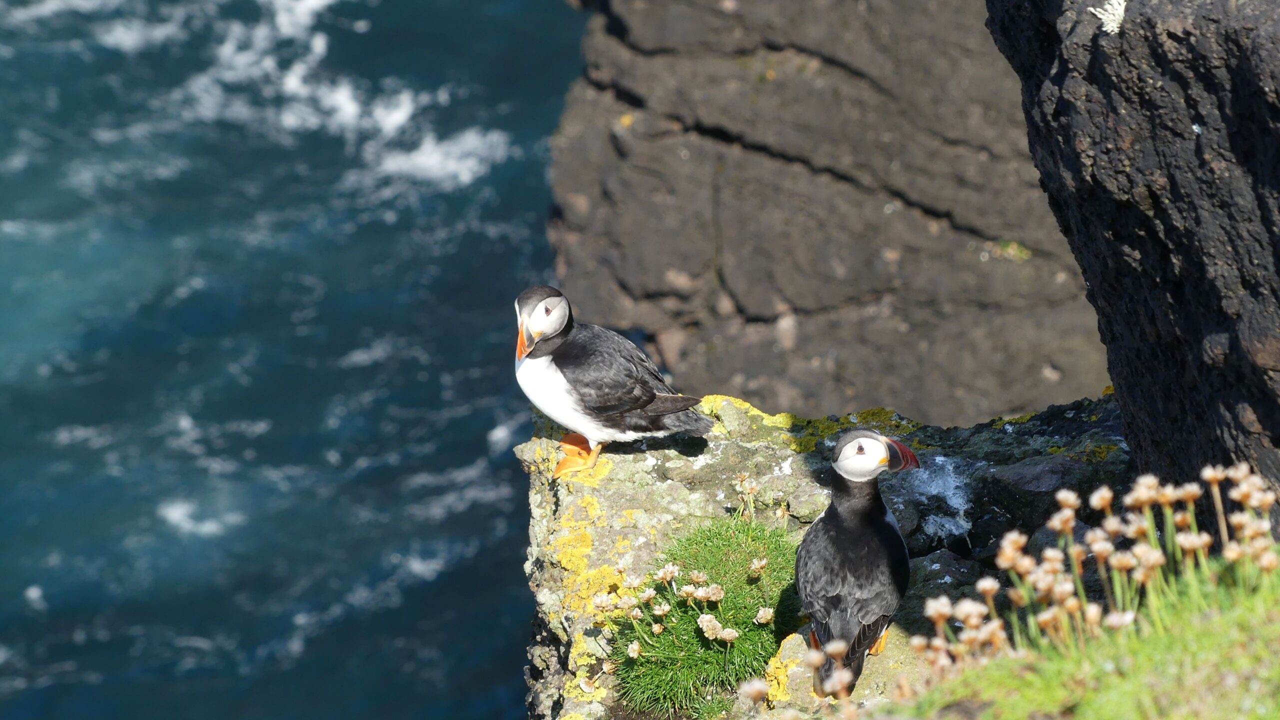
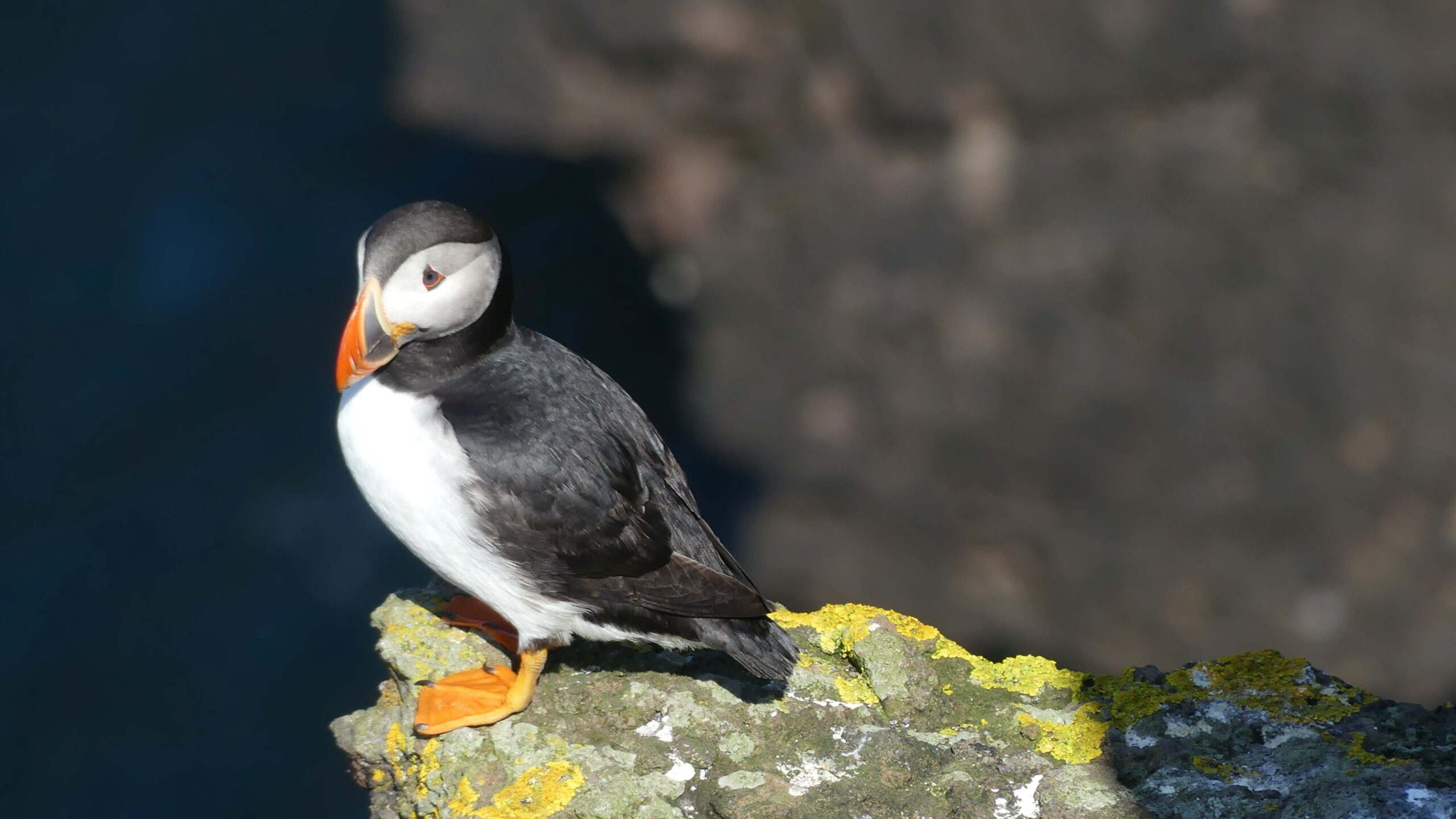
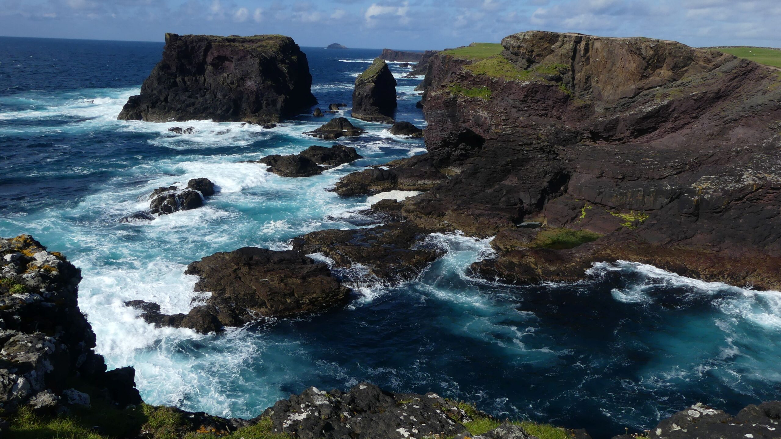
We had an overnight passage from Lerwick, Shetland Island to Kirkwall, Orkney Islands.
A few highlights of our stay in Shetland were the cliffs of Esha Ness and the Puffin birds.
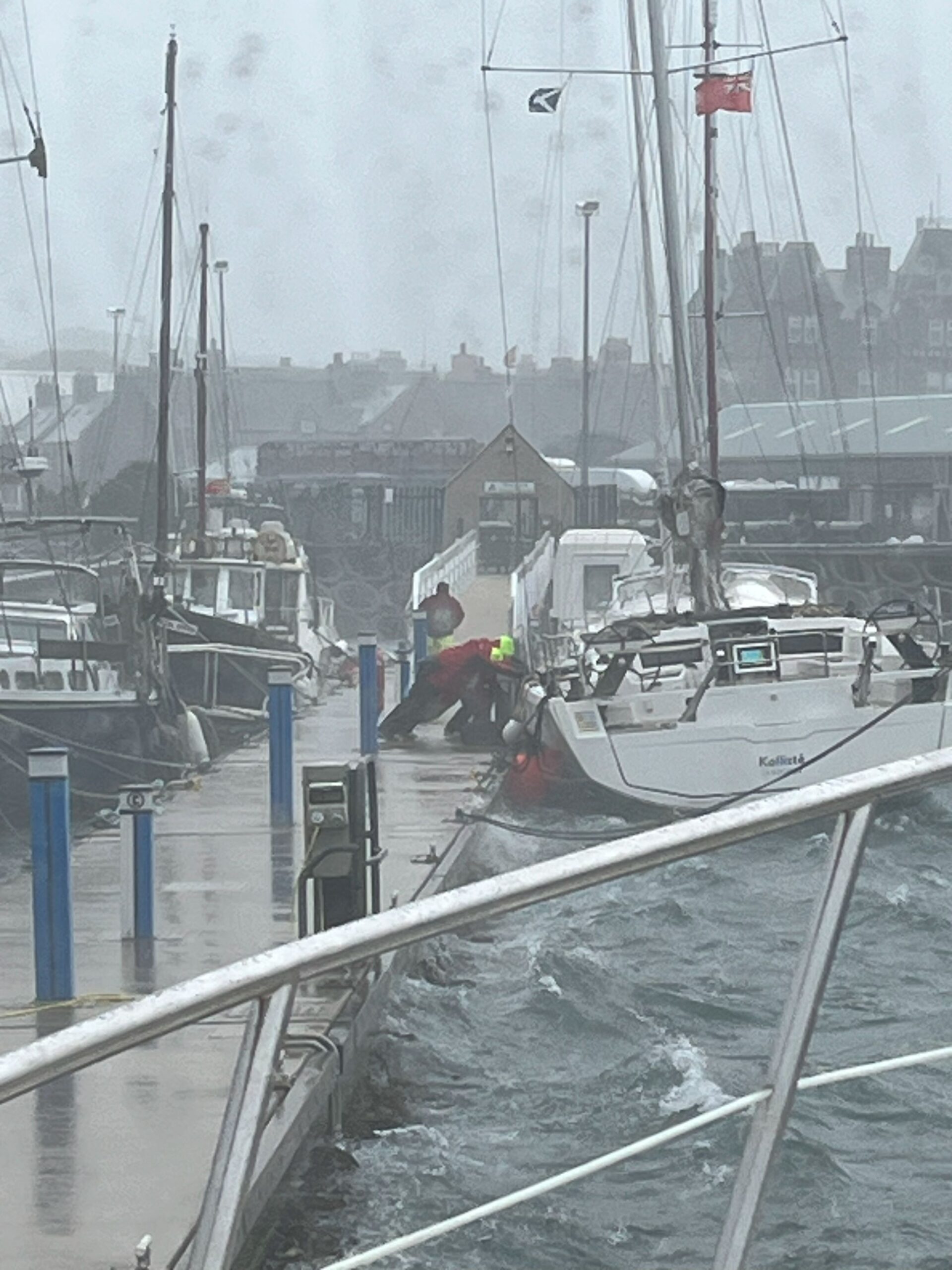
In Kirkwall we had fun riding out the major storm Floris. The boats around us, not so much.
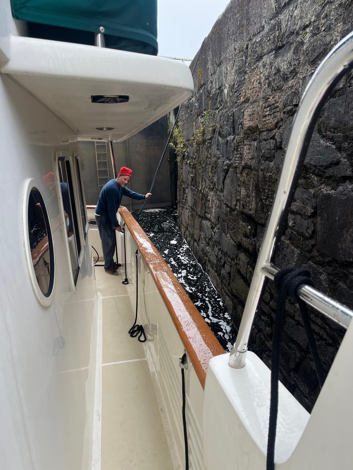
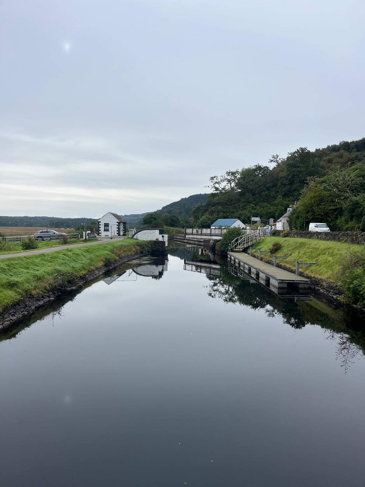
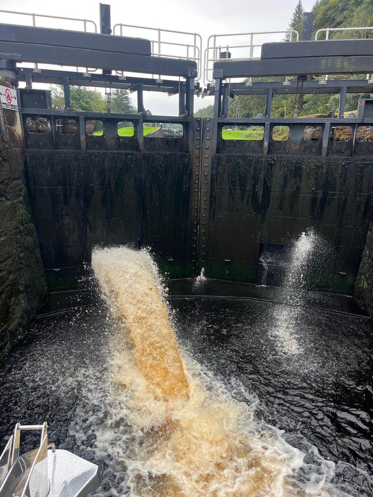
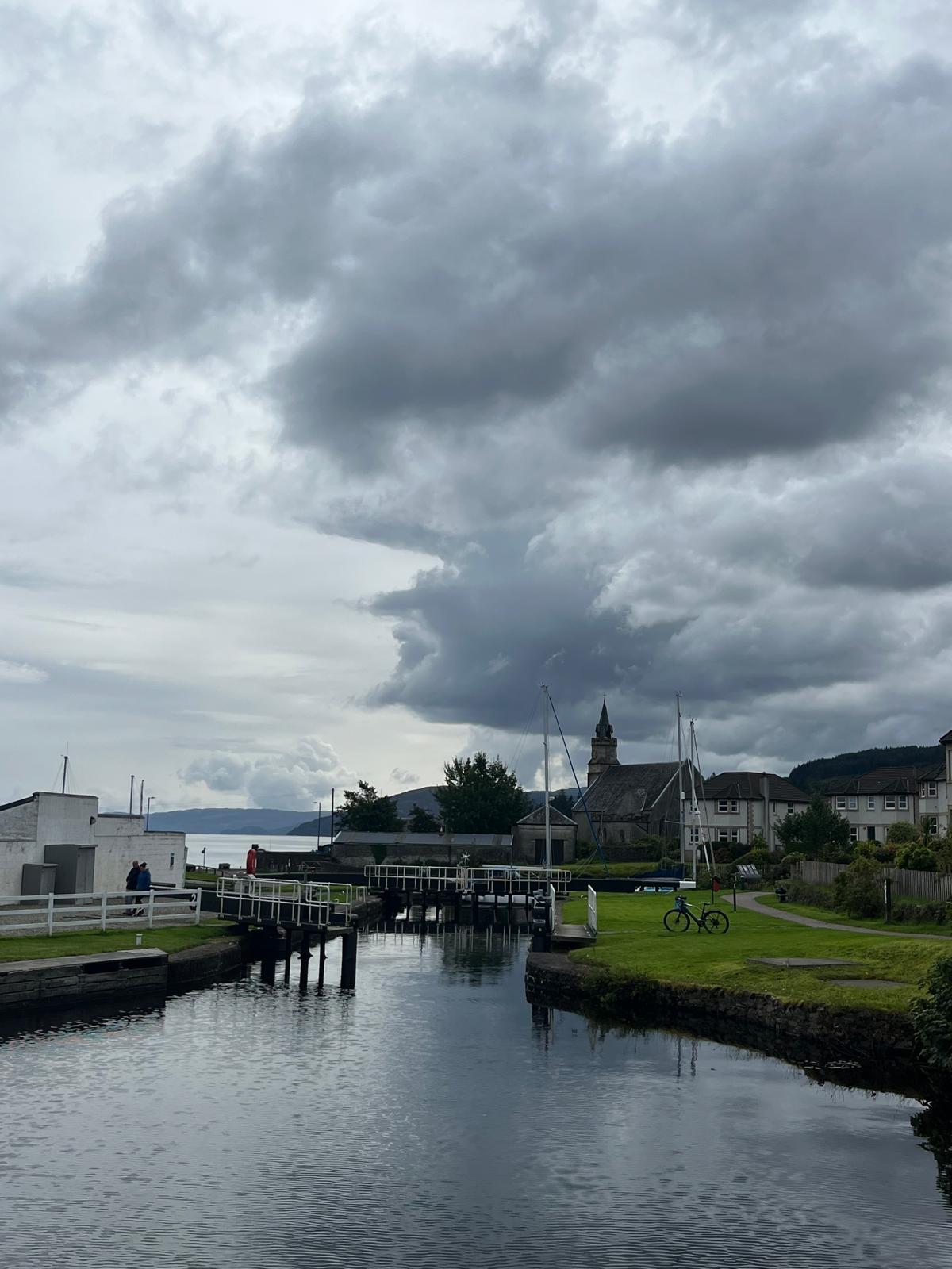
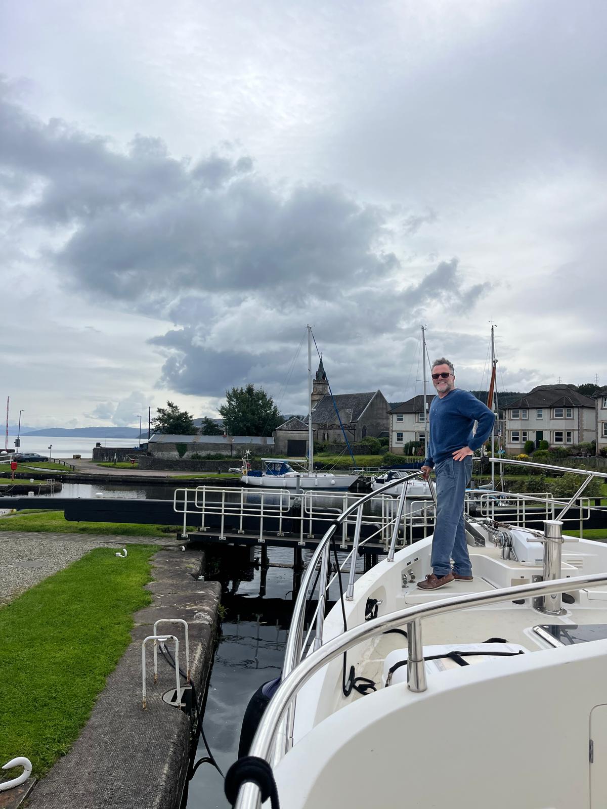
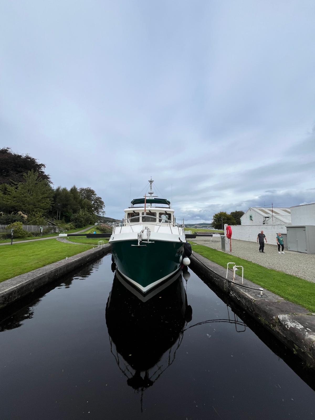
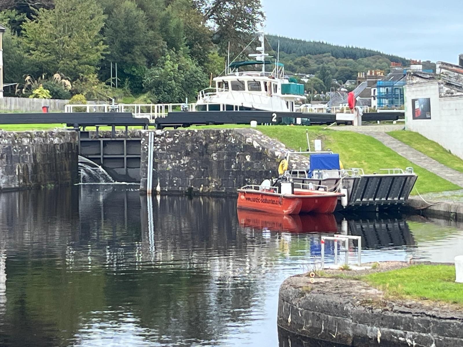
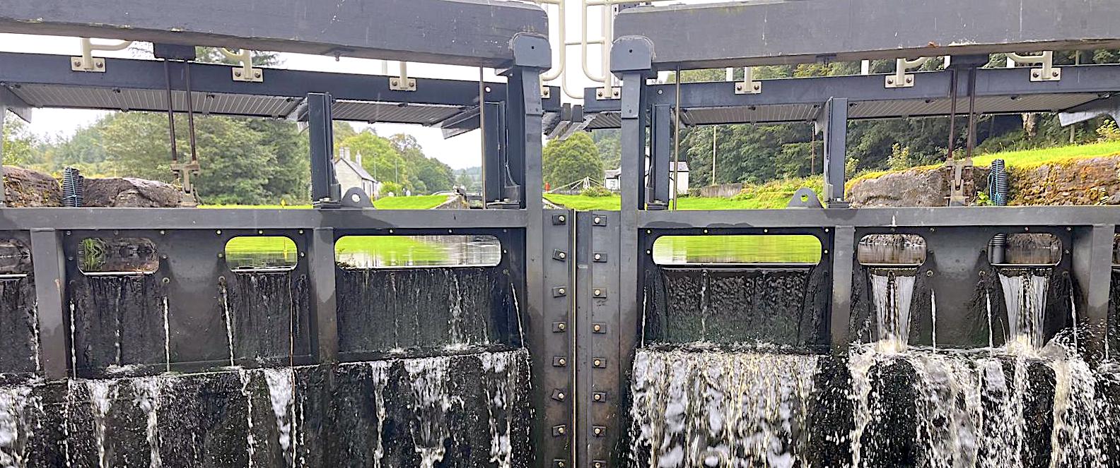
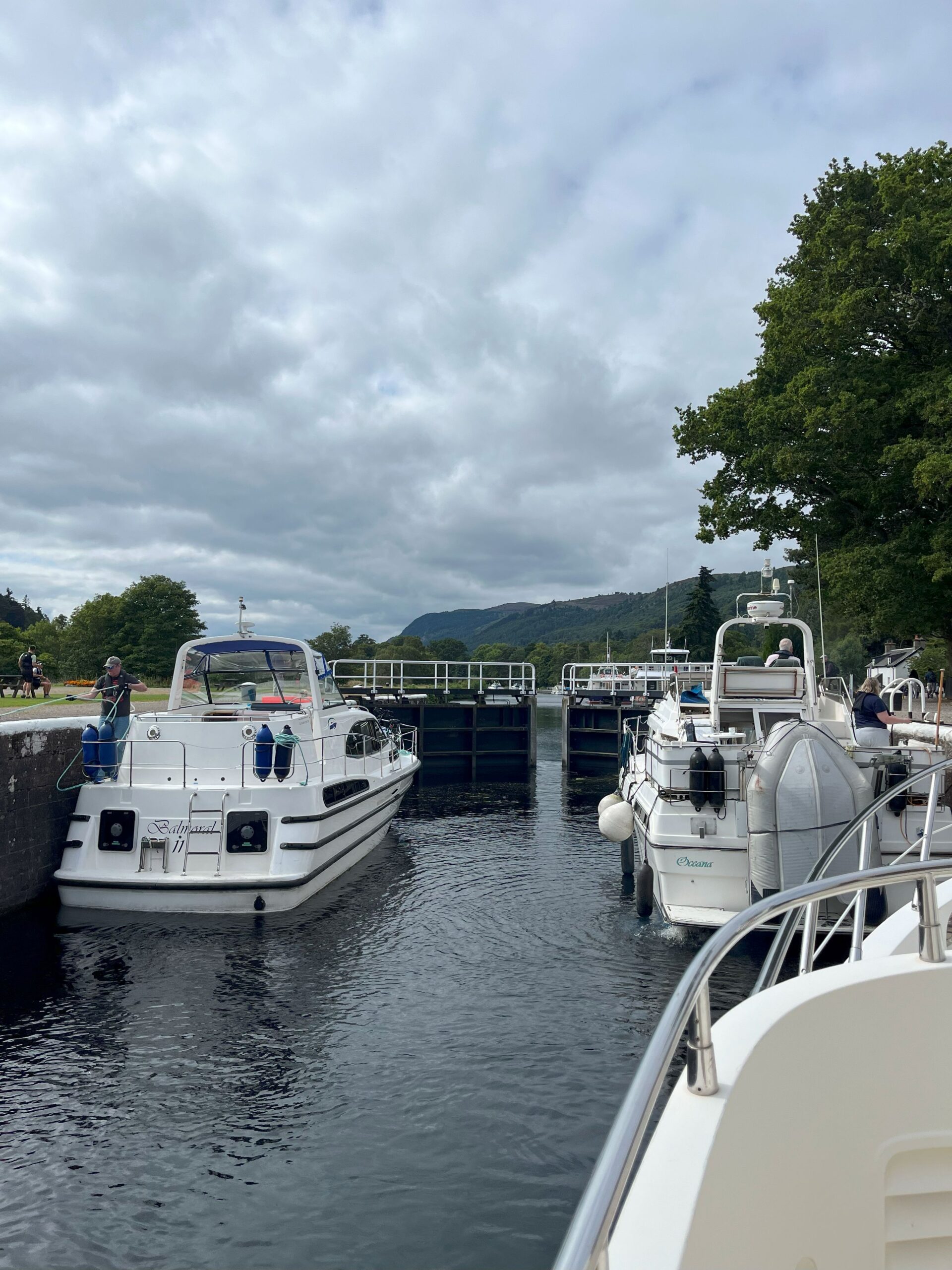
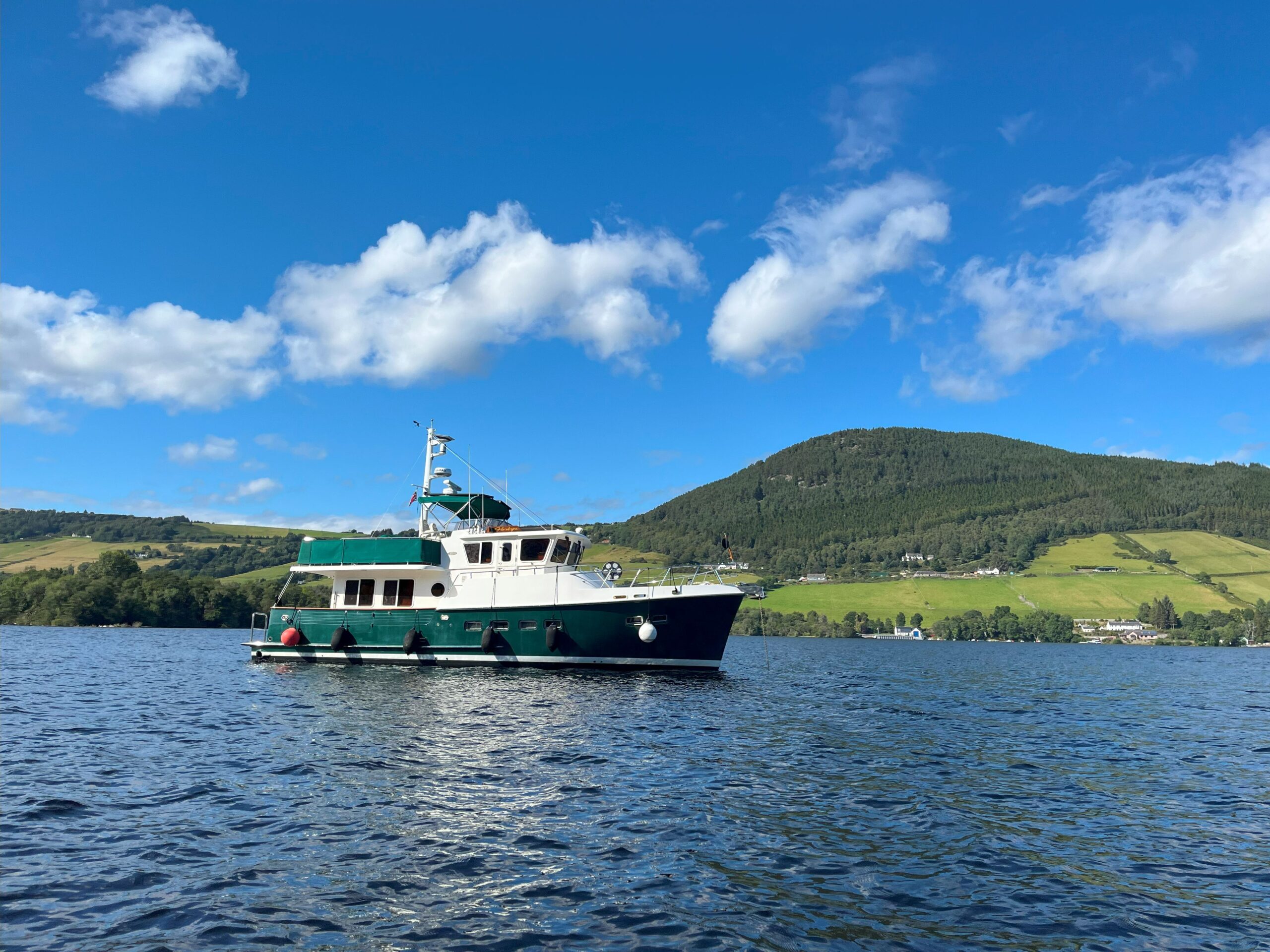
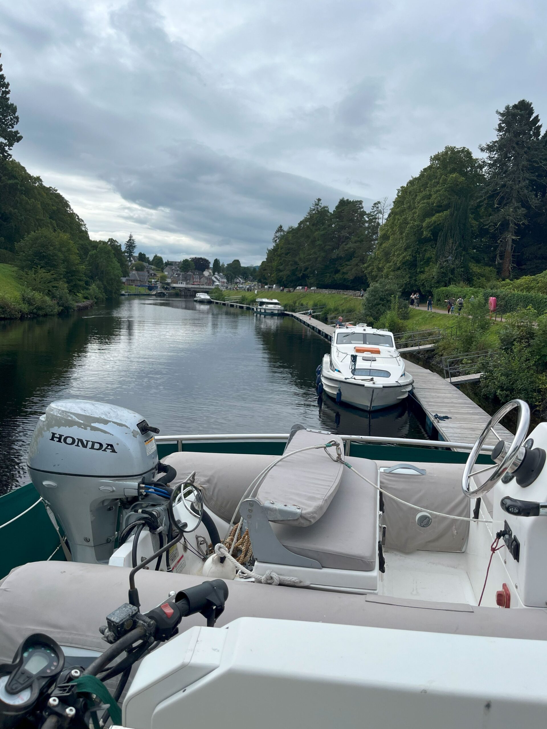
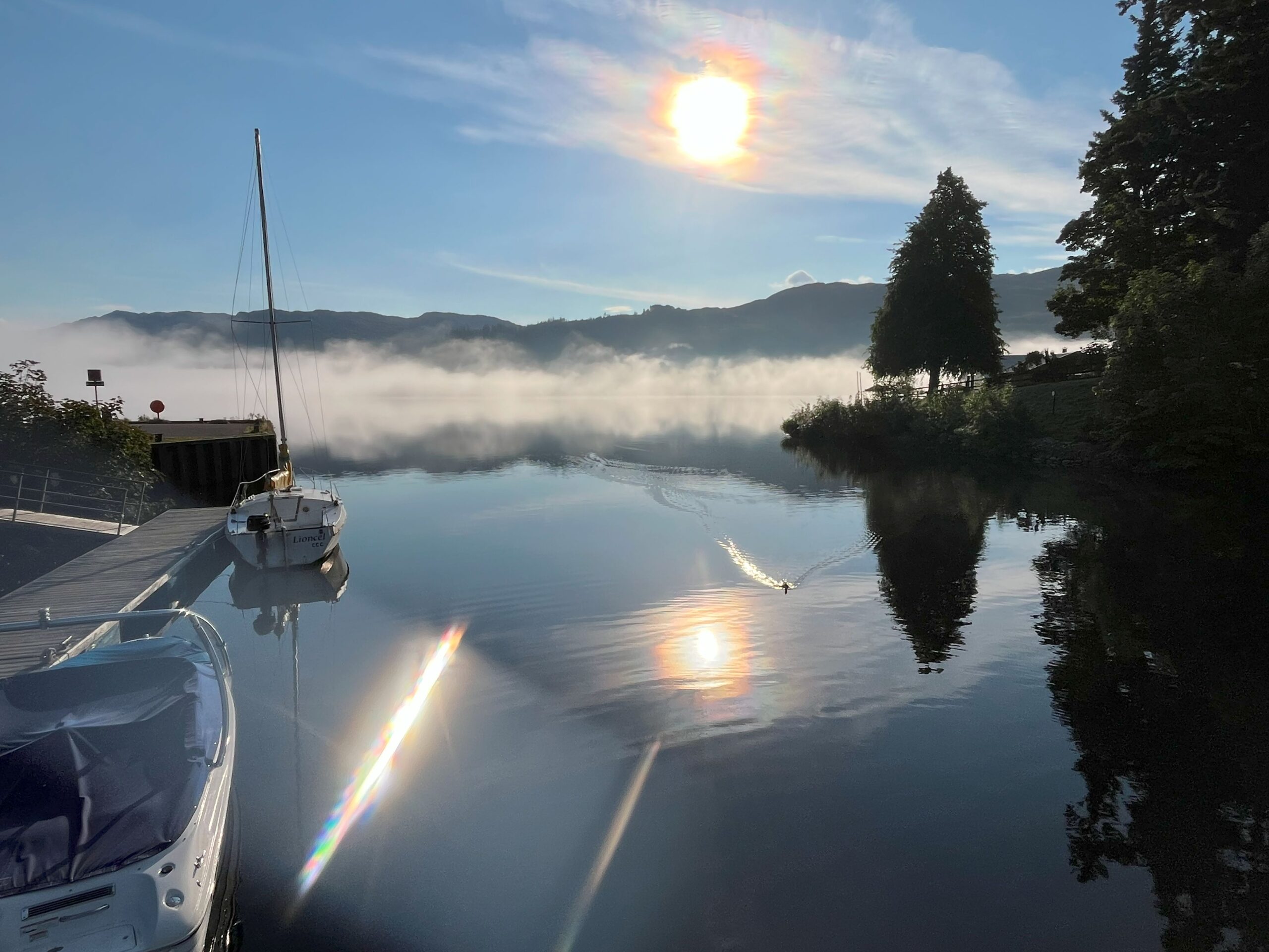
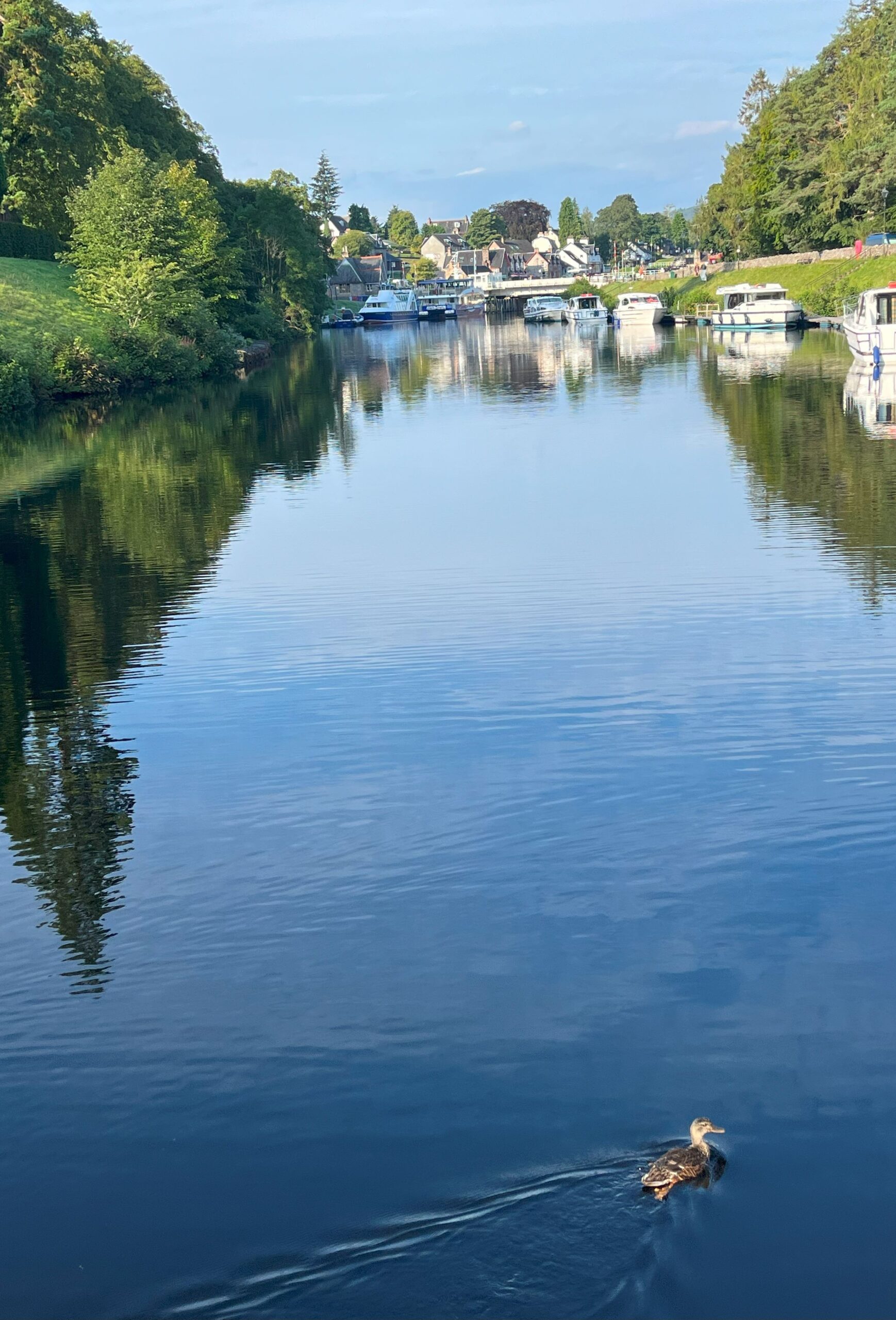
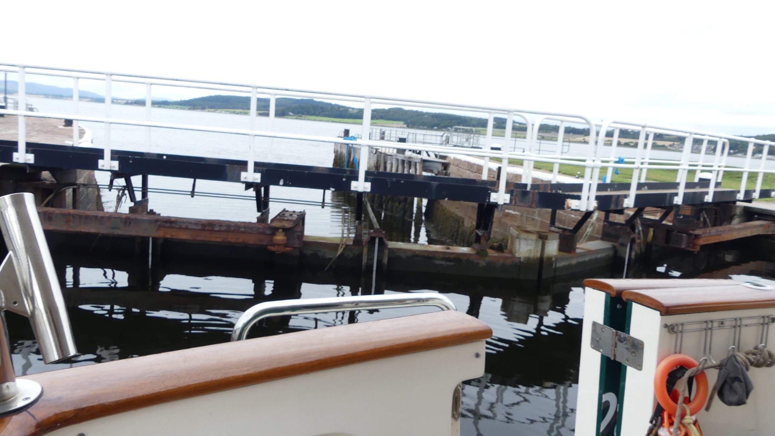
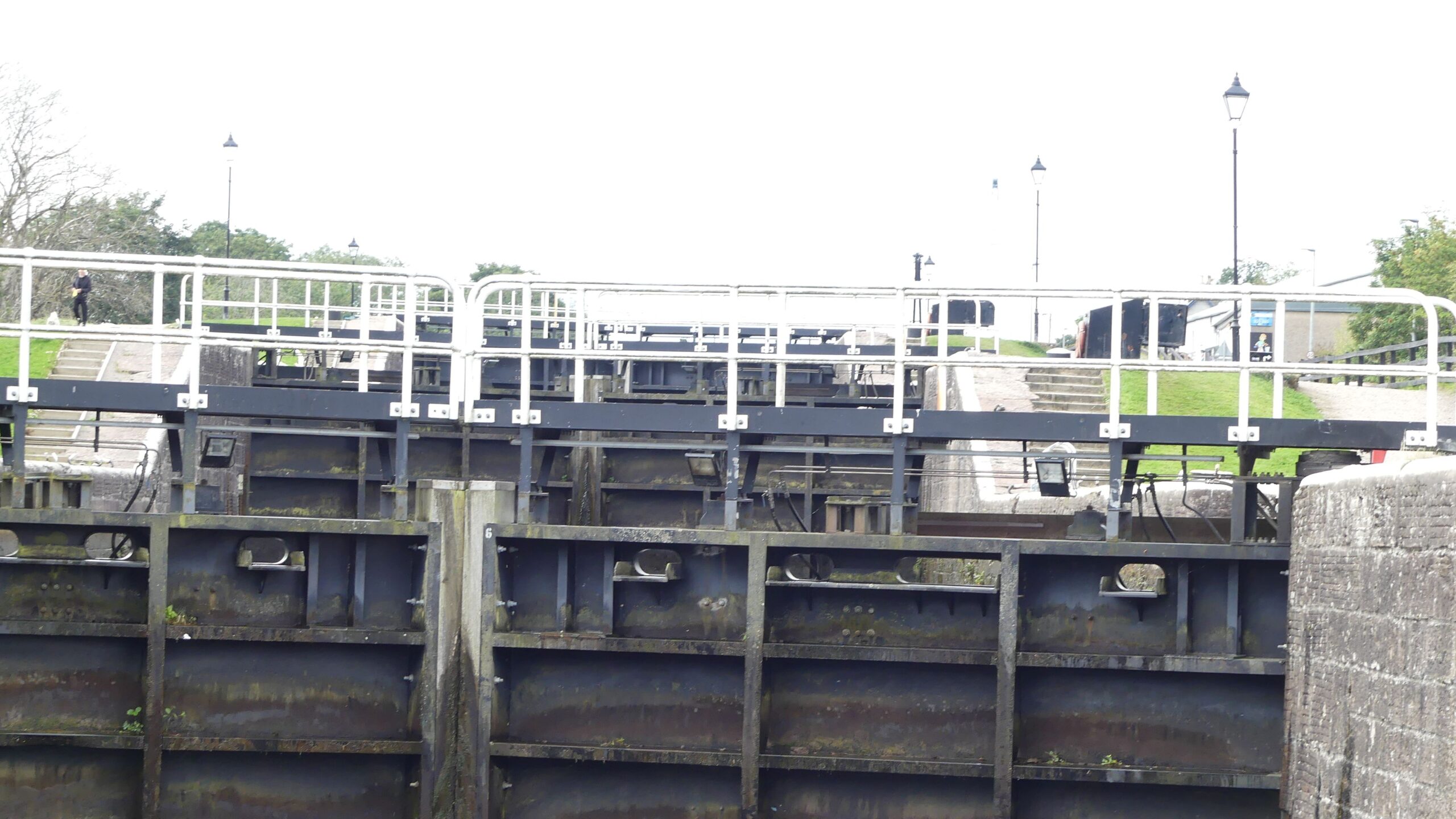
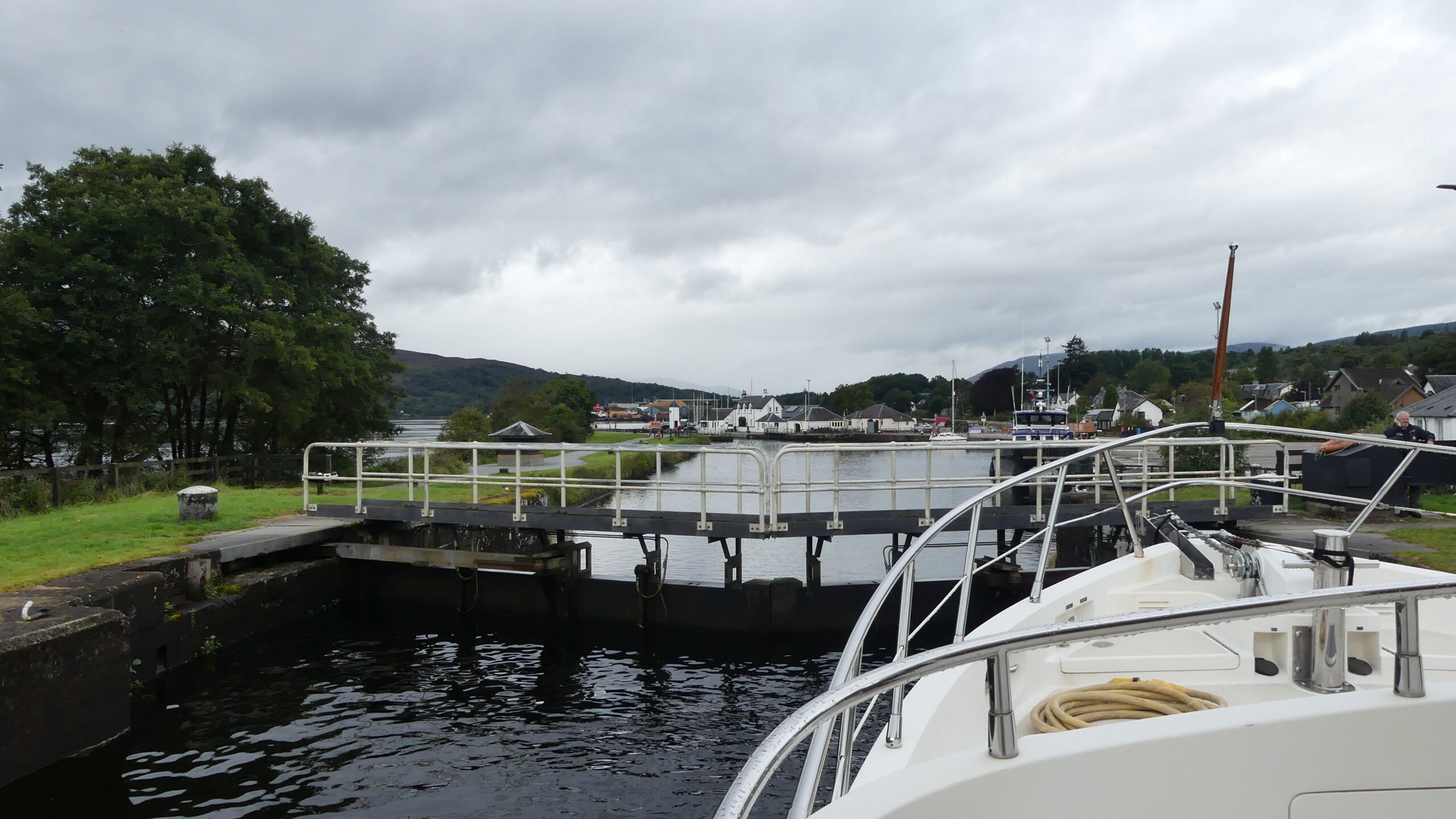
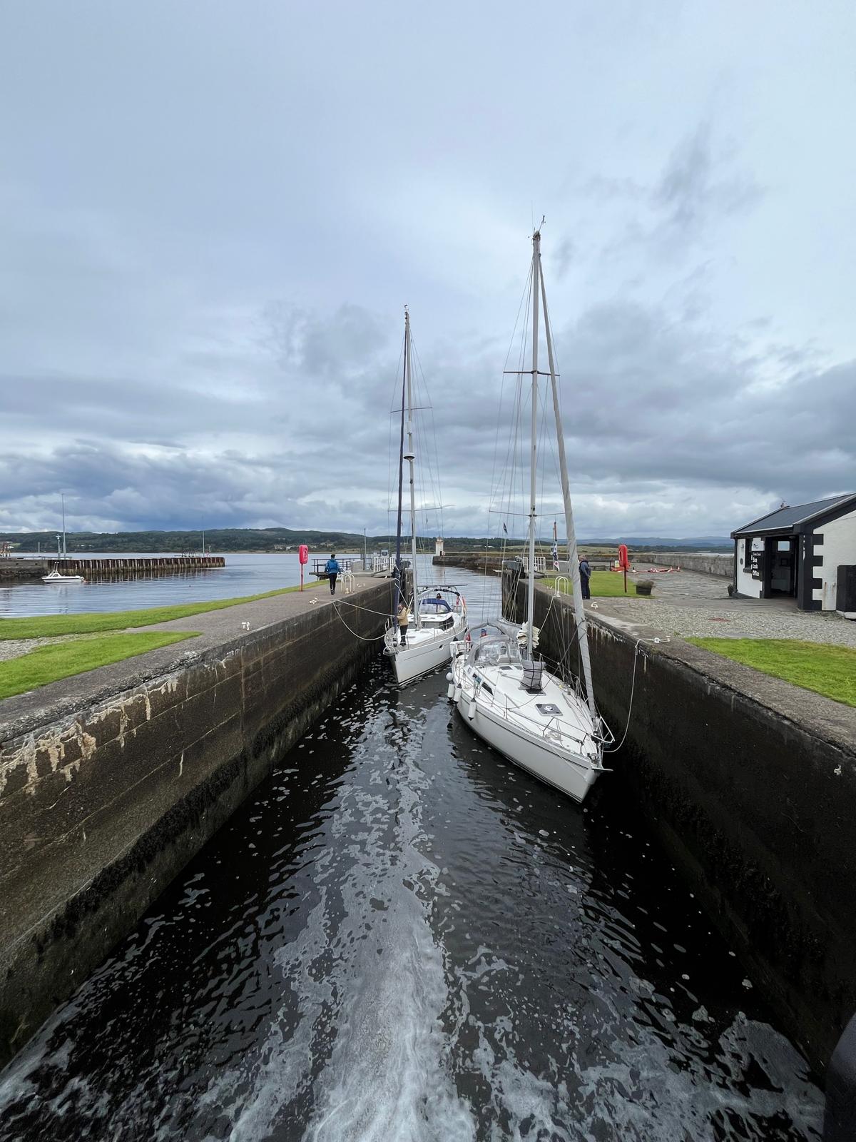
After enjoying the local ambience of Kirkwall, we headed to the mainland of Scotland. We are heading to the west coast of Scotland and decided to forego the longer route across the northern end of Scotland and having to round Cape Wrath and the notorious currents there where the Atlantic and North Sea converge and instead opted for the Caledonian Canal. The northeastern lock entrance to the canal is on the North Sea at Inverness, 95 nm from Kirkwall. To break up the passage we had an overnight in Wick.
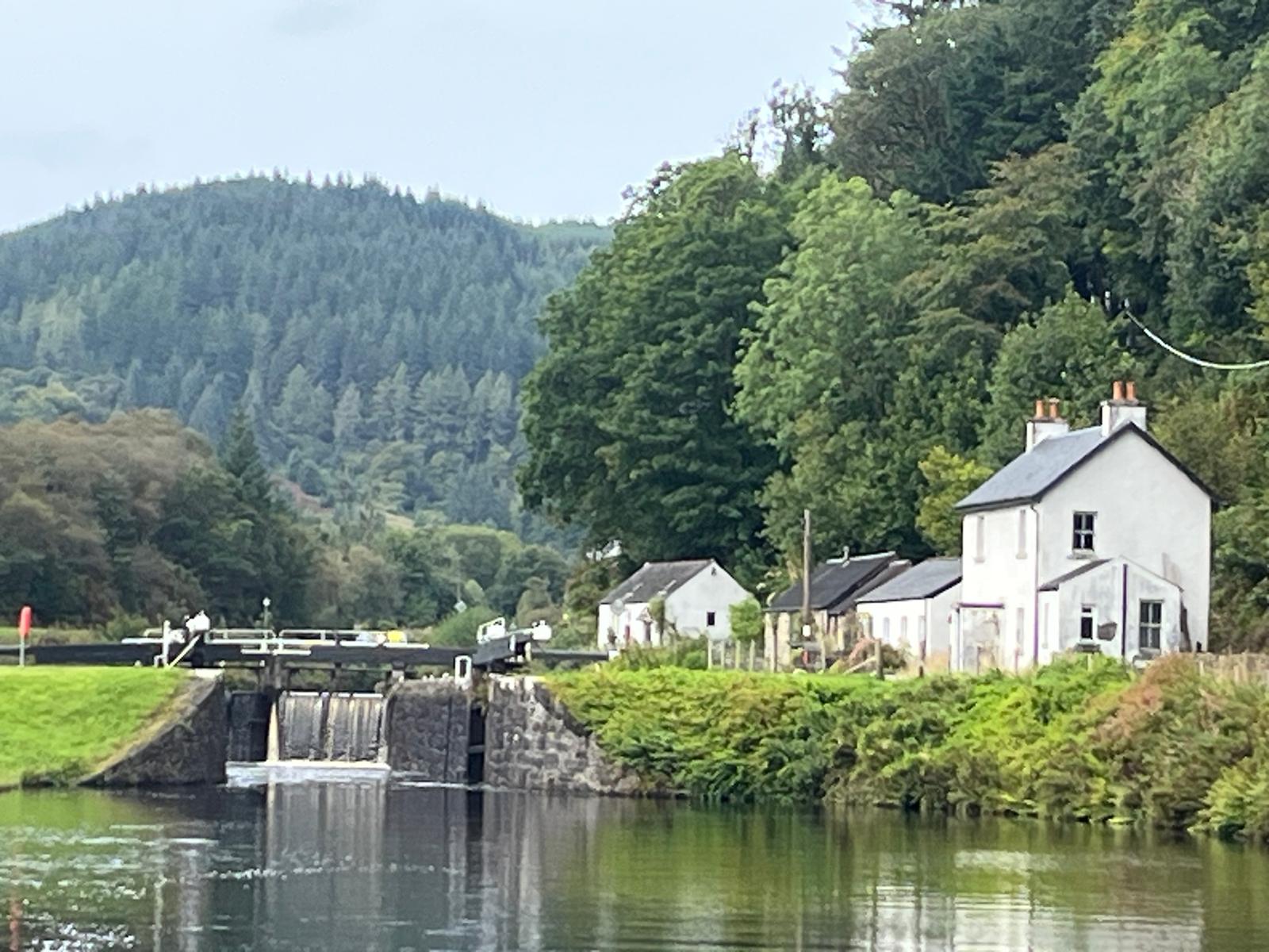
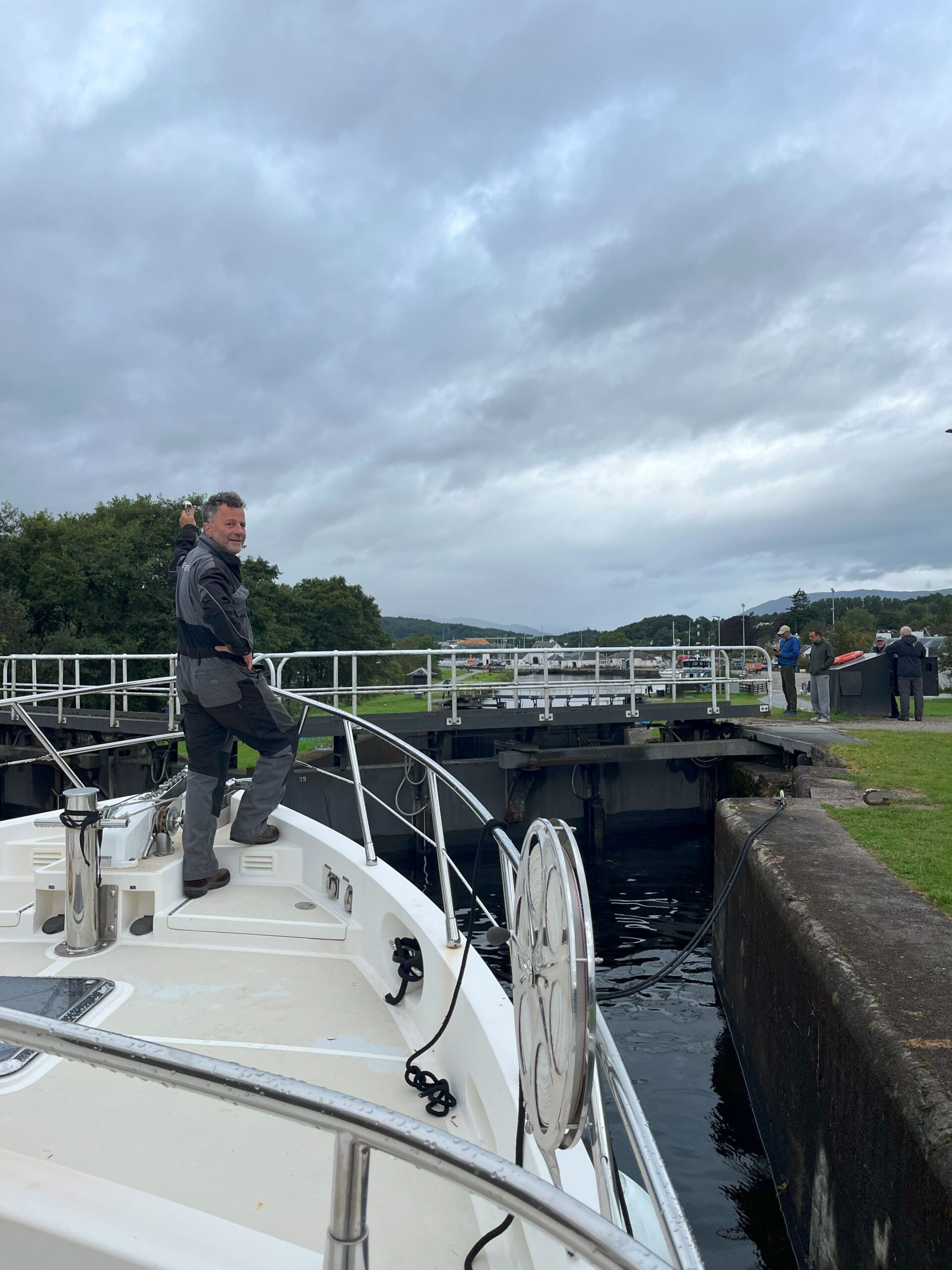
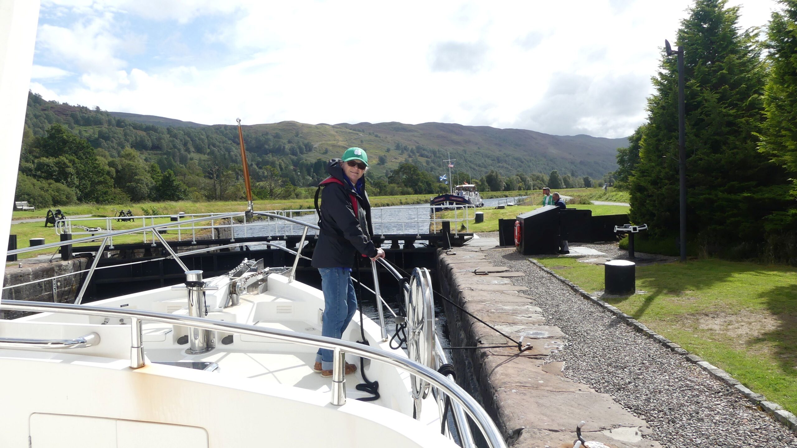
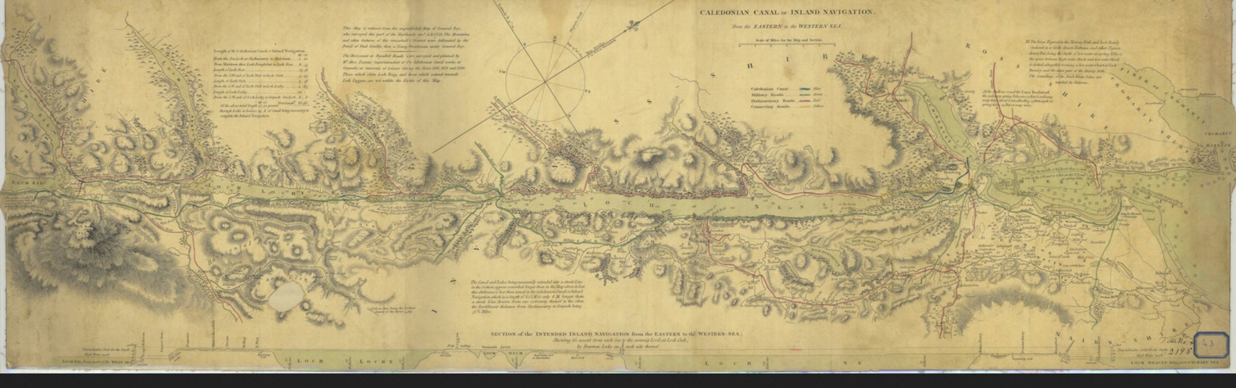
The Caledonian Canal extends fifty nautical miles (22 of which are man-made, and the remainder formed by freshwater lochs, one of which is the famous Loch Ness) and ends at Corpach where the southwestern sea lock is located. A one-way week’s license was £26.80 per meter. Our license for thirteen meters was £348 ($470). This fee included water, showers, WC, and electricity (where available) and docking at pontoons along the route. There are twenty-nine locks and eleven swing bridges along the way. The maximum permitted vessel dimensions on the canal are Length 45.72 m (150ft), Beam 10.67m (35ft), Draft 4.1m freshwater (13.5ft) and mast height 35m (115ft). The locks can accommodate 4 to 6 vessels (3 to a side depending on length). Where there is more than one lock it is necessary to have at least one person on shore to walk the line to the next lock. As we were only two crew members, the Lock Keeper would walk our bow line for us.
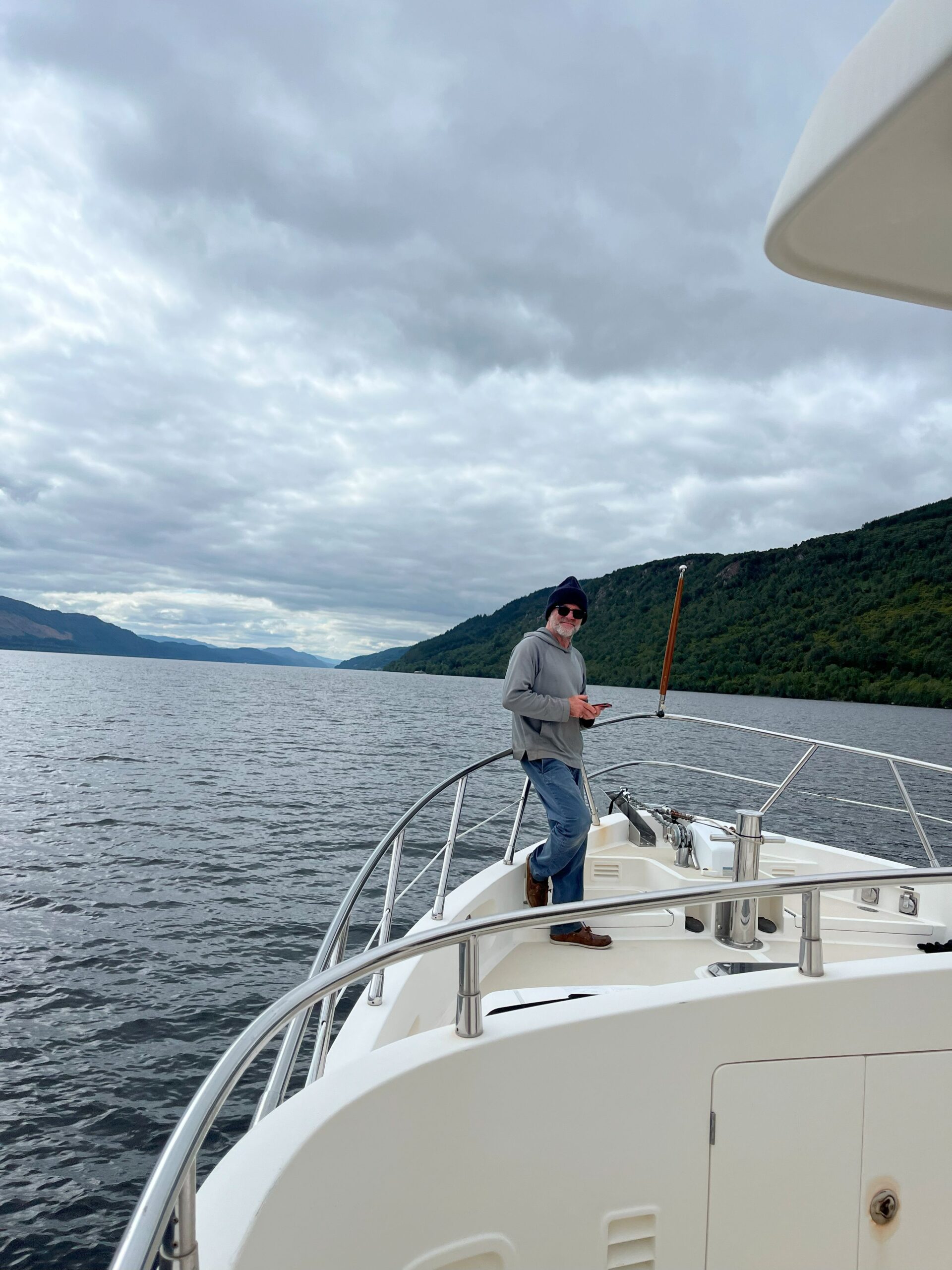
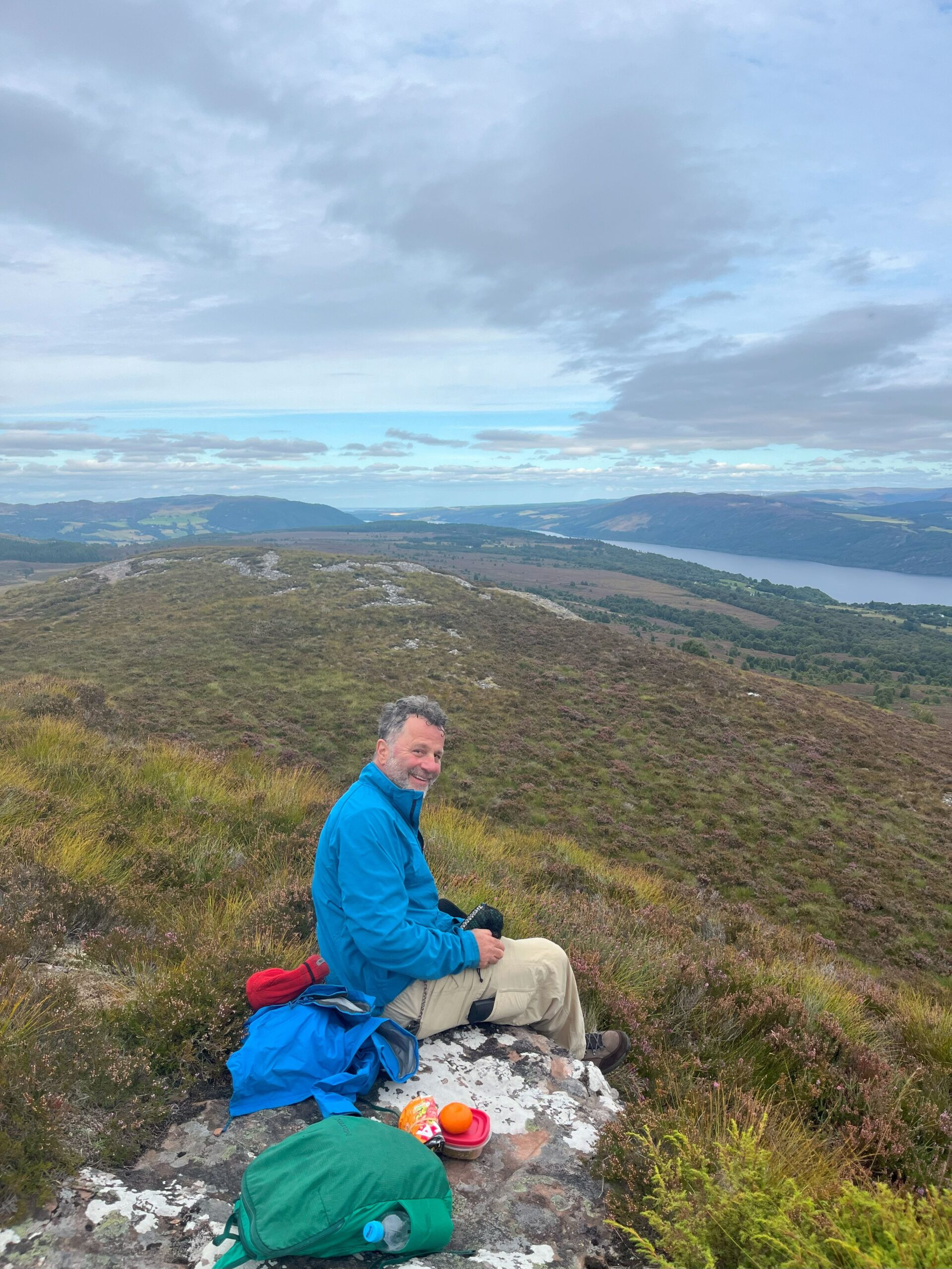
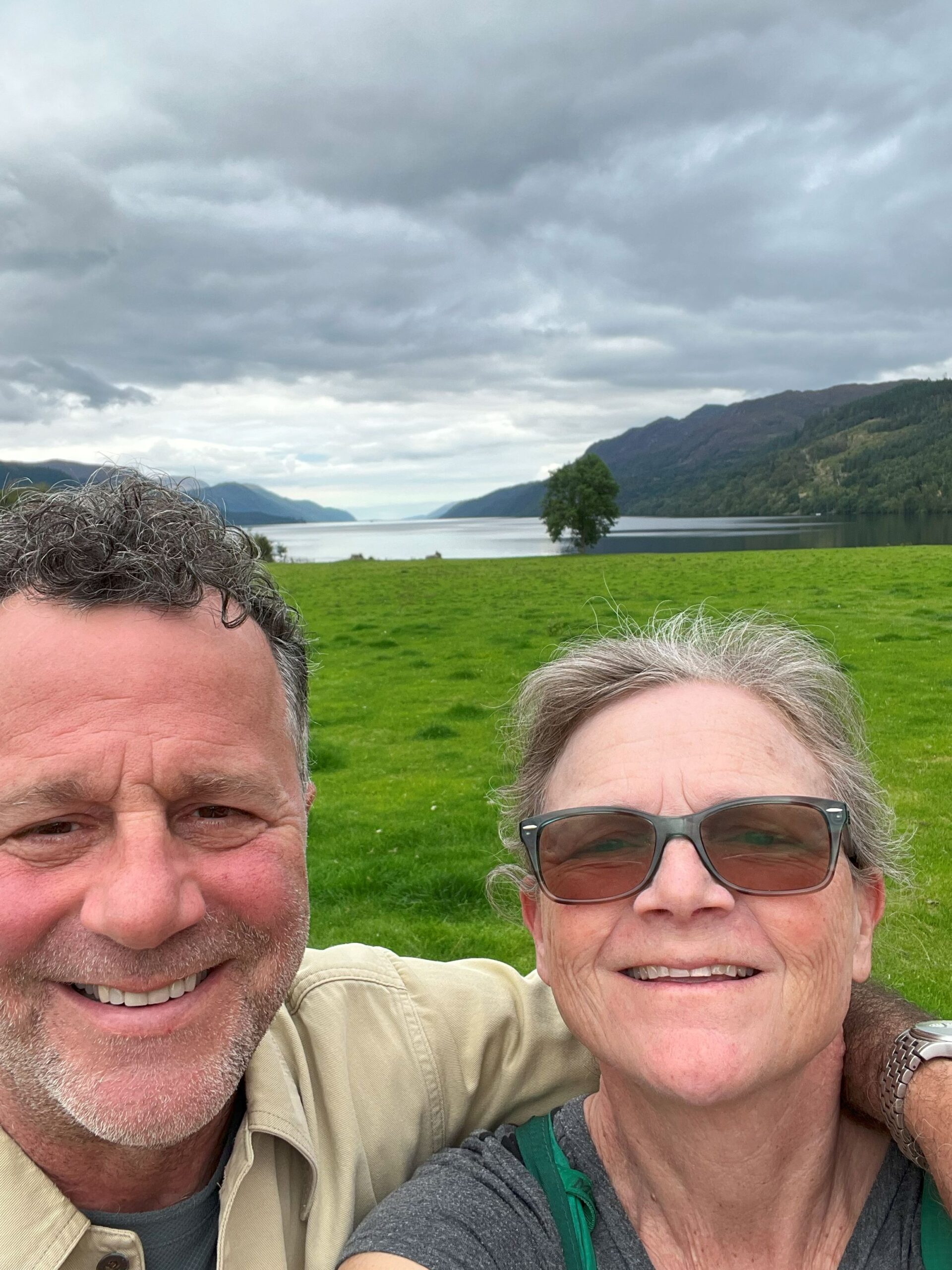
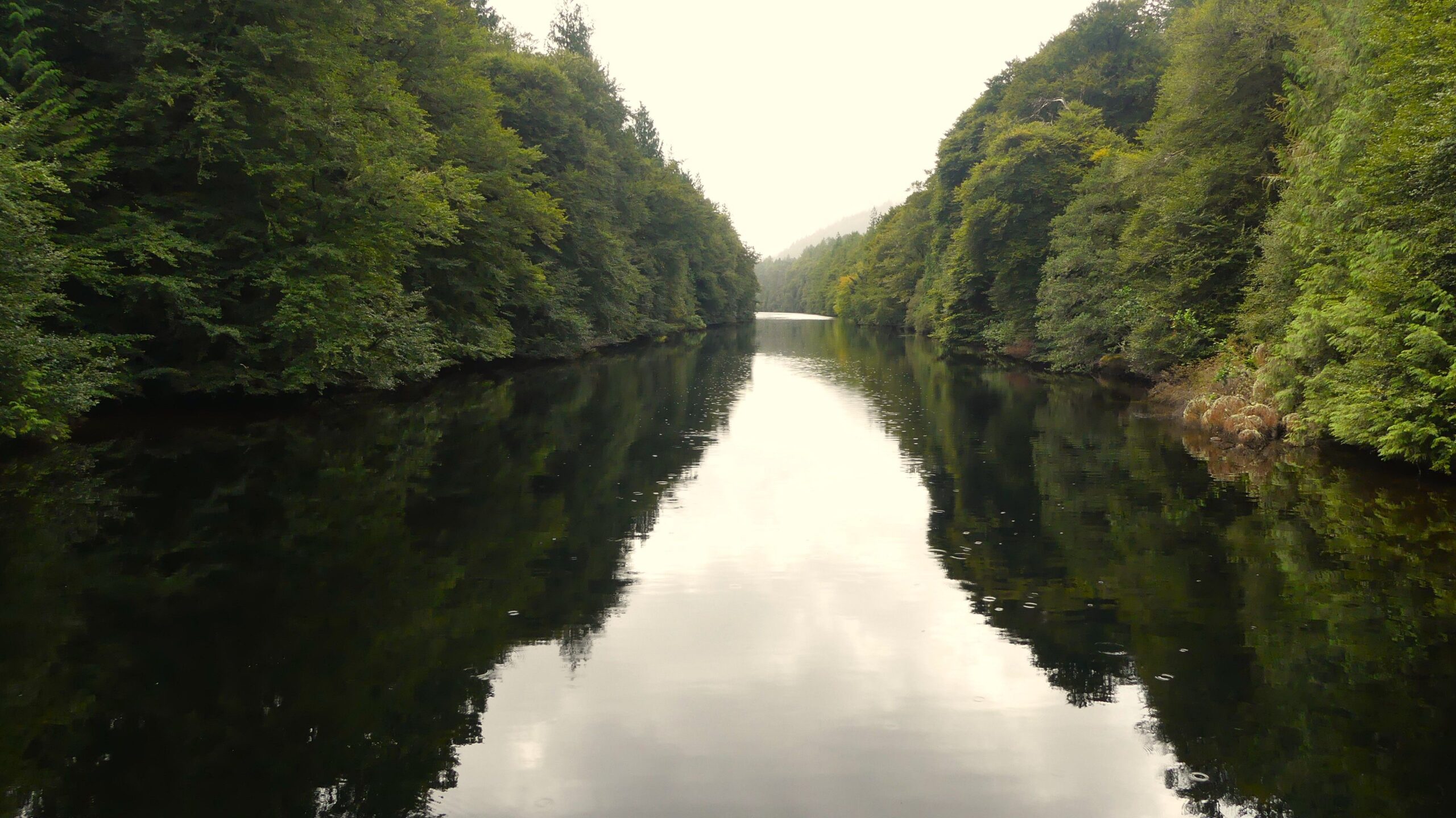
It is a beautiful canal. We were fortunate to have pleasant weather most of the time. We had a wonderful anchorage on Loch Ness. However, no Nessie sighting. While it did rain it was mostly in the late evening, so we were able to take our motorcycle down and rode into the heathered covered hills for a nice hike with a view of Loch Ness.
Aside from some of the rental boats with folks at the helm that are unfamiliar with boating rules of the road and the lookie-loo tourists who came by the bus loads to see Loch Ness and the locks at Fort Augustus at the southwest end of Loch Ness, it’s a great passage. Highly recommended for any cruises in this part of the world.

MY HO’OKIPA 🇺🇸 Lisa & Lucky Chucky – Selene 43′
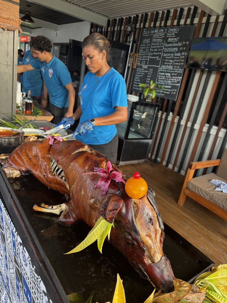
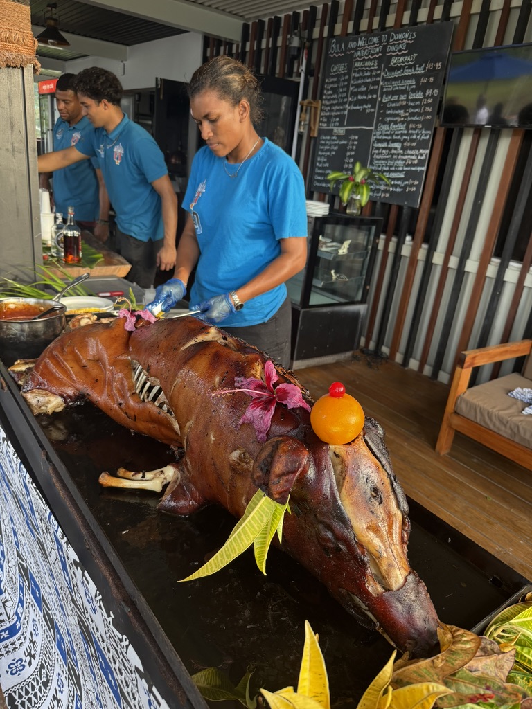
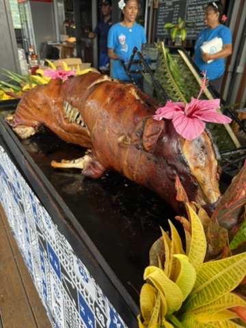
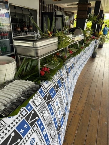
RECAP SOUTH PACIFIC PARTY 🇫🇯
Brought to you by the yacht sales co.

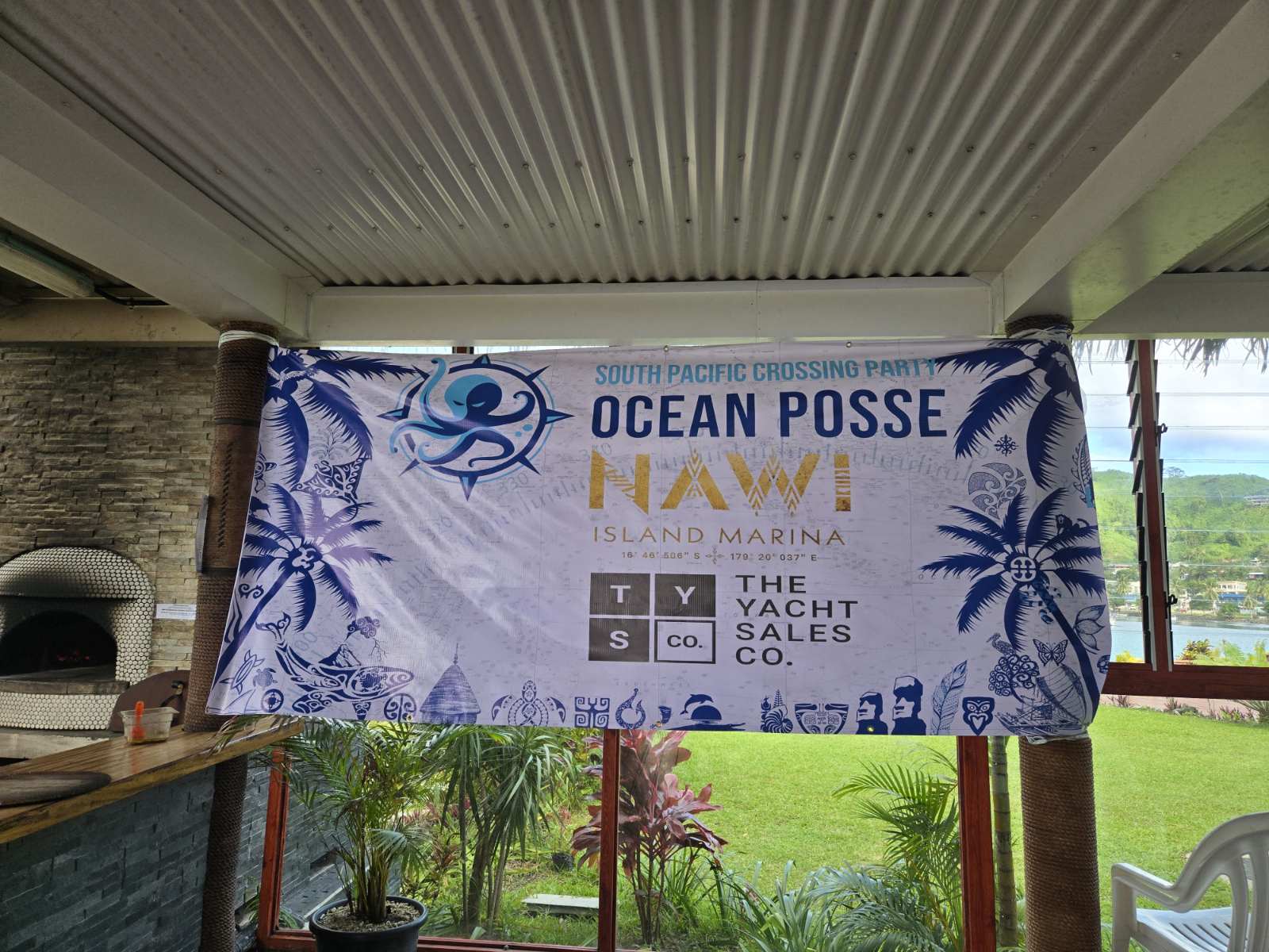
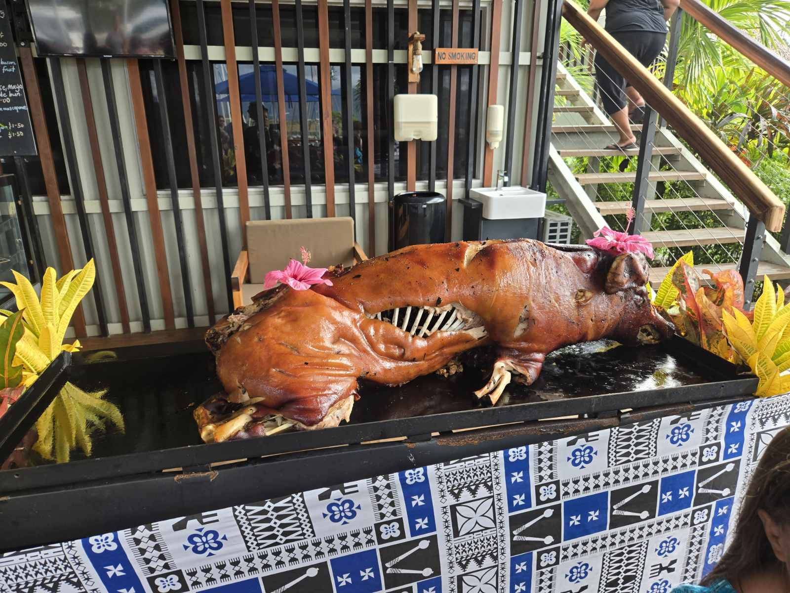
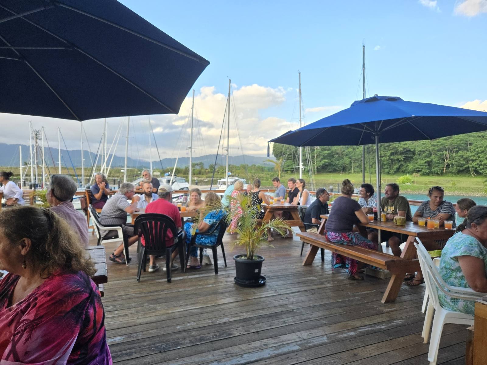
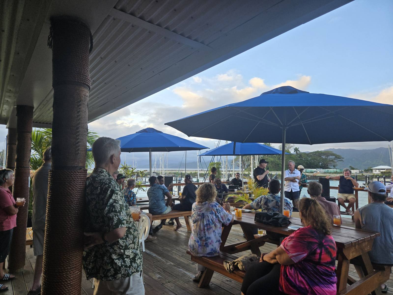
🌺 Nawi Island Ocean Posse Gathering – Event Wrap-Up
Bula Captains,
What an incredible evening at Nawi Island Marina! We had a fantastic turnout with 74 adventurers in attendance, all gathered under the Fijian spirit of hospitality.
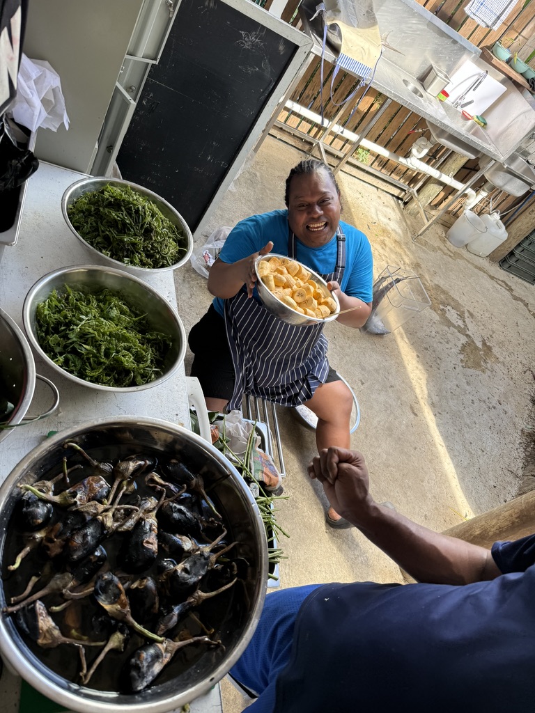
⚓ A Feast to Remember – The star of the night was the 36kg pig, roasted to perfection Hawaiian hot rock style. The crisp skin didn’t last long, and alongside it Domoni’s Waterfront Restaurant laid out a wonderful Fijian-themed buffet that brought plenty of smiles.
🍹 Rum Punch Cheers – While we couldn’t secure a rum sponsor this year, the homemade rum punch flowed freely and kept the camaraderie alive. Let’s raise our sights for next season – Flor de Caña, we’ll be calling on you!
📚 Sharing Knowledge – Two yachtie presentations rounded out the evening, with good feedback from those who attended. Events like this are all about learning from one another while answering the call of the sea together.
📸 Moments Captured – We’ve attached a few photos to relive the fun and fellowship.
A hearty vinaka vakalevu to the Domoni’s Waterfront Restaurant team for their hard work and hospitality, and to all the captains and crew who joined in. These gatherings are what make the Ocean Posse strong – food, friendship, and the bonds of the sea.
Until the next event,
The Ocean Posse Team
TRAVERSING FRENCH POLYNESIA 🇵🇫 WITHOUT A LONG STAY VISA
Traversing French Polynesia in the greater South Pacific is an experience few forget, yes the islands are stunning, the lagoons mesmerizing, and the culture is vibrant. Yet, much of the challenge lies not in the sea or the people, but in administrative hurdles and the artificial influence of scarcity . Long-stay visas are tightly restricted by policy, favoring only more wealthy or highly educated. Despite French Polynesia’s modest 120 islands compared to the thousands across the Pacific, the local administration has done little to expand marina capacity or improve services. Labor and parts are fuel shortages are noticeable especially during April, May June and July, while excessive import duties on yacht spares—even in transit—make upkeep needlessly costly.
TUAMOTUS ANCHORAGES
📍 Rahiroa (Rangiroa) Island ( tide station )
📍 Hao (Bow or La Harpe tide station )
📍 Mangareva Island ( tide station )
ANCHORAGES ●
HEAVY WIND 25knts+ (MARAMU) ANCHORAGES ●

SOCIETY ISLANDS ANCHORAGES
FRENCH POLYNESIA 🇵🇫 LOOKING AHEAD TO NEXT SEASON:
Limits on Tourism, Scarcity Marketing, Higher Prices, Limited Variety, Gatekeeping, Fewer Signals, Reduced Accountability, Informal Practices, Lower trust, Mandatory Moorings, Less choice, Mooring Maintenance Problems…
Under a five-year plan, French Polynesia aims to set an annual cap of approximately 280,000 tourists—roughly matching one visitor per local resident. This strategy reflects French Polynesia’s shift towards “slow,” high-quality tourism—prioritizing environmental protection and cultural preservation over mass arrivals. By capping overall visitor numbers and regulating cruise traffic, the region seeks to sustain its unique appeal while supporting local communities.
-
Mega cruise ships banned – Vessels carrying more than 3,500 passengers have been prohibited from entering French Polynesia since January 2022.
-
Capacity restrictions – Cruise ships with more than 2,500 passengers are only allowed to dock at a handful of ports with sufficient infrastructure.
-
Bora Bora daily cap – The island of Bora Bora enforces a strict limit of 1,200 cruise passengers per day. Paid Moorings prevail.
-
Preference for smaller ships – The government and tourism board encourage cruise operations with vessels carrying fewer than 700 passengers, often favoring locally based cruise companies.
Customs & duties Spare parts are technically duty-free under temporary admission, but only with perfect paperwork and usually an agent. General imports face 16% VAT plus duties calculated on CIF value. Yacht captains widely report steep costs and delays, with some saying even in-transit spares got hit with charges.
Hostility incidents: A few reports (including one serious case of gunfire into a yacht hull) fuel a sense of unease, though these are not widespread. Still, they stick in the cruising community’s memory. RIP Stefan Ramin –
Mooring failures in Bora Bora causing damaged yachts, groundings, sparked safety concerns, strained trust, and endangering yacht owners voyages. And there’s no mention of any party being officially blamed or found liable, just that infrastructure had not yet been brought up to current standards.
Localism is real: Like in Hawaii or California, some prime surf breaks in Tahiti are tightly guarded by local surfers. Visitors can feel unwelcome or even be chased out of the lineup. Accounts on surf forums and blogs describe verbal threats, fights in the water, and in some cases damage to boards or dinghies. This is not universal, but Teahupo’o 17°51.5183′ S 149°16.55′ W especially is famous for its “locals only” attitude when the swell is firing.
⚓ Summary for Yacht Owners visiting and spending time and money
The beauty of the surroundings masks layered tensions:
• Maʻohi vs. Paris over autonomy and culture
• Old French vs. New French over belonging and behavior
• Locals vs. Visitors over resources and respect
• Everyone vs. China’s shadow in business and influence
The takeaway.
Show humility, spend locally, avoid political debates, and recognize you’re sailing through waters with deep historical wounds.

WHAT RIGGERS ⚙️ CAN MISS

1. Hidden Wear Points
- Inside swage fittings – cracks and broken strands can hide inside the metal.
- Sheave grooves – sharp edges or worn bearings can chew lines and wire.
- Spreader tips – chafe against the shrouds often goes unnoticed.
- Check the forestay wire strands for under the furling Jib / Genoa – especially the fixing points
2. Fasteners and Hardware
- Turnbuckle cotter pins – either missing, bent, or incorrectly installed.
- Mast step bolts and partners – not inspected closely for corrosion or movement.
- Chainplates below deck – many focus on the visible stainless above, but the hidden end in damp lockers often corrodes first.
3. Alignment & Tuning
- Mast column straightness – minor bends at spreaders or partners can go undetected.
- Unequal tension – especially on intermediate shrouds and checkstays, which affect mast shape under load.
- Backstay fittings – neglected even though they take tremendous shock loads.
4. Rope & Running Rigging
- Core-to-cover separation – looks fine outside but the inner core is sliding.
- End-for-end rotation – some lines stay in the same load orientation too long, leading to uneven wear.
- Clutch jaws – glazed or worn, which damages halyards.
5. Environmental & Long-Term Issues
- Crevice corrosion in stainless – hidden in low-oxygen areas like under tangs or inside spreader sockets.
- UV damage – particularly on Dyneema lashings or covers that look strong until they fail suddenly.
- Electrolysis – dissimilar metals in spars or tangs quietly eating away.
6. Safety Equipment Integration
- Jackline attachments – riggers focus on mast and shrouds but forget about secure points for crew safety.
- Radar/antenna cabling – poorly secured wires inside mast can chafe and short.
- Liferaftt rack deployment if in a cradle
OCEAN POSSE SPONSORS
YACHT SERVICES NUKU HIVA
SPONSORS THE OCEAN POSSE WITH A SPECIAL DISCOUNT
OCEAN POSSE SPONSORS
- ABERNATHY – PANAMA
- BELIZE TOURISM BOARD
- BOAT HOW TO
- CABRALES BOAT YARD
- CENTENARIO CONSULTING – PANAMA CANAL
- CHRIS PARKER – MARINE WEATHER CENTER
- DELTA MIKE MARINE SUPPLY PANAMA
- DIGITAL YACHT
- DOWNWIND MARINE
- EL JOBO DIST. COSTA RICA
- FLOR DE CAÑA
- HAKIM MARINA AND BOAT YARD
- HERTZ RENTAL CARS MEXICO
- HOME DEPOT PRO MEXICO
- LATITUDES AND ATTITUDES
- MARINA PAPAGAYO
- NOVAMAR YACHT INSURANCE
- PANAMA YACHT BROKER
- PREDICT WIND
- SAFE HARBOR SOUTH BAY MARINA EVENT CENTER
- SAN DIEGO MARINE EXCHANGE
- SAFETY ONBOARD COSTA RICA
- SEVENSTAR YACHT TRANSPORT
- SHAFT SHARK
- SUN POWERED YACHTS
- WESTMARINE PRO
- YACHT AGENTS GALAPAGOS
MEDIA PARTNERS
LATITUDES AND ATTITUDES
OUR 📻 New Media Partner: Dockside Live Radio
We’re pleased to welcome Dockside Live Radio as an official media partner of the Ocean Posse Fleet.
Led by lifelong boater Brian Burns, Dockside Live brings music, stories, and conversations from the waterfront directly to the airwaves. Brian grew up on the lakes of Wisconsin and later sailed a 28’ O’Day before dedicating himself fully to radio. His program reaches boaters across the U.S. and beyond — with the motto:
“Where the music meets the water…”
Stay tuned — LISTEN at DockSideLive.com or download from your favorite App Store.
📡 Dockside Live Radio >>>
OCEAN POSSE FLEET 🛰️ TRACKING
SPONSORED BY PREDICT WIND
MARINA SPONSORS
🇦🇺 AUSTRALIA
🇧🇸 BAHAMAS
- Browns Marina
- Elizabeth on the Bay Marina
- Blue Marlin Cove Resort & Marina
- Great Harbour Cay Marina
- Romora Bay Resort and Marina
🇧🇿 BELIZE
🇧🇲 BERMUDA
🇧🇷 BRAZIL
🇻🇬 BRITISH VIRGIN ISLANDS
🇨🇻 CAPE VERDE
🇰🇾 CAYMAN ISLANDS
🇨🇱 CHILE
🇨🇴 COLOMBIA – Caribbean
- Club Nautico Cartagena
- Club de Pesca Marina Cartagena
- Marina Puerto Velero
- IGY Marina Santa Marta
- Manzanillo Marina Club
🇨🇷 COSTA RICA – Pacific Coast
🇨🇺 CUBA
🇩🇲 DOMINICA
🇩🇴 DOMINICAN REPUBLIC
🇪🇨 ECUADOR
🇸🇻 EL SALVADOR
🇬🇮 GIBRALTAR
🇬🇩 GRENADA
🇬🇵 GUADELOUPE
🇬🇹 GUATEMALA – Pacific Coast
🇬🇹 GUATEMALA Rio Dulce
🇫🇯 FIJI
- Copra Shed Marina
- Nawi Island Marina
- Denarau Marina
- Musket Cove
- Royal Suva Yacht Club
- Sau Bay Moorings
🇭🇳 HONDURAS – Bay of Islands – Roatan
🇮🇹 ITALY
- Marina dei Presidi
- Marina di Balestrate
- Marina di Brindisi
- Marina di Cagliari
- Marina di Chiavari
- Marina di Forio
- Marina di Teulada
- Marina di Policoro
- Marina di Vieste
- Marina de Procida
- Marina de Villasimius
- Marina di Vieste
- Marina Molo Vecchio
- Marina Salina
- Venezia Certosa Marina
🇯🇲 JAMAICA
🇲🇶 MARTINQUE
🇲🇽 MEXICO – Caribbean
- Marina Makax – Isla Mujeres
- Marina Puerto Aventuras
- Marina V&V – Quintana Roo
- Marina El Cid – Cancún
🇲🇽 MEXICO – Pacific Coast
- ECV Marina – Ensenada BC
- IGY Marina Cabo San Lucas BCS
- Marina Palmira Topolobampo – SI
- Marina y Club de Yates Isla Cortes – SI
- Marina el Cid – Mazatlan – SI
- Marina Vallarta, Puerto Vallarta – JA
- Marina Puerto de La Navidad – Barra de Navidad – CL
- Marina Ixtapa, Ixtapa – GE
- La Marina Acapulco, Acapulco – GE
- Vicente’s Moorings, Acapulco – GE
- Marina Chiapas – CS
🇳🇿 NEW ZEALAND
🇳🇮 NICARAGUA – Pacific Coast
🇳🇺 NIUE
🇵🇦 PANAMA – Pacific Coast
🇵🇦 PANAMA – Caribbean
- Shelter Bay Marina
- Bocas Marina
- Solarte Marina
- Linton Bay Marina /a>
- Turtle Cay Marina
- IGY Red Frog Marina
🇵🇹 PORTUGAL
🇵🇷 PUERTO RICO
🇱🇨 SAINT LUCIA
🇸🇽 SINT MAARTEN
🇪🇸 SPAIN
- Alcaidesa Marina
- IGY Málaga Marina
- Marina Del Odiel
- Nautica Tarragona
- Puerto Sotogrande
- Yacht Port Cartagena
🇰🇳 ST KITTS & NEVIS
🇹🇳 TUNISIA
🇹🇴 TONGA
🇹🇨 TURCS AND CAICOS
🇻🇮 US VIRGIN ISLANDS
🇺🇸 USA – East Coast
- Safe Harbor – Marathon, FL
- Pier 66 Hotel & Marina – Ft. Lauderdale, FL
- Titusville Marina – FL
- Port 32 Marina Jacksonville – FL
- Oasis Marinas at Fernandina Harbor Marina – FL
- Morningstar Marinas Golden Isles St. Simons Isl. – GA
- Windmill Harbour Marina – Hilton Head , SC
- Coffee Bluff Marina – Savannah GA
- Hazzard Marine – Gerogetown, NC
- Holden Beach – Town Dock, NC
- Tideawater Yacht Marina, Portsmouth, VA
- Ocean Yacht Marina, Portsmouth, VA
- York River Yacht Haven – VA
- Yorktown Riverwalk Landing – VA
- Regatta Point Marina – Deltaville, VA
- Regent Point Marina – Topping, VA
🇺🇸 USA – Pacific Coast
- Safe Harbor Ventura Isle, Ventura CA
- Vintage Marina , Oxnard, CA
- Safe Harbor South Bay – Chula Vista, CA
🇻🇺 VANUATU
OCEAN POSSE PANAMA 🇵🇦 CANAL AGENTS
info@centenarioconsulting.com
www.centenarioconsulting.com
Cellphone +507 6676-1376
WhatsApp +507 6676-1376
Lake Gatun, at the heart of Panama, is one of the most remarkable man-made lakes in the world and a vital part of the Panama Canal system. Created between 1907 and 1913 during the construction of the canal, the lake covers approximately 164 square miles (425 square kilometers) and was, at the time, the largest artificial lake ever built. Its formation required damming the Chagres River with the massive Gatun Dam near Colón, which both controlled seasonal flooding and provided the immense volume of water necessary to operate the locks of the canal.
From an engineering standpoint, Lake Gatun is indispensable. It sits about 85 feet above sea level and serves as a natural transit corridor for ships traveling between the Atlantic and Pacific Oceans. Vessels enter the canal from the Caribbean side at Colón, rise through the Gatun Locks, and then navigate across the expanse of Lake Gatun before descending again through locks closer to the Pacific. The lake provides the water needed to fill and empty the locks, and with each ship transit, millions of gallons flow by gravity toward the ocean. Rainfall in the surrounding tropical rainforest replenishes this supply, making the watershed around the Chagres River one of the most strategically important hydrological systems in the world.
Ecologically, Lake Gatun supports a vibrant ecosystem. The lake is dotted with islands, many of which were once hilltops before the valley was flooded. The most famous, Barro Colorado Island, is now a world-renowned biological reserve managed by the Smithsonian Tropical Research Institute. Researchers there study tropical rainforest ecology, bird migrations, primates, and countless plant and insect species. For visiting yachts and canal transiting vessels, the lake often feels like a lush, green wilderness despite being part of one of the busiest shipping corridors on earth. Wildlife such as crocodiles, howler monkeys, toucans, and iguanas are common sights along the shoreline.
For sailors and canal transiting crews, Lake Gatun is both a resting point and a challenge. Once vessels are lifted into the lake by the Gatun Locks, they may spend hours motoring across its calm waters en route to the Pedro Miguel and Miraflores Locks on the Pacific side. Some yachts are required to anchor overnight in designated holding areas while awaiting their assigned passage window, giving crews a unique experience: a quiet night aboard in the middle of a vast artificial lake surrounded by rainforest. The sight of massive container ships and tankers sharing the same waters with small cruising yachts underscores the global significance of this passage.
Beyond its maritime role, Lake Gatun is also essential to Panama’s population. It provides fresh drinking water for Panama City and Colón, supplies hydroelectric power, and supports local fisheries. The balance between industrial shipping needs, ecological conservation, and domestic resource use has long been a delicate one.

OCEAN POSSE MERCHANDISE | MADE TO ORDER ONLY
Tidbits
SMITHSONIAN RESEARCH INSTITUTE
#STRI scientists suggest that a significant reduction in wind patterns was the cause of this unprecedented failure. This reveals how changes in our #climate can quickly impact fundamental natural processes that have sustained coastal #fishing communities for thousands of years. Still, further research is needed to determine a more precise cause and its potential consequences for fisheries.
Read the full story: https://stri.si.edu/story/upwelling-failure
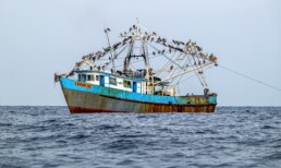
- This can be more than a scientific footnote, it has real implications for sailing comfort, biodiversity visibility, and coastal ecosystems.
-
Higher ocean temperatures can lead to altered local weather patterns—more haze or fewer coastal breezes on the way to the Galapagos.
-
Marine food scarcity may reduce wildlife sightings such as birds or small fish schools common around up welling zones.
U.S. COAST GUARD BARQUE ‘EAGLE’ VISITS PANAMA
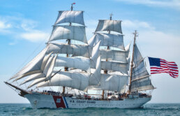
Panama City, April 22, 2025 – The U.S. Coast Guard cutter ‘Eagle,’ a 295-foot, three masted barque used as a training vessel, will arrive tonight at Panama’s Atlantic coast to cross the Panama Canal and begin a tour of various locations along the Pacific coast of Central and North America. After crossing the Canal, the training ship will dock at different ports in Costa Rica, Mexico, the United States, and Canada
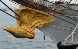
The USCGC Eagle (WIX-327) is one of the most iconic vessels in the United States Coast Guard and serves as its sail training ship. Here’s a quick history:
Origins in Germany:
Eagle was originally built in 1936 by Blohm & Voss shipyard in Hamburg, Germany. She was launched as the Horst Wessel, one of a series of tall ships constructed for training officers in the German Navy.
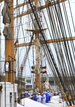
World War II Service:
During the Second World War, the ship served under the German Kriegsmarine. After the war ended in 1945, the Allies divided surviving German sailing ships among the victors.
Transfer to the U.S.:
In 1946, the ship was taken as a war prize by the United States and formally commissioned into the Coast Guard as USCGC Eagle (WIX-327).
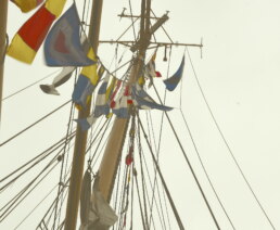
Role in Training:
Since then, Eagle has been used to train cadets from the U.S. Coast Guard Academy in seamanship, leadership, and navigation under sail. Each summer, cadets undertake voyages on Eagle, learning traditional sailing skills and modern teamwork in a demanding environment.
Design and Specs:
Type: Barque (three-masted tall ship)
Length: 295 ft
Beam: 39.1 ft
Free board: 9.1 ft
Draft: 17.0 ft
Max Height: 147.3 ft
Sail Area: 21,350 sq ft
Number of Sails 23
Speed under power: 11 kts
Speed under sail: 17 kts
Rig: Square-rigged on the fore and main masts, fore-and-aft rigged on the mizzen
Crew: About 50 permanent crew and up to 150 cadets or trainees
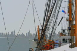
SQUIRREL ON BOARD 🐿️ UNINVITED VISITOR
So I’m going about my business today at anchor at least 500 feet from the nearest point of land and hear a weird noise coming from the bow. I went to check it out and my eyes pop when I see it’s a sopping wet, shaking, chattering mess of a squirrel clinging for dear life to the bow roller. Bursting into action (after staring blankly for far too long)
I decided to rescue the poor thing and take it back to shore. In a fit of optimism I decided we would coax it onto the paddle board and tow it by dinghy to the safety of land. Solid plan, should be easy. Commence absolute shit show. Turns out our new friend very much did NOT want to get near the water again and is much faster than two moderately fit adults. We each grabbed a cockpit cushion and a weapon (boat hook and broom) and turned our deck into a scene from the three stooges for twenty minutes chasing the thing around.
Brian finally managed to swipe it with the broom into the water where it swam like an Olympian to the dingy and climbed onto the outboard. Awesome! I jumped into the dingy and yelled at Brian to untie me so I could row us away from the boat and then shoo the squirrel onto the board. Unfortunately Mr squirrel is waaaay faster than either of us, even when we are highly motivated to move fast, and scampered like a frickin rocket up the side of the dingy and back onboard before we could get untied.
Arrrrrrggh.
Back to three stooges mode, this time minus the broom after I dropped it in the water in my haste to get on the dinghy, and now paired with a husband who has developed murder eyes and a chant of “I don’t have time for this, I’m gonna kill it”. This time I let murder man take the task of shooing rockeg squirrel into the water and stay in the dinghy, positioning the paddle board so its the closest thing to the transom and with the dinghy ready to row off as soon as the squirrel is onboard. Pause for a moment. To date, my biggest regret in life is not wearing a body cam for the next ten minutes because it would gone millions of views viral. First. A now very aggressive Brian somehow gets the thing onto the transom and in the water without injuring it. It IMMEDIATELY heads back to the boat, only to be intercepted by my now roaring mad husband with the boat hook. The squirrel grabs ahold of the hook and Brian starts shaking and swinging the hook like the swashbuckler Zoro in attempt to keep the stowaway from reboarding and to sling the squirrel off and onto the paddle board.
The squirrels grasping at the pole like a stripper squeezing every last dollar bill out of an audience and Will Not Let Go. I’m watching this tragic comedy from the dinghy mentally calculating the trajectory of the beast when it’s inevitably thrown and quickly realize my head is the most likely landing place. By some ridiculous miracle, and after several tosses and retrievals with the boat hook, Brian figures out how to aim the squirrel projectile and it lands within inches of the Paddle board and climbs on.
“ROW ROW” he starts shouting from the transom and I pull with every I’ve got. Naturally, the afternoon wind we’ve been expecting takes that exact second to kick in, sending my and curly back towards the boat. Brian gives the board a big kick and sends it away. The squirrel, either deciding the end has come or realizing the safest place to be is right where it is, crouches down on the board and digs his little claws in. I think at this point nobody would believe this without pictures, and thank goodness Brian grabbed my phone and took some good shots after i started to row away, because I swear it really, actually happened. The squirrel held tight all the way to shore where I was able to pull up to a private dock and give the board a good shake to send him on his way. Best of luck squirrel buddy. Please don’t feel the need to drop by again, we’re good.
Story from Former Posse vessel
SY HALF MOON 🇺🇸 Brain & Elizabeth Sea Wind 39′

TURNING ( BEACH COMBING ) PLASTIC INTO ART
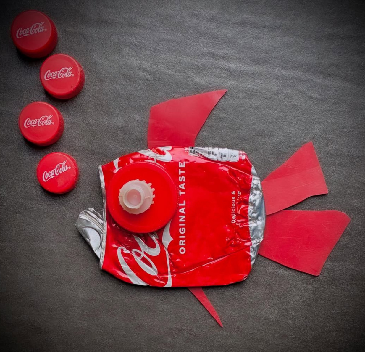
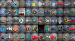
To get inspired and share your own plastic art go to
https://www.instagram.com/telka_plasticfish/
Every single part saved from the sea 🌊 #plasticfish #plasticfishing #plastic #plasticart #trash #trashfish #savetheplanet #savetheocean #🐟#🌊 instagram.com/planetcare_smallsteps
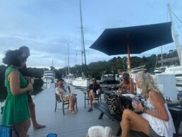
Got a report, scoop, story, picture, subject or contact at a marina who wishes to work with us ? Please get in touch with us.
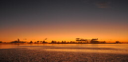
Extraordinary Cruising °°° Join the Fleet
- Access vetted local knowledge, safety resources, and prior experiences to make your passage safer and more enjoyable.
- Unlock a Life of Adventure
Explore hidden destinations, experience new cultures, and discover the freedom of life at sea or near shore – on your terms. - Get VIP Perks & Discounts at marinas, chandleries and boatyards
Get exclusive discounts, priority access, and personalized support at partner marinas across the globe. - Observe the actions of Experienced Captains
Tap into a wealth of tips, tools, and real-world know-how from seasoned mariners to grow your skills and gain confidence. - Make Every Nautical Mile Memorable
Join events, meetups, and shared journeys that turn you voyages into unforgettable stories and lasting memories. - Cruise with a Conscience
Gain insights into sustainable practices and join a movement that protects the waters you love to explore.