
CRUISING ° FLEET UPDATE & NEWS ⚓ 2025-10-19
The great difference between voyages rests not with the ships, but with the people you meet on them
CRUISING ° FLEET UPDATE & NEWS ⚓ 2025-10-19
Pictures of the Week
Burgees in Panama
Meet the Fleet 🇺🇸 SY Alisei
San Diego Kick Off Event
Marina Ixtapa Sponsors the Ocean Posse
The “drug Lord’s Mansion” of Zihuatanejo
Chesapeake to the U.s. Virgin Islands
Must See 🇺🇸 Castillo San Marcos, St Augustine Florida
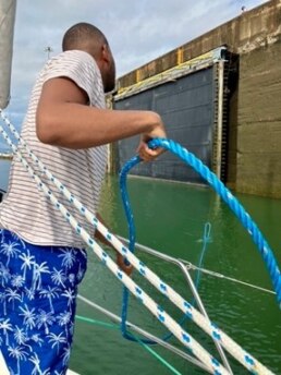
⚠️ Safety Situation: South Central Caribbean
Save the Date – Marine Insurance Seminar – Oct 25
Ocean Posse Kick Off 🇲🇽 Barra De Navidad, Mexico December 3-7 2025
Costalegre: The Happy Coast
Windmill Harbour Marina 🇺🇸 Hilton Head
Introducing Sinbad Maritime Services
Media Partners Latitudes and Attitudes & Dockside Live Radio
Book: ‘My Life’s Dream Took Me To Sea’
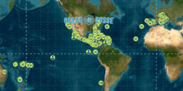
Ocean Posse Fleet 🛰️ Tracking
Ocean Posse Panama 🇵🇦 Canal Agents
Ocean Posse Merchandise | Made to Order Only
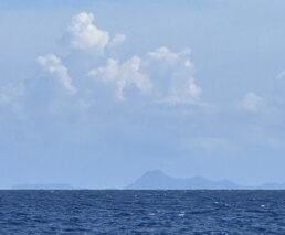
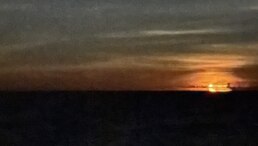
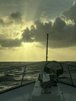
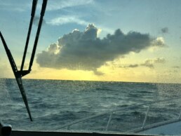
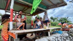
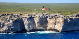
PICTURES OF THE WEEK
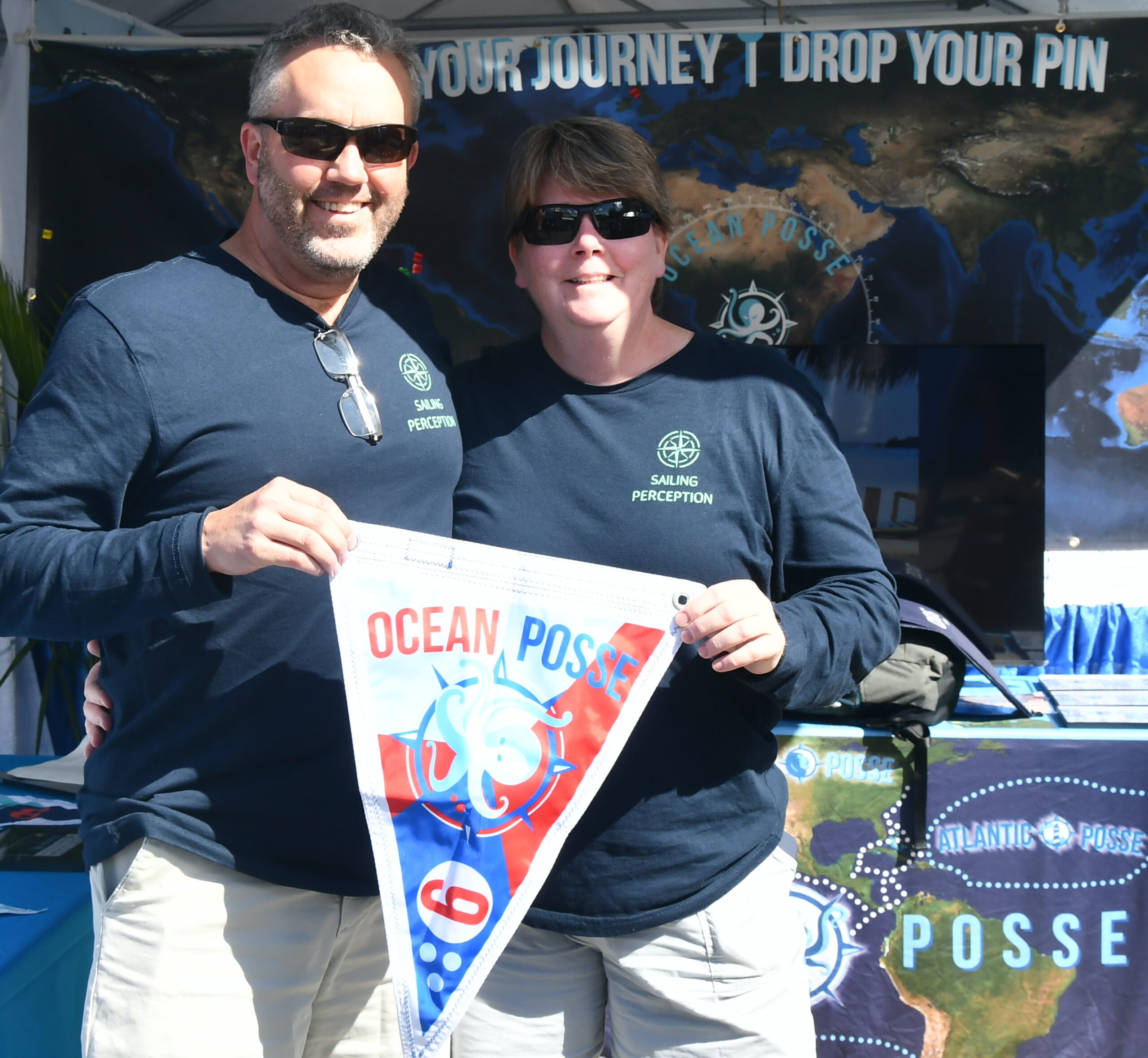
MY TIDINGS OF JOY 🇺🇸 Jeff & Joy – DeFever 52′
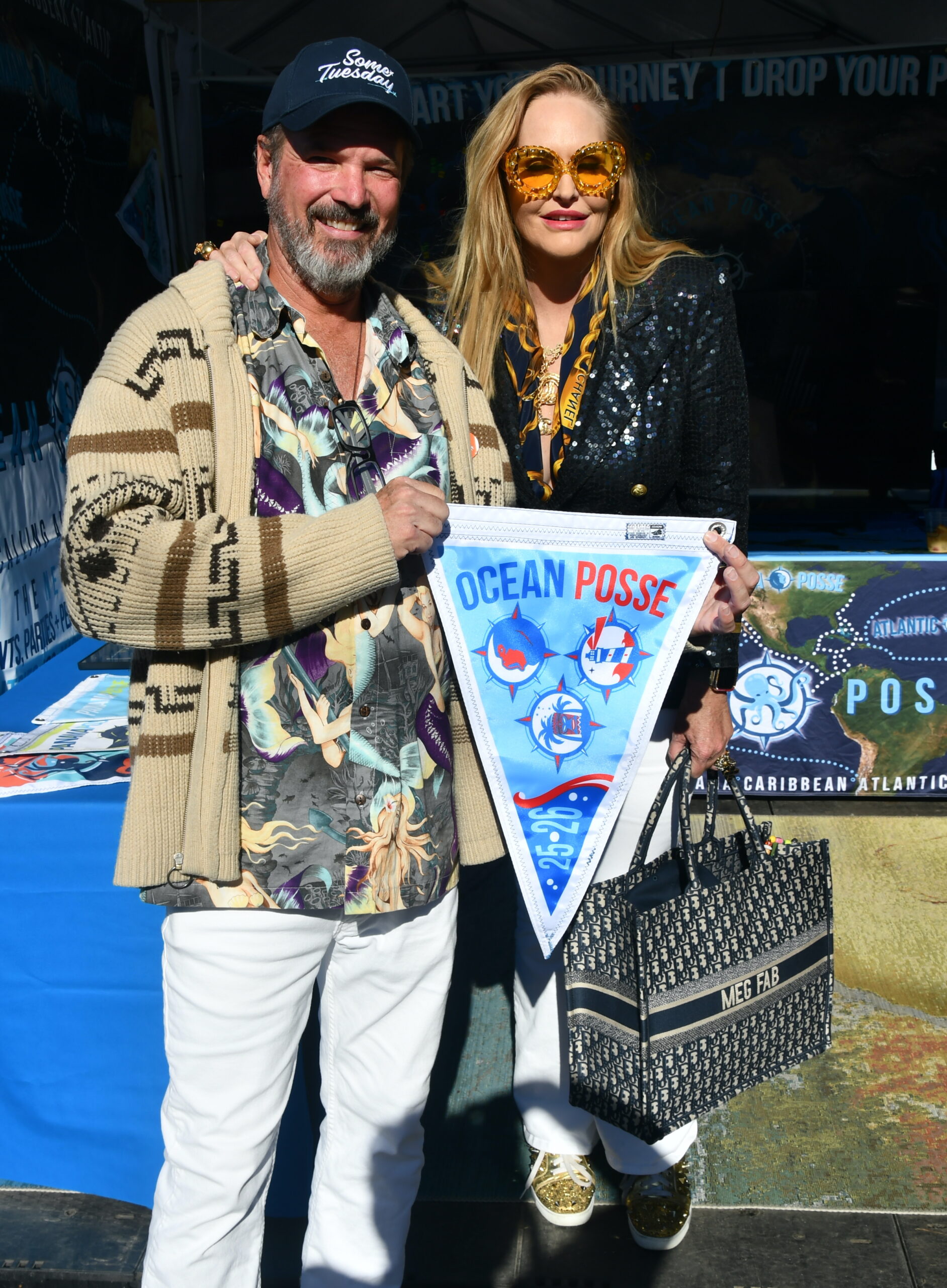
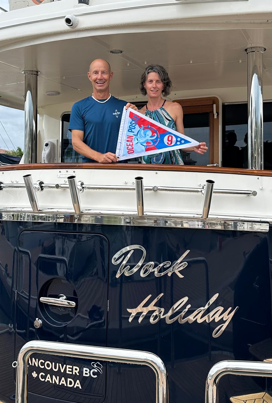
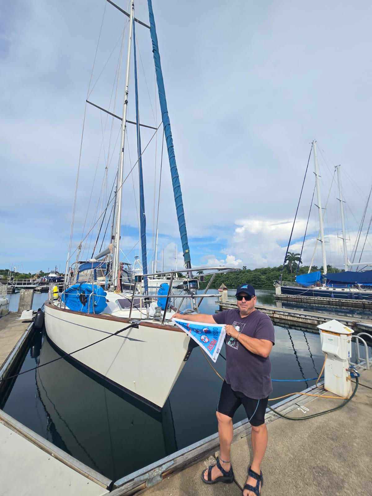
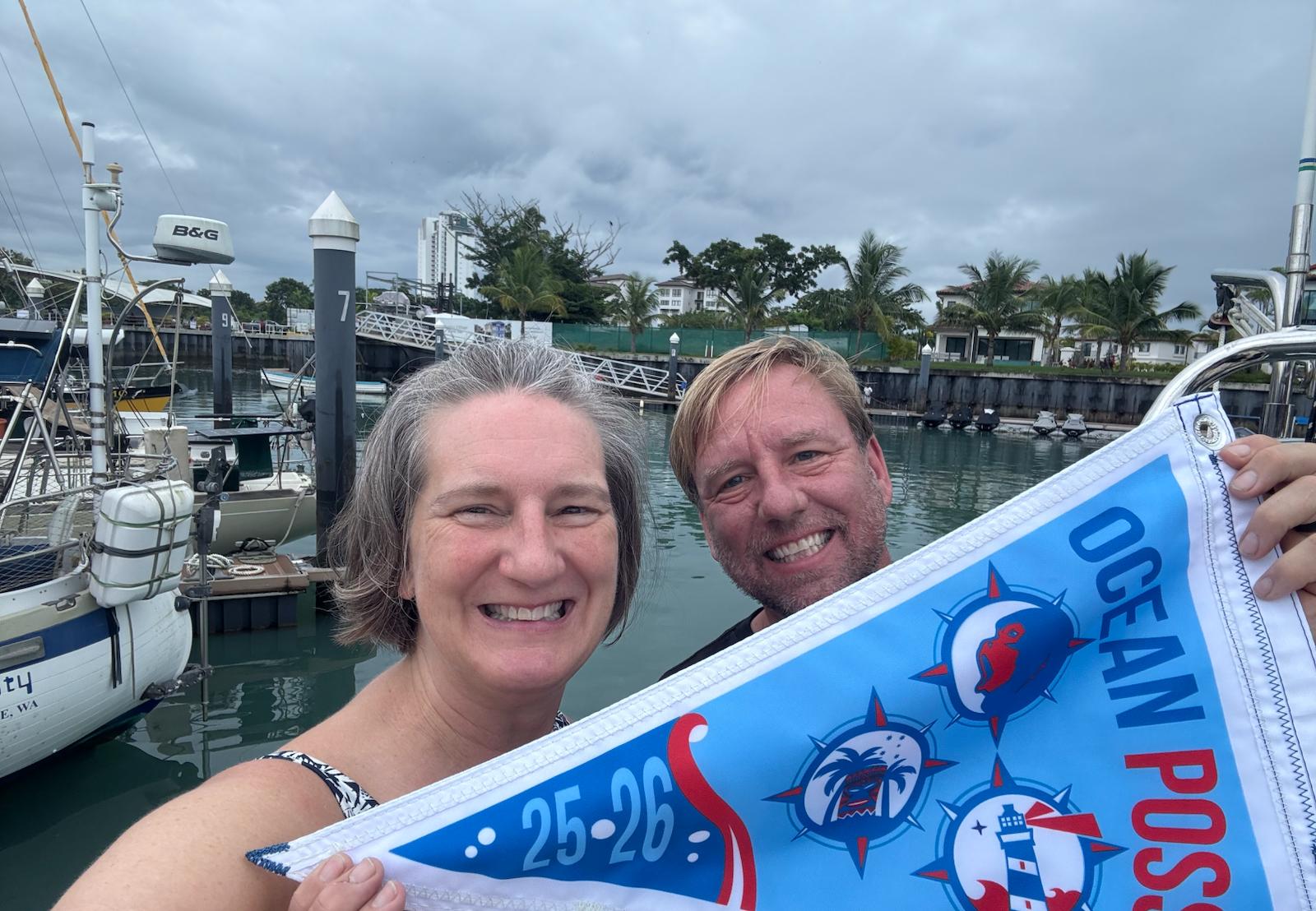
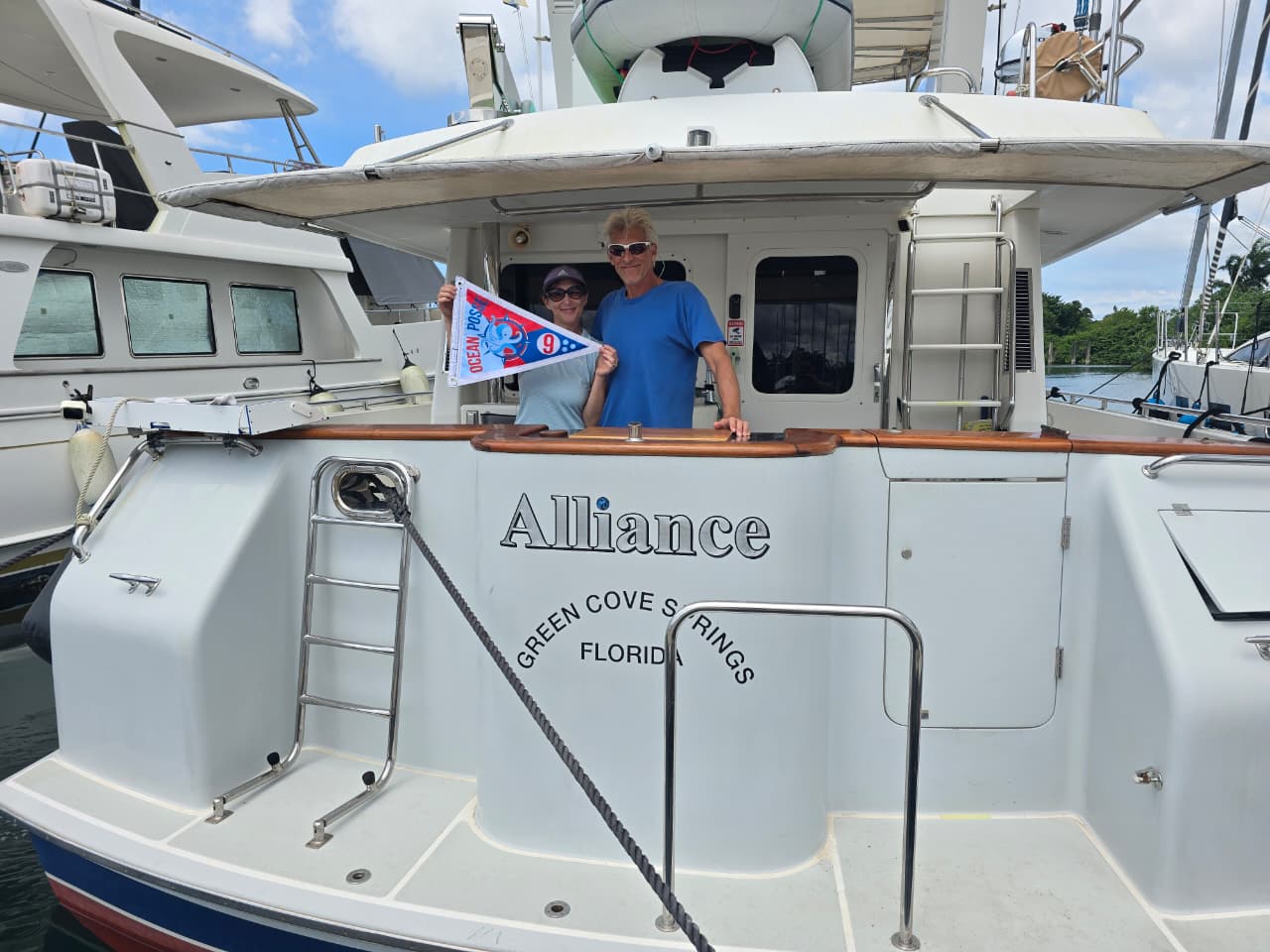
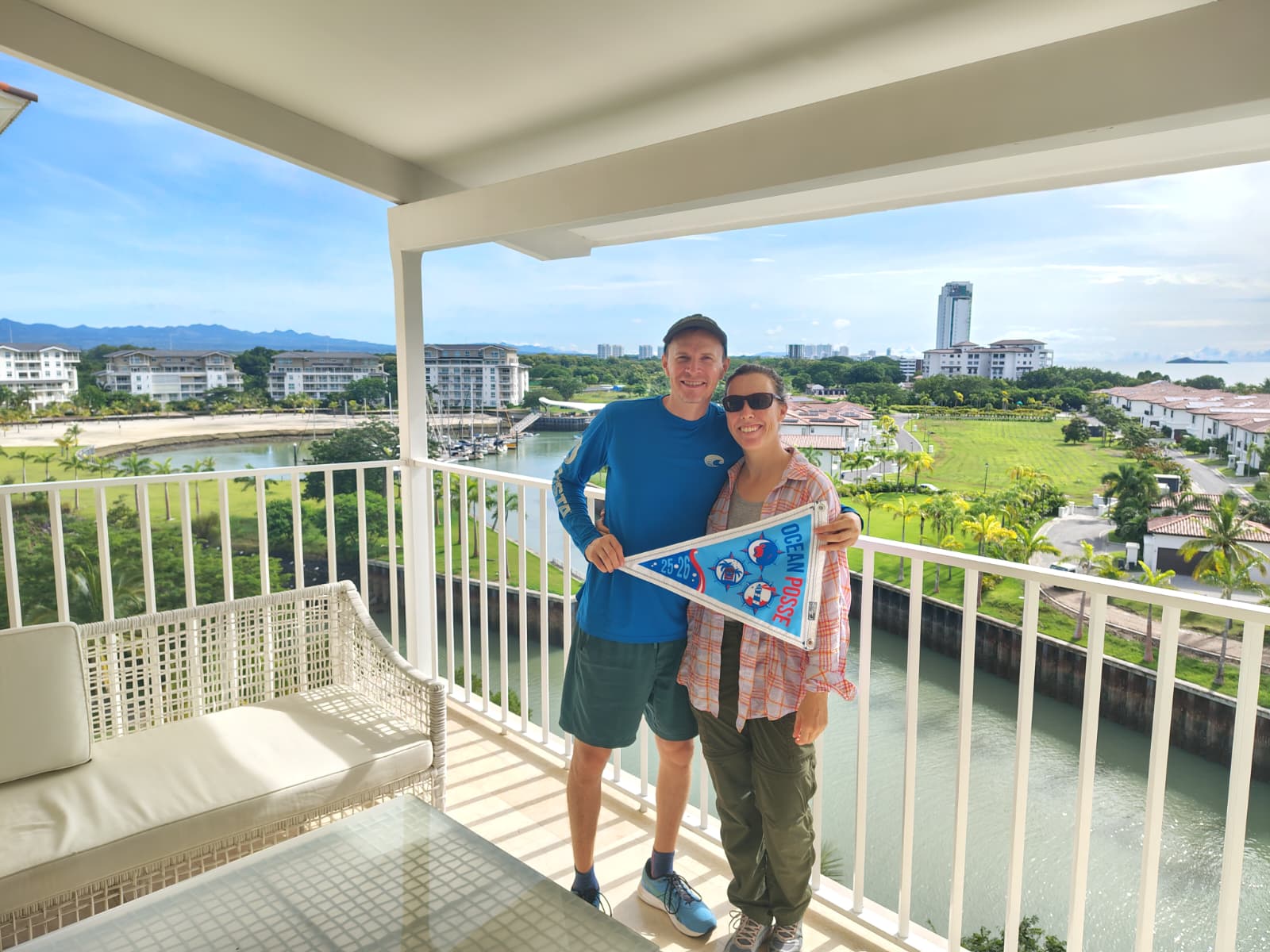
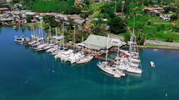
BURGEES IN PANAMA
SV EMBLA relieves their burgee @ Shelter Bay Marina
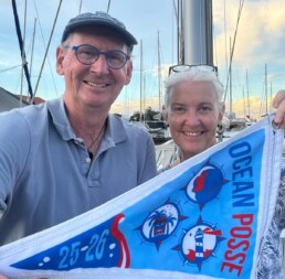
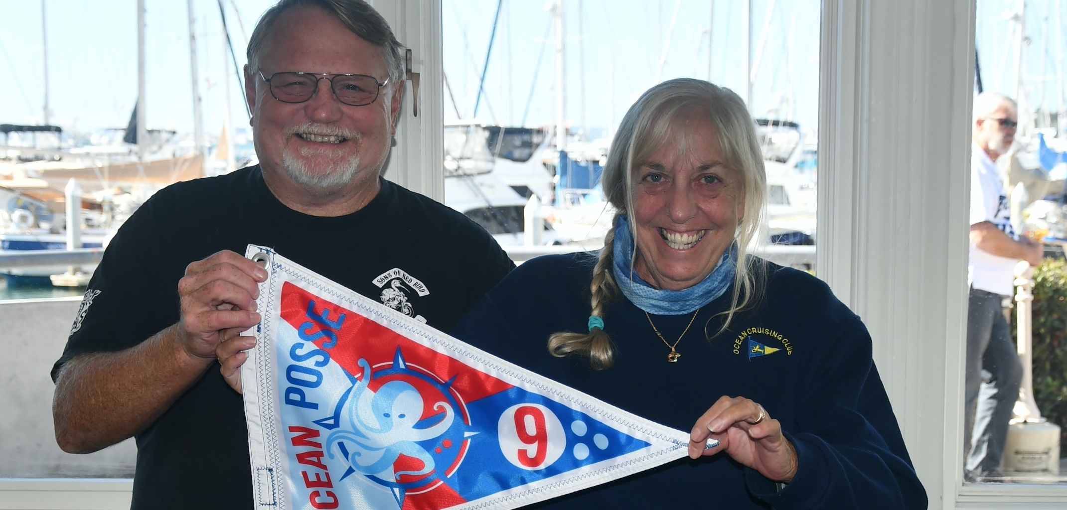
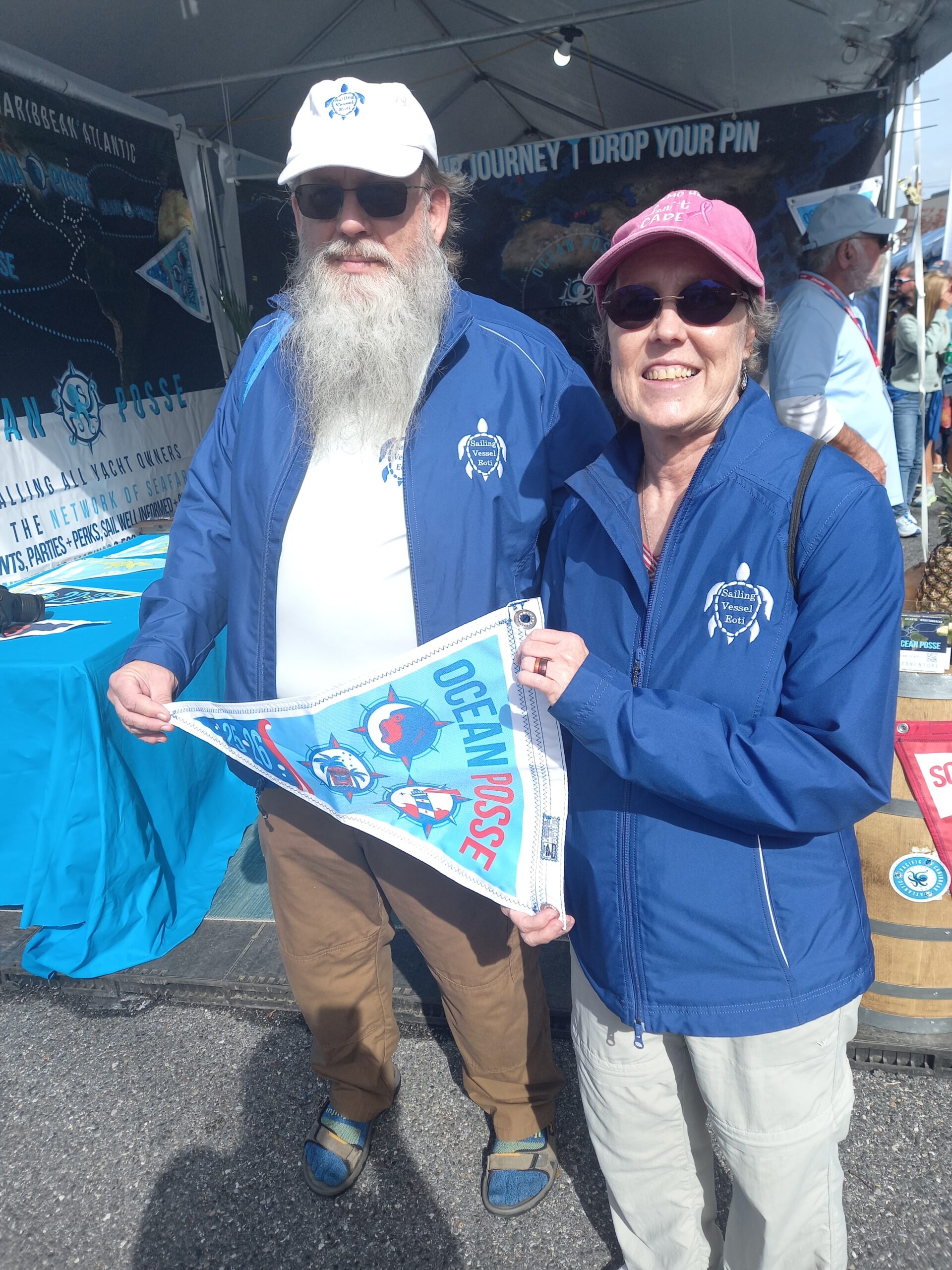
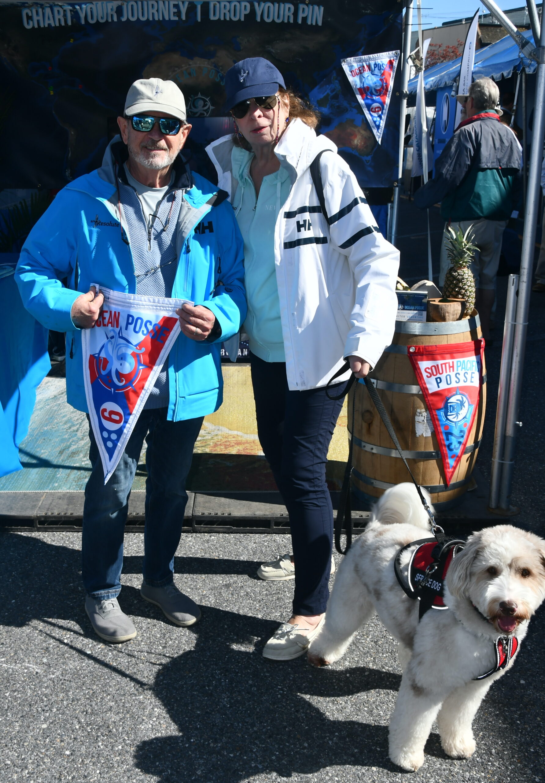
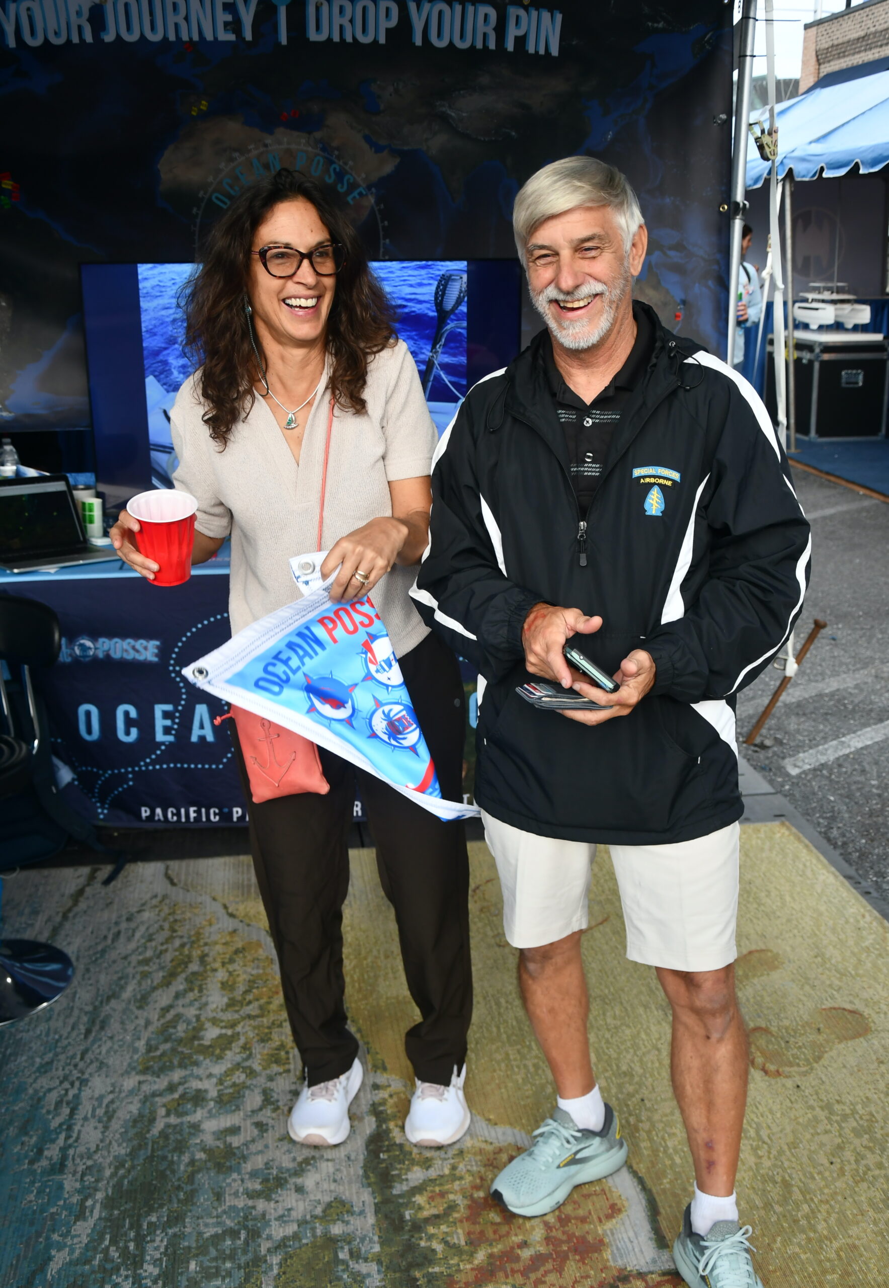
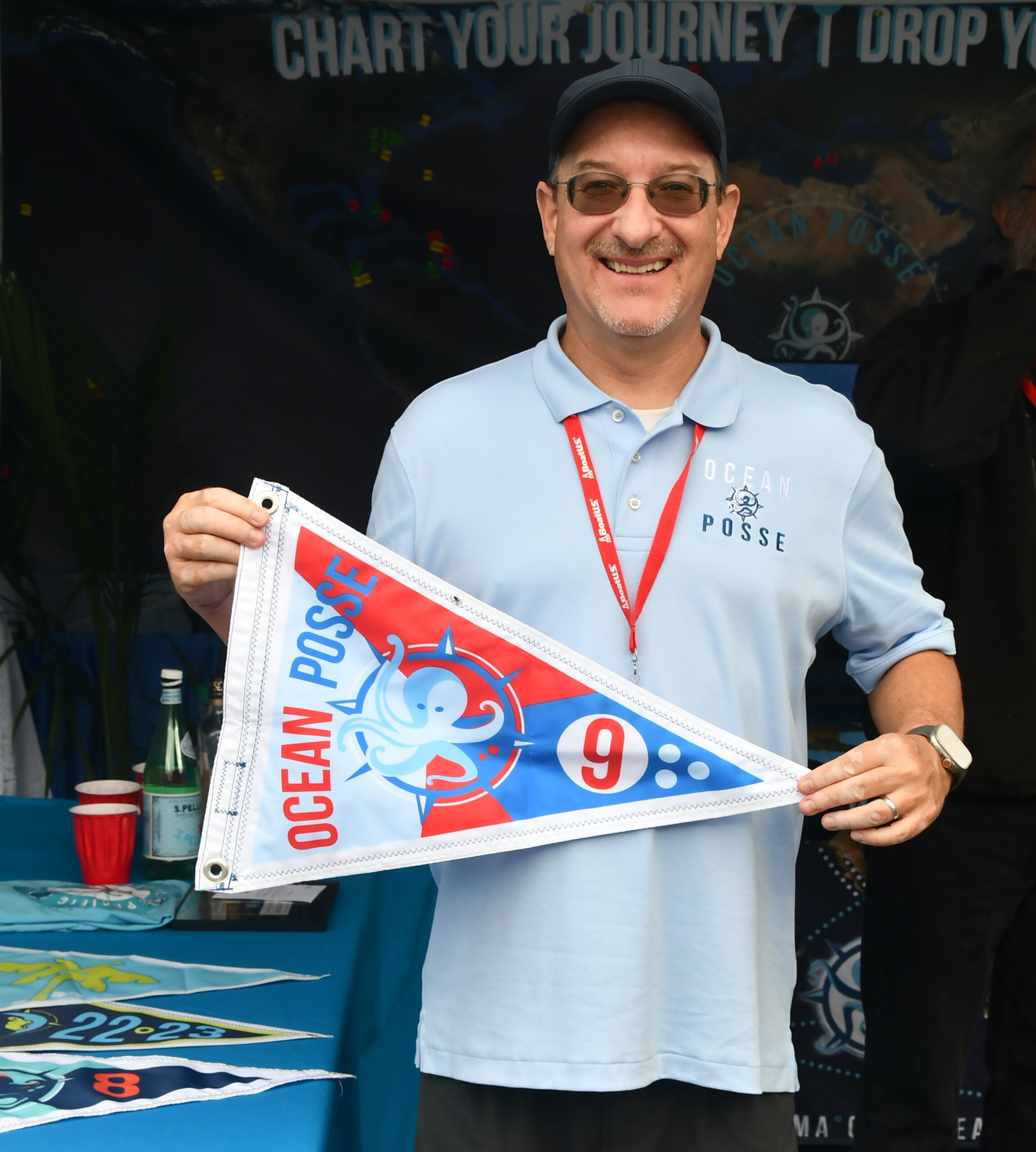
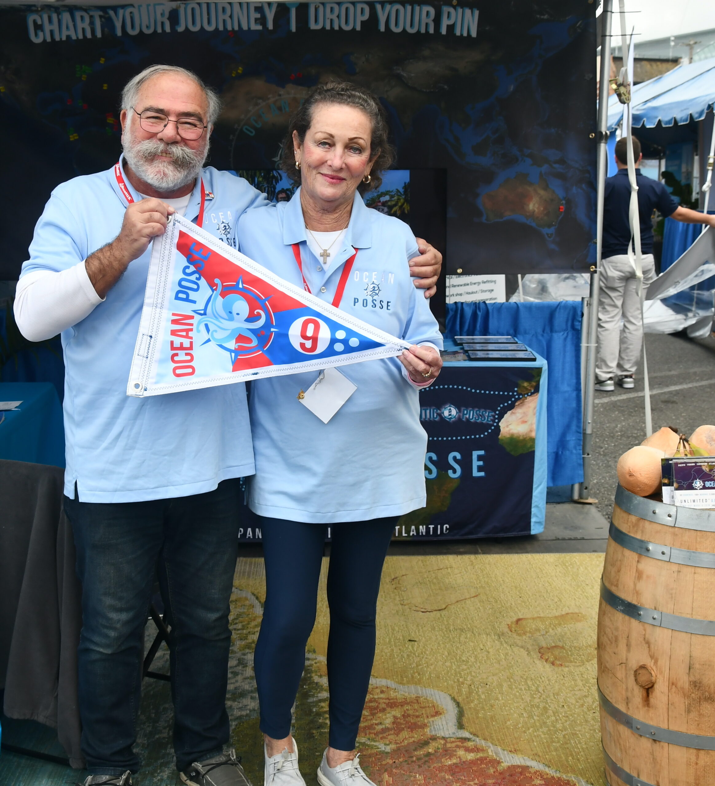
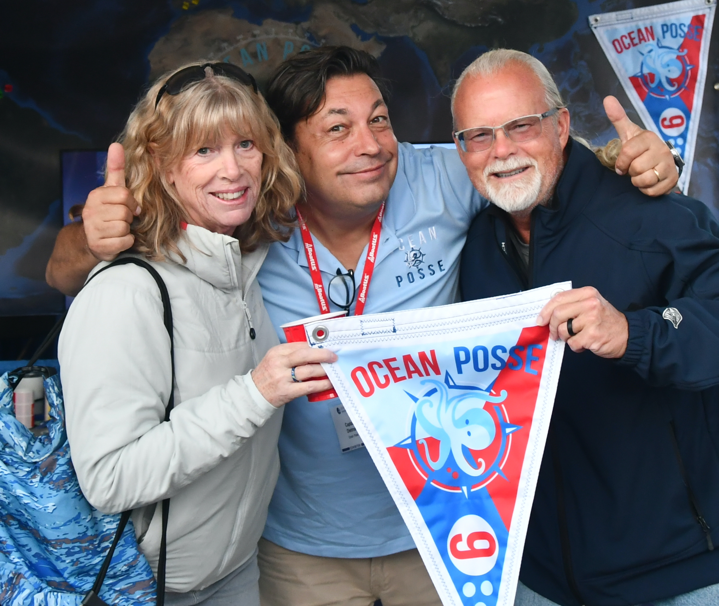
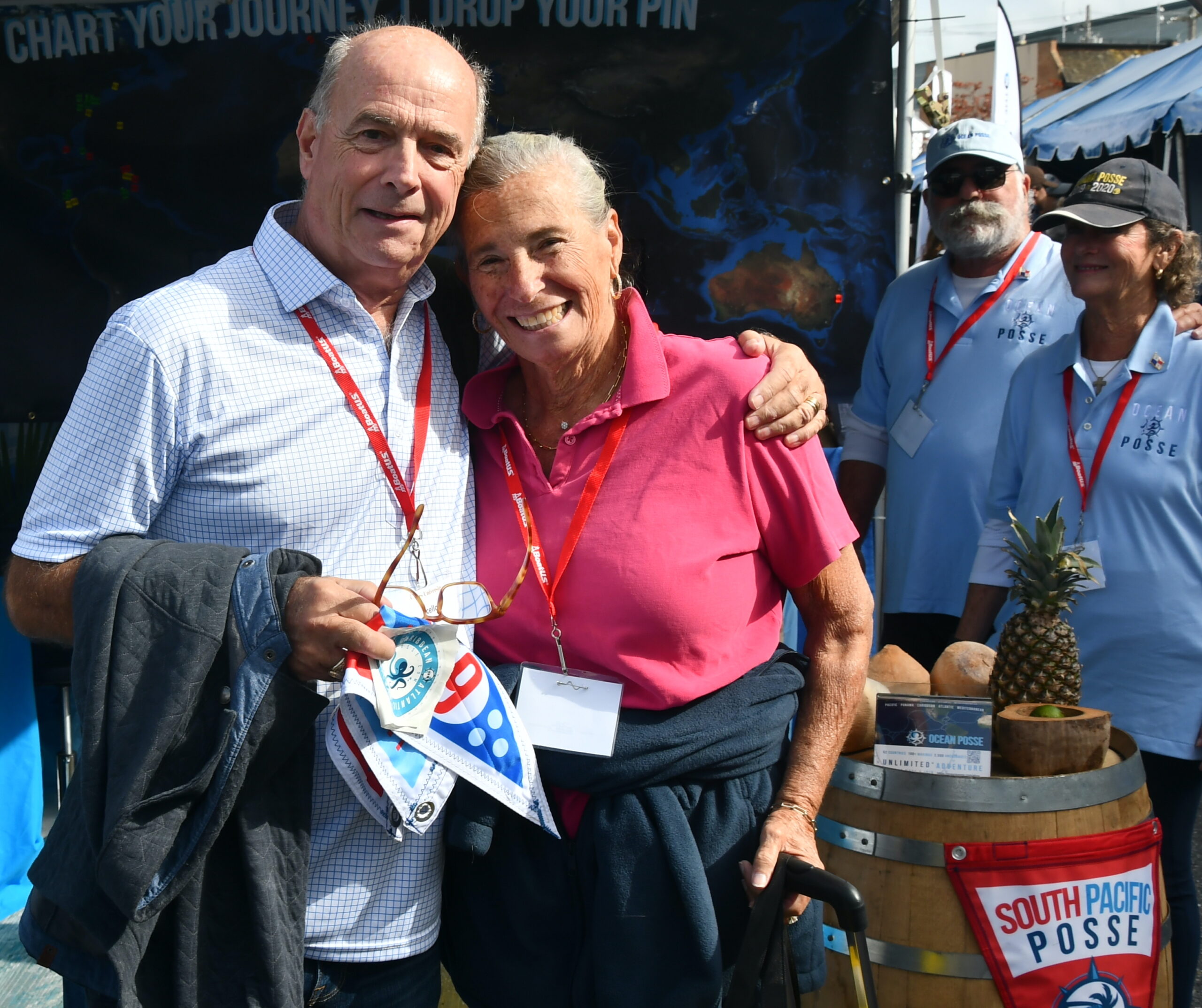
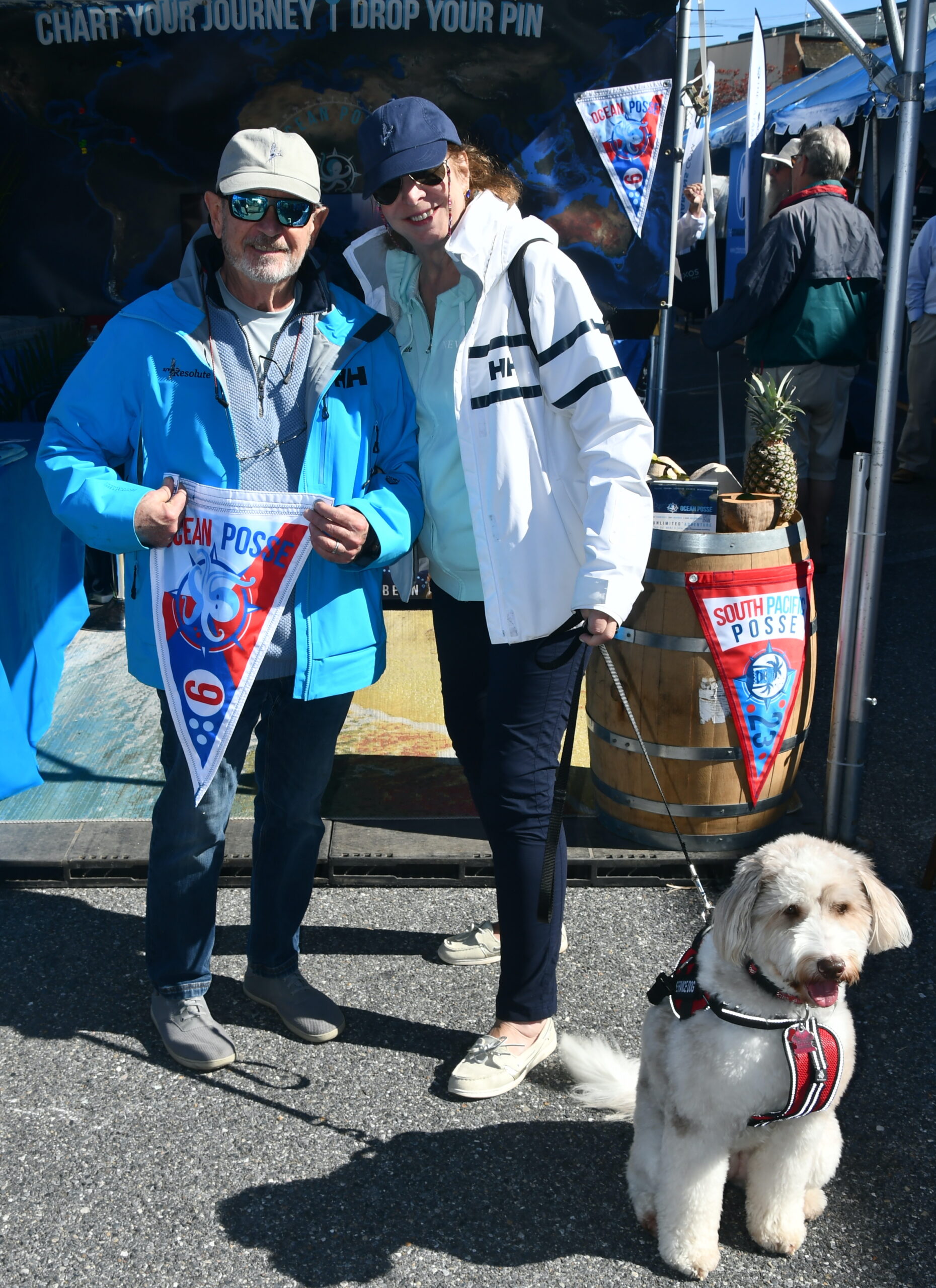
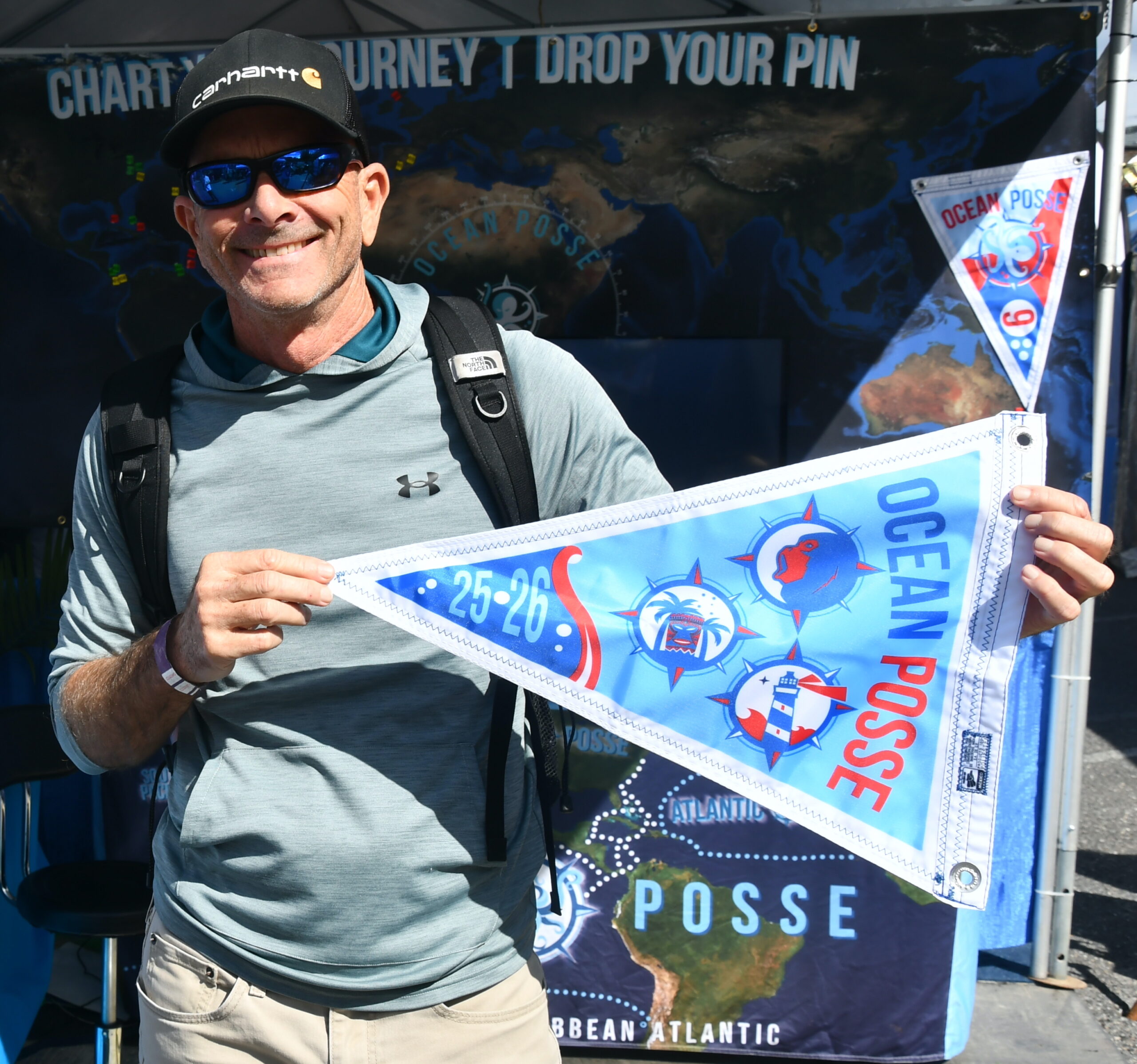
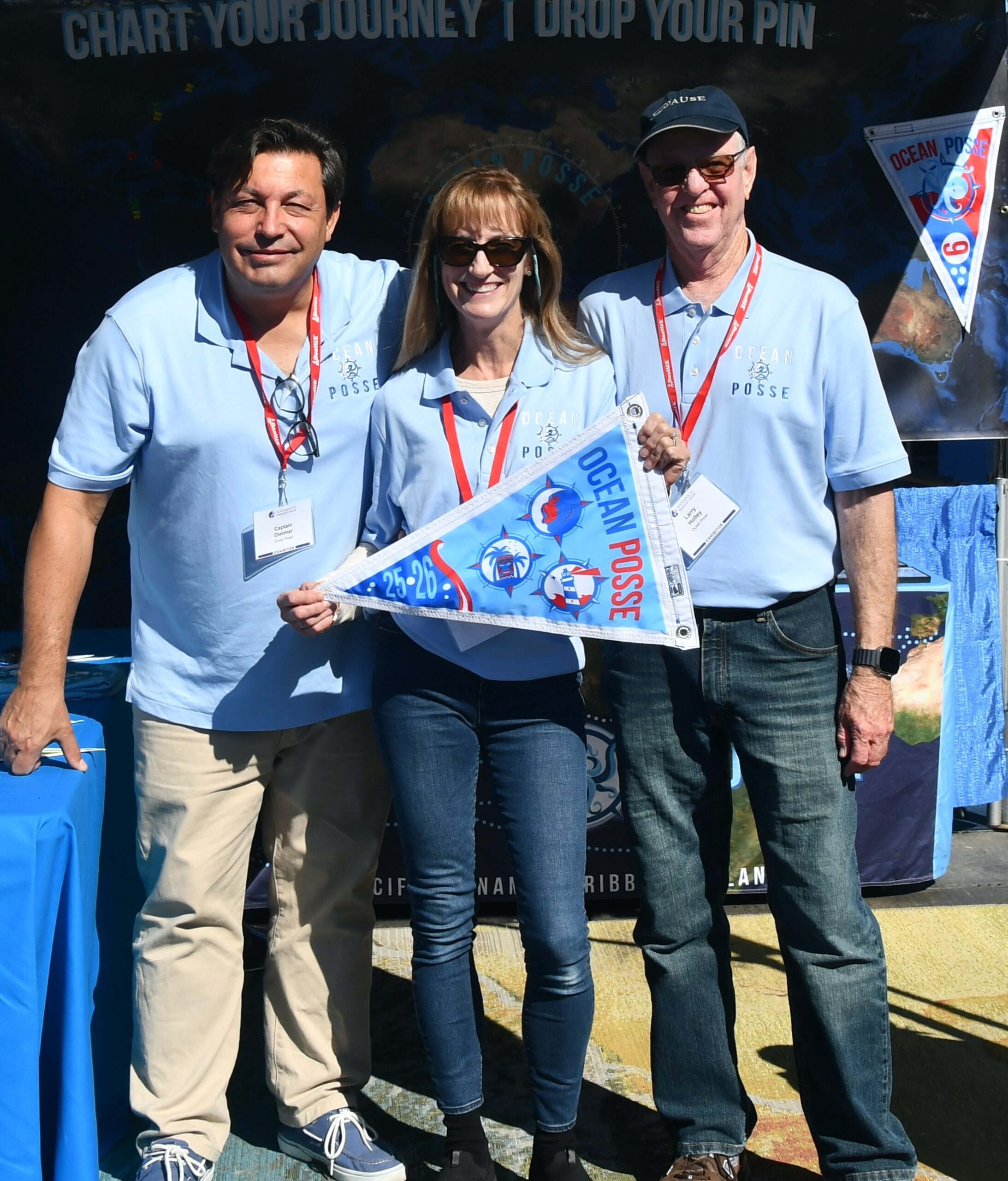
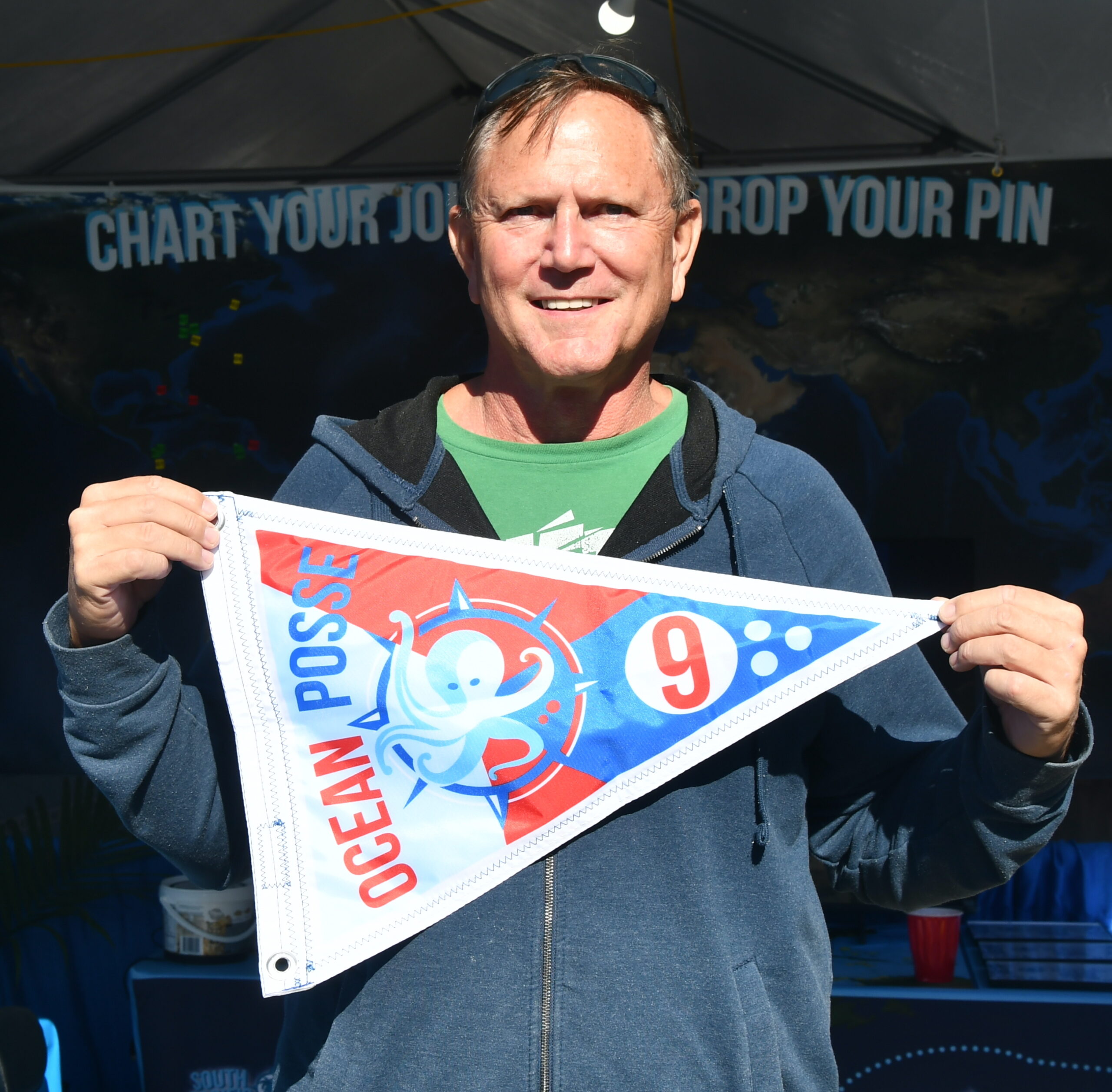
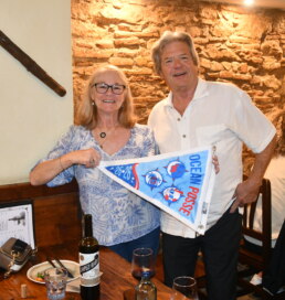
BURGEES AT THE SAN DIEGO KICK OFF EVENT
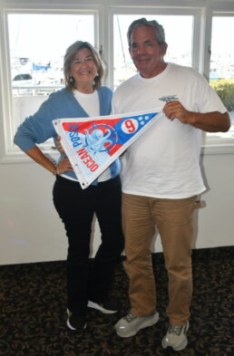
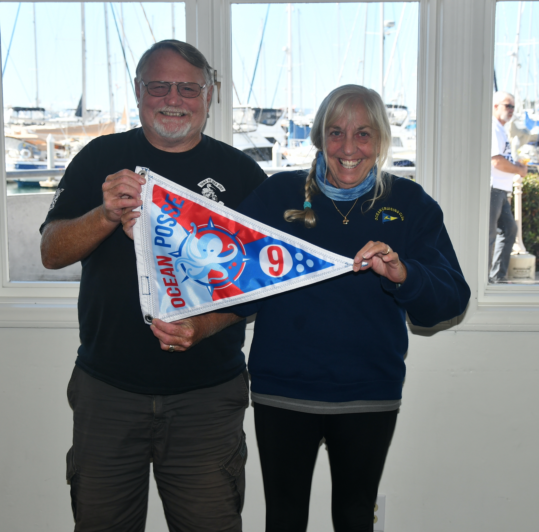
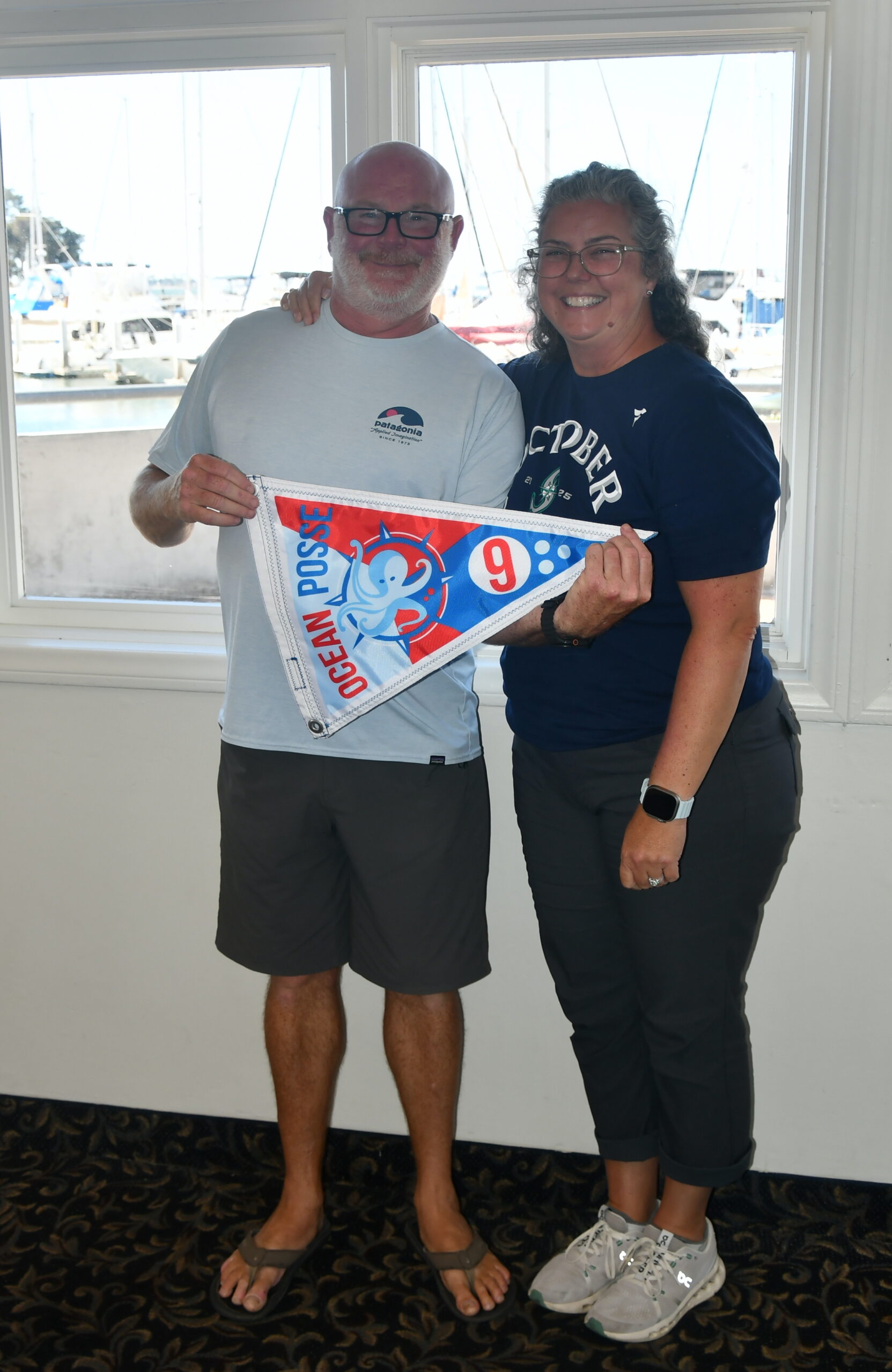
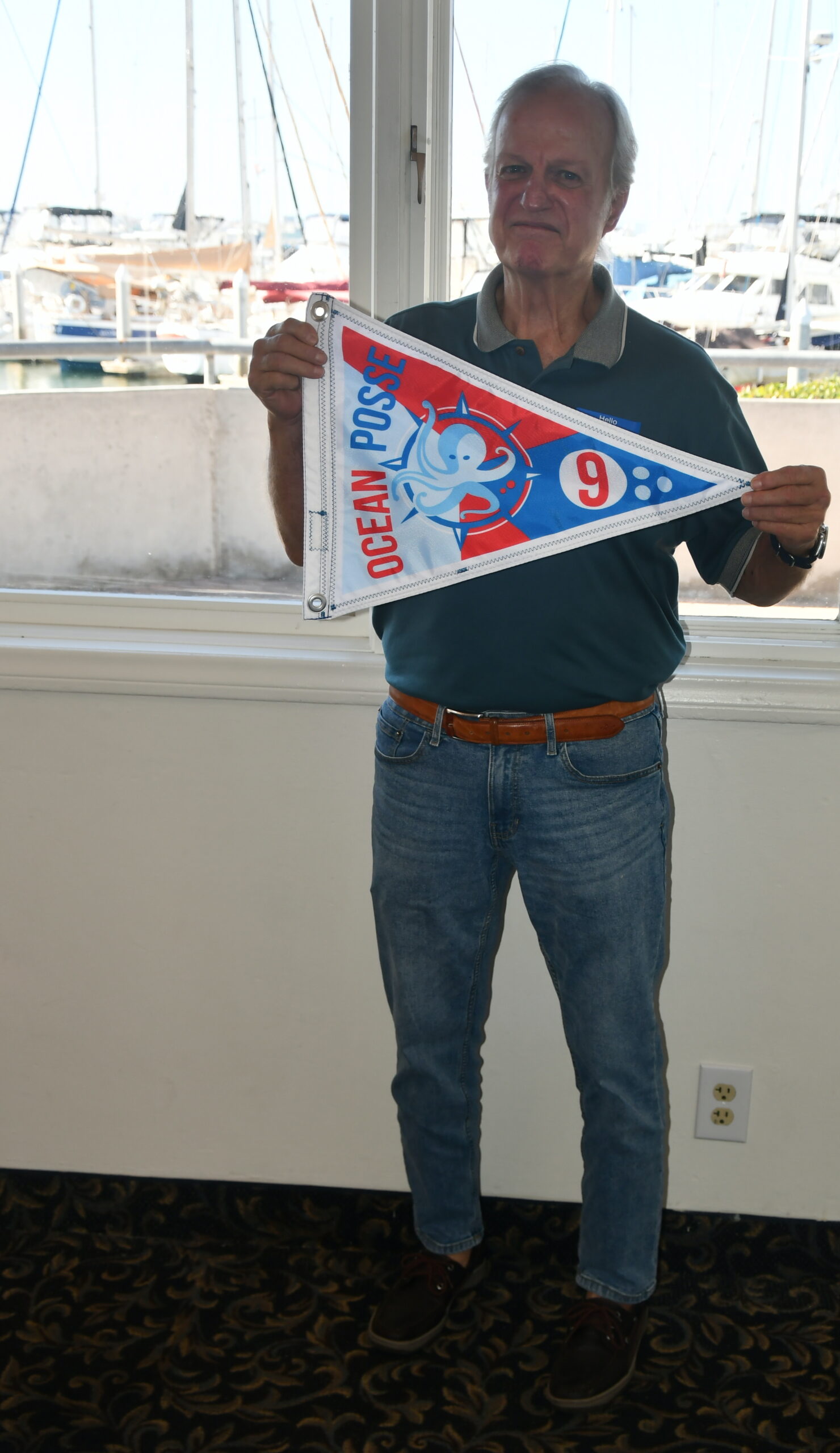
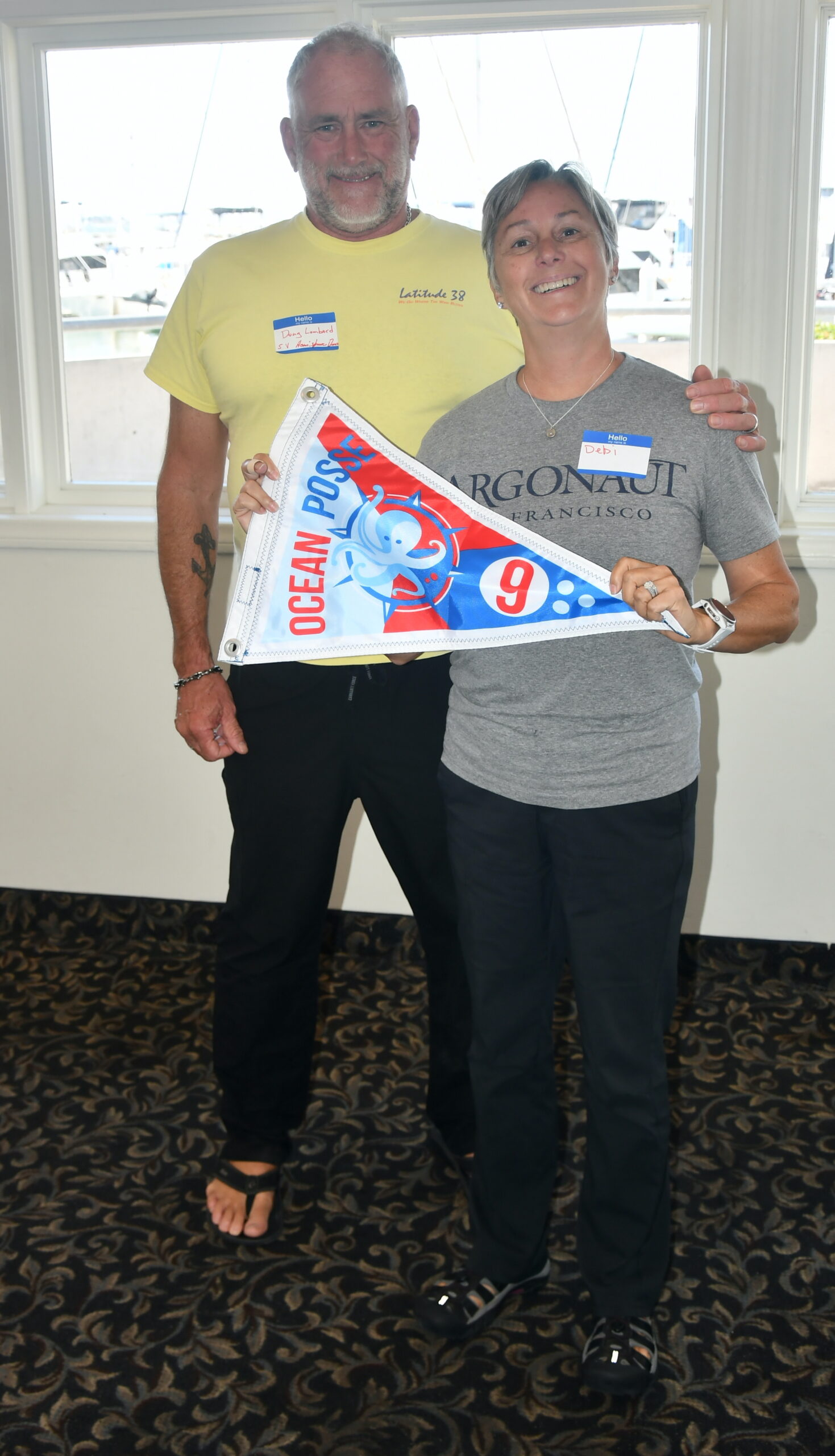
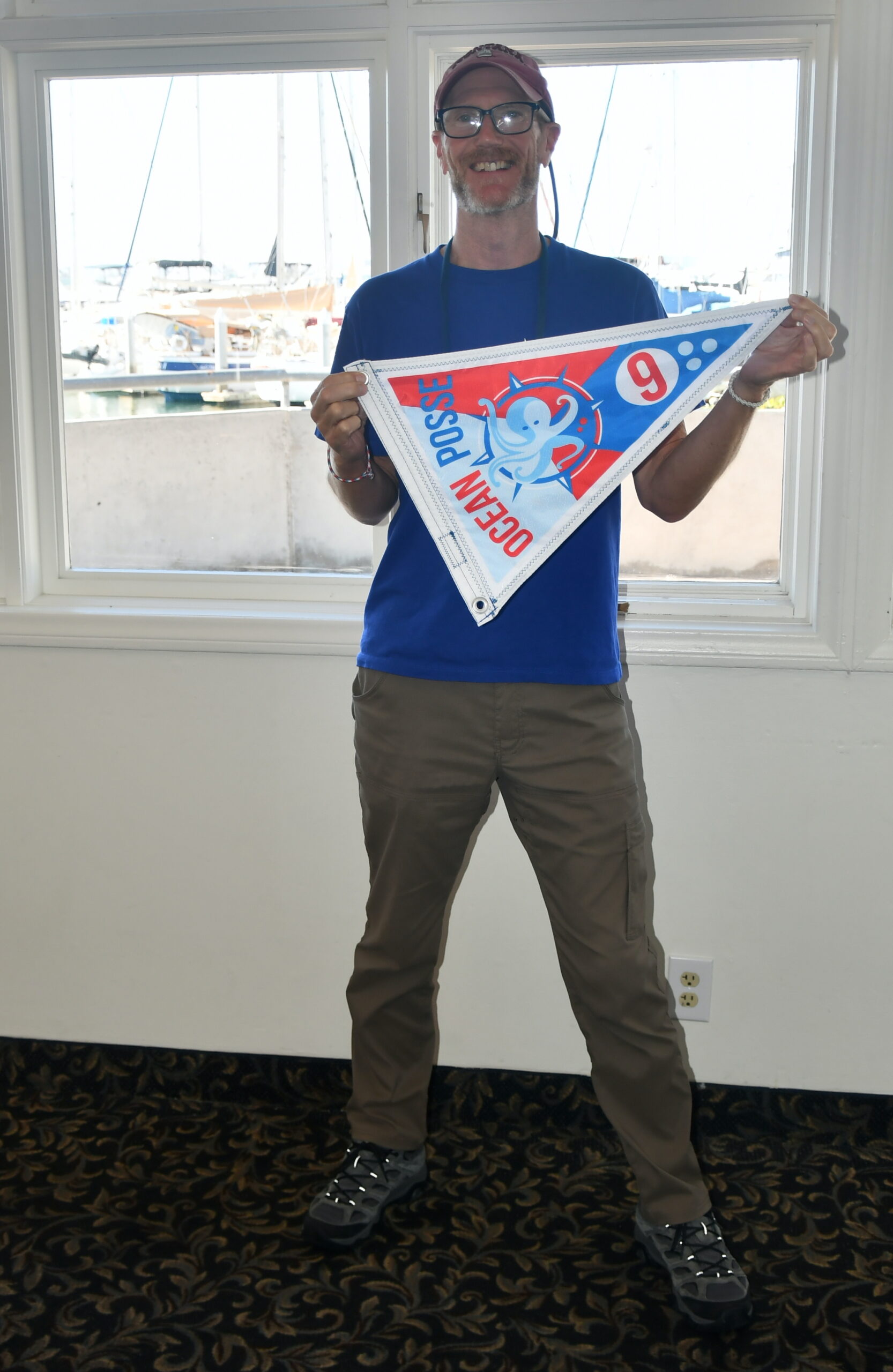
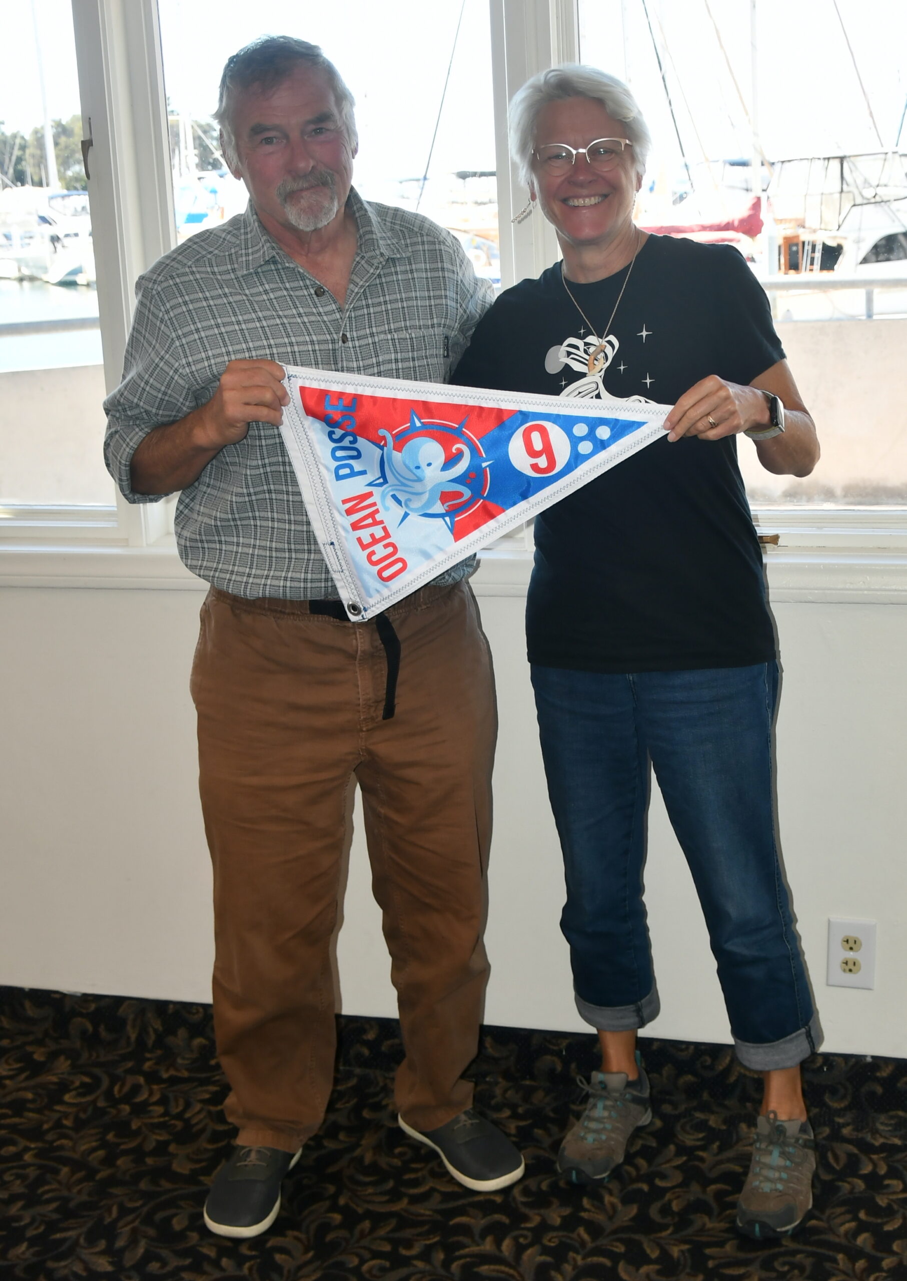
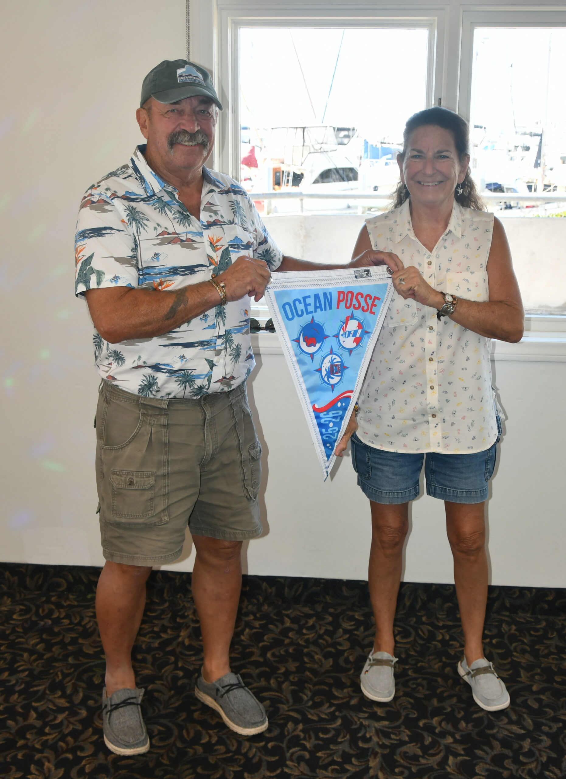
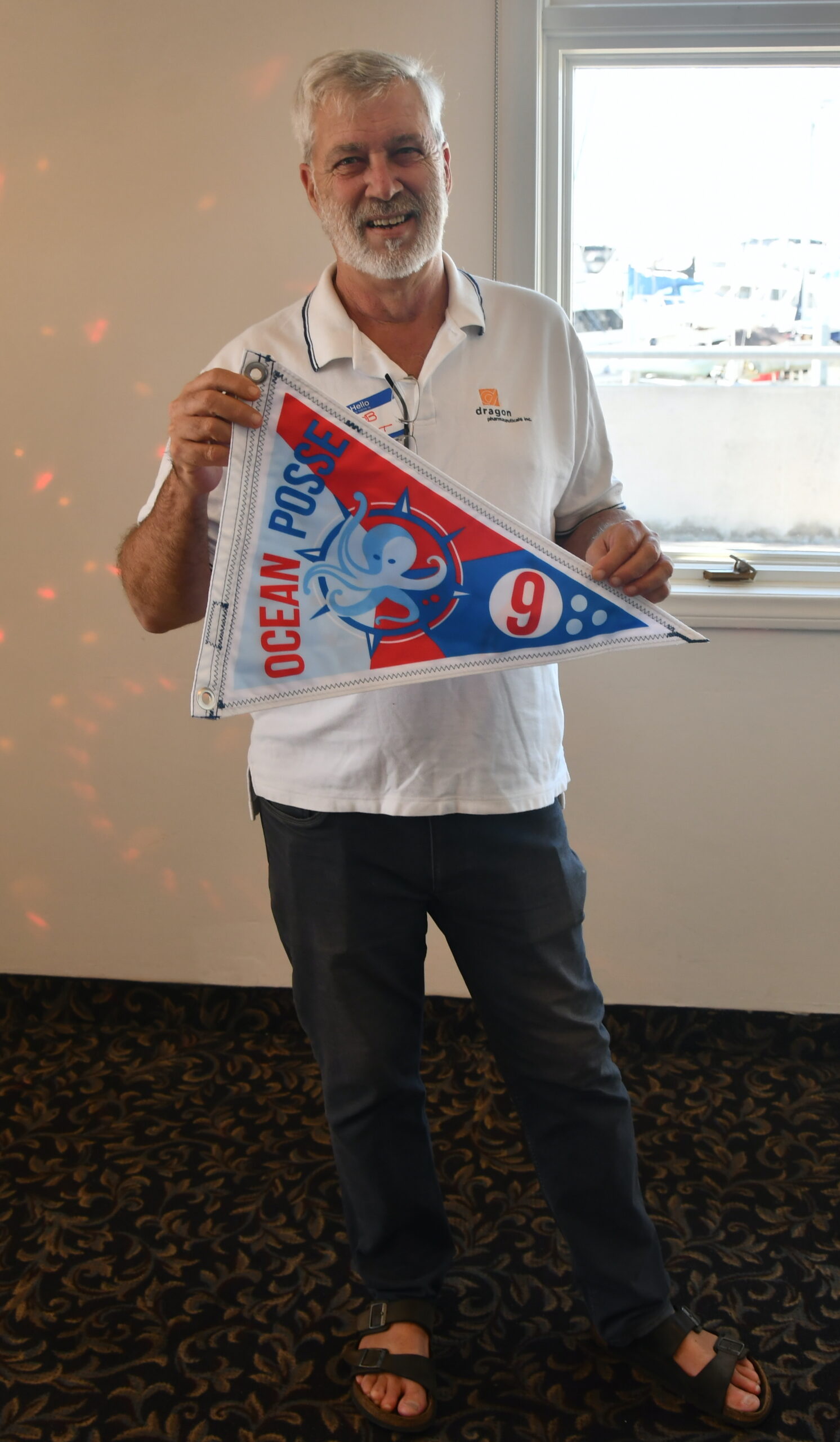
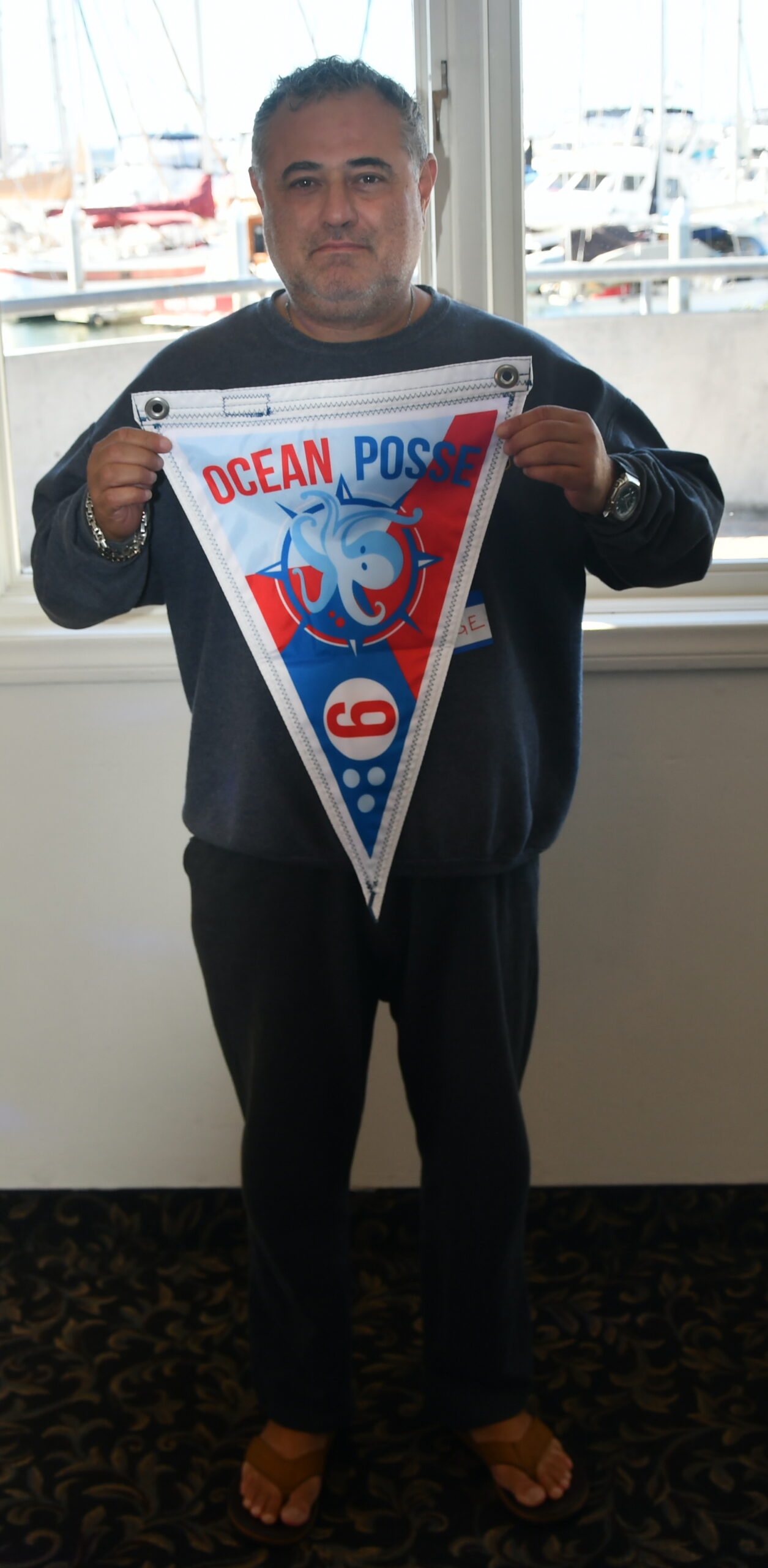


GET YOUR BURGEES HERE >>
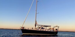
MEET THE FLEET 🇺🇸 SY Alisei
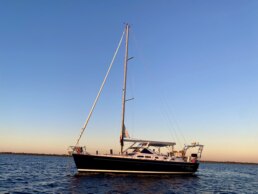
Marina & Marcello – Gulf of Mexico
For Marina and Marcello, the sea has always been home. They’ve been sailing side by side for over 40 years, logging more than 15,000 nautical miles together aboard Alisei – their trusted vessel and partner in countless adventures.
Now retired, they’re setting their sights eastward, answering the timeless call of the sea to cross the Atlantic and explore the storied harbors and islands of the Mediterranean.
Every sunrise at the helm and every evening spent under the stars reminds them why they sail – the freedom, the rhythm of the ocean, and the simple joy of being out there together. To them, cruising is not a solo voyage but a shared odyssey, one that continues to strengthen their bond and expand their horizons.
They believe deeply in the brotherhood of mariners – a global community that transcends borders, languages, and differences. Whether at anchor or underway, they find that sailors everywhere share the same compass: curiosity, generosity, and respect for the sea.
When visiting new shores, Marina and Marcello immerse themselves in local life, savoring each culture as only those who arrive by sail can. Their dream ahead? To wander among every island of the Mediterranean, large and small, one harbor at a time.
You won’t find them posting often – they prefer real conversations over screens – but when they do, you can catch glimpses of Alisei and their adventures on Instagram.
Fair winds, Marina and Marcello – may your wake stretch all the way to the Med! ⚓
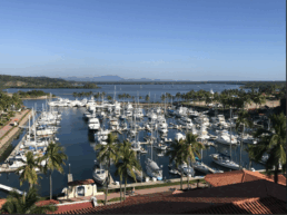
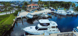
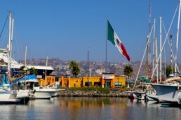
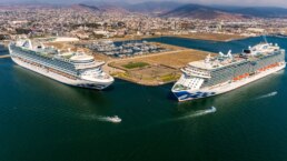
MARINA IXTAPA 🇲🇽 SPONSORS THE OCEAN POSSE
17°39.9733′ N 101°37.0533′ W
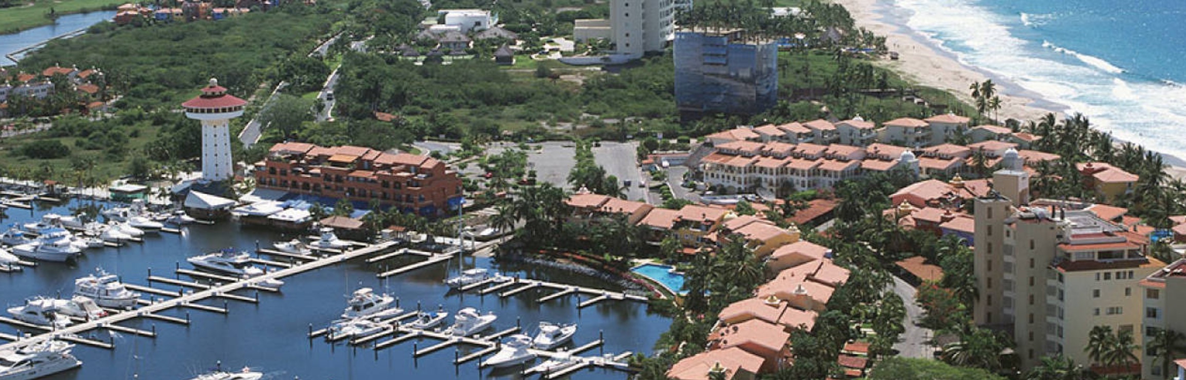
We welcome to the Ocean Posse with the following discounts
- 10% discount on daily rates
CONTACT:
Login | Register for this info
SAFE WAYPOINTS AND APPROACH TO THE MARINA IXTAPA

AMENITIES
The Marina has 583 slips with:
- Power supply for 30, 50 and 100 amps
- Potable water supply
- 24-hour security guards
- Launch ramp for boats less than 30’
- Boatyard for boats up to 120 gross tonnage
- Weather reports, and tourist information.
Other services:
- Pick up and delivery laundry service
- Showers and restrooms (Guest and crew)
In our Harbor Master Office we help all our guest to do the arrivals and departures of boats instead to send them to the Port Captain Office.

RATES
Available from January 1st through December 31st, 2020
| Vessel Length \ Days | 1 – 6 | 7 – 29 | 30+ |
| 30-59 ‘ | $ 0.90 | $ 0.80 | $ 0.70 |
| 60-65 ‘ | $ 1.50 | $ 1.25 | $ 1.00 |
| 66-75 ‘ | $ 2.00 | $ 1.50 | $ 1.25 |
| 76+ | $ 2.50 | $ 2.00 | $ 2.00 |
| Electricity: | $ 0.30 x kw | ||
| Water (potable) | $ 7.00 x m3 | ||
| Pumping out service | $ 25.00 |
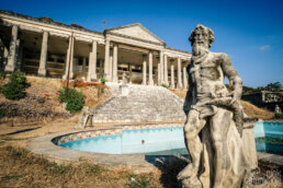
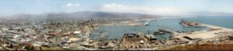
The “Drug Lord’s Mansion” of Zihuatanejo
Location: Hillside above Playa La Ropa, visible from the anchorage — a vast white structure half-finished, with crumbling terraces and overgrown gardens.
History & Legend
Locals often refer to it as La Casa del Narco, a nickname rather than an official name. The story goes that it was commissioned in the late 1980s or early 1990s by a wealthy businessman, widely rumored to have cartel ties, who wanted to build the most luxurious mansion on the coast. Construction began but was abruptly halted after his arrest (or disappearance, depending on which version you hear).
The property was abandoned before completion. Over the decades, the jungle slowly reclaimed parts of it, though the skeletal white frame still looms dramatically above La Ropa. Its balconies and grand staircases look out over the entire bay, an eerie reminder of the excess and sudden collapse of fortunes tied to Mexico’s darker trade.
Visiting
The mansion sits on private land and isn’t open to the public, but you can see it clearly from Playa La Ropa or by dinghy in the bay. Local guides sometimes offer informal hikes up the hillside trails nearby, though not inside the structure itself. The view from the ridge line above is spectacular , especially at sunrise or dusk.
The site has become a local symbol: a contrast to the humble, friendly vibe of Zihuatanejo below. It’s occasionally featured in travel blogs or photography portfolios under names like “Abandoned Mansion Zihuatanejo” or “Casa del Narco.”
For visitors, it’s a reminder of the area’s layered history: once a sleepy fishing village, later a jet-set hideaway, and now a relaxed blend of authenticity and myth
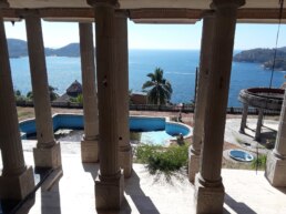
The view of Zihuatanejo Bay
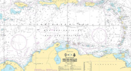
CHESAPEAKE TO THE U.S. VIRGIN ISLANDS and the 3 CLASSIC JUMP-OFF POINTS
SWELL AND WAVES
The run south from the Chesapeake to the Virgin Islands is a 1,300–1,600 nautical mile ocean passage that blends Gulf Stream strategy, mid-Atlantic weather systems, and tradewind navigation. Choosing the right jump-off point affects how you exit the coast, cross the Stream, and settle into your offshore rhythm.Below are three proven departure strategies based on 20 years of yacht passages.
1. HAMPTON / NORFOLK, VIRGINIA – THE TRADITIONAL ROUTE
Why Choose It:
The most common jump-off point for cruisers heading south. Easy provisioning, major yacht services, and plenty of fellow southbound boats make this the “migration highway.”
Distance: ~1,450 nm (via I-65 approach)
Key Waypoints:
1 Chesapeake Bay Exit – 36°58′ N, 76°18′ W (just outside Thimble Shoals Channel)
2 Gulf Stream Crossing – ~36°00′ N, 74°30′ W
3 I-65 Turnpoint – 25°00′ N, 65°00′ W (start running with the trades)
4 Virgin Islands Landfall – 18°20′ N, 64°50′ W
Strategy:
• Weather Window: Leave 24–36 hours after a cold front passes, riding the northwest-north winds offshore.
• Gulf Stream: Cross early in settled weather; avoid strong north winds over the Stream.
• I-65 Approach: Hold southeast until ~65° W before turning south to avoid punching directly into the trades.
Arrival Options: St. Thomas (Charlotte Amalie or Red Hook), St. John (Cruz Bay), or St. Croix (Christiansted).
Pros: Well-supported, good services pre-departure, easy for first-timers.
Cons: Heavy traffic lanes for first 300 nm; crowded during peak November window.
2. CAPE LOOKOUT / BEAUFORT, NORTH CAROLINA – THE GULF STREAM SLINGSHOT
Why Choose It:
Starting farther south shortens the Gulf Stream crossing and often gets you into offshore trades faster. Popular with experienced sailors looking for a quicker jump offshore.
Distance: ~1,350 nm (direct I-65 route)
Key Waypoints:
1 Cape Lookout Sea Buoy – 34°37′ N, 76°32′ W
2 Gulf Stream Entry Point – ~33°30′ N, 74°00′ W (short crossing angle)
3 I-65 Turnpoint – 24°30′ N, 65°30′ W
4 Virgin Islands Landfall – 18°20′ N, 64°50′ W
Strategy:
• Weather Window: Same as from Virginia—leave after a front. This starting point often gives you a cleaner offshore angle immediately.
• Gulf Stream: A more perpendicular crossing than from Hampton, less distance against the current.
• Trades: Expect to reach the NE trades about a day sooner than Virginia departures.
Arrival Options: Same as Hampton route.
Pros: Faster jump offshore, less time in coastal shipping lanes.
Cons: Fewer full-service yards; provisioning not as robust as Hampton.
3. BERMUDA STOPOVER – THE TWO-LEG PASSAGE
Why Choose It:
Ideal for yachts wanting a mid-passage rest, a weather reset, or crew change. Adds mileage but breaks the passage into two manageable ocean legs.
Total Distance: ~1,550–1,600 nm (two legs)
Leg 1: Chesapeake to Bermuda (~650–700 nm)
• Jump-Off Points: Hampton, VA or Beaufort, NC work equally well.
• Arrival: St. George’s Harbour, Bermuda – excellent yacht facilities.
• Weather Tip: Expect north-northeast winds after leaving; watch for Bermuda High positioning before committing to the final approach.
Leg 2: Bermuda to USVI (~850–900 nm)
• Waypoints:
1 Depart Bermuda ~32°22′ N, 64°40′ W
2 I-65 Area – ~23°30′ N, 65°00′ W
3 Landfall – ~18°20′ N, 64°50′ W
• Sailing: Typically a broad reach to beam reach with strengthening trades as you close the islands.
Pros: Safety and rest stop, chance to repair gear, enjoy Bermuda.
Cons: Weather delays common; adds 2–5 days overall depending on waiting periods.
| Jump-Off | Best For | Distance | Average Days | Advantages | Drawbacks |
|---|---|---|---|---|---|
| Hampton / Norfolk, VA | First-time offshore cruisers | 1,450 nm | 10–14 | Full services, easy provisioning, popular rally departures | Longer Gulf Stream crossing, heavy traffic lanes first 300 nm |
| Cape Lookout / Beaufort, NC | Experienced sailors seeking quicker trades | 1,350 nm | 9–12 | Faster Gulf Stream crossing, quicker jump offshore | Limited yacht services and provisioning |
| Bermuda Stopover | Crew changes, safer two-leg passage | 1,550–1,600 nm | 12–18 | Rest, reprovision, repair stop, safer legs | Weather delays common, adds extra miles and days |
ROUTE PILOT CHARTS


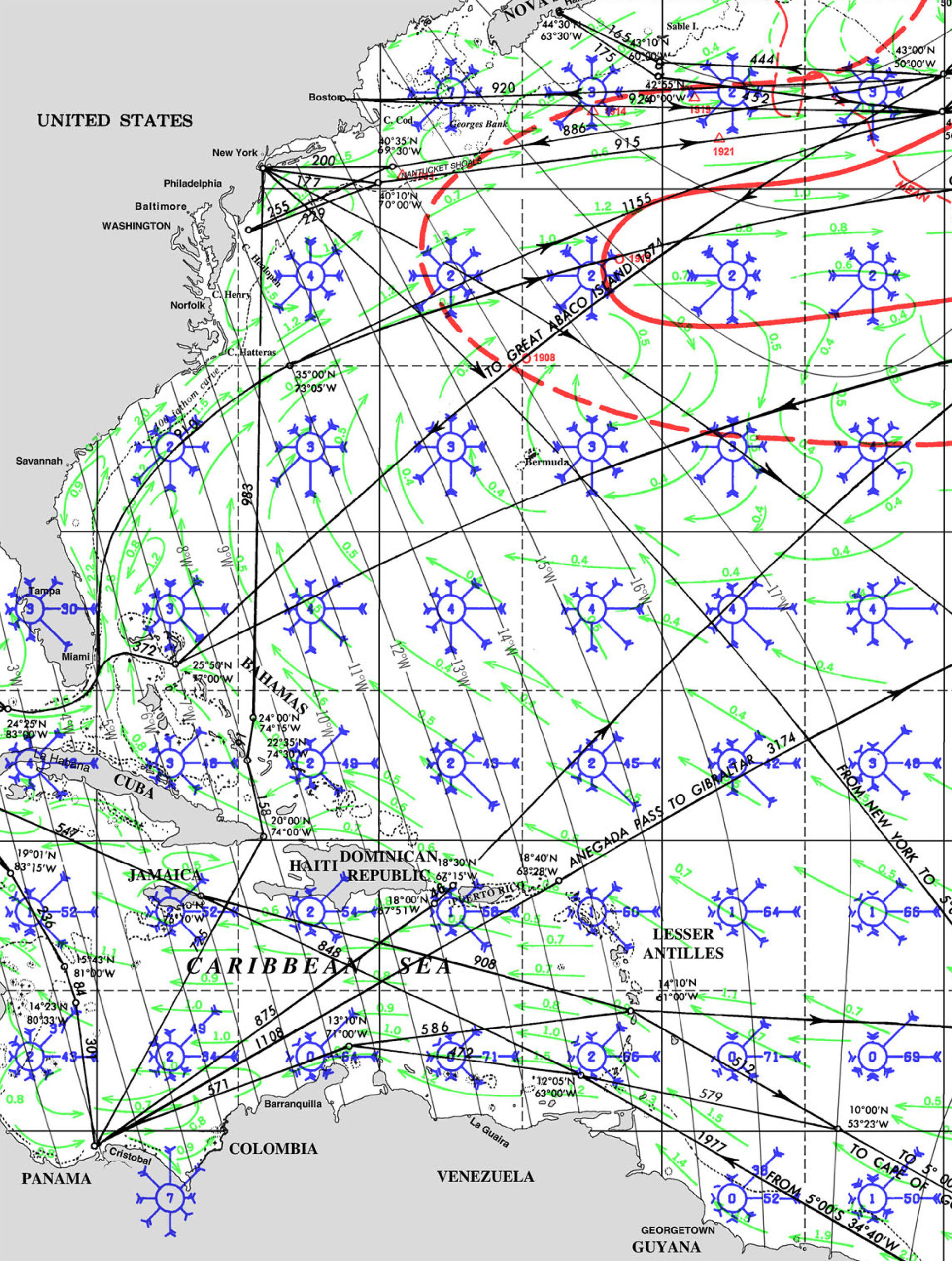


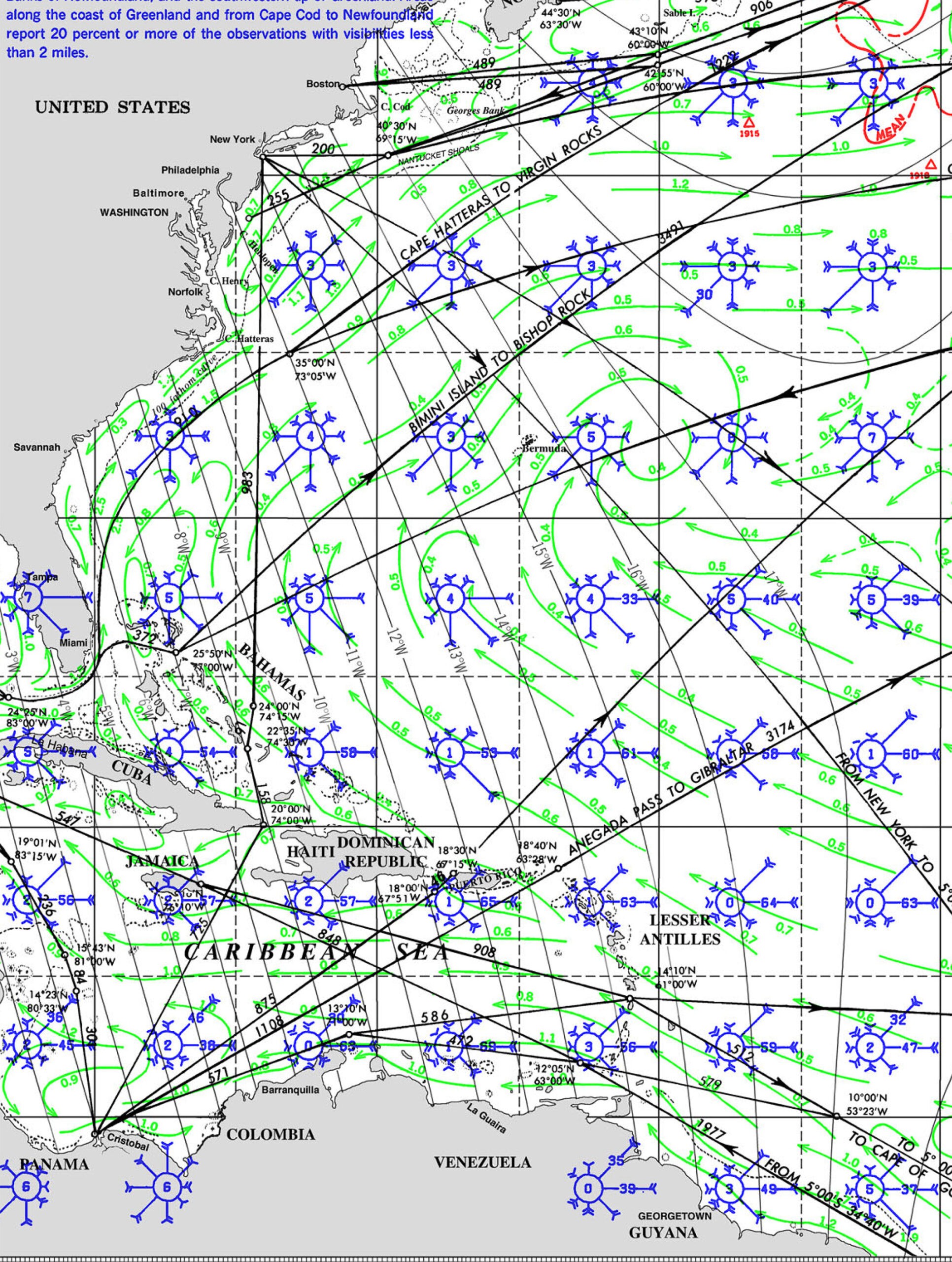


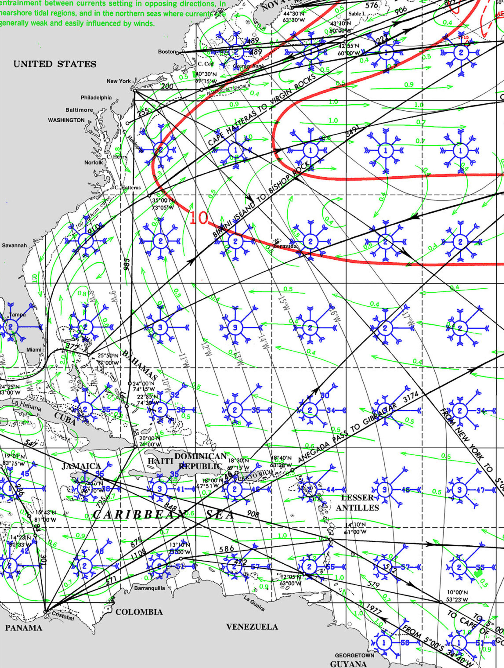
WIND
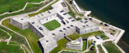
🇺🇸 CASTILLO SAN MARCOS, St Augustine Florida
The Castillo de San Marcos is the oldest masonry fort in the continental United Statesand is located on the western shore of Matanzas Bay in the city of St. Augustine, Florida. The Castillo was designed by the Spanish engineer Ignacio Daza and construction begn in 1672, 107 years after the city’s founding by Spanish Admiral and conquistador Pedro Menéndez de Avilés, when Florida was part of the Spanish Empire.

Castillo de San Marcos was for many years the northernmost outpost of Spain’s vast New World empire. It is the oldest masonry fort and the best-preserved ex-ample of a Spanish colonial fortification in the continental United States. It anchored East Florida’s defenses, which extended northward to the St. Marys River, westward to the St. Johns, and southward to Fort Matanzas. It protected St. Augustine from pirate raids and from Spain’s major rival, Great Britain, during a time when the Florida-Georgia-Carolina coastline was an explosive international battleground.
![When Britain gained control of Florida in 1763 pursuant to the Treaty of Paris, St. Augustine became the capital of British East Florida, and the fort was renamed Fort St. Mark[8] until the Peace of Paris (1783) when Florida was transferred back to Spain and the fort's original name restored. In 1819, Spain signed the Adams–Onís Treaty which ceded Florida to the United States in 1821; consequently, the fort was designated a United States Army base and renamed Fort Marion, in honor of American Revolutionary War hero Francis Marion. The fort was declared a National Monument in 1924, and after 251 years of continuous military possession, was deactivated in 1933. The 20.48-acre (8.29 ha) site was subsequently turned over to the United States National Park Service. In 1942 the original name, Castillo de San Marcos, was restored by an Act of Congress.](https://oceanposse.s3.us-east-2.amazonaws.com/wp-content/uploads/2021/05/castillossanmarcos-1024x637.jpg)
The roots of the Castillo’s history reach back to the years just after Christopher Columbus’s final transatlantic voyage, when conquistadors carved out a vast and wealthy overseas empire for Spain, first in the Caribbean and then on the mainlands of Mexico, Central America, Colombia, Venezuela, and Peru. Products of these tropical and mountainous territories brought high prices on the Continent, and Spanish galleons sailed home laden with exotic dyes, sugar, tobacco, chocolate, pearls, hardwoods, and silver and gold. These so-called “treasure fleets” made Spain the most powerful and envied nation in Renaissance Europe.

Thanks to the travels of Ponce de Leon in 1513, Spanish navigators knew that the best return route from Spain’s rich Caribbean possessions was along the Gulf Stream, through the Bahama Channel, and past the shores of Florida. The Spanish knew they must defend this peninsula to prevent enemies from using its harbors as havens from which to raid the passing treasure fleets.

In 1513 Spain claimed Florida through the expedition of Ponce de Leon, but France gained the first foothold there by establishing Fort Caroline on the St. Johns River in 1564. Seeing this as both a challenge to Spain’s claims and a menace to the treasure fleets, King Philip II sent an expedition under Don Pedro Menendez de Aviles to eliminate the French threat and establish settlements in Florida. It arrived at the mouth of the St. Johns River in September 1565.
After attempting unsuccessfully to board the French ships anchored there, Menendez sailed to a harbor farther south and established St. Augustine as a base for further operations. Almost immediately a French fleet sailed south to attack. But the ships were driven southward and wrecked by a violent storm and the mission failed. Realizing that Fort Caroline would be lightly guarded, the Spaniards marched north, captured the fort, and executed most of the inhabitants.

The same fate befell survivors from the French fleet, whom the Spaniards captured and killed at an inlet 14 miles south of St. Augustine. The episode gave a name to the area: Matanzas, Spanish for “slaughters.”

England became Spain’s next contender for Florida. The Spanish had watched the English warily ever since Sir Francis Drake attacked and burned St. Augustine in 1586. They became even more watchful after English-men settled Jamestown in 1607. British pirates sacked St. Augustine again in 1668, and this hit-and-run attack, followed by the English settlement of Charleston in 1670, caused Spain to build the Castillo de San Marcos.


Begun in 1672 and completed by 1695, the Castillo replaced nine successive wooden fortifications that had protected St. Augustine since its founding. The fort’s commanding location on the west bank of Matanzas Bay allowed its guns to protect not only the harbor entrance but the ground to the north against a land attack.

The Castillo’s baptism of fire came in 1702 during the War of the Spanish Succession, when the English occupied St. Augustine and unsuccessfully besieged the fort for 50 days. The English burned the town before they left, but the Castillo emerged unscathed, thereby making it a symbolic link between the old St. Augustine of 1565 and the new city that rose from the ashes.

When Britain gained control of Florida in 1763 pursuant to the Treaty of Paris, St. Augustine became the capital of British East Florida, and the fort was renamed Fort St. Mark[8] until the Peace of Paris (1783) when Florida was transferred back to Spain and the fort’s original name restored. In 1819, Spain signed the Adams–Onís Treaty which ceded Florida to the United States in 1821; consequently, the fort was designated a United States Army base and renamed Fort Marion, in honor of American Revolutionary War hero Francis Marion. The fort was declared a National Monument in 1924, and after 251 years of continuous military possession, was deactivated in 1933. The 20.48-acre (8.29 ha) site was subsequently turned over to the United States National Park Service. In 1942 the original name, Castillo de San Marcos, was restored by an Act of Congress.

Castillo SAN MARCOS Timeline
- 1513 Sailing from Puerto Rico, Spanish claim Florida.
- 1565 Spanish found St. Augustine and destroy French at Fort Caroline and Matanzas Inlet.
- 1672 Ground is broken on October 2 for Castillo de San Marcos.
- 1695 Castillo de San Marcos (curtain walls, bastions, living quarters, moat, ravelin, and sea-wall) is finished in August.
- 1702 War of the Spanish Succession pits Spain and France against Austria, Great Britain, and others. Coastal Georgia missions are destroyed by Carolinians en route to St. Augustine. Carolinians occupy and burn St. Augustine but the Castillo successfully resists their siege.
- 1738 Spanish governor at St. Augustine grants freedom to runaway British slaves. Black families settle at new town called Fort Mose.
- 1740 St. Augustine successfully endures siege by British, Georgian, and South Carolinian forces. Spanish attack and de-feat British Highland troops camped at Fort Mose.
- 1740-42 Fort Matanzas is built to block southern approach to St. Augustine.
- 1756-62 Fort Mose re-built in masonry. Earth-works at Mose extended to complete northern-most defense.
- 1763 Peace of Paris gives Florida to Great Britain in exchange for La Habana. Castillo becomes known as Fort St. Mark.
- 1783 Peace of Paris recognizes independence of the United States and returns Florida to Spain.
- 1821 Spain cedes Florida to the United States.
- 1825 Castillo de San Marcos renamed Fort Marion.
- 1924 Fort Marion and Fort Matanzas are proclaimed national monuments
- 1933 Transferred to the National Parks Service
- 1942 Original name Castillo San Marcos is restored
GET THERE BY YACHT
⚠️ Safety situation: south central Caribbean
If you are planning to transit the Caribbean between Panama and the eastern Caribbean this year please contact rob on Avant. This includes passages to or from Panama to the DR, Jamaica, and Puerto Rico. The posse has established an informal reporting regime with the US SOUTHCOM command to report our members on innocent passage through these waters and will proactively report your vessel’s float plan and details to the US Military to lessen the chance of bad things happening.
There are now increased live fire exercises by several different nations going on in the region, and not all are reported to notices to mariners. The possibility of gps disruption in the region is high. Search and rescue services may be disrupted. A high degree of caution is advised.
Background
As you are doubt seen in the news, there has been a significant escalation of the tension between the USA and Venezuela in the south-central Caribbean. SOUTHCOM, the US regional military command has sunk at least 6 alleged Venezuelan drug running boats, has deployed an increased ground, naval and Air Force in the region, and has significantly increased its presence in the region. The forces now appear right for a significant military presence to combat drug activity in the region, but short of the force needed for an actual land based military operation.
Some updates include
Naval assets including: at least eight warships (destroyers, an amphibious assault ship, and a littoral combat ship), a nuclear attack submarine, and a special operations ship.
Air assets including including: F-35B Lightning II fighter jets: These were deployed by the Marine Corps.MQ-9 Reaper drones: These remotely piloted aircraft were armed with Hellfire missiles and deployed for more aggressive surveillance and interdiction missions. Based on the videos of Venezuelan drug boats being destroyed, it appears Reapers were used for this mission. B-52 bombers: Two of these conducted operations in the area in October 2025, further highlighting the heightened military posture. They were present with their transponders on, indicating a non-combat mission. Additional patrol and surveillance aircraft: The deployment included more P-8 Poseidon maritime patrol aircraft to improve reconnaissance capabilities.
Ground assets have increased significantly. Troop numbers are estimated at around 10,000, up from the 2024 deployments totaling about 4,000. While this is a large increase, it does not appear to be enough to support actual ground operations in the region (the 1989 invasion of Panama (population about 2.5M, area 29,000 sq mi) involved some 27,000 troops, Venezuela’s population is about 25-30M, area 340,000 sq mi).
New joint task force
On October 10, 2025, U.S. Southern Command (SOUTHCOM) announced the establishment of a new Joint Task Force (JTF) focused on counter-narcotics operations. This JTF operates under the II Marine Expeditionary Force (II MEF) and integrates its expeditionary capabilities with other Joint Force elements and U.S. interagency partners, including those from the Department of Homeland Security. Its primary mission is to synchronize and enhance efforts to combat drug cartels and narcotics trafficking across the Western Hemisphere, with a particular emphasis on the Caribbean Sea.
SOUTHCOM commander to retire
Adm. Alvin Holsey, the commander of U.S. Southern Command (SOUTHCOM), announced his retirement on October 16, 2025, effective December 12, 2025, after less than a year in the role since assuming command in November 2024. No official reason was provided in statements from Holsey, Defense Secretary Pete Hegseth, or the Pentagon, with announcements focusing on his 37 years of service and contributions to national defense.
However, multiple reports indicate the retirement stems from tensions with Hegseth over the ongoing U.S. military operations in the Caribbean, including strikes against alleged drug-trafficking vessels amid escalating actions tied to Venezuela. Sources familiar with the matter described Hegseth’s dissatisfaction with Holsey’s pace and aggressiveness in combating cartels, while Holsey and SOUTHCOM raised concerns about the legality of the operations. This friction reportedly culminated around the time the Pentagon shifted leadership of counter-narcotics efforts from SOUTHCOM to the II Marine Expeditionary Force on October 10, 2025—a move seen as sidelining the command.
Holsey’s successor has not yet been named.
Seasonality
While Venezuela is not subject to hurricanes, the bases that would be supplying any land action (Puerto Rico, and US Gulf and south Atlantic seaboard bases) are. It’s highly unlikely that any significant action will be taken before the end of the hurricane season.
Tides
Traditionally land invasions occur at new or full moons to take advantage of the tides. This is unlikely to be a factor in the south Caribbean as tides are small and of less effect. The invasion of Panama in 1989 took place on a 43% waxing moon. Updates and reassessments of the situation will be made available as possible.
SY AVANT 🇨🇦 Rob & Debra – Beneteau 43′

NOTE:
Marine War Risk Insurance
Standard marine insurance policies exclude war-related perils such as terrorism, piracy, and civil unrest. For vessels operating in volatile or politically unstable regions, a separate Marine War Risk Policy is required. This specialized coverage protects against physical damage to the vessel and cargo, as well as liabilities arising from events like armed conflict, hijacking, mines, or seizure by hostile forces.
SAVE THE DATE – MARINE INSURANCE SEMINAR – OCT 25
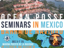
OCEAN POSSE KICK OFF 🇲🇽 BARRA DE NAVIDAD, MEXICO December 3-7 2025
WHEN: December 3-7 2025
WHERE: Barra de Navidad, MX at the Marina Puerto de la Navidad
RSVP PLEASE AND CONTACT THE MARINA DIRECTLY TO RESERVE A SLIP
Come meet the Ocean Posse Pacific fleet!
Learn from seasoned cruisers, swap sea stories, and toast to fair winds at the famous Barra Lagoon.
Workshops by day, tacos, tequila and rum by night , where sailors meet, laugh, and chart new horizons together.
COSTALEGRE: THE HAPPY COAST
The Costalegre (Spanish for “Happy Coast”) is a spectacular stretch of Mexico’s Pacific shoreline running between Puerto Vallarta in Jalisco and Manzanillo in Colima. Known for its rugged beauty and secluded coves, this 150-kilometer region is far less developed than its famous northern neighbor, offering a more intimate and unspoiled coastal experience. The area encompasses several distinct sections — including Chamela Bay, Costa Careyes, Playa Majahuitas, and Bahía de Tenacatita — each with its own character, from pristine beaches to dramatic cliffs and lush tropical hillsides.
Costalegre has long been a retreat for those seeking privacy and tranquility. Exclusive resorts and private estates are scattered along its coastline, particularly in Costa Careyes, where Mediterranean-style villas dot the hillsides. However, beyond the luxury enclaves, small fishing villages and traditional ranchos give the region an authentic Mexican charm. Local communities welcome travelers to explore local markets, sample fresh seafood, and experience regional hospitality.
The waters along Costalegre are inviting year-round, with opportunities for snorkeling, diving, kayaking, and sportfishing. Tenacatita Bay, often called the “crown jewel” of the coast, is especially popular among boaters for its calm anchorage and rich marine life. Inland, mangroves, estuaries, and lowland forests provide habitats for exotic birds and wildlife, making it a draw for eco-tourism.
For sailors and yacht cruisers, Costalegre offers a chain of natural anchorages, each with a distinct flavor, from the lively beach scene in La Manzanilla to the serene isolation of Playa Paraiso. The sailing season typically runs from November to May, when dry weather and steady breezes create ideal conditions.
With over 30 anchorages the Costalegre is the Ocean Posse playground. The water is usually warm and pleasant with gentle dinghy beach landings, Some of these remote anchorages are solitary with the exception of Tenecatitia which at the height of the cruising season will have up to 50 yachts at anchor.
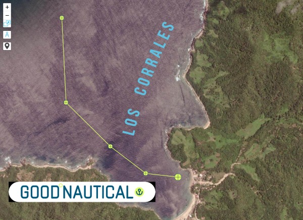 |
⚓ Los Corrales @ 20 246 N 105° 40 W –
(exposed to N – NW & W Swell )
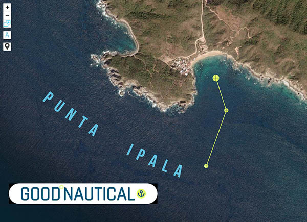 |
⚓ Punta Ipala @ 20° 14.2132′ N 105° 34.4000′ W
(exposed to W – SW – S Swell )
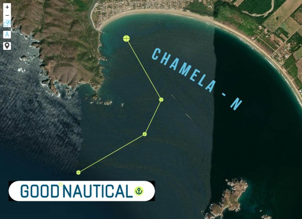 |
⚓ Chamela – N @ 19° 35.0317′ N 105° 07.8500′ W
(exposed to SW Swell )
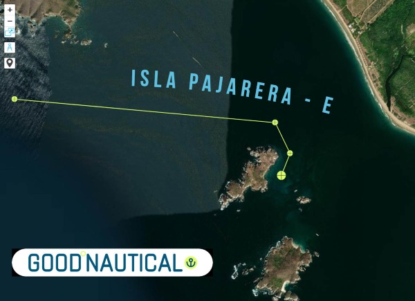 |
Isla Pajarera – E @ 19° 33.5505′ N 105° 06.6070′ W
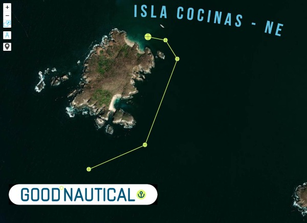 |
Isla Cocinas – NE @ 19° 33.1496′ N 105° 06.3817′ W
 |
Isla Nerita @ 19° 31.4755′ N 105° 05.0901′ W
 |
Chamela – E Bay @ 19° 30.8433′ N 105° 04.8342′ W
 |
Isla Paraiso – E @ 19° 28.6147′ N 105° 03.7655′ W
 |
Cala Paraiso @ 19° 28.4782′ N 105° 03.5512′ W
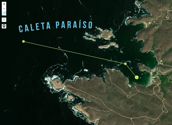 |
Caleta Paraíso @ 19° 28.3383′ N 105° 03.6213′ W
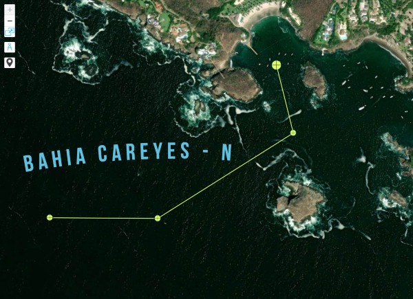 |
Bahia Careyes – N @ 19° 26.6418′ N 105° 02.1684′ W
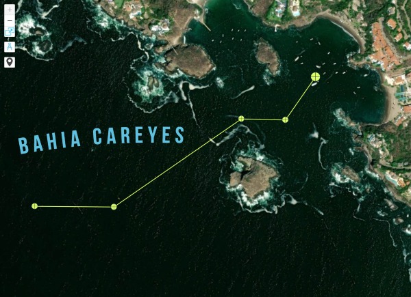 |
Bahia Careyes @ 19° 26.5847′ N 105° 02.0021′ W
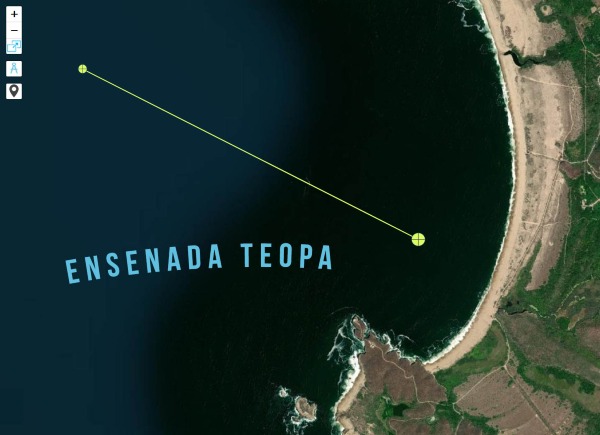 |
Ensenada Teopa @ 19° 23.9448′ N 105° 01.4672′ W
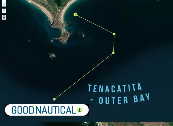 |
Tenacatita – Outer bay @ 19° 17.1346′ N 104° 52.0404′ W
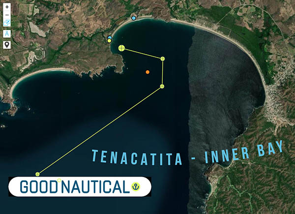 |
Tenacatita – Inner Bay @ 19° 17.8725′ N 104° 50.1806′ W
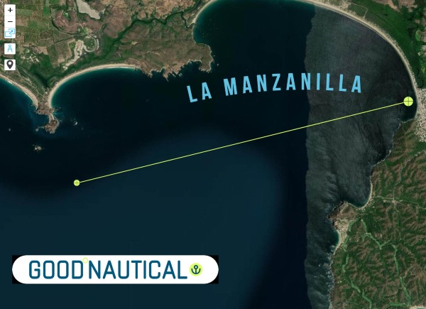 |
La Manzanilla @ 19° 16.8747′ N 104° 47.4327′ W
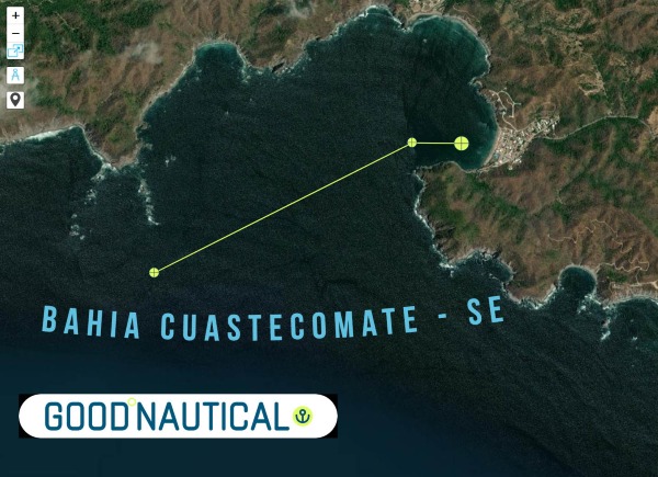 |
Bahia Cuastecomate – SE @ 19° 13.8132′ N 104° 43.8949′ W
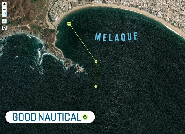 |
Melaque @ 19° 13.1810′ N 104° 42.5871′ W
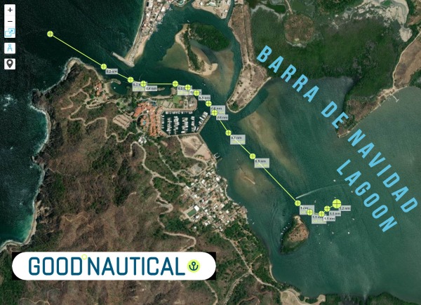 |
Barra de Navidad – Lagoon @ 19° 11.5084′ N 104° 40.3672′ W
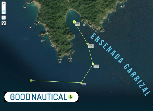 |
Ensenada Carrizal @ 19° 05.7860′ N 104° 26.2464′ W
 |
Higueras Cove @ 19° 06.2471′ N 104° 24.7503′ W
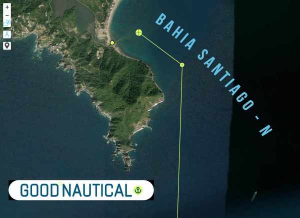 |
Bahia Santiago – N @ 19° 06.6530′ N 104° 23.4890′ W
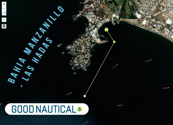 |
Bahia Manzanillo – Las Hadas @ 19° 06.0977′ N 104° 20.6284′ W
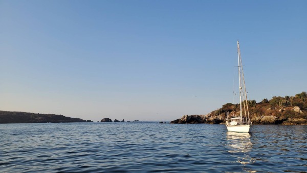 |
SY Seaglub anchored @ Costalegre
| SIGN UP FOR THE OCEAN POSSE |
WINDMILL HARBOUR MARINA 🇺🇸 HILTON HEAD USA SPONSORS THE OCEAN POSSE
32° 12.9616’N 080°46.8716′ W
Welcome to Windmill Harbour Marina, situated on the northwest coast of Hilton Head Island, South Carolina.
We are please to sponsor the Ocean Posse rally with a 20 cent x foot discount over published rates !

Harbourmaster
Login | Register for this info

We are located on the Intracoastal Waterway, just ½ mile south of the Pinckney Island Bridge at mile marker 558, 500 yards south of channel marker 27, and ½ mile north of channel marker 29 in the Calibogue Sound. The marina’s 15.5 acre harbour boasts 258 Hilton Head boat slips, offering many for rent or sale. Transient dockage is available. Our remarkable harbour offers a safe, tide free haven protected by a lock system directly off the Intracoastal Waterway. The Windmill Harbour Marina lock is 75′ long by 19′ wide. Hours of operation are 0800 to 1900 by harbour master or 24 hours by yachtsmen with a keycard. We monitor channel 14 VHF. Our phone number is 843-681-9235 and our email is windmillharbourmaster@gmail.com.
CONTACT
Login | Register for this info

AMENITIES
• High Speed Fueling
• Ships’ store
• Pump out facility
• Easy access to Hilton Head and Savannah Airports
• Harbor side restrooms and showers
• Current and tide free docking
• Constant 8′ depth
• 258 slips from 25′ to 70′
• 19′ wide access
• 15.5 acre harbour
• Direct access to Intracoastal Waterway and Calibogue Sound
• 24 hr security
• Yacht sales and brokerage
• Transients welcome
• Pet Friendly neighborhood with dog park
• Boat slip sales and rentals
• Reasonable rates
• On-call maintenance includes boat cleaning, engine repair, electronics, and canvas
• Home of the elegant South Carolina Yacht Club with fine dining, swimming, tennis, sauna, hot tub, showers and locker room
• Close to supermarkets, restaurants, shopping, lodging, and golf

NEARBY
• Over 12 miles of public beaches
• 24 world famous golf courses designed by some of the preeminent architects such as Jack Nicklaus, Pete Dye, Robert Trent Jones, Arnold Palmer and many more
• Over 350 tennis courts in all three Grand Slam surfaces
• More than 250 restaurants
• A multitude of outdoor adventure options
• A superb selection of over 200 shopping opportunities
• Close proximity to Beaufort and Charleston, SC as well as Savannah, GA
• Hilton Head Regional Hospital

Marina SAFE APPROACH
RATES
TRANSIENT BOAT SLIP RATES
| BOAT LENGTH | NIGHTLY RATE |
|---|---|
| Under 50′ | $2.20 p/ft |
| 50′ and Over | $2.40 p/ft |
ELECTRIC POWER
| ELECTRIC POWER | DAILY | MONTHLY |
|---|---|---|
| 30 amp | $6.00 | $50.00 |
| 50 amp | $9.00 | $90.00 |

DOCK MAP

INTRODUCING Sinbad Maritime Services
Find Your Next Captain the Smarter Way with Sinbad
Hey Ocean Posse friends — ever needed a captain and heard the classic “I know a guy” ?
Yeah, we’ve all been there. Sometimes it works out great… other times, not so much.
That’s why we built Sinbad Maritime Services — a platform by cruisers, for cruisers We’re liveaboards ourselves and proud Ocean Posse members so we understand exactly what it means to trust someone with your vessel. Sinbad was created to make that process transparent, professional, and easy.
Through our web app, you can search verified captains for everything from private sailing lessons, Sea Trials , and haul-outs to full-season vessel management in the Bahamas. Need a delivery captain to move your boat for a sale or a weather window? Sinbad’s got you covered.
Each captain profile lists their experience, rates, reviews, and insurance status so you’ll know exactly who’s at the wheel — no guesswork, no “mystery skippers.” You’ll also … more >>
OCEAN POSSE SPONSORS
- ABERNATHY – PANAMA
- BELIZE TOURISM BOARD
- BOAT HOW TO
- CABRALES BOAT YARD
- CENTENARIO CONSULTING – PANAMA CANAL
- CHRIS PARKER – MARINE WEATHER CENTER
- DELTA MIKE MARINE SUPPLY PANAMA
- DIGITAL YACHT
- DOWNWIND MARINE
- EL JOBO DIST. COSTA RICA
- FLOR DE CAÑA
- HAKIM MARINA AND BOAT YARD
- HERTZ RENTAL CARS MEXICO
- HOME DEPOT PRO MEXICO
- LATITUDES AND ATTITUDES
- MARINA PAPAGAYO
- NOVAMAR YACHT INSURANCE
- PANAMA YACHT BROKER
- PREDICT WIND
- SAFE HARBOR SOUTH BAY MARINA EVENT CENTER
- SAN DIEGO MARINE EXCHANGE
- SAFETY ONBOARD COSTA RICA
- SEVENSTAR YACHT TRANSPORT
- SHAFT SHARK
- SINBAD MARINE SERVICES
- SUN POWERED YACHTS
- WESTMARINE PRO
- YACHT AGENTS GALAPAGOS
MEDIA PARTNERS
LATITUDES AND ATTITUDES
OUR 📻 New Media Partner: Dockside Live Radio
We’re pleased to welcome Dockside Live Radio as an official media partner of the Ocean Posse Fleet.
Led by lifelong boater Brian Burns, Dockside Live brings music, stories, and conversations from the waterfront directly to the airwaves. Brian grew up on the lakes of Wisconsin and later sailed a 28’ O’Day before dedicating himself fully to radio. His program reaches boaters across the U.S. and beyond — with the motto:
“Where the music meets the water…”
Stay tuned — LISTEN at DockSideLive.com or download from your favorite App Store.
📡 Dockside Live Radio >>>
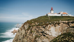
CAPE ROCA LIGHTHOUSE 🇵🇹 PORTUGAL 38° 46.915′ N 009°29.8366′ W
‘My Life’s Dream Took Me To Sea’
My Life’s Dream Took Me To Sea” by Ronald Epner MD is a captivating and enriching narrative that transcends the boundaries of a typical sailing memoir. The book masterfully weaves together the author’s personal journey, practical insights, and the universal themes of self-discovery and the pursuit of dreams.”
– Bookmark Alliance Review

OCEAN POSSE FLEET 🛰️ TRACKING
SPONSORED BY PREDICT WIND
MARINA SPONSORS
🇦🇺 AUSTRALIA
🇧🇸 BAHAMAS
-
 Browns Marina
 -
 Elizabeth on the Bay Marina
 -
 Blue Marlin Cove Resort & Marina
 - Great Harbour Cay Marina
-
 Romora Bay Resort and Marina
🇧🇿 BELIZE
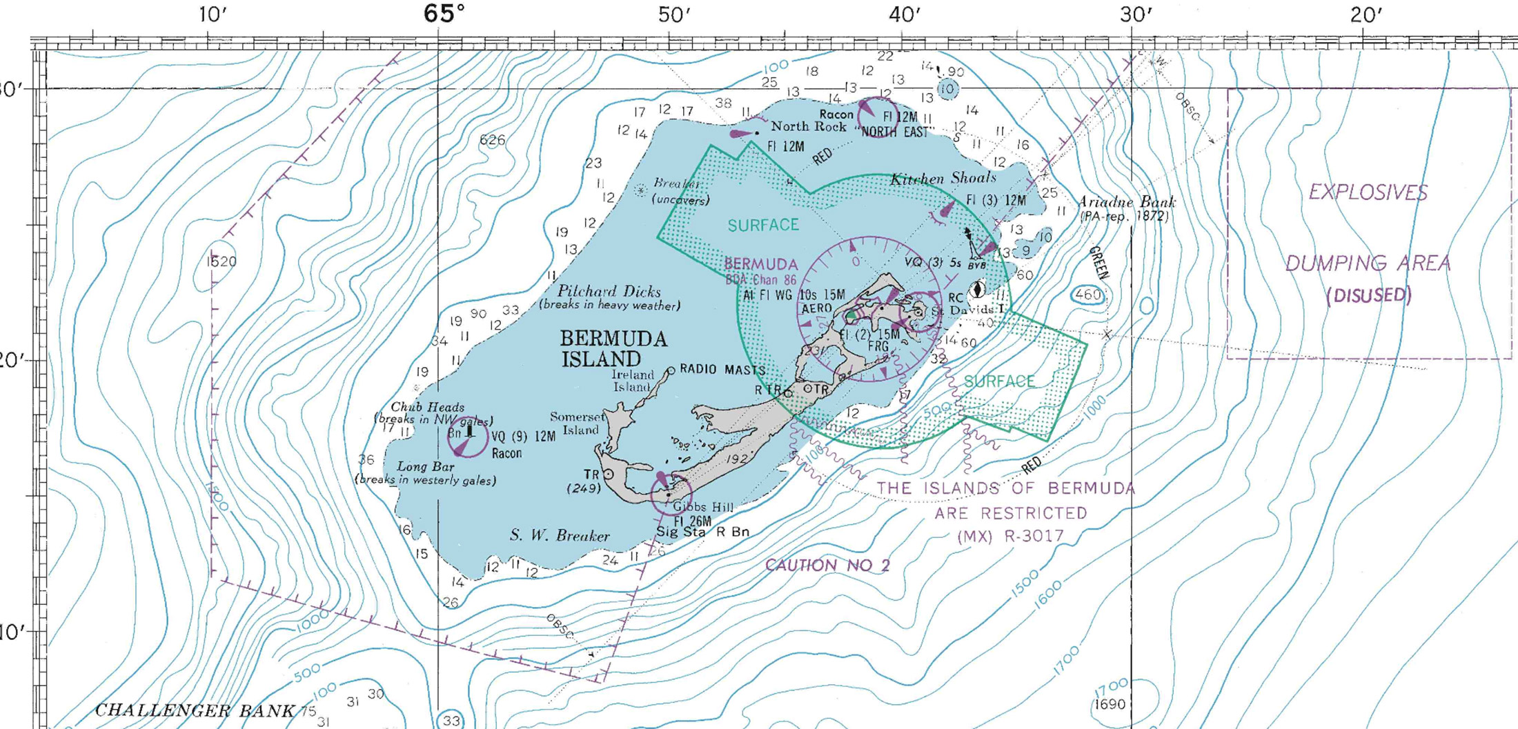
🇧🇲 BERMUDA
🇧🇷 BRAZIL
🇻🇬 BRITISH VIRGIN ISLANDS
🇨🇻 CAPE VERDE
🇰🇾 CAYMAN ISLANDS
🇨🇱 CHILE
🇨🇴 COLOMBIA – Caribbean
-
 Club Nautico Cartagena
 -
 Club de Pesca Marina Cartagena
 -
 Marina Puerto Velero
 -
 IGY Marina Santa Marta
  Manzanillo Marina Club
🇨🇷 COSTA RICA – Pacific Coast
🇨🇺 CUBA
🇩🇲 DOMINICA
🇩🇴 DOMINICAN REPUBLIC
🇪🇨 ECUADOR
🇸🇻 EL SALVADOR
🇬🇮 GIBRALTAR
🇬🇩 GRENADA
🇬🇵 GUADELOUPE
🇬🇹 GUATEMALA – Pacific Coast
🇬🇹 GUATEMALA Rio Dulce
🇫🇯 FIJI
 Copra Shed Marina
 Nawi Island Marina
  Denarau Marina
-
 Musket Cove
  Royal Suva Yacht Club
 Sau Bay Moorings
🇭🇳 HONDURAS – Bay of Islands – Roatan
🇮🇹 ITALY
 Marina dei Presidi
  Marina di Balestrate
 Marina di Brindisi
 Marina di Cagliari
 Marina di Chiavari
 Marina di Forio
  Marina di Teulada
 -
 Marina di Policoro
 -
 Marina di Vieste
 -
 Marina de Procida
 -
 Marina de Villasimius
 - Marina di Vieste
-
 Marina Molo Vecchio
  Marina Salina
  Venezia Certosa Marina
🇯🇲 JAMAICA
🇲🇶 MARTINQUE
🇲🇽 MEXICO – Caribbean
- Marina Makax – Isla Mujeres
- Marina Puerto Aventuras
- Marina V&V – Quintana Roo
- Marina El Cid – Cancún
🇲🇽 MEXICO – Pacific Coast
- ECV Marina – Ensenada BC
- IGY Marina Cabo San Lucas BCS
- Marina Palmira Topolobampo – SI
- Marina y Club de Yates Isla Cortes – SI
- Marina el Cid – Mazatlan – SI
- Marina Vallarta, Puerto Vallarta – JA
- Marina Puerto de La Navidad – Barra de Navidad – CL
- Marina Ixtapa, Ixtapa – GE
- La Marina Acapulco, Acapulco – GE
- Vicente’s Moorings, Acapulco – GE
- Marina Chiapas – CS
🇳🇿 NEW ZEALAND
🇳🇮 NICARAGUA – Pacific Coast
🇳🇺 NIUE
🇵🇦 PANAMA – Pacific Coast
🇵🇦 PANAMA – Caribbean
- Shelter Bay Marina
- Bocas Marina
- Solarte Marina
- Linton Bay Marina /a>
- Turtle Cay Marina
- IGY Red Frog Marina
🇵🇹 PORTUGAL
🇵🇷 PUERTO RICO
🇱🇨 SAINT LUCIA
🇸🇽 SINT MAARTEN
🇪🇸 SPAIN
 Alcaidesa Marina
  IGY Málaga Marina
  Marina Del Odiel
  Nautica Tarragona
  Puerto Sotogrande
 Yacht Port Cartagena
🇰🇳 ST KITTS & NEVIS
🇹🇳 TUNISIA
🇹🇴 TONGA
🇹🇨 TURCS AND CAICOS
🇻🇮 US VIRGIN ISLANDS
🇺🇸 USA – East Coast
- Safe Harbor – Marathon, FL
- Pier 66 Hotel & Marina – Ft. Lauderdale, FL
- Titusville Marina – FL
- Port 32 Marina Jacksonville – FL
- Oasis Marinas at Fernandina Harbor Marina – FL
- Morningstar Marinas Golden Isles St. Simons Isl. – GA
- Windmill Harbour Marina – Hilton Head , SC
- Coffee Bluff Marina – Savannah GA
- Hazzard Marine – Gerogetown, NC
- Holden Beach – Town Dock, NC
- Tideawater Yacht Marina, Portsmouth, VA
- Ocean Yacht Marina, Portsmouth, VA
- York River Yacht Haven – VA
- Yorktown Riverwalk Landing – VA
- Regatta Point Marina – Deltaville, VA
- Regent Point Marina – Topping, VA
🇺🇸 USA – Pacific Coast
- Safe Harbor Ventura Isle, Ventura CA
- Vintage Marina , Oxnard, CA
- Safe Harbor South Bay – Chula Vista, CA
🇻🇺 VANUATU
Loggerhead at Inlet Harbor Marina
OCEAN POSSE PANAMA 🇵🇦 CANAL AGENTS
info@centenarioconsulting.com
www.centenarioconsulting.com
Cellphone +507 6676-1376
WhatsApp +507 6676-1376
OCEAN POSSE MERCHANDISE | MADE TO ORDER ONLY
Extraordinary Cruising °°° Join the Fleet
- Access vetted local knowledge, safety resources, and prior experiences to make your passage safer and more enjoyable.
- Unlock a Life of Adventure
Explore hidden destinations, experience new cultures, and discover the freedom of life at sea or near shore – on your terms. - Get VIP Perks & Discounts at marinas, chandleries and boatyards
Get exclusive discounts, priority access, and personalized support at partner marinas across the globe. - Observe the actions of Experienced Captains
Tap into a wealth of tips, tools, and real-world know-how from seasoned mariners to grow your skills and gain confidence. - Make Every Nautical Mile Memorable
Join events, meetups, and shared journeys that turn you voyages into unforgettable stories and lasting memories. - Cruise with a Conscience
Gain insights into sustainable practices and join a movement that protects the waters you love to explore.

FLEET UPDATE 2025-10-12
I have just three things to teach: simplicity, patience, compassion. These three are your greatest treasures.
CRUISING ° FLEET UPDATE & NEWS ⚓ 2025-10-05
Pictures of the Week
Annapolis Boat Show Burgees
Burgees in Barcelona, Panama & Annapolis
ECV Marina 🇲🇽 Mexico Sponsors the Ocean Posse
Ensenada to Barra De Navidad Mexico in 30 Days
The Baja Run South Bound
Tequila 🇲🇽 Jalisco – Mexico
Reminder 4 Days of Cruising Seminars 🇺🇸 San Diego Oct 14 – 17 2025
Save the Date – Marine Insurance Seminar – Oct 25
Ocean Posse Kick Off 🇲🇽 Barra De Navidad, Mexico December 3-7 2025
Caroline Bay Marina 🇧🇲 Bermuda Sponsors the Ocean Posse
Sun Powered Yachts ☀️⛵ Sponsors the Ocean Posse
Media Partners Latitudes and Attitudes
Our 📻 New Media Partner: Dockside Live Radio
Ocean Posse Fleet 🛰️ Tracking Sponsored by Predict Wind
Ocean Posse Panama 🇵🇦 Canal Agents
Extraordinary Cruising °°° Join the Fleet
PICTURES OF THE WEEK
Passing the top of Curacao now.
Harvest Moonrise on passage
Last night it was so uncomfortable the old posse burgee abandoned ship. Short steep little f-ers kept us continually pitching and slamming since about 1600. And we wound up with lots of adverse current even though we went way up north. Saw sog in 5’s for hours and hours. Fun factor has gone way way down.
Welcome sunrise over the Windward Islands. 38 miles to go.
MY TIDINGS OF JOY 🇺🇸 Jeff & Joy – DeFever 52′
ANNAPOLIS BOAT SHOW BURGEES
BURGEES IN PANAMA
BURGEES IN BARCELONA
Hand deliverd in Barcelona to Delta Swizzler prior to their 40th anniversary Mediterranean cruise
ECV MARINA 🇲🇽 MEXICO SPONSORS THE OCEAN POSSE
31° 51.2766′ N 116° 37.2433′ W
We are pleased to welcome the Participants of the Ocean Posse to Ensenada, BC Mexico
As a special welcome rate we offer 2 nights and one free !
In the minimum stay of 2 nights, you get 1 extra night for free + special DAILY rate for the participants with boats with a length up to 65 ft: $2.10 USD per foot of the vessel + tax +free assistance to clear in and out of Mexico, immigration and to get the Temporary Importation Permit as long as they present all the documents as required by the port authorities.
CONTACT
FACILITIES
- 191 slips from 36′ to 68′.
- 6 end ties from 83′ to 135′.
- A 510′ mega yacht area for oversized vessels and charters, making it the only Marina in Ensenada with an area with this capacity.
- Double breakwater protection, ensuring the calmest marina in the Ensenada area.
- Concrete Bellingham Marine built docks.
- Launch ramp with easy access for boats up to 33′.
- Dock boxes with electricity and water (not safe for drinking) connections per slip.
- Electrical capacity (30, 50 amp).
- Single- and three-phase connection in end ties and megayachts areas.
AMENITIES
- Walking distance to a variety of shops, restaurants and downtown
- Friendly environment
- Active liveaboard community
- Restrooms and showers
- BBQ area
- Bicycle racks
- Courtesy dock carts
- Workout area
- Free complementary WiFi
- Pet friendly
SERVICES
- Free assistance for the arrival, departure, immigration, and TIP procedures with the Port Authorities and Customs
- 24 hour security with cameras and security personnel
- Controlled access to facilities
- Gated parking lot
- Dock master´s office open 7 days a week
- Pump out service right on your slip
- Garbage collection
- Hazardous materials collection
Ensenada Cruiseport Village MARINA MEXICO 🇲🇽 SAFE APPROACH
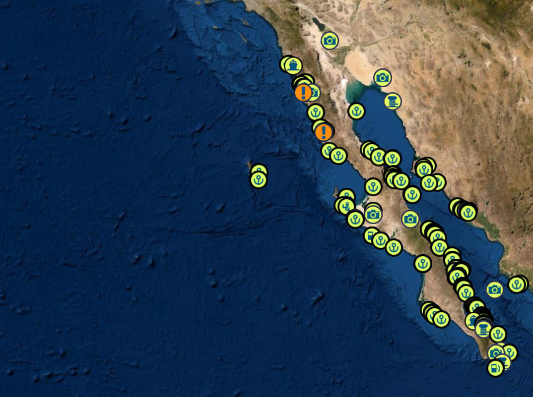
ENSENADA TO BARRA DE NAVIDAD MEXICO IN 30 DAYS
THE BAJA PENINSULA TO BARRA DE NAVIDAD
PLENTY OF ANCHORAGES AND ONE OVERNIGHT SAIL
DANGERS
FOG – KELP – REEFS – SMALL PANGAS – EXPENSIVE FUEL IN TURTLE BAY – WHALES – STRONG NW WINDS
BAJA RUN SOUTH BOUND
|
|
|
① Start at Cruiseport Village Marina Ensenada and do your Mexico check ins 31° 51.2766′ N 116° 37.2433′ W |
|
|
|
|
|
Once you have made it out of Ensenada without dropping to much cash at Hussong’s Cantina |
|
|
|
|
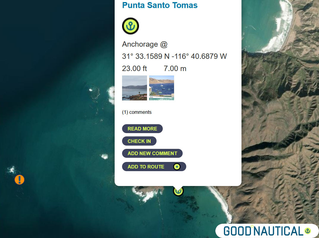
② head for Punta Santo Tomas at 31° 33.1589 N |
|
|
|
|
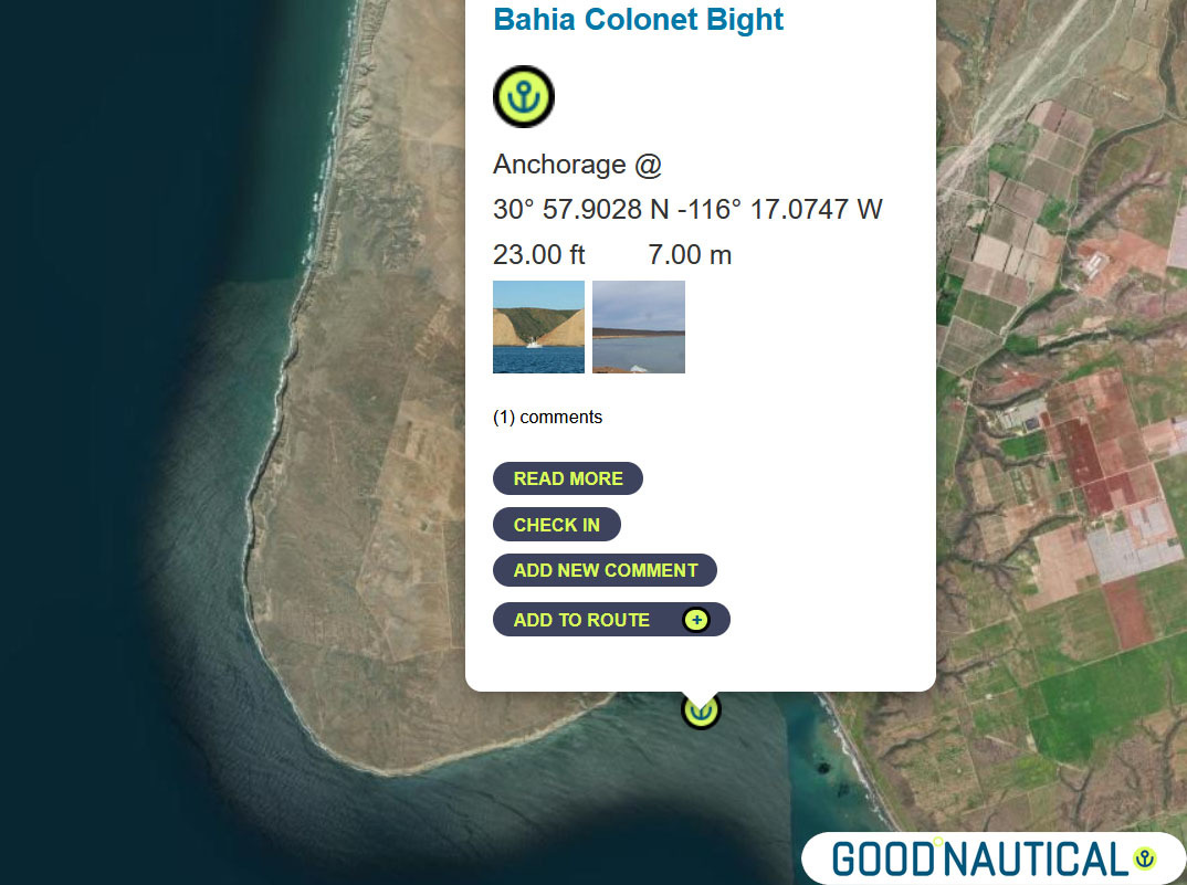
③ The next jump is either 40 nm to Bahia Colonet Bight 30° 57.9028 N 116° 17.0747 W – details at https://goodnautical.com/mexico-pacific/anchorage/bahia-colonet-bight |
|
|
|
|
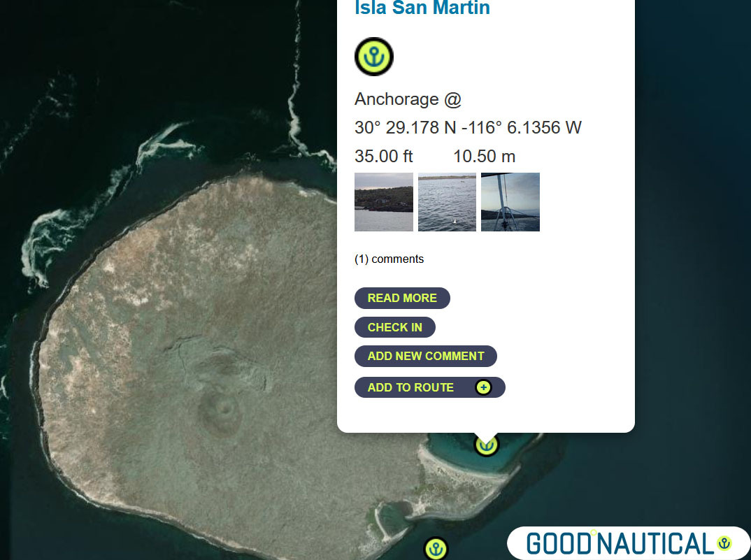
④ Or an extra 30nm Isla San Martin North bay 30° 29.178 N -116° 6.1356 W or South Anchorage depending on swell https://goodnautical.com/mexico-pacific/anchorage/isla-san-martin |
|
|
|
|
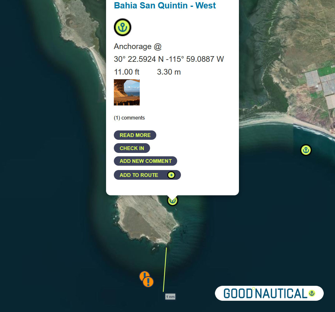
⑤For a more protective bay especially for those who wish to bash back up here is Bahia San Quintin https://goodnautical.com/mexico-pacific/anchorage/bahia-san-quintin-w and https://goodnautical.com/mexico-pacific/anchorage/bahia-san-quintin |
|
|
|
|
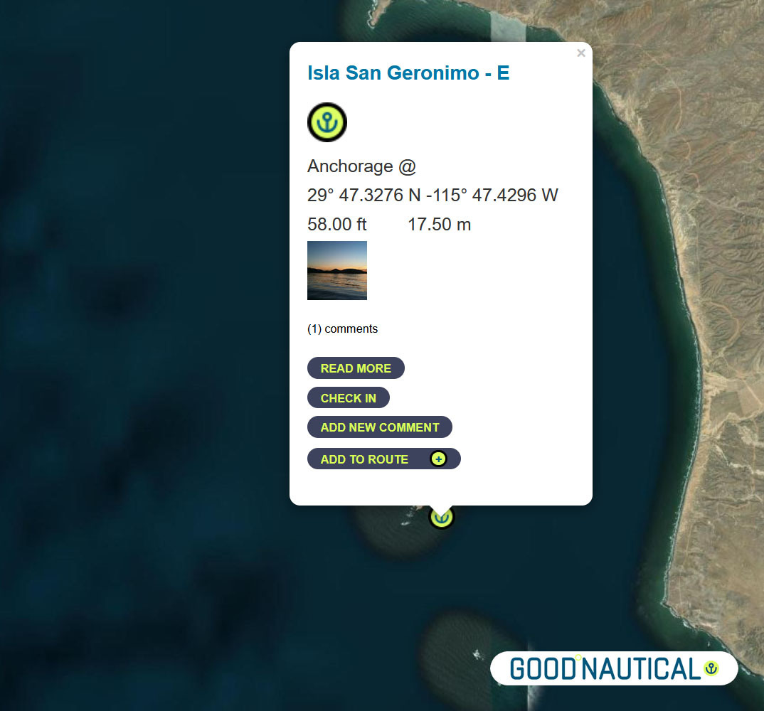
The ⑥ South of this – about 39 nm is a fair weather anchorage at 29° 47.3276 N 115° 47.4296 W behind ISLA SAN GERNOMIO – watch for 2 rocks south of it @ 29° 44.2191′ N 115° 46.2265′ W https://goodnautical.com/mexico-pacific/anchorage/isla-san-geronimo-e |
|
|
|
|
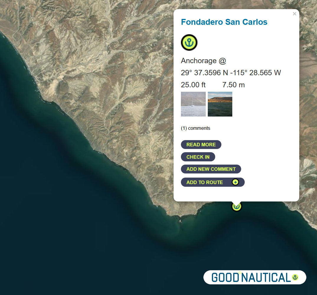
⑦ The next anchorage is a staple along the route FONDADERO SAN CARLOS Especially for those on a northbound track @ 29° 37.3596 N 115° 28.565 W This anchorage is 68 nm South of Sna Quintin – expect some kelp patches and shoaling on the northern bight https://goodnautical.com/mexico-pacific/anchorage/fondadero-san-carlos |
|
|
|
|
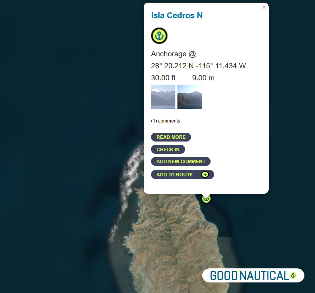
⑧ South ~ 80 nm across the bay of Sebastian Vizcaino is Isla Cedros N – aka the Cedros Island Yacht club anchorage at 28° 20.212 N -115° 11.434 W https://goodnautical.com/mexico-pacific/anchorage/isla-cedros-n Expect |
|
|
|
|
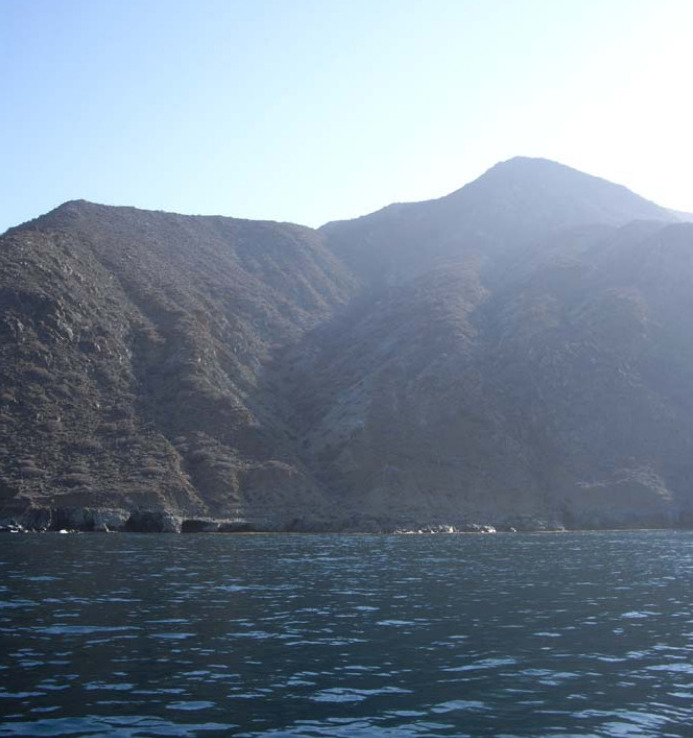
The east coast of Isla Cedros has several anchorages; the northern |
|
|
|
|
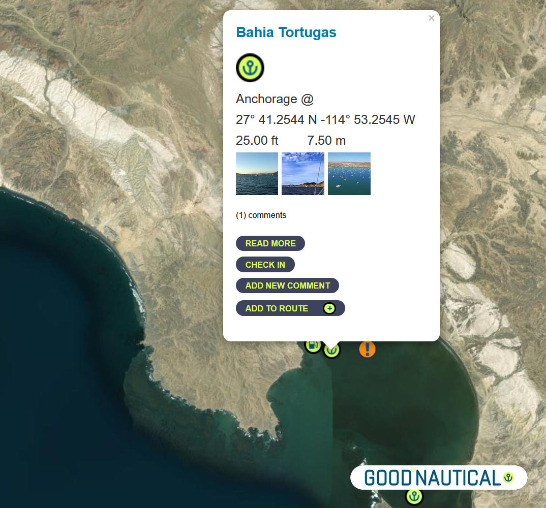
Bypassing a few anchorages on the East and South of Isla Cedros ~ ⑨50 nm south is Turtle Bay / Bahia Tortugas |
|
|
|
|
The locals will try to sell you fuel from pangas or via the fuel dock – |
|
|
|
|
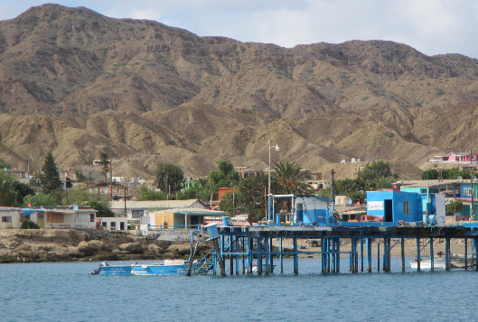
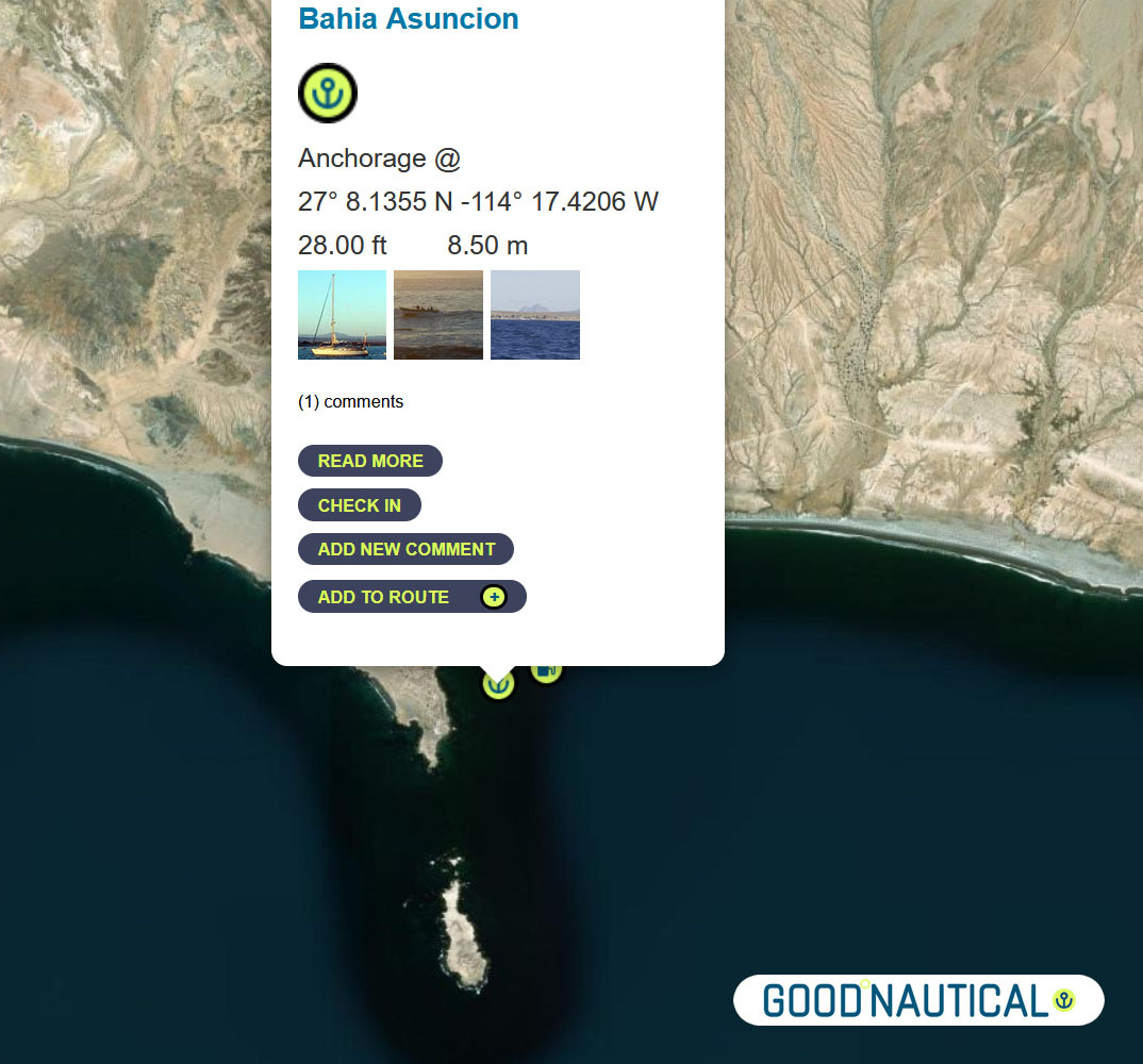
⑩ The next jump is about 50 nm to Bahia Asuncion 27° 08.1355 N 114° 17.4206 W https://goodnautical.com/mexico-pacific/anchorage/bahia-asuncion |
|
|
The |
|
|
|
|
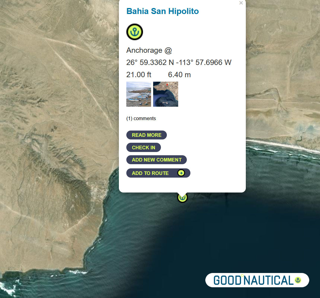
⑪Or push it another 24 nm to Bahia San Hipolito This
|
|
|
|
|
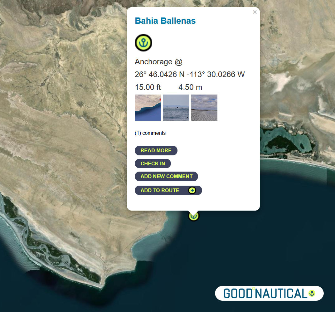
⑫A far more protected anchorage is 50 nm south of Bahia Asuncion or 105 nm south of Turtle bay is Bahia Ballenas @ 26° 46.0426 N -113° 30.0266 W https://goodnautical.com/mexico-pacific/anchorage/bahia-ballenas |
|
|
|
|
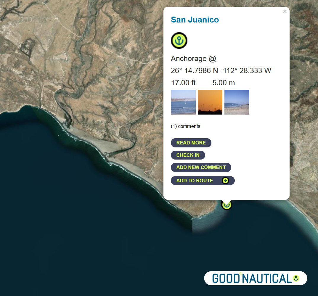
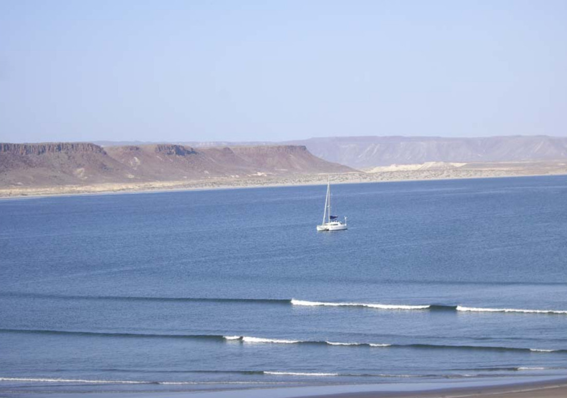
⑬ A prime spot along this coast is San Juanico / Scorpion Bay @ 26° 14.7986 N 112° 28.333 W about nm SE from Bahia Ballenas – with friendly locals and expats In |
|
|
|
|
|
|
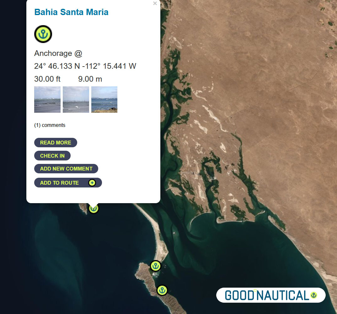
⑭Another 85 nm to Bahia Santa Maria |
|
|
|
|
Bahia Santa Maria |
|
|
|
|
There is no permanent settlement in Bahia Santa Maria but a dinghy ride up
into river channels at the north end of the bay reveals a cluster of fishing shacks with brightly colored pangas tied up along the bank. From November to May itinerant fishermen stay in the bay to fish for tuna, jacks and dorado. |
|
|
|
|
⑮The final jump an overnight sail to Cabo San Lucas ( WEEKEND MORNINGS ARE TOUGH IN CABO MANY FISHING VESSELS LEAVE A T THAT TIME SO TRY TO ARRIVE AFTER 9 AM ) ~ 185 nm with no real stops along the way – as soon as you round the |
|
|
Make a reservation at our sponsorshop Marina IGY Cabo San Lucas – with Jesus A. Esquitel VHF 16 & 88A Tel +52 (624) 173-9140 CSL@IGYMarinas.com www.igy-cabosanlucas.com |
|
|
|
|
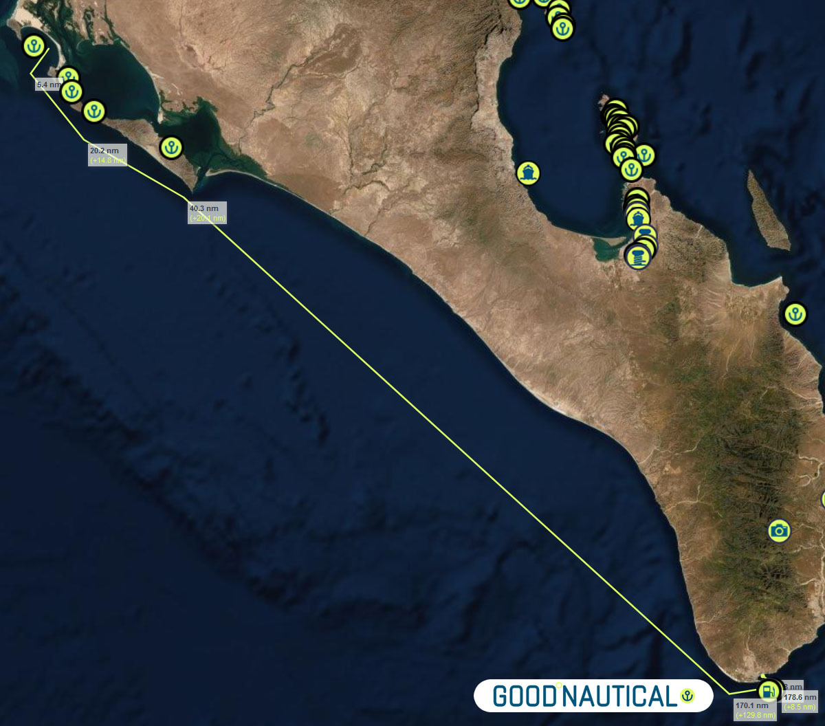
| ID | Location | Latitiude | Longitude | NM | |
| ⓪ | San Diego Police Dock | 32° 42.537′ N | 117° 14.10543′ W | – | ⛽💧 |
| ① | Ensenada Cruiseport Village Marina | 31° 51.2766′ N | 116° 37.2433′ W | 60.04 | ⛽💧 |
| ② | Punta Santo Tomas | 31° 33.1589 N | 116° 40.6879 W | 18.37 | |
| ③ | Bahia Colonet Bight | 30° 57.9028 N | 116° 17.0747 W | 40.65 | |
| ④ | Isla San Martin North Bay | 30° 29.178 N | 116° 6.1356 W | 30.24 | |
| ⑤ | Bahia San Quintin | 30° 22.5924′ N | 115° 59.0887′ W | 8.97 | |
| ⑥ | Isla San Gernomio | 29° 47.3276′ N | 115° 47.4296′ W | 36.71 | |
| ⑦ | Fondadero San Carlos | 29° 37.3596′ N | 115° 28.565′ W | 19.19 | |
| ⑧ | Isla Cedros N | 28° 20.212′ N | 115° 11.434′ W | 78.62 | |
| ⑨ | Turtle Bay / Bahia Tortugas | 27° 41.2544′ N | 114° 53.2545′ W | 42.16 | ⛽💧 |
| ⑩ | Bahia Asuncion | 27° 08.1355′ N | 114° 17.4206′ W | 45.95 | ⛽ 💧 |
| ⑪ | Bahia San Hipolito | 26° 59.3362′ N | 113° 57.6966′ W | 19.66 | |
| ⑫ | Bahia Ballenas | 26° 46.0426′ N | 113° 30.0266′ W | 28.05 | |
| ⑬ | San Juanico / Scorpion Bay | 26° 14.7986′ N | 112° 28.333′ W | 63.50 | |
| ⑭ | Bahia Santa Maria | 24° 46.133′ N | 112° 15.441′ W | 89.47 | |
| ⑮ | Cabo San Lucas East | 22° 53.304′ N | 109° 53.844′ W | 171.87 | ⛽💧 |
| ⑯ | Los Frailes | 23° 22.836′ N | 109° 25.297” W | 39.54 | |
| ⑰ | Isla de Pajaros | 23° 15.2645′ N | 106° 28.3305” W | 162.80 | |
| ⑱ | Isla Isabella Anchorage South | 21° 50.5266′ N | 105° 52.907” W | 90.87 | |
| ⑲ | San Blas Outer Anchorage | 21° 31.043′ N | 105° 14.566′ W | 40.64 | ⛽💧 |
| ⑳ | Punta de Mita | 20° 45.764′ N | 105° 31.15′ W | 47.88 | |
| ㉑ | Punta Ipala | 20° 14.2306′ N | 105° 34.4255′ W | 31.71 | |
| ㉒ | Chamela – N | 19° 35.0404′ N | 105° 7.8663′ W | 46.50 | |
| ㉓ | Isla Paraiso – E | 19° 28.6194′ N | 105° 3.7637′ W | 7.50 | |
| ㉔ | Tenacatita – Inner Bay | 19° 17.9207′ N | 104° 50.1528′ W | 16.72 | |
| ㉕ | Marina Puerto Navidad | 19° 11.7294′ N | 104° 40.8748′ W | 10.73 | ⛽💧 |
TEQUILA 🇲🇽JALISCO – MEXICO

The official town of Tequila – a 3 hour drive from the Coast – Museum Tasting and how it is produced barrels and Tequila Tastings. 
The 34,658 ha site, between the foothills of the Tequila Volcano and the deep valley of the Rio Grande River, is part of an expansive landscape of blue agave, shaped by the culture of the plant used since the 16th century to produce tequila spirit and for at least 2,000 years to make fermented drinks and cloth.

Within the landscape are working distilleries reflecting the growth in the international consumption of tequila in the 19th and 20th centuries. Today, the agave culture is seen as part of national identity. The area encloses a living, working landscape of blue agave fields and the urban settlements of Tequila, Arenal, and Amatitan with large distilleries where the agave ‘pineapple’ is fermented and distilled.


The property is also a testimony to the Teuchitlan cultures which shaped the Tequila area from AD 200-900, notably through the creation of terraces for agriculture, housing, temples, ceremonial mounds and ball courts.
Tequila is produced by removing the heart of the plant in its seventh to fourteenth year
Harvested piñas normally weigh 80–200 pounds This heart is stripped of its leaves and heated to convert the inulin to sugars.
True tequila is made from blue agave. The production of tequila is divided into seven steps: harvesting, cooking, fermentation, distillation, aging and bottling


Best to stay overnight and savor the offerings.

HOW TO MAKE TEQUILA ?
Making tequila (reposado) from scratch is a complex and labor-intensive process that requires specific ingredients, equipment, and adherence to legal regulations, especially if you want to produce it authentically in accordance with Mexican standards. Below is a simplified overview of the process:
Ingredients:
- Blue Weber Agave: The primary ingredient.
- Water: For fermentation.
- Yeast: For fermentation.
Equipment:
- Oven or Autoclave: For cooking the agave.
- Crusher or Mill: To extract the agave juice.
- Fermentation Tanks: For fermenting the agave juice.
- Distillation Equipment: For distilling the fermented juice.
- Oak Barrels: For aging the tequila to make it reposado.
Process:
1. Harvesting:
- Agave Plants: Harvest mature Blue Weber agave plants (usually around 7-10 years old). The heart of the agave, known as the piña, is used.
2. Cooking:
- Cook the Piñas: Cook the agave piñas in an oven or autoclave to convert the complex carbohydrates into fermentable sugars. This usually takes about 24-36 hours in a traditional brick oven or around 6 hours in an autoclave.
3. Extraction:
- Extract the Juice: Crush the cooked agave piñas to extract the sugary juice, called aguamiel.
4. Fermentation:
- Ferment the Juice: Transfer the agave juice to fermentation tanks. Add water and yeast to initiate fermentation. This process can take several days, during which the sugars are converted into alcohol.
5. Distillation:
- Distill the Fermented Juice: Distill the fermented juice twice. The first distillation, called “destrozamiento,” separates the alcohol from the solids. The second distillation, called “rectification,” refines the alcohol further.
6. Aging:
- Age the Tequila: Transfer the distilled tequila to oak barrels for aging. To be classified as reposado, the tequila must be aged for a minimum of two months but less than one year.
7. Bottling:
- Bottle the Tequila: Once the aging process is complete, the tequila is filtered, if necessary, and then bottled.
Legal Considerations:
- Regulations: If you want to label your product as tequila, you must comply with the regulations set by the Consejo Regulador del Tequila (CRT) in Mexico. This includes producing the tequila within designated regions of Mexico and adhering to specific production standards.
Notes:
- The quality of the final product depends significantly on the quality of the agave, the fermentation process, the distillation techniques, and the aging process.
- Making tequila at home for personal consumption is legal in some places, but commercial production requires appropriate licenses and adherence to local laws and regulations.
Additional Tips:
- Experimenting with different types of oak barrels can influence the flavor profile of your tequila reposado.
- Pay attention to the fermentation temperature, as it can affect the flavor and quality of the tequila.
This is a basic overview of making tequila reposado. For a more detailed and precise process, especially if you plan to produce commercially, consider consulting with experts and referring to official guidelines.

REMINDER 4 DAYS OF CRUISING SEMINARS 🇺🇸 SAN DIEGO Oct 14 – 17 2025
RESERVE YOUR SEAT TODAY >>
OCEAN POSSE KICK OFF EVENT 🇺🇸 4 DAYS | CRUISING SEMINARS SERIES
SAN DIEGO BAY @ SAFE HARBOR SOUTH BAY ° EVENT CENTER
$ 50 per person x day – FREE FOR OCEAN POSSE PARTICIPANTS
SCHEDULE:
Tuesday OCTOBER 14th , 2025 ● SEMINARS
10:00
Communications onboard, underway and on shore


11:00
The fundamentals of wires, connectors and fuses


12:00 – 14:00 WORKING LUNCH BREAK ORDER from UBER EATS ETC
13:00
Diesel Engines & Generators and preventative Maintenance


14:00
Rigging 101 Standing and Running

15:00
Weather Weather Weather – planning – routing – underway


16:00
Crew the good the bad and the ugly

17:00
Cruising down Pacific Mexico CHECKING IN AND OUT


WEDNESDAY OCTOBER 15th, 2025 ● SEMINARS
09:00
South Pacific – French Polynesia – Cook Islands – Tonga & Fiji


10:00
Safety Security and Emergencies outside the US and what to expect


11:00
Electrical Systems – Batteries, Chargers, Alternators, Solar Panels

12:00 – 14:00 LUNCH BREAK
14:00
Where and how to repair boats outside the US

15:00
The tropics – Refrigeration, AC, Shading, Airflow + other ways to stay cool

16:00
ANCHORING

17:00
Destination Costa Rica and Nicaragua


THURSDAY OCTOBER 16th, 2025
09:00
Destination Belize & Rio Dulce Guatemala


10:00 – 12.00 presented by rich boren
Water, Water Makers + Plumbing in Paradise


12:00 -14:00 LUNCH BREAK
14:00
Chart Accuracy, Navigation Trips and Tricks

15:00
Provisioning, Propane and Fuel – where to replenish

16:00
YACHT INSURANCE
17:00
Destination Colombia, Jamaica & Bay of Islands Honduras


FRIDAY OCTOBER 17th, 2025
10:00
Cruising in Panama + the Panama Canal


11:00
Open CPN – Satellite Charts – Use Cases and Satellite Chart creation


12:00 -14:00 LUNCH BREAK
14:00
OCEAN CROSSING PACIFC

15:00
SAFETY AND SECURITY

16:00
CREW – THE GOOD THE BAD AND THE UGLY

17:00 – 21:00
PPPPARTY RUM & MUSIC

RSVP HERE
Long term cruising is greatly enhanced by joining the Ocean Posse – share and learn from those who are underway.
SAVE THE DATE – MARINE INSURANCE SEMINAR – OCT 25
OCEAN POSSE KICK OFF 🇲🇽 BARRA DE NAVIDAD, MEXICO December 3-7 2025
WHEN: December 3-7 2025
WHERE: Barra de Navidad, MX at the Marina Puerto de la Navidad
RSVP PLEASE AND CONTACT THE MARINA DIRECTLY TO RESERVE A SLIP
CAROLINE BAY MARINA 🇧🇲 BERMUDA SPONSORS THE OCEAN POSSE
32° 16.215′ N 064° 51.6683′ W
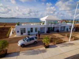
Caroline Bay Marina Bermuda is a Yes!! 50% off Daily rate !
We welcome the Ocean Posse
Kind Regards,
Login | Register for this info
Hours of Operation: 8am-4pm

Marina Amenities
-
30 super-yachts slips over 100ft in length
-
80 berths are available for smaller vessels and super-yacht tenders
-
Electricity with a wide array of power options up to 480V, 3Phase, 200AMPS
-
Water
-
Black water pump out
-
Dock Space for fueling via tanker
-
Dock support and dock coordination
-
Telecommunications
-
Customs Clearance and Immigration Assistance
-
Trash disposal
-
Provisioning
-
Berths for tenders
-
Long & Short Term Leases
-
Security
-
Water is included in dockage fees

SAFE APPROACH Caroline Bay Marina Bermuda

Sun Powered Yachts ☀️⛵ Sponsors the Ocean Posse
We are exited and pleased to sponsor the Ocean Posse with a special 10% discount off SunPower solar panel bundles.
Just use promocode Login for this info
at checkout www.sunpoweredyachts.com/shop and start enjoying clean & quiet solar aboard your boat.
We also offer free consultations so please email or call and let us help you go solar today.
OCEAN POSSE SPONSORS
- ABERNATHY – PANAMA
- BELIZE TOURISM BOARD
- BOAT HOW TO
- CABRALES BOAT YARD
- CENTENARIO CONSULTING – PANAMA CANAL
- CHRIS PARKER – MARINE WEATHER CENTER
- DELTA MIKE MARINE SUPPLY PANAMA
- DIGITAL YACHT
- DOWNWIND MARINE
- EL JOBO DIST. COSTA RICA
- FLOR DE CAÑA
- HAKIM MARINA AND BOAT YARD
- HERTZ RENTAL CARS MEXICO
- HOME DEPOT PRO MEXICO
- LATITUDES AND ATTITUDES
- MARINA PAPAGAYO
- NOVAMAR YACHT INSURANCE
- PANAMA YACHT BROKER
- PREDICT WIND
- SAFE HARBOR SOUTH BAY MARINA EVENT CENTER
- SAN DIEGO MARINE EXCHANGE
- SAFETY ONBOARD COSTA RICA
- SEVENSTAR YACHT TRANSPORT
- SHAFT SHARK
- SUN POWERED YACHTS
- WESTMARINE PRO
- YACHT AGENTS GALAPAGOS
MEDIA PARTNERS
LATITUDES AND ATTITUDES
OUR 📻 New Media Partner: Dockside Live Radio
We’re pleased to welcome Dockside Live Radio as an official media partner of the Ocean Posse Fleet.
Led by lifelong boater Brian Burns, Dockside Live brings music, stories, and conversations from the waterfront directly to the airwaves. Brian grew up on the lakes of Wisconsin and later sailed a 28’ O’Day before dedicating himself fully to radio. His program reaches boaters across the U.S. and beyond — with the motto:
“Where the music meets the water…”
Stay tuned — LISTEN at DockSideLive.com or download from your favorite App Store.
📡 Dockside Live Radio >>>
OCEAN POSSE FLEET 🛰️ TRACKING
SPONSORED BY PREDICT WIND
MARINA SPONSORS
🇦🇺 AUSTRALIA
🇧🇸 BAHAMAS
- Browns Marina
- Elizabeth on the Bay Marina
- Blue Marlin Cove Resort & Marina
- Great Harbour Cay Marina
- Romora Bay Resort and Marina
🇧🇿 BELIZE
🇧🇲 BERMUDA
🇧🇷 BRAZIL
🇻🇬 BRITISH VIRGIN ISLANDS
🇨🇻 CAPE VERDE
🇰🇾 CAYMAN ISLANDS
🇨🇱 CHILE
🇨🇴 COLOMBIA – Caribbean
- Club Nautico Cartagena
- Club de Pesca Marina Cartagena
- Marina Puerto Velero
- IGY Marina Santa Marta
- Manzanillo Marina Club
🇨🇷 COSTA RICA – Pacific Coast
🇨🇺 CUBA
🇩🇲 DOMINICA
🇩🇴 DOMINICAN REPUBLIC
🇪🇨 ECUADOR
🇸🇻 EL SALVADOR
🇬🇮 GIBRALTAR
🇬🇩 GRENADA
🇬🇵 GUADELOUPE
🇬🇹 GUATEMALA – Pacific Coast
🇬🇹 GUATEMALA Rio Dulce
🇫🇯 FIJI
- Copra Shed Marina
- Nawi Island Marina
- Denarau Marina
- Musket Cove
- Royal Suva Yacht Club
- Sau Bay Moorings
🇭🇳 HONDURAS – Bay of Islands – Roatan
🇮🇹 ITALY
- Marina dei Presidi
- Marina di Balestrate
- Marina di Brindisi
- Marina di Cagliari
- Marina di Chiavari
- Marina di Forio
- Marina di Teulada
- Marina di Policoro
- Marina di Vieste
- Marina de Procida
- Marina de Villasimius
- Marina di Vieste
- Marina Molo Vecchio
- Marina Salina
- Venezia Certosa Marina
🇯🇲 JAMAICA
🇲🇶 MARTINQUE
🇲🇽 MEXICO – Caribbean
- Marina Makax – Isla Mujeres
- Marina Puerto Aventuras
- Marina V&V – Quintana Roo
- Marina El Cid – Cancún
🇲🇽 MEXICO – Pacific Coast
- ECV Marina – Ensenada BC
- IGY Marina Cabo San Lucas BCS
- Marina Palmira Topolobampo – SI
- Marina y Club de Yates Isla Cortes – SI
- Marina el Cid – Mazatlan – SI
- Marina Vallarta, Puerto Vallarta – JA
- Marina Puerto de La Navidad – Barra de Navidad – CL
- Marina Ixtapa, Ixtapa – GE
- La Marina Acapulco, Acapulco – GE
- Vicente’s Moorings, Acapulco – GE
- Marina Chiapas – CS
🇳🇿 NEW ZEALAND
🇳🇮 NICARAGUA – Pacific Coast
🇳🇺 NIUE
🇵🇦 PANAMA – Pacific Coast
🇵🇦 PANAMA – Caribbean
- Shelter Bay Marina
- Bocas Marina
- Solarte Marina
- Linton Bay Marina /a>
- Turtle Cay Marina
- IGY Red Frog Marina
🇵🇹 PORTUGAL
🇵🇷 PUERTO RICO
🇱🇨 SAINT LUCIA
🇸🇽 SINT MAARTEN
🇪🇸 SPAIN
- Alcaidesa Marina
- IGY Málaga Marina
- Marina Del Odiel
- Nautica Tarragona
- Puerto Sotogrande
- Yacht Port Cartagena
🇰🇳 ST KITTS & NEVIS
🇹🇳 TUNISIA
🇹🇴 TONGA
🇹🇨 TURCS AND CAICOS
🇻🇮 US VIRGIN ISLANDS
🇺🇸 USA – East Coast
- Safe Harbor – Marathon, FL
- Pier 66 Hotel & Marina – Ft. Lauderdale, FL
- Titusville Marina – FL
- Port 32 Marina Jacksonville – FL
- Oasis Marinas at Fernandina Harbor Marina – FL
- Morningstar Marinas Golden Isles St. Simons Isl. – GA
- Windmill Harbour Marina – Hilton Head , SC
- Coffee Bluff Marina – Savannah GA
- Hazzard Marine – Gerogetown, NC
- Holden Beach – Town Dock, NC
- Tideawater Yacht Marina, Portsmouth, VA
- Ocean Yacht Marina, Portsmouth, VA
- York River Yacht Haven – VA
- Yorktown Riverwalk Landing – VA
- Regatta Point Marina – Deltaville, VA
- Regent Point Marina – Topping, VA
🇺🇸 USA – Pacific Coast
- Safe Harbor Ventura Isle, Ventura CA
- Vintage Marina , Oxnard, CA
- Safe Harbor South Bay – Chula Vista, CA
🇻🇺 VANUATU
COPRA SHED MARINA 🇫🇯 FIJI
OCEAN POSSE PANAMA 🇵🇦 CANAL AGENTS
info@centenarioconsulting.com
www.centenarioconsulting.com
Cellphone +507 6676-1376
WhatsApp +507 6676-1376
OCEAN POSSE MERCHANDISE | MADE TO ORDER ONLY

Extraordinary Cruising °°° Join the Fleet
- Access vetted local knowledge, safety resources, and prior experiences to make your passage safer and more enjoyable.
- Unlock a Life of Adventure
Explore hidden destinations, experience new cultures, and discover the freedom of life at sea or near shore – on your terms. - Get VIP Perks & Discounts at marinas, chandleries and boatyards
Get exclusive discounts, priority access, and personalized support at partner marinas across the globe. - Observe the actions of Experienced Captains
Tap into a wealth of tips, tools, and real-world know-how from seasoned mariners to grow your skills and gain confidence. - Make Every Nautical Mile Memorable
Join events, meetups, and shared journeys that turn you voyages into unforgettable stories and lasting memories. - Cruise with a Conscience
Gain insights into sustainable practices and join a movement that protects the waters you love to explore.