LET THE SEASON BEGIN
Hurricane season is officially over in the Atlantic and people are getting underway and moving
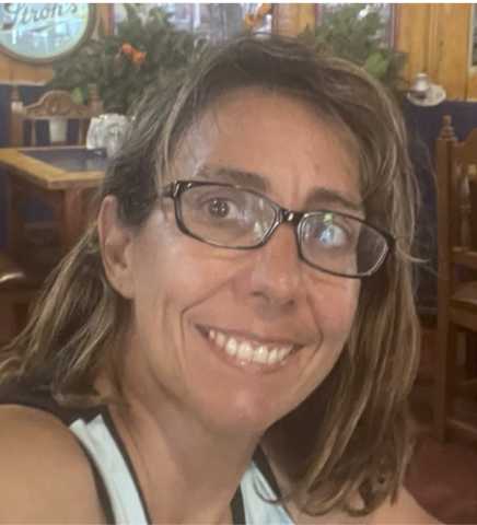
After quite a bit preparation Kosmos, 2006 Nordhavn 43, with crew Christi, Eric, and Keith underway from San Diego to Marina Coral in Ensenada. Planning to get to Panama in a month or so. Our next journey begins! Tracker on.
Keith simple sentiment is he is “excited”. I am reflective how special and rare it is to pull off living on a cruising boat, it offers such a wider range of emotions than land life. I am also ready to use the various upgrades to Kosmos to hopefully keep us safe and comfortable.
SY KOSMOS 🇺🇸 Eric, Christi, & Keith - Nordhavn 43'
CANAL CROSSING NOTES
Many Ocean Posse members cross the Panama Canal at some point on their journey. When this time comes people often wonder about the actual logistics of the transit, what food and beverages make for an easy day and happy line handlers, etc...
SV BRIGADOON III recently crossed the Panama Canal and is sharing the notes they shared of their experience to "give some friends a feel for what to expect and see it from my perspective".
The night before the transit, the four line-handlers arrived with the fenders and lines. One of the line-handlers was (Posse Sponsor and Canal Agent) Erick (Galvarez)’s son, Juan and another was Juan’s uncle “Junior”. Junior seemed to be the head line handler and gave the others direction. They slept one on each salon sofa, one in the aft quarter berth and Junior slept in the cockpit because, as he said, he snores.
The line-handlers arrived on time, as planned, at 6:30 pm and we had dinner ready for them -Spanish style meatballs in a roasted pepper sauce on Orzo, bean-corn salad and grapes for dessert. They devoured everything and all wanted to know what orzo was. They also drank water and Coke. I had read that they like Coke; regular not diet.
We had dinner before they arrived to simplify things. After dinner, they took off and Junior stayed and went to bed. Doug and I also went to bed and didn’t hear a peep from anyone.
We got up at 2:30 am and left the marina at 3:15 am to travel to a point between markers 2 and 4 to pick up our advisor. This area is just outside of Playita Marina. It took a while for Carlos, our advisor, to show up in the big pilot boat but eventually did and readied himself in the rocky seas for a very heroic leap to our boat. Once the advisor was aboard, all the line-handlers, except uncle Junior, went back to bed and we travelled in the dark under the Bridge of the Americas to the first lock which is about 7.5 miles from where we had picked up Carlos at about 4:15 am.
It was just getting light when we entered the first lock. The advisor gave us instructions and explanations for everything we needed to know as we went along, such as what to expect in the lock and that it takes 8 minutes for the water to fill the lock. He also explained how and when we would raft up to the other sailboat we were travelling with.
Because we were up-locking, we would travel behind the commercial ship. At the other end we would be down-locking and would be in front of the commercial ship.
We cleared the third lock at about 8 am so I got the coffee on and had oranges and muffins for everyone to tide them over while I made breakfast - rice and beans, eggs, avocado and salsa plus orange juice and more oranges. They love rice and beans.
As expected, the three younger line handlers went below to bed or rest and we carried on through Gatun Lake passing huge freighters going the opposite way.
At 12 noon and before we got to the Gatun locks, I made lunch - Chicken Chorizo Paella, grapes and watermelon. They also had water, coke and orange juice. Again, they gobbled it all up and helped with the dishes. Phew, no more dinners. We continued through the Gatun locks and about 20 minutes later the pilot boat showed up for Carlos the advisor. The three line-handlers continued on with us to Shelter Bay and Erick was waiting for them to transport them back home.
I want to add a comment on the line-handlers. Generally, when they are not needed, they are happy to hang out inside the boat. They were professional, tidy and kept their bags away and out of sight. They seemed to have a sixth sense of when they were needed as they would appear topsides, ready to work, out of nowhere. I suspect Erick has coached them because they were quiet, pleasant and thanked me for every meal. As for food, they liked the rice dishes and fruit. They had seconds of these dishes and they can pack away the food. They were not too interested in sweets such as muffins but did eat a bit of the chocolate that I had. According to Erick, they also like pasta. Remember, lunch is their main meal of the day. They appreciate water and Coke and enjoyed the orange juice I had.
SV SUMMERBREEZE followed in the wake of SV BRIGADOON III and found the notes super helpful.
SY BRIGADOON III Doug & Patty – Saga 43’ & MV SUMMERBREEZE 🇺🇸 Sam & Kurtis - Bestway 46'
THANK YOU FOR SHARING YOUR NOTES AND YOUR COMMUNITY SPIRIT WITH ONE ANOTHER!
LA PAZ, MEXICO RESOURCE GUIDE
FROM THE CRUISERS HUB AT CLUB CRUCEROS
La Paz, the capital of Baja California Sur, is a major stop for cruisers and a gateway to the Sea of Cortez. About 50 nautical miles from Bahía de Los Muertos, La Paz offers several marinas, boatyards, and provisioning options. The city is known for its vibrant culture, murals big and small, great restaurants, and long Malecon (waterfront promenade). There are numerous anchorages around La Paz, such as Bahía Falsa and El Mogote, but the currents can be tricky, so mariners need to be careful. The anchorage in La Paz proper is noted by many to have what people call, "the La Paz Waltz" because the boats seem to dance around their anchor and one another throughout the day.
Ashore, cruisers find a welcome dinghy dock and cruisers hub at Marina La Paz. The cruisers hub is called Club Cruceros. The club hosts morning coffee, tends a 'give and take' library, and most notably, maintains a La Paz Cruisers Guide. This guide is kept up to date by resident long time cruisers. For all mariners planning a stop in La Paz, this resource is free and available in pdf form here: https://www.clubcruceros.net/Cruiser_Guide.pdf?
Using this guide, the city is made very accessible.
The art and murals throughout the city add to the beauty and whimsy of the visit.
BUNDLED C'S POSSE PERK: COMMUNICATION, COMRADERIE, COMMUNITY
OCEAN POSSE PERK:
BUNDLED C'S
(COMMUNICATION, COMRADERY, COMMUNITY)
Some Ocean Posse Perks don't fit into one liners. Some are the product of the fleet and the way the Posse is purposely set up. Hence "The Bundled C's": this perk is really the result of the serendipitous, inner workings of many Posse Perks which include Communication, Comradery, and Community.
The Ocean Posse is a community of voyagers on their own schedules. Each member participates in one or all of several format options for communication undeniably developing comradery over the course of their conversations, meet ups, shared anchorages, sunsets, and information exchanges. This week was one of many examples between three vessels each in a different part of the ocean along their voyage connecting over where one might drop their hook after crossing into Panamanian Pacific waters from Costa Rican waters.
When a vessel checks out of Costa Rica in Golfito the authorities expect that, weather permitting, the vessel will then leave Costa Rican waters without stopping. Leaving Golfito, Costa Rica for Panama vessels go south to round Punta Burica and east into Panamanian waters. Punta Burica protects the waters and islands to the east from a lot of weather making for a pleasant cruise out of Costa Rica into Panama. Many vessels will tuck into one of the small, less travelled, and spectacular islands of Western Panama en route east to Panama City.
Today, there are a dizzying amount of chat groups out there for wherever you are.. The Ocean Posse uses the LineAp to have a focused, real time format for communicating among the fleet. General communication is usually short lest people take their conversations directly to one another. As rounding Punta Burica is a milestone along the Pacific Central American route, this week MV PAUSE reported :
Just rounding Punta Burica and are now in Panama from West Coast Cost Rica, headed to Isla Parida for the night. It has been pretty much non stop rain for 4 or 5 days now but fortunately no lightning.
This message came as an update on their progress. Fellow fleet member SV RAAJA replied from further east:
I spent several days anchored off of Isla Gomez. It is a tiny uninhabited island with a beautiful beach. Highly recommended if you are headed for Parida!
Another vessel SV JUBEL who spent time cruising this area last season replied from the north side of Panama:
Second this
MV PAUSE apparently swayed and please with the recommendations:
Just dropped the hook at Isla Gomez. Beautiful
THANKS FOR BUNDLING THE C'S TOGETHER & ENJOY THE ISLANDS!
MV PAUSE 🇺🇸 Beth & Larry - Nordhavn 55′, SV RAAJA 🇺🇸 Skip – J boat 46’, & SY JUBEL 🇨🇦 Leah & Kyle - Gulfstar 44'
EMERGENCY COMMUNICATIONS
Emergency Communications
By Rob Murray on SV AVANT
Cruisers spend big dollars on emergency communications, and in most cases never use them. What are some of the options, their pros and cons, and use cases aboard?
EPIRB
EPIRBs (Emergency Position Indicating Radio Beacon(s)) are the gold standard in reliability and durability. Designed by an international consortium of search and rescue agencies in the 1980s, these use the SARSAT (Search And Rescue Satellite Aided Tracking) system of satellites (a combination of government operated LEOSAR, GEOSAR, and MEOSAR satellites) combined with a network of 29 MCCs (Mission Control Centers) which communicate with national RCCs (Rescue Coordination Centers).
When you activate your EPIRB, a SARSAT satellite will pick up the signal within minutes and relay it to the MCC nearest the satellite via their Local User Terminal. The MCC will relay the transmission to the national authority’s RCC you have registered your EPIRB with (typically your flag country). Then ‘your’ RCC will relay the information to the RCC responsible for the area you are in and reach out to the emergency contacts registered with your beacon, and the RCC local to your location will begin a rescue operation. This is typically done in less than an hour.
COSPAS-SARSAT System Overview
The downside of EPIRBs is they are one-way communicators – they simply relay your call for help, and do not indicate if it’s a fire, sinking, or medical emergency.
Once purchased, EPIRBs are free to operate (no subscription fee), and the only ongoing cost is periodic replacement of the batteries (depends on unit specifications). Most units are water activated, so they should be stored where rain or spray won’t set them off inadvertently. They are specified to operate for a minimum of 48 hours, but typically will operate for much longer.
EPIRBs must have the battery replaced after use, they are good for a single activation per battery.
PLB
PLBs (Personal Locator Beacon(s)) are basically EPIRBs in short pants. Smaller and lighter than EPIRBs, they are typically less expensive as well. The broadcast at the same power as EPIRBs (5.0 watts) but have half the battery life (24 hours minimum vs 48 hours with an EPIRB). As with EPIRBs, they will typically operate much longer than the minimum specified.
Similar to EPIRBs, they must be registered with a national authority and have no operating cost beyond periodic battery replacement.
PLBs, like EPIRBs must have the battery replaced after use, they are good for a single activation per battery.
SEND
SENDs (Satellite Emergency Notification Device(s)) are devices like the InReach, InReach Mini, Garmin InReach Messenger, Zoleo, Spot, Spot X, Yellowbrick, ACR Bivy Stick, Motorola Defy Satellite Link and so on.
These use various commercial satellites or commercial satellite constellations and allow emergency ‘send help’ communications, typically with a dedicated SOS button. They also typically allow two-way communications, like a text or SMS on your phone (some allow this in a self-contained method, some require tethering with a smartphone or tablet). Most operate on the Iridium Satellite Network, which is generally considered to be of the highest quality and offers global coverage. Some use other networks like Globalstar, which does not offer global coverage. They typically operate at about 1.5 watts of transmit power.
Most use the IERCC (International Emergency Response Coordination Center) as their emergency response partner ( WWW.IERCC.COM ). Spot uses Overwatch Rescue ( WWW.OVERWATCHXRESCUE.COM ).
When you press ‘SOS’ on the device, it sends a message via the satellite or satellite constellation to the emergency response partner and they act in a way like the EPIRB response mechanism above, but they call/text you back (if your device allows) as well as calling your emergency contacts.
If the device allows you to send and receive messages you can also initiate a two-way conversation with a shoreside contact for a serious but not life-threatening situation, such as an engine or medical problem.
Most SENDs also support the sending of ‘breadcrumb’ trails while cruising. This is useful to allow shoreside contacts to follow you and leaves a record of your journey should you ‘go dark’ in an emergency that incapacitates you and your crew such that you are unable to activate any of your devices, giving search and rescue teams a starting place to look for you.
Each of these devices, being commercial, requires a subscription. Costs vary.
SENDs are rechargeable and can be used again and again. Battery life varies between units.
There is a good comparative review of many units at ( https://www.treelinereview.com/gearreviews/best-personal-locator-beacons )
DSC Distress Calls
Marine radios (VHF and MF/SSB) can send a DSC (Digital Selective Calling) alert, usually by pressing a red button on the radio. The button usually must be held down for more than 3 seconds to activate it (this to limit the chance of false alerts). This sends a GPS position if your radio contains or is connected to a GPS, plus your MMSI (Marine Mobile Service Identity).
VHF is monitored for these alerts worldwide (withing coverage limits), but coverage via MF/SSB is spotty. (There are propagation issues, and some rescue authorities no longer monitor the frequency. The USCG stopped monitoring the 2182Hz rescue frequency in 2013.)
VHF DSC alerts will be picked up by other vessels within radio range.
This is cost-free.
How do you contact Search and Rescue directly wherever you are?
Each country has SEARCH AND RESCUE NUMBERS. These can be found on the Ocean Posse website for each area we operate in:
https://oceanposse.com/aruba/#emergencies
https://oceanposse.com/azores/#emergencies
https://oceanposse.com/bahamas/#emergencies
etc
https://oceanposse.com/italy/#emergencies
https://oceanposse.com/mexico/#emergencies
Ocean Posse members can substitute the country you are in to get to the right numbers
What about Cell Phone Satellite Communications?
Some newer cell phones from Apple or Google/Pixel have limited SOS satellite connectivity, and Samsung has announced forthcoming satellite capability. Somewhat klugey, they require manual alignment of the device and use the GlobalStar network. Not all devices have the feature, and some are limited by the carrier. The geographic coverage is quite limited. These should be considered back-ups until the technology becomes more mature.
What should you do to get ready for an emergency?
Select and install your chosen devices and set them up appropriately.
For EPIRBs and PLBs, that means registering them with the appropriate national authorities and mounting their storage brackets in suitable locations. Each device has a testing schedule and protocol, so add reminders to your calendar to ensure you keep up with the schedule.
For SEND devices, ensure you have the appropriate subscription in place and the emergency contacts are registered, and the appropriate contacts are in the device’s address book or contact list. If the device tethers with a smart phone or other device, ensure the appropriate software is installed and up to date, and the tethering connection(s) have been tested. Having the tethering connection enabled on multiple devices adds redundancy. Most send devices get firmware updates from the manufacturer, so find out how your device updates and schedule a check every 90 days or so to ensure you’re up to date. Ensure you have a charging/battery replacement protocol in place so that the device is always charged up or, if it has replaceable batteries, you have spares on hand.
For DSC Alerts, make sure your radio(s) have your MMSI programmed in and have access to a reliable GPS signal, and that the radio(s) have a first-class antenna connection (testing with an SWR meter is the best way to ensure this).
Once the hardware and software are established, train your crew in the use of these devices and make sure they know how and when to use them. Preparing a ‘Cheat Sheet’ of simple instructions that can be posted in a handy spot ensures they are not falling back on memory in an emergency.
You have an emergency, what should you do?
If you are faced with a life-threatening situation or there is an imminent threat of danger such as loss of life, potential loss of life, loss of the vessel, potential loss of the vessel, sinking, fire, loss of the rig, or other serious emergency you should activate all of your emergency communications all at once. If you have all three, use the EPIRB, SEND and DSC alert all at the same time.
- The EPIRB will get SAR resources mobilized rapidly on a nation-to-nation basis. It is hands down the most reliable distress signaling mechanism.
- The SEND will typically allow two-way communication on the nature of the emergency and what aid is required.
- The VHF DSC Alert will summon any nearby vessels to your aid.
If you are faced with a potential life-threatening situation or there is the potential for an imminent threat of danger to develop, you should initiate a two-way communication with a shoreside contact to seek advice and/or advise them of the situation (ideally with one of the emergency contacts for your EPIRB or SEND). This could be via any means available, Cell Phone, Starlink (email, teleconference, etc.), SEND, or whatever works. Nearby vessels should be alerted via a normal VHF radio call. This allows them to be aware of what’s going on and be ready to scale up response appropriately as the situation demands.
Posse Perk
Ocean Posse members have access to additional help from other Posse members who may be nearby and from Posse HQ. Members can send a message on the Posse line Ap to reach out for nearby vessels. The Posse Team has assisted in rescue coordination and has connections in many regions with search and rescue and other resources to assist if required. Contact Dietmar at dietmar@oceanposse.com or text him at ( +1 (702) 861-9823 ) to set the team in motion!
EVERY SEASON STARTS WITH THE ROAR OF THE HOWLER MONKEY
EVERY SEASON STARTS WITH
THE ROAR OF THE HOWLER MONKEY
Like the sound of the conch sounding as the sun meets the horizon pronouncing the beginning of sunset,
the Ocean Posse likes to start every season with the roar of the Howler Monkey.
Watch this video to hear the loudest mammal above ground roar at it - you can hear them 3 nm through then densest of jungles. Howlers are stoutly built bearded monkeys with a hunched appearance and thickly furred tails that are naked on the underside of the tip to afford a better grip. The hair is long and dense and, depending on species, is typically black, brown, or red.
Endemic to the southern tip of Mexico, Guatemala, El Salvador, Honduras, Nicaragua, Costa Rica, Panama, and Colombia - the howler monkey is an endangered species but shall not go quietly into the night!
ONE YEAR AFTER HURRICANE OTIS STRUCK ACAPULCO
Hurricane Otis was the result of a tropical storm that rapidly intensified off the coast of Acapulco in October 2023. No one expected it and everyone was caught off-guard. In the dark of night three 20 foot waves came through the bay and destroyed everything. In one fell swoop the entire Acapulco Yacht Club was thrown on land. Four marinas were obliterated. Boats got swamped and sunk rapidly. 650 boats were destroyed or sunk. Some people escaped with their lives, others did not.
A longtime friend of the Posse, Vincente, who lived in the bay and managed several mooring buoys experienced a horrific tragedy. He and his wife, son, and grandson were sleeping aboard their boat the night Otis hit. His boat was among those quickly destroyed and sunk. He was the only one aboard who survived. The city was an absolute mess immediately following the Hurricane. Power, water, and cell towers were out and it took weeks to discover that Vincente had survived. Many Posse members pooled donations to help him and he was very grateful. The memorial for his loved ones is this weekend;
In the aftermath of Otis's devastation, the Mexican government sent in assistance to help lift the boats out of the bay and get the city out from under the rubble. It has been a long road and true to many Mexican coastal towns the spirit of recovery has gotten them far and, by the sounds of it, the people of Acapulco are still working to get their Port town back. We reached out to Vincente to see how he is doing and what he could share for Posse members cruising to Acapulco this season.
Vincente shares:
Buenas noches Capitán envío las respuestas a sus cuestionamientos que me fueron enviados:
A un año del huracan Otis le puedo decir que nos estamos recuperando lentamente en todos los aspectos y confiamos en que muy pronto tendremos el Acapulco de antes del Huracán Otis.
El turismo no a dejado de visitarnos tanto nacional como internacional poco pero siempre tenemos turismo en el Puerto.
La costa actualmente está bien dentro de lo que cabe.
La bahía en este momento puede recibir a todos los visitantes que vienen navegando y tenemos ya listas las bollas de amarre para darles un excelente servicio cuando sean requeridos.
Informo a usted que no fueron recuperados ninguno de los barcos porque el gobierno los retiró como chatarra.
Los amarres en la bahía se siguen gestionando a la hora que sean requeridos.
Informo a usted también que seguimos desembarcando en el mismo lugar de siempre.
Reafirmó a usted que quedó a sus órdenes para cualquier servicio o acciones en las cuales podamos apoyarlos anexo mi tarjeta y quedó a sus órdenes saludos
(TRANSLATION)
Good evening Captain, I am sending the answers to your questions that were sent to me:
A year after Hurricane Otis I can tell you that we are slowly recovering in all aspects and we trust that very soon we will have the Acapulco that we had before Hurricane Otis.
Tourism has not stopped visiting us, both nationally and internationally, but we always have tourism in the Port.
The coast is currently doing well within what is possible.
The bay can currently receive all the visitors who come sailing and we already have the mooring bollards ready to give them an excellent service when they are required.
I inform you that none of the boats were recovered because the government removed them as scrap.
The moorings in the bay are still being managed at the time they are required.
I also inform you that we continue to land in the same place as always.
I reaffirm to you that I remain at your service for any service or actions in which we can support you. I enclose my card and I remain at your service. Regards.
The financial toll of the storm is estimated to be between $12 billion and $16 billion, making it one of the most costly tropical cyclones in Mexico's history. The storm devastated the region, destroying over 51,000 homes, damaging more than 250,000 others, and displacing over 34,000 households. Additionally, around 80% of Acapulco’s hotels were affected, severely disrupting the local tourism industry, which is crucial to the region’s economy. Hurricane Otis caused significant damage to vessels, especially in Acapulco. The storm destroyed 480+ public tourist boats, and at least 33 vessels sank in Acapulco Bay. Additionally, some boats were rescued near Playa Manzanillo, and others were found in the bay of Puerto Marqués.
SOUTH PACIFIC TROPICAL CYCLONE SEASON OUTLOOK
SOUTH PACIFIC TROPICAL CYCLONE SEASON
NOVEMBER 1-APRIL 30
NEW OUTLOOK RELEASED
Tropical cyclones, like hurricanes, are known for their powerful winds, heavy rains, and potential to cause significant destruction. Tropical cyclones frequently affect the southern Pacific and can pose serious threats to both public health and infrastructure. All vessels are advised to have a plan of action for the cyclone season.
According to New Zealand's National Institute of Water and Atmospheric Research (NIWA) and Metservice, the South Pacific may see either fewer or a normal number of tropical cyclones this season. The cyclone season in the South Pacific starts November 1 and runs until the April 30, with the typical 'peak' of the season being January - March. The outlook that has recently been released, "Southwest Pacific Tropical Cyclone Outlook - October 2024" describes a slower start to the Cyclone season, potentially less cyclone risk overall in the eastern region while potentially elevated risk in the western region. According to the NIWA Outlook, "As of early October 2024, sea surface temperatures across the eastern and central equatorial Pacific Ocean are below average and close to La Niña thresholds." Forecasters are observing more La Niña-like characteristics that tend to reduce risk in the east and elevate risk in the west where warmer water may 'stack up' later in the season. As with many weather outlooks of late there continues to be caution that while there may be less risk in the frequency of tropical storms this season, there is still a risk that those that come may intensify more rapidly or simply be very intense.
For cruisers in French Polynesia South Pacific Posse member Scott on Tartaruga shares:
What is critical to following storms in FP is the location of the MJO. Madden Julien Oscillation. You can research that but when that is over French Poly that is when the highest probability of big storms occur. Per some local Tahiti sailors they almost never have any cyclonic storms outside of MJO events. This last season Fiji announced the MJO forecast and when it would be over FP and boom the storms came. Also note that Fiji is the official metrological organization for these storms. Another important data point is they name their storms very early, mean the wind scale starts at a much lower number....NOAA tracks (the MJO) closely as well. I would educate yourself on how to read the graph. It is a bit strange.
Fiji Meteorological Service Regional Specialized Meteorological Centre Nadi-Tropical Cyclone Centre also just released a forecast on the upcoming tropical Cyclone season. Their predictions are similar.
Stay alert on great weather sites including:
- https://www.met.gov.fj/index.php?page=tcoutlook
- https://niwa.co.nz/climate-and-weather/southwest-pacific-tropical-cyclone-outlook/southwest-pacific-tropical-cyclone-outlook-october-2024
MEXICO ENTRY AND EXIT REQUIREMENTS
FOR FOREIGN FLAGGED VESSELS
- Paperwork and fees for the people (and animals) onboard the vessel.
- This involves getting tourist visas through Immigration and going through customs. Visitors need to provide their passport, crew list, and vessel documentation.
- Paperwork and fees for the Vessel to obtain a TIP.
- TIP’s are temporary Import Permits that boat owners apply for and pay for upon entry into Mexico. Captains present vessel and ownership documentation for permit. The TIP is on the vessel and the ownership of the vessel is unimportant. The fee is less than $100 and yet the paperwork associated with it is the vessel’s Golden ticket into Mexico. TIP’s for foreign flagged vessels are valid for ten years in Mexican waters. Foreign vessels are meant to cancel their TIP upon exiting Mexican waters.
When a vessel leaves Mexico without cancelling their TIP and this same vessel tries to enter Mexico complications arise. In recent years, one of the biggest challenges cruisers entering Mexico have faced is discovering that their vessel has an uncanceled TIP. If a vessel is found in Mexico without their ‘Golden Ticket’. The vessel can be impounded immediately. Only fees, paperwork and stress build in this scenario.
POSSE PERK: WEEKLY LIVE CALLS WITH LOCAL WEATHER REPORTS
☎️ Free Weekly live calls on Mondays via dedicated LINE.me group
The Ocean Posse has weekly, live, in-season calls dedicated to five different regions where posse members are cruising:
- The Pacific Americas Route (Beginning October 28 through June)
- The Caribbean Route (Beginning October 28 through June)
- The Atlantic Route (Beginning October 28 through June)
- The Mediterranean Route (Beginning October 28 through June)
- The South Pacific Route (In process now ending November 4th)
During the Weekly calls members join in to:
- Share any emergency or emergency relay needed
- update one another on location, any issues they may be having, or fun stuff they are doing
- Receive weather report from Captain Dietmar
- Questions people have for one another.
This weekly communication is a a little bit like a net and fulfills all the same functions.