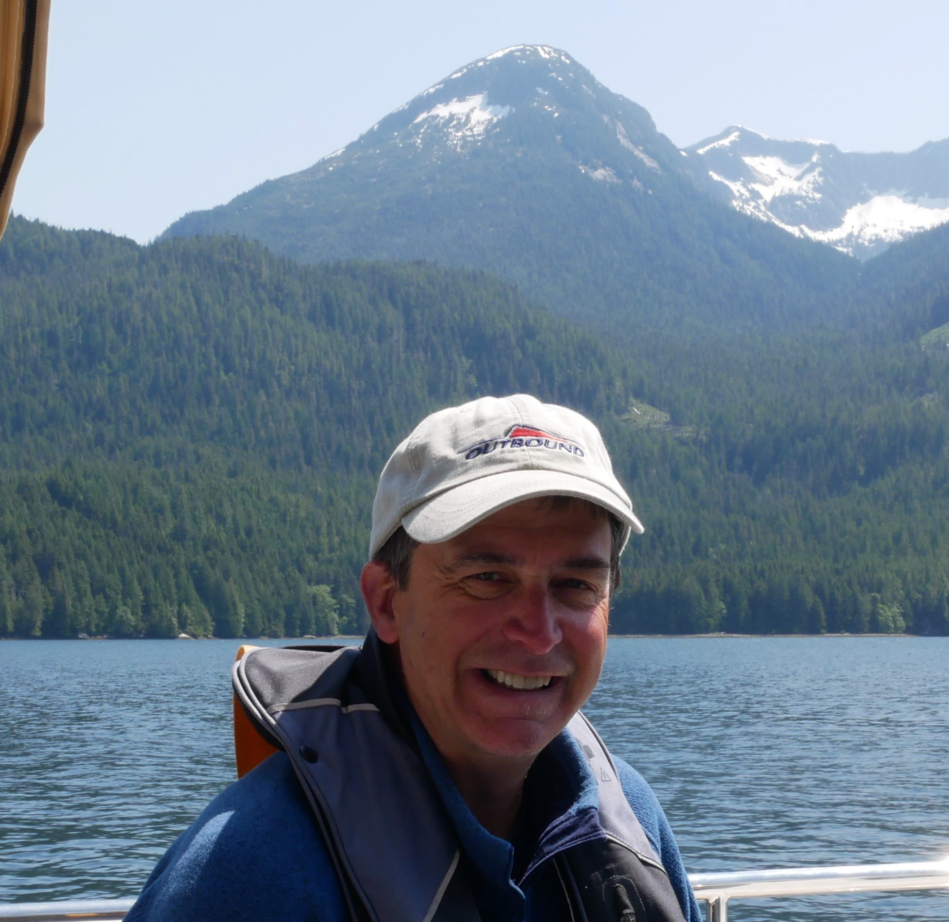
KEKADA II SAILS INTO NEW ZEALAND FOR THE SUMMER

SV KEKADA II CLEARS INTO NEW ZEALAND 🇳🇿

FOR THE SUMMER

Recently, SV KEKADA II and her crew just finished their third Pacific Crossing and cleared into New Zealand.  I asked Don and Anja if they would share a bit of their experience as there are many members of the Ocean Posse that do not have three Pacific Crossings under their keel...and just might some day.  So what's it take?  Read on to find out.

Kekada II Wallis Island South pacific

Don shared:

We cleared into New Zealand at Opua.  Very quick.  Had done the notice of arrival and inward passenger cards online prior.  Customs entailed answering a few basic questions while they completed the TIE (Temporary Import Entry) (very handy for GST free boat stuff).  They also gave me a biosecurity master's declaration form which I could have also finished prior to arrival but simply forgot to.  Two minute inspection and all finished.  We can work, stay as long as we like, no visas, etc.  Biosecurity was a few minutes later and I had time to finish the declaration.  He checked the fridge but we really did not have anything left.  We showed him some shell necklaces we had been given, all good.  Basically, he accepted our word for everything else.  Our last stop had been Norfolk Island 🇦🇺 (Australia) which probably helped.    

This is our third Pacific crossing so after French Polynesia we did the Samoa, Wallis, Fiji, New Caledonia route for a change.  Previously, we have done the Rarotonga, Niue, Tonga, Fiji, New Caledonia route.  The boat will spend summer in New Zealand.  We will have some home time in Adelaide.  

(Preparing for our passages) I check as many sources as I can re: weather but do my own passage planning.  Since French Polynesia the coffee machine has not had to be moved from the bench top.  (There were) a couple of days where it came close but basically a milk run.  If this is your first time then I suggest Tonga, Minerva Reef, New Zealand even if you backtrack to Tonga from Fiji.  The passages are shorter to one has a better chance of accurate weather predictions than Fiji to New Zealand.

Best advice: Be patient and wait for weather windows.  NO SCHEDULES

SV KEKADA II 🇦🇺 Don & Anja – Leopard 53’


People'ing in the Americas

THE DISCOVERY OF THE LANDMASS OF THE MODERN AMERICAS did not begin with Christopher Columbus.  The most long-standing and widely held theory has been that people entered the Americas in the north at the tail end of the last ice age some 10-15,000 years ago and began to settle across the land.  This long standing theory holds that homo sapiens came across the Bering Straight on a now extinct land bridge from Asia.  However, recent finding across the Americas are questioning this theory and proposing other theories.   Interestingly, the study of Home Sapien migration through science, archeology, geneology and more continues to uncover more and more clues that cloud the picture of how and when homo sapiens populated the Americas more than they are shedding light on the mystery.    Basically, people came overland by foot or people came by water from the east or the west.  Experts have and continue to piece together the past with new findings and new ideas, yet sometimes the mystery just gets bigger.  Regarding the 'by water theory from the west' according to Megan Gannon from Sapiens.org,

"According to this coastal migration theory, some 16,000 years ago the ice had retreated from the coastlines of the Pacific Northwest, such that seafaring people could take advantage of coastal resources like kelp forests to navigate all the way down the shores of California, eventually reaching sites like Monte Verde in Chile.

Proving the coastal theory is tricky. No wooden boats from that era have been found along the shore. The earliest campsites along the ancient Pacific coastline may be lost for good due to erosion and sea level rise. Yet scholars have some clues that people were living along the Pacific coast, including the footprints at Calvert Island.

Evidence of human habitation from at least 13,000 years ago on the Channel Islands in California suggests that people had the skills to build boats and reach these land masses, which were islands even then. In the last 15 years, archaeologists at Cedros Island off the coast of Baja California in Mexico have found traces of a nearly 13,000-year-old settlement. Some archaeologists, such as Loren Davis of Oregon State University, are turning to methods such as coring—removing of a long column of soil—to search for hints of now-underwater prehistoric sites along the Pacific continental shelf."

*NOTE: Cedros Island is on the southbounders route down the Pacific side of the Baja Peninsula.  Multiple anchorages can be found.  The fall is often a good time to use the southern Anchorage: https://goodnautical.com/mexico-pacific/anchorage/isla-cedros-s

This stone artifact is one of many found on the Channel Islands off the coast of California that suggest mariners have traveled to this site for at least 10,000 years. Photo Credit: National Park Service

Nonetheless, while their daily life was not recorded or documented as ours it today, humans were in the Americas for likely over 10,000 years before the first life-changing contact with Europeans occurred in the end of the 15th century.  A that time the Americas were the home to more than 50 million, perhaps as many as 75 million highly evolved communities of people.  These ancient civilizations had experienced many changes and many catastrophes during their long history in the Americas, yet it seems certain that none of these experiences was as tragically transforming as the arrival of Europeans. In the long term, European settlers came to dominate most areas of the Americas.  But even in the short term—in the first violent years of Spanish and Portuguese exploration and conquest—the impact of the new arrivals was profound.  Battles between Natives and Europeans in the Americas continued but there were also many other interactions through which these very different civilizations shaped one another, learned from one another, and changed each other permanently and profoundly.

An early map of the continents

Europeans were almost entirely unaware of the existence of the Americas before the fifteenth century. A few early wanderers like Leif Eriksson, an eleventh-century Norse seaman, and perhaps others—had glimpsed parts of the New World and had demonstrated that Europeans were capable of crossing the ocean to reach it. But even if their discoveries had become common knowledge (and they had not), there would have been little incentive for others to follow. Europe in the middle ages (roughly 500– 1500 A.D.) was not an adventurous civilization.  Europe was divided into innumerable small duchies and kingdoms, its outlook was overwhelmingly provincial. Subsistence agriculture predominated, and commerce was limited; few merchants looked beyond the boundaries of their own regions.  The Roman Catholic Church exercised a measure of spiritual authority over most of the continent, and the Holy Roman Empire provided at least a nominal political center.  Even so, real power was for the most part widely dispersed; only rarely could a single leader launch a great venture.  Gradually, however, conditions in Europe changed so that by the late fifteenth century, interest in overseas exploration had grown.

15th Century: WHY EUROPEANS LOOKED WESTWARD

Two important and related changes provided the first incentive for Europeans to look toward new lands. One was a result of the significant population growth in fifteenth-century Europe following the Black Death.  The Black death was a catastrophic epidemic of the bubonic plague that began in Constantinople in 1347, which had decimated Europe, killing (according to some estimates) more than a third of the people of the continent and debilitating its already limited economy.  By the early 1500's the population had rebounded.  With that growth came a rise in land values, a re-awakening of commerce, and a general increase in prosperity.  Affluent landlords became eager to purchase goods from distant regions, and a new merchant class emerged to meet their demand. As trade increased, and as advances in navigation and shipbuilding made long-distance sea travel more feasible, interest in developing new markets, finding new products, and opening new trade routes rapidly increased. Paralleling this rise of commerce in Europe, and in part responsible for it, was the rise of new governments that were more united and powerful than the feeble political entities of the feudal past. In the western areas of Europe, the authority of the distant pope and the even more distant Holy Roman Emperor was necessarily weak.  As a result, strong new monarchs emerged there and created centralized nation-states, with national courts, national armies, and—perhaps most important—national tax systems. As these ambitious kings and queens consolidated their power and increased their wealth, they became eager to enhance the commercial growth of their nations. Ever since the early fourteenth century, when Marco Polo and other adventurers had returned from Asia bearingexotic goods (spices, fabrics, dyes) and even more exotic tales, Europeans who hoped for commercial glory had dreamed, above all, of trade with the East. For two centuries, that trade had been limited by the difficulties of the long, arduous overland journey to the Asian courts. But in the fourteenth century, as the maritime capabilities of several western European societies increased and as Muslim societies seized control of the eastern routes to Asia, there began to be serious talk of finding a faster, safer sea route to Asia. Such dreams gradually found a receptive audience in the courts of the new monarchs. By the late fifteenth century, some of them were ready to finance daring voyages of exploration. The first to do so were the Portuguese. They were the preeminent maritime power in the fifteenth century, in large part because of the work of one man, Prince Henry the Navigator. Henry’s own principal interest was not in finding a sea route to Asia, but in exploring the western coast of Africa. He dreamed of establishing a Christian empire there to aid in his country’s wars against the Moors of northern Africa; and he hoped to find new stores of gold.

Duke of Viseu (4 March 1394 – 13 November 1460), better known as Prince Henry the Navigator
The ships of Prince Henry the Navigator's day

The explorations Prince Henry began did not fulfill his own hopes and yet, they ultimately led farther than he had dreamed.  Some of Henry’s mariners went as far south as Cape Verde, on Africa’s west coast. In 1486 (six years after Henry’s death), Bartholomeu Dias rounded the southern tip of Africa (the Cape of Good Hope); and in 1497–1498 Vasco da Gama of Portugal proceeded all the way around the cape to India. In 1500, the next fleet bound for India, under the command of Pedro Cabral, was blown westward off its southerly course and happened upon the coast of Brazil.


Map made by Juan de la Cosa in 1500, first representation of the New World

But by then another man, in the service of another country, who had already encountered the New World. Christopher Columbus, who was born and reared in Genoa, Italy, obtained most of his early seafaring experience in the service of the Portuguese.  As a young man, he became intrigued with the possibility, already under discussion in many seafaring circles, of reaching Asia by going not east but west. Columbus’s hopes rested on several basic misconceptions. He believed that the world was far smaller than it actually is. He also believed that the Asian continent extended farther eastward than it actually does. He assumed, therefore, that the Atlantic was narrow enough to be crossed on a relatively brief voyage. It did not occur to him that anything lay to the west between Europe and Asia. Columbus failed to win support for his plan in Portugal, so he turned to Spain. The Spaniards were not yet as advanced a maritime people as the Portuguese, but they were at least as energetic and ambitious. In the fifteenth century, the marriage of Spain’s two most powerful regional rulers, Ferdinand of Aragon and Isabella of Castile, had produced the strongest monarchy in Europe. Like other young monarchies, it soon grew eager to demonstrate its strength by sponsoring new commercial ventures. Columbus appealed to Queen Isabella for support for his proposed westward voyage. In 1492, having consolidated the monarchy’s position within Spain itself, Isabella agreed to Columbus’s request. Commanding ninety men and three ships—the Niña, the Pinta, and the Santa María — Columbus left Spain in August 1492 and sailed west into the Atlantic on what he thought was a straight course for Japan. Ten weeks later, he sighted land and assumed he had reached his target. In fact, he had landed on an island in the Bahamas. When he pushed on and encountered Cuba, he assumed he had reached China. He returned to Spain in triumph, bringing with him several captured natives as evidence of his achievement.

Replica ship of the Santa Maria, one of 3 ships captained by Christopher Columbus in 1492

(He called the people he found in what was to him The New World' "Indians" because he believed they were from the East Indies in the Pacific.) But Columbus had not, of course, encountered the court of the great khan in China or the fabled wealth of the Indies.  A year later, therefore, he tried again, this time with a much larger expedition. As before, he headed into the Caribbean, discovering several other islands and leaving a small and short-lived colony on Hispaniola. On a third voyage, in 1498, he finally reached the mainland and cruised along the northern coast of South America. When he passed the mouth of the Orinoco River (in present-day Venezuela), he concluded for the first time that what he had discovered was not in fact an island off the coast of China, as he had assumed, but a separate continent; such a large freshwater stream, he realized, could emerge only from a large body of land. Still, he remained convinced that Asia was only a short distance away. And although he failed in his efforts to sail around the northeastern coast of South America to the Indies (he was blocked by the Isthmus of Panama), he returned to Spain believing that he had explored at least the fringes of the Far East. He continued to believe that until he died. Columbus’s celebrated accomplishments made him a popular hero for a time, but he ended his life in obscurity.  When Europeans at last gave a name to the New World, they ignored him. The distinction went instead to a Florentine merchant, Amerigo Vespucci, a member of a later Portuguese expedition to the New World who wrote a series of vivid descriptions of the lands he visited and who recognized the Americas as new continents. Columbus has been celebrated for centuries as the “Admiral of the Ocean Sea” (a title he struggled to have officially bestowed on him during his lifetime) and as a representative of the new, secular, scientific impulses of Renaissance Europe.  Columbus was also a deeply religious man, even something of a mystic  His voyages were inspired as much by his conviction that he was fulfilling a divine mission as by his interest in geography and trade. A strong believer in biblical prophecies, he came to see himself as a man destined to advance the coming of the millennium. “God made me the messenger of the new heaven and the new earth,” he wrote near the end of his life, “and he showed me the spot where to find it.”

A map showing areas the Portuguese and Spanish came to and claimed for their crown as they explored the ocean westward from Europe.

A similar combination of worldly and religious passions lay behind many subsequent efforts at exploration and settlement of the New World. Partly as a result of Columbus’s initiative, Spain began to devote greater resources and energy to maritime exploration and gradually replaced Portugal as the leading seafaring nation. The Spaniard Vasco de Balboa fought his way across the Isthmus of Panama in 1513 and became the first known European to gaze westward upon the great ocean that separated America from China and the Indies. Seeking access to that ocean, Ferdinand Magellan, a Portuguese in the employ of the Spanish, found the strait that now bears his name at the southern end of South America, struggled through the stormy narrows and into the ocean (so calm by contrast that he christened it the “Pacific”), then proceeded to the Philippines. There Magellan died in a conflict with the natives, but his expedition went on to complete the first known circumnavigation of the globe (1519–1522). By 1550, Spaniards had explored the coasts of North America as far north as Oregon in the west and Labrador in the east, as well as some of the interior regions of the continent.

While Humans as a species have been in the Americas for well over ten thousand years, the effect of European explorers upon their arrival in the late 1400's to the mid 1500's was staggering and swift.  While Christopher Columbus was not the first person to come to the Americas, he and his compatriots put a proverbial stake in the ground and claimed their discovery for their crown, their nation and the world.  Prior to this, the world outside of people's immediate environment had previously been so obscure.  European explorers came from their distant land, charting the ocean along the way, and encountered both lands and people they did not know existed and yet as a species humans, homo sapiens had existed on this round planet for hundreds of thousands of years.  How had they spread out so far and wide? How had they become so isolated from one another?  How had their stories been shared and lost?

Piecing together the past through the lens of today, available historic records, and scientific findings is no easy task.  In fact, it leads one to the Paradox of Knowledge that Albert Einsein described with “The more I learn, the more I realize how much I don’t know.” 


MUST SEE: MONASTERY OF THE HIERONYMITES AND TOWER OF BELEM LISBON, PORTUGAL

MUST SEE: 🇵🇹 Monastery of the Hieronymites and Tower of Belém

Lisbon, Portugal 🇵🇹

The Monastery of Hieronymites was built in the 16th century and stands today as an architectural and historical treasure of Portugal


Nearby the Torre de Belem or Tower of Belém built in the same era guards the entrance to Lisbon Harbor, Portugal

The Monastery of the Hieronymites and the nearby Tower of Belém  are UNESCO world heritage sites that represent the story of the Portuguese Age of Discovery.  Standing along the Tagus River at the entrance to Lisbon harbor, the Monastery of the Hieronymites  and the Tower of Belém . To some the estuary the town of Belem sits on is a perfect metaphor for what the historical landmarks at Belém emphasize – Portuguese influence going out across the ocean and the consequences of all that came back across the sea.

THE MONASTERY OF HIERONYMITES or JERONIMOS

Construction of the Monastery of Hieronymites began in 1501 and culminated 100 years later in 1601.  Today the structure exemplifies Portuguese Gothic Manueline style art at its best.  The Monastery with built near the launch point of Portuguese explorer Vasco da Gama's first voyage and its construction was funded by a tax on the profits of the yearly Portuguese Indai Armadas.  There was in fact a church in this spot falling into disrepair where it is said that Vasca da Gama and his men stopped to pray before their historic departure to the New World after which he proclaimed the discovery of the sea route to Asia.  In 1880, da Gama's remains and those of the poet Luis de Camoes (who celebrated da Gama's first voyage in his 1572 epic poem, The Lusiad), were moved to new carved tombs in the nave of the monastery's church, only a few meters away from the tombs of the kings Manuel I and John III, whom da Gama had served. The monastery was originally a monastery for the Order of Saint Jerome and was built in such proximity to the Tagus river so that sailors could stop in to pray for protection before setting out to sea.  It became the necropolis of the Portuguese royal dynasty of Aviz in the 16th century and was abandoned in 1833.  In 1983, the Jerónimos Monastery was classified as a UNESCO World Heritage Site, along with the nearby Tower of Belém .

The covered pathways around a grassy quadrangle were unusual in at the time.
The curved archways and intricately carved pillars display symbols tied to religion, royalty, nautical themes and nature.

THE TOWER OF Belém

The nearby Tower of Belém was built between 1514-1520 while the Monastery of Jerome was also under construction with the same stones.  The Tower was built during the reign of King Manuel I as a fortification defending the entry to Lisbon.  Indeed a heavily armed 1,000 ton ship, the Grande Nau, guarded the estuary at the mouth of the Tagus until the fort’s completion.  There are 16 or 17 openings for cannons and ditches around it that were used as dungeons.  The Tower was not a spartan fortification however; the Tower of Belém was also built elaborately as a symbol and a celebration of Portuguese power and triumph in the New World commemorating Vasco da Gama's famous expedition to Asia in the late 1490's.  By the early to mid 1800's the tower’s function changed into a lighthouse and customs house to collect tolls on mariners entering and exiting port.  The Tower is a reminder of the great maritime discoveries that laid the foundations of the modern world.  The Tower of Belém is considered one of the best examples of the architecture of its time, known as the Manueline style, but it also includes distinctive Moorish features such as ornately decorated turrets.  The Tower was adorned with intricate carvings much like the nearby monastery.  All the symbols had a bearing on passersby: some stand too welcome visitors, grant safe passage to explorers, others to protect the shores and people of Portugal while threatening and scaring off invaders.

From the top of the Tower there are sweeping views to the east to the fresh water coming from Portugal and and west to see the salt water coming in from the sea
From the Tower on the the mouth of the Tagus River, Portugal could defend itself from any invading force.
Intricate carvings adorn the Tower of Belém with religious, royal code of arms, and nautical and natural symbols.  

MUST SEE: LA RUTA DEL CAFE in CHIAPAS MEXICO

MUST SEE: LA RUTA DEL CAFE  🇲🇽 CHIAPAS MEXICO 

FINCA HAMBURGO >> The sun rises over the Chiapas mountains around the Tacaná volcano

One cold January morning in the late 1800's, Arthur Erich Edelmann, his wife Doris, and seven other colleagues set sail from Hamburg, Germany, all from Perleberg, a small town an hour and a half from Berlin. Erich had a coffee machinery factory in his hometown, owned by his family, which was facing financial problems when they received and invitation from the Mexican government to bring their machinery and their expertise to the fertile region of Chiapas, Mexico.  It would be amazing to know what they felt when they read that letter of invitation?  That is a story that we do not know and perhaps we never will.  What would you have thought to go from the deeply familiar to a place that seemed like a different world.  Would you take a risk, abandon your business, your city, your people, your country, your language to start from scratch in a place so far away, so different in culture, language, nature and climate?

Erich traveled for three weeks across the Atlantic until he arrived at the Port of Veracruz, where he took a horse-driven cart with his people to go to Soconusco, Chiapas to the wild and untouched lands that he and his family would soon call home.

Before arriving in Mexico, we suppose that Erich had to have read all the information available about Chiapas, about Mexico and its culture, its people, language, nature, its history. However, there was nothing that could have prepared him for the intensity of his new life.

Erich, Doris and their people arrived in Huixtla, a small village with some houses built in adobe and palm trees, inhabited by friendly indigenous families who gave them the mules and human capital necessary to reach their final destination.  From there, it took them another 8 hours to be able to transport along the newly created dirt roads, which looked like tunnels through the dense jungle. On their way they could observe the Tacaná, a volcano whose eruptions transformed the land around it into a fertile paradise.

With the help of workers from San Cristóbal, San Juan Chamula and Guatemala, Erich and his team of architects and engineers began to harmonize the land, build the first houses for the workers, the mill, roads. Erich and Doris lived for 11 years in one of these simple houses, couldn’t afford a bigger house, not yet. The priority was to prepare the land, build all the necessary infrastructure to work, keep people working, provide money and work, houses and food. The priority was its people and the priority was coffee.

They put a lot of work into investing in this long-term project so far from home, a lot of determination and hope, a great risk and a gamble. All that work, all those years, until finally: the first harvest and the start of Finca Hamburgo.

Finca Argovia

This exemplary coffee Resort Located in the Sierra Madre of Chiapas with More than 130 years of history and culminates  as a cultural and extremely worthwhile experience

Argovia is a partner and initiator of the Coffee route in Chiapas, with  cabins, outdoor pool, Spa, Yoga area, Restaurant,  Bar, Event areas and tours.

Chiapas is the southernmost state in Mexico, and it borders the states of Oaxaca to the west, Veracruz to the northwest, and Tabasco to the north, and borders Guatemala to the east and southeast. Chiapas has a significant coastline on the Pacific Ocean.

The lowland, tall perennial rainforest has been almost completely cleared to allow agriculture and ranching. Rainfall decreases moving towards the Pacific Ocean, but it is still abundant enough to allow the farming of bananas, coffee and many other tropical crops near Tapachula. On the several parallel sierras or mountain ranges running along the center of Chiapas, the climate can be quite moderate and foggy, allowing the development of cloud forests like those of Reserva de la Biosfera El Triunfo, home to a handful of horned guans, resplendent quetzals, and azure-rumped tanagers.

Chiapas is home to the ancient Mayan ruins of Palenque, Yaxchilán, Bonampak, Chinkultic and Toniná.

How to get Argovia?

To get to the Finca you have to take 8th Street north (reference: intersection with 17th Street west) located on the border of the city, which will take you north, right at the end will become Road to New Germany. 40 minutes of road without changing your way to find the 39km, you´ll find a signal that says “Argovia 5 minutes” turn your way to the right. You will continue by Finca Eduviges paved road better known as New Germany and only 5 minutes more you’ll be in Argovia. We guarantee that any vehicle from compact to mini sedans can access our Finca with no trouble.

Or sit back and relax on this day trip leave early from marina Chiapas with Miguel Angel of Discovery Tours +52 962 133 6820 toursdiscoverchiapas@hotmail.com

Miguel and Tony lead fabulous, custom tours from Marina Chiapas.


SAFETY: THE DREADED DIESEL BUG

THE DREADED DIESEL BUG

Fear not! The dreaded diesel bug can be remedied.

ABOUT THE DIESEL BUG 

Usually, fuel can stay in a usable condition under storage for up to a year, after which it may begin to develop sediments.  Vessel in the the tropics are wise check any stored diesel before putting it into action.  Fuel in tanks deteriorates over time as it reacts with the oxygen in the air.  Water in a fuel tank harbors bacteria and fungi that feed on diesel.

Water can form in fuel tanks due to condensation from the tank heating and cooling over a 24 hour period.  This creates the perfect petri dish for bacteria and fungi.  One of the most common microorganisms that can grow under these circumstances is the diesel bug.  The diesel bug deteriorates your fuel and creates a sludge capable of damaging your engine.

Once you get underway the sediments slosh around and the fuel pickup hose quickly gets clogged. The bug clogs the fuel system.

The diesel bug clogs the fuel system

ACTUAL CAUSES

  •     Humidity in the air
  •     Fuel tank condensation
  •     Fuel tank insulation
  •     Air leak on seals on fuel tank filler cap inc damaged o-rings
  •     Poor fuel station storage quality
  •     Low volume of sales at fuel station
Avoid buying fuel that has been stored in tanks for too long.

REMEDIES

Once you have the bug ...

1) Separate the water from the diesel

2) Shock and kill the diesel bug with biocides

3) Remove sediments from the bottom of your tank

A biocide will quickly and effectively kill the problem

 
To Prevent the bug

1) Fill the tank

2) Use a fuel filter to take on fuel from the pump

3) Use Enzymes to prevent the bug from forming in the first place

*For ongoing maintenance. Fuel Doctor, Soltron and Star Tron have result oriented enzyme formulations.

A full rundown on tests and solution lives here >>


SAILING NOTES FROM THE SOUTH PACIFIC FOR OCEAN VOYAGERS

Sailing Notes from the South Pacific for Ocean Voyagers

Geologically young and dramatically, steep, mountainous Marquesan islands jut skyward out of the Southern Pacific Ocean. Tikis and coconut palms look out to sea.
The Ocean Posse is working to bring three posses together: the Atlantic posse, the Panama posse and the Pacific Posse so that we will have better overlap to share information and benefits across the oceans that we sail.  Some have crossed oceans that others are considering crossing.  Here, I will share notes from the South Pacific for people considering sailing to the South Pacific, or for those that just want to vicariously enjoy the cerulean blues, coconut palms, island communities spread throughout the South Pacific.
Presently, SV WHILRWND is underway in the Tuamotus, the second of five island groups in French Polynesian that we have visited since making landfall from Panama in May 2024. The Tuamotus, are sometimes referred to as ‘the dangerous islands’ for all the low lying fringing coral reefs boats can and have run aground on which require careful navigation.  So far, with a person on bow watch, the charts on Navionics, and multiple satellite overlays in OPEN CPN navigating the Tuamotus has been very fun.  There is a timing element one must consider when entering and exiting the atolls, between atolls we are sailing in the open ocean with ocean swell instantly, and within the atolls we are sailing in lagoons with little to no waves navigating coral bommies looking for a calm spot in the sand to drop our anchor.
So many different shades of blue in the Tuamotus atoll lagoons.
Slivers of fringing reef encircle blue lagoons studded with coral heads called "bommies"
Over the past two months, We have had the good fortune to see an abundance of coral and undersea life, more blue hues than I knew existed, and a few of the Southern Hemisphere Humpback whales that come annually to the oceanic islands of the South Pacific to breed and calf.  According to a cruising marine biologist friend the Southern Hemisphere Humpback whales will be turning back towards their summer feeding grounds off Antarctica in the next few weeks. There is a singular raised atoll in the NW part of the Tuamotus called Makatea where, in settled conditions, one can anchor outside the atoll on the leeward side and possibly see whales this time of year.  Looking at the weather with this possibility in mind we saw a sweet weather window that looked perfect for an adventure: two days of downwind sailing from Fakarava to Makatea in time for the wind to die off for three calm days anchored in the lee of the island, followed by wind from the south to carry us north to Tikihau where there is a manta ray feeding station, and on Rangiroa the second larges atoll in the world.  We have friends coming in on October 11th and as all cruisers know this hard stop commitment presents an added element into every sailing schedule.  Guests visiting the Tuamotus fly into Tahiti and then take an inner island flight to the Tuamotus. Interestingly, many atolls have airports: Fakarava and Rangiroa being the two largest atolls have airports that are more frequented than others. So, (Option 1) we could stay in and around Fakarava until our guests come (very relaxing) or (Option 2) we could go on a little atoll tour and make our way to Rangiroa to meet them (an adventure). We decided that the weather window looked good for an adventure and the plan was sound.
Our 'plan' was to sail from Fakarava for two days, spend a few days on the leeward side of Makatea, then sail to Tikihau for a few days and around to Rangiroa to pick up our friends.
Downwind sailing with the mainsail, mizzen, and spinnaker
We weighed anchor in time to catch the high water slack and sail through the exit in the southern pass.  After exiting the atoll, one is in the ocean immediately and we noted a long slow 1m southerly swell. The conditions were great and we set our kite for a smooth downwind sail.  A few hours in our buddies received an email from a French weather service sending out an alert to all mariners of a significant southern swell developing and moving north into the Tuamotus. We pulled up the weather and, sure enough, although the wind was still forecast to be settled in a few days around Makatea the swell was going to be too big to comfortably anchor on the outside of the atoll much less enter through the pass of an atoll.  We decided to reroute to Tikihau and save Makatea for another time.
There is a 'plan' and then there is the reality that unfolds when new information comes to light, conditions change, and the route must change as well.
We arrived outside Tikihau in the night, hove to outside the entrance, and waited for the low slack at first light. Upon arriving in Tikihau the weather forecast changed multiple times over the course of the day. In the southern hemisphere winter has just turned to spring and now this northern hemisphere sailor can say the spring weather down here is as fickle as one might expect in the spring: changing so often it’s hard to hang you hat on much beyond the immediate conditions. There are significant blows coming in and out of the forecast and still a large swell coming with mixed forecasts on how long it will affect this part of the Tuamotus. Based on these changing forecasts and the expected conditions in the passes when the swell arrives we have now determined that today, seems to be the best day in the next ten (when our friends are to arrive) to make our way from Tikihau to Rangiroa, so we are underway once more.
No matter the ocean, the weather calls the shots.  So far, sailing in the South Pacific has been nothing short of a dynamic adventure demanding that we constantly keep an eye on the weather and a sharp lookout over the bow.  While on lookout this morning we saw manta rays entering the Pass into Tihihau and dolphins surfing our bow as we set out into the ocean to Rangiroa...and we still could see a whale.
Sailing to Rangiroa: the second largest atoll in the world.
For cruisers looking to the South Pacific for adventure; crossing the ocean to get here is an epic adventure in and of itself.  Most people set sail for the South Pacific from points west in the late winter/early spring.  Presently, many cruisers are beginning to rub their palms together, eyeing up routes and weather patterns, running through their inventory of parts and spares, making lists, reading about storm tactics and high sea debacles, and/or taking care of a host or pre-departure maintenance or upgrades.  Shaking down our fears can also be a big part of mentally preparing for a ocean voyage.  Some, like my friend, may be wondering, "What were your scariest moments on the passage (to French Polynesia)?"
Taking a panoramic shot aboard SV WHIRLWIND out at sea while rocking and rolling.  Fear can feel like this: exaggerated and out of control.
In jest, my husband and our captain said, "the day we realized we didn't bring enough rum."  That was more sad really, but nothing we can't get over.
More sincerely, he said, "The day the autohelm and went a little wacky and (he) had visions of the rudder breaking loose."  Terrifying!  Indeed, one of our worst nightmares.  That 'wackiness' was rectified at sea with no major drama.  And we installed a back up autohelm before leaving Panama Bay.
In my most sincere and more lengthy response, I shared:  We spent 30 days at sea: they were both utterly glorious and unexpectedly difficult at times. A huge realization for me was that the infamous Coconut Milk Run starts west of French Polynesia….or maybe in French Polynesia…or maybe to the east...it’s the Eden out there somewhere, the Fair Winds and the Following Seas of every sailors dreams.  As we set out to cross the Pacific we actually thought we were on the Coconut Milk Run from Panama to the Marquesas.  So when we got out there and spent far longer in confused seas than we ever imagined could be part of a 'Coconut Milk Run' we joked, desperately at times while tossing chaotically in a confusion of seas and open sky, saying “this is coconut milk!? I imagined something sweet and smooth not a frothy mess" Or, "If this is coconut milk, I’ll stick to beer (or rum)!” Crossing the ocean can easily be romanticized…in my experience it is with the adventure ahead of me or behind me that I can romanticize really well about it.  When I am in it, it is usually....well...a Whirlwind of calm joy, uncertainty, chaos, thrill, or somehwere in between.
In preparation, I tried hard to be realistic, to plan for the worst and hope for the best, to be ready for the voyage and not simply long for the destination, to pack the boat full of provisions and spares, to check everything twice sometime thrice.  While the dream to cross the Pacific was years in the making for us and I had years to consider the magnitude of this voyage, still he scariest moment for me was somewhere SW of the Galapagos when I realized how far offshore we were, how much further we had to go, and that there would be no real rest until we were in French Polynesia.  It was nighttime and I woke out of a sleep to my husband, Mike, and our 13 year old son, Russell, reefing the main in sloppy seas and having a heck of a time.  I hopped up to help and the sky was SO big and SO black, spotted more stars than I had ever seen.  I could not immediately see Mike or Russell but somehow the wavetops were illuminated, so swift and heaving.  I was struck with a desperate feeling knowing there was no turning back, still so far to go, and only us to make that happen.  In that moment reefing the main felt goliath, possibly insurmountable, and I had to have a serious talk with myself!  I had to take the task at hand for just the task at hand, not the hundreds of miles we had come or the thousands of miles to go.  I had to just focus and reef the main.  'Stay calm.  Stay Steady.  We got this,' I reminded myself.  Finally, we prevailed.  For whatever reasons, reefing was more than difficult that night and with some mighty cursing and some steady determination we did it.  And then we just moved right along.  The boat settled nicely due to the reef, mind you the seas did not miraculously settle, but the motion certainly improved.  The boys went back on watch, and I to easily slipped back into bed.  For whatever reason, that was my scariest moment.  Basically, when the breadth of what we had set out to do actually hit me like it never quite had before - we were in the middle of the ocean and I felt like an absolute imbecile for only then realizing what I had gotten myself and my family into?!  I thought I had thought it through but in that moment I did not think I had.  I felt enormously overwhelmed by how easily we could get swallowed up.  I also felt that there was no turning back.  (Now in hindsight I know that is not entirely true, but it was certainly how I felt and continuing west was certainly the best option.)  Still, I felt I was stuck and incomprehensibly vulnerable which was truly scary.  The other side of these completely humbling feelings was how absolutely beautiful the stars, the ocean, and the sky were.  Steering away from the overwhelm of fear I definitely made a point to take comfort in the grandeur and holdfast.  It is wild when terrifying can also be infinitely impressive.  There is no doubt the ocean is mighty!  The colors and the expansiveness are nothing short of awe-inspiring making the trials of the adventures worth it....especially when I am on the other side of that particular part of this adventure and can romanticize all about it.
Romantic and Real: Tuamotu sunset.
Lagoon sailing can be exceptionally pleasant.

SY WHIRLWIND 🇺🇸 Maurisa, Mike, Russell & Josea – Alajuela 48’

WHIRLWINDWHIRLWINDWHIRLWINDWHIRLWIND


EXPANDING POSSE PERKS: YACHT PORT CARTAGENA, SPAIN💰 Save real money at Marinas with discounts

ANNOUNCING: NEW MARINAS SIGNING ON WITH THE OCEAN POSSE

EXPANDING POSSE PERK:💰 Save real money at Marinas with discounts

Ocean Posse's new cruiser friendly and liveaboard friendly sponsorship marina in Cartagena Spain 🇪🇸
Dietmar tending bar. Thanks Flor de Cana! The 12 year old rum was a hit!!!

SV QUESO GRANDE II and Captain Dietmar kicked off the first Ocean Posse event in Yacht Port Cartagena, Spain!

Dietmar says: Thank you Sherri for all the event support and promotion to the international cruisers who came! AND THANK YOU LANCE FOR SOME SUCCULENT RIBS !!!

Sherri from SV QUESO GRANDE II says: Great fun, great cruisers, and great grilled meat by my darling husband Lance.  

Thank you for securing the Cartagena, Spain marina. We loved it so much, SV PATHFINDER

Currently, the Ocean Posse has ????some number of marinas in ????some number of countries bla bla bla.  This represents great savings bla bla bla


TRIP REPORT: COLUMBIA INLAND

TRIP REPORT: COLUMBIA INLAND

WITH MV NEXT CHAPTER

MV NEXT CHAPTER sailed from Shelter Bay Marina in August to Cartagena, Colombia.  They explored the city and then travelled inland off the boat.  Their photos and enthusiastic report of their time so far in Colombia follows:

After leaving Panama it is time to raise the Colombian flag

Colombia exceeded our expectations in every way! We weren’t 100% sure what to expect but what we found was incredible people, safe walkable cities, delicious food and affordable prices for work and goods.

Cartagena, Colombia
That's Right.
Fruit Vendor on the street in Cartagena, Colombia
Taking a horse drawn carriage ride through the narrow streets of Cartagena, Colombia.

We stayed at Club de Pesca (they are a posse sponsor and a great marina) if you message their WhatsApp, Maricela Speaks great English and can help with your reservations) book very early as their marina is small and space fills up quickly.

Also at Club de Pesca is phenomenal workers! We had our bright work completely redone, some small fiberglass repairs, a wash and wax. Javier and his team were the best we have ever worked with! If you are stopping there and want his contact info I would be happy to pass it along

We also took side trips (it’s super affordable to fly within Colombia) to Medellín and Bogota. Both cities were incredible, rich culture so much to see and do!

Checking into the city/country was also pretty easy- Jose our agent was $300 and handled all of our paperwork and brought the officials to our boat, applied for our cruising permit and TIP.  You have to check into and out of every major port in Colombia but it’s pretty quick and easy.

Tram in Medellín, Colombia
Palace of Culture in Medellín, Colombia
Shawna and Lexi loving Colombia.
Fernando Botero's Woman on a Bull in Medellin.

Hope this helps other boaters feel comfortable stopping into Colombia! It’s in my opinion and must see country.

Presently, MV NEXT CHAPTER is underway to Santa Marta, Columbia.

MY NEXT CHAPTER 🇺🇸 Chris & Shawna & crew - Selene 59′

  Fair winds MV NEXT CHAPTER, thank you for sharing your inland adventures!

 SHARING YOUR ADVENTURES  
is the heart and soul of the Ocean Posse 

Please share pictures of your adventures, your award entries, your breathtaking sunsets, and picturesque anchorages on our group communications platform for others to enjoy in real time and/or email Maurisa at editor@oceanposse.com to share in the upcoming newsletter.  Maurisa is a sailor among us.  She is part of the Ocean Posse crew and enjoys writing fun and helpful updates to the Ocean Posse.


The Birth of the United States Navy

THE BIRTH OF THE UNITED STATES NAVY:

A Mad Idea that Stuck.

By Mike Descheemaeker of SV WHIRLWIND

George Washington’s secret navy's first ship: the schooner Hannah

Both the Revolutionary events in Massachusetts in the year of 1775 and the need to keep the British Army under siege in Boston led to the early formation of the US Navy.  The British were surrounded by the Continental army in Boston and the people of the colonies wanted a voice and a say in the running of their colony.  At this point the 13 colonies were only rebelling against the tyranny of the parliament and hoped the King would see that colonists were in the right and simply give them representation.  While history has shown that kings do not view their reign as tyrannical, time and time again people hope for more autonomy without a fight.  Many hoped war was not the answer and yet obtaining their goal was otherwise quite complicated.  The colonies were dependent on Britain in many ways and Continental Leadership knew that challenging the Royal Navy on the high seas was, as Samuel Chase of Maryland said, the Maddest Idea; they could be no match.  In spite of the madness of the idea, the congress slowly debated whether or not there was a genuine need for a true American Navy.  The congress was concerned that the creation of a navy would be seen as an act of aggression or a move toward sovereignty a threat to the crown.  While the debate wore on the continental congress gave the commander of the Continental Army, George Washington, authorization to spend money as he saw fit in an emergency.  As it was, Washington saw fit to secretly and, at first, privately funded the arming of two schooners, the Hannah and Warren, for potential military purposes.

A typical 20 gun frigate of the Royal Navy circa 1770s: well funded and well built.

Working with the New England maritime community to ready two ships of merchant service for naval service quickly turned into more than Washington anticipated.  With lack of gunpowder and cannons combined with a New England sense of independence and Sea Lawyer obstinance among the volunteers who manned these ships, it’s amazing they were able to accomplish what they did. Using the small rocky harbors to the north and south of Boston Harbor, Washington's ships were able to rush out and intercept a merchant ship arriving from England or Canada sent to supply the besieged British Army in Boston proper. The British army and loyalist citizens of Boston were slowly whittled down to starvation rations; they began tearing down structures and stealing furniture inside abandoned rebel leader mansions to gather fuel for cooking fires.  Firewood and fresh food was being imported from Maine and Nova Scotia because of the siege. These early schooners of the continental army had limited oversight and often took advantage of their interceptions as opportunities to enrich themselves with the spoils of war thereby making themselves no more than privateers with captain and crews.  In the beginning they captured as many friendly ships as they did enemy ships.  At the time with the lines of independence being still blurred it was difficult to determine what was a legal prize. Many of the core families of the initial rebellion were involved in merchant shipping on the New England coast and into the Caribbean. Needless to say Washington had more than one awkward meeting with a angry rebellion financier questioning why Washington’s secret navy had captured one of their legitimate merchant ships.

After the first two schooners started to see some success in capturing actual military supply vessels and independence seemed the only path forward the congress approved a navy.  Washington quietly let them know what he had been up to with his secret navy.  Some of the challenges the young Navy faced was competing with privateers and there financiers for capable ships, commanders and armament for effective naval combat. It’s rather amusing to see the work orders from the captain of one ship requesting top masts and yards, studding sail spars, and a quiver of sails needed to capture or flee from a well canvased enemy. The simple working sail plan of a New England fishing schooner was not adequate for a military vessel facing the dreaded Royal Navy and its well honed ships and crews.

After a rough and quiet start, the young US Navy had, by wars end, fitted out close to fifty ships and captured two hundred enemy ships some with military munitions bound for the British war effort. With really no chance of going broadside to broadside against the British, snatching a prize lost in the fog or separated from its escort was a common tactic in the early days.   Captain John Paul Jones and others did have success in the North Sea in direct action against the British towards the wars' end. This action gave Jones title to the first American Naval vessel to force an enemy naval vessel to strike her colors.

Captain John Paul Jones captained the first American Naval vessel to force an enemy naval vessel to strike her colors.
Author and his kids at the John Paul Jones statue in Washington, DC

In 1778, France allied with the United states and joined in the fight for independence from Great Britain.  Subsequently, the small but growing US Navy was joined by a large French Naval force.  This alliance made way for a gradual change in direction for the colonies.  Finally, with a fleet of 36 French naval ships, a blockade of Yorktown from the sea, and a combined French and US army Cornwallis was forced to surrender.  This surrender brought a decisive victory for the United States an end to the Revolutionary War.  In 1783, the Paris Peace Treaty was signed with Great Britain.  This treaty recognized the United States as a sovereign nation.

Upon Independence, the fledgling US Navy was quickly regarded by some as not necessary and definitely expensive.  This new nation, however, was ready to get out in the world, cross oceans, and continue trade with other nations.  The Navy took on a new task with the turning of the tide in French - US relations.  Circumstances in France quickly changed with the French Revolution which brought a change in heart amongst the former allies in the American Revolution.  The French Revolutionaries were using public guillotines to chop the heads off aristocrats to make their point and get their way.

Execution of Louis XVI on the Place de Republique 1793, painting from Pierre de Machy's studio. French Revolution, France, 18th century. (Photo by DeAgostini/Getty Images)

Washington and Hamilton were appalled by the bloodshed of the French approach to revolution.  Concurrently, Jefferson and Madison looked past the gore and considered themselves loyal allies to French. The US congress stood with the Washington and Hamilton opinion and decided not to uphold the alliance with France after the American Revolution.   The US Congress declared that the new French government with their violent actions was not the government the treaty was originally signed with.  This departure brought the US into Qusai conflict with French Naval vessels and privateers in the Caribbean.  The US Navy quickly became indispensable.  The French preyed on US merchant ships doing trade in the Caribbean with the British.  In 1796-1797 the French captured 316 American merchant vessels with a loss of 12-15 million dollars in goods and vessels. In 1794 congress approved the creation of six heavy frigates to protect American shipping abroad.  Unfortunately the frigates came off the ways slowly and only served in the latter years of this Quasi-War with France...too late to stop a French privateer from snatching up a prize off the coast of New York in May of 1798.
The Frigates United States, Constellation and the famous Constitution were the first three ships off the ways in 1797 with three more to follow in the following years, the frigates President, Congress, and Chesapeake.  These six ships are regarded as the official first ships of the United States modern day navy. Fortunately, for American ship builders having the forests of the new world at their disposal was a great advantage for trying to compete with Old World Naval powers. The American shipbuilders were matching nearly unlimited wood sources with superior craftsmanship blended by naval architects with new visions of speed and strength. Knowing that six ships would be no match for the large navies of Europe these six ships were built heavy for defense and the ability to carry a lot of cannons but with big rigs to maximize speed.

The US Constellation was one of the first official ships built for the US Navy

The USS Constitution which is still in active service took over 60 acres of forest to construct.  Her nickname old Ironsides came from her ribs being so tightly spaced that it’s difficult to place a hand between them. With thick oak planking laid over these ribs cannon balls would just bounce off.  Like many a Navy build, these first naval ships were over budget and late on delivery especially for the beginning of the Quasi-War with France.  However by 1798 the first three frigates were sent to stations centered around commerce hubs in the Caribbean. The frigate captains were given orders not to engage with the French naval ships.  They were to capture the French privateers who patrolled the surrounding waters.  Eventually, the early naval frigates saw action with the French on multiple occasions. By 1800-1801 the Quasi-War was brought to an end through treaties and renewed trade agreements.  The fledgling navy was sent into common service and sent home to sit idle at the dock once more.

Meanwhile, the young nation of the United States was tired of paying ransom to the Barbary Pirates on the northern coast of Africa Tunis, Tripoli and Algiers. For hundreds of years the Barbary Pirates or corsairs were in the habit of raiding mostly Christian villages in Spain and Italy and enslaving those they captured. Their treatment was less than wholesome and most of the captives lived out their lives enslaved. Later on, the pirates preyed on merchant vessels plying the Mediterranean and the Atlantic around the Straits of Gibraltar.  Once captured these vessels would be taken back to the Barbary strongholds, their ship and crew enslaved and held for ransom. Lucky crews were freed from the horrors of enslavement when the ships owners paid up.  Unlucky crews were left to rot. This became so common that the British and other European nations paid a flat rate to the pirates so they would leave their ships alone.  America, being young and poor, couldn’t afford to make the payments so American shipping soon became prey for the Corsair pirates.

Morocco actually sent the yet to be formed United States a trade agreement in 1778 but apparently everybody in power was too busy fighting a war and organizing a government that they failed to acknowledge or respond to this request.  In 1784, acting on behalf of the Sultan of Morocco, US merchant vessel Betsy was captured and used for leverage to bring the US to the bargaining table.  A free trade agreement was struck and all seemed well except the Corsairs were basically a mercenary force that worked for the different Sultans along the Mediterranean. In Algeria things were not going well for the US.  For a decade two US ships and there crews were held captive in horrific conditions until some sort of release was secured.  Many in power in the US didn’t want to continue to pay the tribute money because they figured it would just keep going in the wrong direction which it constantly did. The monetary tribute amounts were constantly increased with added demands like Algiers requesting the United States build them a naval vessel. All of this was occurring in much of the same time period as the Quasi-War with France so as things really started to come to a head in the Mediterranean the young Navy was really looking ready to handle this global dilemma.

In 1800 Captain William Bainbridge on the USS George Washington arrived in the Port of Algiers with tribute money and other gifts for the Dey. After getting the anchor down they were informed that the ship would be used to transport the Dey around the Mediterranean to conduct his business. Now the ship had already sailed into the harbor under the protection or threat of the large coastal batteries served by the Deys troops. Bainbridge felt like he didn’t have much choice so he essentially surrendered the vessel to the Dey's demands.  Back home in the US the nation was not happy about this turn of events. This was the beginning of the end for the US sending tributes to the Sultans.  In fact, President Jefferson, with approval from congress, sent the Navy in force.

In 1803 commodore Preble arrived in the Mediterranean with the Constitution and the rest of his ships. Unfortunately, the new fleet consisted of heavy deep draft vessels which had a difficult time negotiating the shallows and reefs that protected the ports of Northern Africa. In an ambitious action Bainbridge in the USS Philadelphia chasing a Corsair vessel ran hard aground off of Tripoli. Under attack from small gunboats of the Tripolis and unable to refloat the vessel Bainbridge surrendered. Thinking they had flooded the vessel beyond salvage they were horrified to see the USS Philadelphia float in to Tripoli harbor from there new accommodations in the prison. There they sat for almost two years. The Americans knew they needed to recapture or scuttle the Philadelphia before it could be repaired and put back into service against them.  So in February 1804 lieutenant Stephen Decatur with his crew brought a captured Tripoli merchant ketch renamed USS Intrepid into the harbor with the assistance of Sicilian pilot who knew the local waters. They trimmed the rig down to make it look like a local trading vessel and roughed it up to make it look like they had been through a bad storm.  They brought the ketch right along side the Philadelphia under the cover of darkness and attacked the small guard crew.  However, they were unable to cut out the Philadelphia so they set charges and destroyed her at her mooring.

The fleet continued blockades and bombardments of the harbors to some effect but it was a land force of US Marines backing the exiled brother of the ruling Pasha of Tripoli that turned this tide of war. From Alexandria the forces of US marines, led by the former US consul to Tunis, William Eaton, and a mercenary force of the exiled Pashas brother were marched along the coast to capture Derna, Benghazi and eventually Tripoli. With success in Derna the Pasha surrendered to the land force and the constant naval bombing from the USS Constitution.

This, however, did not bring an end to hostilities in the Mediterranean because the British were not happy with the foot hold that the United States was gaining in trade.  Britain used their position to try and squeeze the young nation out of the game.  Determined to defend their trade position, the US sent another force led by Stephen Decatur which defeated the British backed Algerian fleet.  Subsequently, the United States was able to achieve a period of somewhat free trade into the Mediterranean for a time. These actions by the British were fueling the flames of the next war on the horizon in 1812.  And so it was that by this time the United States Navy had proved herself as a valuable and effective tool for the United States to defend, expand, and stand her ground to become a thriving nation.


SEASON 8 AWARD ENTRIES: GOOD SAMARITAN OF THE YEAR

SEASON 8 AWARD ENTRIES:

GOOD SAMARITAN OF THE YEAR

One more turtle survives the dangers of getting caught up in fishing debris!

MV MARTINI 🇺🇸 Mary & Bryan - Nordhavn 64′

Thank you SV MARTINI, entanglement is a terrible and real threat to many marine animals including sea turtles...you made a difference for that turtle!

https://conserveturtles.org/information-sea-turtles-threats-commercial-longline-fisheries/

For the more scientifically minded readers this article is "A global review of marine turtle entanglement in anthropogenic debris: a baseline for further action" : https://www.int-res.com/articles/esr2017/34/n034p431.pdf


OCEAN POSSE IS ACCEPTING SEASON 8 AWARD ENTRIES:

SUMBIT YOUR ENTRIES OR NOMINATE A FRIEND.

SEND PHOTOS TO MAURISA AT EDITOR@OCEANPOSSE.COM

Season 7 Good Samaritan Award winner, Muranda on SV FICKLE flies water maker membrane to fellow cruisers in need.

OCEAN POSSE SEASON 8 AWARD CATEGORIES:

BIGGEST FISH CAUGHT*

PICTURE OF THE YEAR

YODA OF THE YEAR

SPEEDY AWARD – SEVENSTAR AWARD

THE CAPTAIN RON AWARD

MOST UNWELCOME VISITOR ONBOARD

HIGHEST WIND RECORDED

SPIRIT OF EXPLORATION

GALLEY GOD(ESS)

GOOD SAMARITAN OF THE YEAR

BOAT YOGA POSE OF THE YEAR

COURAGE AWARD

SAND CASTLE AWARD

FLOR DE cANE
Flor de Caña sponsors the OCEAN Posse & awards 1 bottle of 12 year to the winner in each category annually.