

SV PERCEPTION in the Cayman Islands
SV PERCEPTION in the CAYMAN ISLANDS
November 20-23, 2024
Ocean Posse vessel, SV PERCEPTION, started this cruising season off in northern Costa Rica. They have spent the last three months cruising from Marina Papagayo, Costa Rica southeast along the coast through the Panama Canal and north-northwest to the Isla Mujeres, Mexico off the west coast of Cancun. On their recent passage to Isla Mujeres they decided to avoid a cold front and take a detour and pause in the Cayman Islands. Here they share of their adventures upon their arrival in the Cayman Islands en route to Isla Mujeres Mexico.

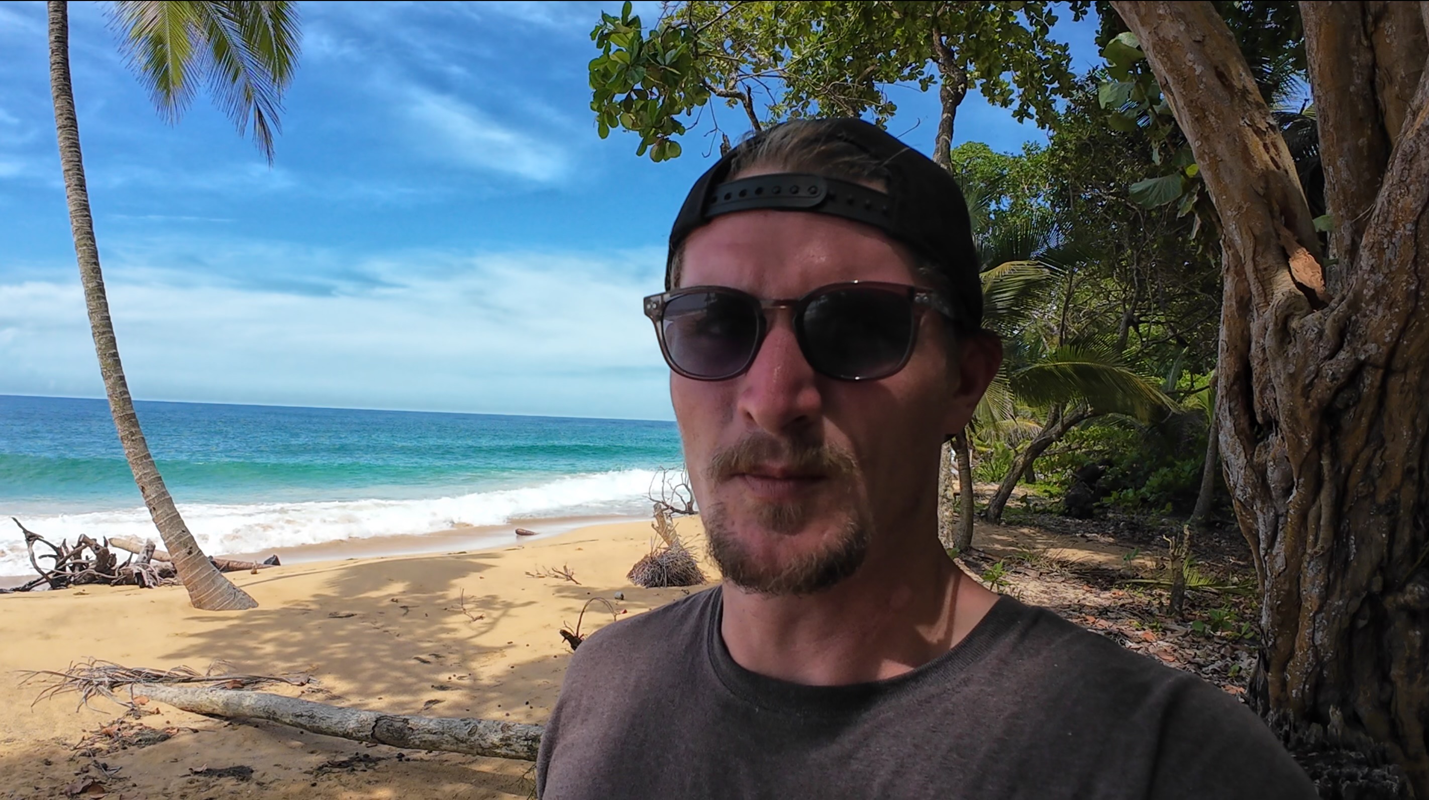
The blue-water crew of Perception (Marty, Grace, Jim) arrived at Grand Cayman on a fine Wednesday afternoon after a raucous 4-day sail from Panama. And boy is the water blue – after life in the Pacific; we’ve seen nothing like the clarity and brilliant azure color of the water surrounding the island. We cleared in at the port in Georgetown after following the harbor patrol pilot boat up to the quay. Port Security and the customs and immigration officials were all super friendly and helpful – a real pleasure after some of our experiences on the mainland over the past year. We had reservations at Marina Barcadere thanks to the shore-side persistence of Admiral Melinda and motored for 2.5 hours around the island into the bottom of North Sound to finally tie up and relax.

Our first surprise at Marina Barcadere was the docks – no floating docks! Obviously, the tidal range is minimal, about ½ meter while we were there, but we weren’t used to high docks that don’t move with you. It took some fender adjustments to get things right and avoid trapping our big ball fender under the dock during the tidal cycle. I don’t think we’ve ever been at a marina where we’ve had to step off Perception at the shrouds.

The marina is in decent shape with wooden docks that are sound, with solid power, and potable water. The marina office is in the nearby Scotts Marine building which contains a chandlery mostly targeted at fishing boats. The boat yard sports a 26-foot beam travel lift – I haven't had a chance to investigate further but it could have been a haul-out point even for our fat cat. The nearby Georgetown Yacht Club has a good restaurant where we dined three times during our stay. Conch fritters anyone?
We had about a day and a half to tour the island while waiting for our next weather window. The airport rental car center is just a 15-minute walk from the marina, so we picked up a little Toyota for about $45 per day and buzzed around the island. Our first stop was the Cayman Crystal Caves on North Side. The caves were opened for touring relatively recently, and offer 1.5 hour guided tours of the caves. (https://www.caymancrystalcaves.com/)
The caves and surrounding grounds are quite interesting and extensive. Our guide entertained us with history and information about the flora and fauna of the area. I was impressed at the good condition of the caves and features inside. They seemed little disturbed other than what had been done to open the caves for visitors. The lake in the caves offered a reflective view of the cave ceiling deeper in, and was the gem of the tour.


Our next stop on the island was Hell, pretty much a tourist trap but a fun and free stop where you can mail a postcard from Hell if the post office is open. The attraction in Hell is really just a jagged assortment of limestone rock formations with a couple of wooden platforms for an overlook. Hell is a painless stop on the way to the Cayman Turtle Center as long as you aren’t competing with a busload of cruise ship passengers.


Our last tourist stop on the island was the Cayman Turtle Center ( https://www.turtle.ky/). The center opened in 1968 and is billed as the longest operating conservation center for green turtles. The main attraction is the turtle breeding bay, where approximately 280 turtles are in constant motion giving you an up-close view of the massive animals. The bay is backed by a sandy beach where the females can lay their eggs which are then collected by the park staff to incubate in a controlled environment.
The friendly park guides provide information about the center and the turtles therein, happily pointing out Sparky, the oldest turtle in the pond at 95 years. There are many other pools in the park where you can get really close to the big turtles and touch the smaller ones.


After a few days stretching their sea legs SY PERCEPTION got their weather window from the Cayman Islands to Isla Mujeres Marina, Mexico. Jim reports that,"The sail from Cayman to Isla Mujeres was a pretty wild ride for me" and " We sailed almost the whole way with just our white sails doing 7-10 knots (pretty good for our cruising cat and my sailing skills)." With this leg of their voyage behind them they are now they are enjoying some well deserved downtime poolside.

SY PERCEPTION 🇺🇸 Jim & Melinda & Grace - Lagoon 42'


THANK YOU FOR SHARING YOUR ADVENTURE!

CANAL CROSSING NOTES
CANAL CROSSING NOTES
Many Ocean Posse members cross the Panama Canal at some point on their journey. When this time comes people often wonder about the actual logistics of the transit, what food and beverages make for an easy day and happy line handlers, etc...
SV BRIGADOON III recently crossed the Panama Canal and is sharing the notes they shared of their experience to "give some friends a feel for what to expect and see it from my perspective".


The night before the transit, the four line-handlers arrived with the fenders and lines. One of the line-handlers was (Posse Sponsor and Canal Agent) Erick (Galvarez)’s son, Juan and another was Juan’s uncle “Junior”. Junior seemed to be the head line handler and gave the others direction. They slept one on each salon sofa, one in the aft quarter berth and Junior slept in the cockpit because, as he said, he snores.
The line-handlers arrived on time, as planned, at 6:30 pm and we had dinner ready for them -Spanish style meatballs in a roasted pepper sauce on Orzo, bean-corn salad and grapes for dessert. They devoured everything and all wanted to know what orzo was. They also drank water and Coke. I had read that they like Coke; regular not diet.
We had dinner before they arrived to simplify things. After dinner, they took off and Junior stayed and went to bed. Doug and I also went to bed and didn’t hear a peep from anyone.
We got up at 2:30 am and left the marina at 3:15 am to travel to a point between markers 2 and 4 to pick up our advisor. This area is just outside of Playita Marina. It took a while for Carlos, our advisor, to show up in the big pilot boat but eventually did and readied himself in the rocky seas for a very heroic leap to our boat. Once the advisor was aboard, all the line-handlers, except uncle Junior, went back to bed and we travelled in the dark under the Bridge of the Americas to the first lock which is about 7.5 miles from where we had picked up Carlos at about 4:15 am.
It was just getting light when we entered the first lock. The advisor gave us instructions and explanations for everything we needed to know as we went along, such as what to expect in the lock and that it takes 8 minutes for the water to fill the lock. He also explained how and when we would raft up to the other sailboat we were travelling with.
Because we were up-locking, we would travel behind the commercial ship. At the other end we would be down-locking and would be in front of the commercial ship.
We cleared the third lock at about 8 am so I got the coffee on and had oranges and muffins for everyone to tide them over while I made breakfast - rice and beans, eggs, avocado and salsa plus orange juice and more oranges. They love rice and beans.
As expected, the three younger line handlers went below to bed or rest and we carried on through Gatun Lake passing huge freighters going the opposite way.
At 12 noon and before we got to the Gatun locks, I made lunch - Chicken Chorizo Paella, grapes and watermelon. They also had water, coke and orange juice. Again, they gobbled it all up and helped with the dishes. Phew, no more dinners. We continued through the Gatun locks and about 20 minutes later the pilot boat showed up for Carlos the advisor. The three line-handlers continued on with us to Shelter Bay and Erick was waiting for them to transport them back home.
I want to add a comment on the line-handlers. Generally, when they are not needed, they are happy to hang out inside the boat. They were professional, tidy and kept their bags away and out of sight. They seemed to have a sixth sense of when they were needed as they would appear topsides, ready to work, out of nowhere. I suspect Erick has coached them because they were quiet, pleasant and thanked me for every meal. As for food, they liked the rice dishes and fruit. They had seconds of these dishes and they can pack away the food. They were not too interested in sweets such as muffins but did eat a bit of the chocolate that I had. According to Erick, they also like pasta. Remember, lunch is their main meal of the day. They appreciate water and Coke and enjoyed the orange juice I had.

SV SUMMERBREEZE followed in the wake of SV BRIGADOON III and found the notes super helpful.
SY BRIGADOON III Doug & Patty – Saga 43’ & MV SUMMERBREEZE 🇺🇸 Sam & Kurtis - Bestway 46'

THANK YOU FOR SHARING YOUR NOTES AND YOUR COMMUNITY SPIRIT WITH ONE ANOTHER!