BOCAS DEL TORO BEACH CLEAN UP
Report from Maison de Sante:
We had a nice group of Posse boats and local residents here in Bocas Del Toro, Panama who came out this morning for clean up on Red Frog beach. Many pounds of plastic garbage was collected 😊. The strangest items collected included a bicycle mud flap, a scuba purge valve, and a diaper🤢. Some people had to leave early so not everyone is pictured. Stay tuned for a future date where we can ALL participate in beach clean up wherever you are located!
SY BISOU 🇦🇺 Robin and Tad - Fountaine Pajot 44′ & SY MAISON DE SANTÉ 🇺🇸 Nicole & Keenan - Cal 46'
THANK YOU FOR BEING STEWARDS OF OUR ENVIRONMENT!
MUST SEE: LEVUKA, FIJI
THE ORIGINAL GUNKHOLES OF THE SOUTH PACIFIC
Levuka is a town on the eastern coast of the Fijian Island of Ovalau. Up until 1877, it was the capital of Fiji. Currently, this strangely haunted town has a population of about 5,000. It is the economic hub of the largest of 24 settlements on the Island. Levuka was designated a UNESCO World Heritage Site in June 2013, in recognition of the port town's exceptional testimony to the late colonial port towns in the Pacific Ocean.
The modern town of Levuka was founded around 1820 by European settlers and traders as the first modern town in the Fiji Islands. Levuka quickly became an important port and trading post in the Pacific. A disparate band of settlers made up Levuka's population- traders, missionaries, shipwrights, speculators, vagabonds, and even respectable businessmen. Much of Levuka’s unique heritage is in its wooden architecture (highly vulnerable to fire).
The South Pacific's first Masonic Lodge was built in 1913 and housed the Freemasons that were established in Levuka by Alexander Barrack in 1875. There is much controversy about the Masonic fraternity in Fiji. The dominant traditional Christian faiths consider the Masons to be devil-worshippers. The Masonic Lodge was burned down in the 2000 Fiji coup d'etat. The Lodge contained priceless historical artifacts and records of Levuka's history dating back to 1875. The arsonists have yet to be identified and prosecuted.
CALL TO ACTION: FORWARD NEWSLETTER TO A FRIEND
CALL TO ACTION:
HELP THE OCEAN POSSE EXPAND OUR NEWSLETTER SUBSCRIBERSHIP
AND FOLLOW US ON INSTAGRAM
We enjoy sharing our weekly fleet update with you and putting the spirit of adventure on the water out to the world. People enjoy seeing the Pictures of the Week, reading Stories from the oceans, learning about Webinars, Meet ups, Safety / Security Alerts, and finding Perks from our sponsors.
As our readers and members know we are in the process of expanding our membership, expanding our connections within the maritime industry, and expanding our perks. We have LOVED putting out this free resource to you for all these years (8!! )....AND we need your help expanding our subscribership.
Could you please think of 5-10 friends or family members that you think would love the newsletter and pass them the link?
https://oceanposse.com/
Subscribing to the newsletter is one of the best ways to get people to learn about the Posse and what we do.
- Maybe they arehttps://oceanposse.com/ someone who dreams of cruising.
- Maybe they are someone who already does.
- Maybe they love sharing in the adventurous life from a slip or from shore.
Whoever you share with, we thank you - this is a great way to join us in our mission of expanding the Posse and finding more mariners who want to:
“Sail on your own schedule”, discover good anchorages, marinas and world heritage sites while joining a fleet of explorers, cruisers and adventurers
GOOD NAUTICAL: BAIE MARQUISIENNE
Nuku Hiva, Marquesas
8°54.8555'S, 140°13.4389'W
Baie Marquesienne is on the western facing side of the island of Nuku Hiva. The Trade Winds generally blow from the East or SE; the swell is similar so this anchorage is generally in the lee of the island making the anchorage very calm and surprisingly dry. Since the water is calm, the clarity is pretty good too and there is a nice spot to snorkel on the N side of the anchorage. I saw sharks, dolphins, and lots of very colorful fish among large boulders and small bits of coral here and there. The bay is surrounded by rocky hillsides that appear to be dry with patches of green vegetation where wild goats roam and bleat all day long. A valley winds up into a steep canyon.
The head of the bay is a rather steep too so landing is not really an option. We have four people onboard and were fortunate to have two that wanted to stay onboard and two that wanted to explore. So, we got dropped off on the beach, brought a radio, some water, and headed off into the wild. There is no marked trail to follow but there are waterways (some dry, some running, some rushing) that we followed up and up and up...until we could not go up any more. As we travelled up the valley we found an oasis and a waterfall, wild pigs and goats, many different flowering trees and plenty of shade to stay cool.
https://goodnautical.com/french-polynesia/anchorage/anse-uea-bai-marquisienne
SURFING IN POLYNESIA PAST TO PRESENT
with help from Russell Descheemaeker age 14
Polynesia covers a vast stretch of Pacific Ocean Islands that has a longstanding history of distinctly self-sufficient island people who spoke their own unique language that had a rich seafaring life in common. What is known as modern day surfing once went by many different names from “Hōrue” (Tahitian for gliding on the waves) to heʻe nalu (Hawaiian for wave sliding). While the word for the activity varied by dialect, early water sliding and gliding dates as far back as the 12th century in Polynesia. Many believe that this water activity had religious significance and was seen as an important part of ancient Polynesian life and culture before making tis way to Hawaii where it developed and grew substantially. Formally, surfing was recorded by Joseph Banks aboard the Endeavour during the first journey of the famous Captain James Cook in Tahiti 1769.
Joseph banks wrote in Captain Cook's journal
...their chief [sic] amusement was carried on by the stern of an old canoe, with this before them they swam out as far as the outermost breach, then one or two would get into it and opposing the blunt end to the breaking wave were hurried in with incredible swiftness. Sometimes they were carried almost ashore...”
In Tahiti and Samoa, surfing was a popular activity that was often used as part of warriors' training. Said warriors would often be seen by early Europeans paddling to surf breaks spending many hours bravely paddling head-on into large surf and riding waves. Canoes often went with surfing parties and the men would often swap between canoeing and paddling boards.
In the late 1700's missionary’s spread the word of God through Polynesia. Much native culture, language, and spirituality was suppressed as a direct result of contact with early missionaries. (Side Note: The Shark God by Charles Montgomery is an interesting story tracing the history of missionaries in Polynesia) Wave sliding was deemed a form of Devil worship and was thereby among the suppressed native activities. However, the sport was so widespread across the Pacific Ocean that it was not fully stamped it out. In Hawai'i, surfing had become ingrained into the very fabric of Hawaii'an religion and culture that it managed to withstand many tests through time, conflict, and diseases brought by early Europeans. Some estimates speculate that the native population of the Hawaiian islands was about 800,000 people before European germ contact dessimated the native population to 40,000. There were surfers among the survivors and the sport continued to entertain, interest, and connect people to the water. In 1890, a man named Duke Paoa Kahinu Mokoe Hulikohola Kahanamoku was born. In his lifetime, he changed the sport, restoring its popularity and fanfare. Duke was a two time gold mettle Olympic swimmer and he loved the water. His love was contagious.
Duke died at the age of 77 on January 22, 1968. The sport continued to grow and his memory and influence live on. Fast forward to the present and surfing is enjoyed by enthusiasts both recreationally as a relaxed water activity and by olympic athletes as a modern and extreme sport.
France is currently hosting the 2024 Surfing Olympics on the South side of the island of Tahiti, an island in western French Polynesia. The world famous blue barrel wave called Teahupo'u was so big on Thursday July 29, that the surfing games are on hold until Saturday, Aug 3rd.
A very interesting graphic and description of the wave and how it is uniquely formed by off the mountainous reef fringed reef is here:
https://www.reuters.com/graphics/OLYMPICS-2024/SURFING/akpeoxnyopr/
LAND TRIP: DELTA SWIZZLER BEATS THE MEXICAN HEAT AT 5000'
LAND TRIP: MV DELTA SWIZZLER CREW
BEATS THE MEXICAN HEAT AT 5000'
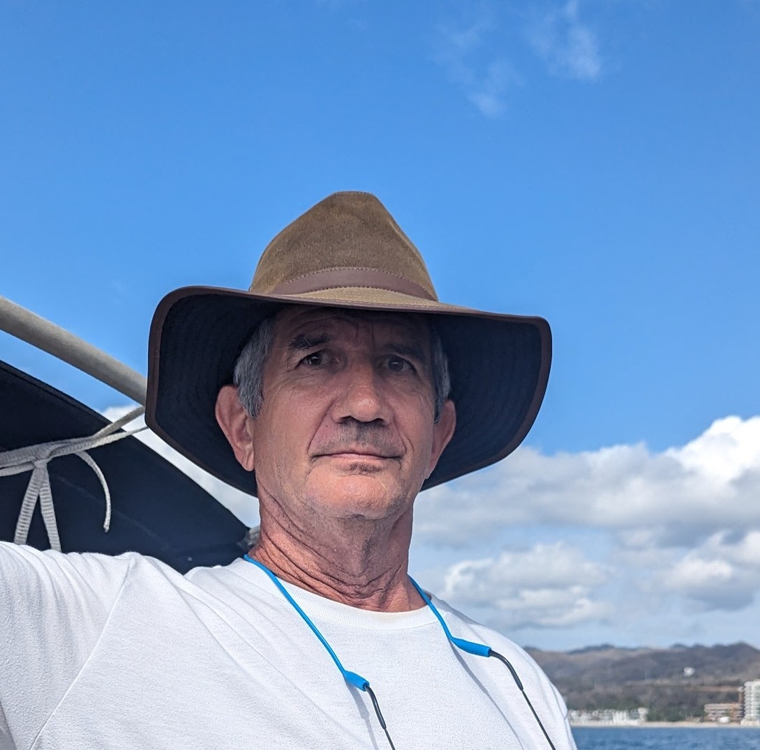
Mexico is known for so much: rich history, relics of ancient civilizations to modern cities, colorful art, lively music and dancing, and flavorful food to name a few. Mark and Cindy on MV DELTA SWIZZLER have been members of the Posse since the beginning. They have travelled down from California through the Panama Canal and back to Mexico over many years. Currently, they are beating the heat at sea level and enjoying some of Mexico's many and varied communities at higher elevations inland. Travelling inland is an excellent way to see more of what Mexico has to offer.
MV DELTA SWIZZLER Mark & Cindy - Vantare 58
STAY COOL AND THANKS FOR SHARING YOUR ADVENTURES INLAND
SEASON 8 AWARD ENTRIES: PHOTO OF THE YEAR NOMINATION
SY PERCEPTION 🇺🇸 Jim & Melinda & Grace – Lagoon 42′
MY TIDINGS OF JOY 🇺🇸 Jeff & Joy – DeFever 52′
SY WANDERLUST 🇺🇸 Kristin, Fabio, & dog Yoda – Seawind 1600
SY WHIRLWIND 🇺🇸 Maurisa, Mike, Russell & Josea – Alajuela 48’
MV SUMMERBREEZE 🇺🇸 Kurtis – Bestway 46′
SV ALICORN Devona -Lagoon 44.5
OCEAN POSSE AWARD CATEGORIES:
- BIGGEST FISH CAUGHT*
- PICTURE OF THE YEAR
- YODA OF THE YEAR
- SPEEDY AWARD – SEVENSTAR AWARD
- THE CAPTAIN RON AWARD
- MOST UNWELCOME VISITOR ONBOARD
- HIGHEST WIND RECORDED
- SPIRIT OF EXPLORATION
- GALLEY GOD(ESS)
- GOOD SAMARITAN OF THE YEAR
- BOAT YOGA POSE OF THE YEAR
- COURAGE AWARD
SUBMIT PHOTOS OF ALL NOMINATIONS TO EDITOR@OCEANPOSSE.COM
MUST SEE: LAUREL FOREST IN SAO VICENTE, MADEIRA 🇵🇹 PORTUGAL
MUST SEE: LAUREL FOREST IN SAO VICENTE,
MADEIRA 🇵🇹 PORTUGAL
Portugal's Madeira Island is an island in the Atlantic off the coast of Africa. Madeira itself is a sight to behold. The volcanic island erupted in the Ocean during the Miocene Epoch about twenty million years ago. After the lava cooled and erosion shaped the island.
The highest point on the island stands at 1,862 metres (6,109 feet) and the distance to Madeira’s submerged base at the bottom of the Atlantic is just over 6,000 metres (about 20,000 feet).
The spectacular landscape of the Laurisilva Forest is a strongly scented, integral part of Madeira Island's landscape. Its lush vegetation hides the fascinating indigenous laurel forest, recognized by UNESCO in 1999 as Natural Heritage of Humanity. The Laurisilva of Madeira is an outstanding relic of a previously widespread laurel forest type. Historians believe that forty million years ago up until the last Ice Age there were great swaths of Laurisilva forest covering much of southern Europe. However, today this ecosystem is mostly confined to the three Atlantic archipelagos of Madeira, Azores, and the Canaries.
The Laurisilva Forest of Madeira is the largest surviving area of laurel forest and is believed to be 90% primary forest meaning the trees in this forest have never been cut down. This forest area dates back to the dinosaurs and has somehow survived almost six hundred years of human habitation. The forest contains a unique suite of plants and animals, including many endemic species such as the Madeiran long-toed pigeon. Madeira is … World Heritage
The Laurisilva Forest is not only a UNESCO site preserved for it's unique beauty and as an example of primary forest; this forest is also it is a precious mass of fertile forest that plays an increasingly important role in maintaining the island’s hydrological balance and biological diversity.
The Laurisilva Forest of Madeira has long played and important role to the islanders. Much of the forest is criss-crossed by a network of irrigation channels known as Ievadas which carry water from the fertile north to the more arid regions on the south side of the island.
Laboriously cut from the sturdy mountain rock to transport water to the island’s plantations and hydro-electric power stations, the levadas date right back to the island’s very first settlers in the early 15th century.
Today, the the levadas still play an essential role in the cultivation of a variety of crops, including bananas, grapes (used for making Madeira wine), sugar cane and passion fruit, that grow in abundance all over the island.
Interested in learning more of the history of this special place, click this link:
https://viajealpatrimonio.com/listing/laurisilva-de-madeira/
POSSE PERK: UP TO DATE AND VERIFIED INFORMATION BY FELLOW YACHTS
POSSE PERK: UP TO DATE &
VERIFIED INFORMATION BY FELLOW YACHTS
Ocean Posse members share a chat group where members ask questions, share informations, and pictures. Members appreciate the 'Up to Date & Verified Information' shared in the group chats.
Recently, Lyle on MV ALGONQUIN asked:
Hello. For those in the know could we get some information on how far out we should be contacting the agent to schedule our canal transit? Rough plan at this point is late December early January transit west to east.
Currently boat less in Canada Vancouver Island preparing the house for rental and disposing excess land assets in preparation for full time live aboard. Returning to the boat in PE mid September.
SV MAISON DE SANTE answered from their experience going through the Panama Canal last season:
I don’t think any time is too early to connect to an agent because you can reach out and get the list of info they will need like photos and measurements for the boat and just be that much more prepared. South to North didn’t start getting busy until mid January last season so picking a transit date would probably be important to do by November. They don’t like changing dates so try to firm it up when you’re closer and pretty certain on a date.
I’ll reach out to Erick Galvez.
.....After Reaching out to Ocean Posse Canal Agent Erick Galvez.....
🇵🇦PANAMÁ CANAL🇵🇦
You must be near the Panamá Canal with a verified arrival either with AIS validation or a photo of your vessel anchored near the canal or at a nearby marina. If anchored, they will visually look for your vessel.
Last season, you were allowed to request a transit date prior to arriving in Panamá and it created too many issues, according to Erick Galvez.
You are allowed to leave once you have your date confirmed. The furthest out you can request your transit date is 2 months.
The average wait time for the earliest transit date is as follows, according to Erick.
December and prior: 3-4 days
January: 5-10 days
February: 10-20 days
March: 20-30 days
THANK YOU FOR ASKING QUESTIONS,
SHARING YOUR EXPERIENCE AND USEFUL INFORMATION
GOOD NAUTICAL ON THE WEST COAST OF THE BAJA: BAHIA SAN QUINTIN
GOOD NAUTICAL ON THE WEST COAST OF THE BAJA:
BAHIA SAN QUINTIN, MEXICO
30° 23.7384′ N, 115° 55.5760′ W
Posse members on the West Coast are beginning to set their sights on the southbound journey. Consider a stopover in Bahia San Quintin on the west cost of the Baja Peninsula. Whale watching, sport fishing and fantastic seafood bring tourists to San Quintin. Oysters, mussels and abalones are harvested from the crystal clear waters of the bay so please avoid dumping waste of any kind overboard. The lagoon provides great opportunities for dinghy exploration and the remains of an abandoned British colony lie in the shore of the inner bay.
Anchorage
The anchorage on the east side of the bay is open to the SW and feels quite exposed with surf breaking even a mile offshore. Anchor on a sandy bottom in 5-10m just outside the shoal line which is marked by small breakers.
https://goodnautical.com/mexico-pacific/anchorage/bahia-san-quintin
Bahía San Quintín, located on the Pacific coast of Baja California, Mexico, is a hidden gem for sailors seeking an authentic and tranquil maritime adventure. This natural harbor, about 190 nautical miles south of San Diego, offers a unique blend of pristine beauty, rich marine life, and a glimpse into the unspoiled wilderness of Baja California.
Geography and Navigation
Bahía San Quintín is a broad, sheltered bay framed by volcanic hills and sandy beaches, providing excellent protection from the Pacific’s swells. The bay is about 6 miles wide and 11 miles long, offering ample anchorage space with good holding ground in sand and mud. The entrance to the bay can be tricky, especially for first-time visitors, due to shifting sandbars and shallow areas. It is advisable to enter during daylight with good visibility and to use updated nautical charts. Depth sounders and GPS are essential tools for navigating safely into the bay.
Weather and Climate
The climate in Bahía San Quintín is typically mild and dry, with average temperatures ranging from the mid-50s to the mid-70s Fahrenheit. The area enjoys a Mediterranean climate, with dry summers and mild, wet winters. Fog can be a common occurrence, especially in the mornings, so sailors should be prepared for reduced visibility at times. Winds are predominantly from the northwest, providing favorable sailing conditions for those heading south.
Flora and Fauna
Bahía San Quintín is a haven for nature lovers. The bay and its surrounding areas are home to a diverse array of wildlife. Birdwatchers will be delighted by the presence of numerous bird species, including the endangered black brant, as well as various shorebirds and waterfowl. The bay’s waters teem with marine life, making it a popular spot for fishing and snorkeling. Anglers can expect to catch species such as halibut, sea bass, and yellowtail.
Activities and Attractions
For sailors looking to stretch their legs, the area offers plenty of onshore activities. The surrounding landscape is perfect for hiking, with trails leading through volcanic rock formations and coastal dunes. The nearby fishing village of San Quintín provides a glimpse into the local culture and an opportunity to sample fresh seafood, particularly the region’s renowned oysters and clams. Visiting the local oyster farms can be a fascinating experience, offering insights into the aquaculture practices that sustain the local economy.
Services and Facilities
While Bahía San Quintín is relatively undeveloped compared to more popular tourist destinations, it offers essential services for visiting sailors. There are a few basic facilities, including fuel, provisions, and some repair services available in the village of San Quintín. It is advisable to stock up on necessary supplies before arriving, as options may be limited. For those needing more extensive services, the port of Ensenada, located about 130 nautical miles to the north, provides a wider range of amenities, including marinas, chandleries, and professional repair services.
Conservation and Sustainability
Bahía San Quintín is part of a protected natural area, and visitors are encouraged to respect the environment and practice sustainable boating. Efforts to preserve the bay’s natural beauty and biodiversity are ongoing, and sailors can contribute by following Leave No Trace principles, minimizing waste, and avoiding damage to sensitive habitats such as seagrass beds and bird nesting areas.
Conclusion
Bahía San Quintín offers a serene and rewarding destination for sailors looking to explore the less-traveled waters of Baja California. Its natural beauty, abundant wildlife, and tranquil atmosphere make it an ideal spot for those seeking to experience the unspoiled charm of Mexico’s Pacific coast. Whether anchoring in its calm waters, exploring its diverse ecosystems, or engaging with the local community, sailors will find Bahía San Quintín to be a memorable and enriching part of their maritime journey.
Landing on the Beach in High Surf
Landing on the beach in high surf at Bahía San Quintín can be challenging and requires careful planning and execution. The key to a successful landing is timing and understanding the wave patterns. It is essential to observe the surf for a period to identify any lulls between sets of larger waves. When ready, approach the beach at a 90-degree angle, maintaining enough speed to stay ahead of the breaking waves. As you near the shore, reduce speed and be prepared to jump out and pull the dinghy up the beach swiftly to avoid it being swamped by incoming waves. Ensure all equipment and passengers are secure, and wear appropriate safety gear such as life jackets. Landing in high surf can be risky, so if conditions seem too dangerous, it might be best to wait for calmer seas or find a more sheltered landing spot within the bay.