
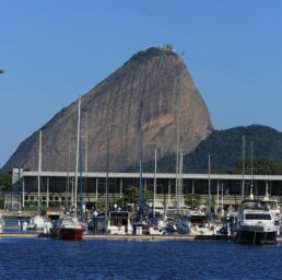
MARINA DA GLORÍA 🇧🇷 BRASIL - SPONSORS THE OCEAN POSSE
MARINA DA GLORÍA 🇧🇷 BRASIL – SPONSORS THE OCEAN POSSE
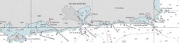
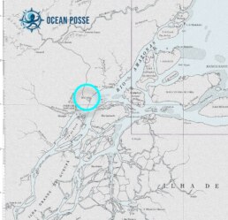
22° 55.0666′ S 043° 10.2133′ W
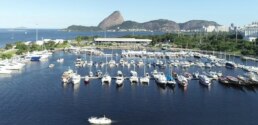
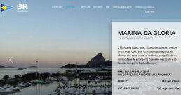
MARINA GLORIA IS PROUD TO WELCOME THE OCEAN POSSE
We offer a 5% discount on the daily package price, based on the current rate at the time of use, for members of the Ocean Posse. Energy, water, and other services provided to vessels during the daily rate will be charged separately at the current rate and will be agreed upon arrival between BR Marinas and the vessel.
Marina da Glória combines several qualities in a single location. With a privileged location, it offers its users comfort, tranquility, and the convenience of being close to the city center and next to Santos Dumont Airport.
Amenities
- Electricity
- Water
- Showers
- Restrooms
- Fuel
- Wifi
- Restaurants
- Laundry Machines
- Chandlery
- Security
- Pharmacy
- Sailing School

GLORIA MARINA SAFE APPROACH
LOCATION
OFFICIAL WEBSITE >>
NEARBY
Igreja de Nossa Senhora da Glória do Outeiro
Built in 1739, this hilltop Baroque church is one of Rio’s most beautiful colonial landmarks. Its whitewashed façade and gilded interior reflect the Portuguese influence, while the elevated site gives sweeping views of Guanabara Bay.
Praça Paris (Paris Square)
A formal French-style garden designed in the 1920s, complete with symmetrical walkways, fountains, and manicured flowerbeds. It was modeled after the gardens of Versailles and restored to its original elegance in recent years.
Monument to the Dead of World War II
A striking modernist memorial erected in the 1960s, honoring Brazilian forces who fought in WWII. Its solemn architecture and eternal flame make it an important national remembrance site.
Museum of Modern Art (MAM Rio)
Housed in a landmark building designed by Affonso Eduardo Reidy, the museum features Brazilian modern and contemporary art. Its permanent collection and rotating exhibitions make it a cultural centerpiece of Flamengo Park.
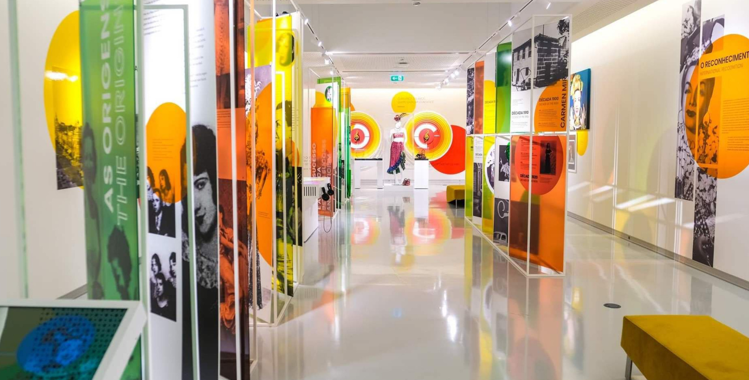
Carmen Miranda Museum
A quirky and colorful museum dedicated to Brazil’s beloved samba singer and Hollywood star. It showcases her costumes, jewelry, and stage memorabilia—perfect for a deep dive into Brazilian popular culture.
Glória Neighborhood Streets
Wandering the sloping streets of Glória reveals a mix of colonial townhouses, early 20th-century mansions, and traditional bars. It’s one of Rio’s oldest neighborhoods, full of atmosphere and a sense of lived history.
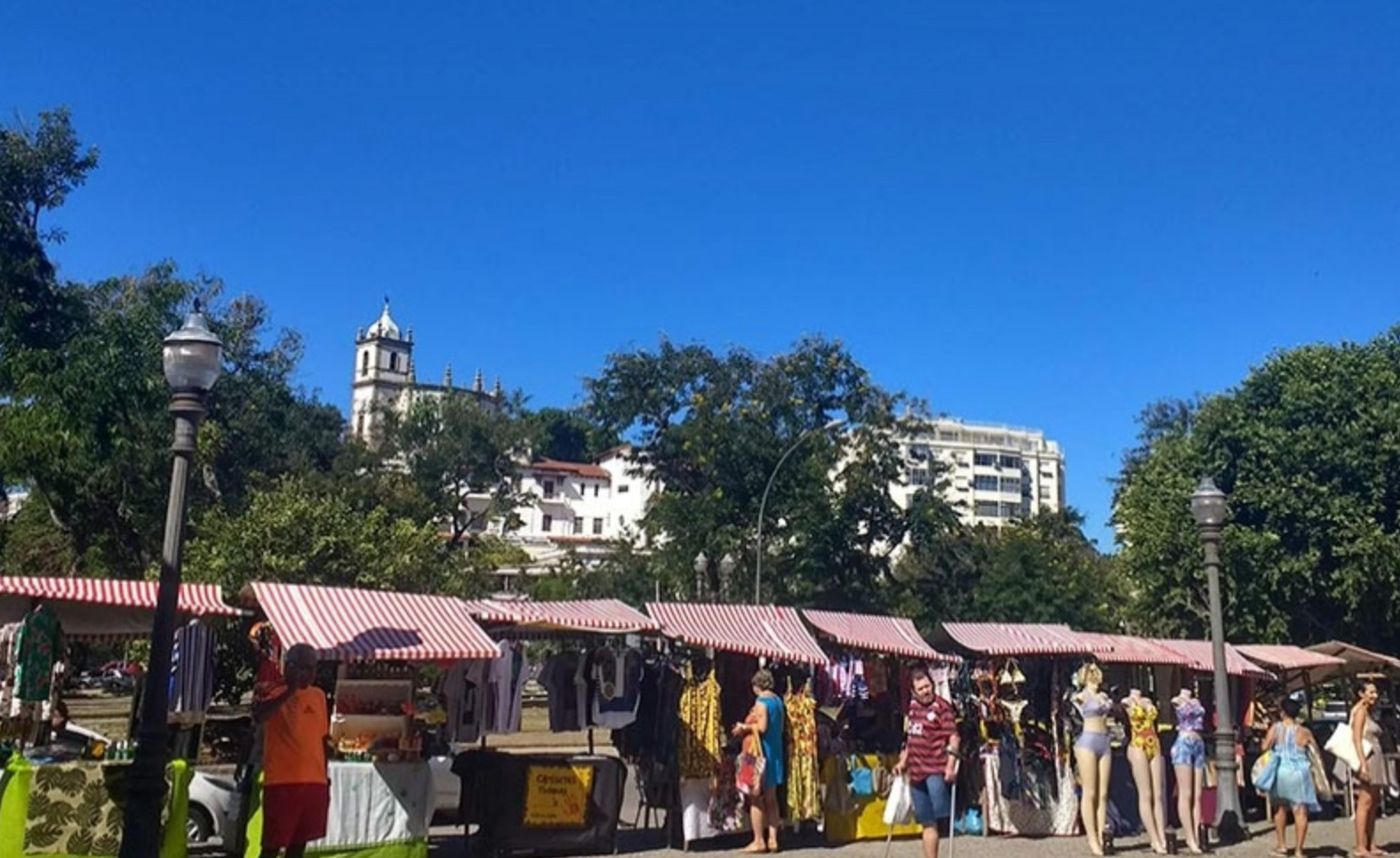
Glória Fair (Feira da Glória)
Held every Sunday since the 1940s, this bustling open-air market offers fresh produce, tropical fruits, and typical Brazilian street food. It’s as much a cultural immersion as it is a local shopping tradition.
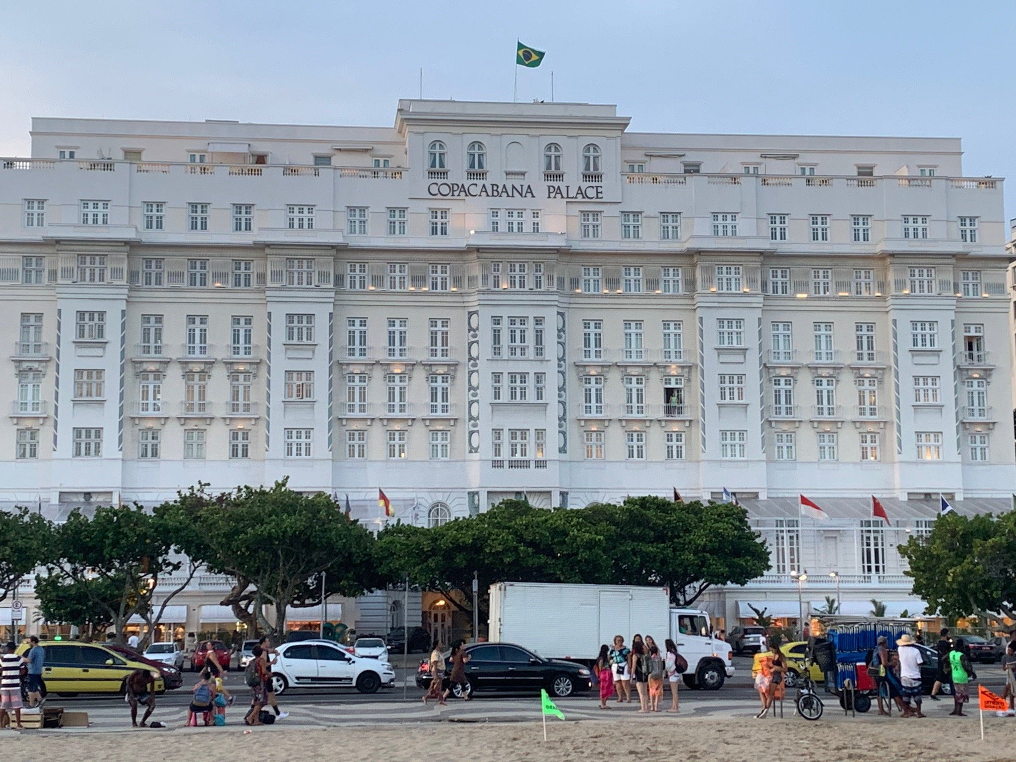
Hotel Glória (Historic Facade)
Opened in 1922, this Art Deco-influenced hotel was once Rio’s most glamorous address, hosting heads of state and celebrities. Although currently closed, its elegant exterior remains an architectural highlight of the neighborhood.
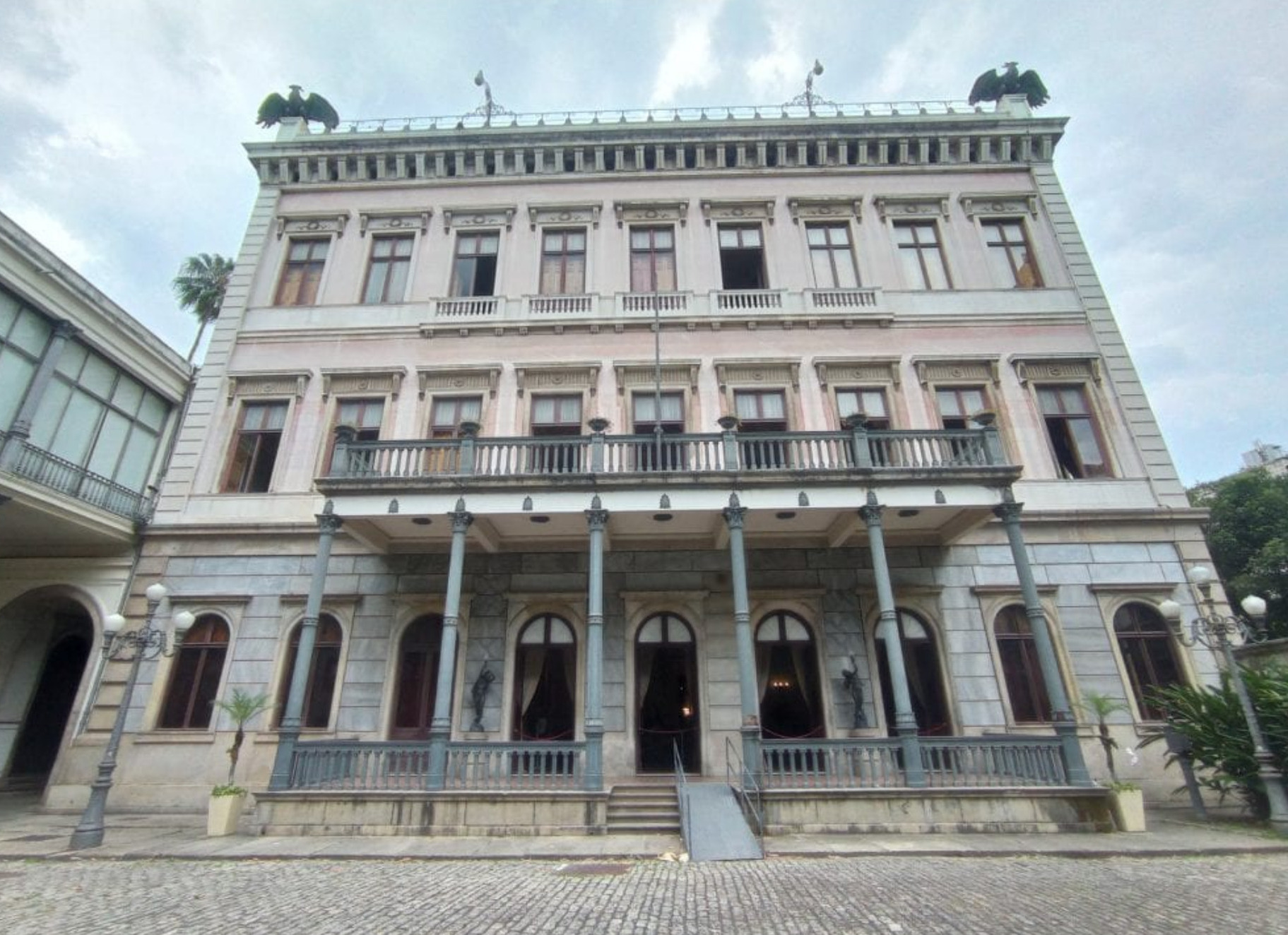
Catete Palace (Palácio do Catete)
Just a short walk from Glória, this 19th-century neoclassical palace was Brazil’s presidential residence until 1960. Today it houses the Museum of the Republic, showcasing artifacts from Brazil’s political history.
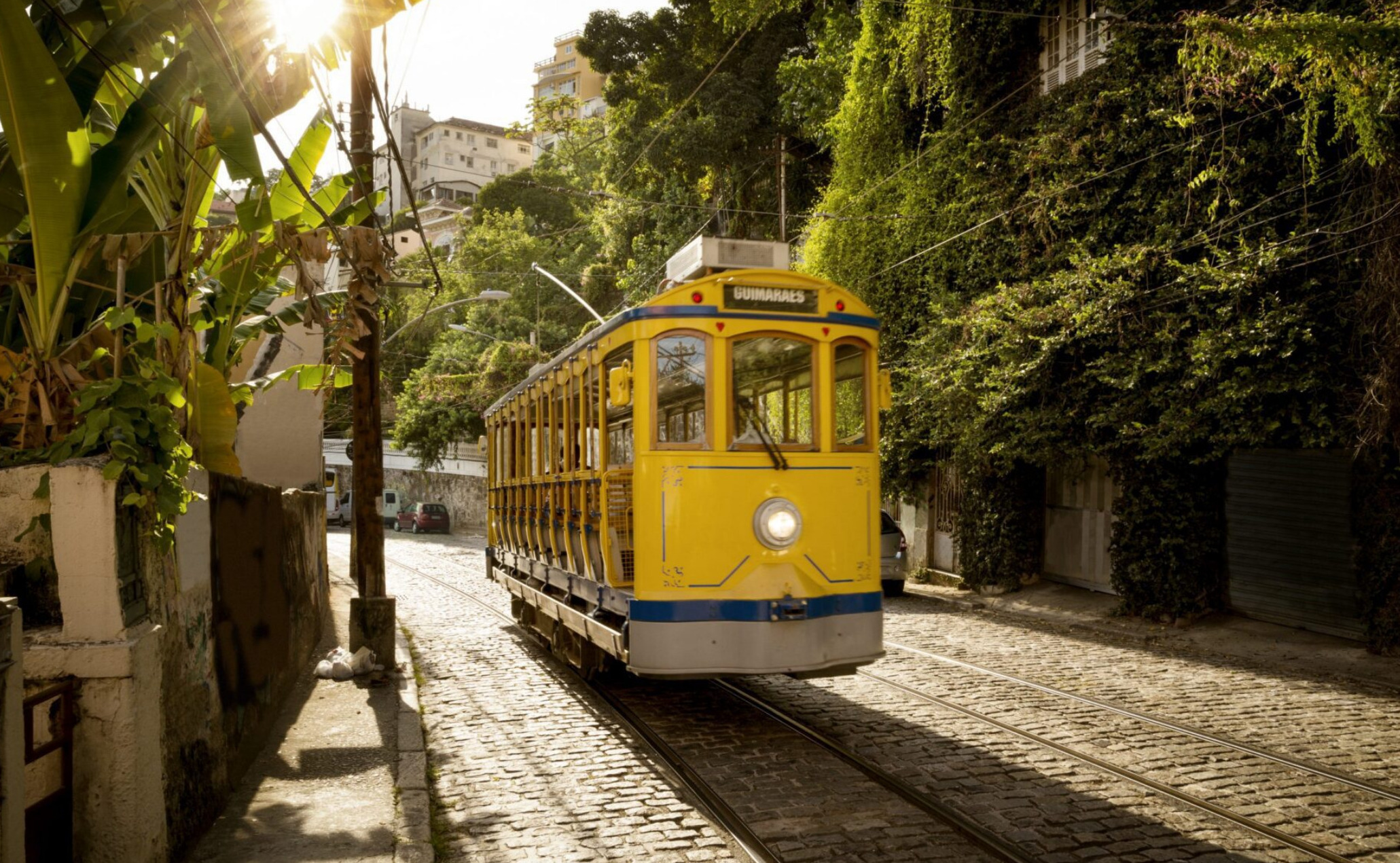
Santa Teresa Tram & Neighborhood (Nearby)
A historic tramway runs from downtown into Santa Teresa, a bohemian district perched on a hill above Glória. Its colonial houses, ateliers, and murals make it one of Rio’s most charming cultural quarters.


Must See and Sail the Amazon
Must See and Sail the Amazon 🇧🇷
The Call of the River Sea
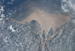
Few waterways on Earth carry the weight and mystery of the Amazon River. To sailors accustomed to oceans and coastal passages, the Amazon offers a different voyage altogether—a journey not defined by horizons and swell but by endless freshwater, jungle canopies, and currents that rival trade winds in strength. For those answering the call of the sea upriver, the Amazon is as much about seamanship as it is about discovery. It demands respect, careful planning, and a willingness to navigate both bureaucracy and nature. But in return, it offers encounters with cultures, wildlife, and landscapes unmatched anywhere in the cruising world.
How to Approach the Mouth
The Amazon’s estuary is immense, more like a sea than a river. Its mouth stretches more than 150 miles wide, with tidal flows strong enough to push or hold a yacht at four knots. The pororoca—the famous tidal bore—sends walls of water racing inland with thunderous power, and while spectacular, it can overwhelm an unprepared vessel.
Entering from the Atlantic, most yachts aim for Macapá, situated near the equator on the northern bank. This is where many clear in with Brazilian authorities. Anchoring here requires care: mud bottoms, heavy tidal currents, and limited holding make dragging a real risk. Double anchors, preferably set in opposite directions, are recommended.
Timing is everything. Arrive near slack water, and plan anchoring strategies with the same seriousness you’d devote to reefing a mainsail before a squall. Captains accustomed only to coastal cruising will find the Amazon’s tidal hydraulics sobering.
Clearance and Bureaucracy
Patience is a virtue when dealing with Amazonian formalities. Immigration and customs in Macapá or Belém can take a full day. Officers are generally polite and professional, though procedures are slow and sometimes involve multiple offices. Captains should bring all ship’s papers, crew passports, and—crucially—a sense of calm.
Brazil issues visas of varying length depending on nationality, often between 90 and 180 days. Ensure passports have adequate validity and crew lists are accurate. Most yachtsmen recommend anchoring for at least two nights before starting upriver, to both recover from the Atlantic approach and finish paperwork.
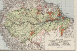
The River Itself—Currents, Depths, and Tides
The Amazon flows with the force of an ocean. Expect currents of three to five knots in the main channel, less in backwaters, but always present. Unlike ocean passages, where wind is your adversary or ally, here it is water movement that rules. An engine in good condition is essential. Relying on sail alone is possible in places but impractical against the steady push of the current.
Depth is seldom an issue—the river is deep enough for container ships bound for Manaus, nearly 800 miles inland. What is an issue are sandbanks, floating debris, and shifting channels. Radar helps, but so does a sharp bow watch. Heavy rains can release entire trees into the current, making collisions a hazard.
To clear your yacht into Brazil at the Amazon’s entrance near Macapá, proceed to the Fazendinha Pilot Station at
0° 03.435′ S 051° 06.6283′ W
and await inspection by Brazilian authorities during their working hours (08:00-12:00 and 14:00-17:00 local time). You must complete a Pre-Arrival Customs Declaration online beforehand and, depending on your nationality, may need an advance e-visa. After clearance, you can proceed upriver, but ensure your vessel is equipped with up-to-date nautical charts and avoid entering during the busiest times of the year if you prefer to avoid extremely high temperatures and humidity.
Steps for Clearing In
1. Pre-Arrival Online Declaration:
Complete the necessary Customs declaration online before your arrival.
2. Navigate to Fazendinha:
Proceed to the Fazendinha Pilot Station, located approximately 174 nautical miles from the North Bar, at coordinates above
3. Await Authorities:
Wait to be inspected by Brazilian authorities. The inspection typically occurs during their working hours: 08:00-12:00 and 14:00-17:00 local time.
4. Anchoring:
If you arrive outside of these hours, you will need to anchor in the nearby Macapá anchorage until you can be inspected.
5. Crew Visas:
Ensure all crew members have the necessary advance e-visas if required for their passports
6. Charts:
Have up-to-date nautical charts of the Amazon (charts 200-206 and 210) on board to navigate the channel safely.
Important Considerations
Authorities:
Be prepared for inspection by Brazilian authorities.
Timing:
Be aware of the authorities’ working hours and plan your arrival accordingly to avoid needing to anchor overnight.
Navigational Hazards:
While the pilot station provides information, the Amazon entrance is complex, so have your charts and be prepared for shifting sandbanks, changing currents, and river debris.
Security:
Take sensible precautions for your personal safety due to the extreme contrasts of wealth in Brazil.
Agents:
While using a local agent might be an option, it’s not strictly necessary for the clearance process.

Must-See Towns and Cities
Belém—Gateway to the River
Known as the “City of Mango Trees,” Belém lies at the edge of the estuary. Founded in 1616 as a Portuguese stronghold, it remains a lively colonial port with a bustling waterfront market at Ver-o-Peso. Here, sailors find a vivid introduction to Amazonian life: stalls overflow with açaí berries, river fish, and medicinal plants harvested deep in the jungle. Belém’s cathedral and fortress remind visitors of its maritime past, while its modern marinas offer respite for yachts.
Santarém and Alter do Chão
Roughly 500 miles upriver lies Santarém, where the Rio Tapajós meets the Amazon. The waters of the Tapajós are strikingly clear, contrasting with the Amazon’s sediment-rich flow. Just nearby is Alter do Chão, a river town famous for its white-sand beaches. When water levels drop between August and December, islands emerge, creating natural anchorages that resemble Caribbean lagoons—only surrounded by rainforest instead of palm-fringed coasts.
Manaus—The Opera House in the Jungle
The great city of Manaus is perhaps the Amazon’s most remarkable urban landmark. Once the heart of the rubber boom, its wealth built the ornate Teatro Amazonas, an opera house completed in 1896 with Italian marble, French glass, and European artistry—all transported at staggering expense. To arrive by yacht at this inland metropolis, after more than 800 miles of river navigation, is to witness firsthand the scale of human ambition in the heart of the jungle. Manaus is also the practical turnaround point for most yachts. Beyond it, the river narrows, and formalities increase near the Colombian and Peruvian borders.
Must-See Natural Wonders
The Meeting of the Waters
Just outside Manaus lies one of the Amazon’s most famous spectacles—the confluence of the Rio Negro and the Amazon (Solimões). For miles, black and brown waters flow side by side without mixing, creating a natural boundary visible from the deck. This phenomenon is due to differences in temperature, speed, and sediment load, and it is one of the must-photograph moments of any Amazon voyage.
Wildlife of the Flooded Forests
The Amazon is alive with creatures. Macaws flash scarlet and cobalt overhead. Pink river dolphins surface near bows. Sloths cling to riverside branches. For those with dinghies or kayaks, the flooded igapó forests offer a chance to glide silently under the canopy, surrounded by birdsong and the hum of insects. Unlike ocean crossings, where sightings are rare and distant, here every bend in the river brings new life into view.
The Varzea—Life on the Floodplain
Seasonal floods create vast wetlands where houses rise on stilts, and people travel by canoe. Visiting varzea communities provides a window into resilience and adaptation: families fish, farm floating plots, and live attuned to the rhythms of the river. Captains are often welcomed with curiosity, though gifts of useful items (fishing line, batteries, school supplies) are appreciated.
Seasons and Weather
The Amazon has two seasons: rainy and less rainy. From December to May, rains swell the river, raising levels by as much as 30 feet. During this time, currents are strongest, and floodwaters inundate the forest. From June to November, waters recede, beaches appear, and currents ease slightly. For sailors, the drier season is generally easier for upriver passages, though both offer their own rewards.
Temperatures hover around 27–32°C (80–90°F) year-round, with high humidity. Tropical squalls are common, bringing intense downpours and gusts. Careful deck preparation and watertight hatches are non-negotiable.
Seamanship Tips
Anchoring: Use two anchors set in a V or Bahamian moor. Currents can reverse with tides in the lower stretches.
Engine Readiness: Carry spare parts, fuel filters, and impellers. Expect debris in water intakes.
Charts and Navigation: Electronic charts are helpful but often imprecise. Satellite imagery and local pilots can be invaluable.
Mosquitoes and Health: The riverbanks are mosquito country. Malaria prophylaxis is recommended, and screens for hatches are essential.
Provisioning: Major cities like Belém, Santarém, and Manaus offer good provisioning. Between them, expect only local markets. Stock long-term staples before leaving.
The Dark Side of the River—Piracy and Security
No essay about the Amazon is complete without addressing security. While most encounters are benign, there are risks. Small-scale river piracy, particularly targeting local boats, does occur. Yachts should avoid isolated anchorages near major towns, and anchor closer to communities rather than in desolate stretches. Sir Peter Blake’s death in 2001 underscored these dangers. – read below:
Why Sail the Amazon?
To sail the Amazon is to test seamanship in a new dimension. Unlike trade-wind passages or coral navigation, it demands patience with bureaucracy, constant vigilance against currents, and flexibility in the face of changing conditions. But the rewards are immense.
You will see dolphins leap beside your hull in freshwater. You will anchor off towns that blend Portuguese colonial charm with jungle survival. You will drift past forests alive with creatures found nowhere else. And you will, if only for a season, join the pulse of the greatest river on Earth.
Conclusion—Answering the Call
The Amazon is not for every sailor. It is demanding, humid, and unpredictable. Yet for those who long for adventure beyond the familiar trade routes, it offers something profound. It is not just a river; it is a world entire, a river sea that dwarfs imagination. To sail it is to measure oneself not against storms or oceans, but against time, current, and the patience required to let a river reveal its wonders.
Sailors who have ventured there speak not of miles logged but of sights etched into memory: the meeting of the waters, the songs of macaws, the grandeur of Manaus, the humility of small river villages, and the sheer sense of having carried a yacht into the beating heart of South America.
To must-see the Amazon is one thing. To must-sail it is another. Together, they form a journey few forget, and fewer still regret.

The Death of Sir Peter Blake – A Sailor’s Tragedy on the Amazon
A Life Under Sail
Sir Peter Blake was more than a yachtsman; he was a figure who embodied the adventurous, competitive, and environmental spirit of the sea. Born in Auckland, New Zealand in 1948, Blake grew up in a country where sailing is as natural as breathing. He raced in every Whitbread Round the World Race from its founding in 1973 until 1990, culminating in his legendary victory aboard Steinlager 2, which swept every leg of the 1989–90 race without a loss. He went on to lead New Zealand to America’s Cup victories in 1995 and 2000, achievements that earned him knighthood and a place in the pantheon of great seafarers.
But in the years after these triumphs, Blake shifted his focus from racing to environmental advocacy. He realized that his reputation and seamanship could draw attention to something far more pressing than silver trophies: the health of the oceans and the fragile ecosystems of the planet. His new vessel, the 120-foot schooner Seamaster, would become both laboratory and platform for this mission.
The Seamaster Expedition
By 2001, Blake and his crew were deep into a series of expeditions under the banner of blakexpeditions. Sponsored by the United Nations Environment Programme, their aim was to raise global awareness of environmental change by visiting sensitive regions—from Antarctica to the Amazon.
The Seamaster was well-equipped for this task. She was not just a yacht but a floating base for scientists, educators, and sailors. The Amazon leg of the journey was particularly symbolic: the river basin is both one of the most biodiverse areas on Earth and a region facing immense pressures from deforestation, mining, and development. Blake intended to use the power of his name and the reach of his expeditions to inspire change.
For two months, Seamaster journeyed upriver, documenting the realities of Amazonian communities and wildlife. Blake, always charismatic, was seen not just as a sailor but as a modern navigator for the planet’s conscience. It was a voyage that combined exploration with purpose.
The Night of 5 December 2001
On the night of December 5, 2001, the Seamaster was anchored near Macapá, at the mouth of the Amazon, awaiting customs clearance. For most yachtsmen, Macapá is a routine stop for immigration paperwork. But the anchorage was isolated, and that night, it became the setting for tragedy.
Shortly after 10 p.m., a group of six to eight armed intruders approached by boat. Masked and helmeted, they were river pirates—part of a shadow economy that preys on vessels in the region. While such attacks usually targeted cargo or local transport, the gleaming Seamaster was an obvious mark.
The attackers boarded and threatened the crew. Most were forced into the salon at gunpoint, but Blake himself, hearing the commotion, grabbed a rifle. Accounts suggest he fired and wounded one intruder before the weapon jammed. In the chaos that followed, one of the pirates, later identified as Ricardo Colares Tavares, shot Blake twice in the back. He collapsed in front of his crew, mortally wounded.
The assailants fled with little more than wristwatches and an outboard motor—trivial loot compared to the value of the life they had taken. For the crew, the shock was immense. Two others were injured, but Blake was beyond saving. He died almost instantly.
Aftermath and Justice
The Brazilian authorities responded swiftly. Within weeks, most of the assailants were captured. Trials followed, and sentences were harsh by Brazilian standards: the gunman received 36 years in prison, while others faced terms averaging more than 30 years.
Yet justice, while served, did little to ease the global grief. New Zealand mourned the loss of its national hero. Environmentalists lamented the silencing of a powerful voice. The sailing world lost not only a champion but a mentor who had redefined what it meant to live a life under sail.
The Lessons for Sailors
Blake’s death struck a deep chord in the yachting community, not only because of his stature but because it exposed the vulnerabilities of even the most experienced mariners. His fate became a cautionary tale for sailors venturing into remote or unstable waters.
Security Awareness: The Amazon, like many river systems in developing regions, carries risks of piracy. Small, opportunistic bands are more common than organized syndicates, but they are unpredictable and often desperate. For yachts, blending in and avoiding confrontation is generally the wiser path.
Weapons Onboard: Blake’s choice to resist with a rifle remains debated. Some argue that arming oneself escalates situations, while others believe it offers necessary deterrence. In this case, the jammed weapon may have contributed to the fatal escalation. The broader lesson: prioritize crew safety above possessions.
Anchorage Choices: Remote anchorages near port towns can be particularly vulnerable. Local fishermen know where yachts sit overnight, and the cover of darkness emboldens attackers. Many recommend anchoring near populated areas, even if less comfortable, rather than in isolated stretches.
The Legacy of Sir Peter Blake
Despite the horror of his death, Sir Peter Blake’s legacy endures in powerful ways.
Environmental Leadership
The Sir Peter Blake Trust (BLAKE) was established in New Zealand to carry forward his mission of environmental leadership. Thousands of young people have since participated in programs that instill awareness of climate change, conservation, and the call to protect fragile ecosystems.
Seamaster Lives On
The Seamaster herself survived the tragedy. She was later sold, renamed Tara, and continues to operate as a scientific research vessel, conducting expeditions from the Arctic to the Pacific. In this way, Blake’s platform remains alive, still gathering knowledge and bearing witness to the changes he cared so deeply about.
A Symbol of Courage
For sailors, Blake’s story is both an inspiration and a reminder. His racing victories represent the pinnacle of seamanship. His environmental voyages show how yachtsmen can contribute to global awareness. And his death, though tragic, underscores the truth that the sea—and the rivers that flow into it—remain unpredictable, requiring vigilance and humility.
Conclusion – A Hero Remembered
The death of Sir Peter Blake was a moment of profound loss for the world. He was a sailor who had conquered oceans, lifted nations with victory, and then turned his energy toward the greater cause of protecting the planet. That his life ended violently on the deck of his own yacht, not in a storm or a capsize, but at the hands of desperate men, is one of the cruelest ironies in modern seamanship.
Yet Blake’s story is not defined by that night alone. It is defined by the sweep of his voyages, the victories etched on the sails of Steinlager 2 and Black Magic, the curiosity that took him to Antarctica and the Amazon, and the belief that sailors could be guardians of the Earth.
For those who set sail today, whether across oceans or up rivers, the lesson of Sir Peter Blake is twofold: to live boldly, answering the call of the sea with courage and vision, and to remember that vigilance and prudence are as much a part of seamanship as skill at the helm.
Blake once said, “You can achieve anything you want, as long as it is what you want.” His life proved the truth of those words. His death reminds us of the risks that shadow adventure. His legacy ensures that his spirit sails on.